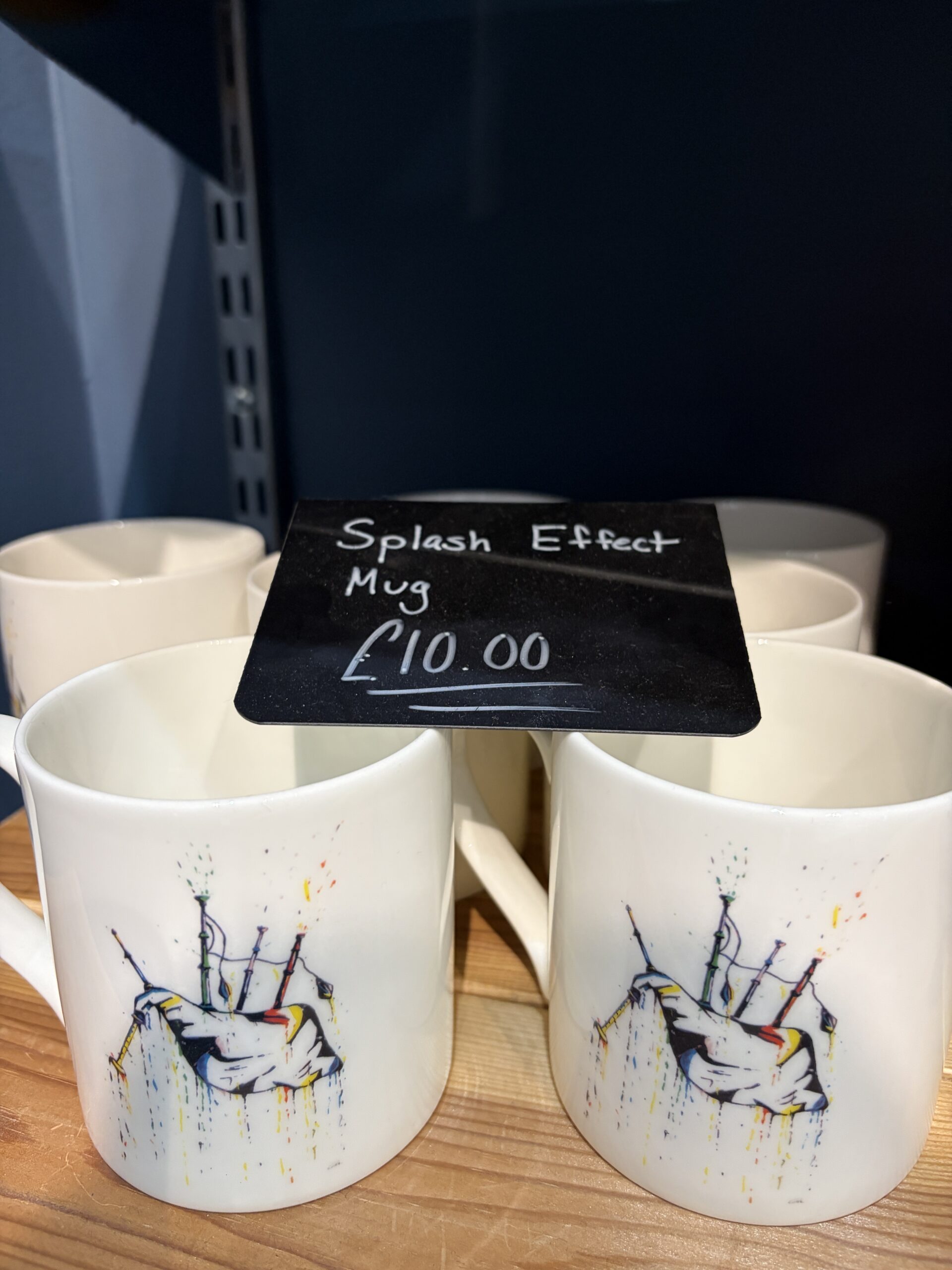
In the National Piping Center’s gift shop in Glasgow there are mugs for people who like to think about all the places spittle can emerge from bagpipes–while drinking their tea.
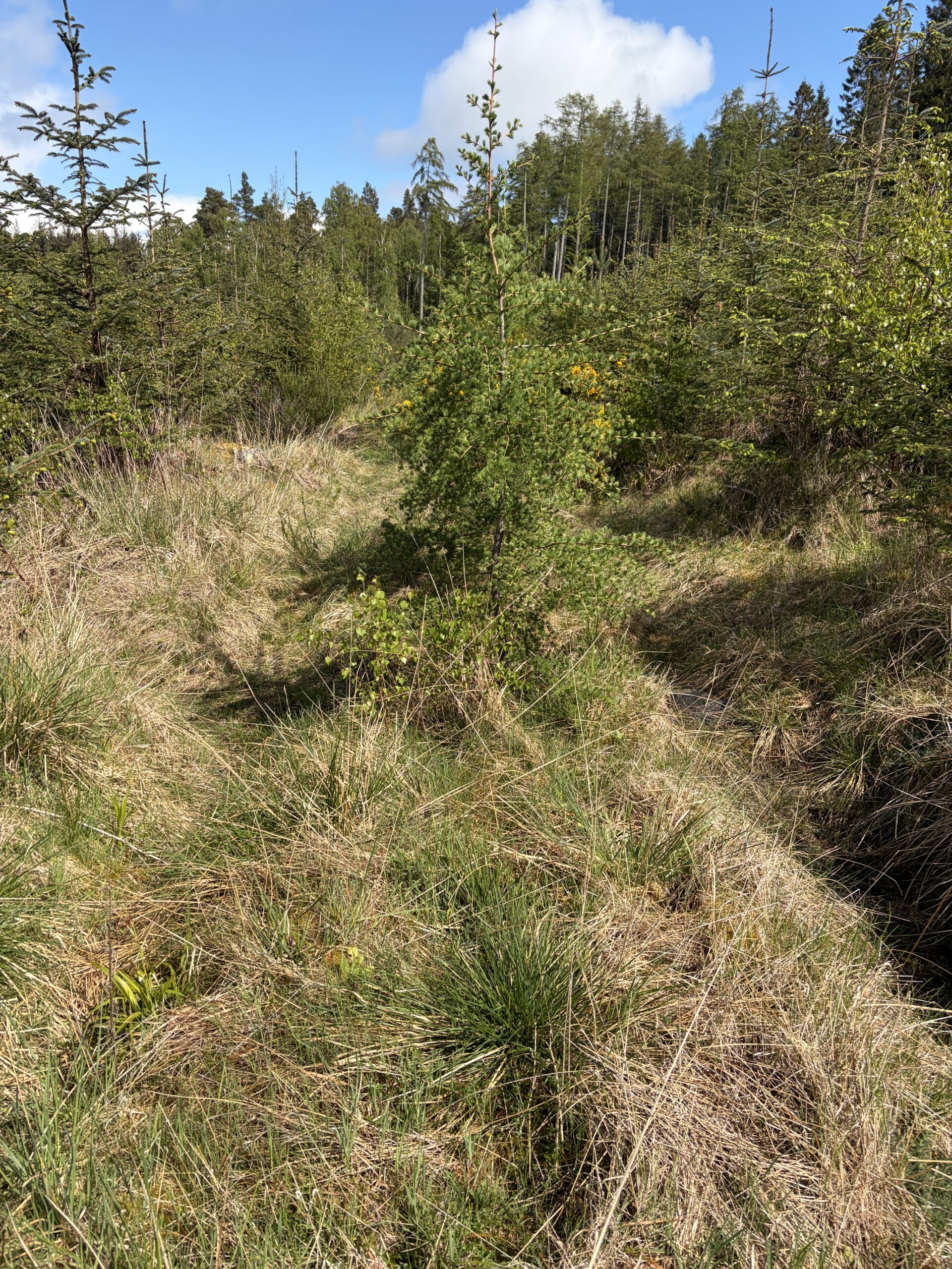
Up close Scotland is beautiful too.
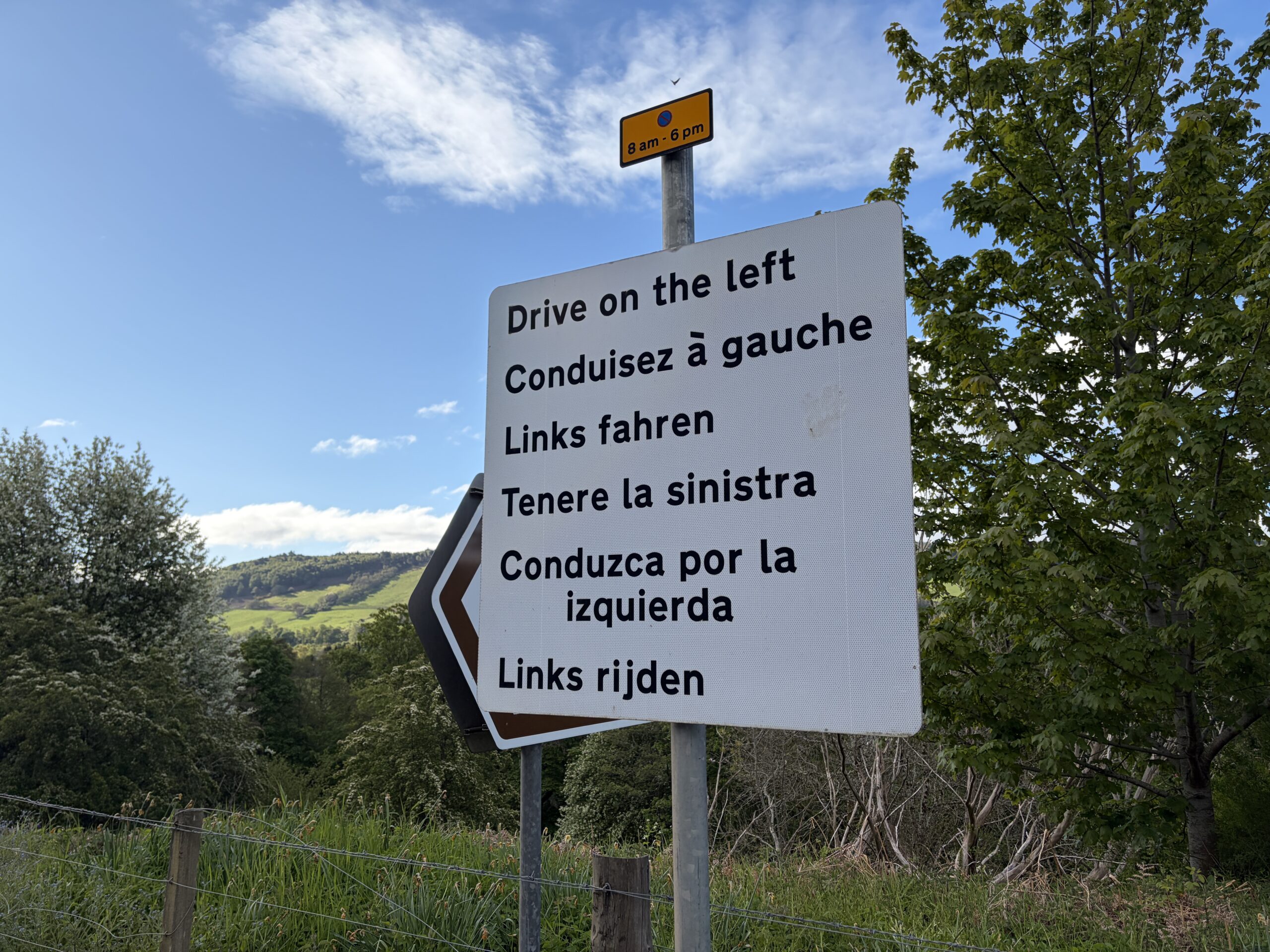
No need to put it in Gaelic.
Lilacs not fully in bloom on May 15.
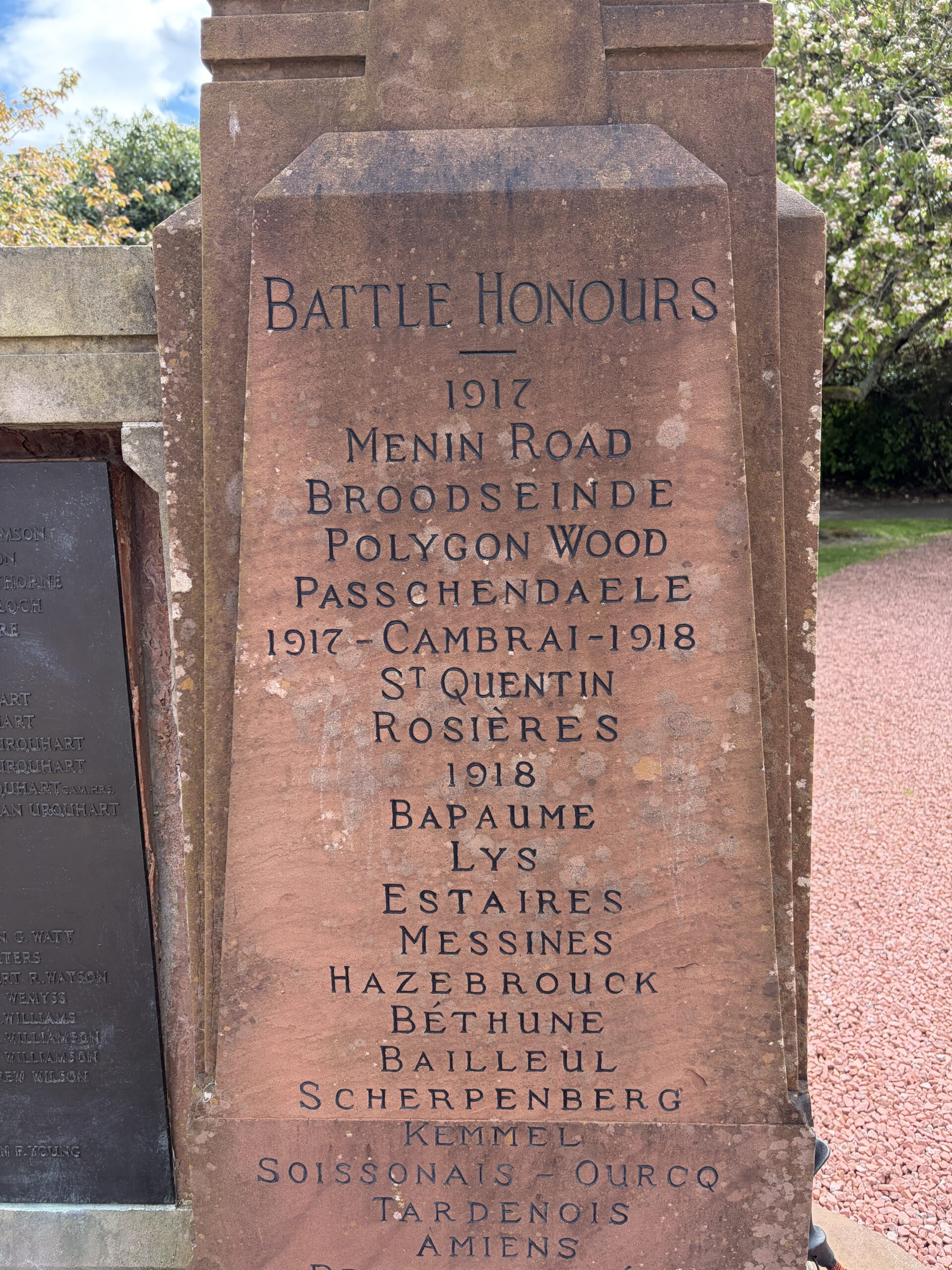
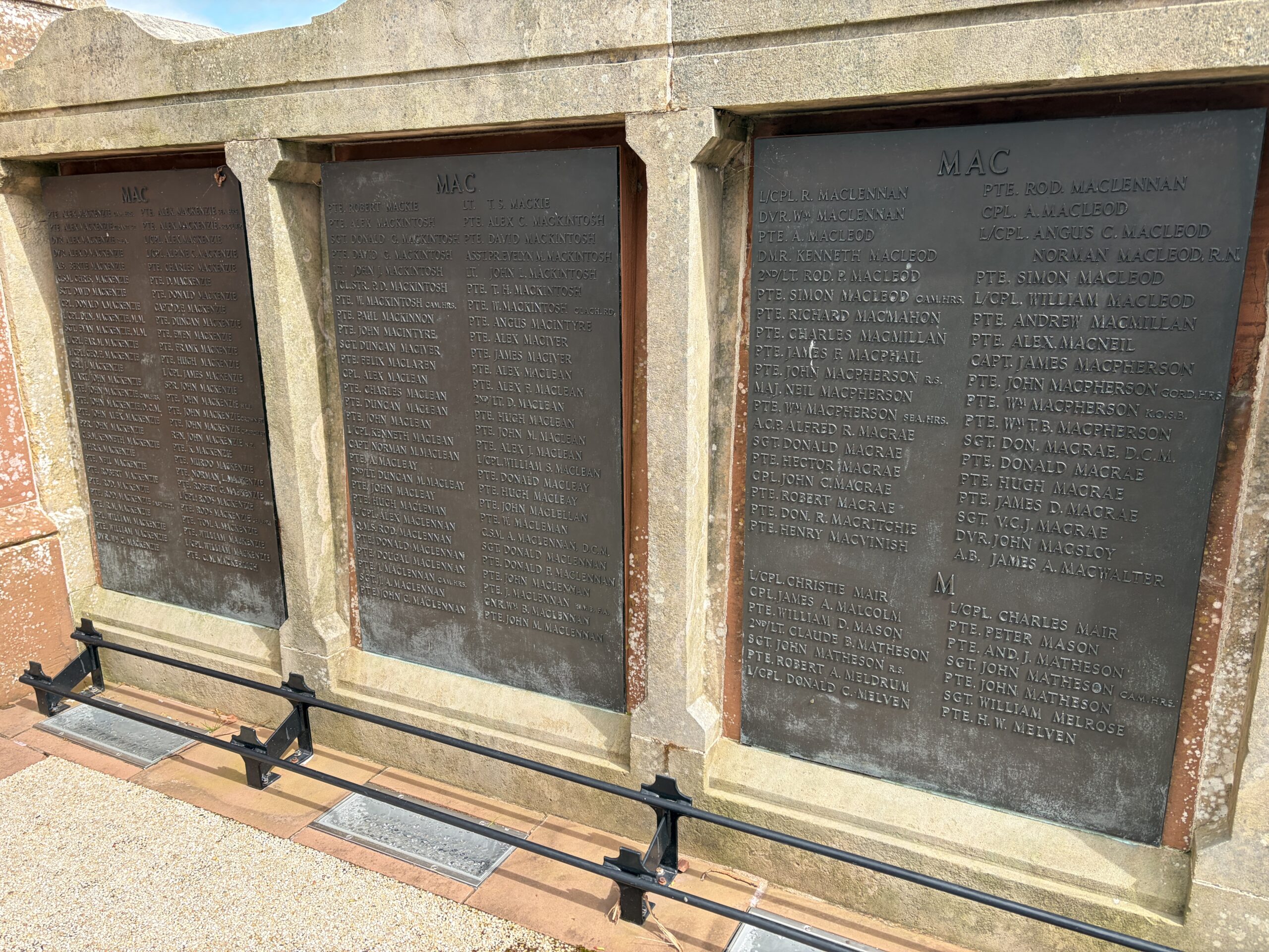
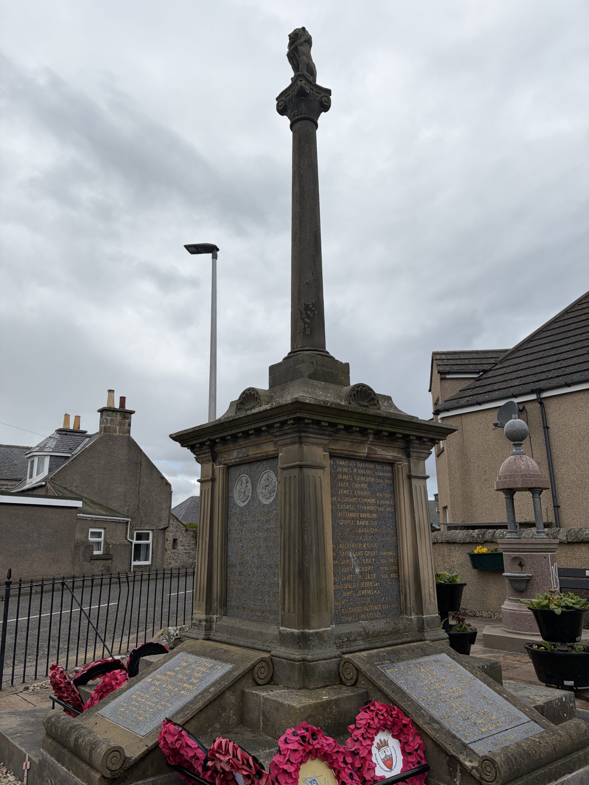
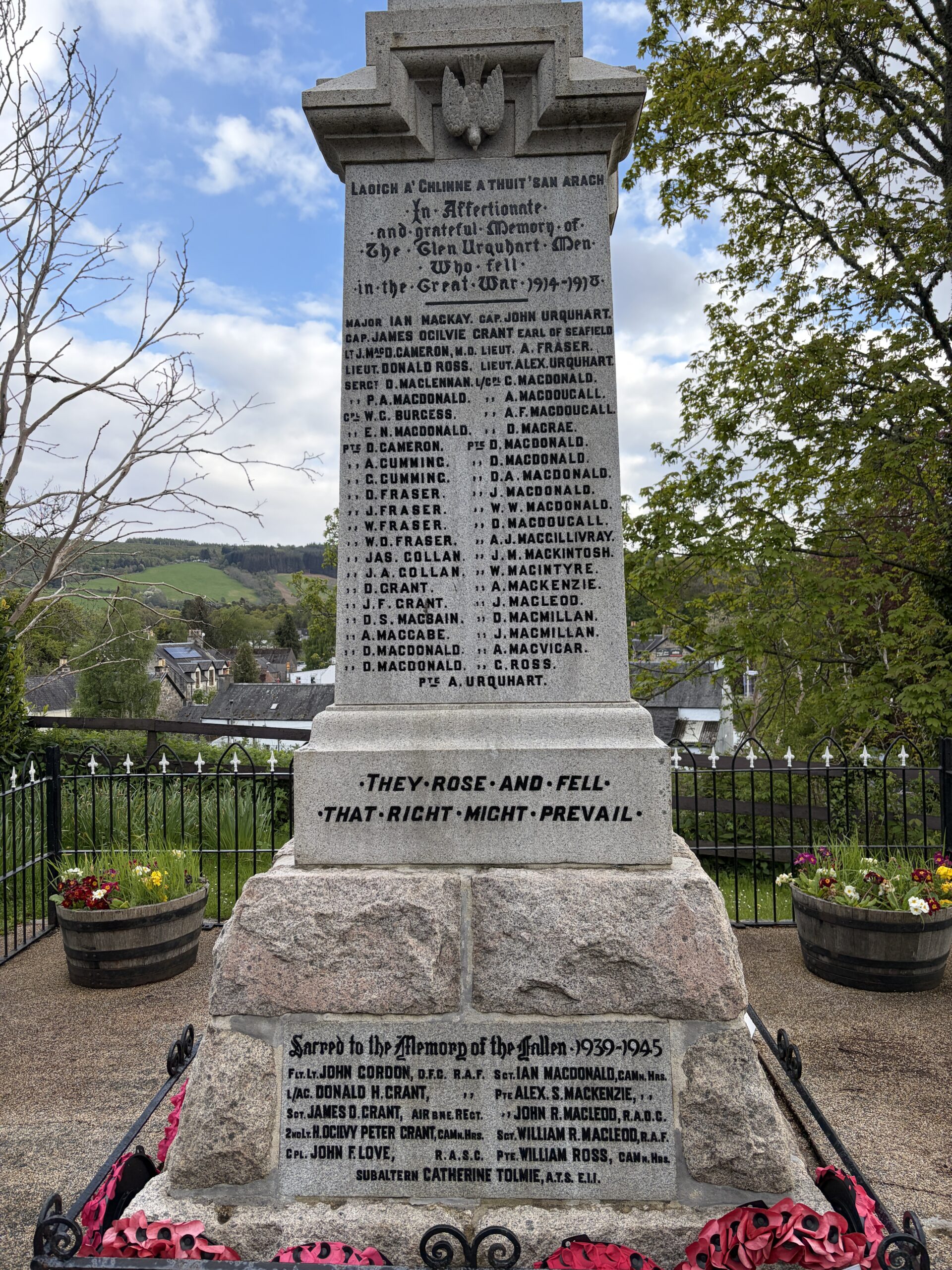
I find the Great War memorials in every town and village moving in a way that’s undiminished by time. I once saw one with two names on it in a hamlet of four houses.
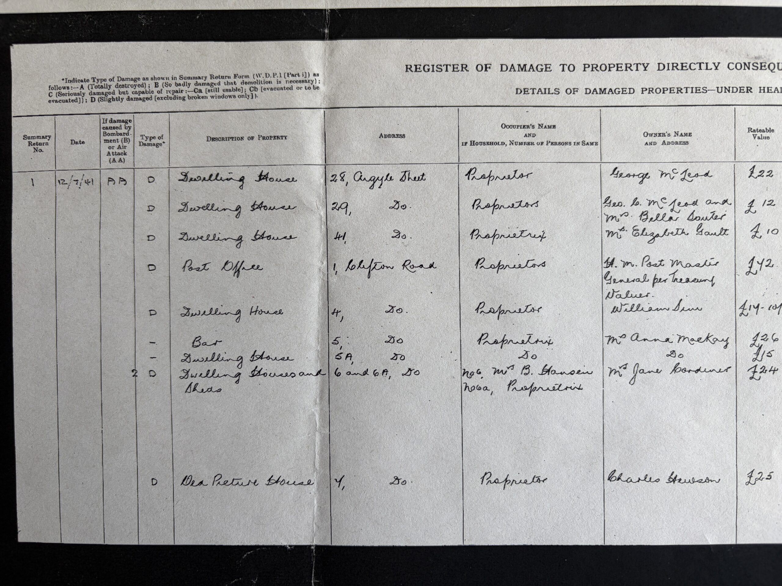
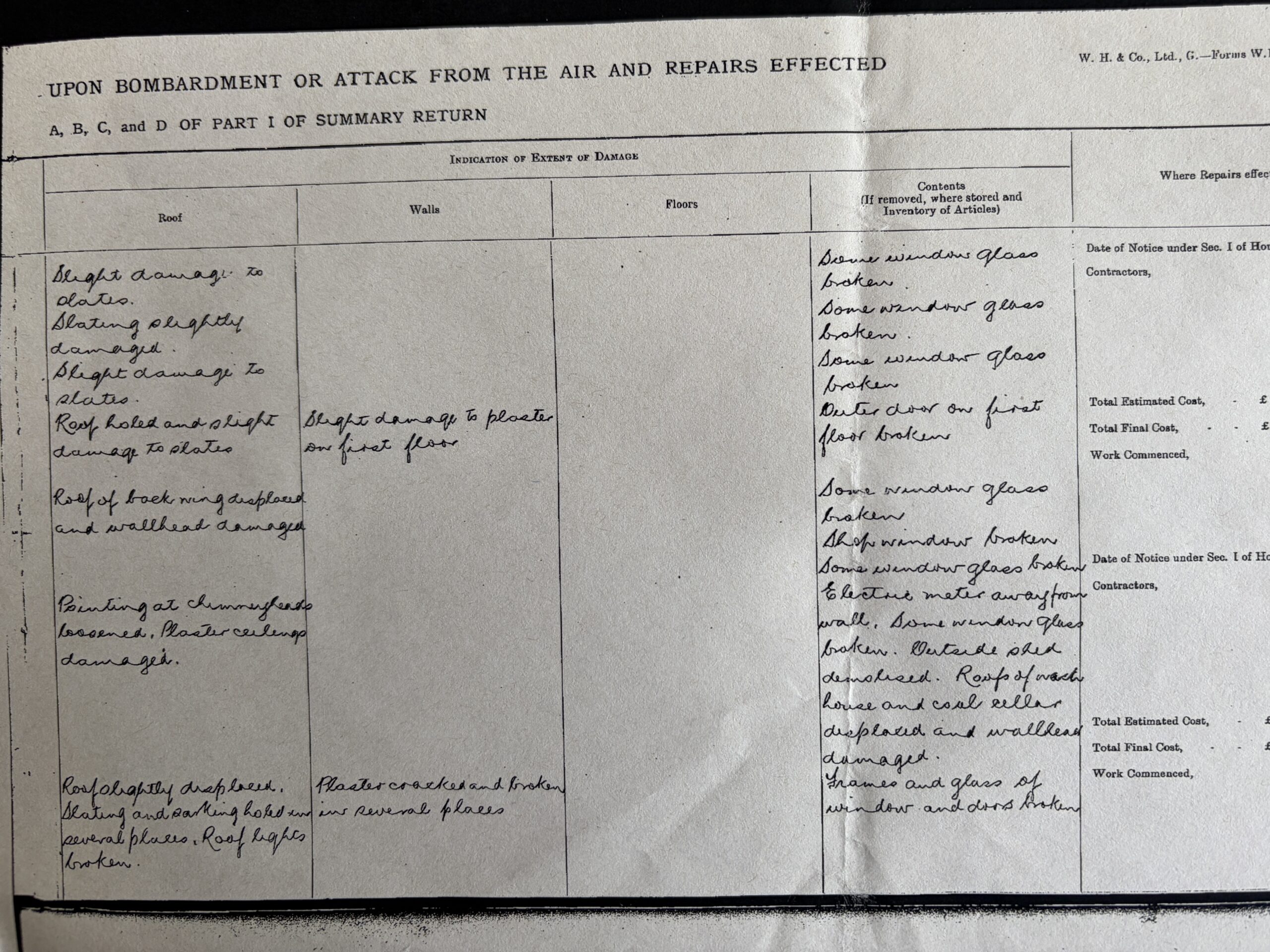
The first two below are from Inverness. It lists every violent encounter no matter how small. It lists all of the city’s war dead. There are three panels for whose last name begins with “Mac.”
May no death go unremembered!
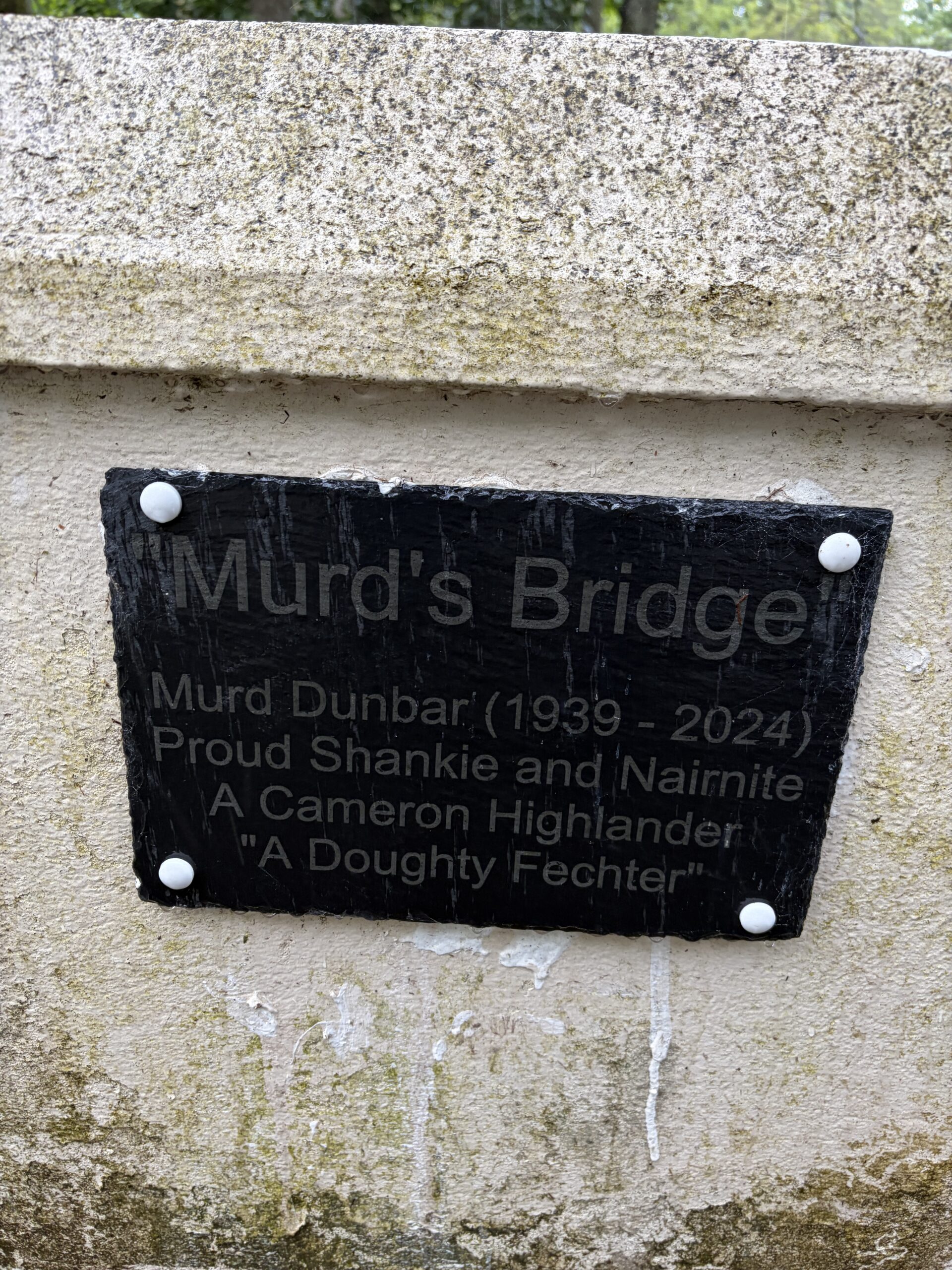
“Shankie”: a surname that’s also a nickname for a person with distinctive legs. “Fechter”: a fighter or champion.
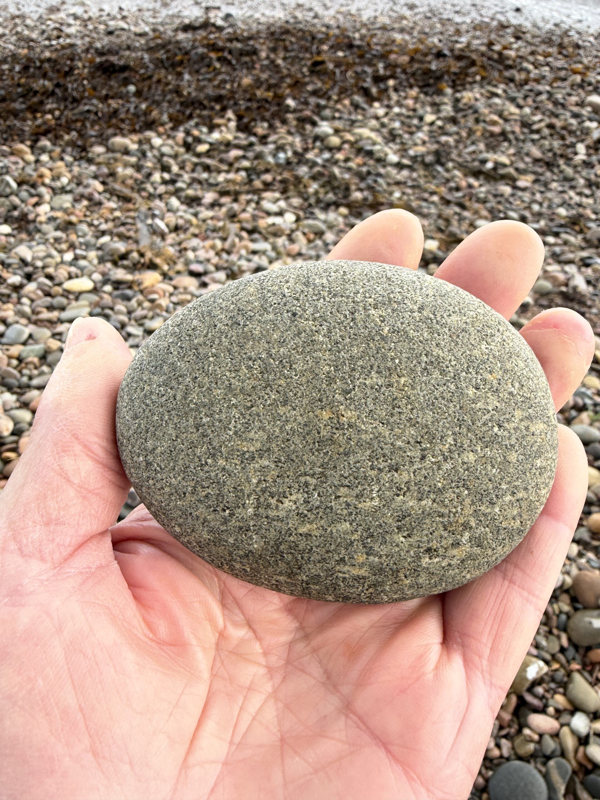
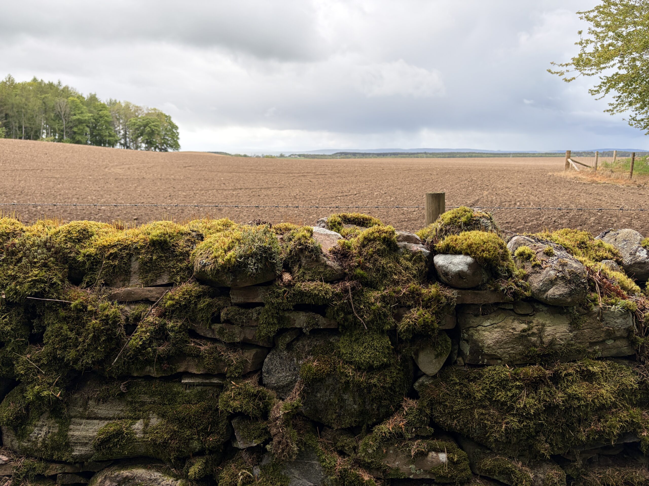
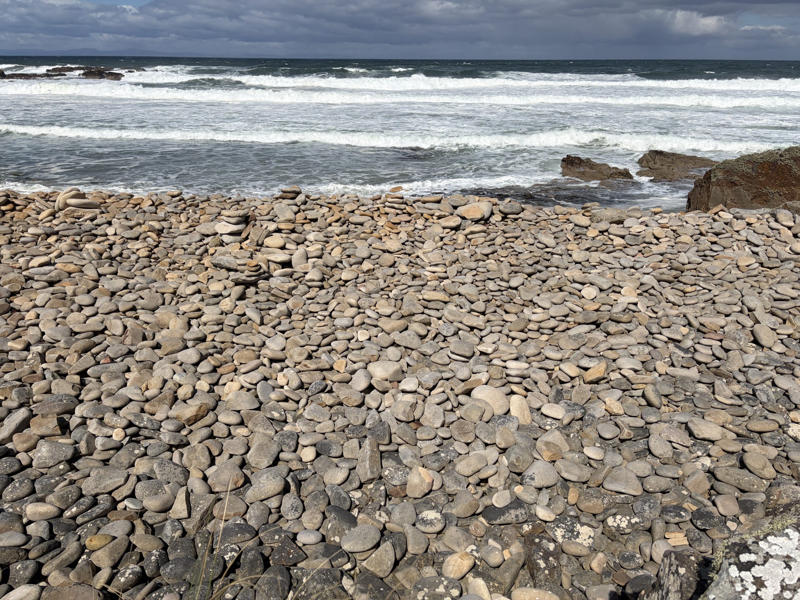
One could spend all day admiring the billions of wave-polished stones on the Moray Coast. This one exemplifies nature’s preference for ellipses over circles (which holds even for the orbits of celestial bodies.) I was tempted to take it and some of its perfect sisters. But I do have a few personal Challenge rules, one of which is: “Carry no rocks.”
Nobody likes to take the last cookie either.
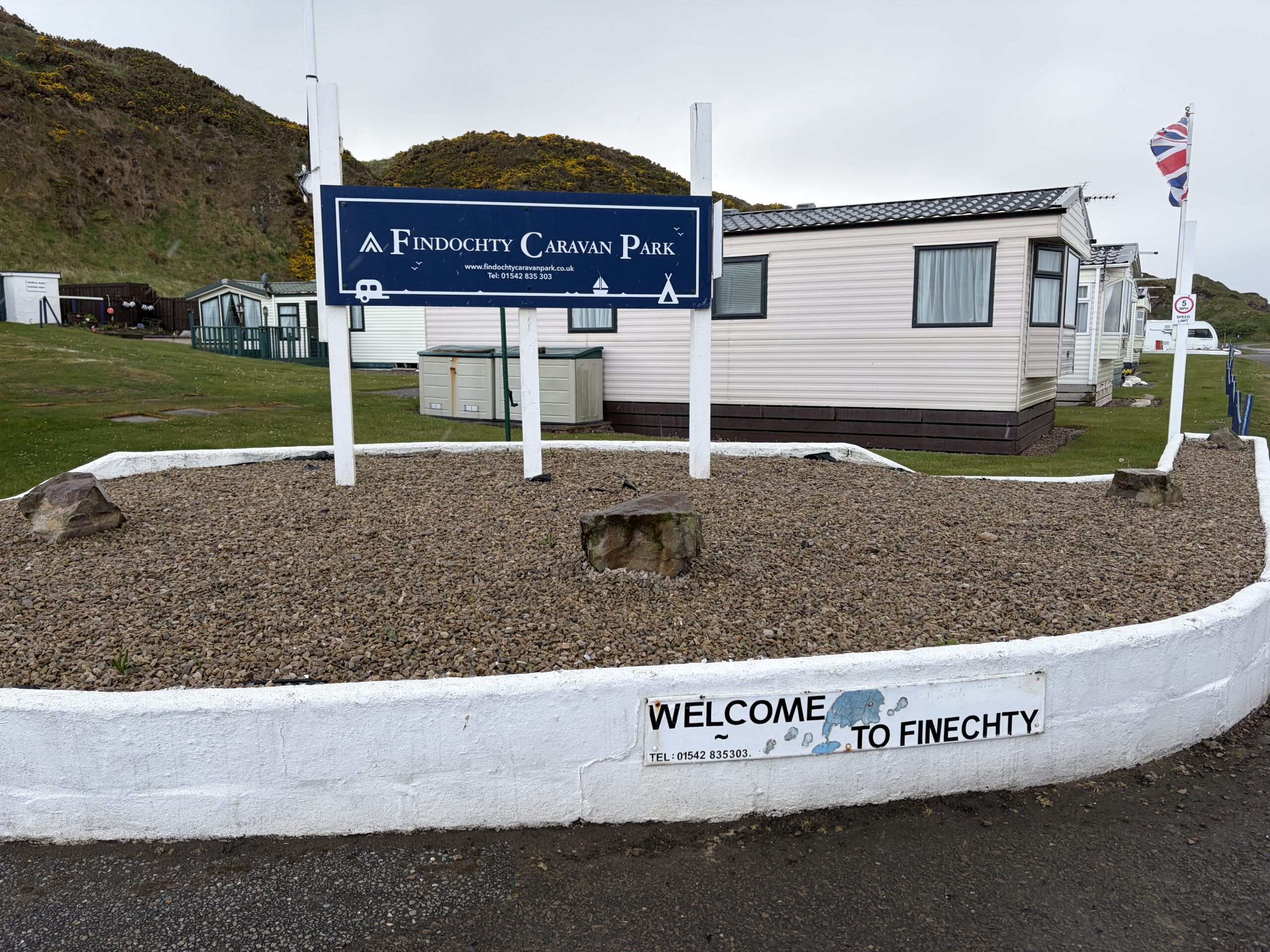
“Findochty” is the name, “Finechty” is how it’s pronounced.
This is from back when change amounted to something.
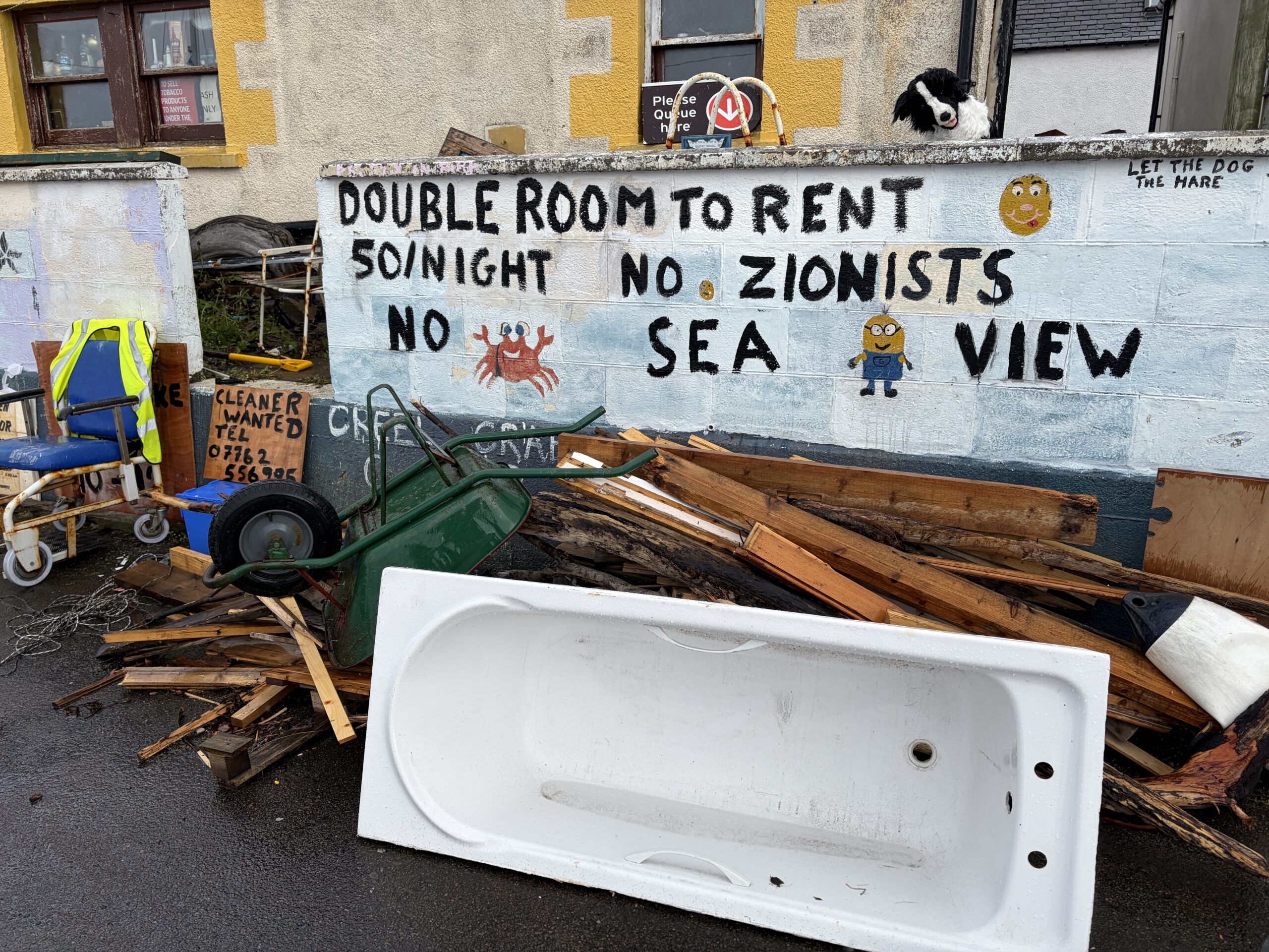
Cleaners wanted indeed!
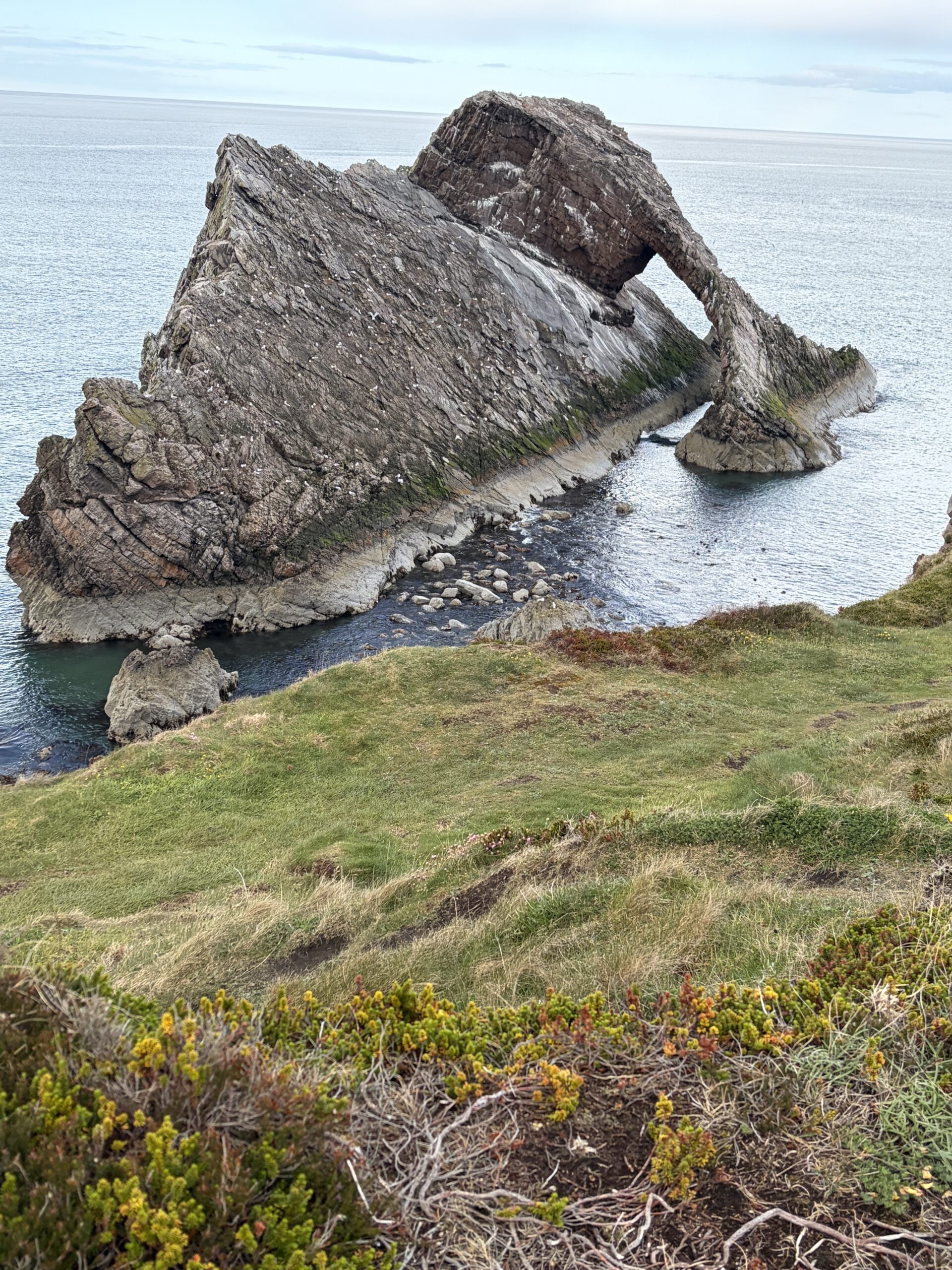
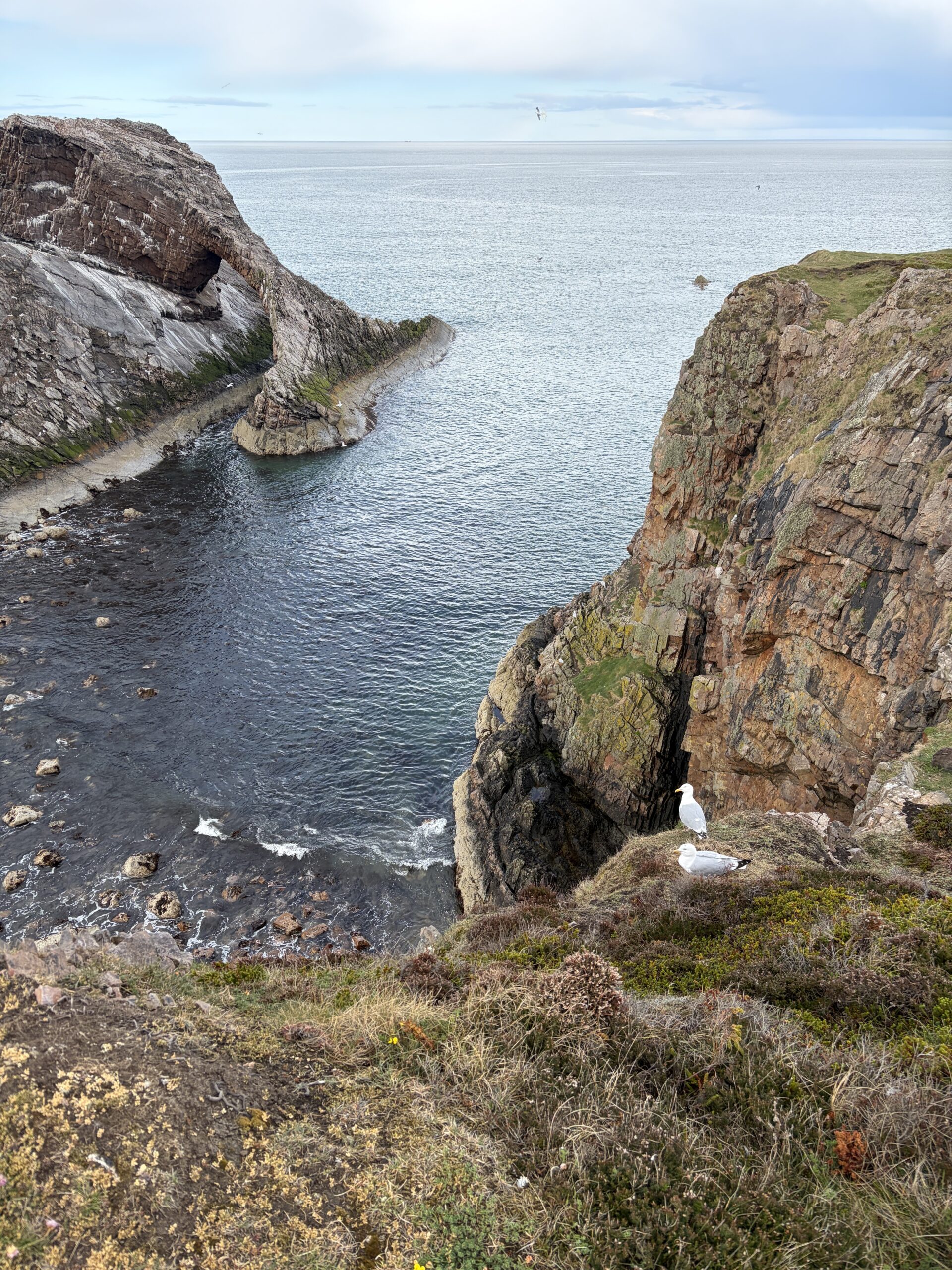
The white specks on Bow-Fiddle Rock are nesting pairs of seagulls. The couple below the path have no competition and a great view.
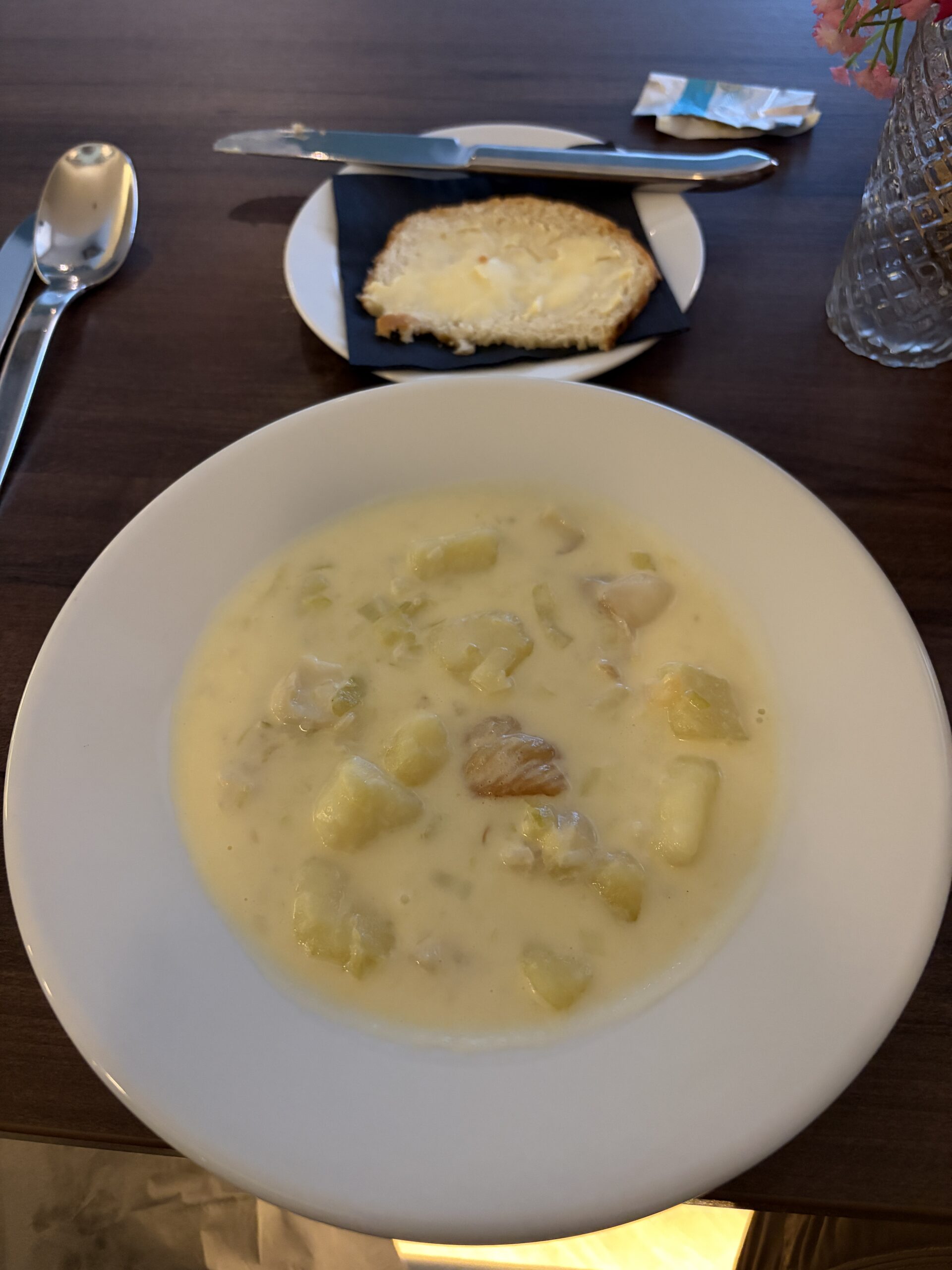
Scotland is justly famous for many things, but with national dishes named “Cullen skink,” “haggis,” “bacon buttie,” and “black pudding,” cuisine is not likely to be one of them. However, I spent a night in a hotel in Cullen and ordered its eponymous dish, which is a chowder of smoked haddock, potatoes, and onions. It was tasty.
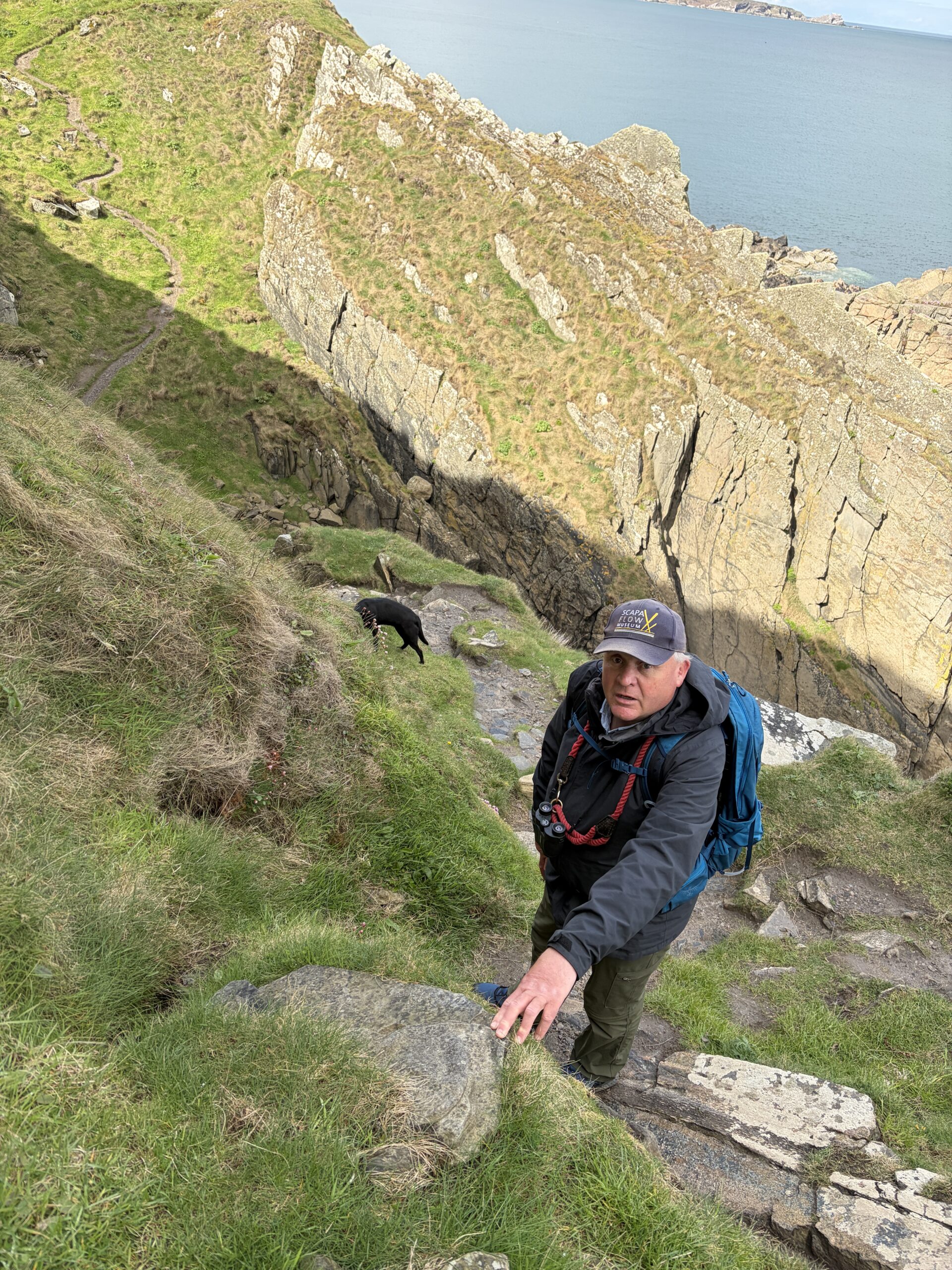
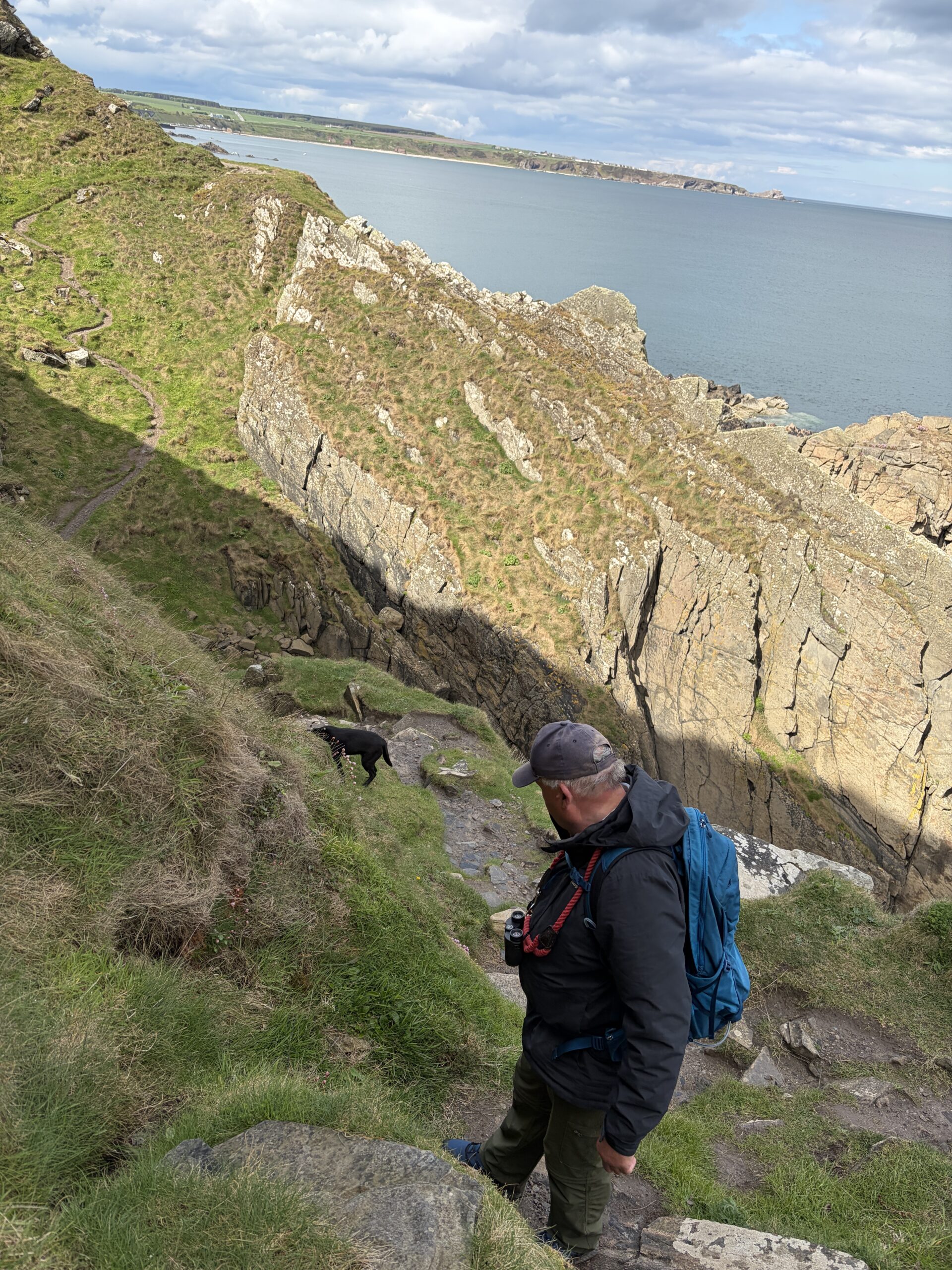
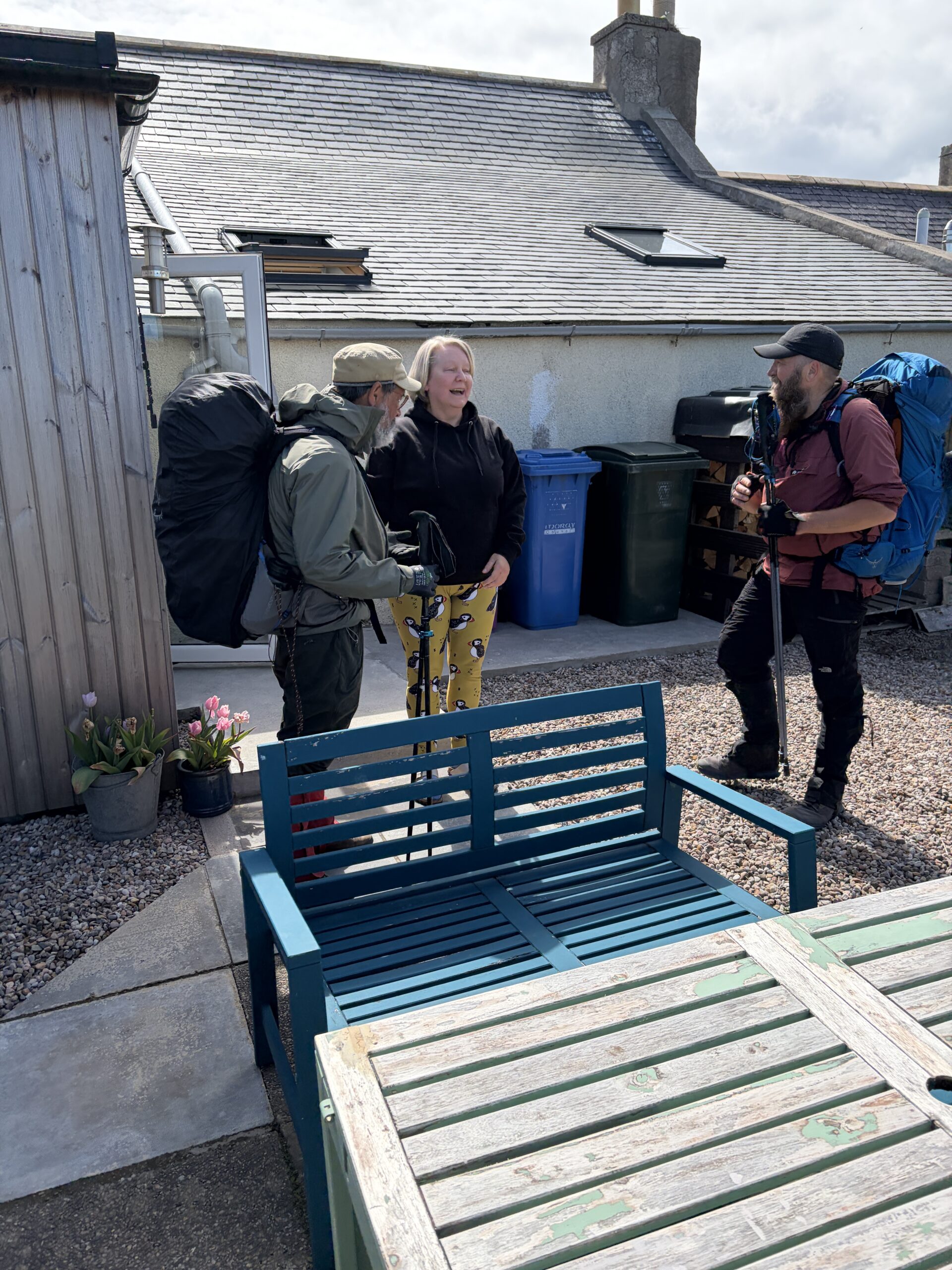
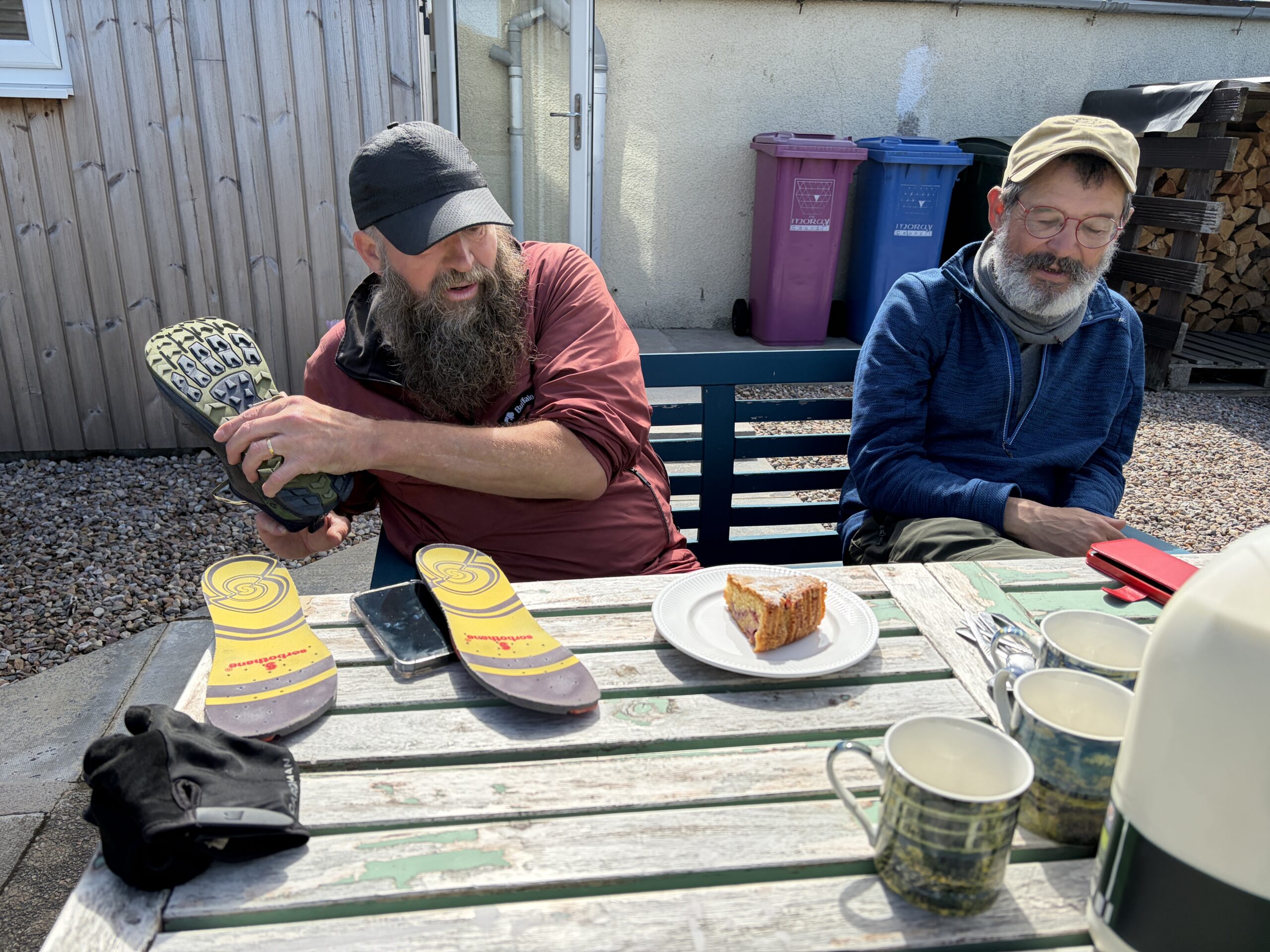
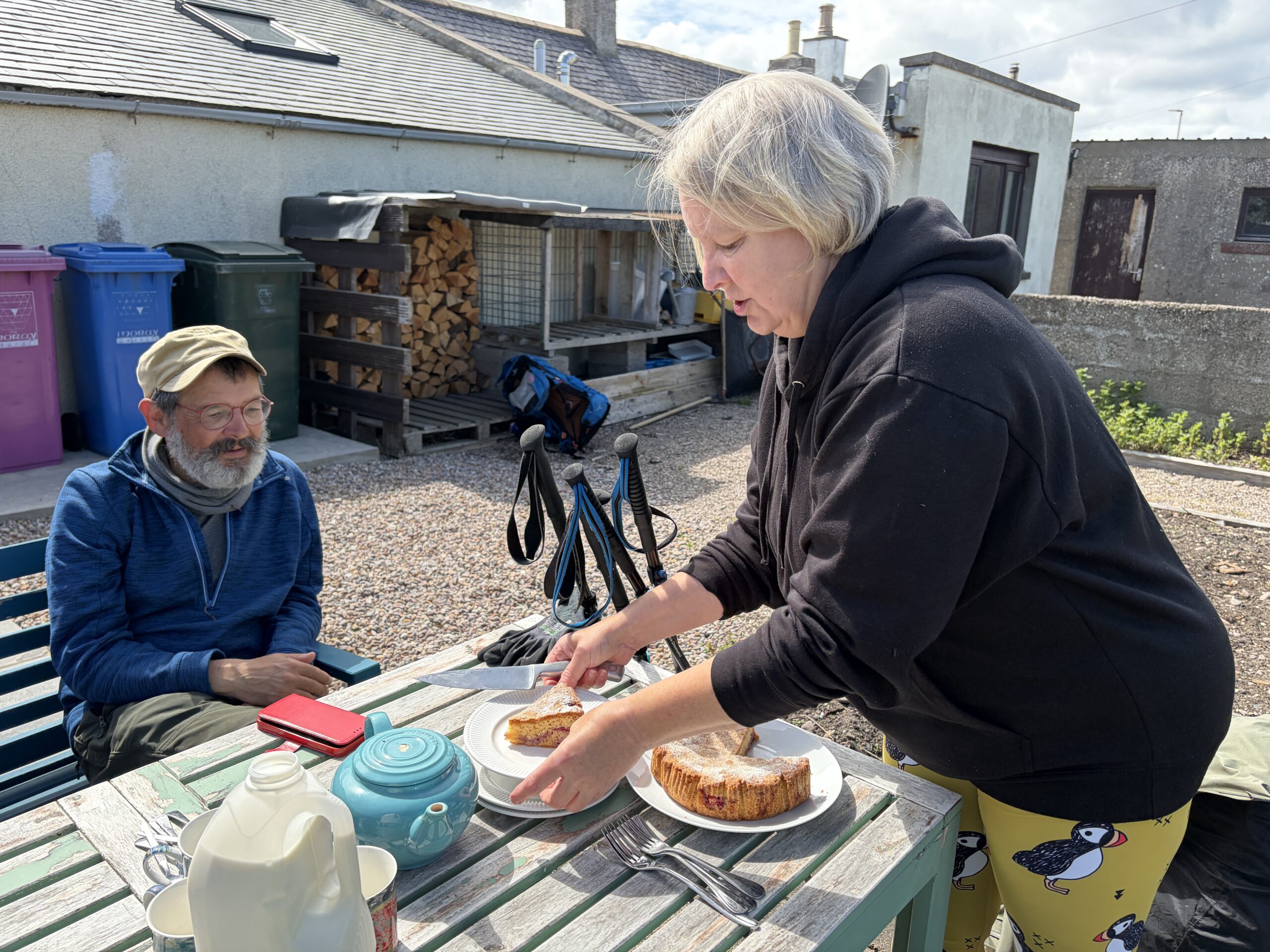
You can learn a lot about someone when talk is an excuse for a break on a difficult climb or tricky descent.
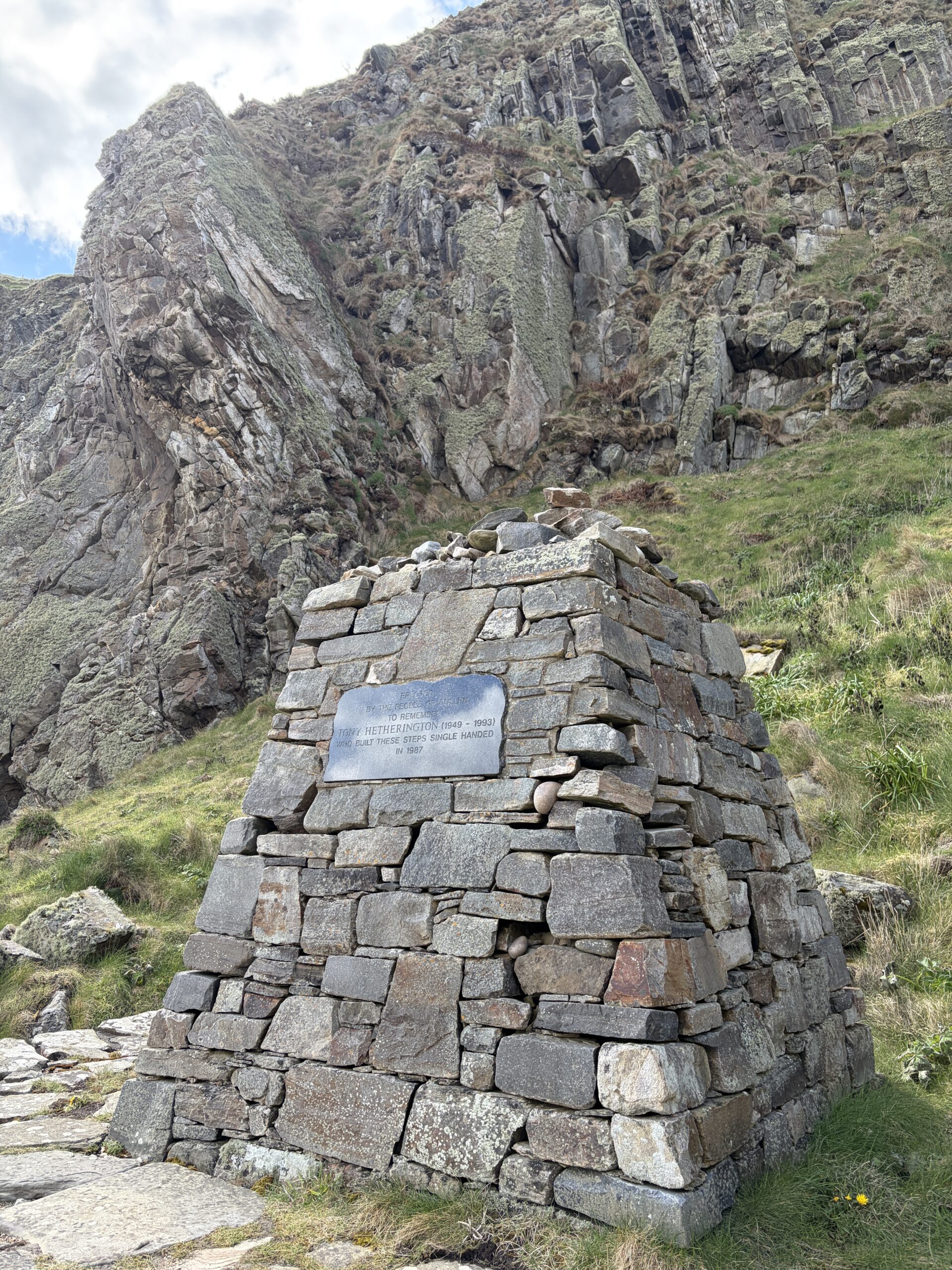
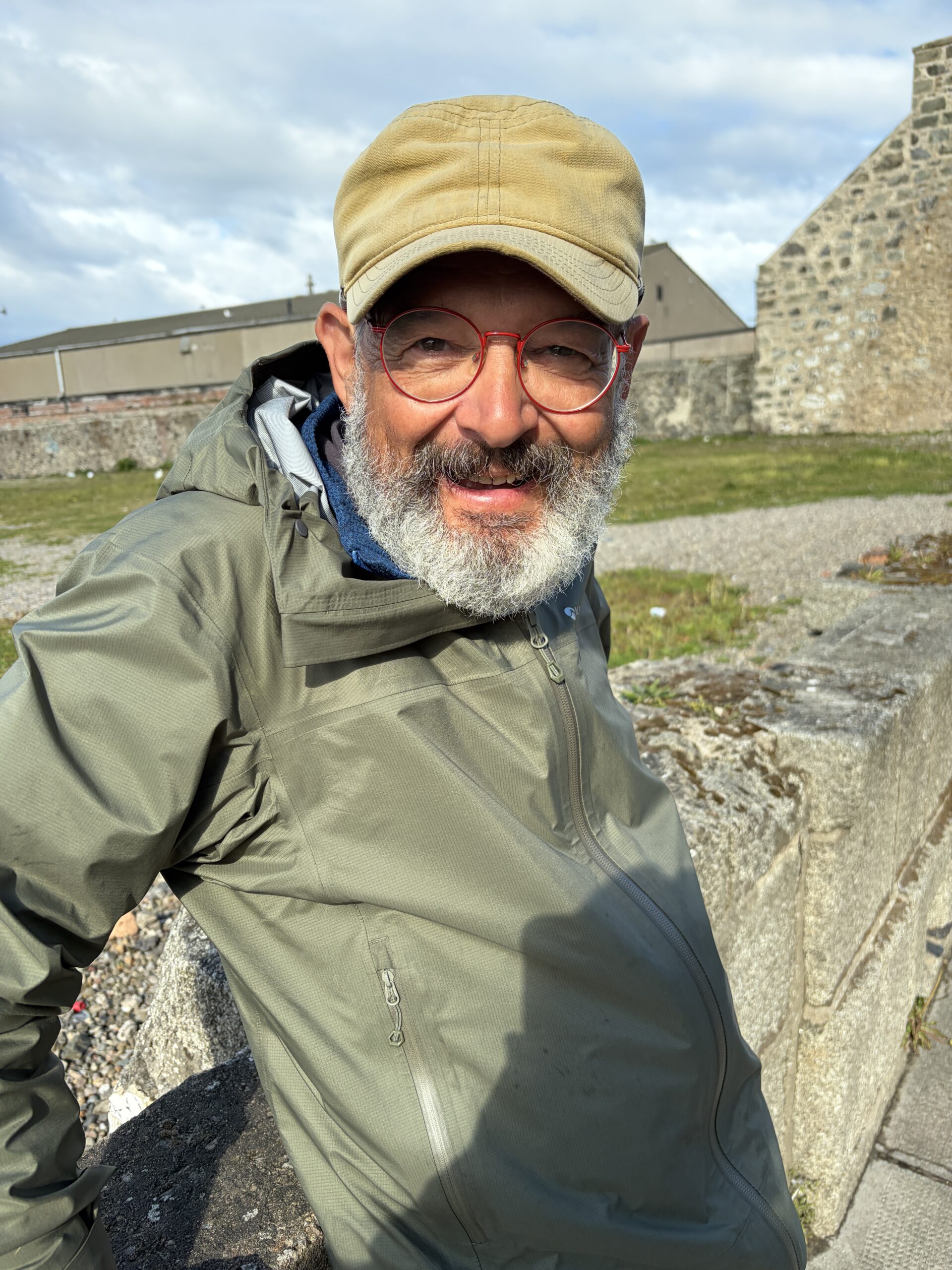
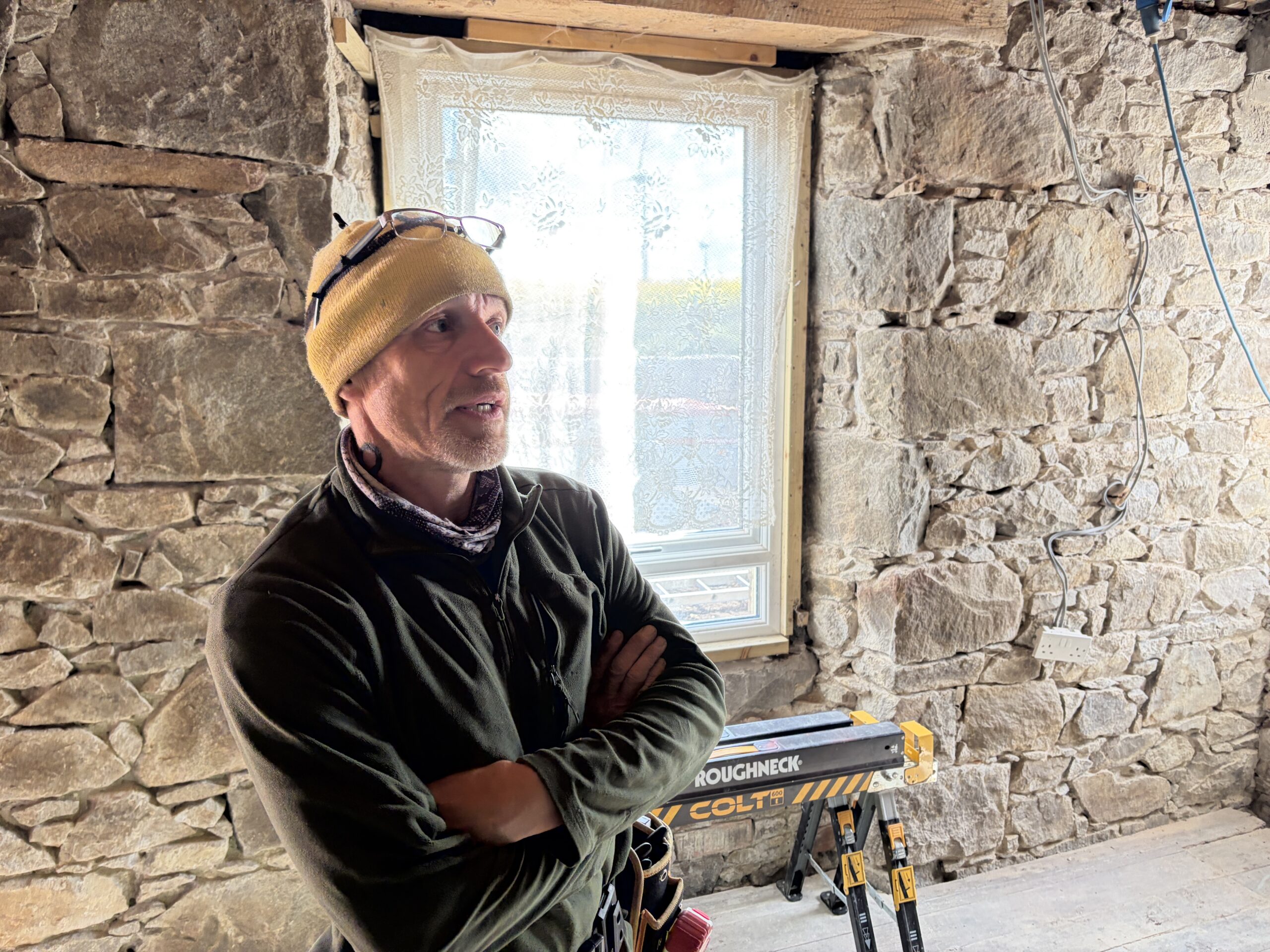
This is Ronald Barr, a native of the Shetland Islands who’s an expert in U.S. military history. He got a doctorate in history at Louisiana State University under Charles Royster, a historian who won the Bancroft Prize and the Lincoln Prize. Barr lived in Takoma Park, Maryland, for a year while he had a fellowship at the Library of Congress. He taught at the Army War College in Pennsylvania before spending his career at universities in the U.K. Once a week, he walks with his dog from his home in Portsoy to Portknockie–a distance of about five miles–where he spends the afternoon lawn bowling.
He is a digital subscriber to The Washington Post, although he said he’s “not very happy with what Bezos has done with it recently.” Then he added: “Frankly, I’m not very pleased with what’s happening in the United States either. It’s not the country I knew.”
I asked him how he gets back home after these weekly treks.
“The bus. The odd driver complains, but most are good with the dog.”
Then it was time for him to continue down and me to continue up.
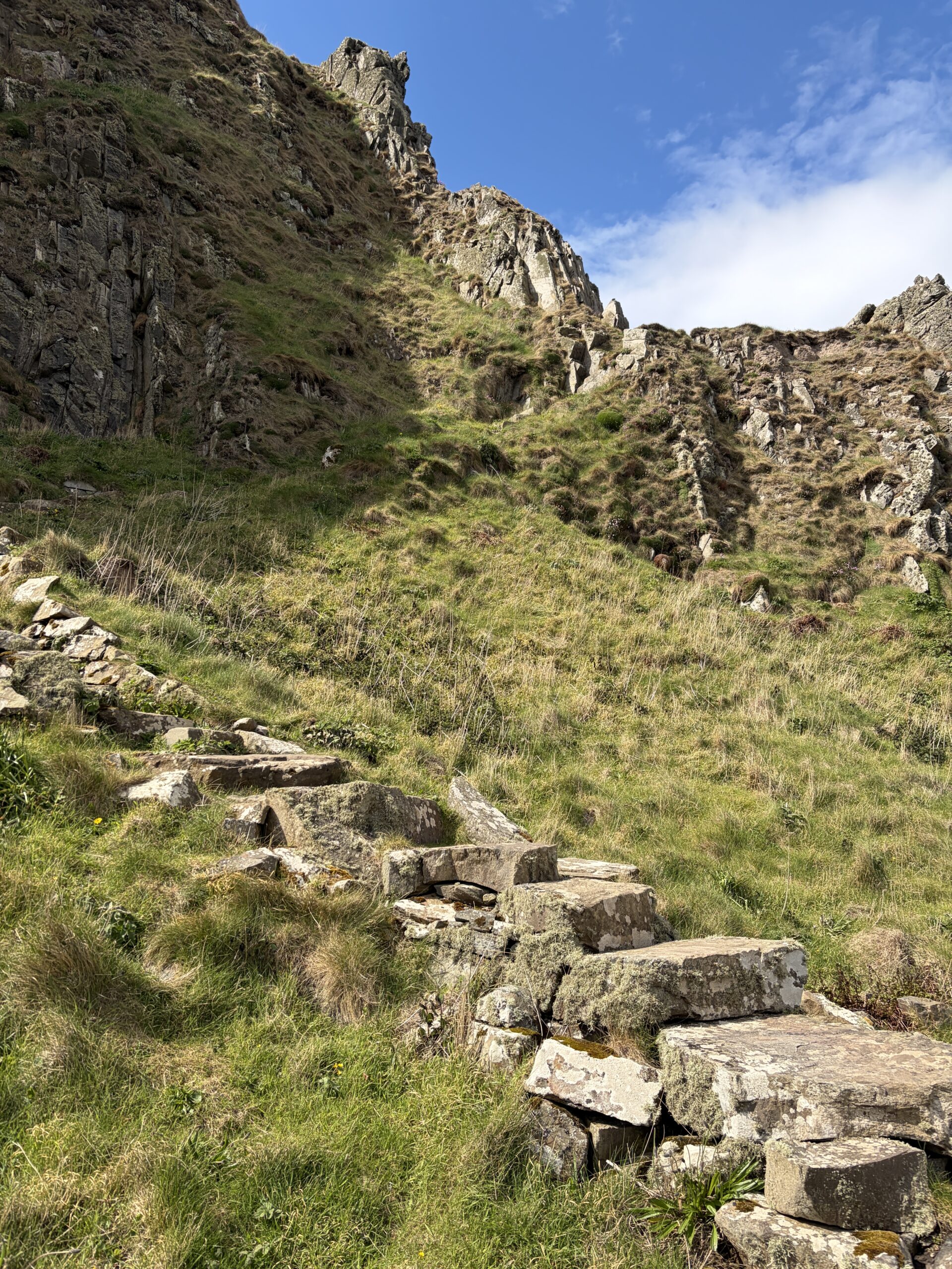
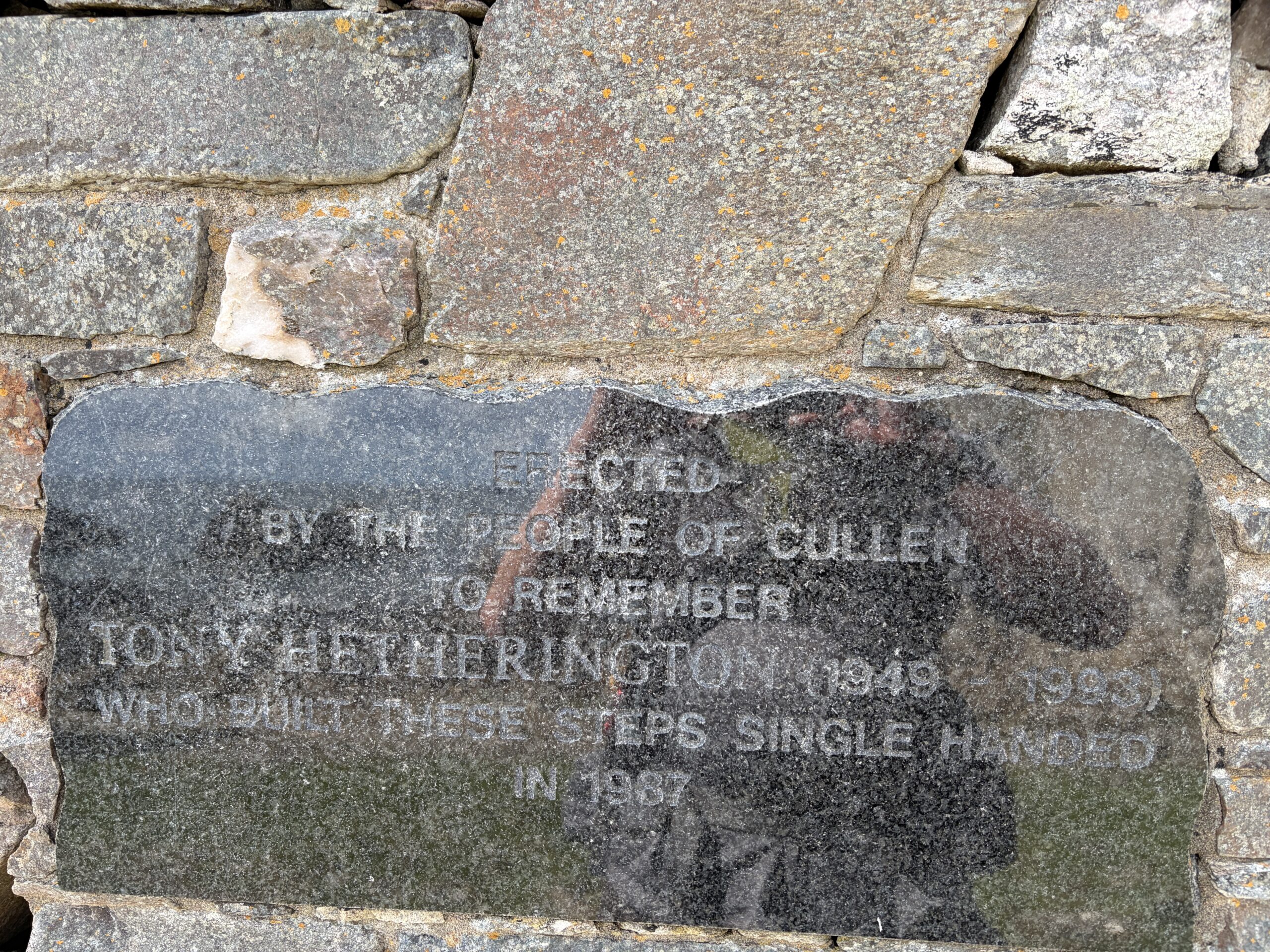
Most path builders are anonymous. This one thankfully is not.
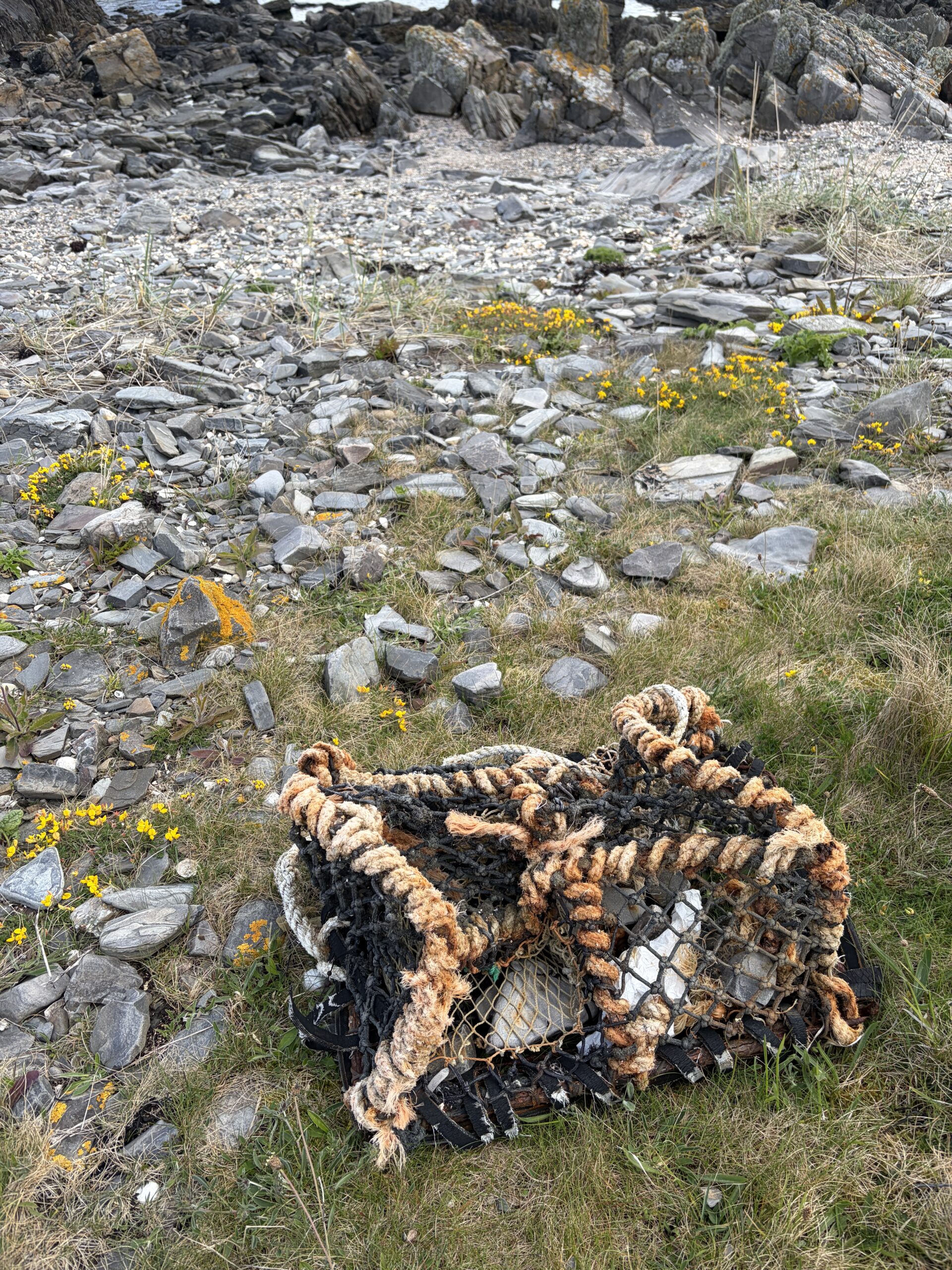
With echoes of Maine, lobster traps wash ashore.
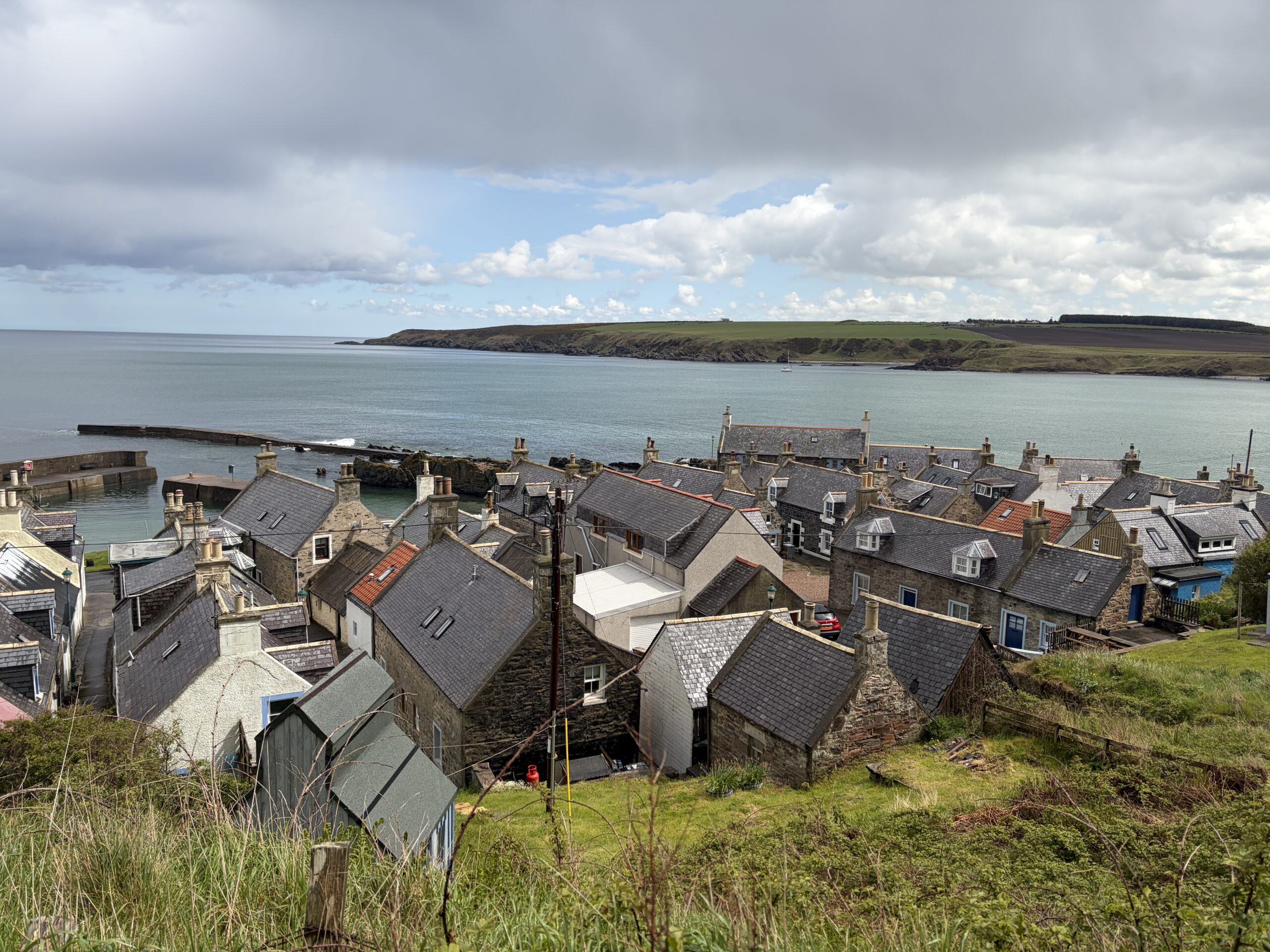
The crowded village of Sandend, in the middle of almost nowhere.
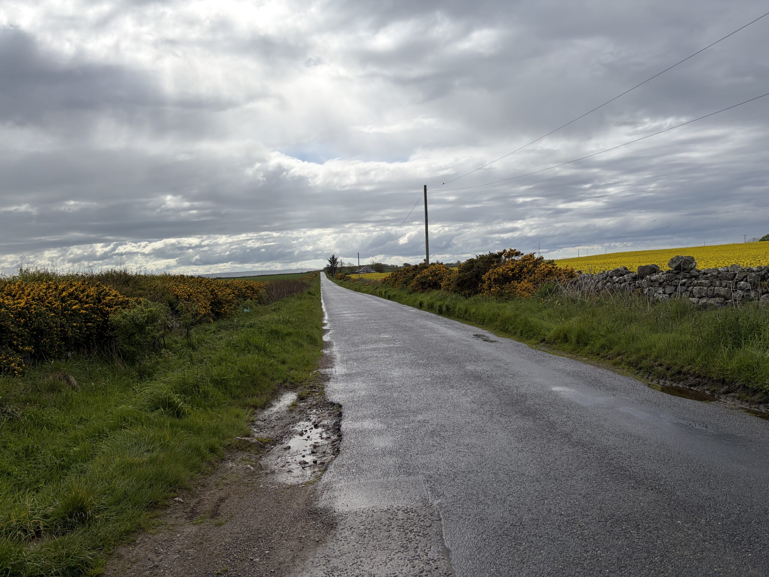
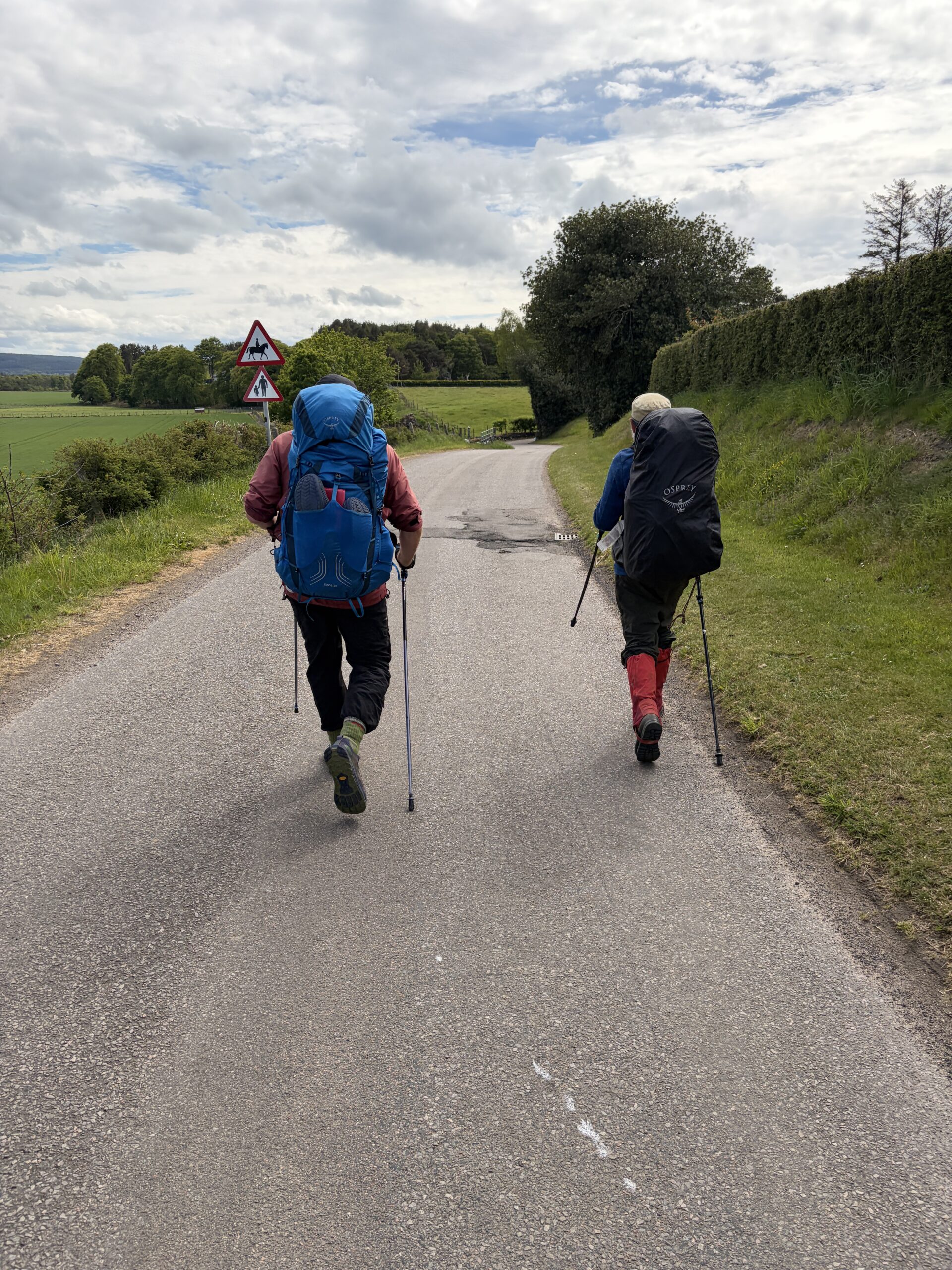
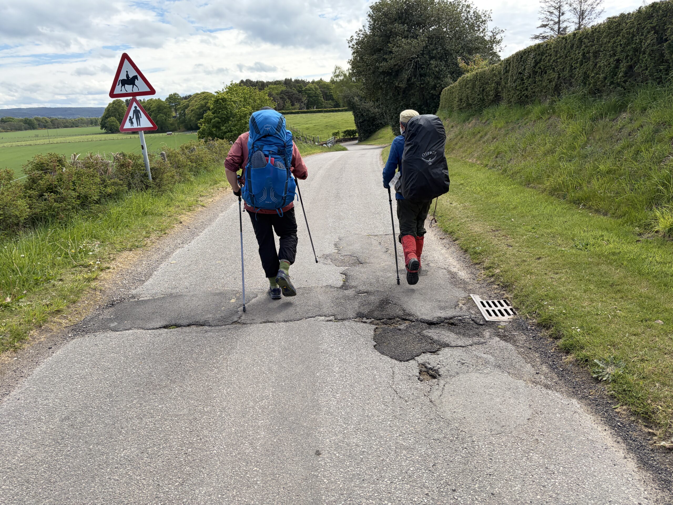
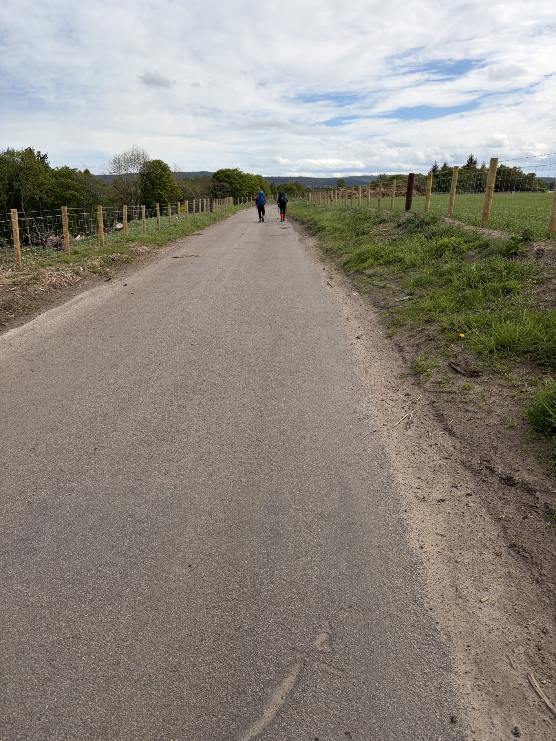
I left the Mill of Nethermill and headed east. It would be mostly roadwalking on this, the last day of the Challenge.
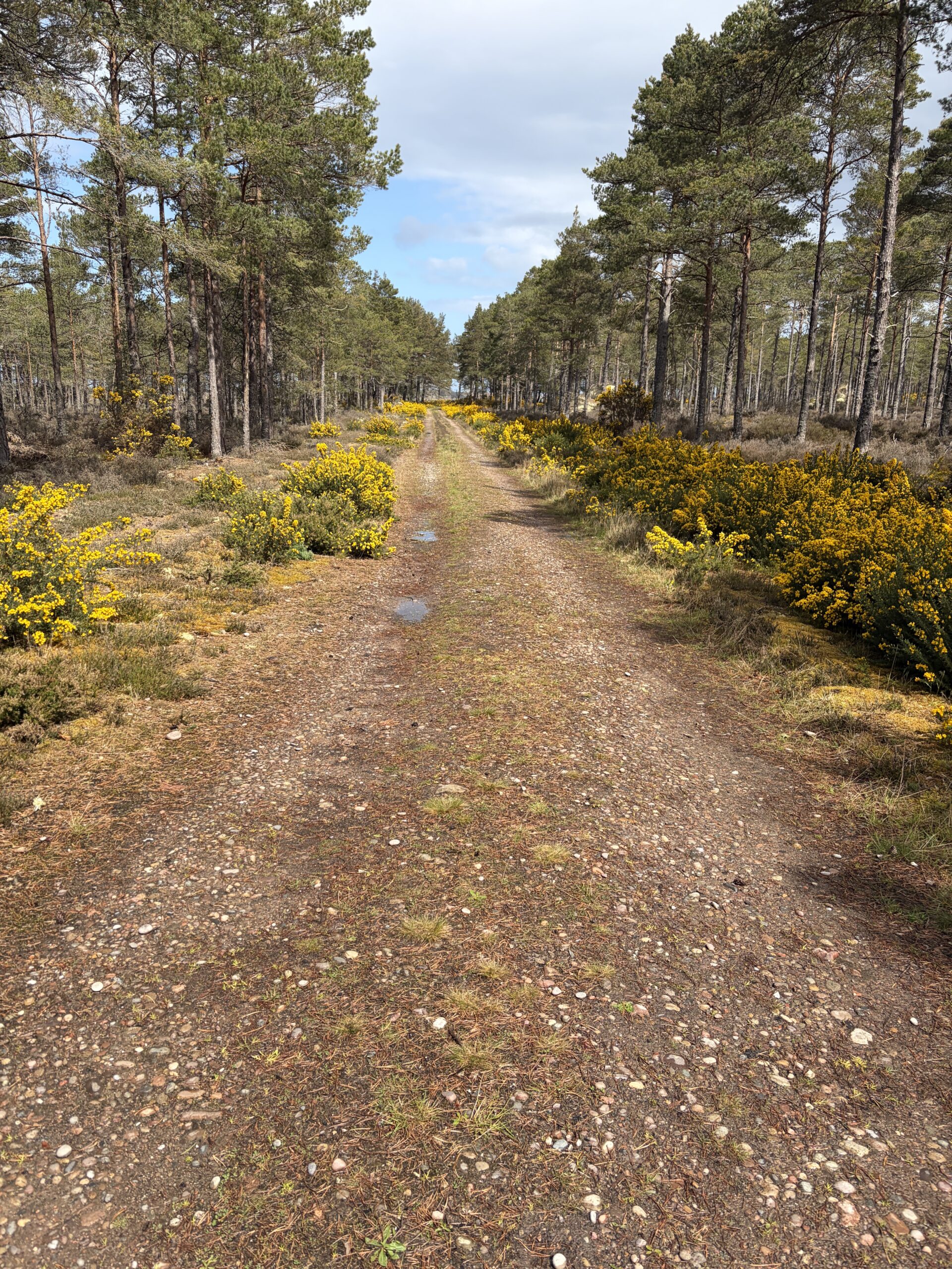
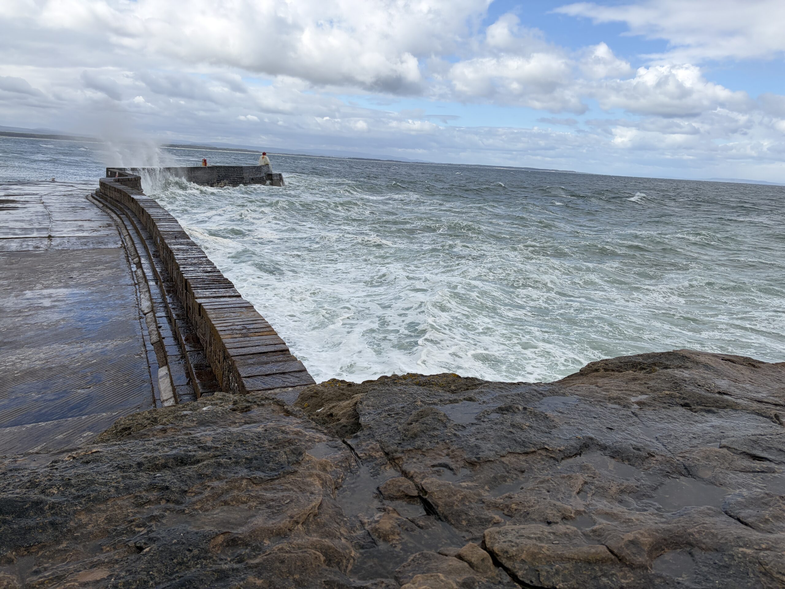
There was a path along the coast, but a report from a year before said following it involved negotiating gorse—the prickly yellow shrub that’s everywhere—and some fences without gates. My feet were sore—no blisters, but the soles battered from stony paths and shingle—so I shortened the distance by cutting out the headlands and taking a local road with little traffic.
I soon passed Mounthooly Doocot—the second word is the Scottish word for dovecote—built in 1800 in a faux-Gothic design. It has 300 nesting boxes for pigeons, and a ladder on a rotating central pillar from which they can be robbed. This wa from a time when for some people money was no object in building chicken coops.
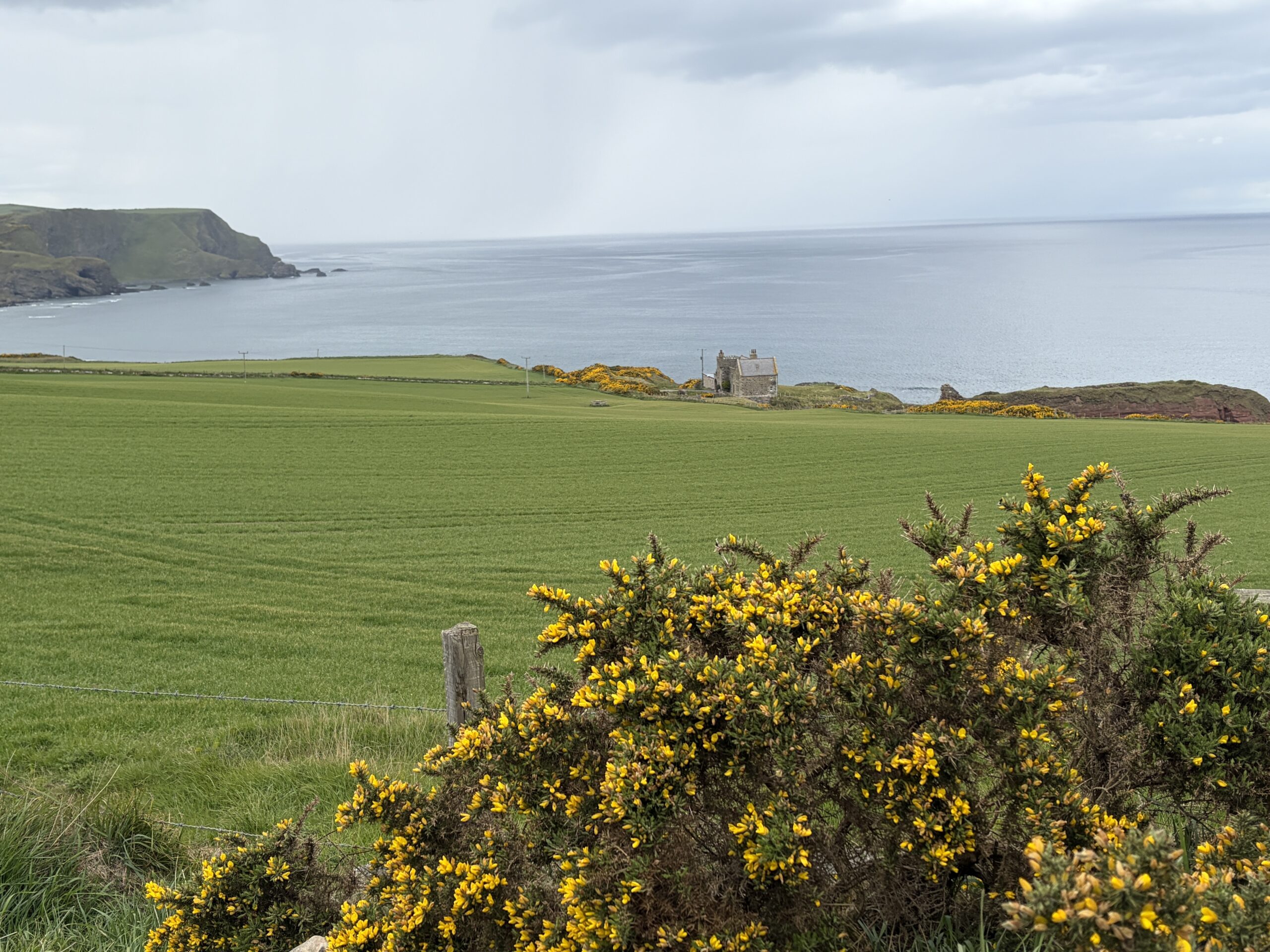
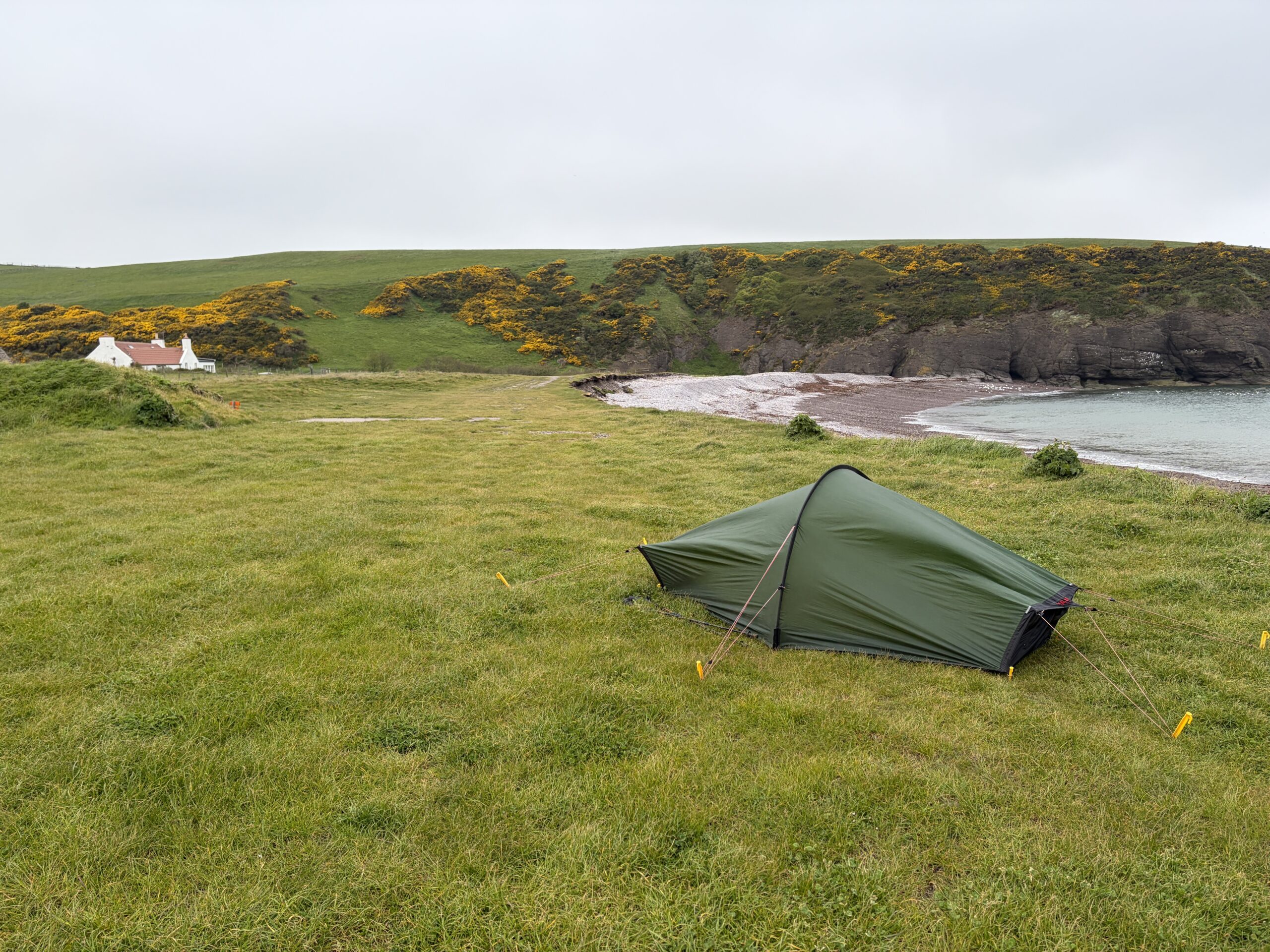
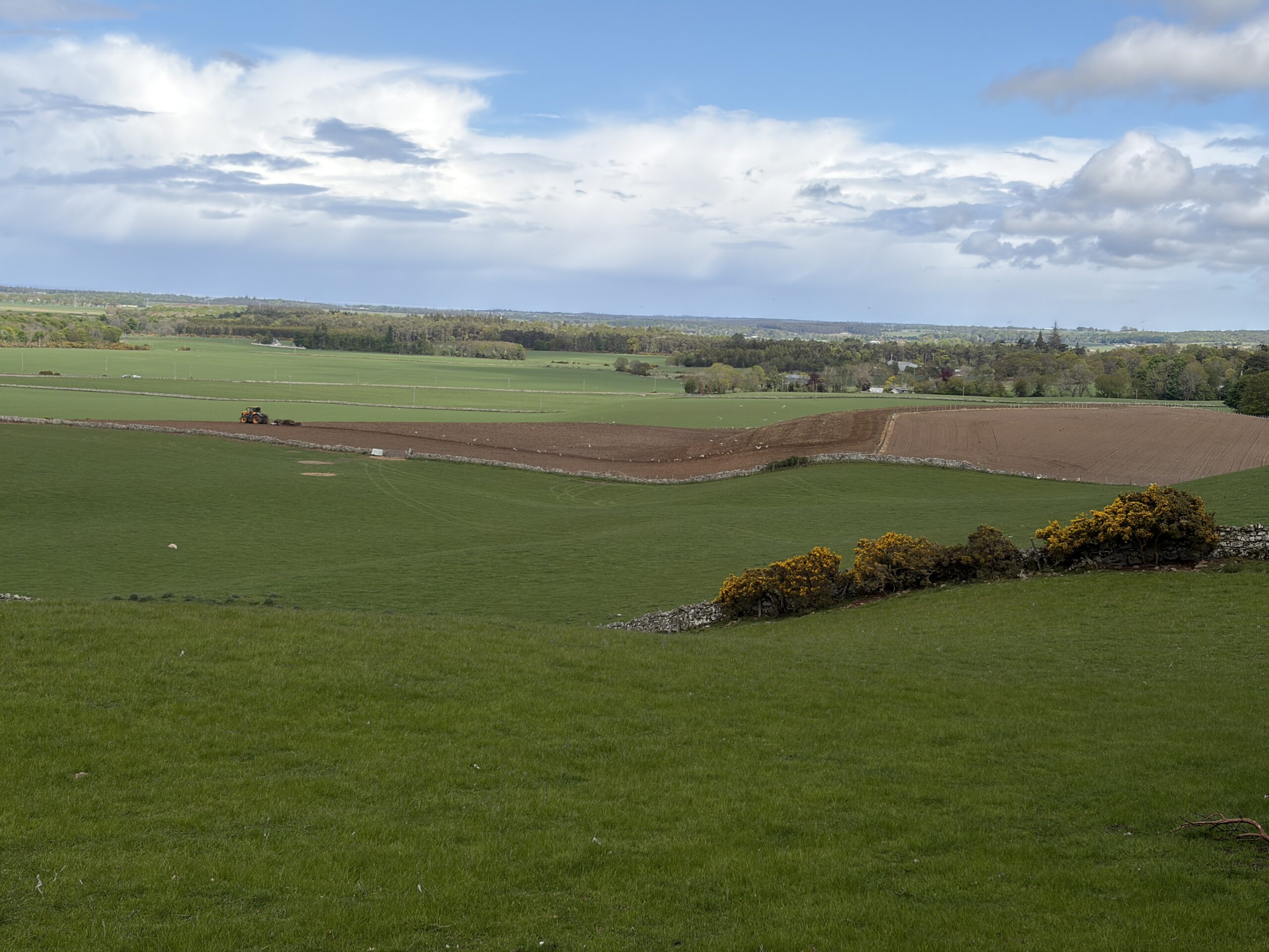
The road was hard underfoot, but gave great valedictory views of the Moray Coast. This one contains the essential elements: grass, gorse, sea, rock, and a single stone house.
I looked back. This is the direction I’d come from in what seemed an age ago.
The minor road connected with a big one (thankfully with a cycle track next to it) that headed into Fraserburgh. I lifted my head at one point and saw a man in an orange sweatshirt standing in the track waving his arms.
It was Duncan Bain Smith. He and his wife, Cham, were staying in their camper van, parked nearby. Duncan and his cousin Charlie had cracked on and finished a day early. Duncan invited me in for tea, but I declined. I wanted little more than to finish and take my boots off.
As I walked on and entered the town by chance I ran into Charlie Bain Smith. This time I had the presence of mind to get out my phone and take a picture.
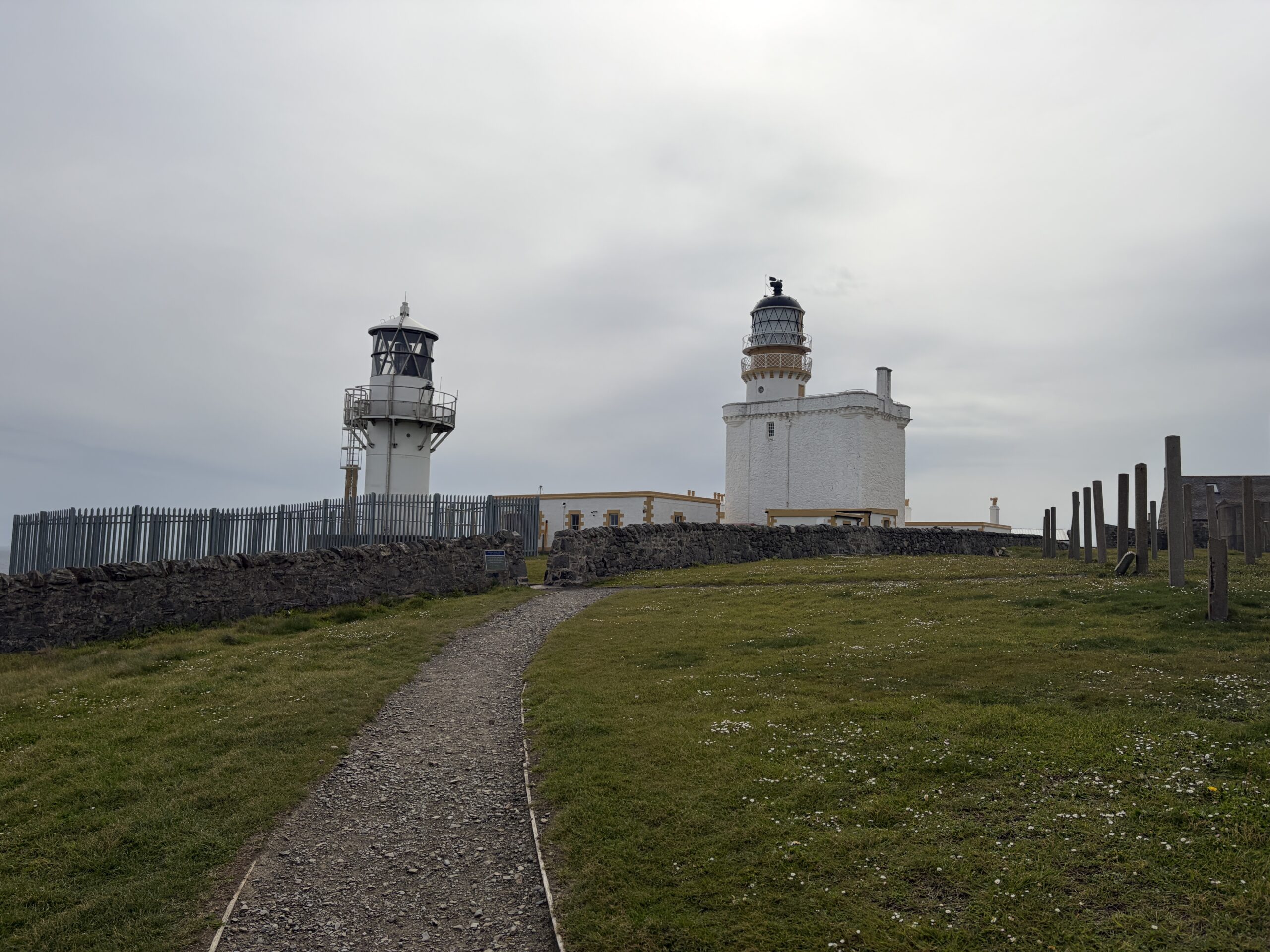
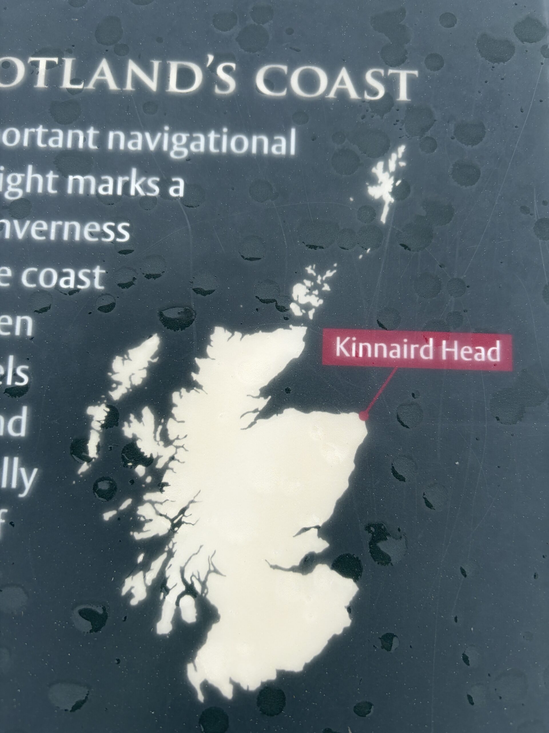
Soon enough Fraserburgh’s most distinctive landmark hove into view, the Kinnaird Head lighthouse. On the right is the original one, built in 1787 on the ruins of Alexander Fraser’s castle from the 1500s. On the left is its unmanned replacement.
The Kinnaird Head Lighthouse was the first built by the Northern Lighthouse Board, which eventually established more than an hundred along Scotland’s coasts. It stands at the apex of a right-angle of land where the North Sea meets the Moray Firth. It’s a feature that vessels coming from Scandinavia, or sailing either way around Britain, need to see.
In the encounter on the sidewalk, Charlie Bain Smith had recommended the Museum of Scottish Lighthouses, which is in the original lighthouse, if I had time for one tourist stop.
I took his advice.
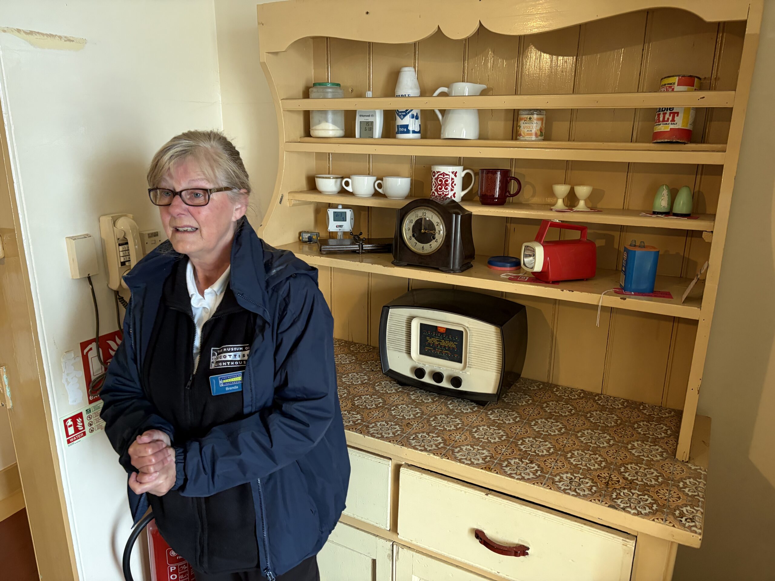
After a night in an hotel, I was at the museum at 10 a.m., with just enough time for a tour and a visit. At 12.20 p.m. I needed to board a bus for Montrose, a town a few hours to the south, where I had to check in and officially end my TGOC walk.
A wonderful docent named Brenda gave me and two other people a tour. This is the assistant-keeper’s quarters, left as it was in 1991 when the last one moved out.
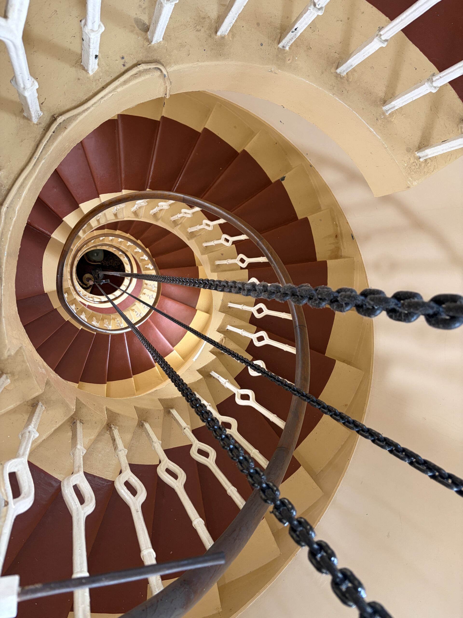
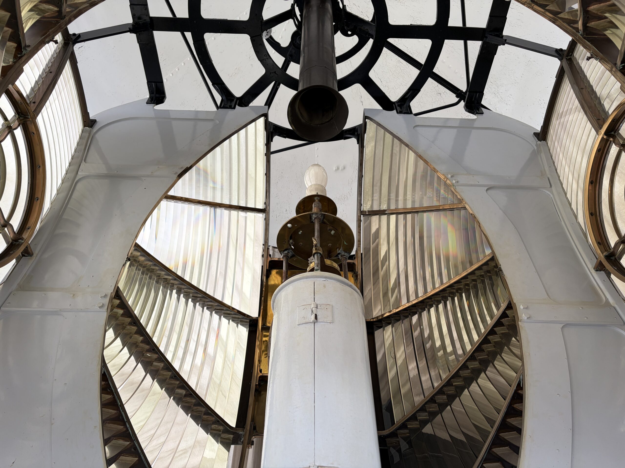
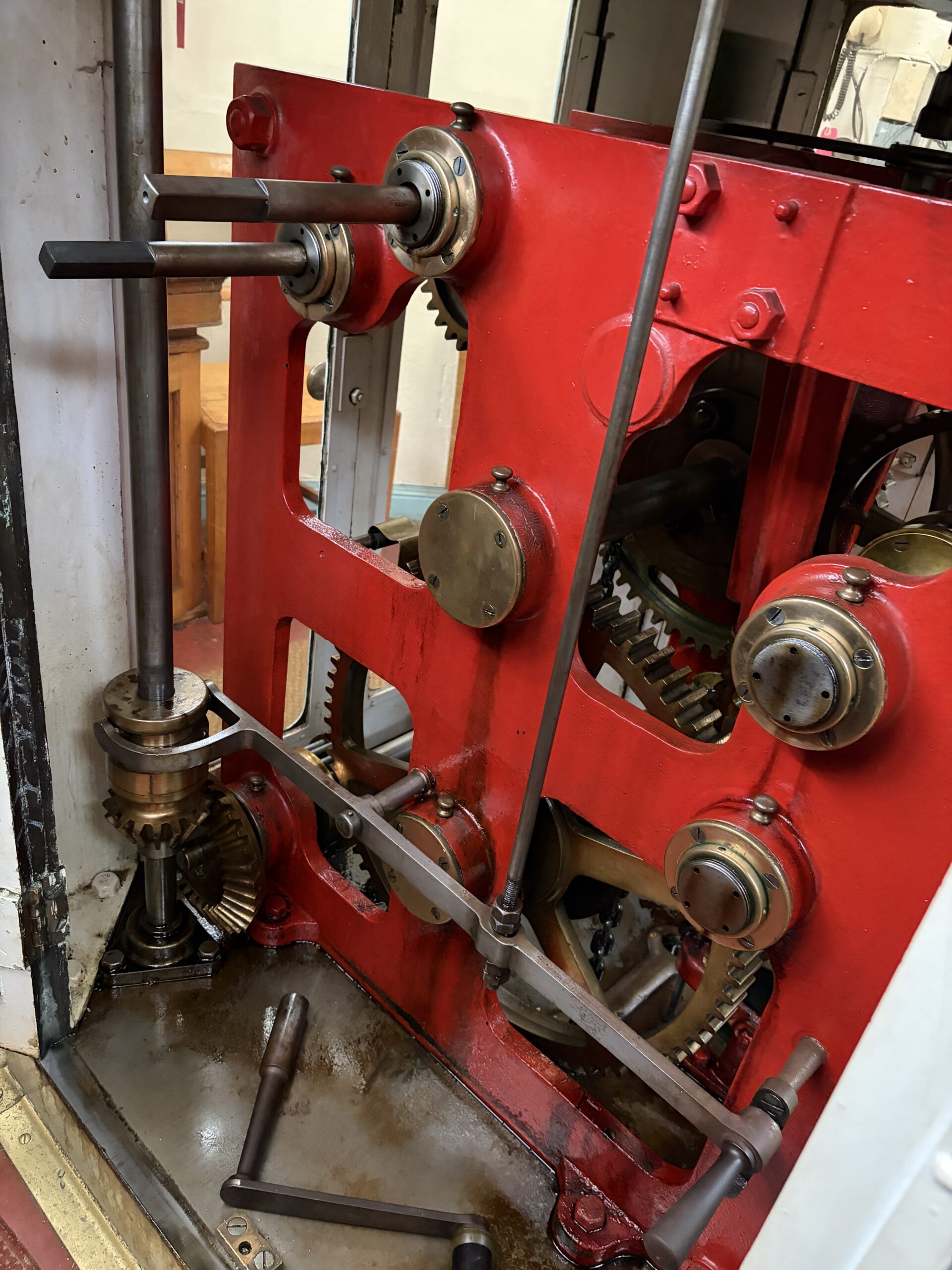
The lighthouse is a thing of precision, durability, and beauty. It’s a giant mechanical clock that also produces light and rotates (at least part of it).
When the optical system was upgraded with a Fresnel lens, the beam could be seen 27 miles away, with one flash every 15 seconds.
The light rotated, driven by suspended weights, as in a grandfather clock. If the keeper let the light become “standing”–not turning–he was likely to be dismissed. (There was never a woman lighthouse keeper.)
There are small adjustable vents–brass, of course–in the room with the light. They create draft for the flame and prevent the keeper from being overcome by kerosene fumes and toxic gases.
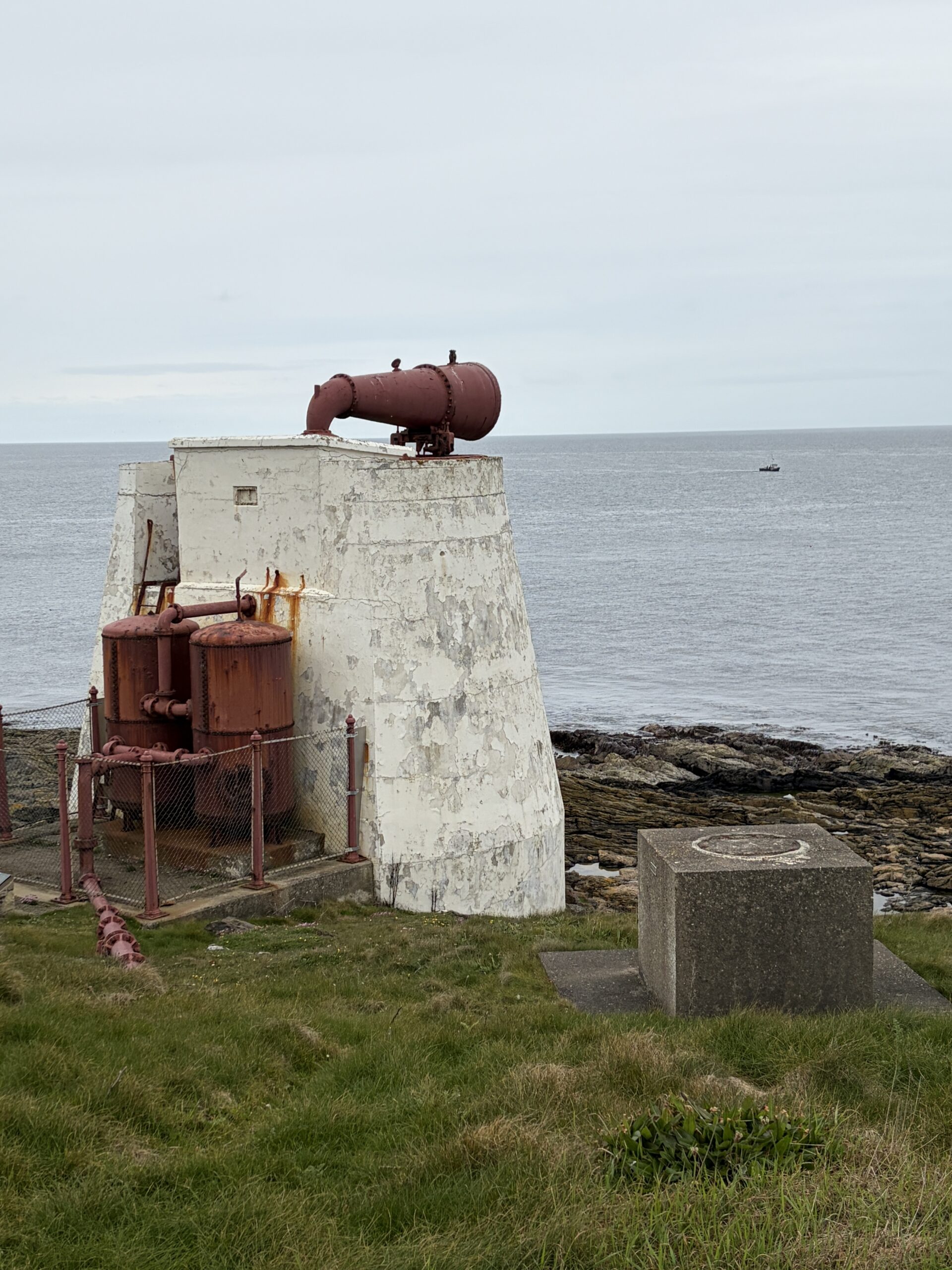
On the ground is a building dedicated to creating the pressurized air and timing for a foghorn. It gave a seven-second blast every 90 seconds in foggy weather. It operated from 1903 to 1987.
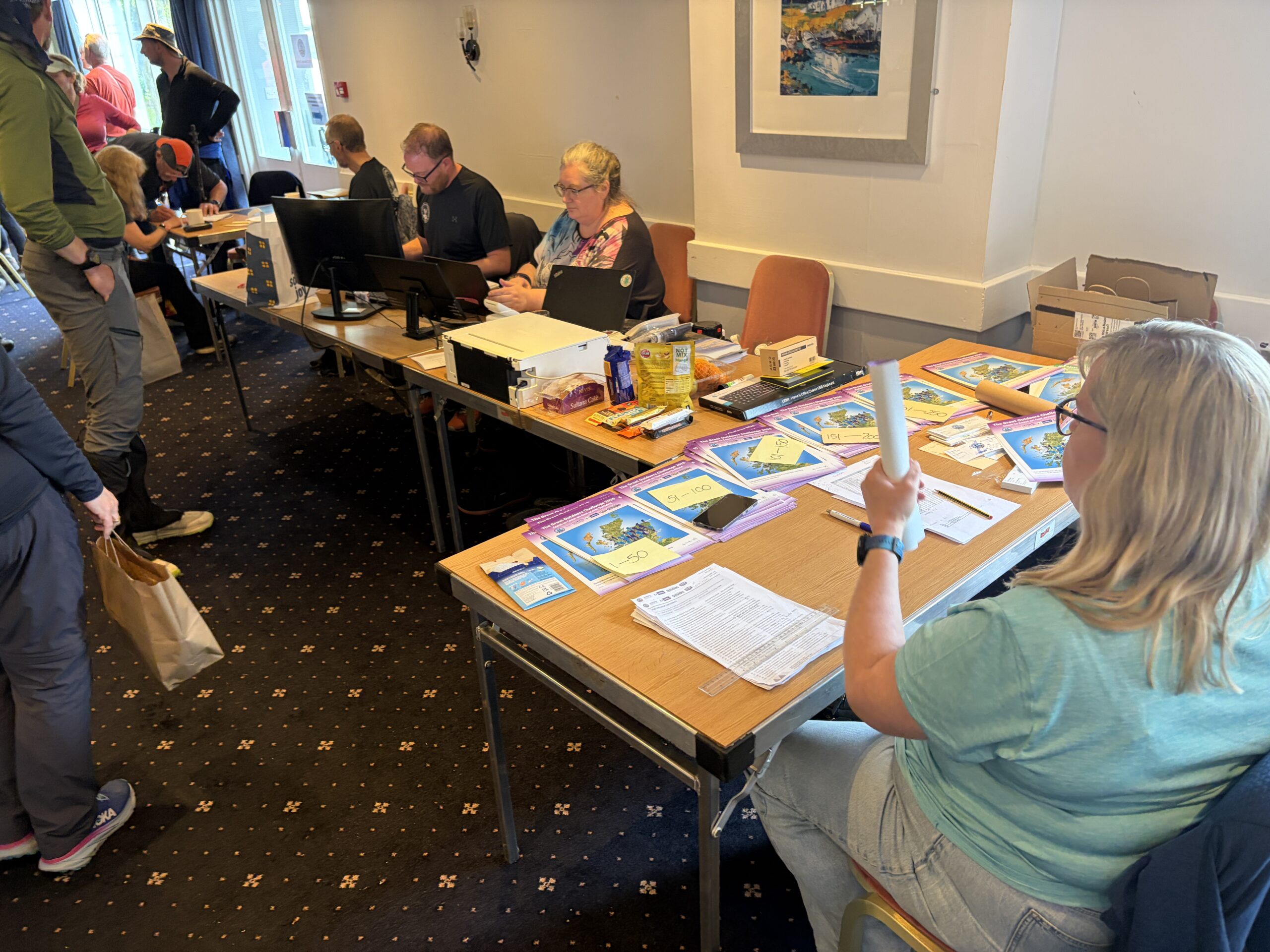
In Montrose, I went to the hotel that housed Challenge Control, checked in, signed the roster, and collected my bag of swag (tee shirt, mug, pin).
There were two things left to do.
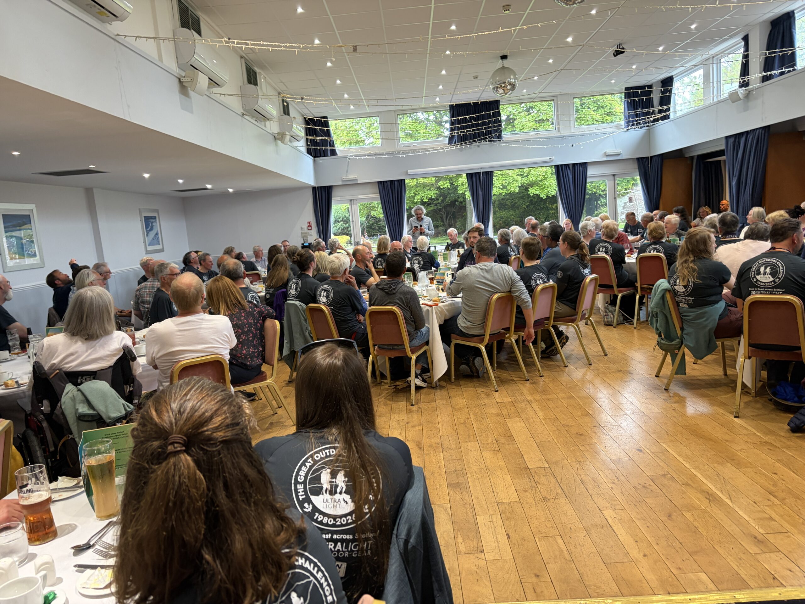
The first was to attend the banquet for Challengers finishing that day. There were banquets the day before and the day after for people finishing then.
It’s an event of great revelry and storytelling. One of the organizers gave a few statistics. There were 341 starters; 21 countries were represented; the youngest walker was 22; the oldest first-timer was 78; the fastest crossing was six days.
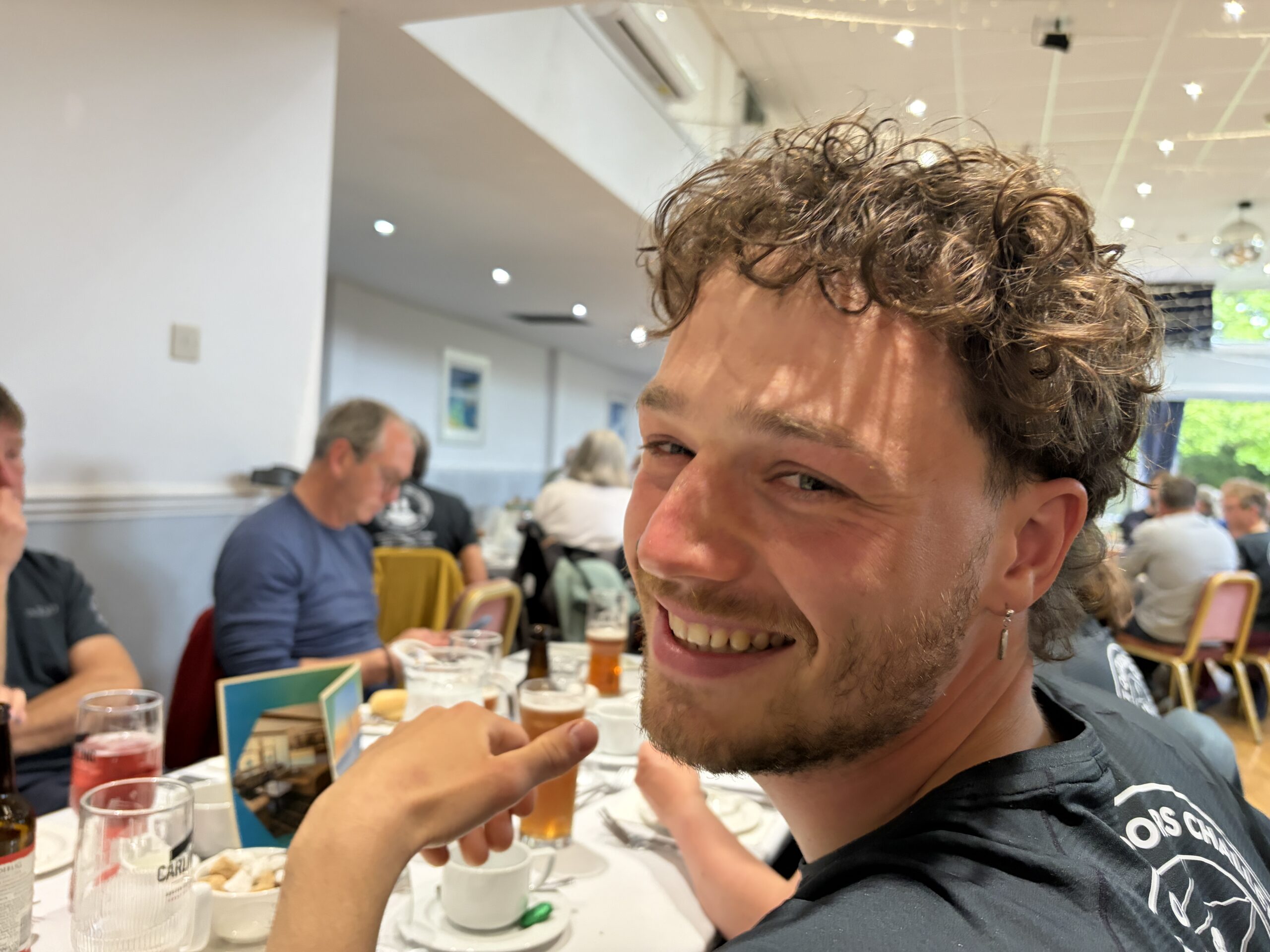
I was at a table with several young Dutch people. The one next to me, Kaas, turned 30 on the Challenge. He summitted seven Munros in one day and was snowed on part of the time.
Across from me were Duncan and Charlie, and Duncan’s wife, Cham. It’s nice to see relatives who seem to enjoy each other’s company so much.
I had breakfast the next morning with Graeme and Liz, with whom I’d camped one night two years earlier. I’d given them a spare bag of gorp, which they really liked, so I’d packed an extra one, confident I’d see them again. They didn’t look a day older.
But before breakfast, I did the other thing left to do.
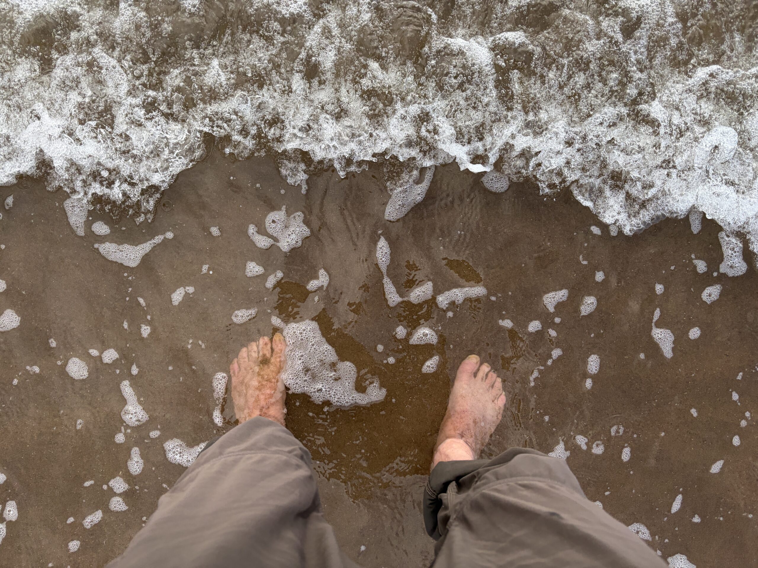
I walked a half-mile to the beach to wade into the North Sea. The Great Outdoors Challenge is serious about this act of pedal intinction; your crossing isn’t over until you’ve performed it.
The beach is a vest-pocket patch of sand between rocks. A woman was on the beach. When I got close I recognized her. She was Emma Warbrick, whom I’d met on the long train ride from Glasgow to Mallaig before my first Challenge, in 2014. She remembered me too, but more for something else.
Halfway across she twisted an ankle and wasn’t sure she could go on. I did an exam and determined it wasn’t broken or unstable, got out my kit of analgesics, and prescribed her some. She said I’d consulted something on an iPad. (I have a digital copy of the Special Forces field medical manual on it.) I had forgotten this encounter.
“I don’t think I could have made that crossing without you,” she said.
I was gratified to hear this. The Challenge is a self-indulgence, even if a self-punishing one. Someone on this walk asked me: “Are you raising money for charity?” “No,” I said. “I’m just trying to make it across.” So, it was nice to hear I’d been of help in a previous one.
“I’ll leave you to the ritual,” Emma said, and left the beach.
Some of you may wonder if I will do the Challenge again? I ask myself that, too. It was hard this time, even on a route that had less climbing than many of my previous ones, and no days longer than 18 miles.
I said “No” two years ago. I’m more sure now that’s the right answer. But I am glad I came back one last time.
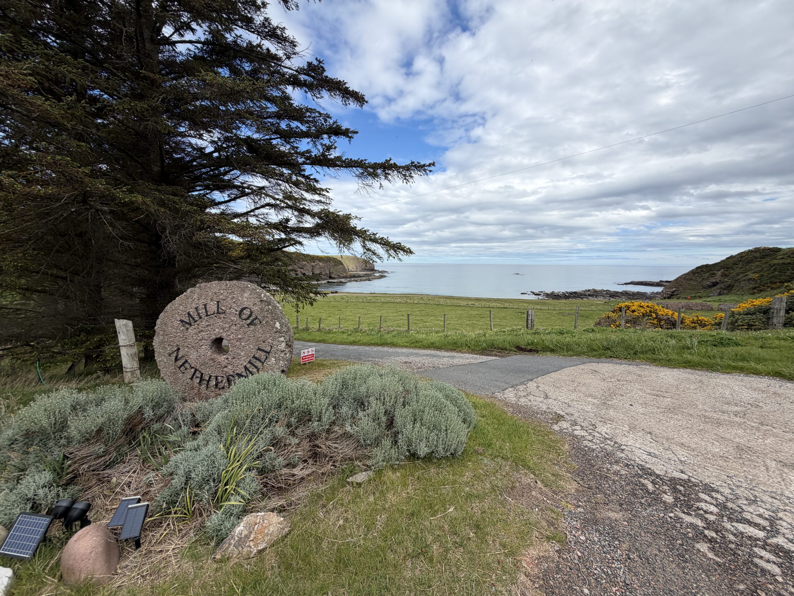
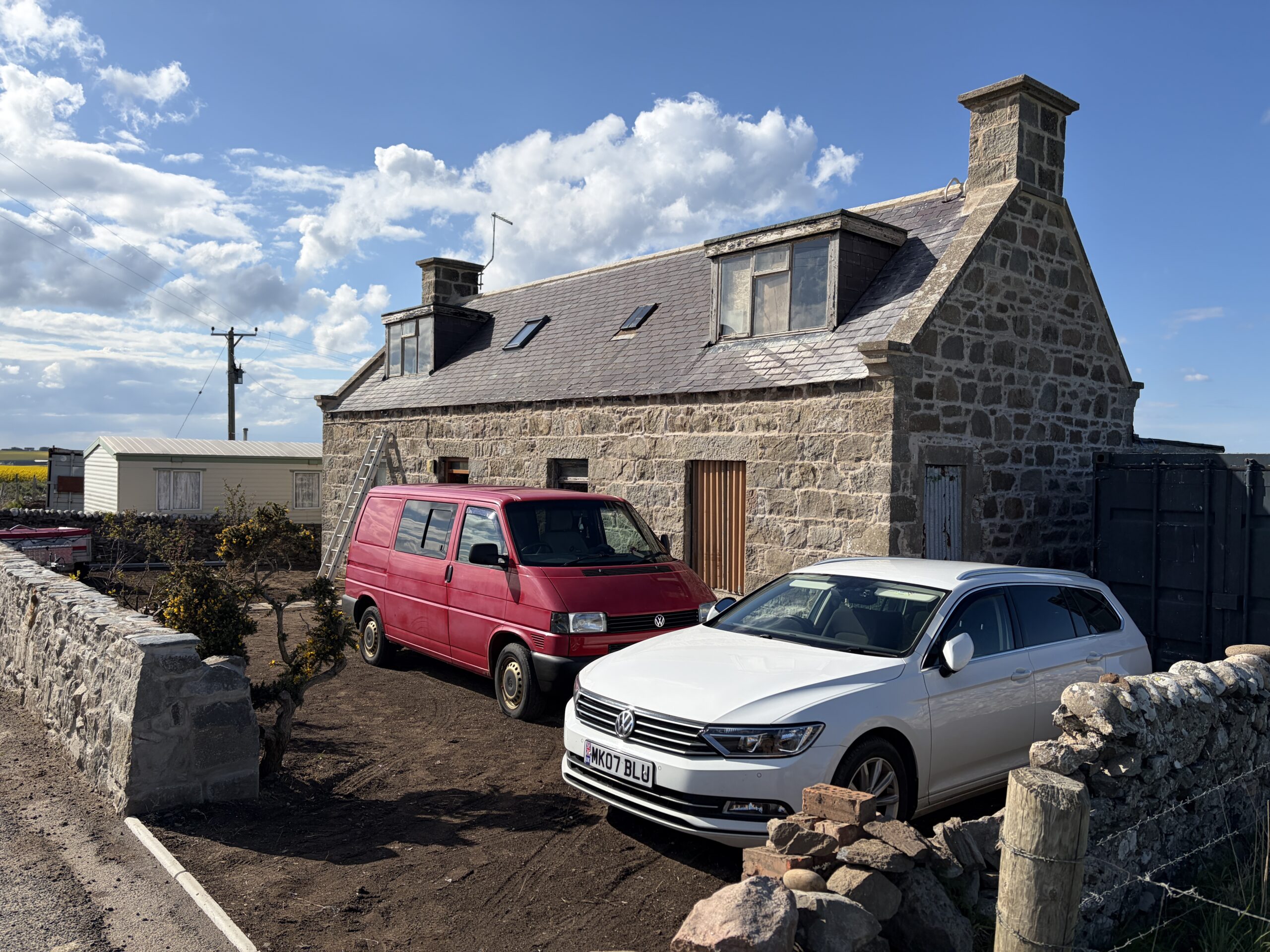
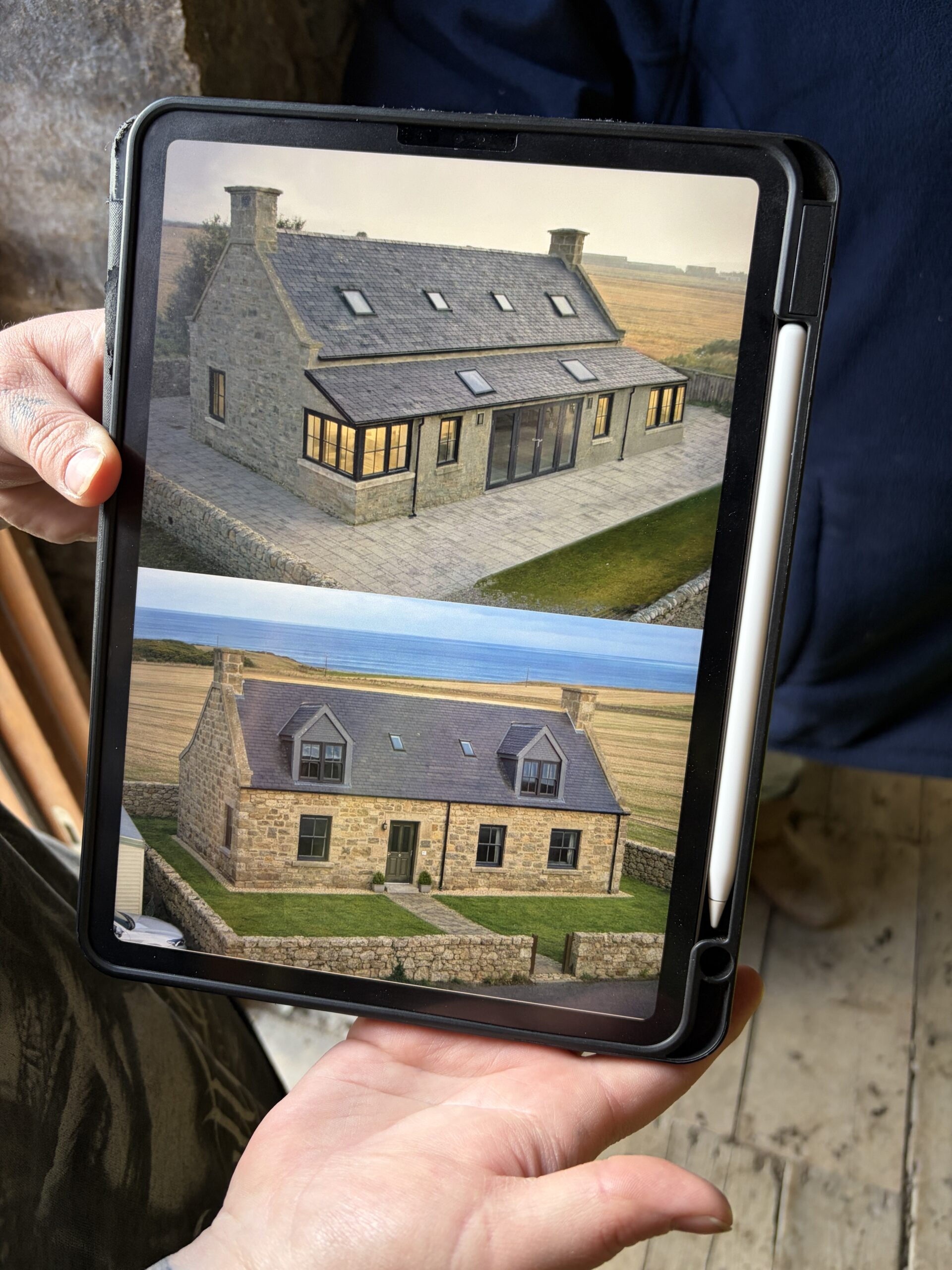
The people who reviewed and approved my route, John and Sue Tattersall, had walked the Moray Coast on their TGOC crossing in 2025 and had lots of helpful suggestions. One was for a possible camping spot for my last night out—the Mill of Nethermill, about 14 miles from my ending place, the fishing town of Fraserburgh. It had holiday rentals, a pottery studio, and place for camper vans and tents.
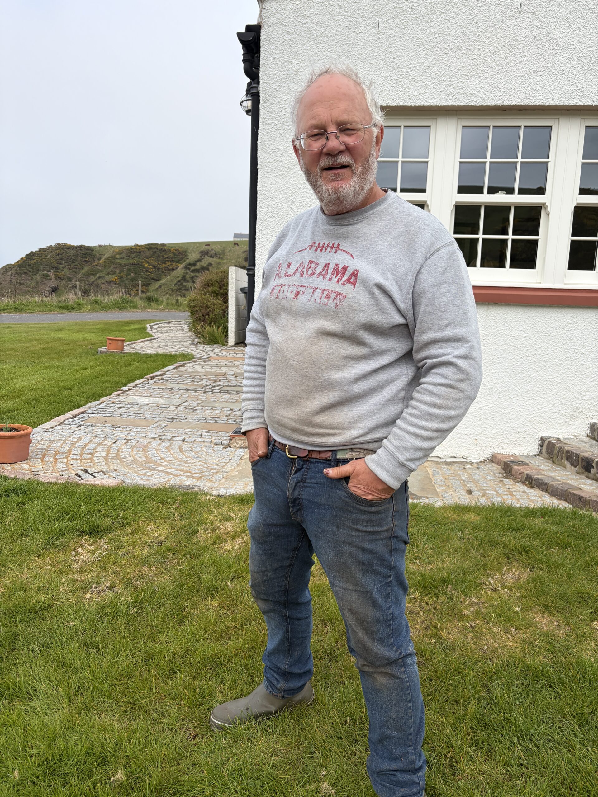
I contacted the owner, William Pitt, who told me they’d stopped the camping part of the business because of bad behavior by customers. But he said I could pitch a tent on his lawn.
He mentioned he’d grown up in Maryland and said he looked forward to offering me “some mid-Atlantic hospitality,” which I didn’t know was a thing. I looked forward to meeting him and hearing what had to be a story worth telling.
First, however, I had to get there.
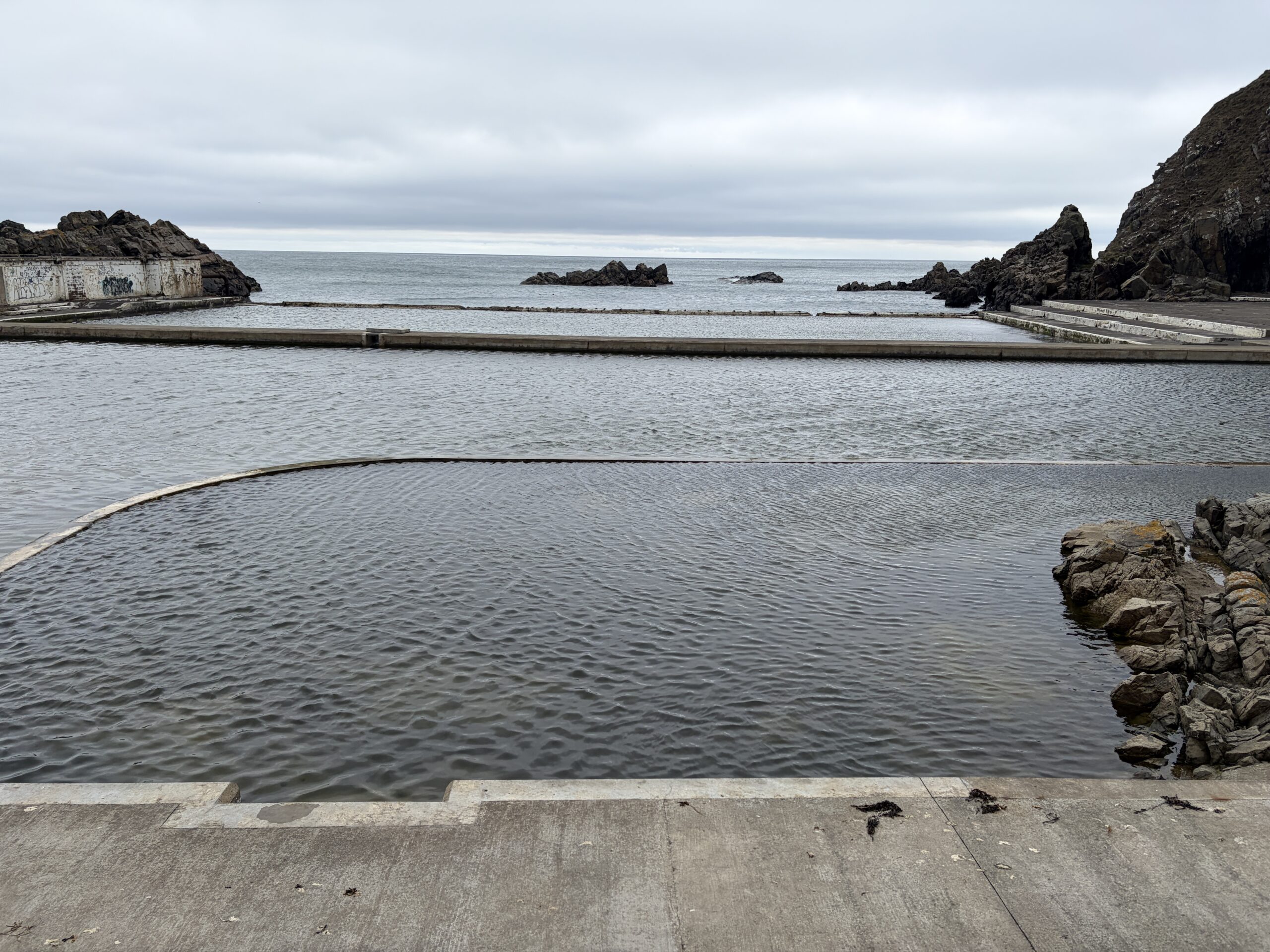
I left the golf-course campground just west of Banff, walked the coast to MacDuff, a town with a non-tourism commercial sector—shipbuilding and repair—and on to a place called Tarlair Pools.
It’s a pair of tide-fed pools that is currently closed, but being rehabilitated. In my experience, these self-filling and self-emptying swimming venues are good ideas that don’t survive a couple of big winter storms.
Of particular interest to me was a cafe where I could have lunch, two cups of coffee, and a scone.
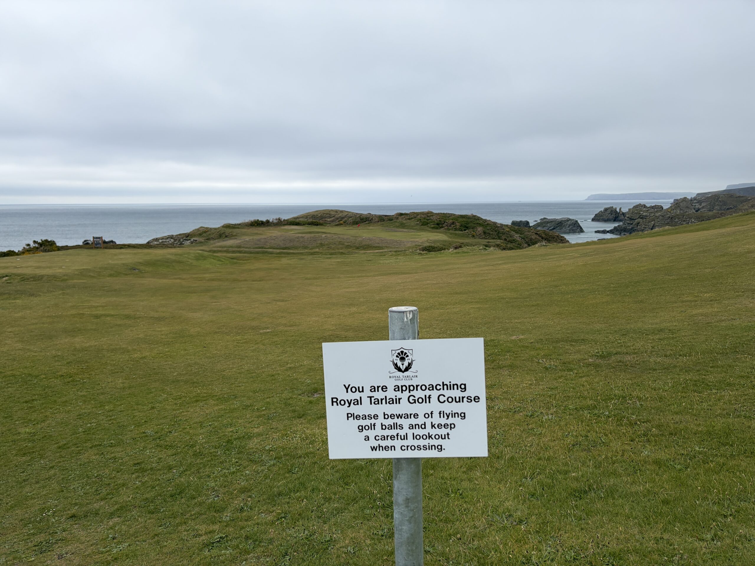
The cliffside trail beyond was in poor repair, and it was windy and cold, so I decided to go inland, which required a climb up a path to the plain above, which happened to be the Royal Tarlair Golf Course.
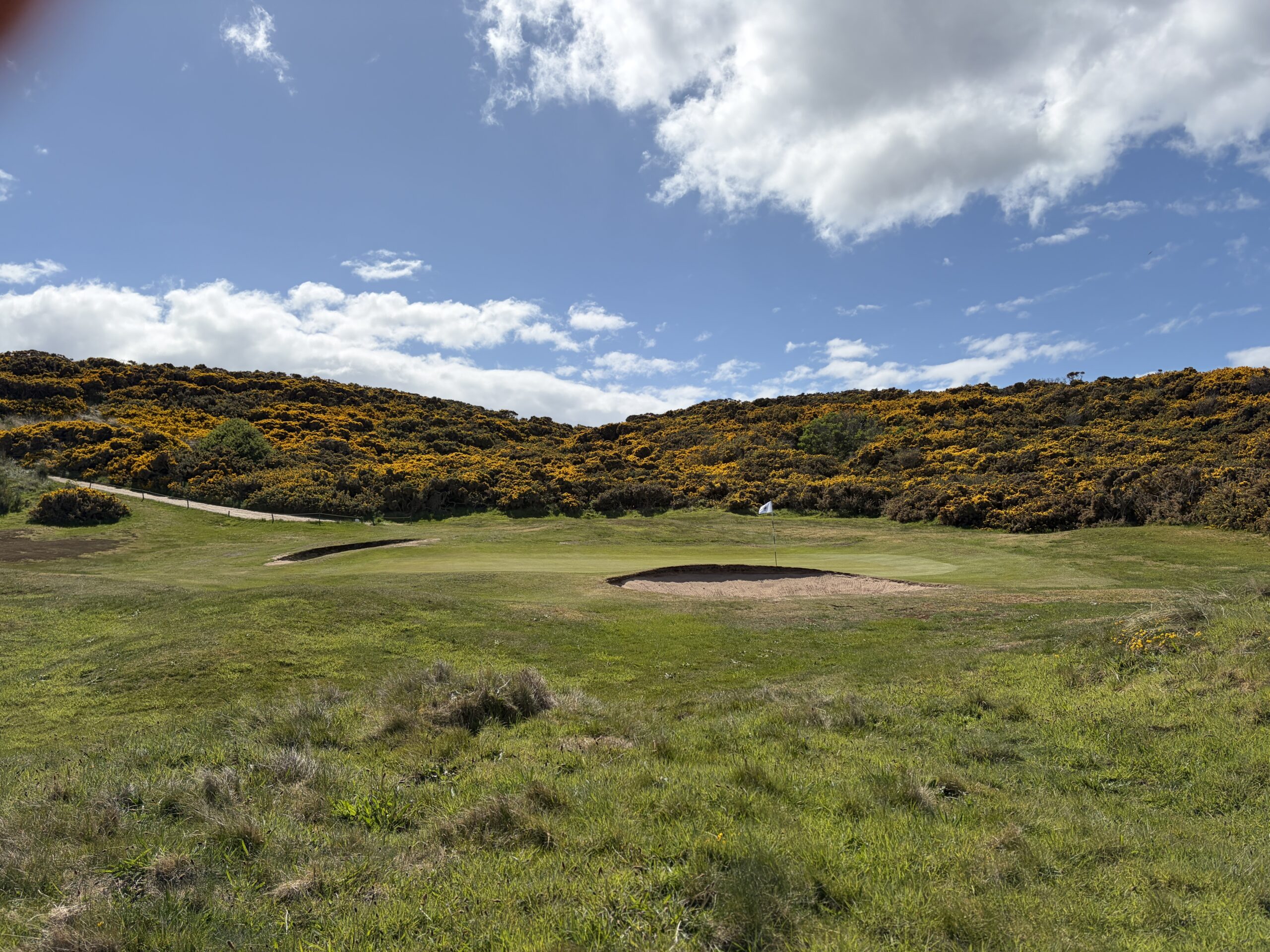
To my surprise, I saw no golfers. I’d seen them in worse weather on other courses I’d passed in the crossing. If you like golf links, can hit reasonably straight, and don’t mind walking—there are no golf carts—the Moray Coast is the place for you.
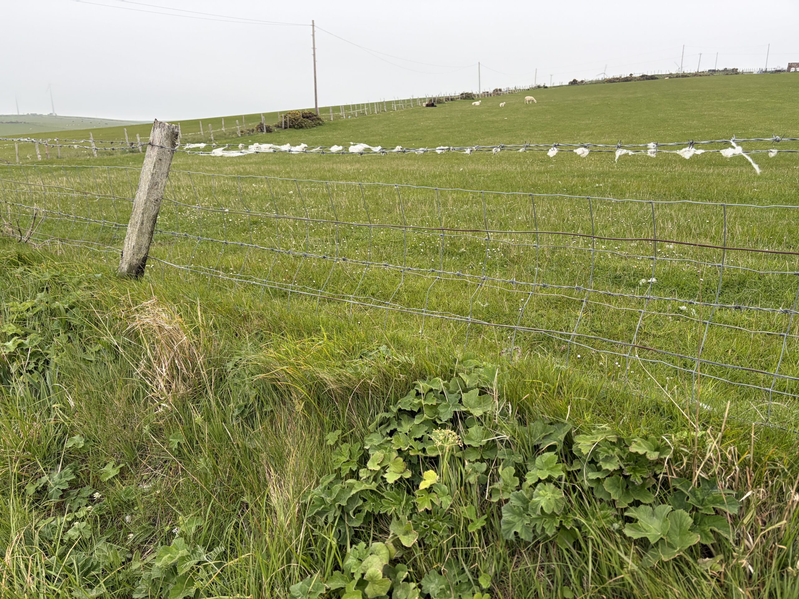
It was cold and very windy. These tufts of fleece snagged on barbed wire are standing horizontal in the wind.
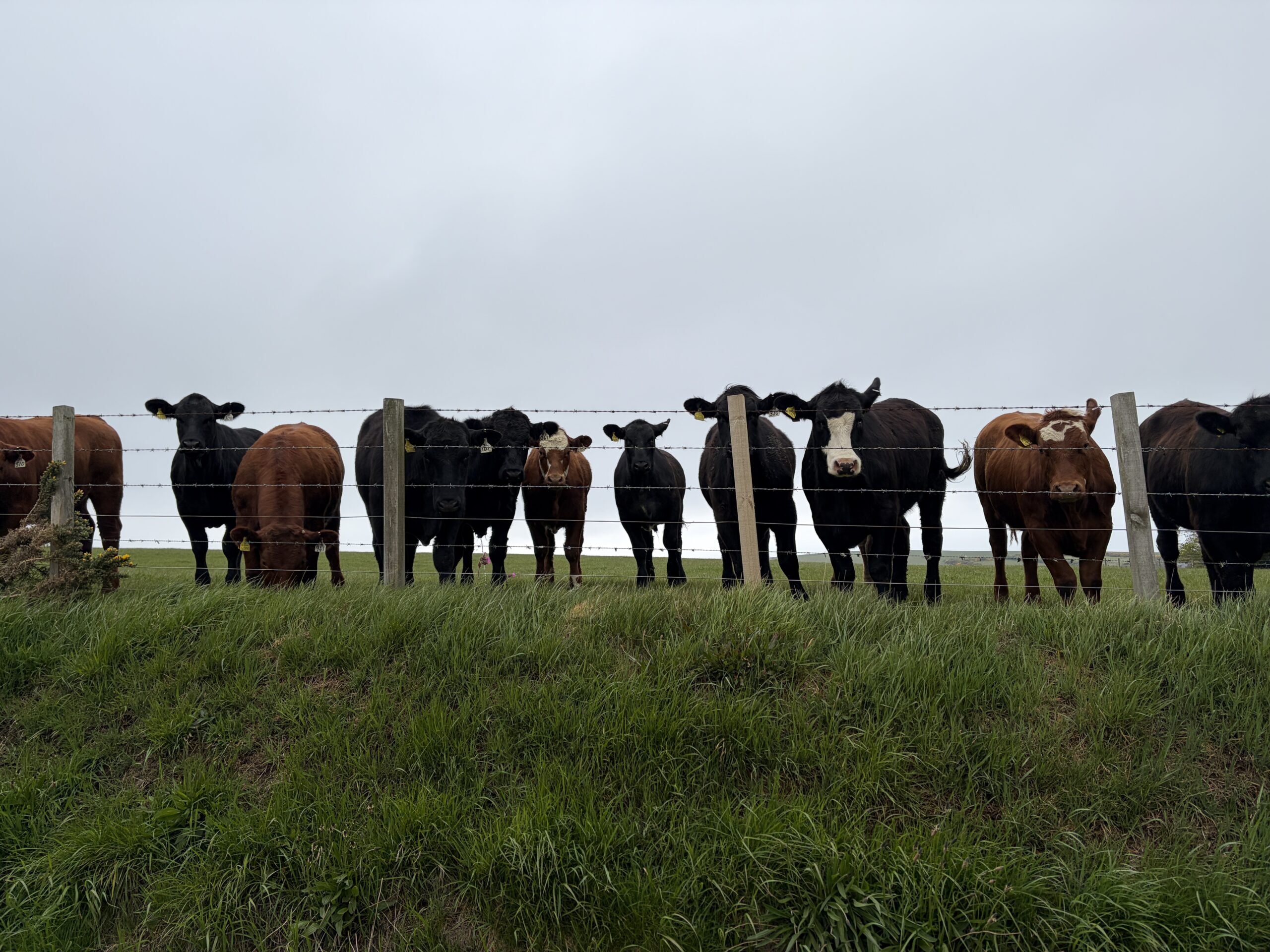
Cattle are a combination of curiosity and skittishness.
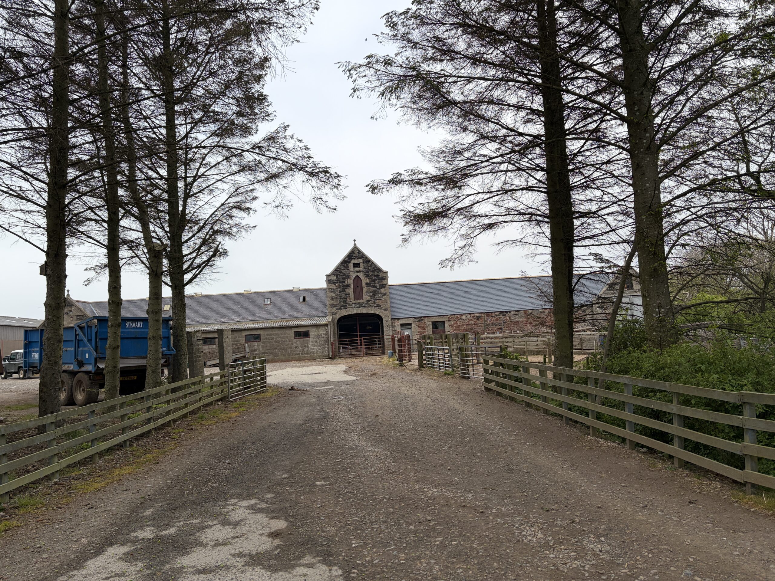
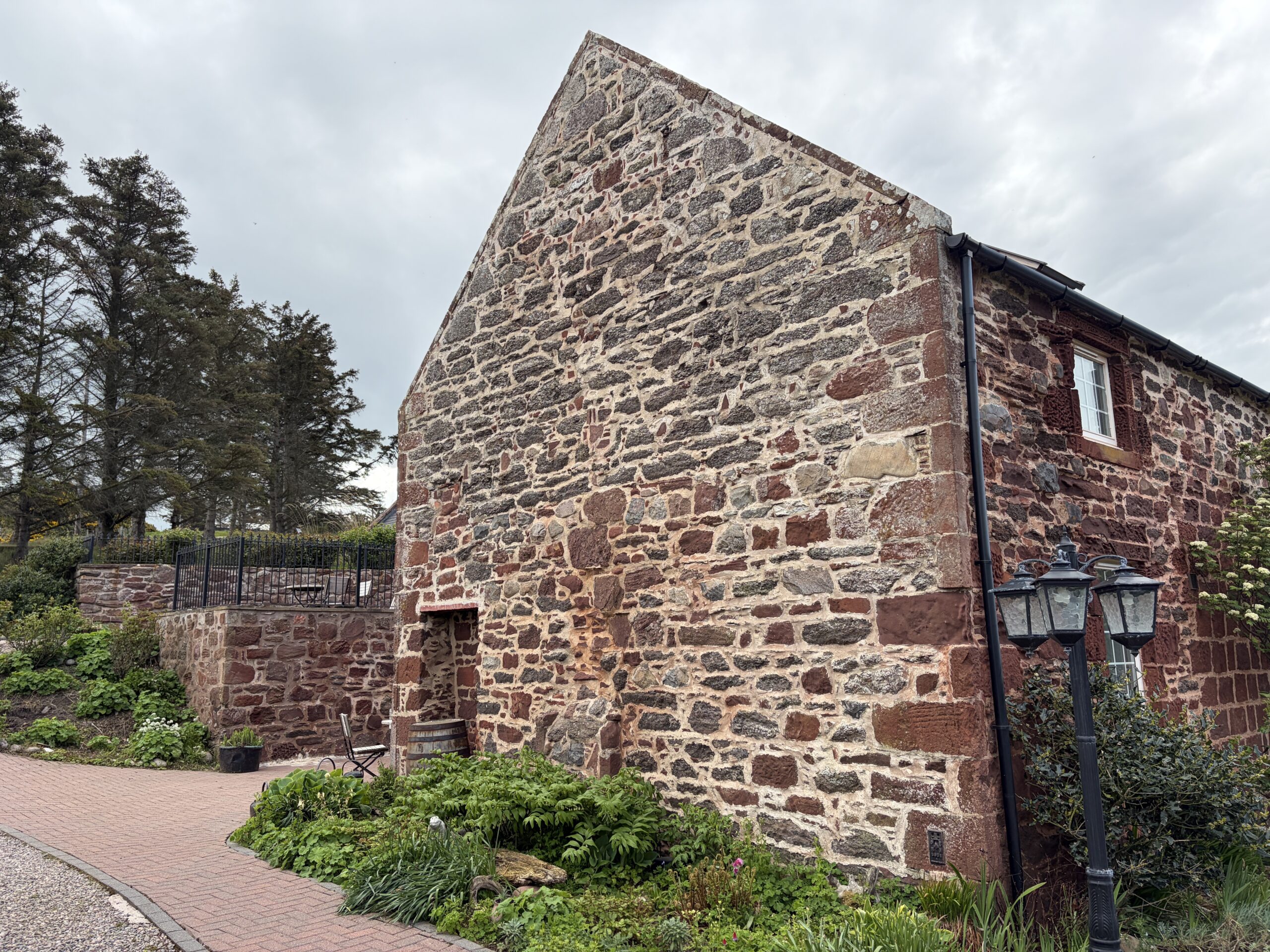
This stone barn with a central tower is a design you’d be unlikely to find in America.
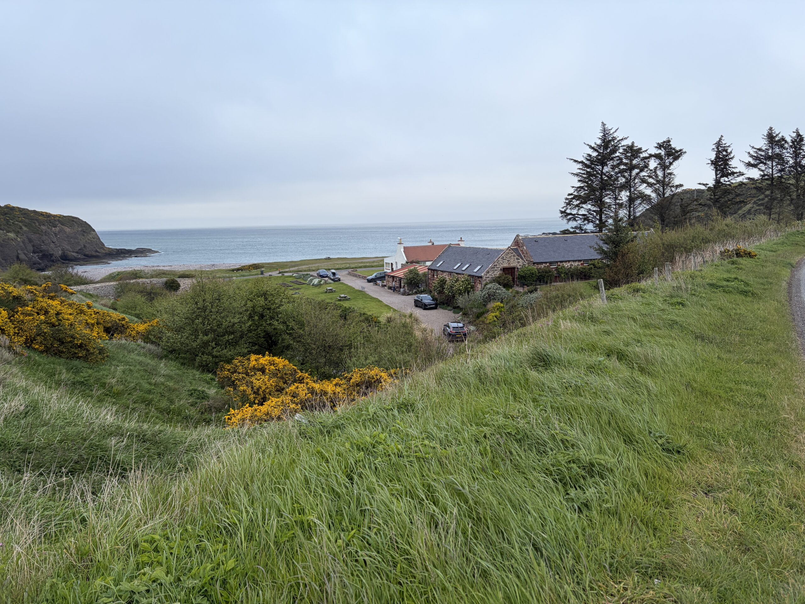
I eventually approached the Mill of Nethermill—“the mill below the mill.” (There must be a story there, too.) It was below the brow of the coastal plain, a cluster of buildings with an arched stone bridge built in the 1700s, now closed to vehicular traffic. I was tempted to take it and save a few steps, but I opted for the official entrance.
I’d texted Bill Pitt of my approach. He was waiting for me.
We exchanged pleasantries. I refreshed him with my 25-word autobiography, and also my interest in hearing how he got there. We agreed that the morning would be the better time to talk. He directed me to the closed tenting grounds (which he and his wife, Lynn, have decided to reopen) and invited me to find a pitch and return about 8.30 in the morning.
It was a beautiful place to spend the night–a crescent beach bounded by the apostrophe of rocky cliffs, with a clear view to the Moray Firth. In the winter there are often Northern Lights, Bill said, but not now. Because of the perpetually cloudy Scottish skies there weren’t any stars either. I haven’t seen the moon in two weeks.
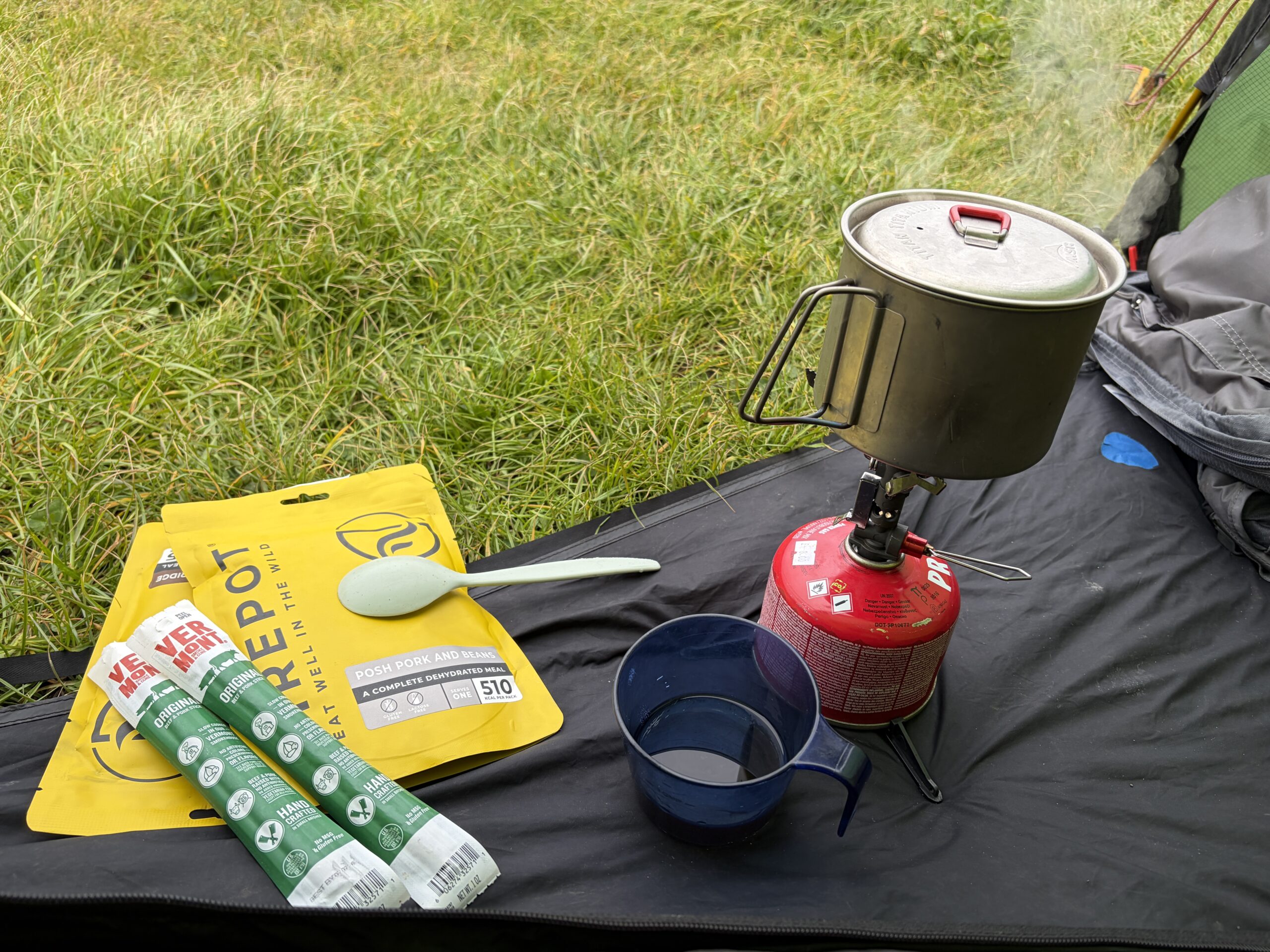
It was a good place to have “posh baked beans,” especially if they are accompanied by Vermont smoked meat sticks and a wee dram of malt.
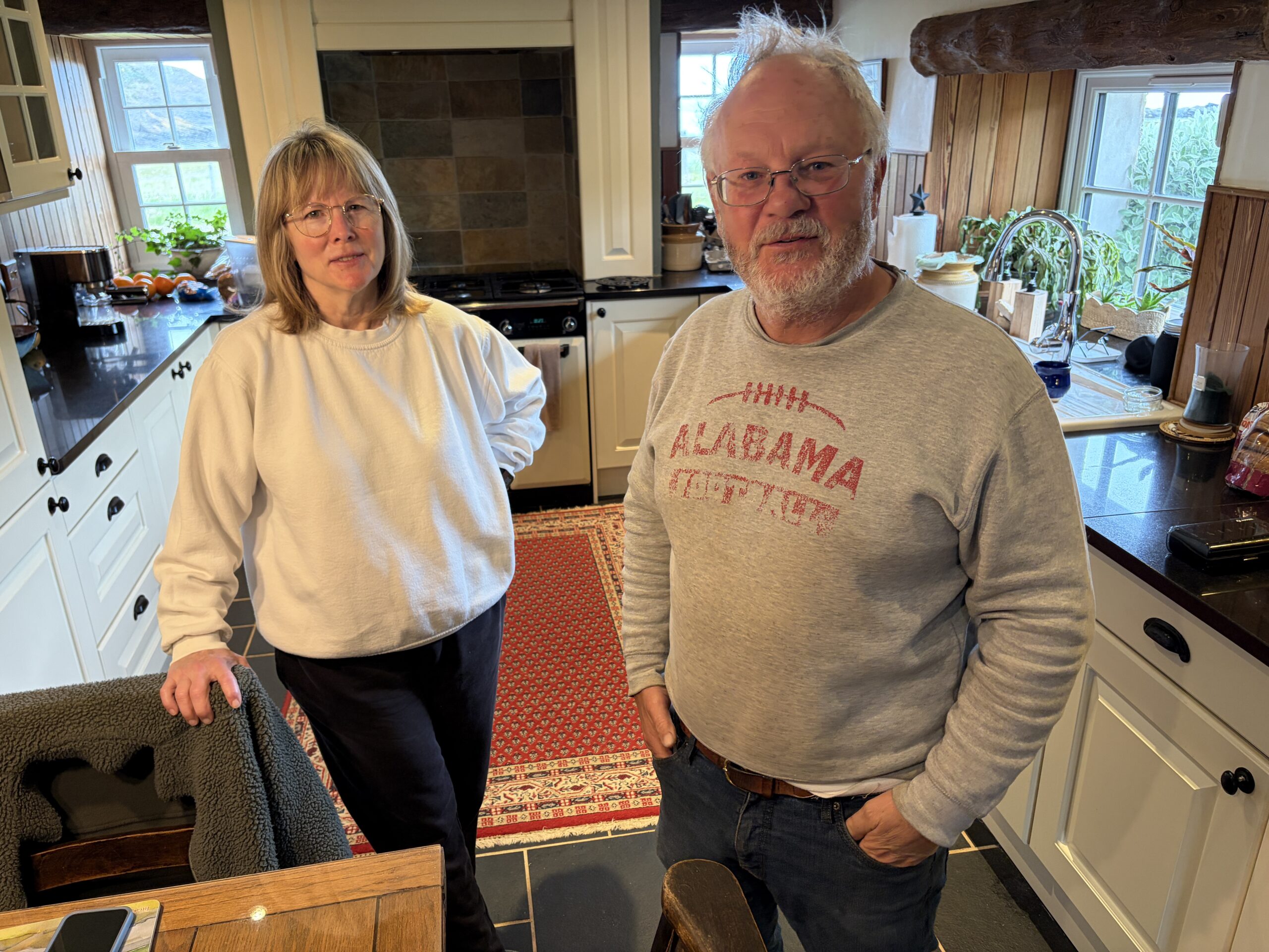
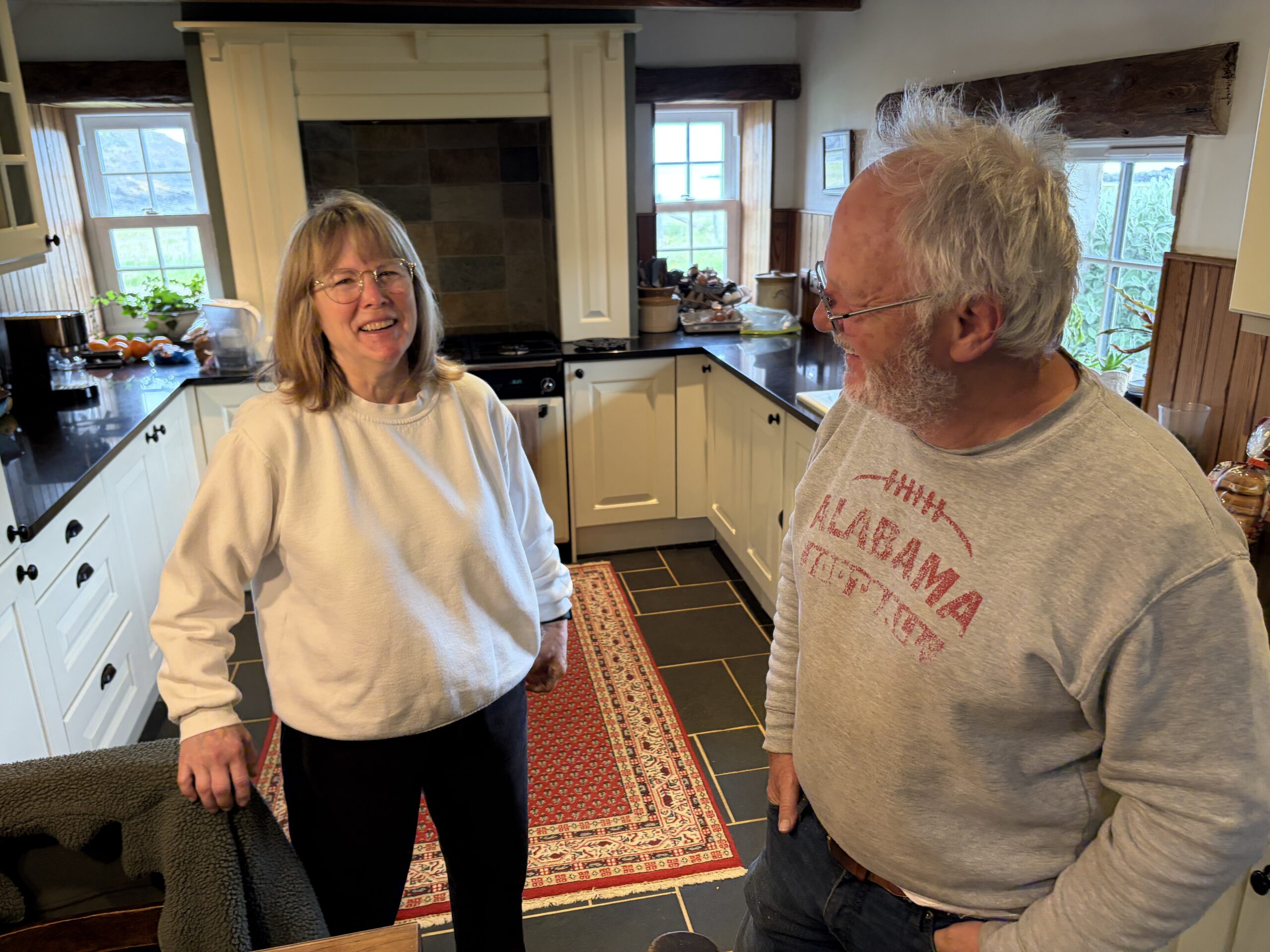
Bill and Lynn Pitt have a long and interesting story, full of small but consequential moments of good fortune and a huge amount of work. I won’t tell you all of it, but I’ll tell you some of it.
Lynn, who is 64, grew up in Charleston, South Carolina; she still has a trace of a Low Country accent. Bill, 66, was born in England, where his father was an Air Force intelligence officer (possibly CIA) involved in surveillance of the Soviet Union. When Bill was a toddler, his father was recalled to the Pentagon; the family settled in Germantown, Maryland.
Bill became a steamship agent, a job that requires solving problems for large vessels whose downtime in port is measured in tens of thousands of dollars per hour. Lynn was a customs broker—a person licensed to clear cargo through customs—chrome ore, blue jeans, automobiles. They were both high-stress, on-call jobs.
They have one child—a daughter—and were active in the Scottish Society of Charleston, which sponsored an American version of the Highland Games. Lynn has Scots heritage and they’d visited the country several times and liked it.
In 2005, they had a family reunion at the village of Crovie a few miles west of where they live now. It’s a virtually inaccessible hamlet of a few dozen houses set with their gable ends facing the sea and the weather, their front doors on a narrow passage between houses.
“We had a rental car, and on the drive back to Macduff I said, ‘One day we’re going to retire over here and I’m going to join that golf club’,” Bill recalled, referring to the links I’d just walked across.
“Within 11 months we were here,” Lynn said.
“We got back to Charleston and all we could think about was Scotland,” Bill said. “We couldn’t get it out of our brains.”
They explored immigrating and discovered it would be much easier if Bill could prove he’d been born in the United Kingdom. To his surprise, he found his late father’s transfer orders from 1962 that listed him as an infant, which was enough.
They asked their daughter, who was 14, whether she was interested in moving to Scotland. She was all for it, “so we got that box checked,” Bill said.
In 2006 they sold their house in Charleston at the top of the market. With the money they bought a fisherman’s cottage in Macduff. On the first day there Wallace, their dog, ran off. Within a few hours everyone in the neighborhood knew the Americans had lost a dog, and soon he was found.
“We knew at that point that we’d made the right choice,” Bill said.
They lived there and in the neighboring town of Portsoy for four years. Lynn worked at a historic castle nearby; Bill played golf and fixed up a “holiday house” they bought and rented out. Eventually they learned of the Mill at Nethermill and bought it when a sale to a Frenchman fell through.
The former occupants hauled water by hand from a well whose pump had failed. The grounds were nettles and brambles. They stored furniture from the holiday house, which they’d sold, in the old mill building. Someone broke in, stole it, and set the building on fire. Bill, Lynn, and their daughter moved onto the cottage on the property to keep an eye on things.
They calculated they needed four rental units to have a profitable business. They started the long slog of renovating the mill, hiring local workers and a Lithuanian man whom they met when he was collecting shellfish on the beach. They took no loans, spent all their money, and were down to a credit card when they got an unexpected tax refund check in the mail.
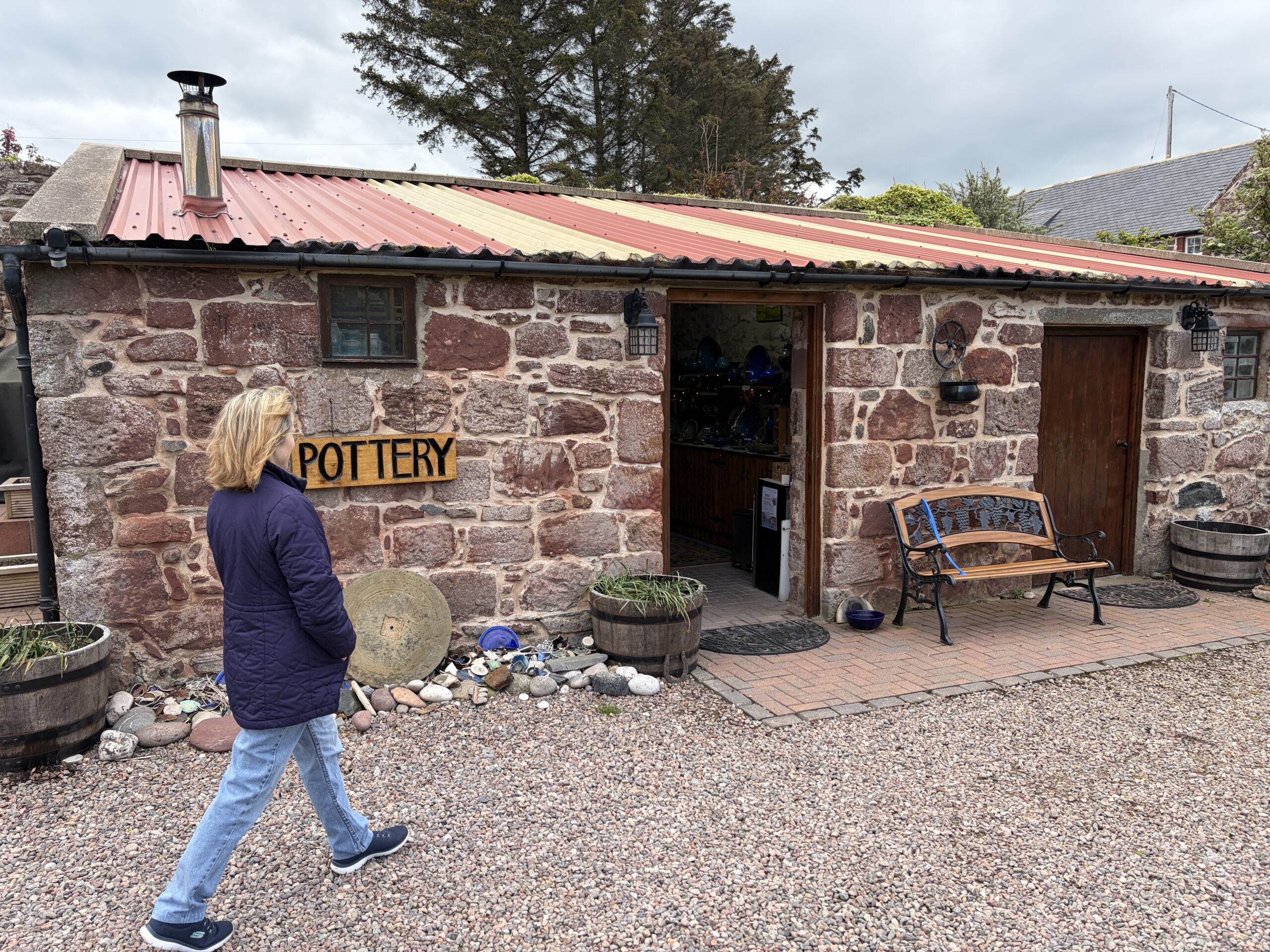
Lynn took a pottery course, set up a studio with a kiln, and began selling her wares. Bill taught himself various masonry skills.
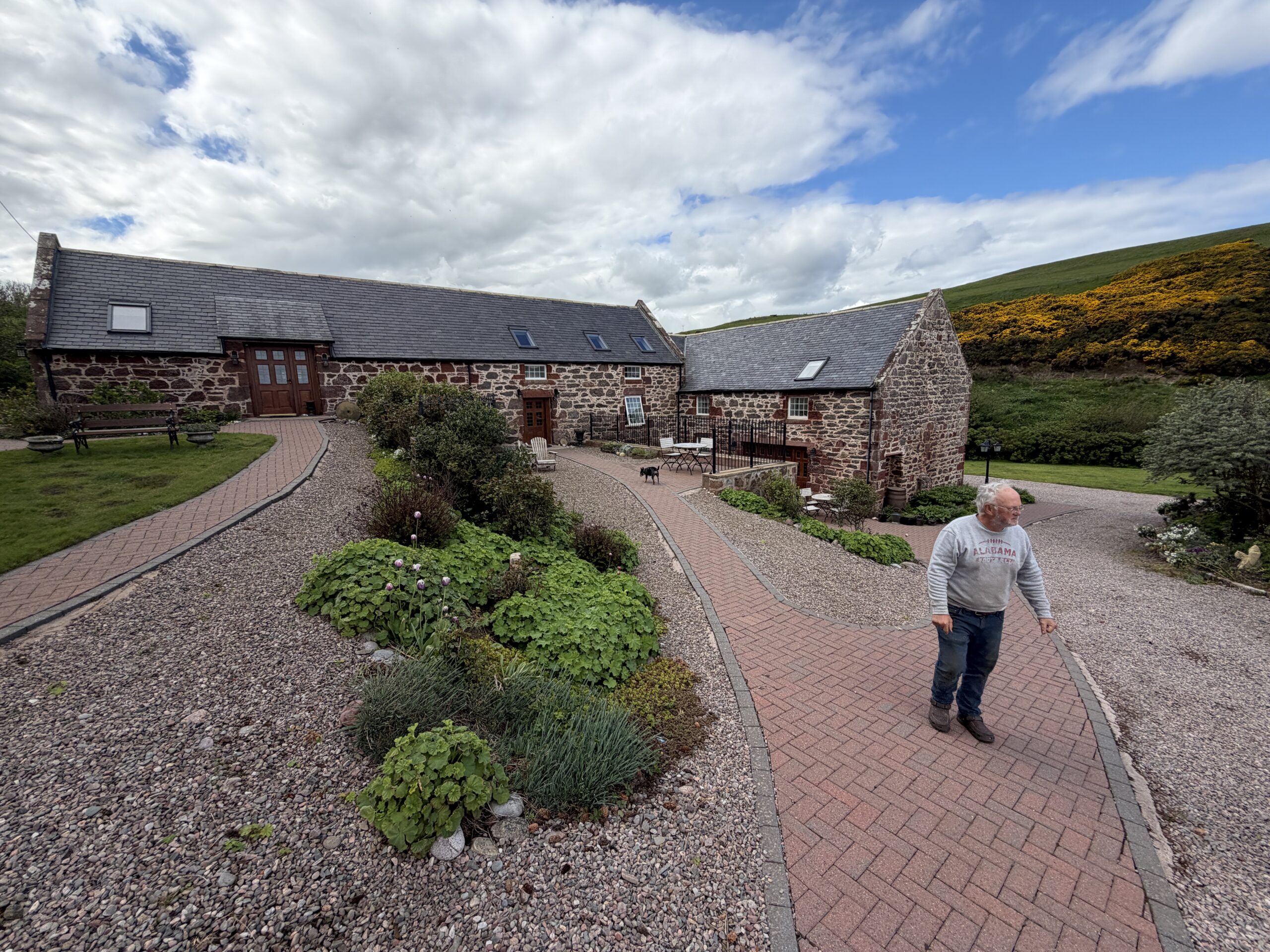
Today, they have four units in the mill building–the rehab cost more than the whole property did–that they rent out by the week in the summer and for a three-day minimum in the off season. A few years ago they won an award from a Scottish tourist bureau.
The rental business and the pottery shop both make a profit.
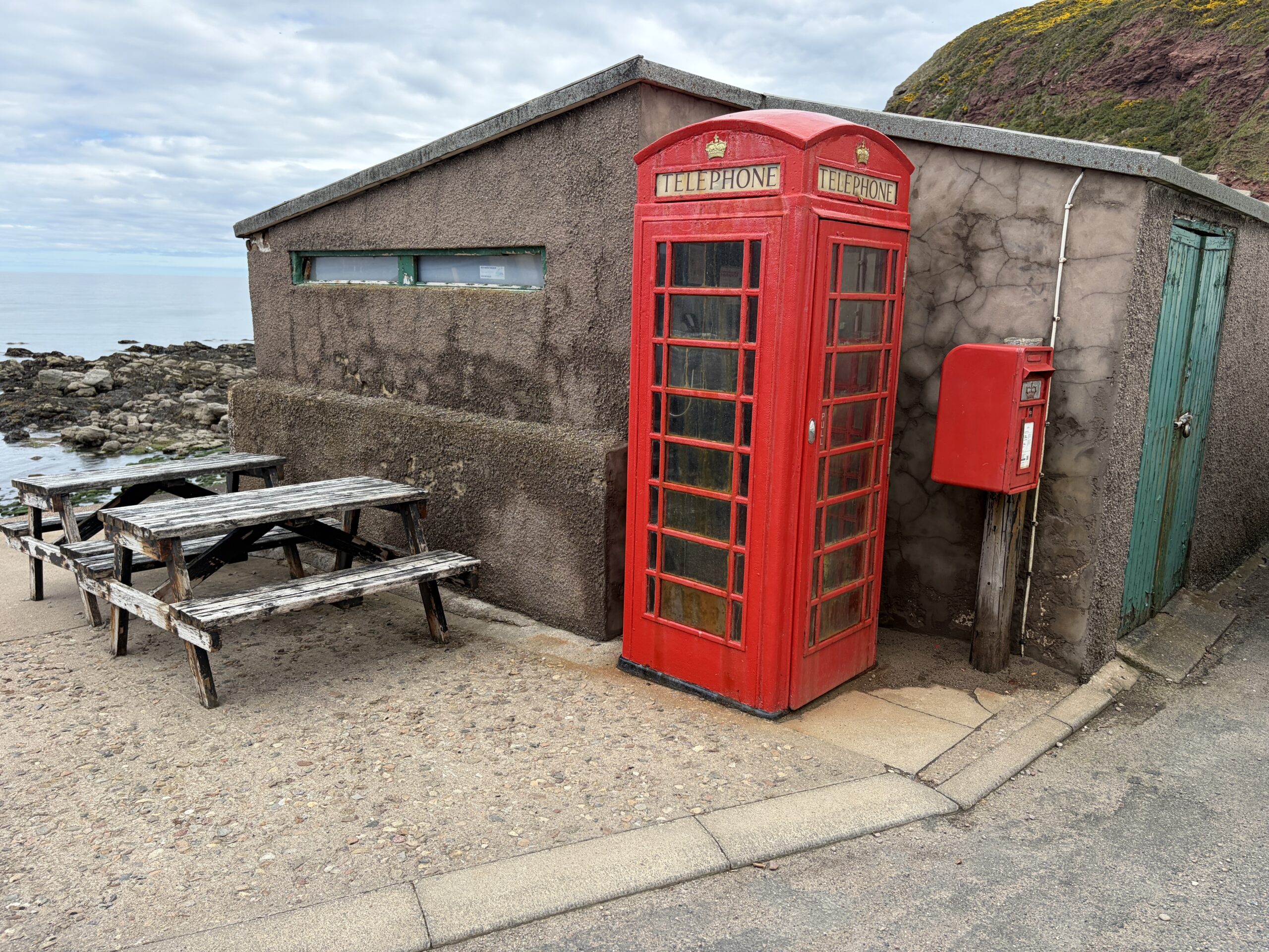
They’re involved in various local projects. Several years ago Bill helped organize a 40th anniversary of the movie ‘Local Hero,” which was filmed in the village of Pennan a mile away.
Although I’ve never seen it, the story apparently features a classic red phone box, which people now come from around the world to see. Bill and a friend named Eddie paint it every year–many phone boxes are shabby and derelict–and they planned to do the job the next day.
One time they got there with paint and brushes and saw a man sitting and looking at the phone box, deep in thought. He was an American Airlines pilot who’d flown into Edinburgh, rented a car, and driven to Pennan just to see it. Bill let him load a brush and take a few strokes. It was kind of a dream come true.
It’s an unexpected and hard-earned and satisfying life that Bill and Lynn Pitt have built for themselves in Scotland, a long way from Maryland and South Carolina.
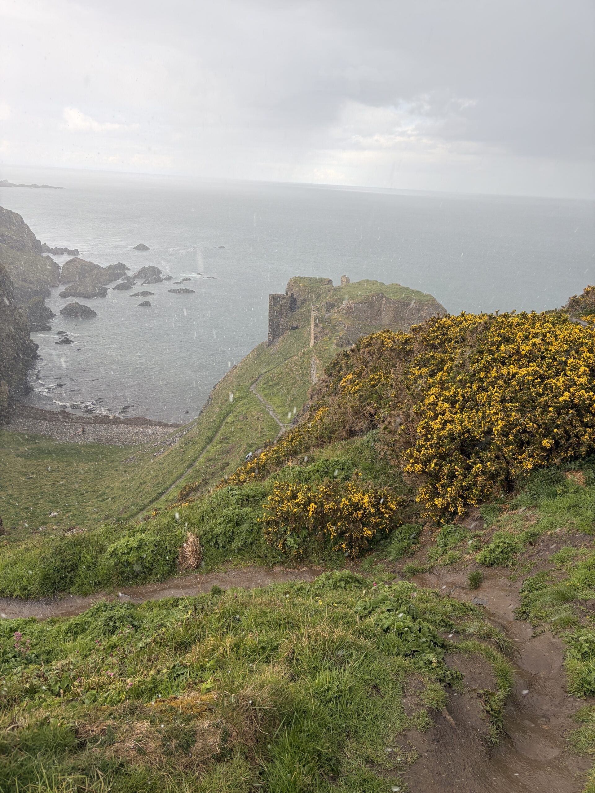
As I mentioned in my first post of this Challenge, one of the reasons I wanted to return to the Moray Coast was to see Findlater Castle.
When I did a crossing in 2016 that included parts of the coast, I looked longingly down on the castle from the cliff above. It was too late in the day, and I was too tired, to descend the embankment and explore it.
Ruined castles evoke the unknowable past and the impermanence of the works of man in an intense and romantic way. That ‘s why painters Iike Thomas Cole and Caspar David Friedrich painted them. I’m a sucker for those painters and for ruined castles, although I’ve only seen an couple of the latter.
In his book “Portrait of the Moray Firth,” Cuthbert Graham quotes an unattributed description from the 19th century: “The outer walls of several parts of the building are so founded on the cliffs as to correspond with the face of the precipice, so that the principal tower seems to hang over the sea, and from the windows of several apartments a pebble may be dropped into the waves.”
The royal license to build the castle was issued in 1455, but there may have been a structure there before then. No carriages could access the building, only people and horses. There was an unattached “forecourt” on the cliff above where transactions with visitors began.
The history of the place is complicated and bloody, The barony it was on changed families when a man disinherited his son. Fighting of course followed; the new owner was eventually captured and beheaded and the castle returned to the ownership of the original family, which abandoned it in the mid-1600s.
How were the enormous blocks of its walls cut and lifted into place? What were its rooms like? What was left when the last brazier was extinguished and ther owners moved to town (Cullen, in this case)? And what’s the point of it? No invading force would consider landing there, with harbors and coves east and west of it.
A visit wouldn’t answer those questions, but it would set the imagination wandering in a way pictures can’t.
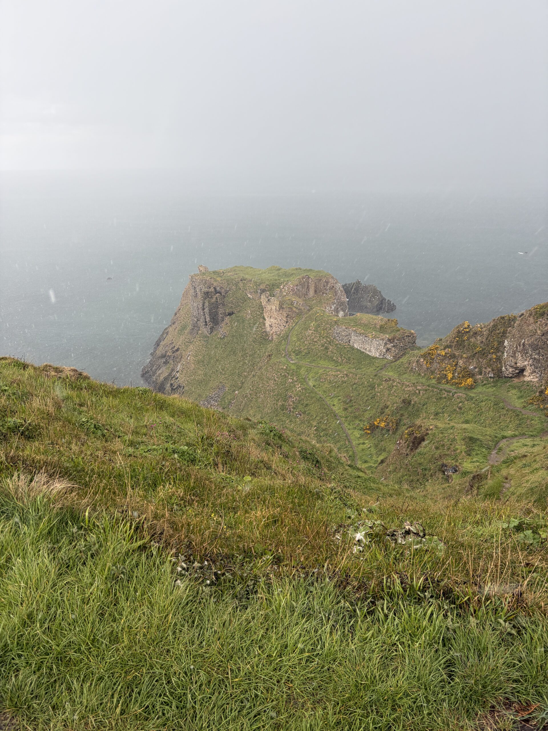
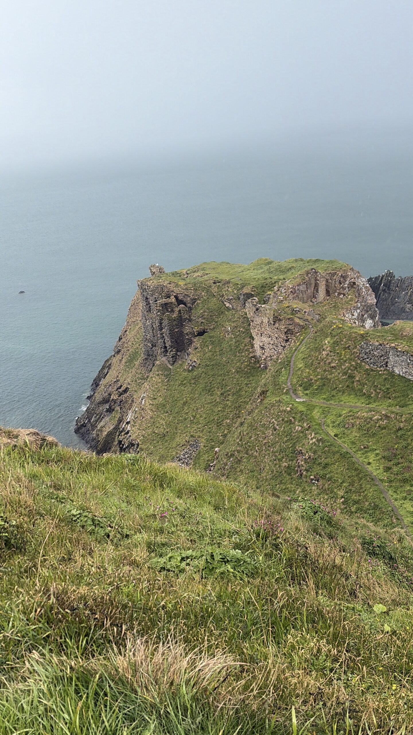
I didn’t put on rain pants when I set out from Cullen (where, soaked and tired, I’d snagged a cheap hotel room at the last minute the night before). It wasn’t supposed to rain—a prediction I’ll never believe again.
By the time I got to Findlater Castle two hours later light rain had turned to hail. The hail then stopped and was replaced by the first real downpour of whole trip. My hiking trousers and boots (and socks, of course) were soaked.
I took off the pack and left it on a bench on the cliff top and started down to the castle. Soon it was clear that the two trench-like paths had become freshets of mud and that footing, even aided by trekking poles, would be impossible. The only thing worse than being soaked is being soaked and covered with mud, I thought—that is if I didn’t slide down and over the edge.
I saved Findlater Castle for another life.
Of course, by the time I got back to the top and put on my pack the storm was clearing. The castle likes to keep its secrets, whatever they are.
hitting yo k
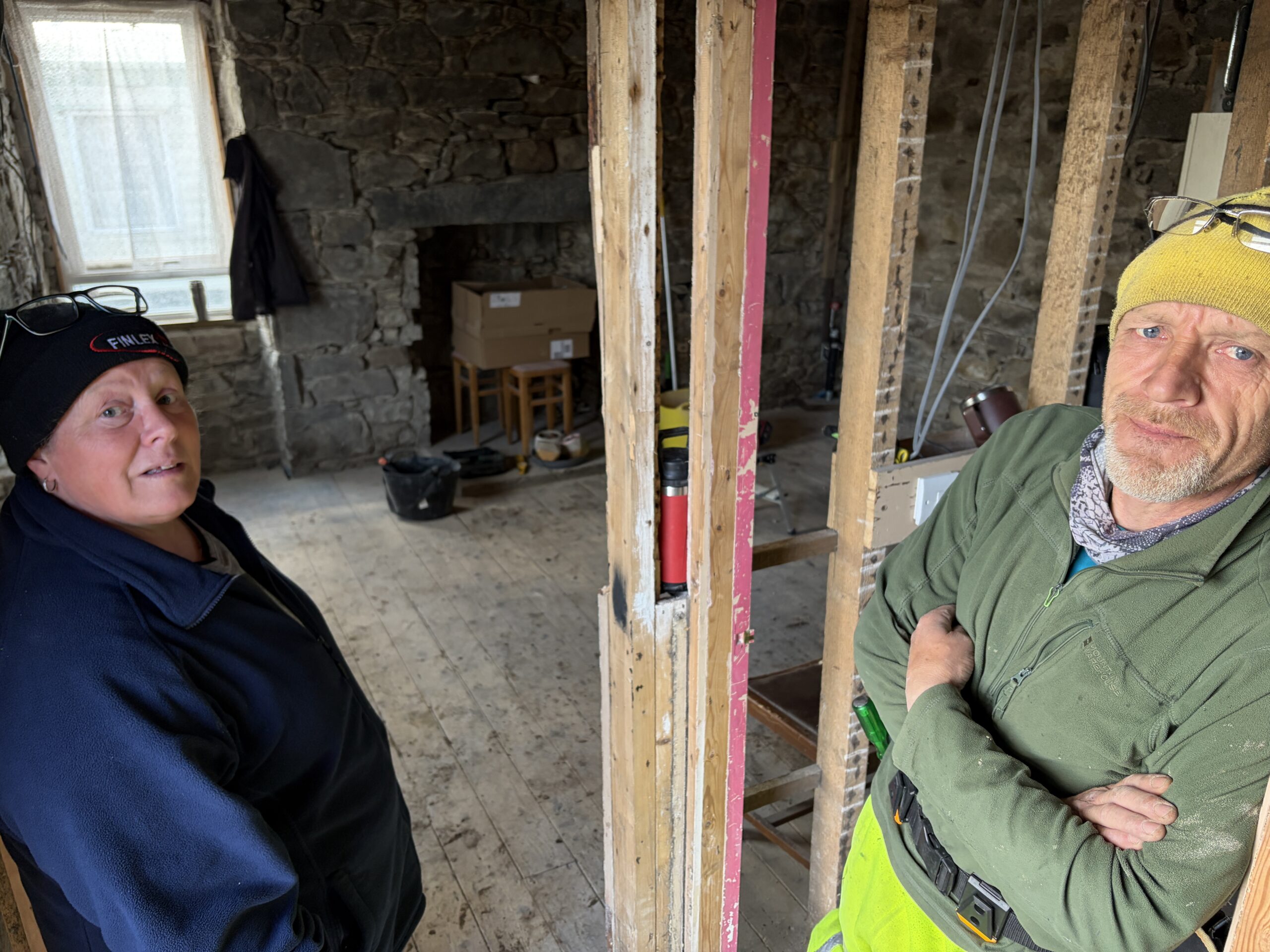
I walked on and by mid-afternoon the sun was out as I passed the hamlet of Wester Whyntie, which consists of a single duplex building. Both front doors were open and it seemed to be under renovation, although I didn’t see anyone.
I stopped because there was wall in front of the house where I could rest the pack and get it off easily; also a place to sit when that was done. I sat in a tired daze (but no longer soaked!) for about 15 minutes before a man wearing a tool belt appeared.
“Checking to see if you was all right,” he said in an accent that wasn’t Scottish and was harder to understand. I told him I was okay, and he invited me in. His name was Mike; he didn’t want to give his last name.
Formerly a warehouseman, Mike is from Norfolk, England. He and couple he’s friends with had been looking for a house in the country to renovate and move to for several years. They looked in Cumbria and then in Yorkshire but couldn’t find something they could afford, (Mike insisted it had to have a roof on it at time of purchase.) So they started looking in Scotland, and found this place for about 100,000 pounds.
An old woman and her son had vacated it two years earlier. They were hoarders. Mike and the couple made periodic trips up to clean out the place before moving up last fall to work on it full time.
“You couldn’t get some of the doors open the whole way. Things was stacked to the ceiling,” Mike said. They filled seven dumpsters “and we had a fire burning rubbish for six months.”
A room at one end of the house had been used by domesticated and then wild animals. The floor was rotting away and it had an unmentionable smell. They found nothing of value, although Michelle, the wife of the couple, said she kept a “mangle”—an old-fashioned machine that squeezes the water of washed laundry between two rollers.
“I liked that. I’m going to get it restored,” she said.
They’re turning it into a single, shared house. They’re putting in bigger windows upstairs to make the most of views of the sea.The couple have two children—a young man and woman—who will live there, too.
Except for where they’re changing the slope of the roof with the help of a builder, they’re doing the work themselves, learning what they don’t know as they go. They’re even moving the staircase.
I asked who is designing the new structure. Mike said it was Michelle.
”It’s all in her head. She’s brilliant,” Mike said.
”It’s all in my head,” Michelle confirmed. But her daughter is a tattooist, so can draw, and has helped (along with some online programs) with coming up with written plans.
I didn’t ask about ownership, where they were getting the money for all the work, or where they were staying in the meantime. Even if they were willing to tell me, I didn’t have the time. I’d already stayed an hour and it was time to crack on.
Wester Whyntie Cottage will be beautiful when it’s finished, and like Findlater Castle a miraculous feat in its own right.
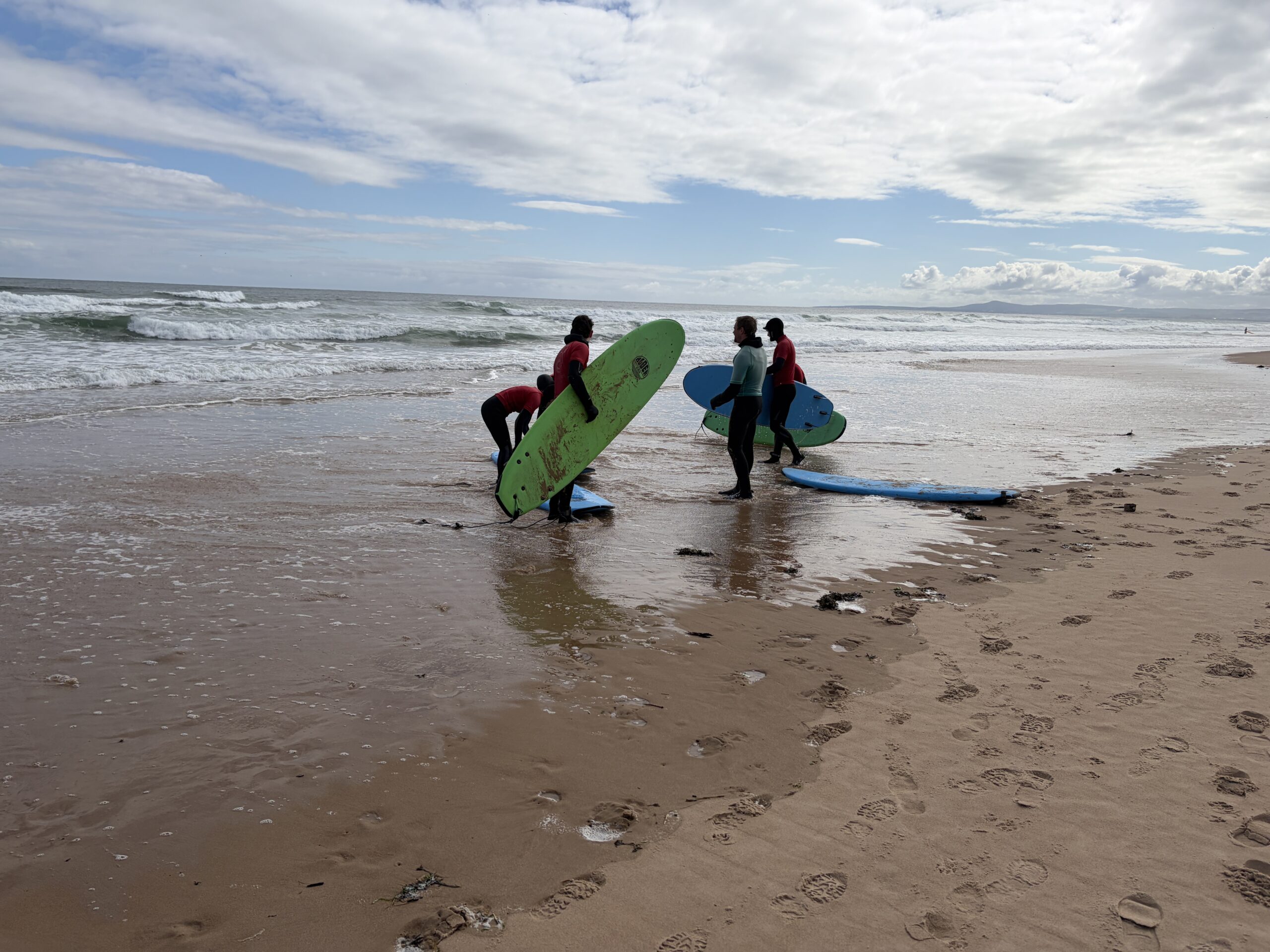
When I left Lossiemouth on a bridge over the river to the beach the first people I met were the instructor and students of a surfing school. You have to really want to learn to surf to take lessons in the Moray Firth in May. I asked the teacher what the water temperature was. He didn’t know. “It’ doesn’t matter with the wetsuits,” he said.
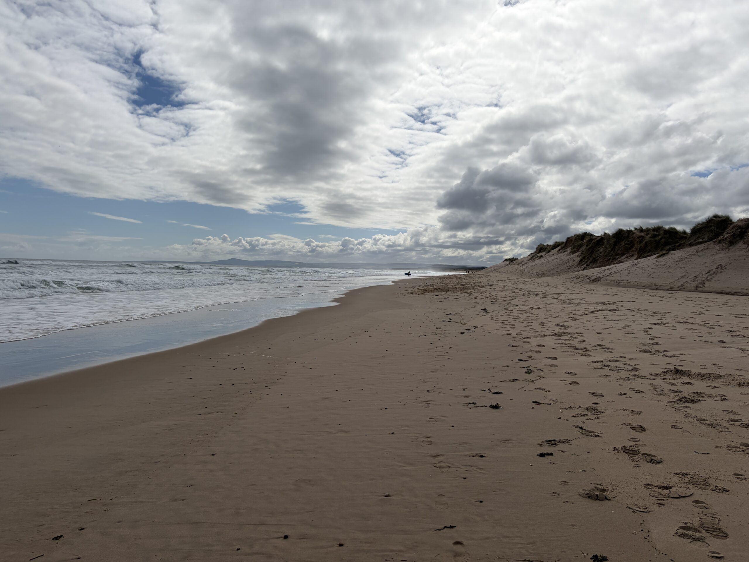
The beach is long and beautiful, justifiably famous in Scotland.
I eventually ran into Duncan and Charlie, two Challengers I’d met in Burghead, at the only open cafe. It was above the beach and we were entertained by four windsurfers and one surfer, who caught one wave in 35 minutes and came in.
Duncan is on his third Challenge (he retired from one because of injury) and Charlie is on his second. They are cousins. Duncan, 65, is a former bicycle mechanic turned addictions counselor, and Charlie, 59, is an architect. Their last names are “Bain Smith (no hyphen).”
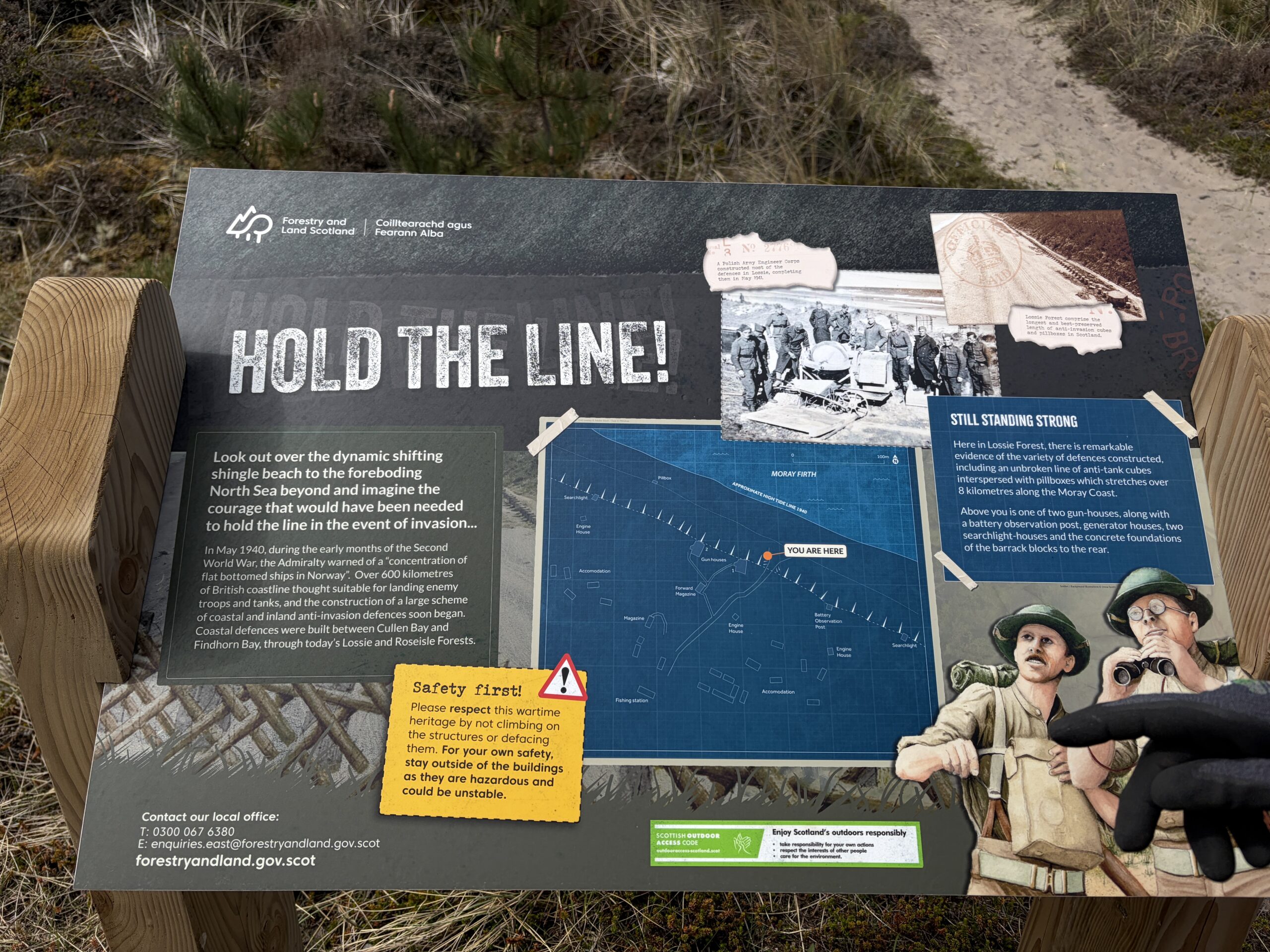
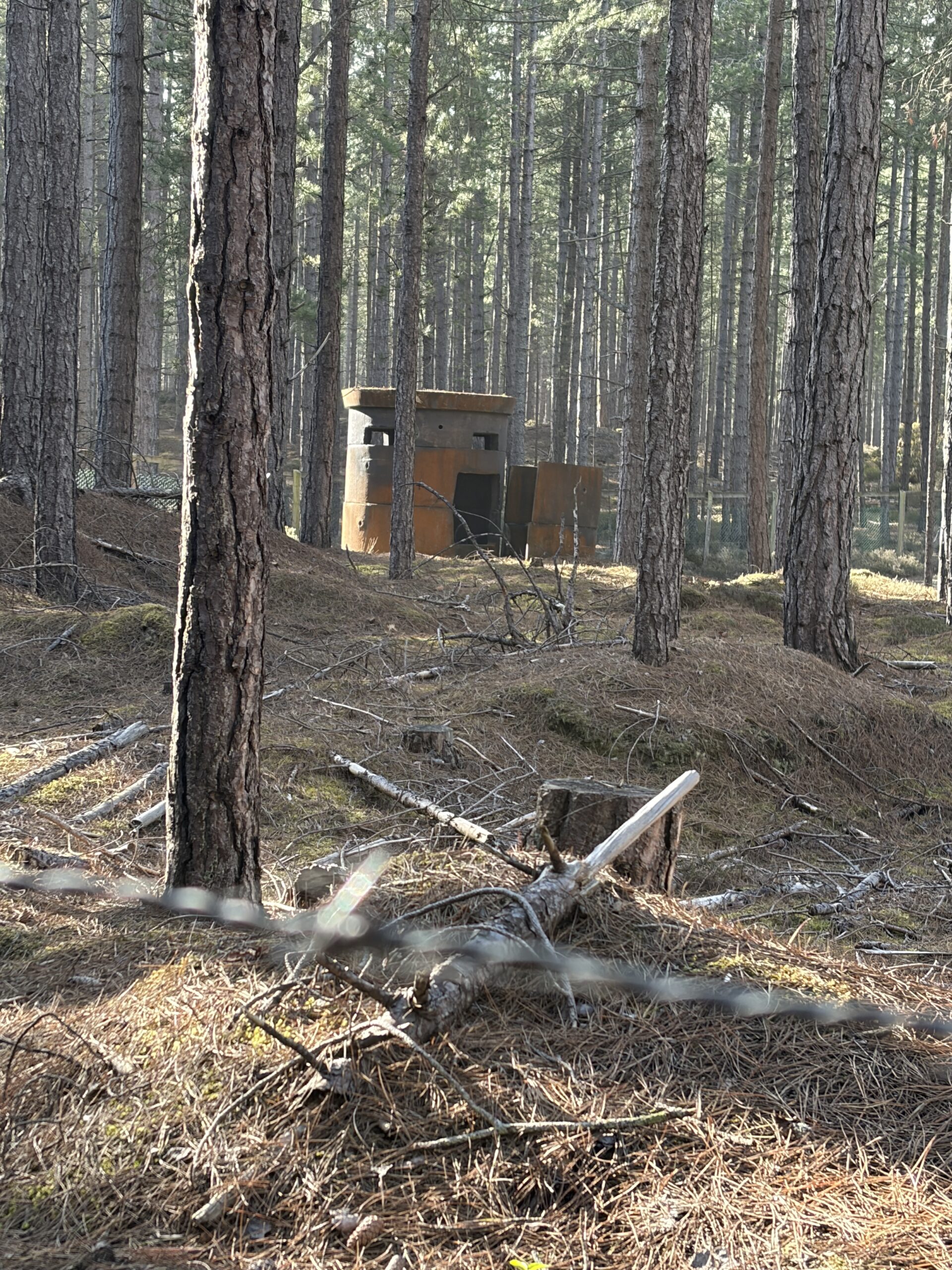
We passed many World War II defenses as we walked along the beach path–dozens of concrete-cube tank barriers, pill boxes, and occasional big-gun emplacements on top of the dune.
We stopped at this interpretive placard. Charlie narrated the order of battle in a posh accent as if he were a “leftenant.”
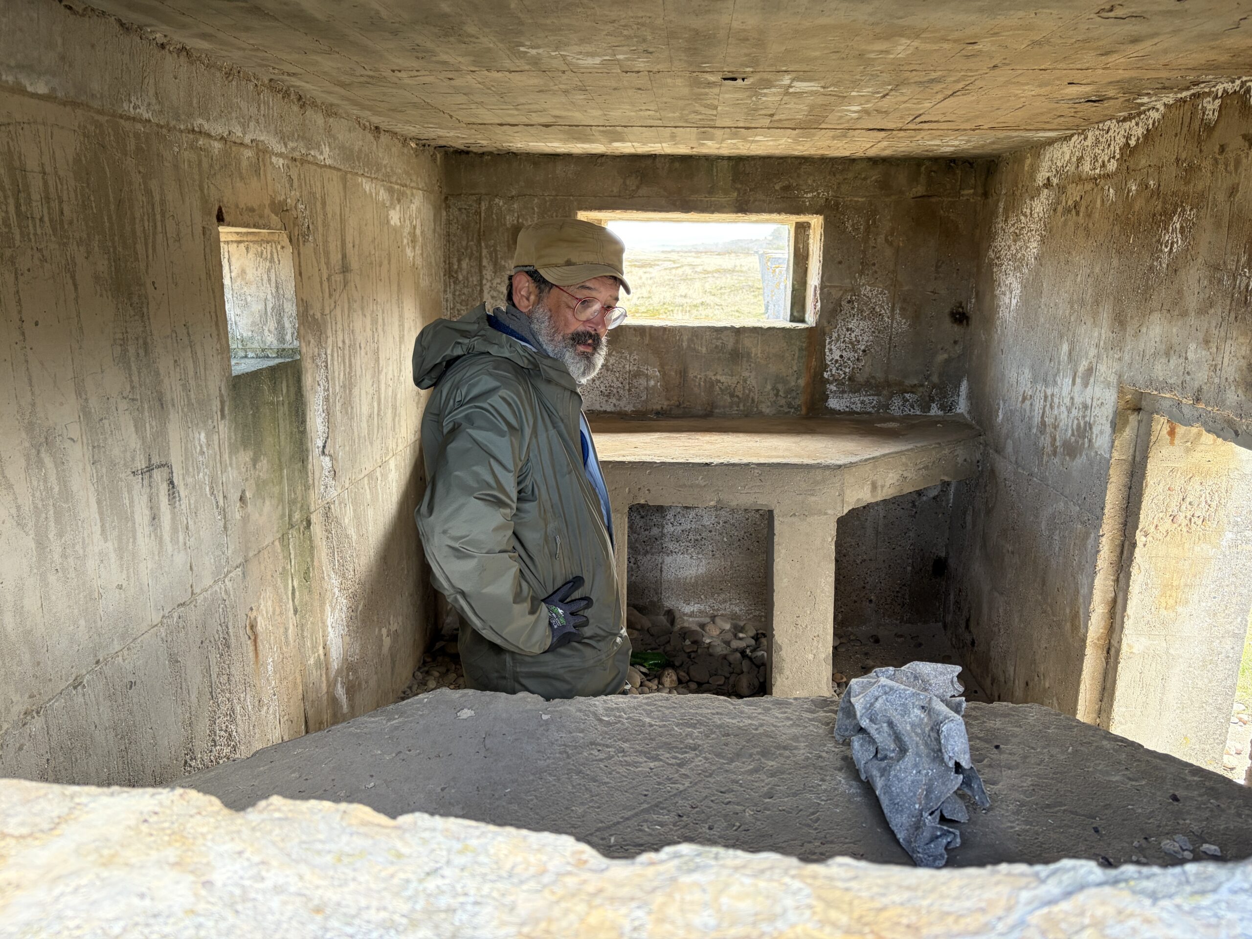
Here is Charlie inside one of the pill boxes.
We went through the usual oral autobiographies. It turns out one of their ancestors (possibly a great grandfather) who was the younger son of a rich man, moved to Wyoming in his twenties. Or, more likely, was sent there by his family after trouble at home.
He was a “remittance man.” A quick Google search found this definition in The Canadian Encyclopedia: “a term once widely used, especially in the West before WWI, for an immigrant living in Canada on funds remitted by his family in England, usually to ensure that he would not return home and become a source of embarrassment.”
This term and phenomenon applied equally well to the United States, and especially for Wyoming, where there was at least one school for teaching posh Scots, Englishmen, and New England elites the requirements, discipline, and skills to become a western rancher.
My great uncle, Frank T. Brown, was sort of a remittance man. He moved to Medicine Bow, Wyoming, in the 1880s and ran a sheep ranch with an older man. My father believes he’d been sent away from Framingham, Massachusetts, because of some sort of trouble—with the law, or perhaps after getting a girl pregnant. He died of suicide after a “spree” with choral hydrate, according to a coroner’s report a researcher found for me in the 1990s.
Duncan and Charlie’s remittance man fared better. His older brother died, so he went back to England and inherited the family fortune.
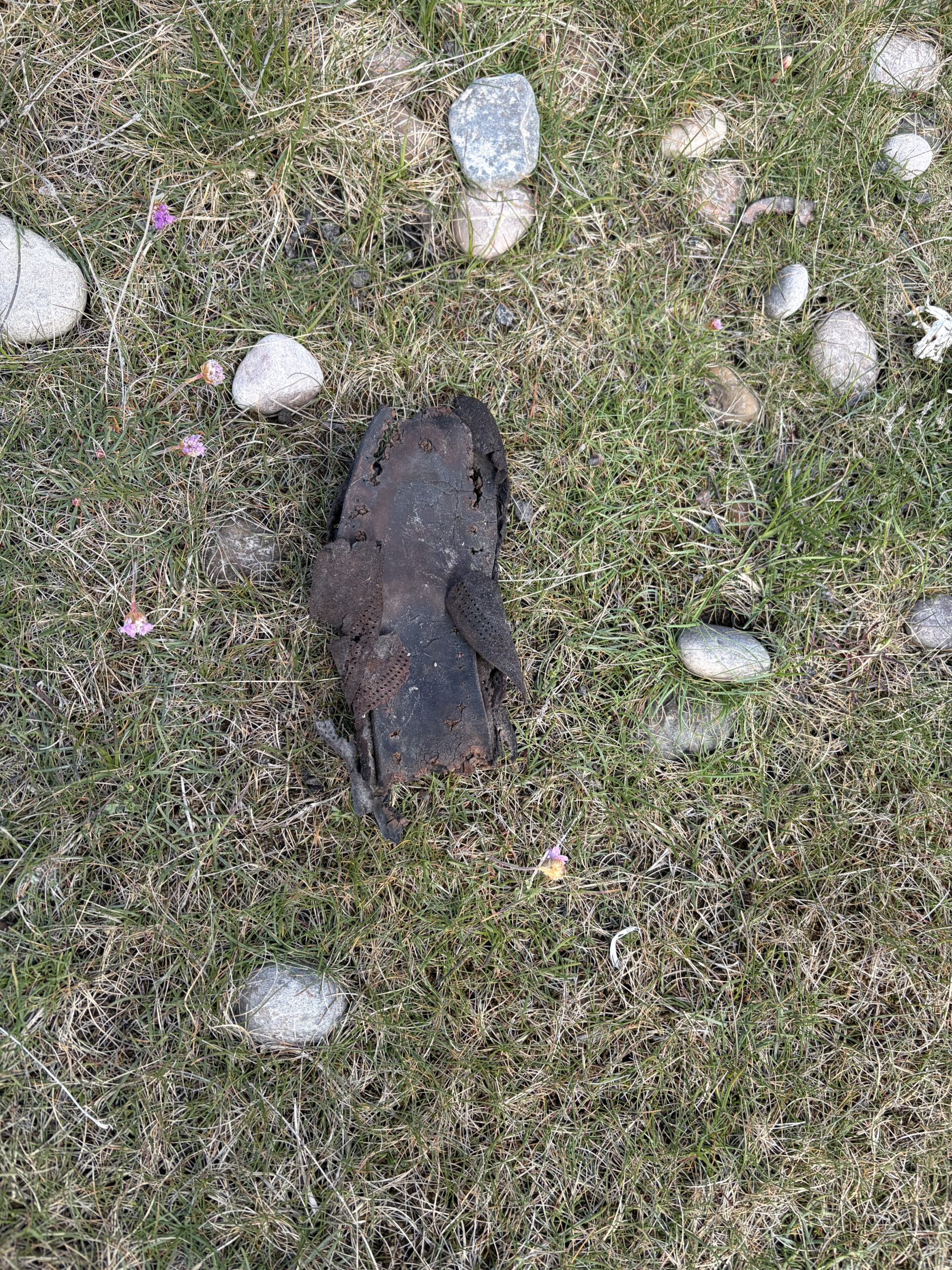
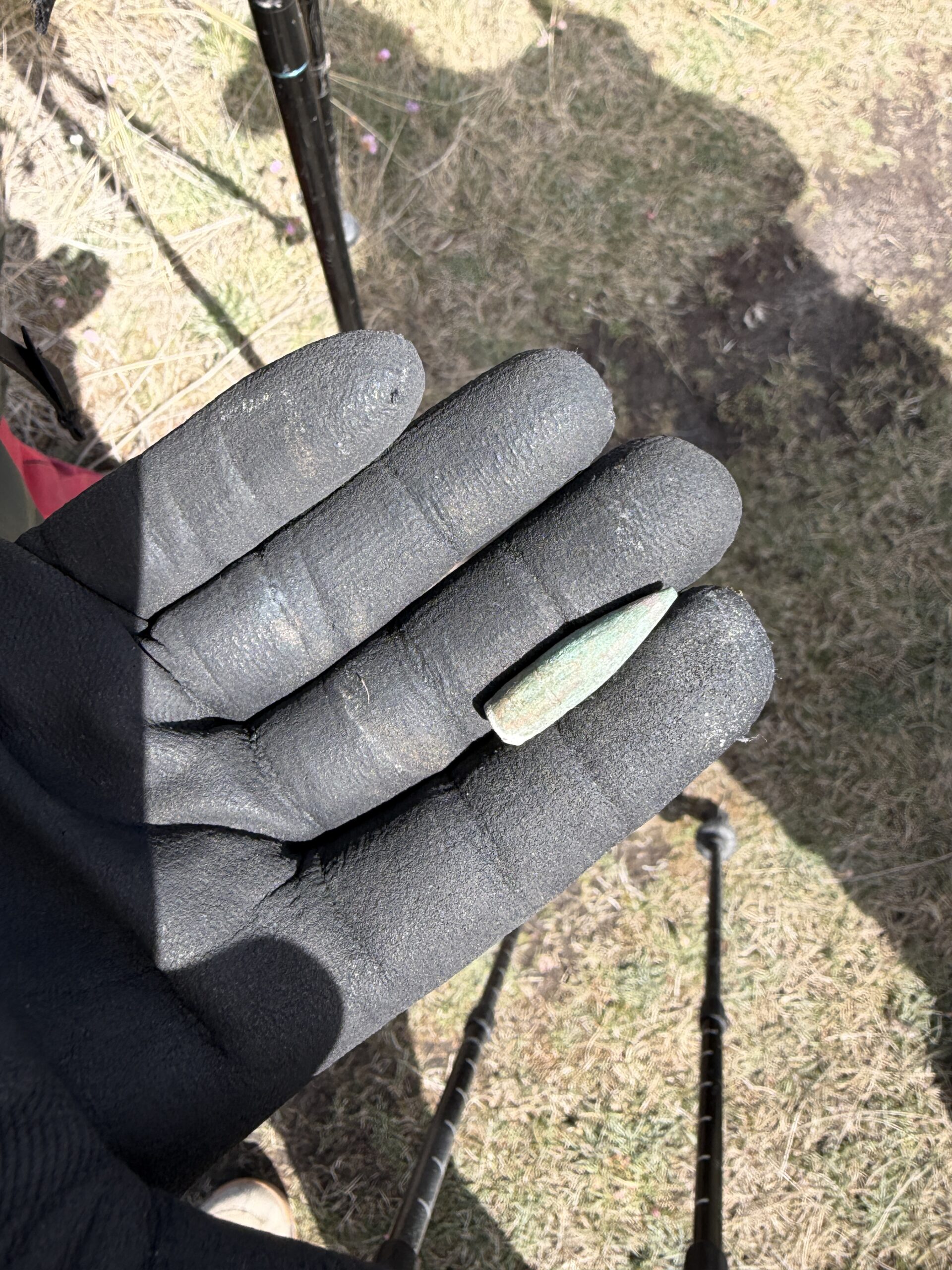
We found a few relics on the marsh, including the remains of a Victorian leather shoe, and a slug from rifle bullet. In fact, we found three (one deformed) in the same area, which suggests some sort of target practice.
fdycgcg
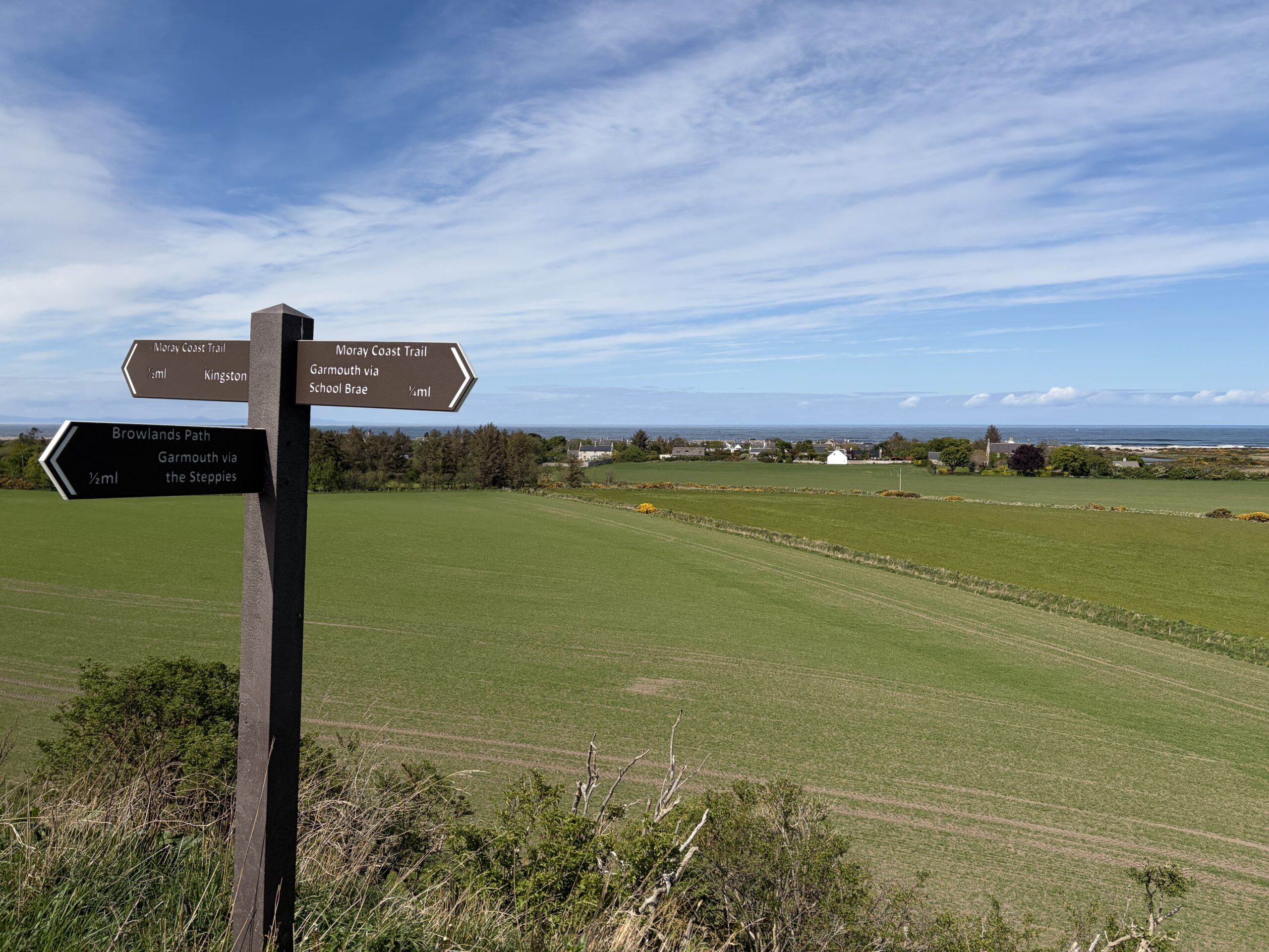
Our immediate goal that morning was the home of a woman named Janet Donnelly in Kingston, a village just to the west of where the River Spey empties into the Moray Firth. For years she has offered Challengers tea, cake, and a bathroom. Duncan, who is on the right, had let her know a day or so earlier that he and Charlie planned to stop by, and had updated that with a message that there’d be a third person, me.
Duncan, left, and Charlie, right.
It was a great break, and a lovely thing for Janet to do.
We thanked her and headed out of town. We got a good view of it as we made our way south toward a way over the River Spey.
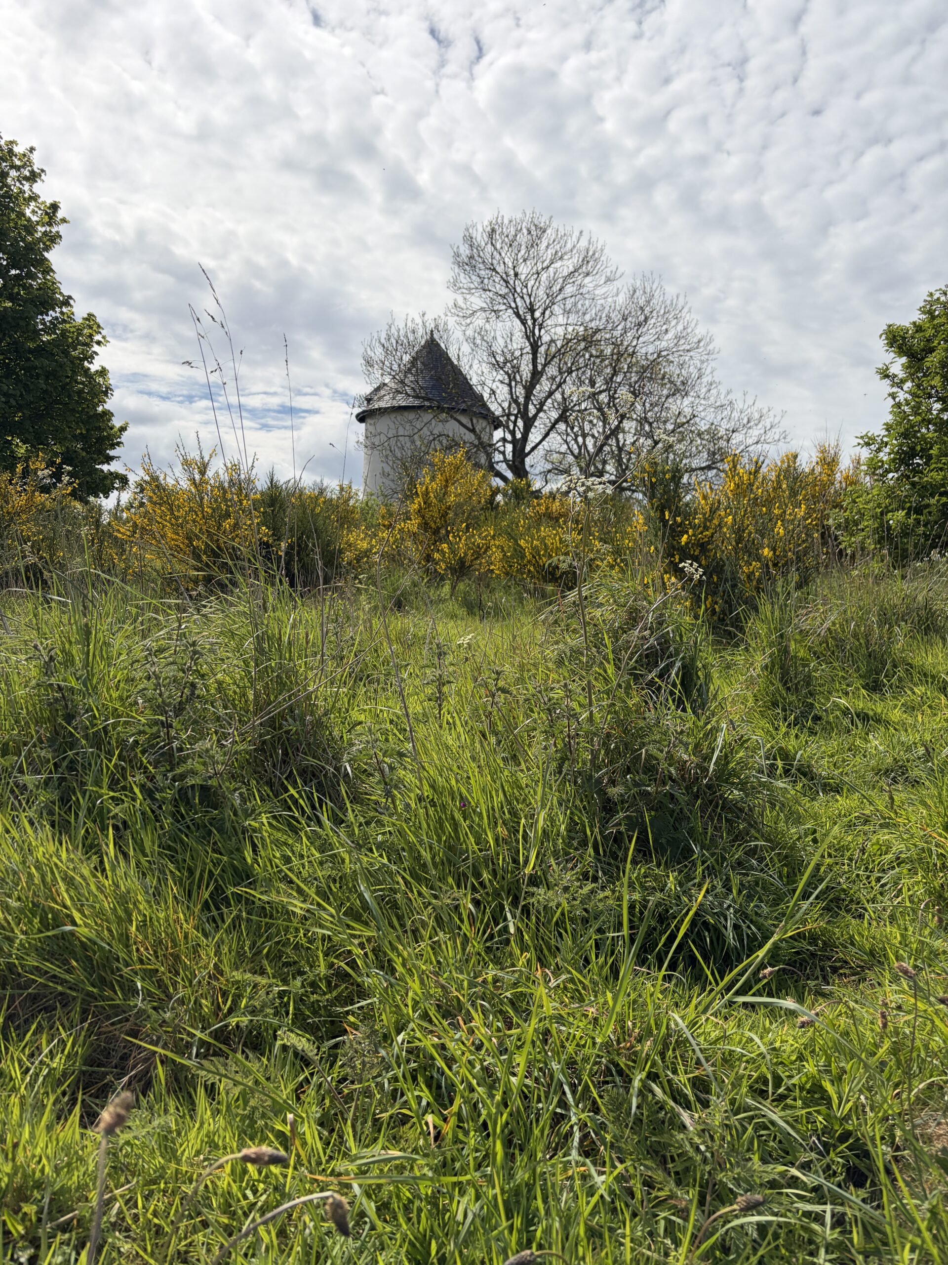
We passed a structure that Charlie described as a “dovecote”—a place that attracts doves to nest, and from which people harvest young doves for food.
“There used to be a lot of them around. They’re quite rare now,” Charlie said.
A few minutes later we passed a sign that said: “Path to water tower.”
”They’re even rarer now,” Charlie said with a straight face.
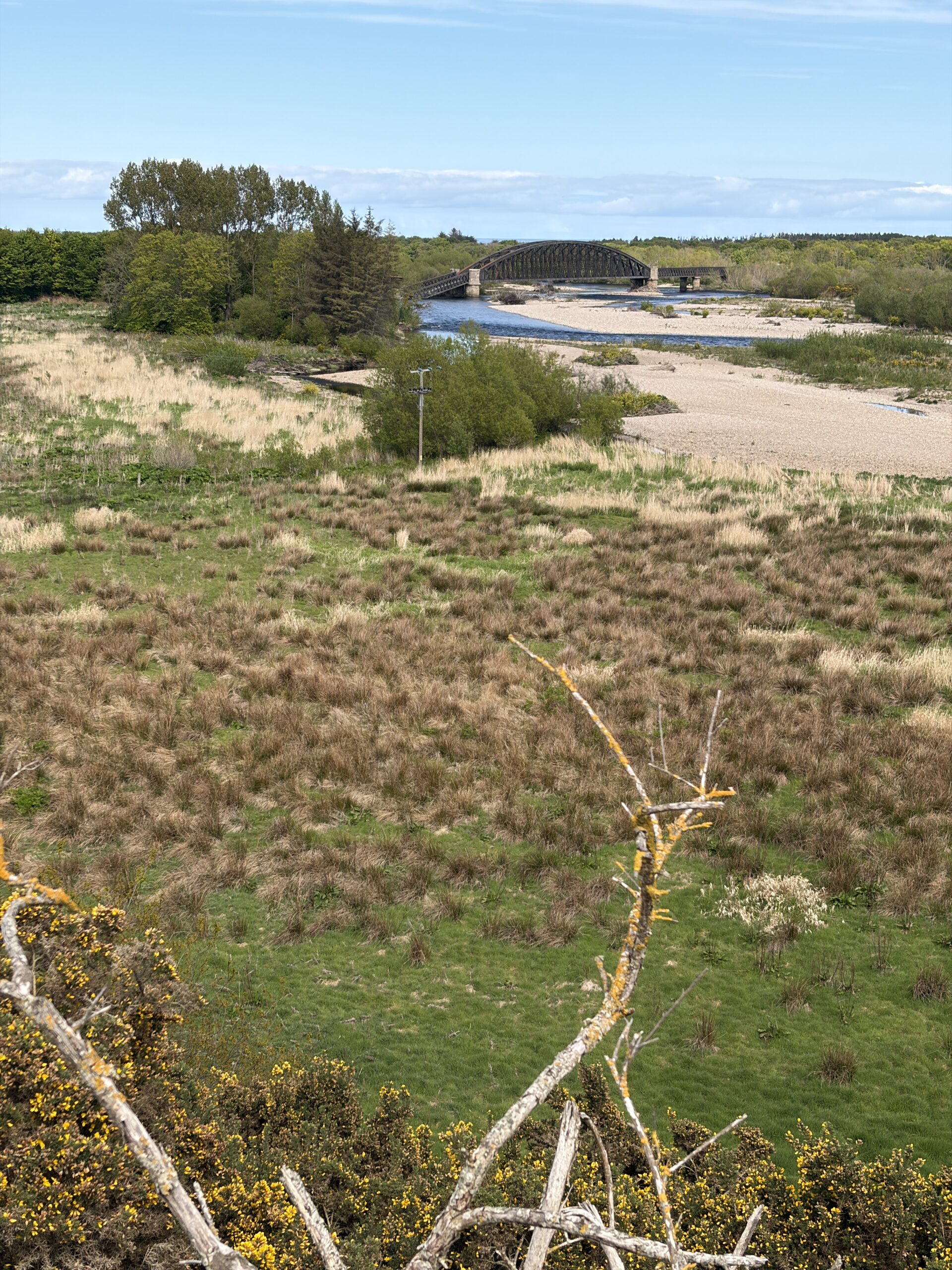
Normally, we would have crossed the river on an old railroad bridge that had been turned into a footbridge. But one end of it had washed out in a flood a few months earlier. This necessitated walkers to go south four miles, cross the river on a highway bridge, and then walk back four miles to the coast trail.
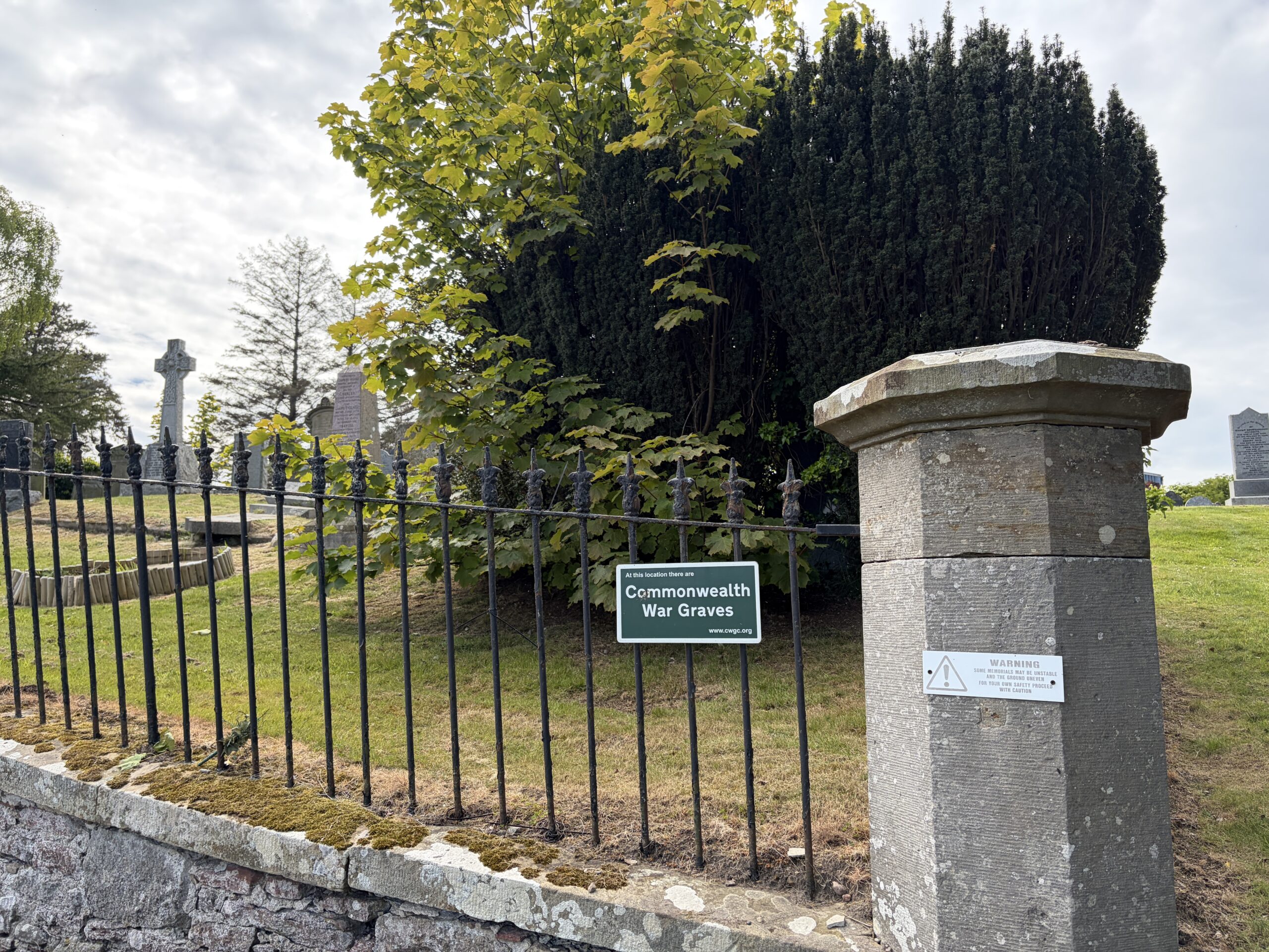
There were a few things to see, like this cemetery with war graves. But basically, this diversion was an unpleasant task to put behind you as quickly as possible.
It had been clear all morning, however, that I probably wasn’t going to be able to keep Duncan and Charlie’s pace. I’d mentioned that to them out on the beach path. I said they should feel free to go on ahead. But they clearly didn’t.
As we undertook this long road walk, I was behind them a bit. Duncan was solicitous, several times turning around and asking how I was doing.
”Doing fine,” I said. “But you all should go on. Really. It’s the etiquette of the Challenge. Go at your own pace, and no hurt feelings if you leave someone behind.”
He, of course, knew this. I didn’t feel the slightest abandoned as they pulled away.
I stayed in a “caravan park” near Culloden that’s part of a chain of van-and-trailer holiday destinations around Britain. This one had 84 places for vehicles and six spots for tents. I suspected the white tent in the distance was occupied by a Challenger. I didn’t see him, but I met him later.
It rained on and off during the night, and I packed the tent up wet, which adds weight.
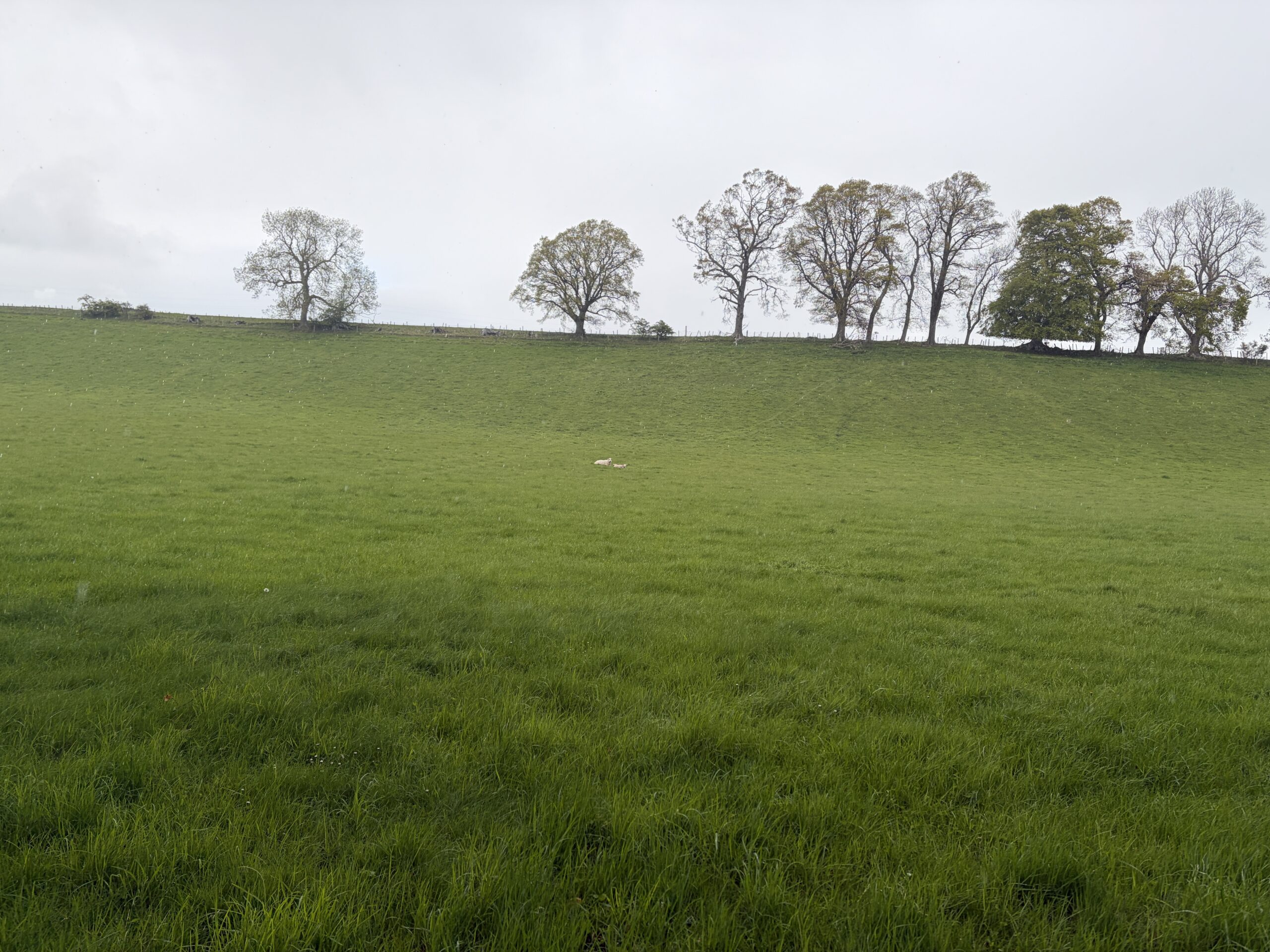
Here’s a portrait of May in Scotland–a ewe and her lamb, lying in a lush field in the rain.
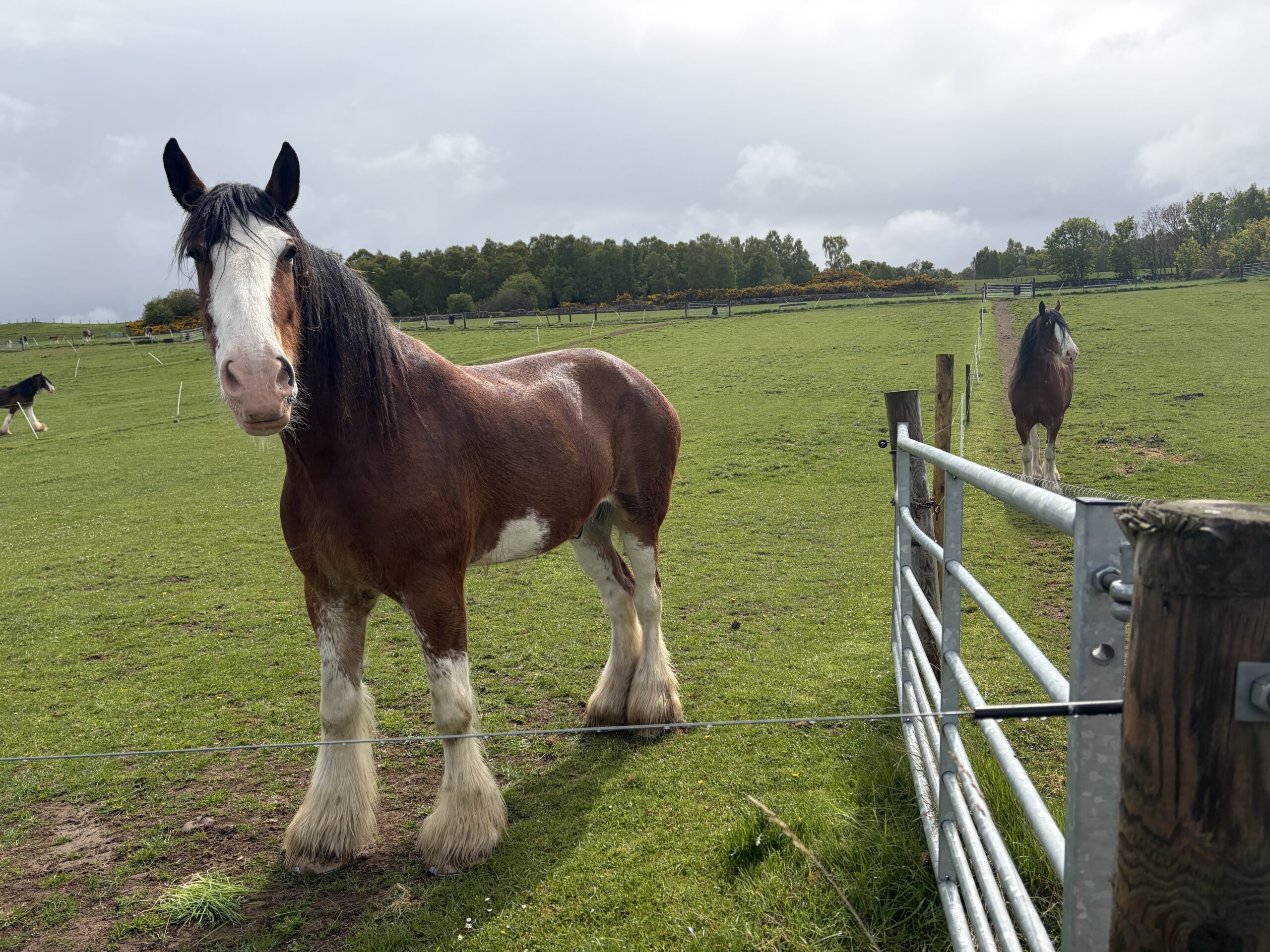
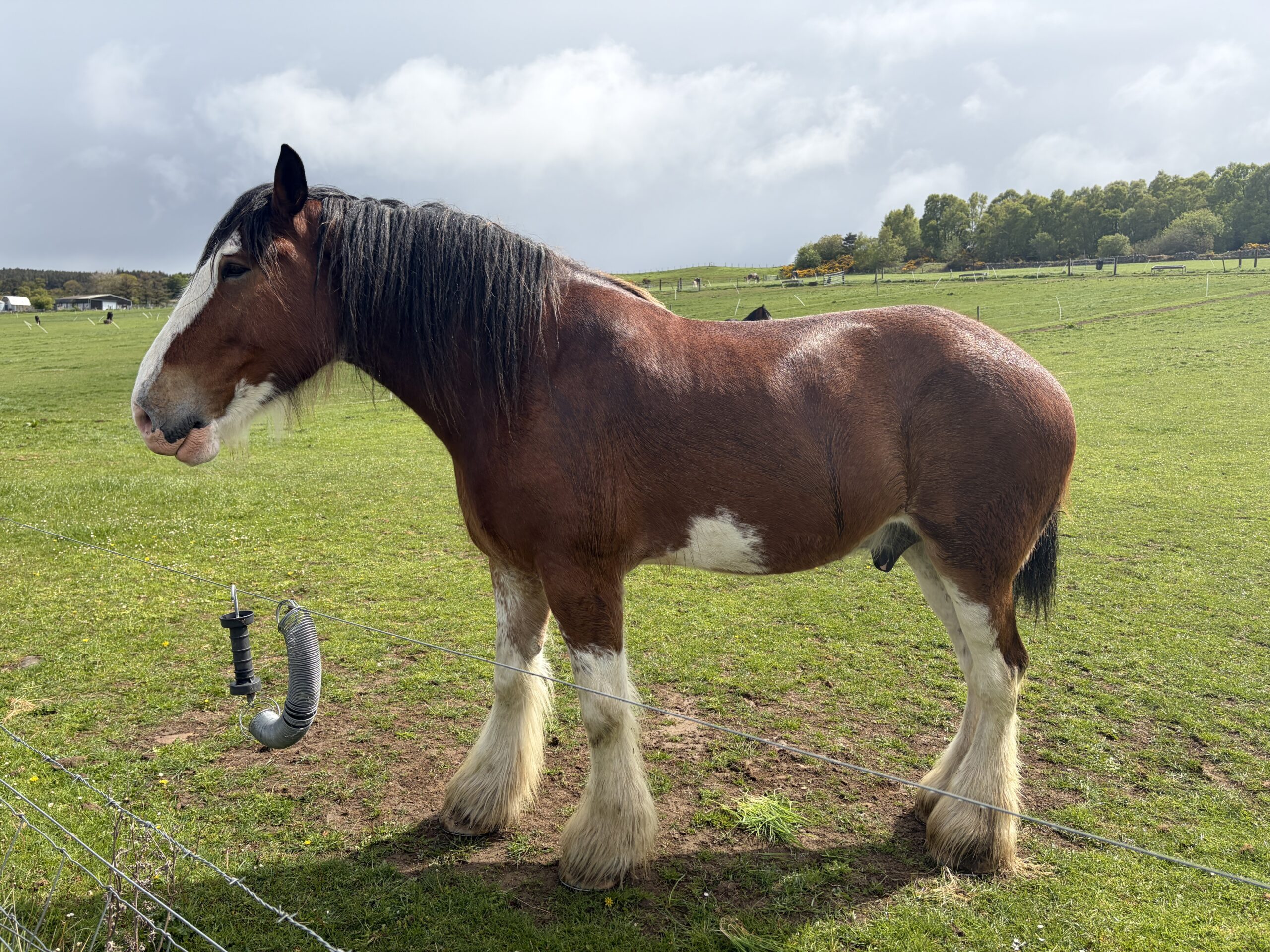
I walked through a farm with a herd of Clydesdale horses. I’m not sure what they’re used for now, but they’re a handsome tribute to selective breeding.
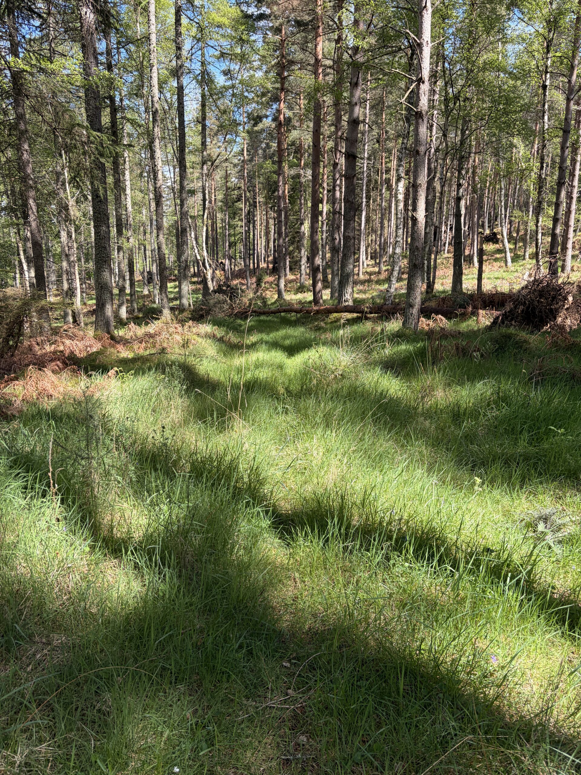
My route took me through the woods much of the day, following grown-over roads.
A tractor plowed a field, followed by a flock of seagulls dining on things turned up.
The rain came and went through the day, never hard and never far off. It’s about to start again.
An interim destination on my way to the coastal town of Nairn was Cawdor Castle. As I entered the village of Cawdor I met Sinead and her border collie Ellie.
Ellie was given away by a farmer because she was scared of sheep. She had a standoff with one from 30 feet away, turned tail and hid under a car. Kind of like a “Ferdinand the Bull” of herding dogs.
This part of Scotland has several places mentioned in Shakespeare’s “Macbeth”–Forres (where he meets the three witches), as well as Inverness Castle and Cawdor Castle. As Thane of Cawdor, Macbeth might have lived in the latter–except that the historical Macbeth wasn’t the thane and the castle wasn’t built until centuries after his death.
My plan was to camp on the far side of Nairn in the dunes, but I was wet, cold, and tired, and looked around for a place to stay. Like most of the old towns in this part of Scotland, the buildings are of sandstone, made to last.
I found a room in a place called the Waverley Hotel–nine rooms, run by a friendly woman named Denise. She’s had it for decades and is about to pass it on to her daughter.
“The only problem is my daughter lives in Switzerland and has been there for 29 years,” she said.
“It sounds like she might not be coming back to take it over,” I said.
“I don’t think so either,” Denise said. And then in sotto vocce: “And I don’t blame her.”
I had a warm and dry night inside, with a shower particularly welcome. I had dinner down the street at a Tandoori restaurant. Nairn has several Indian restaurants. In my experience, in any Scottish town big enough to have three restaurants, one of them will be Indian.
This is one of the streets I walked down the next morning, in a drizzle of course. I guess you could call them row houses, but they’re distant cousins to Baltimore’s.
It was too windy and cold to walk along the beach beyond Nairn, so I took an inland path through a forest. Eventually the sun came out.
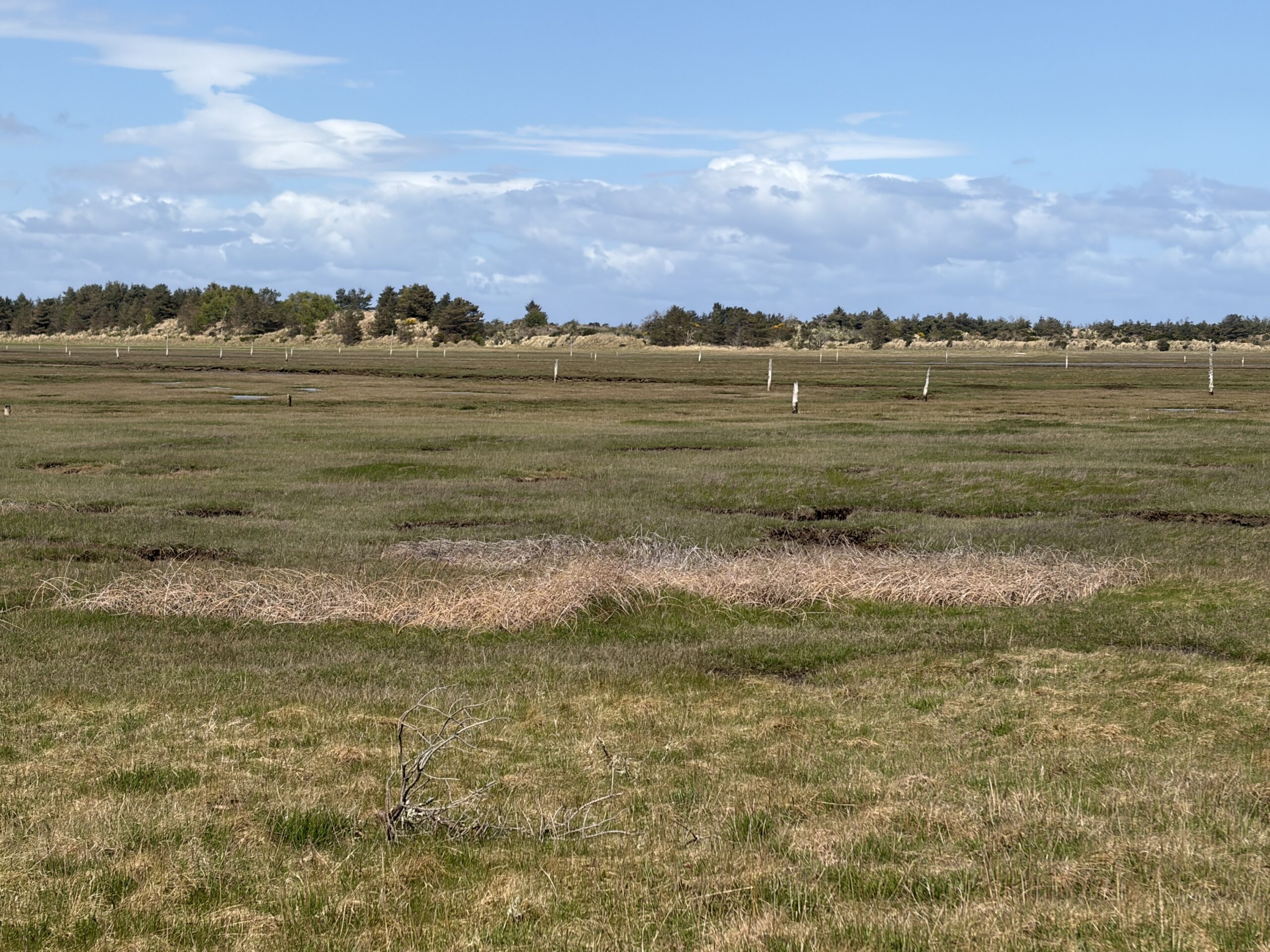
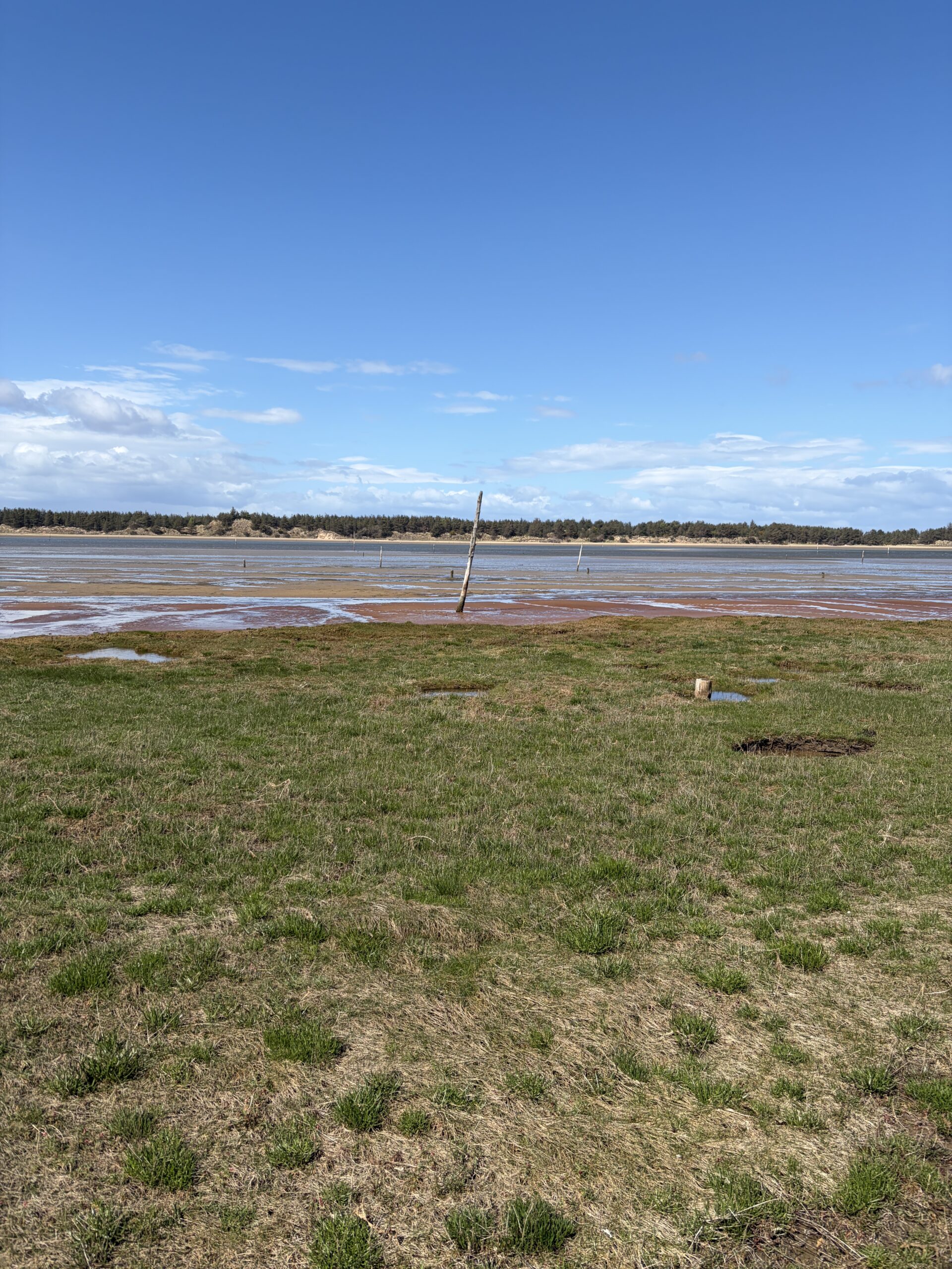
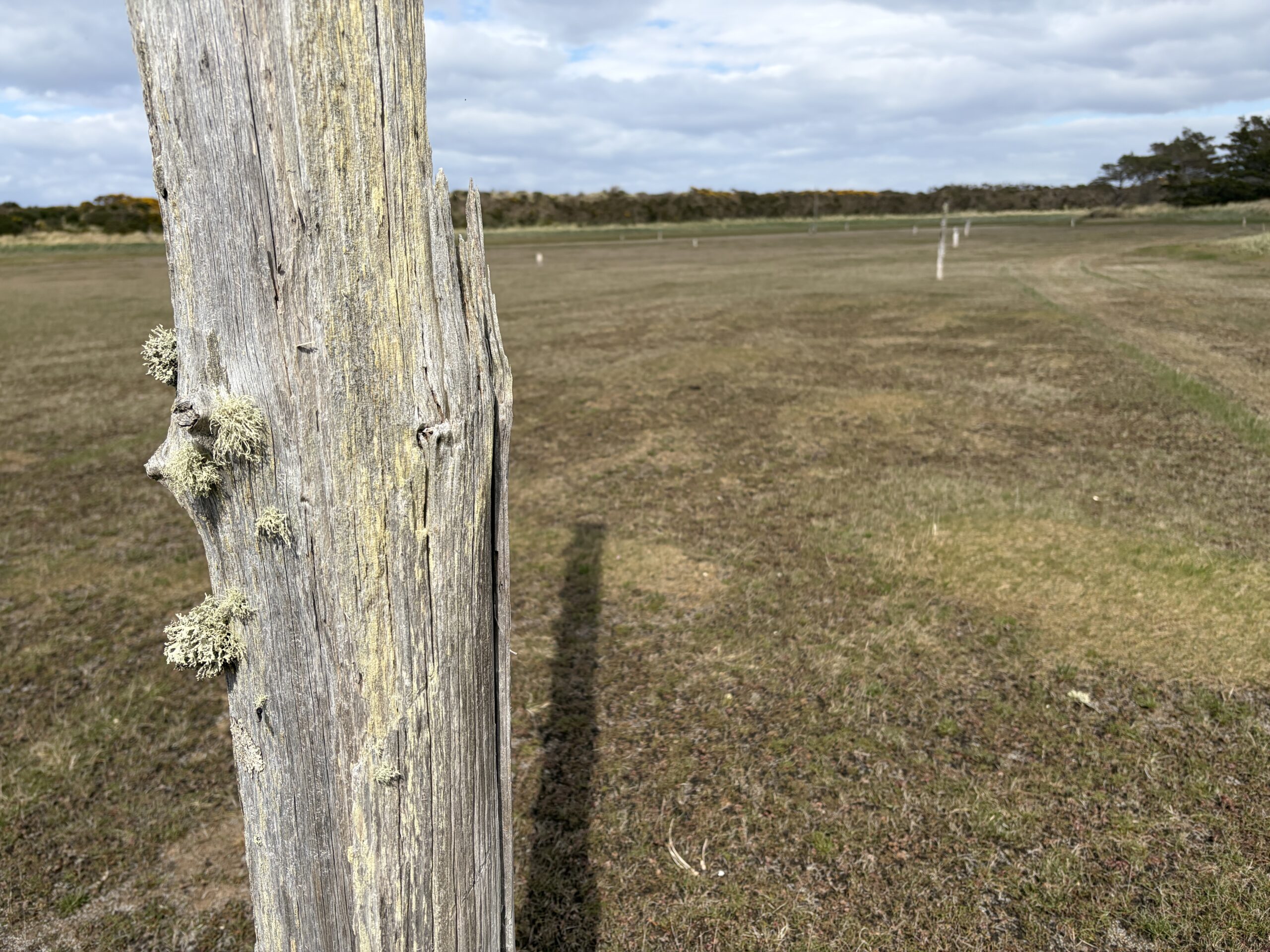
The area between Nairn and the mouth of the River Findhorn is called the Culbin Sands, a nature preserve.
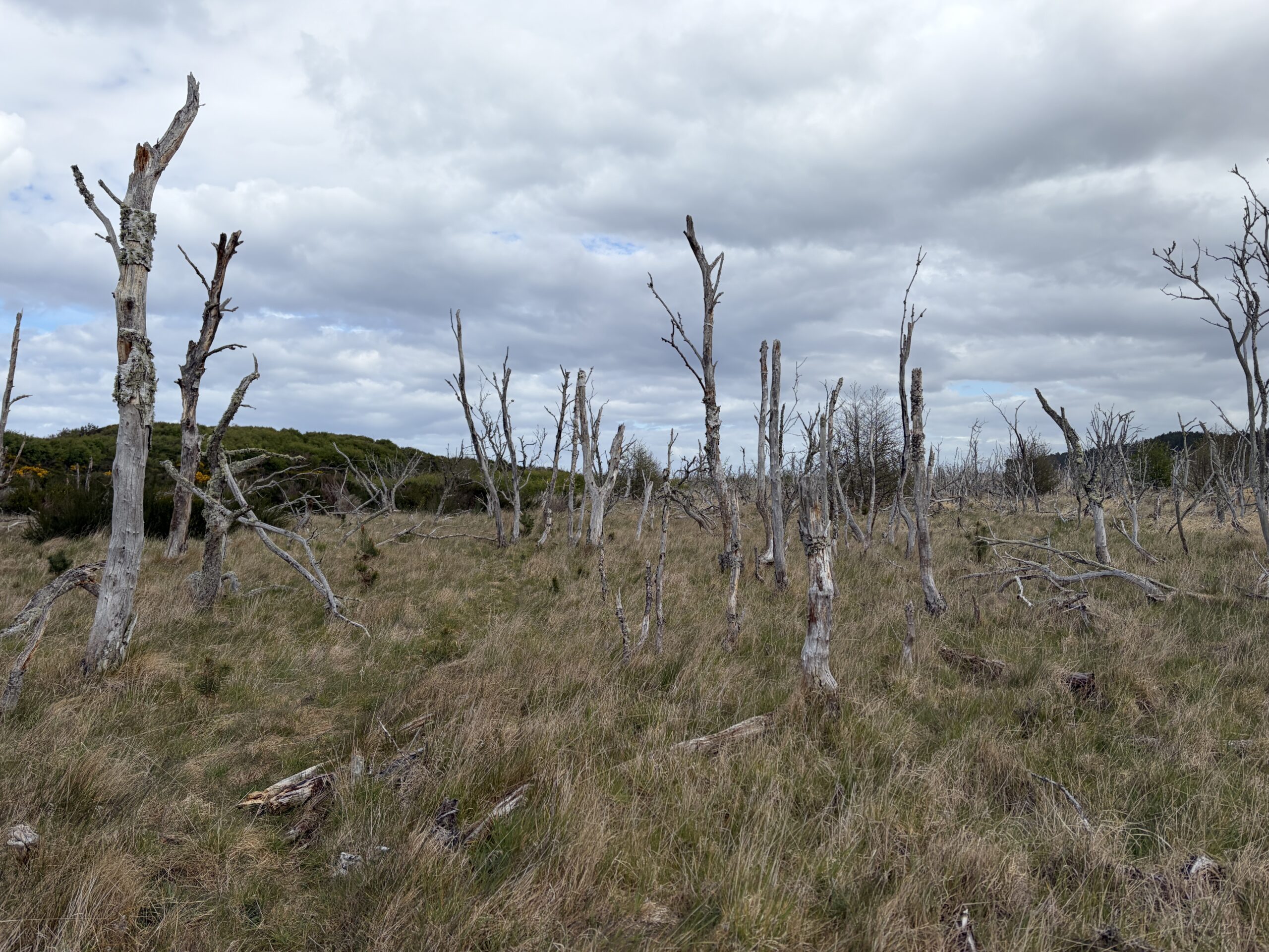
It is a massive beach with a long peninsular beach offshore that’s halfway to becoming a barrier island. On the landward side are peat marshes, and over many miles one can see the remains of poles set in the marsh and tilted in an offshore direction. They are defenses from World War II designed to snag gliders in an invasion from Nazi-held Norway. The invasion never came, of course.
I was on a punishing schedule. Crossing the River Findhorn where it empties into the Moray Firth requires either walking upriver about four miles to a bridge, or taking a water taxi across Findhorn Bay. The latter is offered by a woman named Jane Morrison, who with her husband runs a sailing school and water sports center. You set a time and she picks you up, 4.30 pm being the last appointment (she hopes).
I had to walk fast and not get lost to make that hour. I stopped to eat some naan left over from the night before, but otherwise it was cracking on the whole day.
In places the path was barely discernible as it wound from dune to drowned woods to forest. I don’t think I could have followed it without a plotted GPS signal to help me.
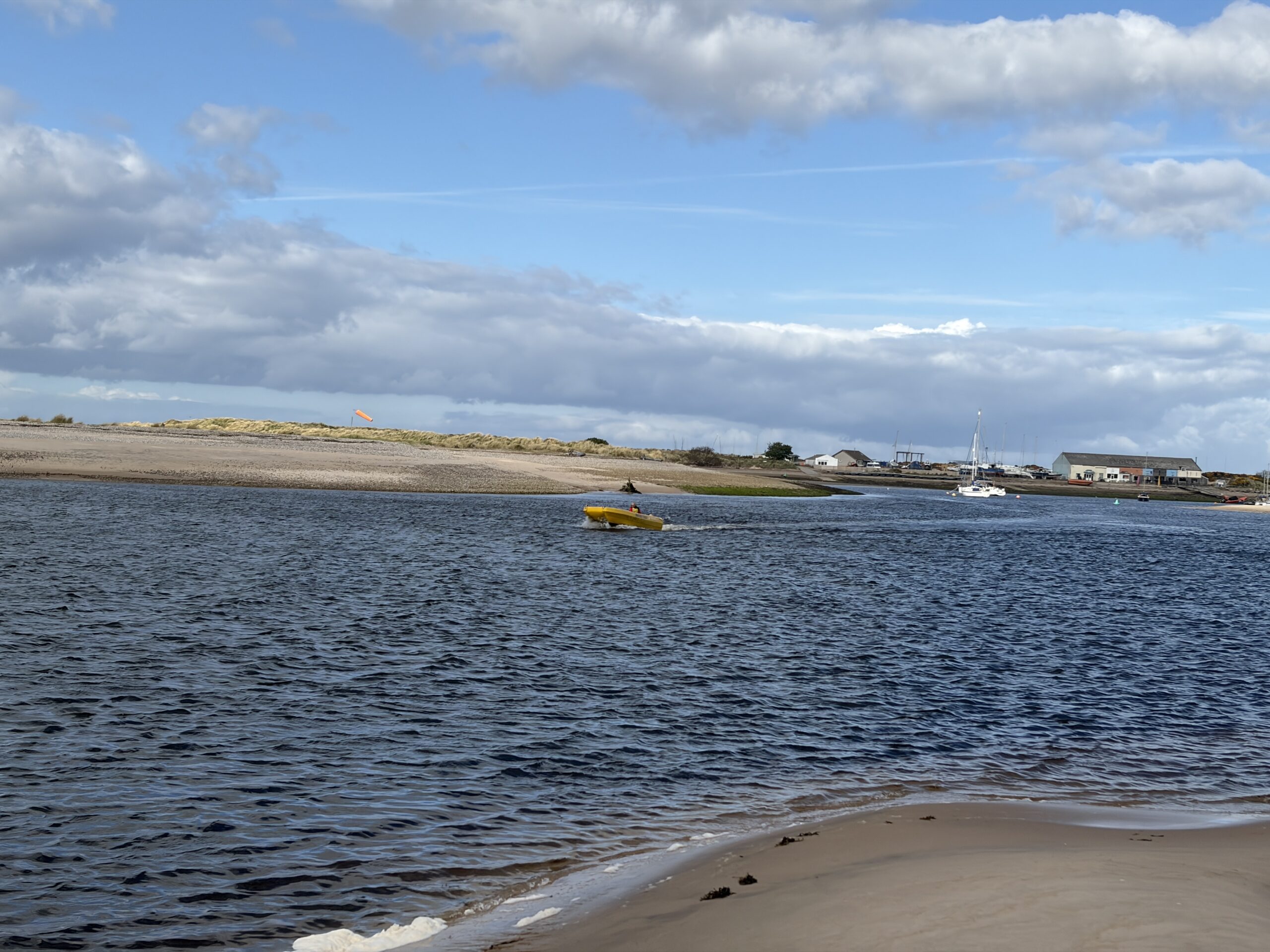
I emerged from the woods on the banks of the Findhorn at 4.15 pm, but of course didn’t know where the pickup spot was. I texted Jane. She sent me the coordinates, which I was able to put on the digital map as a waypoint (to my amazement; such tasks usually take hours).
I had to walk downriver toward the mouth almost a mile. I sat on a dune and she appeared. We crossed at 5 o’clock.
“We wouldn’t have left you,” she said as I apologized for being late. She’d made two trips that day for Challengers, and had another one booked for tomorrow.
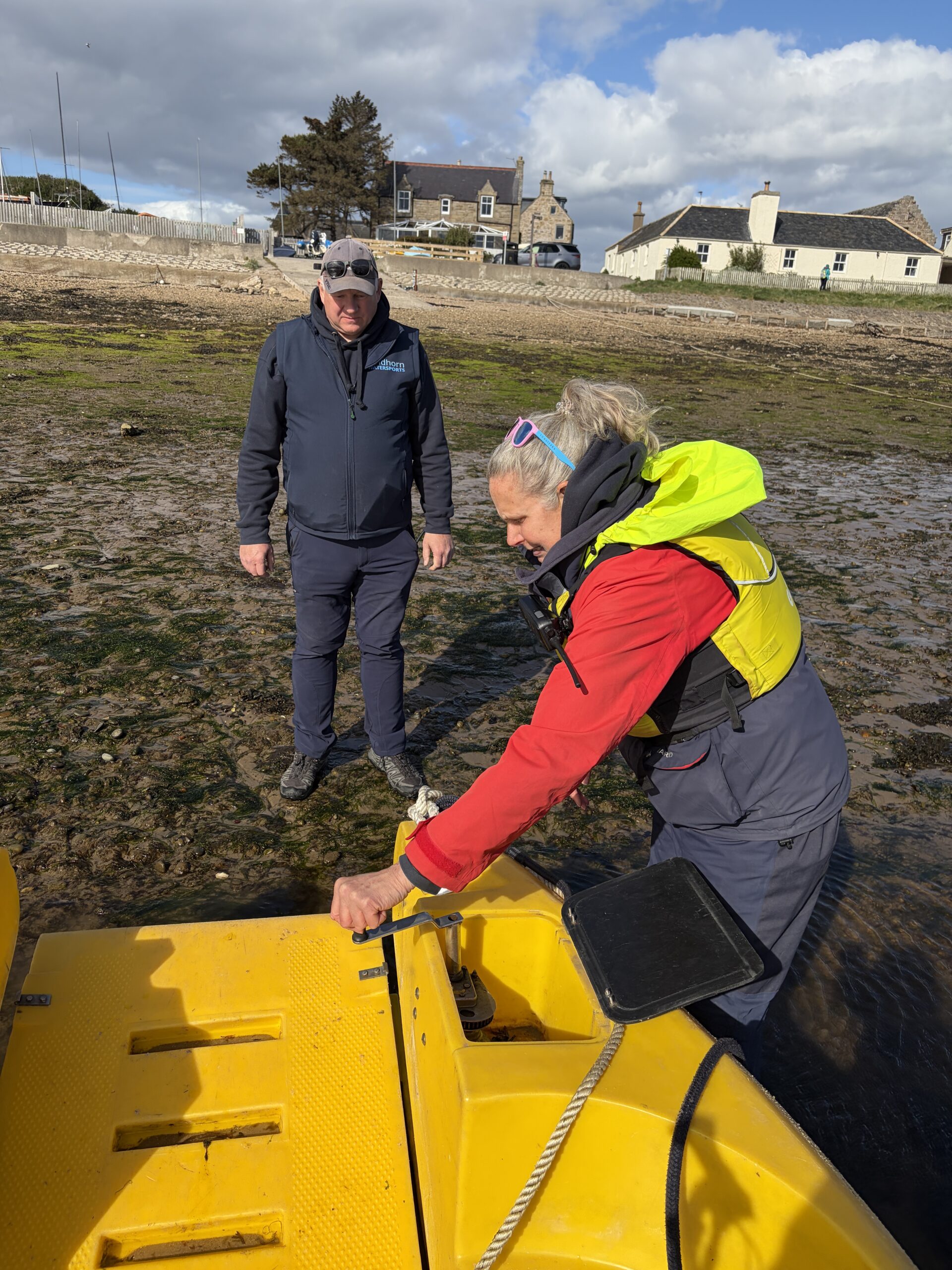
Her husband Neil took me up to the office, where I paid the fare and he pointed the way out of town.
I could camp at a nature preserve in Findhorn, but I had 17 miles to go the next day to get to an Airbnb in the town of Lossiemouth (which was the site of an aerodrome in World War II and still has an active Air Force detachment). I knew from the experience of a few days earlier that 17 miles was a few miles too many for me to walk in a day. I reluctantly left Findhorn and kept walking east to get a head start.
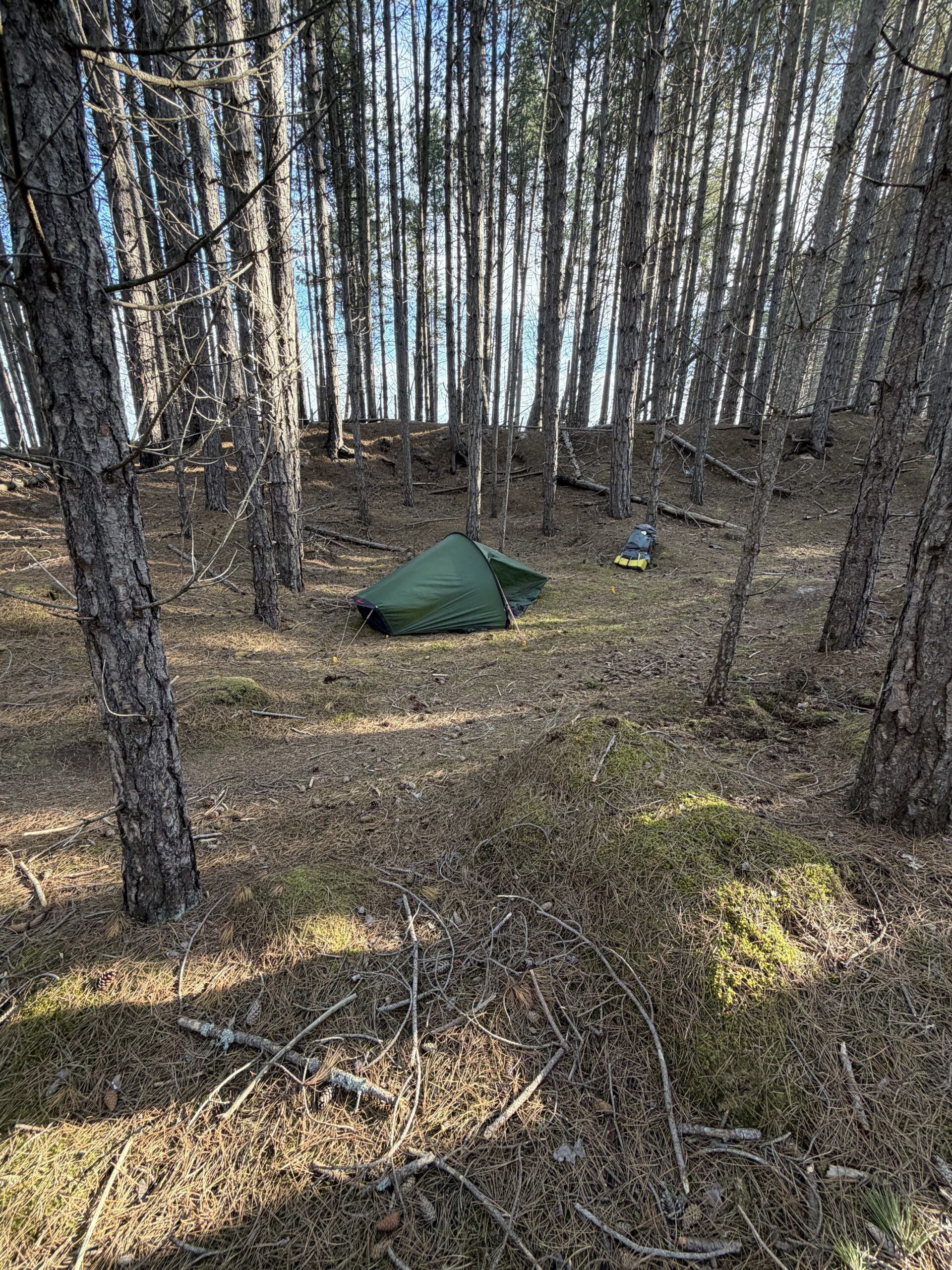
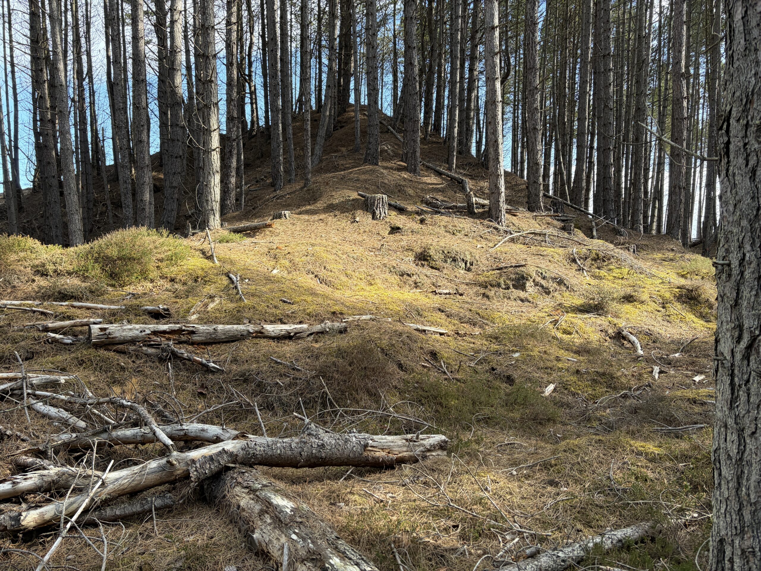
It had been unusually windy all day, but at least it wasn’t raining, About 2.5 miles out I found a decent spot to pitch the tent, somewhat protected by the ancient dunes.
And, it turns out, by the ghost of a steel pillbox from the war.
I still had a long way to walk the next day, so I got an early start (for me). In a few miles I ran into Paul, an analytical chemist who works for GlaxoSmithKline in Cambridge, England.
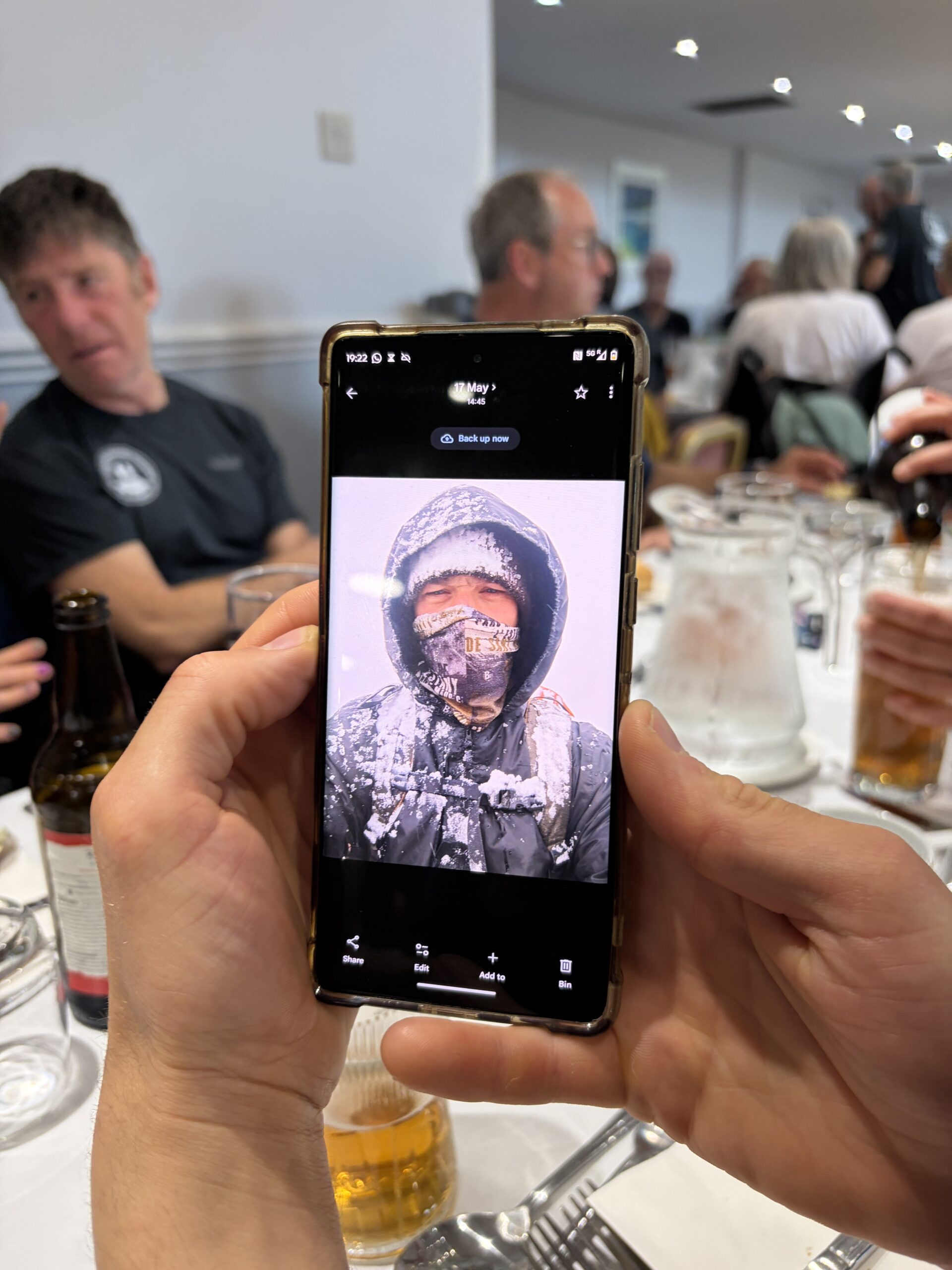
We’d walked a couple of hours into Inverness–he taking it slow because he’d sumitted five Munros two days before–and had interesting conversation about lots of stuff, pharmaceutical and not.
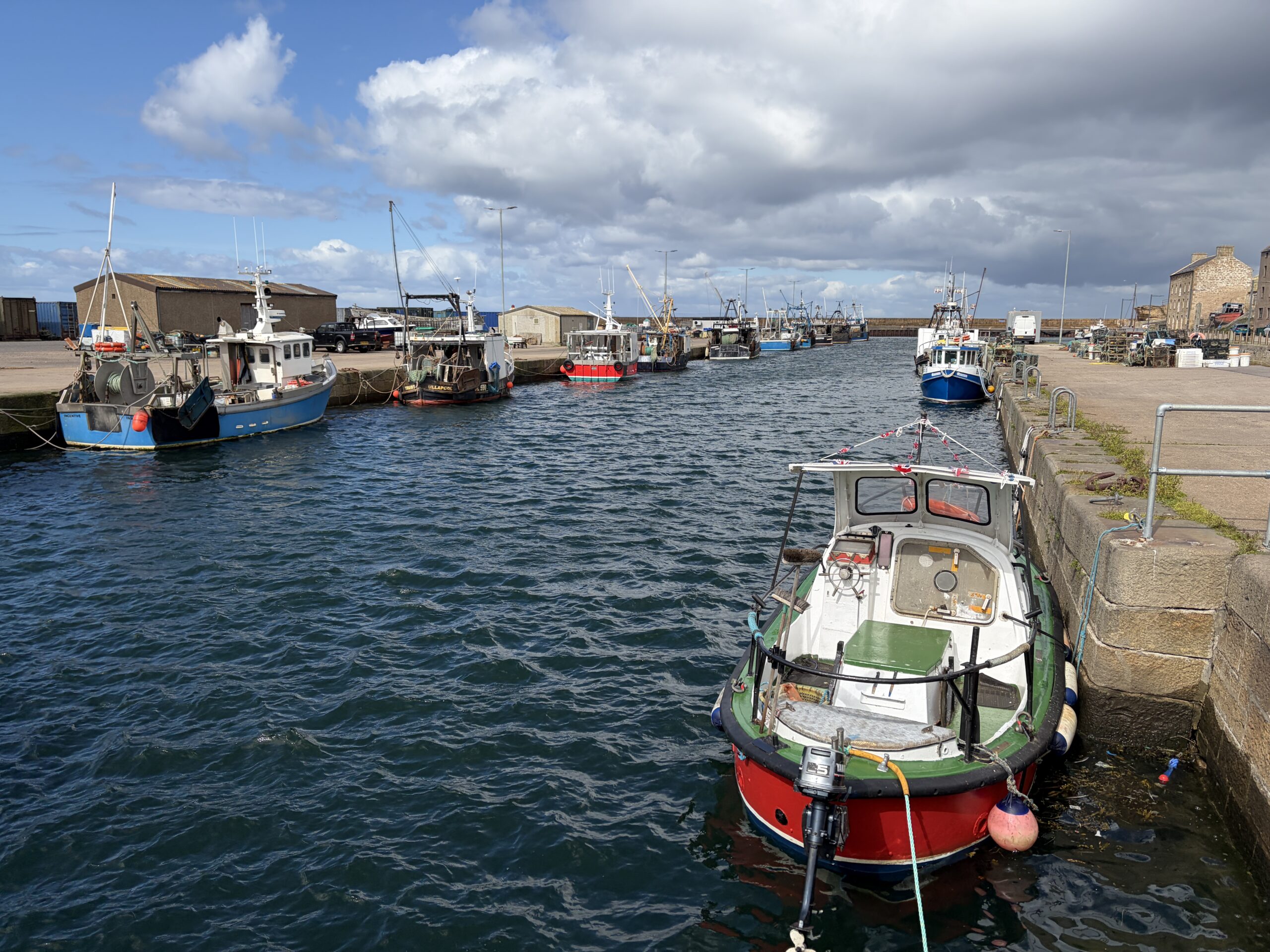
At the town of Burghead there was what appeared to be a small fishing fleet.
The wind was sending waves crashing into the breakwater. I went out to the end of the land to see the remains of a Pictish fort, but it wasn’t obvious, and the conditions were too cold and windy for exploration.
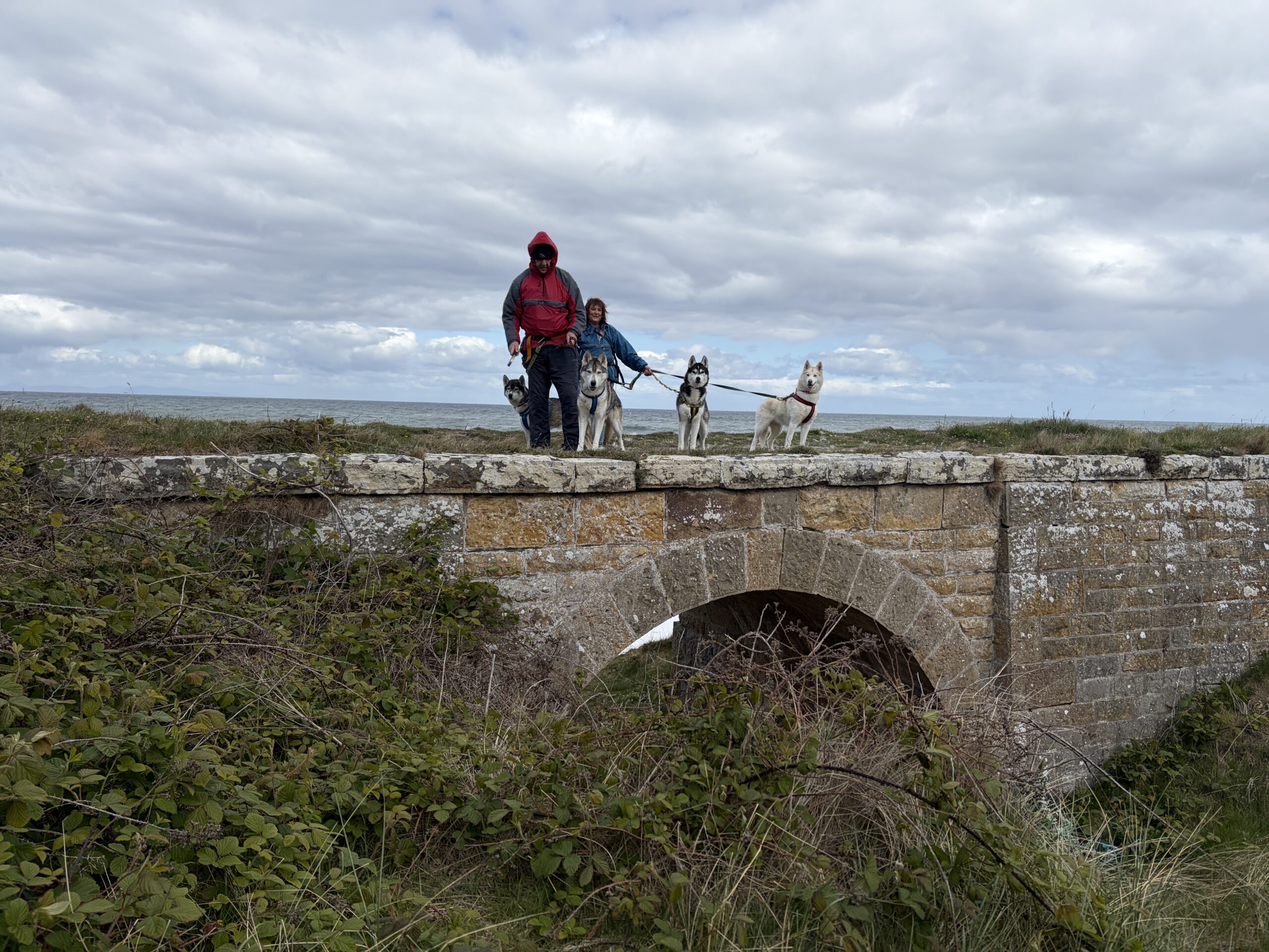
Eastward beyond Burghead I passed two people with four huskies, the first time I’ve seen that breed on this walk.
I passed what appeared to be Scotland’s only 1-hole golf course. (I ran into some more holes farther on.)
An endless berm of polished stones gave testimony of the power of the sea.
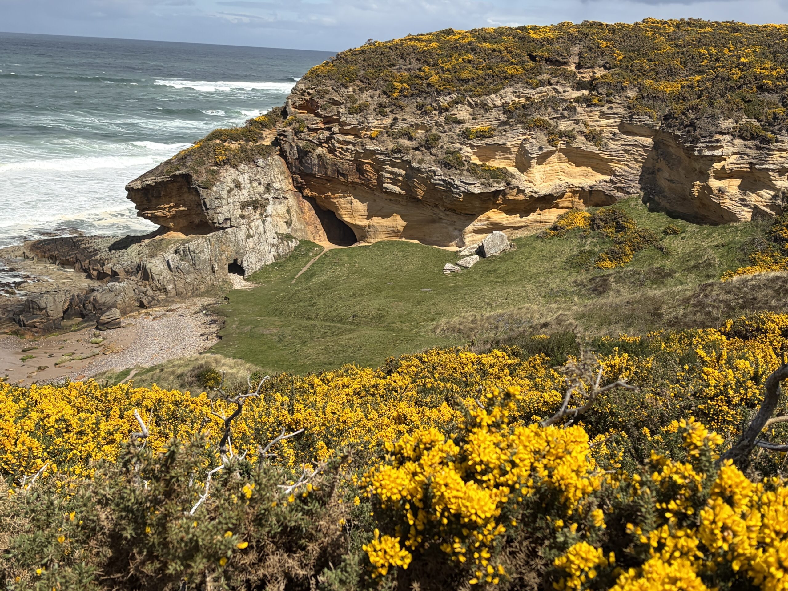
A few caves had been carved in the sandstone shore.
The wind combed the grass on the top of the dunes into a hipster’s haircut.
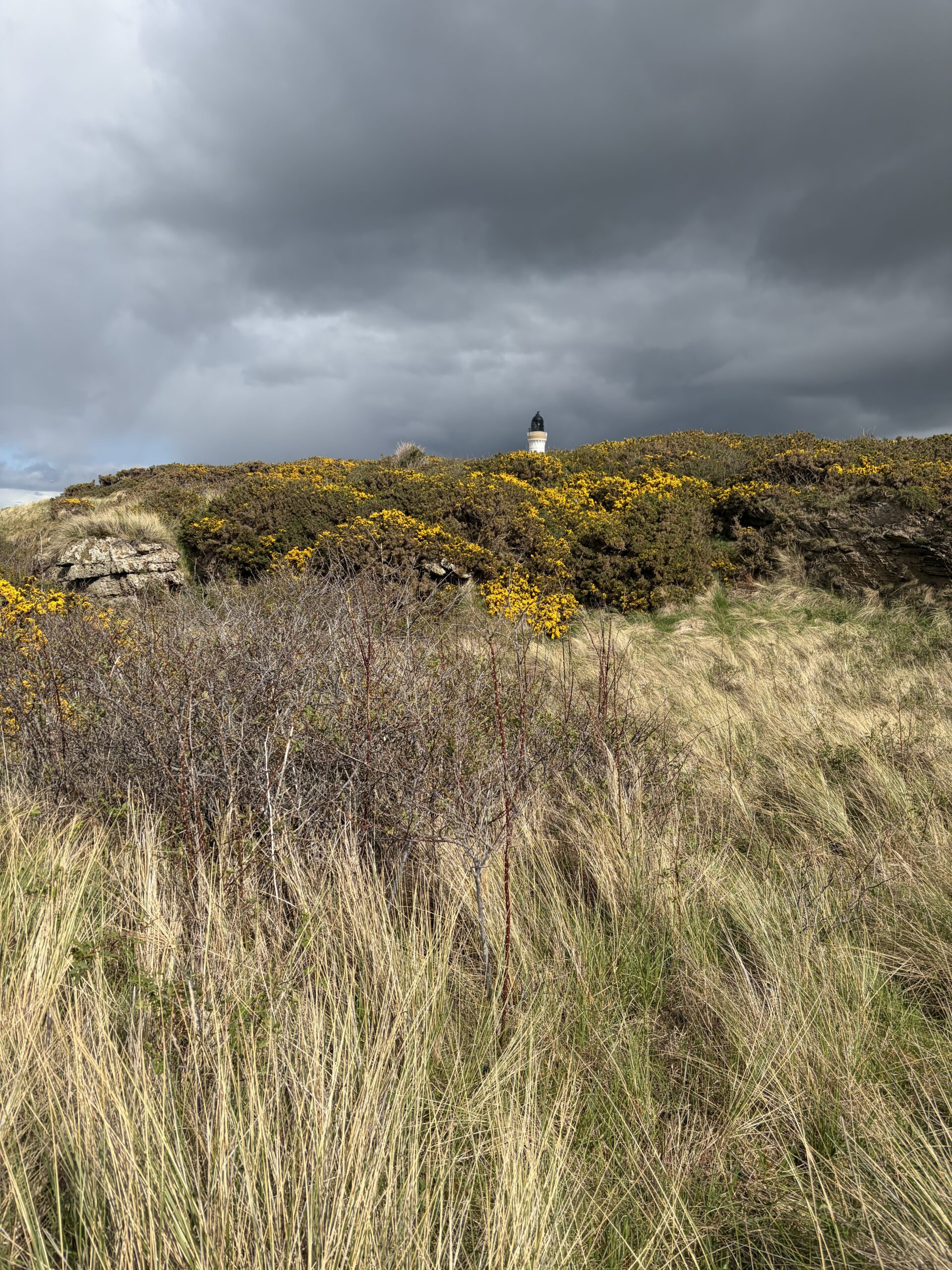
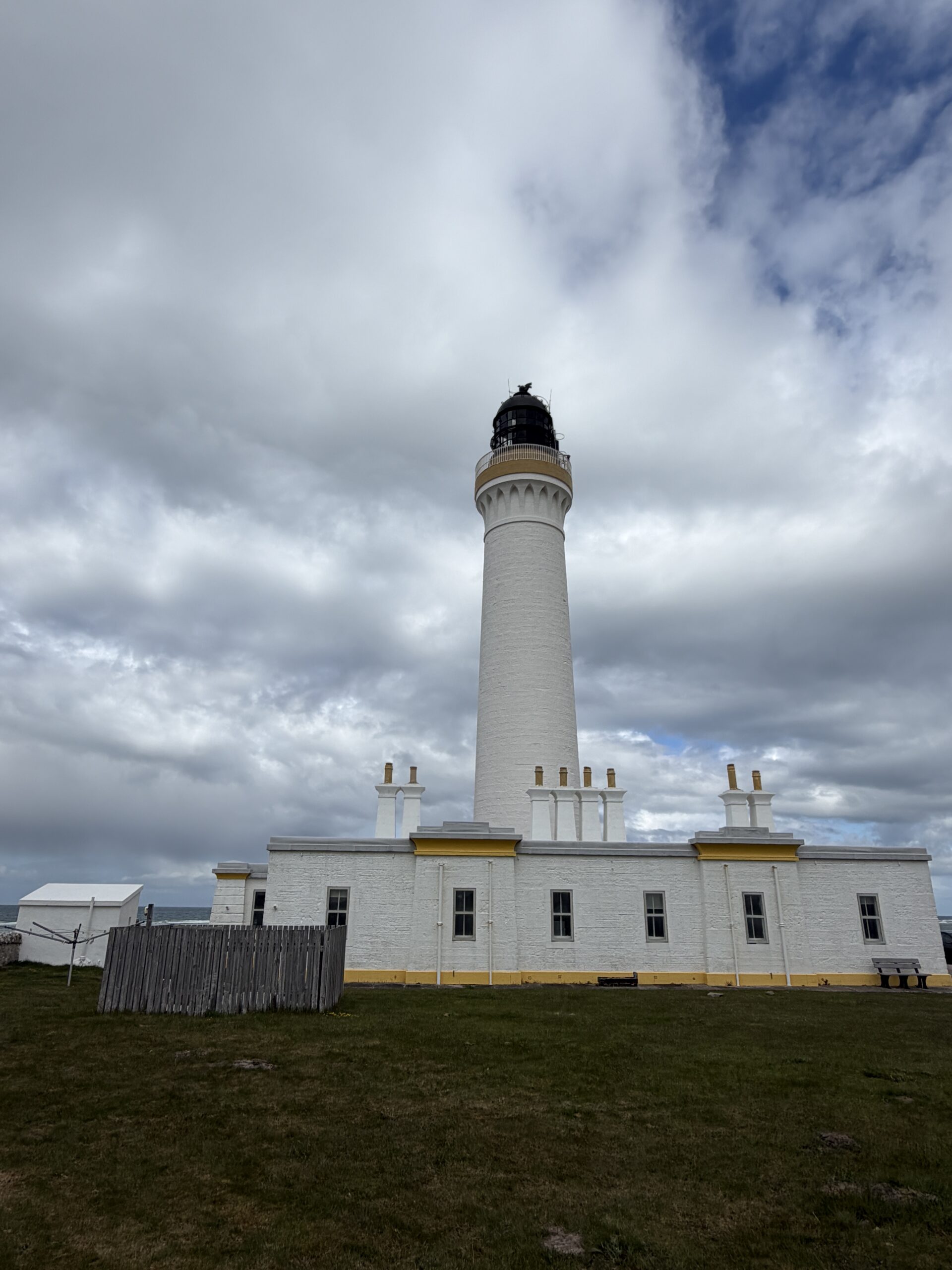
In the distance the Covesea Lighthouse peeked over the grass and gorse.
This is one of about 25 lighthouses designed and built by members of the Stevenson family of engineers between 1797 and 1925. Robert Louis Stevenson was a member of that family, although a writer not an engineer.
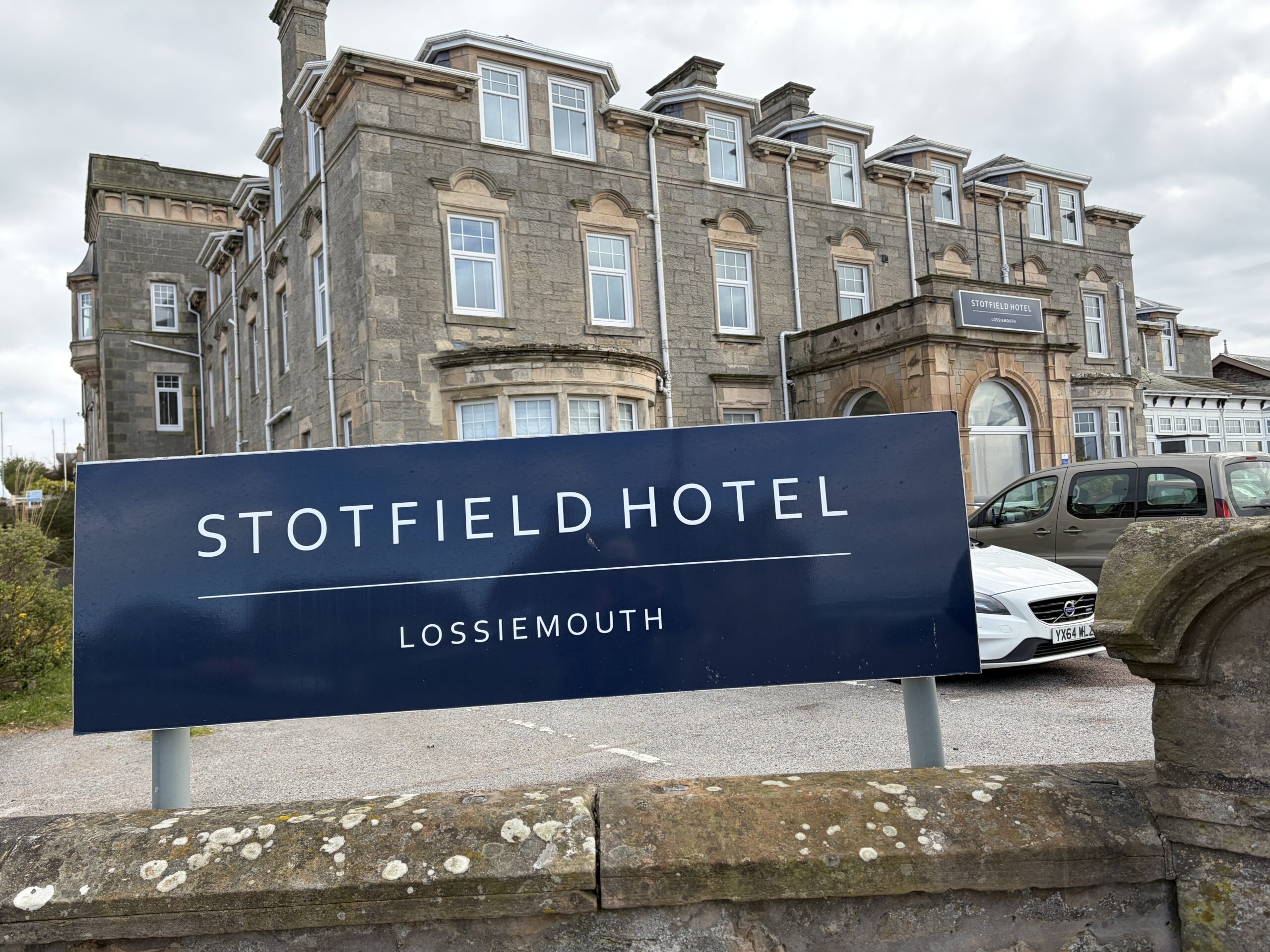
At the western edge of Lossiemouth I walked past the site of the long-gone hamlet of Stotfield. One of the more shocking of the Moray Coast’s many maritime disasters happened there.
On December 25, 1806, the village’s three boats–two-masted sail boats also fitted for rowing known as “scaffies”–put out for a day of fishing. (That it was Christmas attests to how little that was a holiday in the austere Presbyterianism of the time.) Around noon the temperature dropped from 50 to 39 degrees Fahrenheit, a fierce southwest wind blew up, driving the boats away from the land. They were never seen again.
Twenty-one men and boys were lost. Stotfield was left with 17 widows, 42 children, and a few old men.
The Aberdeen newspaper reported later that 190 pounds had been raised in 18 parishes for support of the survivors of the Stotfield disaster and of three other boats from nearby villages that disappeared in the same storm.
I eventually made it to my Airbnb rental, which was in a former dairy built in 1620, the year the Pilgrims landed in Plymouth, Massachusetts.
The woman who runs it, Simone, came to Lossiemouth when her husband, an Air Force officer, was assigned there.
As she showed me around, three people with backpacks appeared outside the window, moving on in the evening sun, which doesn’t set until after 9.30 at night.
I’d walked 44 miles in three days, however, and was done.
[Note: This is an edited and updated version of a post I wrote when I first crossed the Moray Coast 10 years ago.]
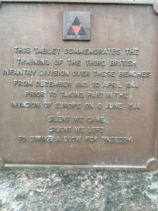
I got the idea to walk this route when I learned that parts of the Moray Coast had been used to practice amphibious landings in World War II in advance of the Normandy invasion.
It turns out very little has been written on this subject. Winston Churchill devoted two sentences to it in his six-volume history of World War II.
“One British division with its naval counterpart did all its earlier training in the Moray Firth area of Scotland. The winter storms prepared them for the rough-and-tumble of D-Day.”
Information from various sources, however, reveals that exercises occurred from December 1943 to March 1944. They involved principally the 3rd Infantry Division of the British Army, as well as Navy and RAF forces.
These “combined operations” were unusual and unpredictable, given the different command structures and cultures of the military services. People paid with their lives getting the kinks worked out.
Some sources say the two shores of the Moray Firth were chosen because they resemble the beaches of Normandy where the invasion of France was to take place. How true that is I don’t know. I’ve never been to Normandy. I know, however, that the beaches I walked on where the rehearsals occurred do not have high bluffs over them, as do some of the Normandy beaches.
What this area clearly offered, then and now, are long beaches (several over five miles); tides that leave huge expanses of sand when the water is out; cold, rough water; and relatively few people.
On November 11, 1943, the village of Inver on the Tarbat Peninsula that forms the north shore of the Moray Firth (across from where I am walking) was told it had one month to finish the harvests and move all inhabitants and animals. The affected area was 15 square miles and had about 900 residents. There were 56 children in the Inver primary school, which closed November 26.
A “displenishing sale” was held at the nearby town of Dingwall, where 1,050 cattle, 8,000 sheep, 60 horses, and 50 pigs were sold. (Chickens weren’t sold; they were taken or eaten before the evacuation). The prices were low because of the season and a prohibition against widespread advertising of the sale for reasons of war security.
Tarbat was a the site for live-fire with tank weapons, as well as a limited amount of shelling from ships.
About the same time, a sparsely populated area just west of the mouth of the River Findhorn, including a hamlet named Kintessack (on the side of the Moray Firth where I’m walking), was given by three weeks to evacuate. Eighteen Italian prisoners of war were brought in to help with the threshing of grain and the digging of potatoes and sugar beets.
Personal accounts of the exercises are rare.
A 2007 doctoral dissertation by historian Tracy Craggs (University of Sheffield) quotes a veteran named Peter Brown, who recalled a mock assault in November 1943. He was immersed after jumping out of the landing craft.
” ‘Our objective in this exercise was a wood about fifteen miles inland across rough countryside. By the time we got there and had dug a slit trench I was in a pretty poor state. My clothes had partially dried but as darkness fell and it got colder I could not stop shivering and began to think I would not last the night. However about three in the morning the exercise was called off and we were able to light a huge bonfire and this, together with a generous rum ration, probably saved my life’. “
(I personally doubt the beach assault was followed by a 15-mile walk inland. Fifteen-hundred yards is more likely. But who knows?)
The historian writes that “in January, three days were spent at Burghead Bay during Exercise `Grab’, with the intention `to practice assaults on beaches and the capture of initial objectives by assault battalions’. There was also emphasis on night operations, including breaching minefields, compass work and direction finding, as well as time spent on the range.”
It was a difficult time of year to undertake such maneuvers, with winter seas and only six hours of daylight. It’s intimidating enough now, when the weather is pretty good and there’s useful light for about 19 hours a day.
Exercises at Burghead on December 22 and January 9 had landing craft leave from Fort George, near Inverness, cross the firth, and return to the southern shore to simulate a crossing of the English Channel. There was apparently much seasickness.
The biggest exercise was on March 30-31, also at Burghead, where 204 Sherman tanks, 32 Stuart tanks, and all the infantry of the 3d Division, plus cruisers and destroyers, took part, according to the pamphlet “Evacuation: Tarbat Peninsula 1943-4” (undated) by Dr. James A. Fallon.
There were surprisingly few casualties. One occurred in February and involved so-called “duplex-drive” tanks, which were outfitted with watertight collars that allowed them to float and move with a propeller connected to the engine. Two tanks swamped and one person drowned. In all, five tanks were lost in the rehearsals, according to records. (These amphibious tanks proved an unsuccessful invention in World War 2.)
In April, the troops moved to the south coast of England, where larger, more complicated, rehearsals were held. One was disastrous.
On April 27-28, 1944, American and British troops suffered more than 700 deaths by friendly fire and attack by German speedboats–both the consequence of failures of communication between American and English navy commanders. These were more deaths than the U.S, Army suffered at Utah Beach, the smaller of the two beaches American forces landed on art D-day. The details of the so-called Slapton Sands Catastrophe were suppressed for decades, and are not widely known now.
In May, 1943, the local people were allowed to return to Inver. The government paid for damages to houses and farm buildings. With English punctiliousness, the details of losses were recorded. How much of this information was publicly available at the time is uncertain. Given the previously expressed concern for security, this detailed record-keeping seems unusual.
In many places, however, the ground had been compacted from tanks and took years to recover. Purebred herds that had taken decades to build were gone. Farmers removed unexploded shells from the ground for a long time, according to a pamphlet “The Evacuation of Inver” put together by the village’s schoolchildren a number of years ago.
It was all chocked up to “doing your bit” for the war effort.
There were other, subtle disruptions, too. The Inver school reopened at the end of August, and the logbook for September 1, 1944 notes: “Attendance is disappointing. Some of the boys absent themselves from School for no apparent reason.”
A newspaper account sent to me by Tim Negus, one of the volunteers at the Findhorn Heritage Center, whom I met when I passed by 10 years ago, included this observation from a woman who was a schoolteacher when the area near the Findhorn was evacuated.
“All stoppers from the sinks were removed. I understand that the troops carried their own personal stoppers wherever they went. But I hasten to add the soldiers took the stoppers only.”
A number of years ago, Tim tried hard to find someone who remembered the assaults. They would have been visible from the village of Findhorn, which was not evacuated.
“It must have been like a hundred Guy Fawkes Days,” he said. But he could find nobody who recalled seeing them.
The book “Portrait of the Moray Firth” by Cuthbert Graham (1977) has details about hundreds of historical sites but contains no mention of the invasion rehearsals on the Moray Coast.
It turns out a plaque on the beachfront at Nairn may tell the whole story.
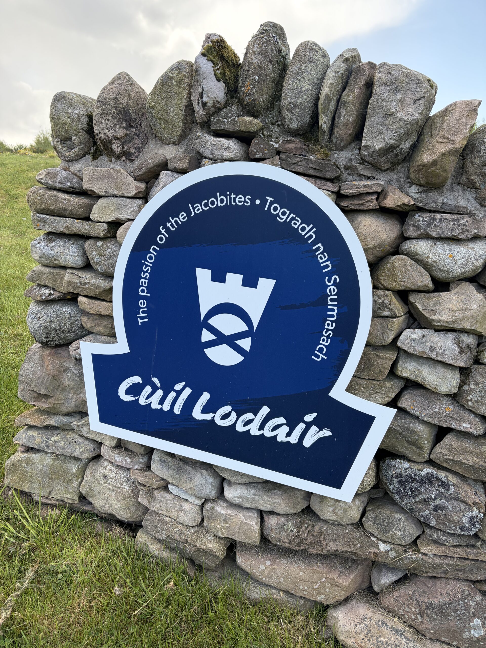
Like many important battlefields in America, the battlefield at Culloden is only part of where the fighting and dying happened. (Antietam and Gettysburg are the exceptions.) That the core acreage is reverently preserved and evocative is an achievement of which the Scottish National Trust can be proud.
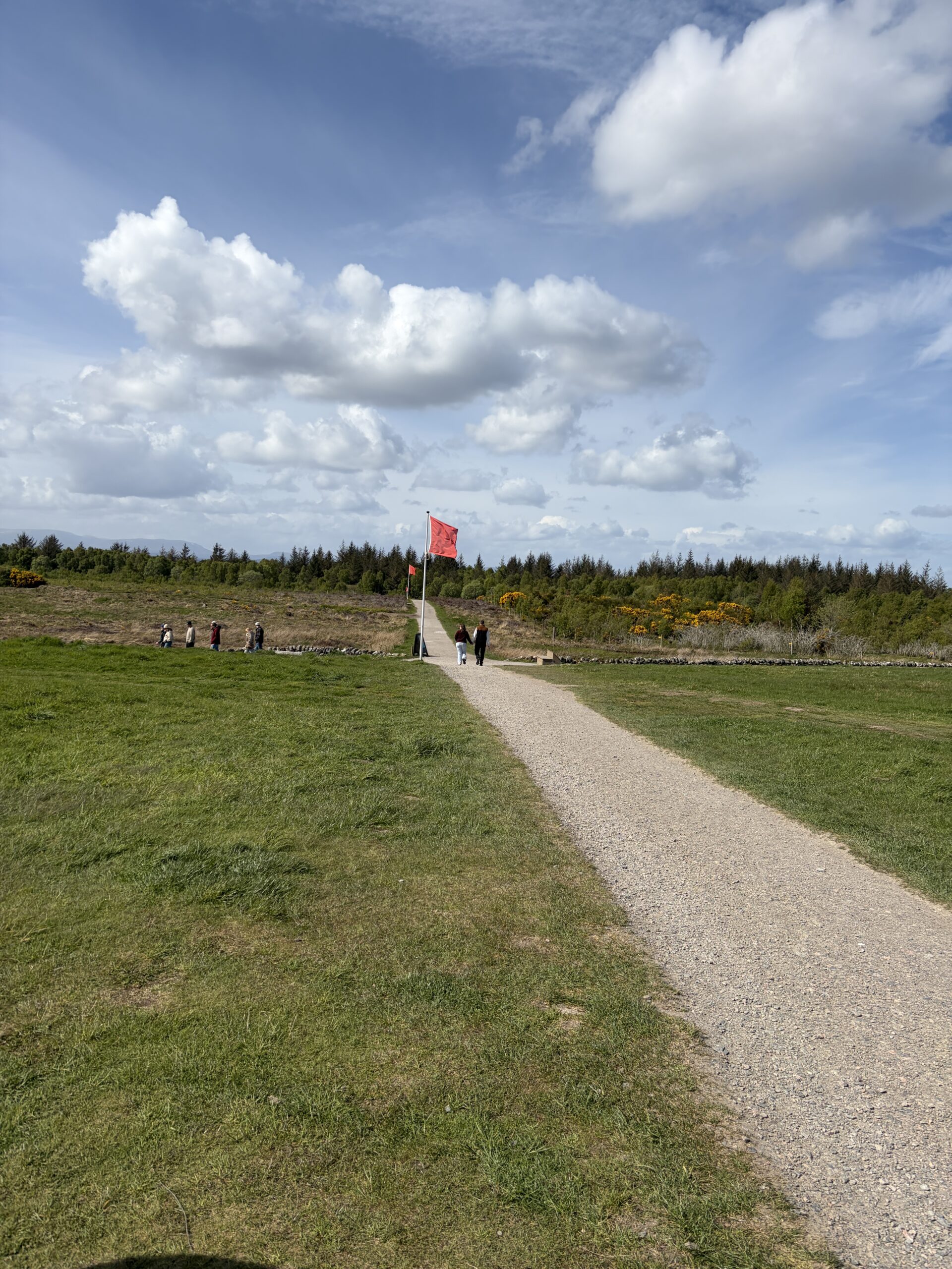
The field is still cleared of sight-limiting vegetation, as it was on April 17, 1746, although the fringes, where fighting also occurred, are taken up by 5th and 6th-growth trees, and in some places, “holiday houses.”
Red flags mark the government (Duke of Cumberland) front line, blue flags the Jacobite (Bonnie Prince Charlie) line.
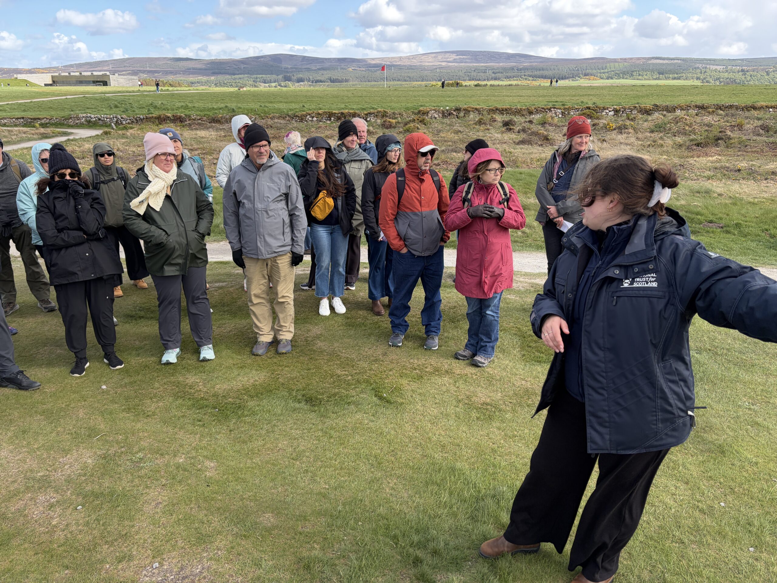
You could pay 5 pounds for a tour, and it was worth it. Our guide, a woman named Charlotte, was well informed and efficient. Her first big point was this wasn’t a battle between Scotland and England.
It was a battle between two royal houses–the Hanoverians, who were on the British throne, and the Stuarts, who’d been ousted and were the “pretenders.” The Stuarts were of Scottish descent and had a large following among the clan-based people of the Highlands.
She said tour would take 45 minutes–“about the length of the battle.” It was cool and breezy, as you can tell from her listeners’ dress.
All accounts of the battle say that part of was held on a “boggy moor.” Some of that remains. The water and mud slowed a Jacobite charge, making the soldiers easy targets for musket fire and grapeshot.
The Duke of Cumberland, who had just turned 25, sealed off the battlefield when the fighting was over, and gave his troops an order “to show no quarter.” The wounded died or were killed.
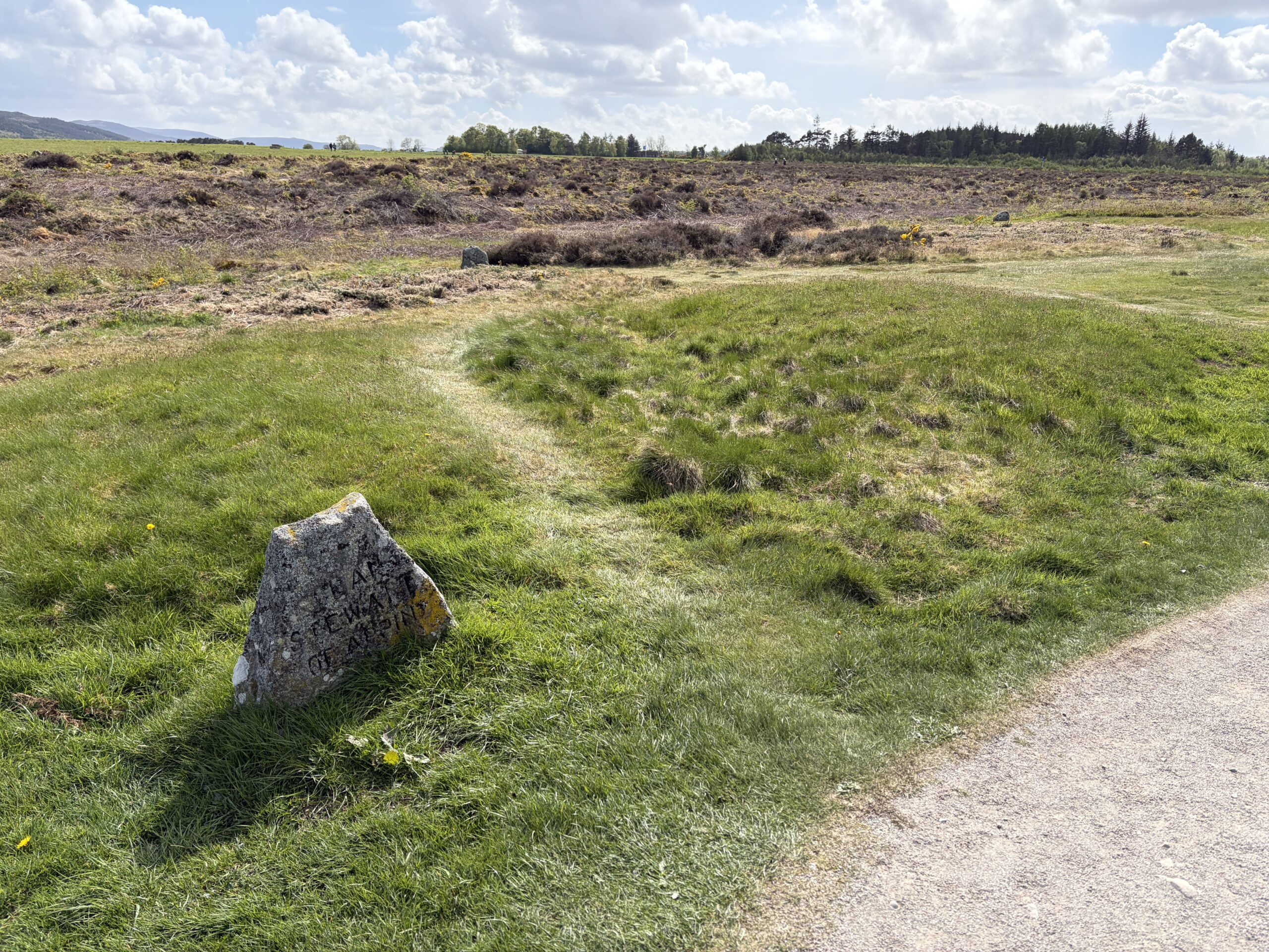
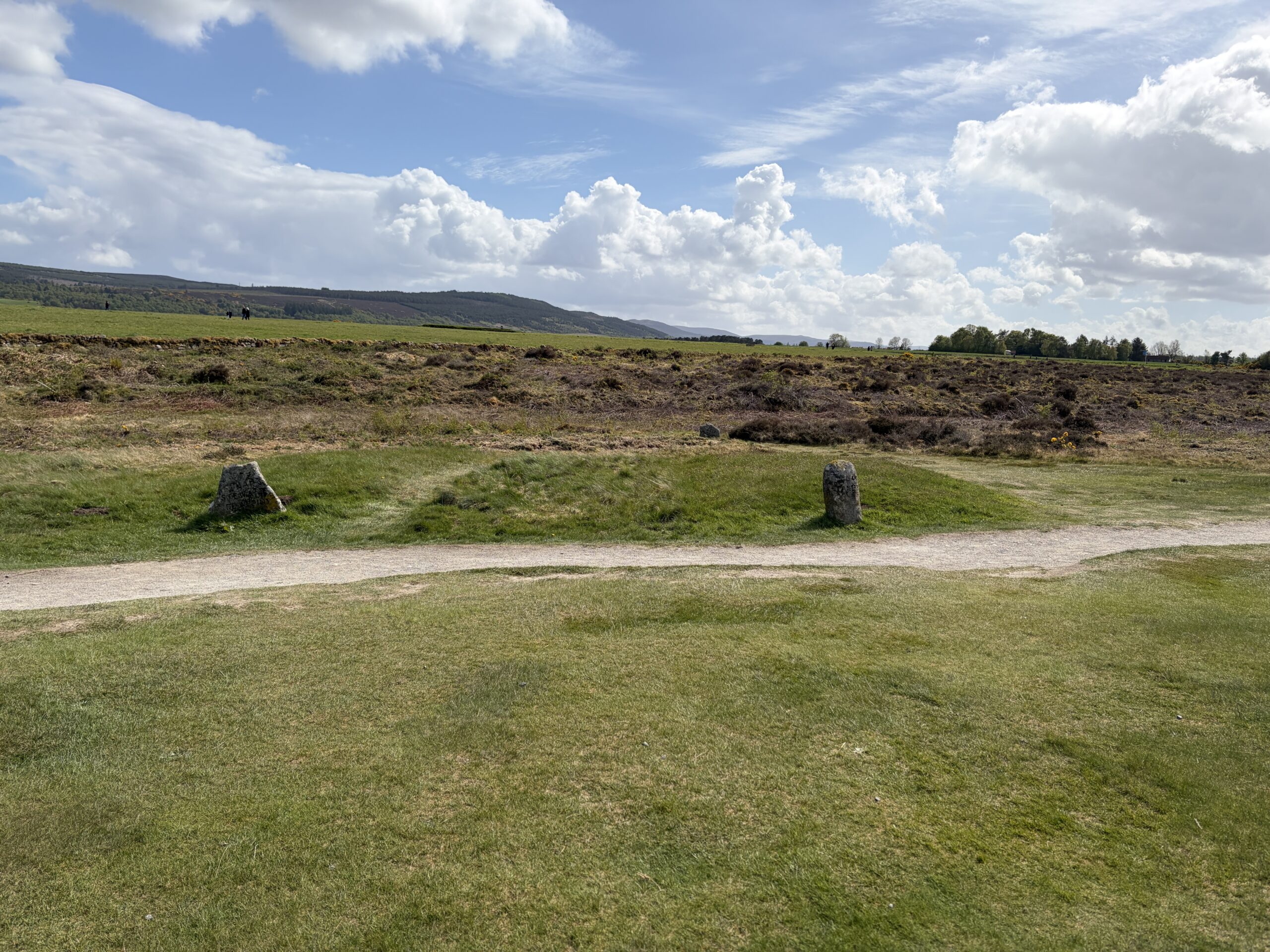
Several days later he went to Inverness, rounded up some Jacobite sympathizers, and brought them to Culloden to bury the Jacobite dead. About a dozen mass graves were dug. You can still see slight humps in the ground where they are. Charlotte said they’ve never been opened for archaeological or other purposes.
In the Victorian resurgence of Scottish clan pride, an aristocrat named Duncan Forbes put stones with clan names at the head of the graves. But in truth, nobody knows the identity of their occupants. Many are Irish, French, and English, as Jacobitism had international support.
Behind the government lines was a stone cottage with a thatched roof. Like the Dunkard Church on the Antietam battlefield, it’s often described as the only surviving architectural witness to the battle. But Charlotte said it had undergone several rebuilds since 1746, and at most contains only some stones from the original structure. It was occupied until 1911; the people who lived in it were the first battlefield tour guides.
The official death toll was 50 government dead and 1,500 Jacobite dead. The numbers are imprecise; in particular there were probably more than 50 of the Duke’s soldiers killed.
Nevertheless, there’s no question it was a Jacobite rout, and slaughter. At the visitor center there’s a wall that has a raised stone for each of the “official” dead–the government on the left, the Jacobite in the distance on the right. It’s a moving linear tribute, a bit like the Vietnam War Memorial in Washington, and the Flight 93 Monument in Shanksville, Pennsylvania.
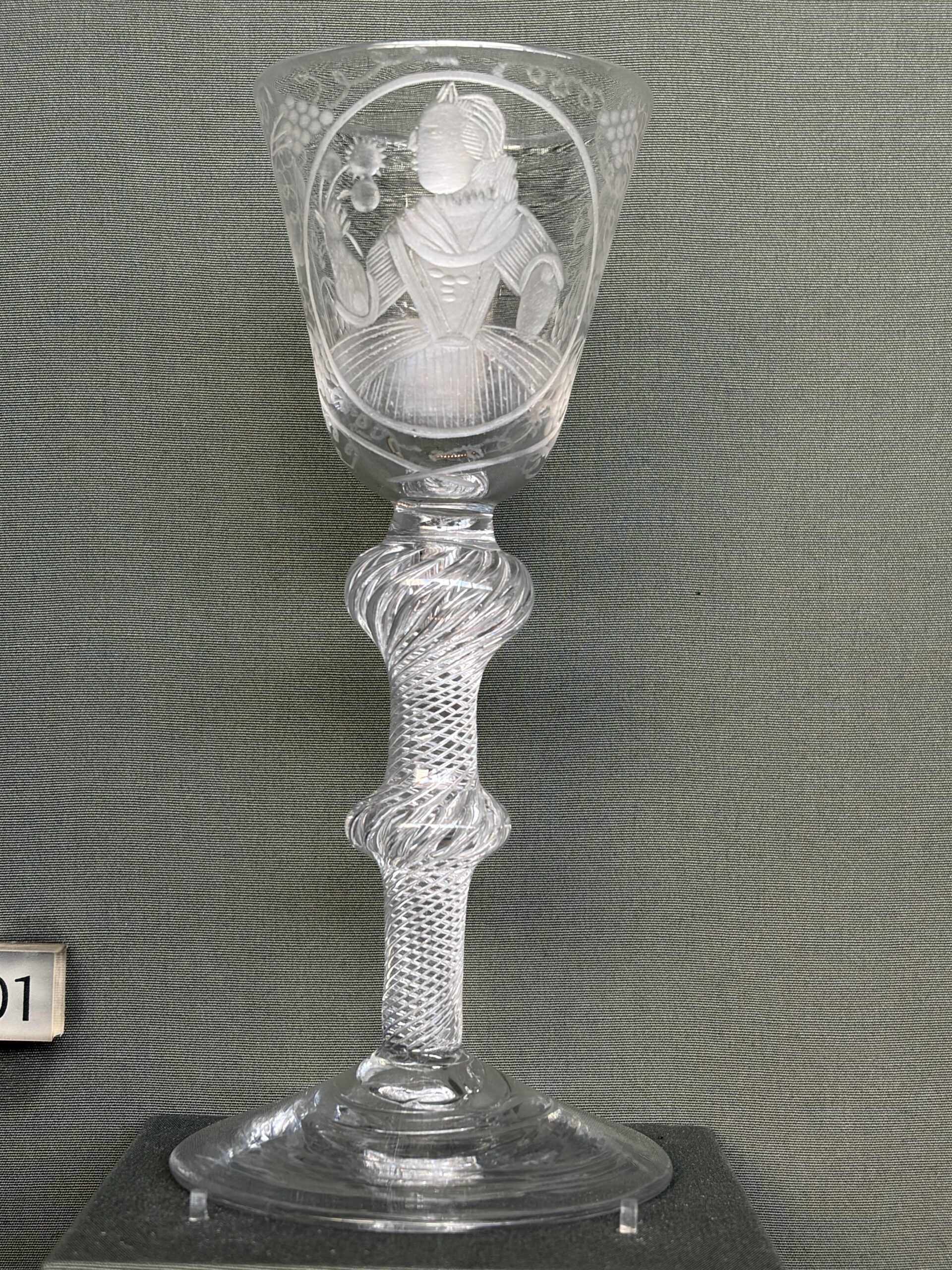
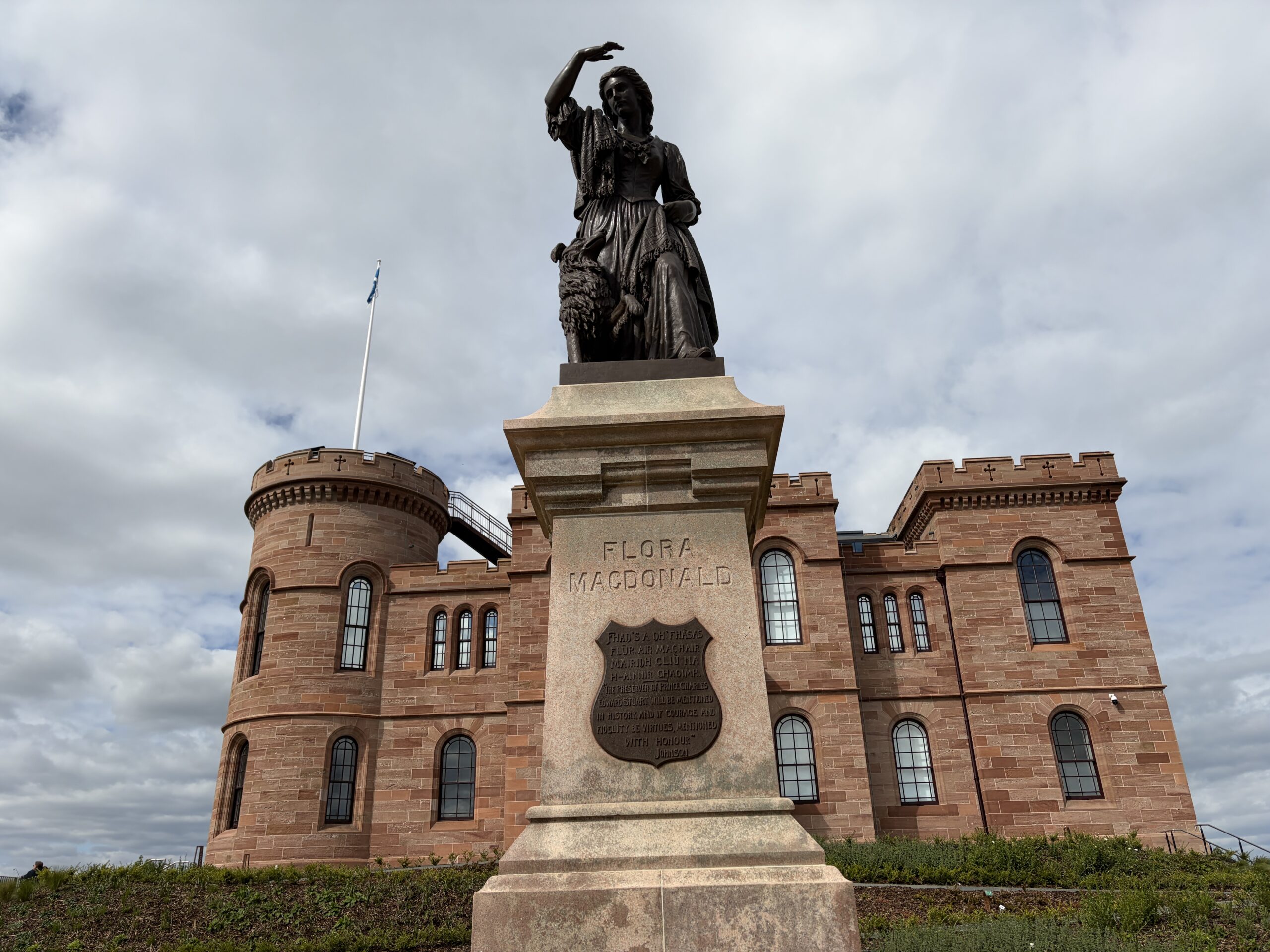
There are few material artifacts from the battle, mostly musket balls and scraps of metal. There’s a robust collection of post-Culloden knickknacks. One is this etched goblet that shows Bonnie Prince Charlie dressed in drag as the maid of a Highland woman named Flora Macdonald, who helped him escape west to a Hebridean island, where he was picked up and taken back to France.
Flora Macdonald is more of a hero than the prince. Her statue stands in front of Inverness Castle, a symbol of Scottish resistance and ingenuity more than of anything that might have been achieved by the strange and failed cause of Jacobitism.
One of the reasons I chose the route I’m on was so I could visit Culloden, the most famous battlefield in Scotland.
A few miles east of Inverness, it’s the place where Jacobite rebels (most of them Scots) who’d been fighting the government of England for half a century were defeated for the last time.
The details of Jacobitism are a mind-clouding mess of monarchs named James, Frenchified pretenders, Protestants who supported Catholics and Catholics who enlisted austere Presbyterians to fight beside them, tartan-wearing clans going at each other with broadswords, and other non-intuitive alliances and hatreds.
By the time I first heard the name “Culloden” all I could deduce was that it evoked a sort of “Lost Cause” Scottish resistance. It dinged a faint bell in Scotland’s campaign for independence, which was in the air when I did my first Challenge in May 2014. (The vote, on September 18 that year, failed; Scotland remains in the United Kingdom.)
Personally, I like visiting battlefields.
In the most self-conscious strategy of father-son bonding my father ever executed, the two of us spent the spring vacations of my 7th- and 8th-grade years visiting Civil War battlefields in Virginia, Maryland, and Pennsylvania. These included Richmond, Petersburg, the Wilderness, Cold Harbor, Appomattox, Antietam, and Gettysburg. I’ve visited many others since then.
In the last three years I’ve gone to Antietam, Gettysburg, Petersburg, and the Little Big Horn battlefields. In keeping with the trend of more sophisticated interpretation of historical sites, all are fairer, more interesting, and more evocative than when I walked on them 50 years ago. I’m curious to see how Culloden compares.
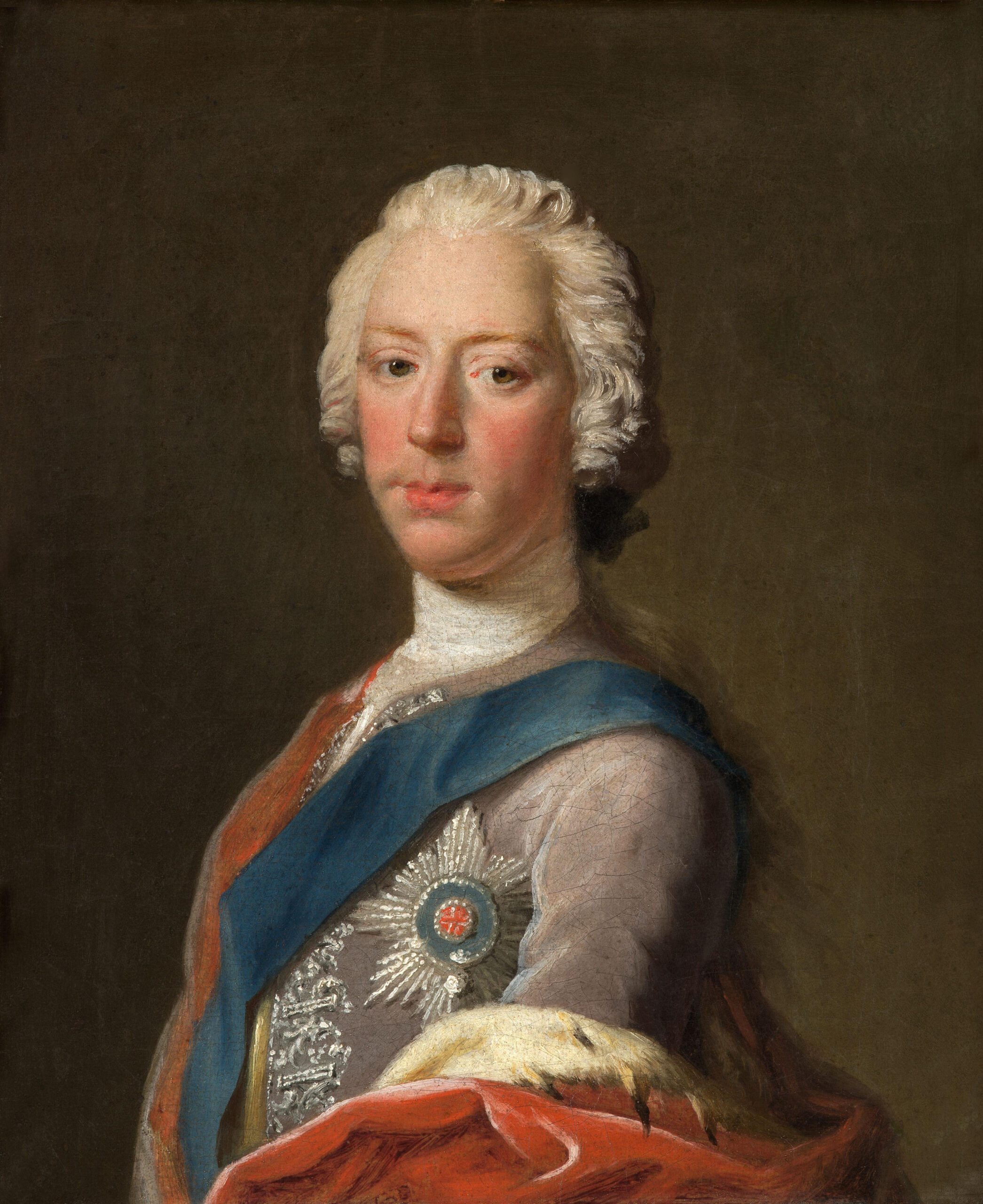
I will leave it to interested readers to research the full backstory of Culloden. The minimum a person should know is that it was the last stop of a feckless campaign by Prince Charles Edward Louis John Casimir Sylvester Severino Maria Stuart, known to friends as Charles Stuart and to pamphleteers and historians as “Bonnie Prince Charlie.”
“Prince Charles Edward Stuart” by Allan Ramsay (ca. 1745)
He was the great-great-great grandson of the Catholic Mary, Queen of Scots, the great-great grandson of a man who was both King James VI of Scotland and King James I of England, the great-grandson of King Charles 1 of England and Scotland, and the grandson of James VII and II. This was the “House of Stuart” line of succession.
The increasingly Protestant aristocracy and parliamentary establishment forced the Catholic James VII and II from the throne in 1688–an event that became known as the “Glorious Revolution.” The king and his wife fled to France with their infant son, also named James, who became the Pretender to the throne when his father died. His son was “Bonnie Prince Charlie.”
The Latin word for James is Jacobus; the people who wanted to restore these Jameses to the English and Scottish thrones became known as “Jacobites.”
They launched invasions in 1715 and 1719, which were not successful. In August 1745 they tried again. Bonnie Prince Charlie landed in the Hebrides off the west coast of Scotland with a small number of men. (A larger ship carrying most of the weaponry had been fired upon by a Royal Navy ship on the passage from France and had to return for repairs.) They were soon joined by 2,000 Highland Scots.
On the side of the English crown was Prince William Augustus, also known as the Duke of Cumberland (by which he was commonly known). He was the younger son of the sitting king, George II, who was of the “House of Hanover” line. The son, one historian wrote, was not “softened by gentle persuasive arguments by which gentlemen, particularly those of a British constitution, must be governed.”
Inexplicably, by late September Bonnie Prince Charlie’s shoestring army had beaten an English force outside Edinburgh and captured the city. The English army got suddenly serious as Jacobite forces–which had lost fewer than 50 men–headed south into England. London was 150 miles away.
What followed was a dispute over strategy in the Jacobite leadership that was to recur several times over the next year. Charlie wanted to forge ahead; his generals favored retreat to the Highlands to recruit more soldiers and consolidate power. With 5,000 troops to the crown’s more than 16,000, the prince reluctantly agreed to the latter plan.
What followed was several months of pursuit, with the Jacobite army taking and abandoning cities (as it had with Edinburgh), capturing one fort and putting another to siege, as the government forces followed it. The Jacobites also employed guerrilla tactics, angering the English army, which fought in ranks.
By the spring of 1746 the armies were milling around Inverness, where the Jacobites had stored supplies. A full-scale battle was inevitable, and it was shaping up to occur on a boggy piece of land six miles east of Inverness near the River Nairn. It was not a great place to fight.
The Jacobite army markedly worsened its chances by launching–and then aborting–a sneak attack on the Duke of Cumberland’s army, which was camped 10 miles away and celebrating the duke’s 25th birthday with extra rations and brandy. (Military commanders were young back then, and vain.)
In three columns over uncertain routes, they marched in the darkness and rain, with a plan to attack at 2 a.m. However, they didn’t proceed at the same pace, and three miles from the duke’s encampment the commander of the lead column realized an organized surprise was impossible. He called off the attack, the Jacobite troops turned around, and were back at Culloden at dawn, wet, hungry, and unrested.
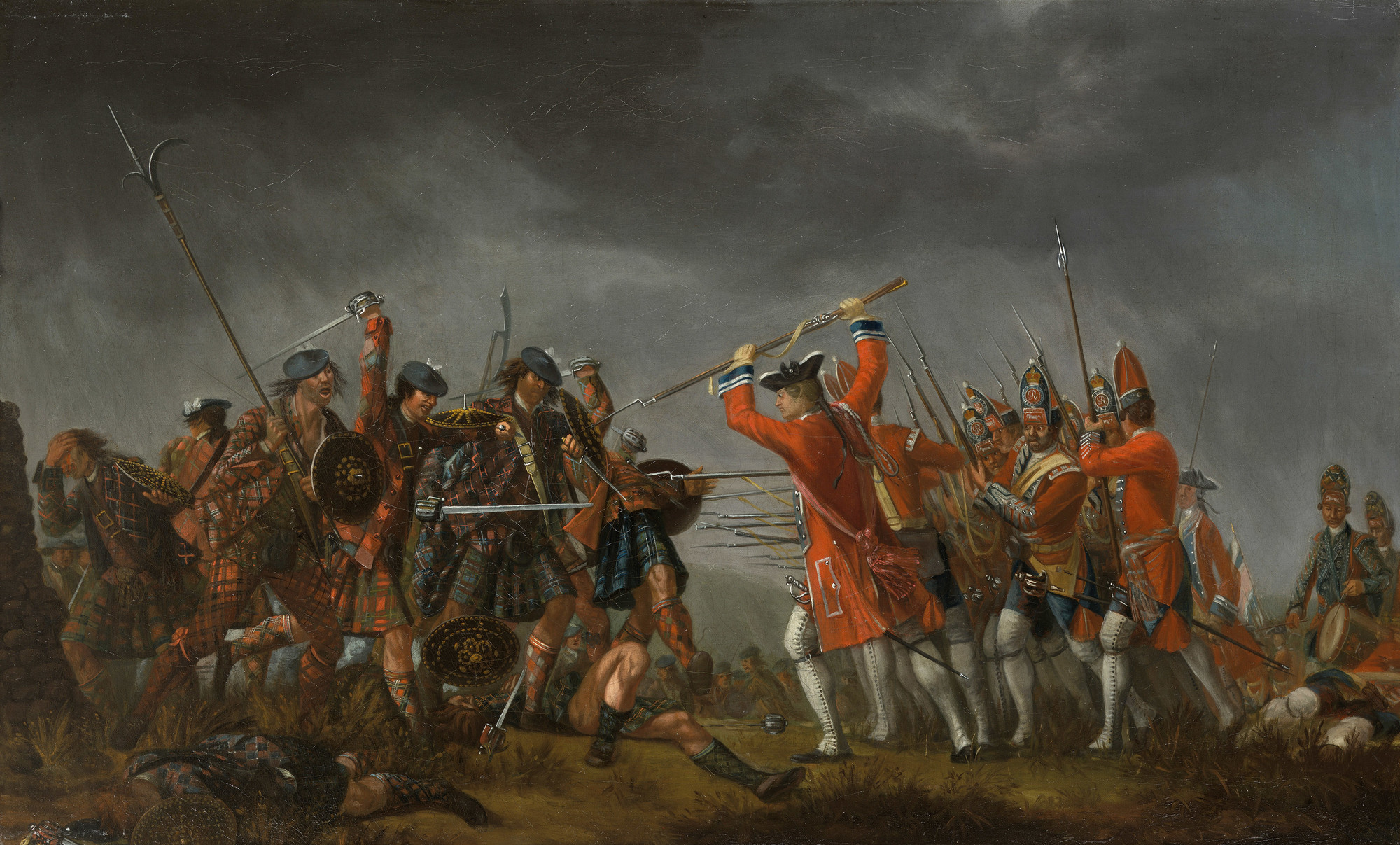
The duke’s forces attacked, engaging the Jacobites shortly before noon.
It was Prince Charlie’s first battlefield command. It showed; parts of his army were attacked from three sides. In less than an hour in the afternoon of April 16, 1746, the Battle of Culloden was over. The duke lost 50 men killed and 260 wounded. The Jacobite army had 1,500-2,000 casualties, with the exact number killed uncertain.
The Duke closed off the battlefield. The wounded Jacobite troops were left to die or helped along with bayonet thrusts. Thirty-six government deserters to the Jacobite army were hanged on the battlefield the next day.
It’s a testament to how little agency ordinary people had over their lives in that era that clan leaders could easily round up thousands of men to fight for a foreign would-be royal who believed in the divine right of kings. And that the English government could easily round up thousands of men to fight them. And with death often coming from an edged weapon.
“The Battle of Culloden” by David Morier (between 1746–1765)
The significance of Culloden was not the battle itself, but what followed it. (Perhaps that’s true of every battle.)
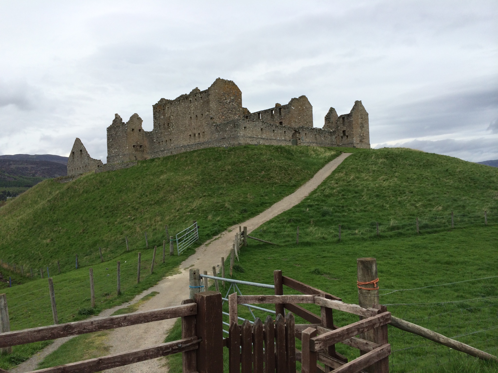
The Jacobite army initially fled south to a designated rendezvous point, Ruthven Barracks, which they’d recently captured from the government. It’s a striking stone complex I’ve walked past on two of my Challenge crossings. About 1,500 Jacobite troops got there; many others, however, simply disappeared into the Highlands, heading home.
The ruins of Ruthven Barracks
The Irish and French troops captured at Culloden were generally treated well and eventually “paroled” and allowed to return home. The Scottish soldiers, however, had a different fate.
They were treated as rebels, and that identity was supplemented with the belief that clansmen in particular were an uncivilized, dirty, and inferior race (and in some cases Catholic). Highanders were viewed the way Indians were in the western expansion of the United States–barely human. Many of the fleeing Scottish soldiers were executed if caught. People suspected of harboring them, including some titled aristocrats, had their houses burned and livestock driven off or sold. Some were killed.
“In the months ahead, bloodshed would become the norm as the government army continued its pursuit of Jacobite soldiers and their supporters, mounting what would later be called a counter-insurgency campaign against the largely civilian population of the Scottish Highlands,” wrote Trevor Royle in his 2016 book, “Culloden: Scotland’s Last Battle and the Forging of the British Empire.”
The Duke of Cumberland became known as “Butcher Cumberland,” a well-earned sobriquet, the rest of his life. There’s a story from years later in which he’s speaking publicly about his desire, as a royal, to become a patron of a worthy guild of working men. “How about the butchers?” someone in the crowd called out.
“After Culloden, Rebel Hunting” by John Seymour Lucas (1884)
This reign of terror by an army usually considered well-disciplined and respectful of the distinction between soldier and civilian brings to mind the experience of Italy when it was a battleground for the Allied and German armies.
In its slow, bloody retreat northward on the peninsula, the German army was attacked from the front by the British, Canadian, and American armies, and from the rear and flanks by partisan forces. Historian Mark Gilbert, in a book published last year called “Italy Reborn: From Fascism to Democracy,” wrote that in the last year of World War II “approximately 200,000 Italians fought in the resistance and tens of thousands of patriots assisted in non-combatant roles.”
German fear and fury knew few bounds. Hitler at one point set a policy (incompletely enforced) that for every Wehrmacht soldier killed, 10 Italians would be executed. The 2016 “Atlas of Nazi-Fascist Massacres in Italy 1943-1945”–a project of 120 Italian and German researchers–found “5,300 such [retaliatory] episodes with a total death toll of over 22,000 civilians, mostly children, women and elderly people.”
Memory of these reprisals has lasted into this century. The memory of Culloden also lived on for more than a century, not just because of its violent aftermath but because of the political and cultural changes it brought.
After it, the power of clan leaders was legally limited; the wearing of tartan (except in certain circumstances) became a crime; 13 Highland estates of people involved in the Jacobite rebellion were confiscated and some owners were executed; a law was passed to suppress houses of worship where “the King and the Royal Family shall not be prayed for by name.” Nearly a thousand Jacobites suffered “transportation”–forcible exile to America or the Caribbean as indentured servants.
Culloden occasioned an assault on Scottish identity that still echoes faintly. Although today’s Scots don’t venerate Bonnie Prince Charlie, they tell a story about him that venerates Highlanders.
After the battle, the prince hid in the Highlands until he was picked up by a ship on September 20, 1746 and taken back to France. During that time there was a reward of 30,000 pounds to anyone who turned him in. That’s the equivalent of 5.8 million pounds today–about $7.9 million. Nobody did.
It’s not by chance that Jamie Fraser, the hero of the “Outlander” television series is a Jacobite survivor of the battle.
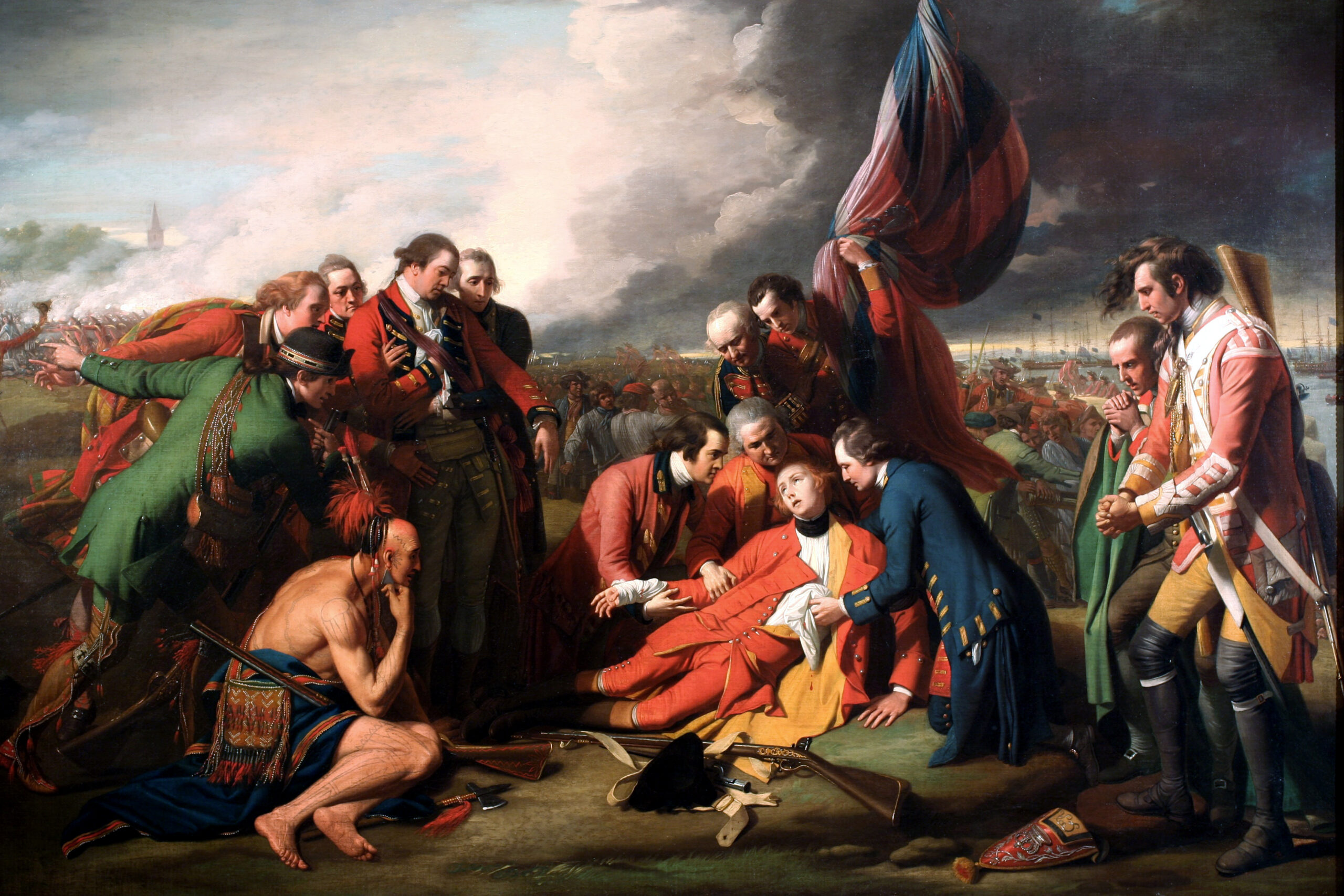
The Battle of Culloden also had a long military tail. Many of the men who were leaders in the wars of British North America were young officers on the boggy moor that day. Two of the more famous were James Wolfe and Thomas Gage.
Wolfe took part in the post-Culloden pursuit of Scottish soldiers, writing later that “as few Highlanders were made prisoners as possible.”
On September 13, 1759, he was commander of British troops in the Battle of the Plains of Abraham outside Quebec City–a place with spooky similarities to the Culloden battleground. Facing him were French forces under the command of Marquis Louis Joseph de Montcalm (whose aide was a man named Joseph Johnstone, a Jacobite veteran of Culloden who’d fled to France).
Both commanders were killed in the battle, which was the beginning of the end of French rule in North America. Wolfe’s death-by-sniper was memorialized by the painter Benjamin West, who rendered it as a Pietà.
“The Death of General Wolfe” by Benjamin West (1770)
Thomas Gage was a lieutenant colonel in the fighting in Western Pennsylvania in 1755 that marked the start of the French and Indian war. George Washington was a colonel there, and knew him. By the eve of the American Revolution, he was the governor of the Province of Massachusetts Bay, and commander-in-chief of British forces in North America.
Gage sent troops to confiscate colonists’ weapons west of Boston, a foray that became the disastrous Battle of Lexington and Concord, with 273 British casulaties to the Americans’ 93. He was in office (although not in command) at the Pyrrhic victory of Bunker Hill, where the British suffered a thousand casualties. He wasn’t optimistic about England’s chances in an American war. By October 1775 he’d been relieved of his duties and was on the way back to England.
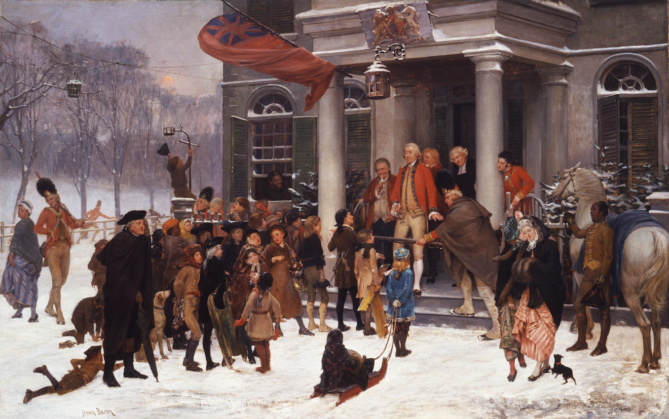
In 1884, a man named Benson J. Lossing published a history of the United States that told a story about Gage in siege-bound Boston that the painter Henry Bacon depicted a century later.
Even the children seemed to lose their timidity, and became bolder. They nobly exhibited it on one occasion. They were in the habit of building mounds of snow in the winter on Boston Common. These the soldiers battered down, so as to annoy the boys. This being repeated, a meeting of larger boys was held; and a deputation was sent to General Gage to remonstrate.
“We come, sir,” said the tallest boy, “to demand satisfaction.”
“What” exclaimed Gage, “have your fathers been teaching you rebellion, and sent you here to exhibit it?”
“Nobody has sent us here, sir,” said the boy, while his eyes flashed with indignation. “We have never insulted nor injured your troops; but they have trodden down our snow-hills, and broken the ice on our skating-grounds. We complained; and calling us young rebels, they told us to help ourselves if we could. We told the captain this, and he laughed at us. Yesterday our works were destroyed for the third time; and we will bear it no longer.”
Gage admired the spirit of the boys, promised them redress; and, turning to an officer, he said, “The very children here draw in a love of liberty with the air they breathe.”
“The Boston Boys and General Gage” by Henry Bacon (1875)
Bacon, a Massachusetts native, had served in the Union Army. At the Second Battle of Bull Run he sustained a crippling wound to his left arm, which was not his painting arm. He presumably knew something about things worth fighting for.
The painting, owned by The George Washington University, is famous for the variety of people depicted–and, by implication, the universality of support for the appeal for the redress of grievances. In addition to the “tallest boy,” there was a respectful girl pulling a child on a sled, an old man using an umbrella as a cane, a woman walking a dog, a maid flirting with a British soldier, a scamp climbing a lamp post, and two Black men.
Trevor Royle, in his book, says of Gage: “In the aftermath of the loss of North America, Gage was criticised for his docile behaviour and his refusal to crush the rebellion if necessary by employing overwhelming force from the very beginning. It was not as if he did not have the necessary experience . . .”
Suppression of an uprising in support of an exiled royal pretender was possible in Scotland. Suppression of an uprising in support of democracy–or the incomplete 18th Century version of it–wasn’t possible in America
Everyone on the Challenge devises a route that must be reviewed and approved by a team of omniscient hill walkers known as the “vetters.” Only then can they do the walk.
My approved route had me leaving Drumnadrochit on the Great Glen Way, a popular and well-maintained path like the Affric Kintail Way I’d come into town on.
The Great Glen Way made a westward-facing semi-circle along the shore of Loch Ness before heading northeast toward Inverness. I saw a way to avoid that semicircle by walking on what was essentially a chord across it. It would require climbing a steep single-lane road through three hamlets before heading into the hills on a farm track, and then on footpaths over a couple of hills and back to the Great Glen Way.
This was a small modification. It would cut some distance–and perhaps some time–but would alter only one-third of the day’s route. The weather was good and the elevation low; it seemed a safe (and spoiler alert: was!) change.
However, it was freelancing in the sense that if I collapsed and died my body woudn’t be where the coordinators would first come looking for it.
I got to the end of the paved road, unlatched the gate, and headed down the farm track.
The footpath I was looking for was supposed to intersect the track, but I couldn’t find it. However, I knew where I needed to go–thatta way.
I headed across the heather and grass and eventually came across a path going my way. But it didn’t last long.
Soon I was back on open ground, which it should be noted is harder to get across because it’s soft underfoot and wet in places.
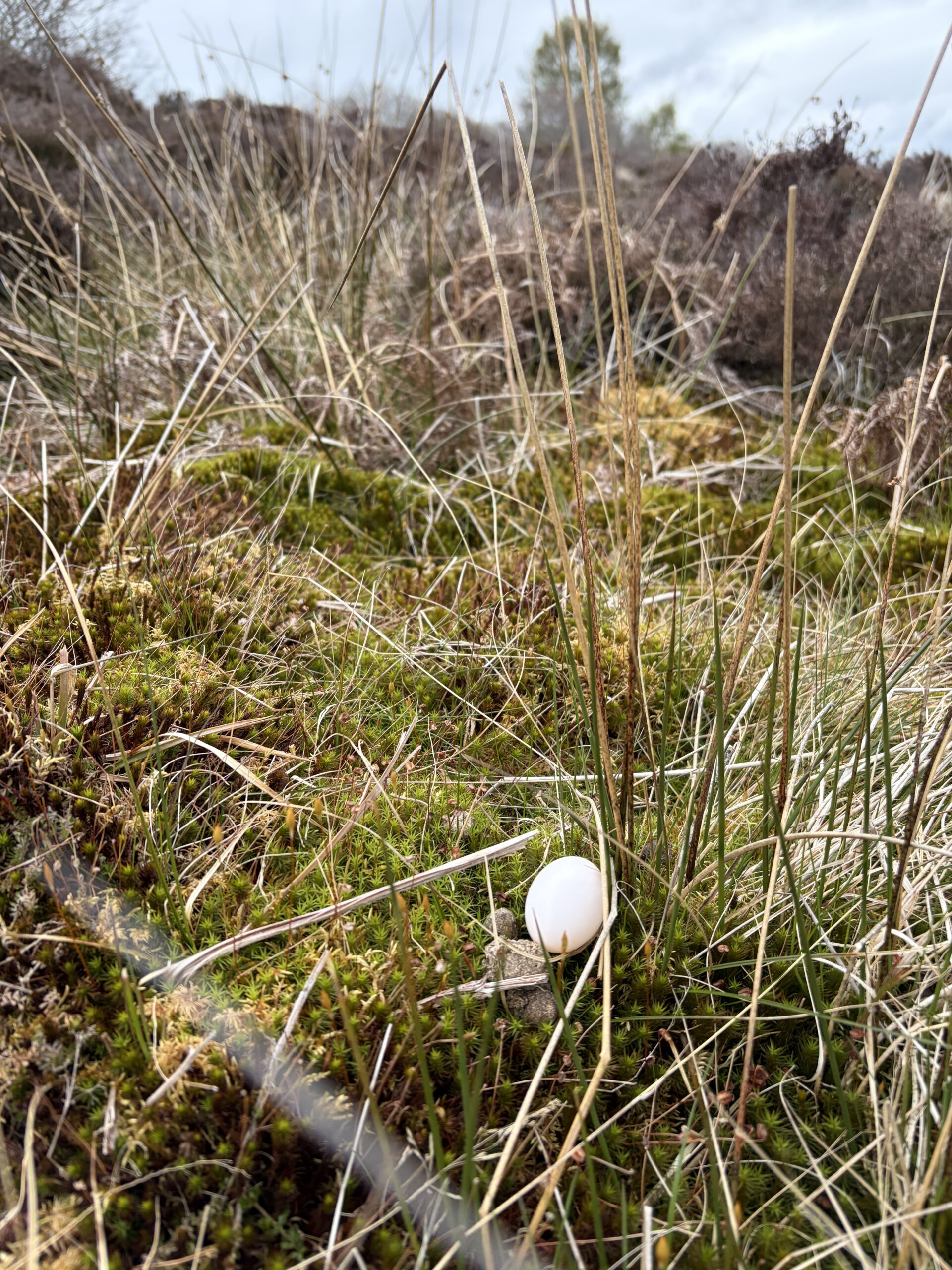
I came across a single egg lying on a bed of moss, a long way from where it should be and destined never to hatch.
A bad sign?
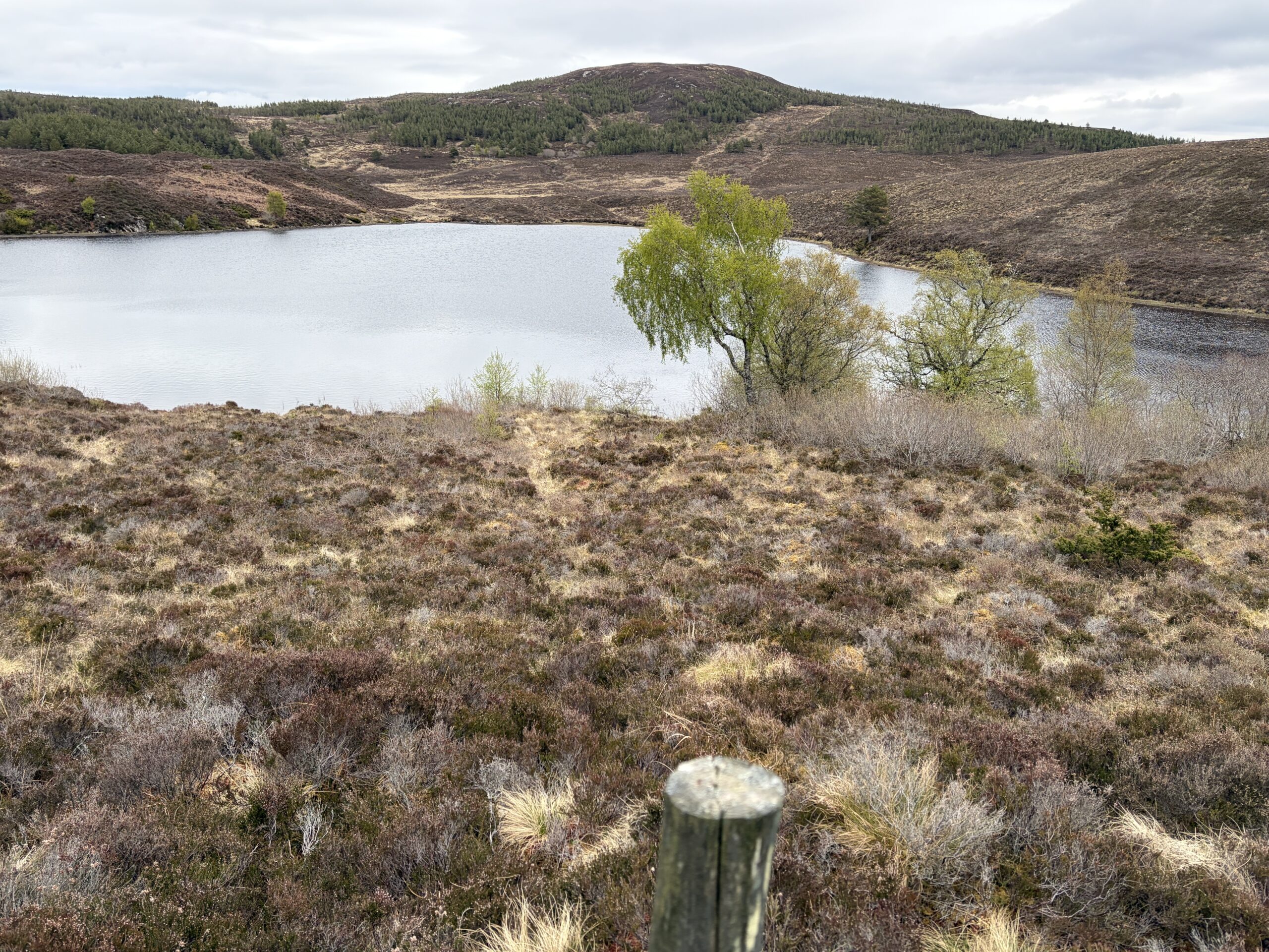
I knew from the map that I had to go on the left (west) side of a little loch, and was happy to see it to my right as I came over a hill and got a view.
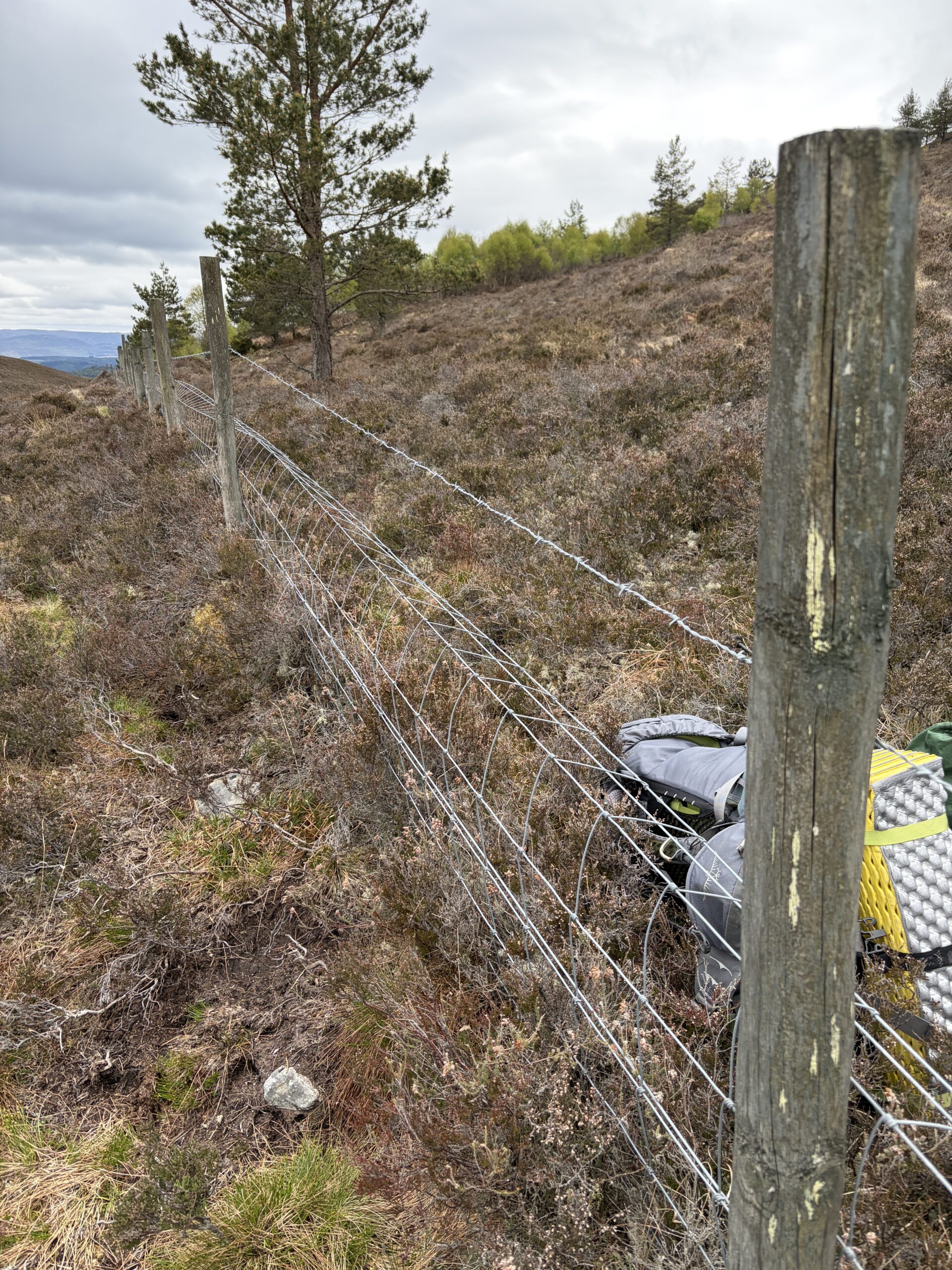
A fence went along hill. My GPS signal put my location on the wrong side of the fence from where the path was on the map, although I was starting to conclude the path, rarely used by man or animal, had been reclaimed by nature.
However, I knew where I was heading and that I’d eventually need to be on the other side of the fence. So over I went, pack first. Luckily it had only a single strand of barbed wire (on top, of course).
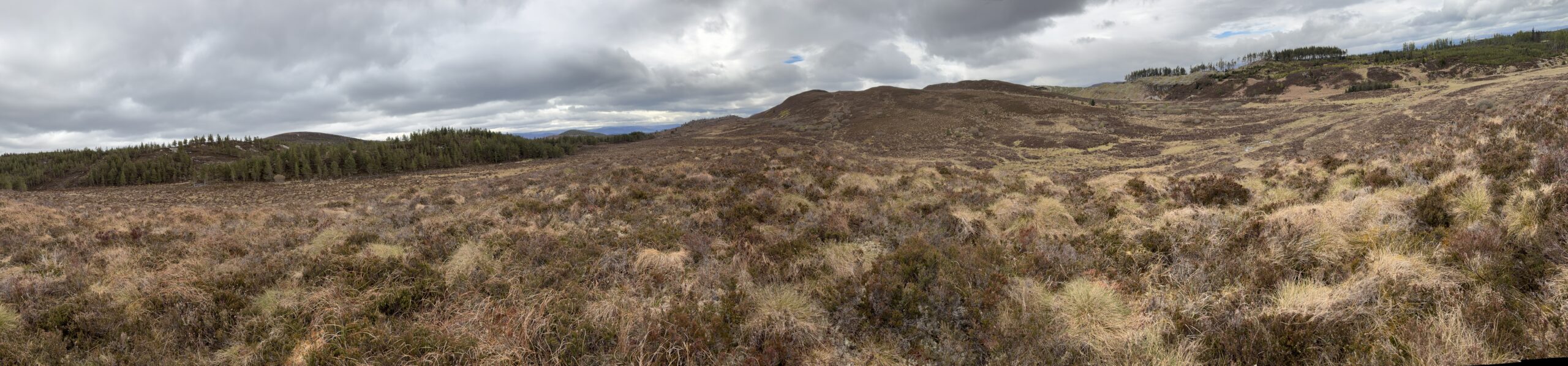
When I got to the top of the final hill and saw the farm buildings next to the Great Glen Way, I turned around and took a panoramic shot of the direction I’d come from.
It looks bigger and wilder than it was. Nevertheless, pathless walking is always a bracing exercise. Like al fresco dining, which turned out to be the theme of the afternoon.
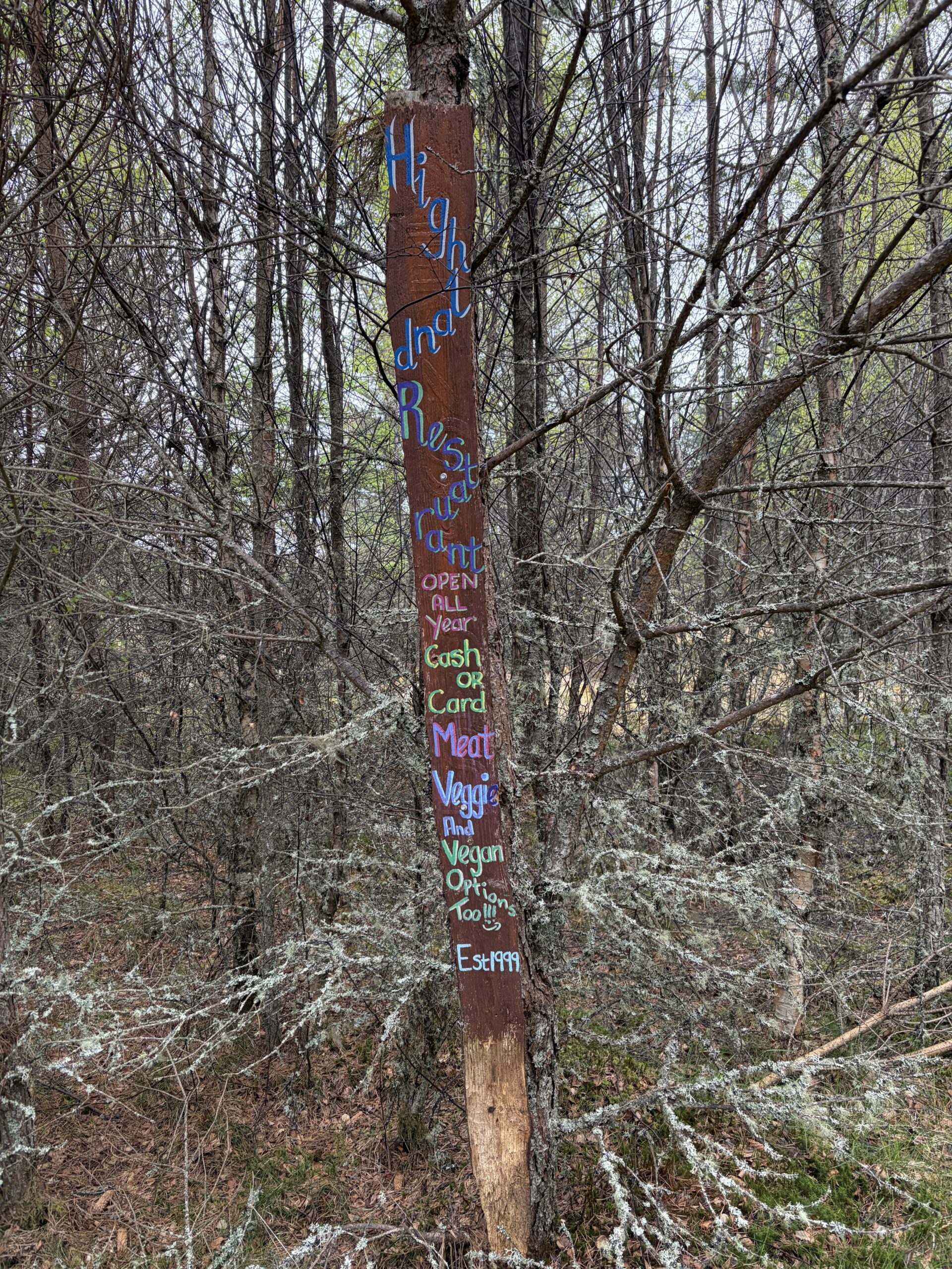
The Great Glen Way went through a pretty forest of mixed hardwoods and conifers. Out of nowhere appeared this vertical, hand-painted sign advertising a restaurant. “Open all year . . . Cash or card . . . Vegan options too.”
I must have passed 10 more over the next two miles. They all said the same thing, but none said where the restaurant was.
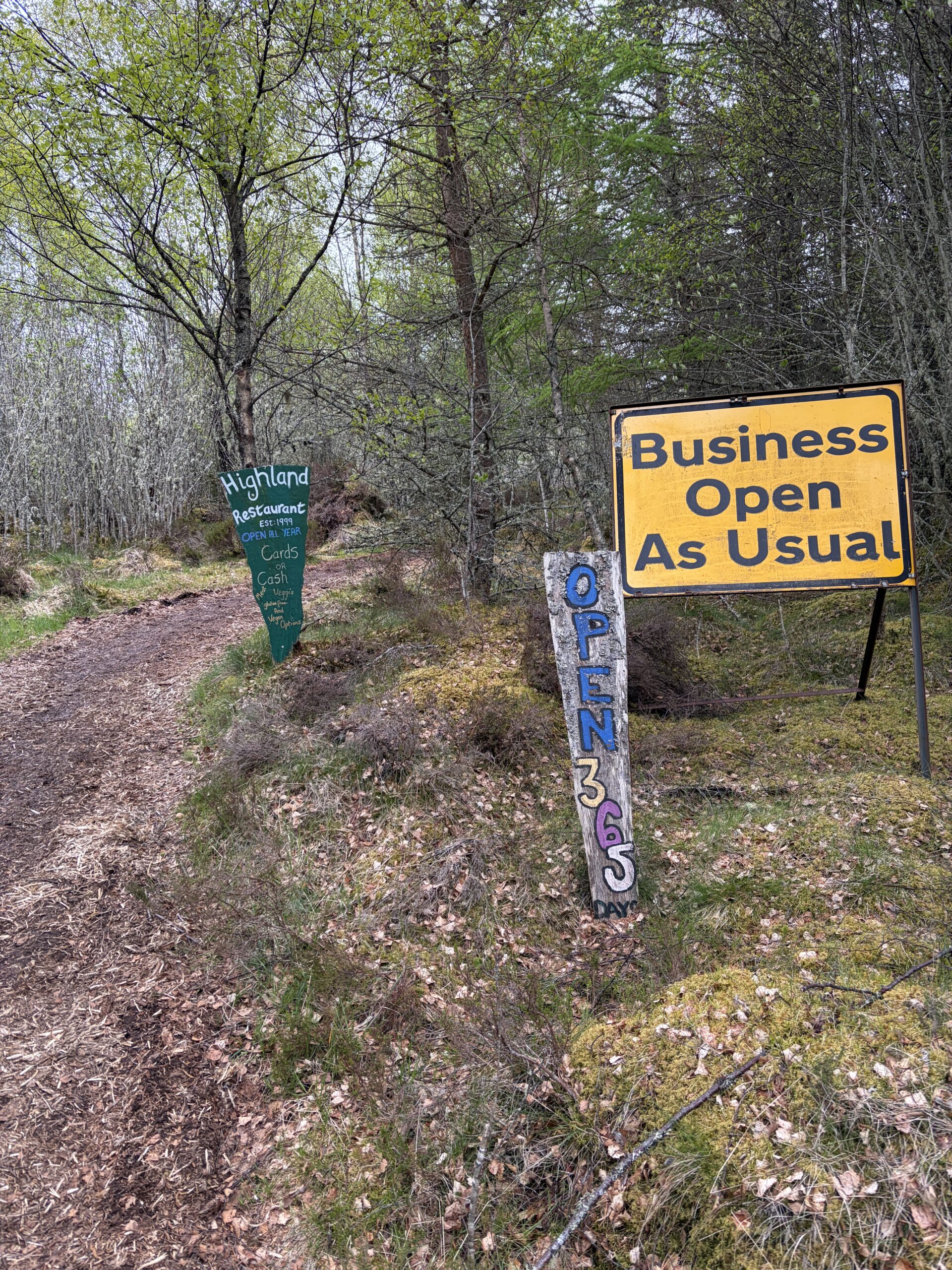
Eventually I came to a turnoff from the Way. There were different signs. The pathway was soon paved in freshly ground wood chips.
I passed a derelict building, a few picnic tables, and stacks of newly cut rounds of tree trunk. I eventually got to a fence with a brass bell hanging from a post, and a sign instructing potential customers to ring an electric doorbell above it.
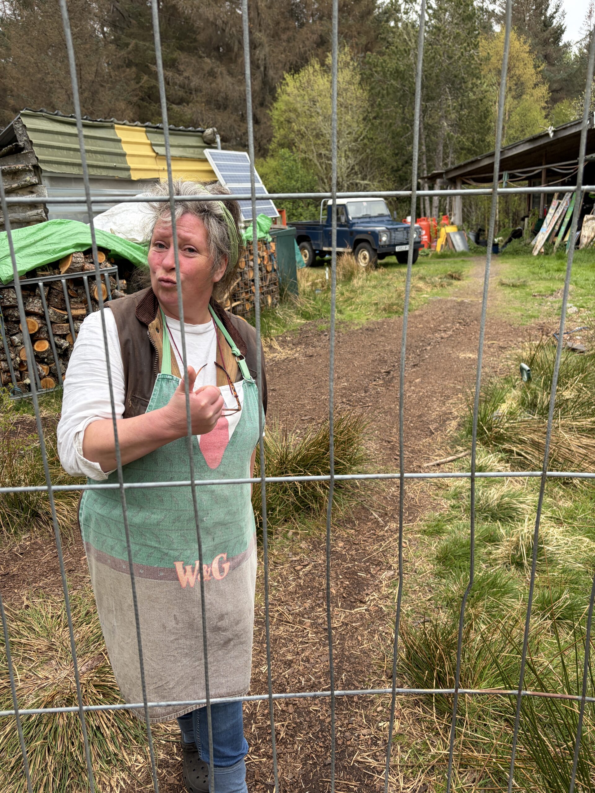
I pushed the button, heard a dog bark, smelled woodsmoke, and waited. A woman in an apron appeared.
What I really needed was to fill two water bottles because my camping destination for the night was not near a water course, which is pretty unusual in Highland Scotland. I was happy to buy a cup of coffee and a scone, however, so as not to just be asking for favors.
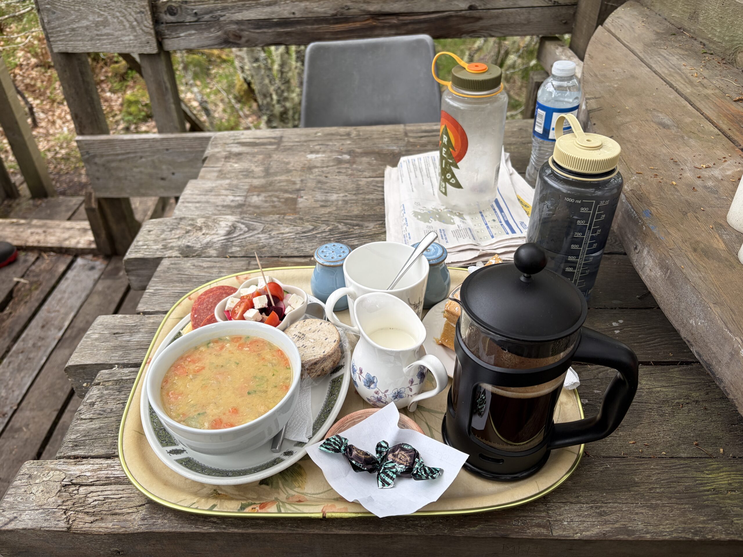
The woman said the restaurant wasn’t a coffee shop, but that it did sell “a light meal” that might appeal to me. This was comprised of a bowl of soup, a small salad of cucumbers and olives, a packet of oatcakes, a piece of lemon cake, and a hot drink of one’s choice.
It was more than I wanted, but I said yes. In the meantime, where could I fill my water bottles? I asked.
“We’re off the grid here,” she said. “I’ll bring you some water with the food.”
She asked me where I was from, we bantered a little, she saying “you must be sweet enough” when I told her I needed only cream, no sugar, with my coffee.
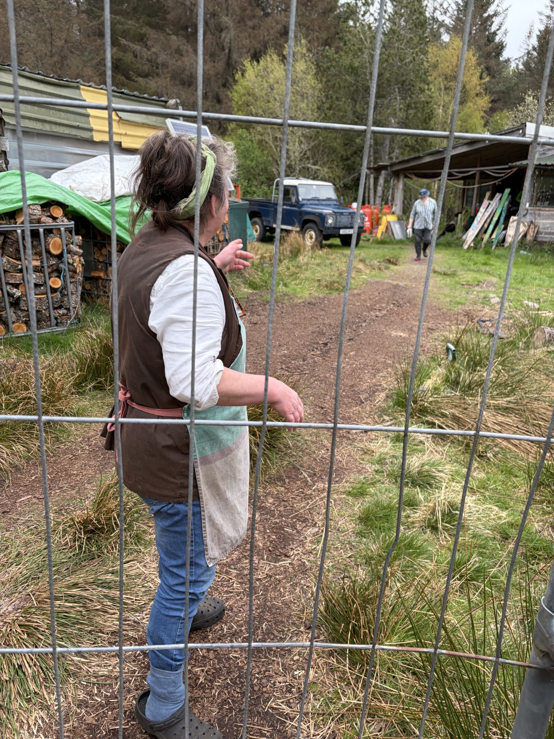
In a few minutes a man with a white beard appeared from out of the house and walked to the fence.
“This gentleman will show you where to sit.”
The man walked through a gate in the fence that wasn’t obvious and walked ahead of me down the path I’d come in.
“This weather is going to turn, so I’ll get you under cover,” he said. A minute later he asked, “Were you ever in the navy?”
“No,” I said. I may have missed something with the accent and lack of hearing aids. Or perhaps not.
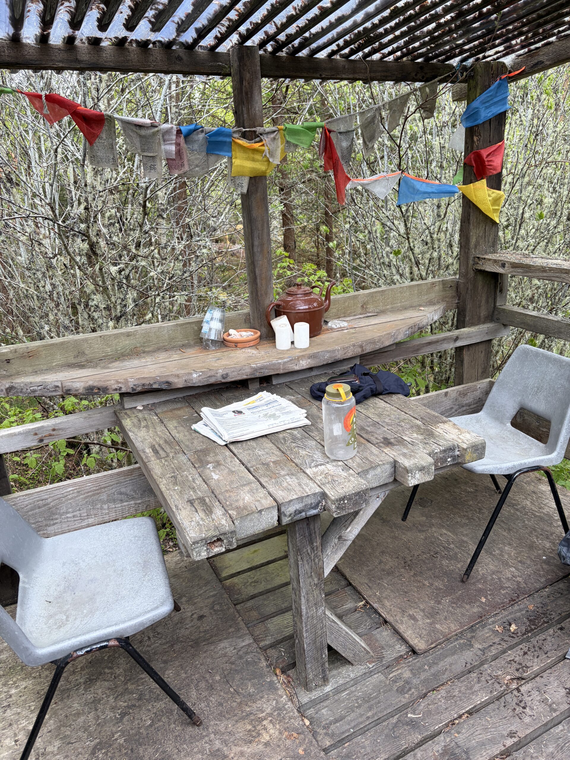
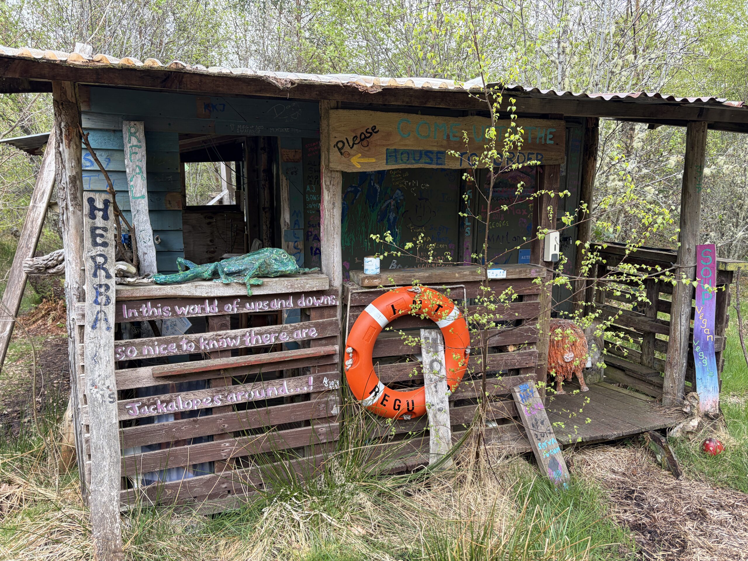
He led me back to the derelict building, which looked a little better up close, and to a back porch under a plastic roof. Tibetan prayer flags, worse for wear, adorned it. He put down several folded tabloid newspapers.
“Here’s something to read if you’d like. I’ll bring you your food when the ladies are finished preparing it.”
I introduced myself and asked his name.
“It’s Howie,” he said. “That’s short for Howard.”
We talked briefly and I managed to learn the woman was his wife, her name was Sandra, and that they were in their seventies. I figured I’d get a second chance when he came back.
To my surprise I didn’t even look at the newspapers. There was no WiFi, but I had a cell phone signal and read e-mail instead. It was getting cold and I was looking forward to the coffee and soup, if nothing else.
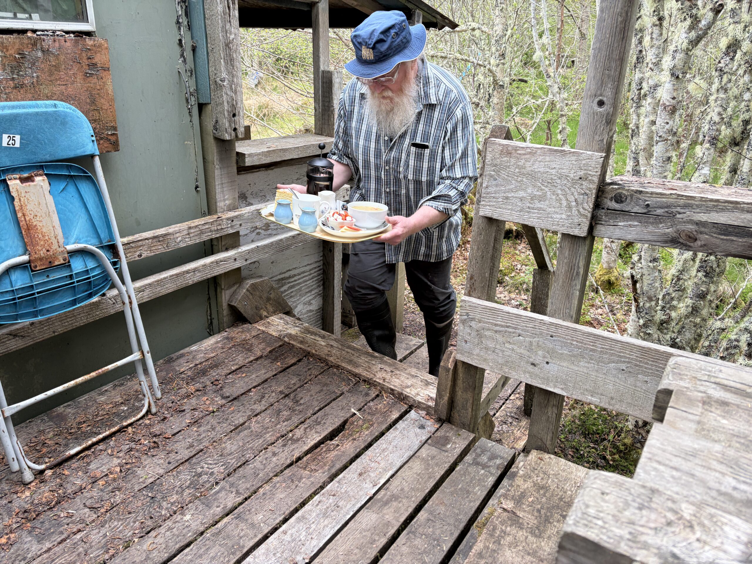
In about 15 minutes later I saw Howie coming down the woodchip path carrying a tray.
It was an amazing spread. No plastic, everything homemade, not too much of anything (except perhaps the piece of lemon cake, which was huge), nothing missing. It reminded me of my own entertainment Standards & Practices.
There was also a half-liter bottle of water. Whatever the couple’s water source was they weren’t sharing it with customers for some reason. There’d be no filling my Nalgenes, but it was better than nothing.
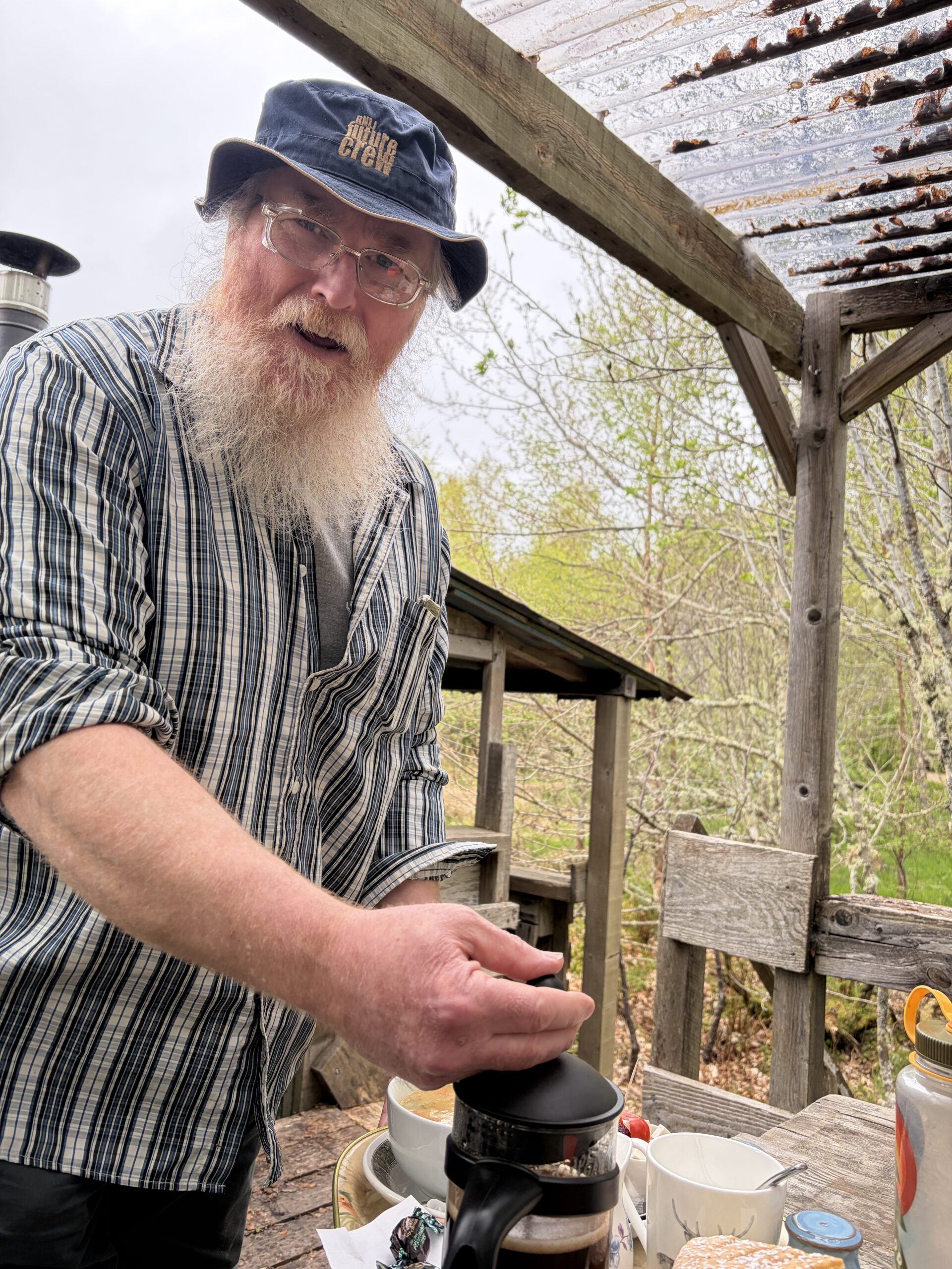
As Howie plunged the French press I started to ask him questions. He graciously answered. I told him enough about myself to keep him from feeling interrogated.
He used to be a coxswain in the Royal National Lifeboat Institution, a sort of coast guard.
“I spent a lot of time going out to sea at times when everyone else was coming in.” After a pause he said, “It was founded in 1824, about the time of the Texas Republic.”
“I’m curious, how do you know what year Texas was founded?” (It was 1836.)
“We send a lot of engineers to Texas to work in the oil fields, and we stay in touch.”
This was not a preposterous assertion. In the 19th and early 20th centuries Scotland produced more engineers, mathematicians, and inventors than it could employ at home. They were lured to Canada, the United States, Australia, and New Zealand to work. It’s not by chance the engineer on the Starship Enterprise was named “Scotty.”
Their al fresco restaurant “is not a hobby,” Howie said. “We have to make a living.” It’s part of a 279-acre farm, where they raise cows, pigs, and chickens. (“No sheep,” he added emphatically.)
“We’re lucky. We own our farm. Most of our neighbors are renters and subsidized by the government,” he said. “Some of the richest people around are Bolsheviks supported by the government We’re capitalists here!”
He asked if he could take a picture of me for the restaurant’s Facebook page, and of course I said yes. I asked how I could pay for the beautiful lunch.
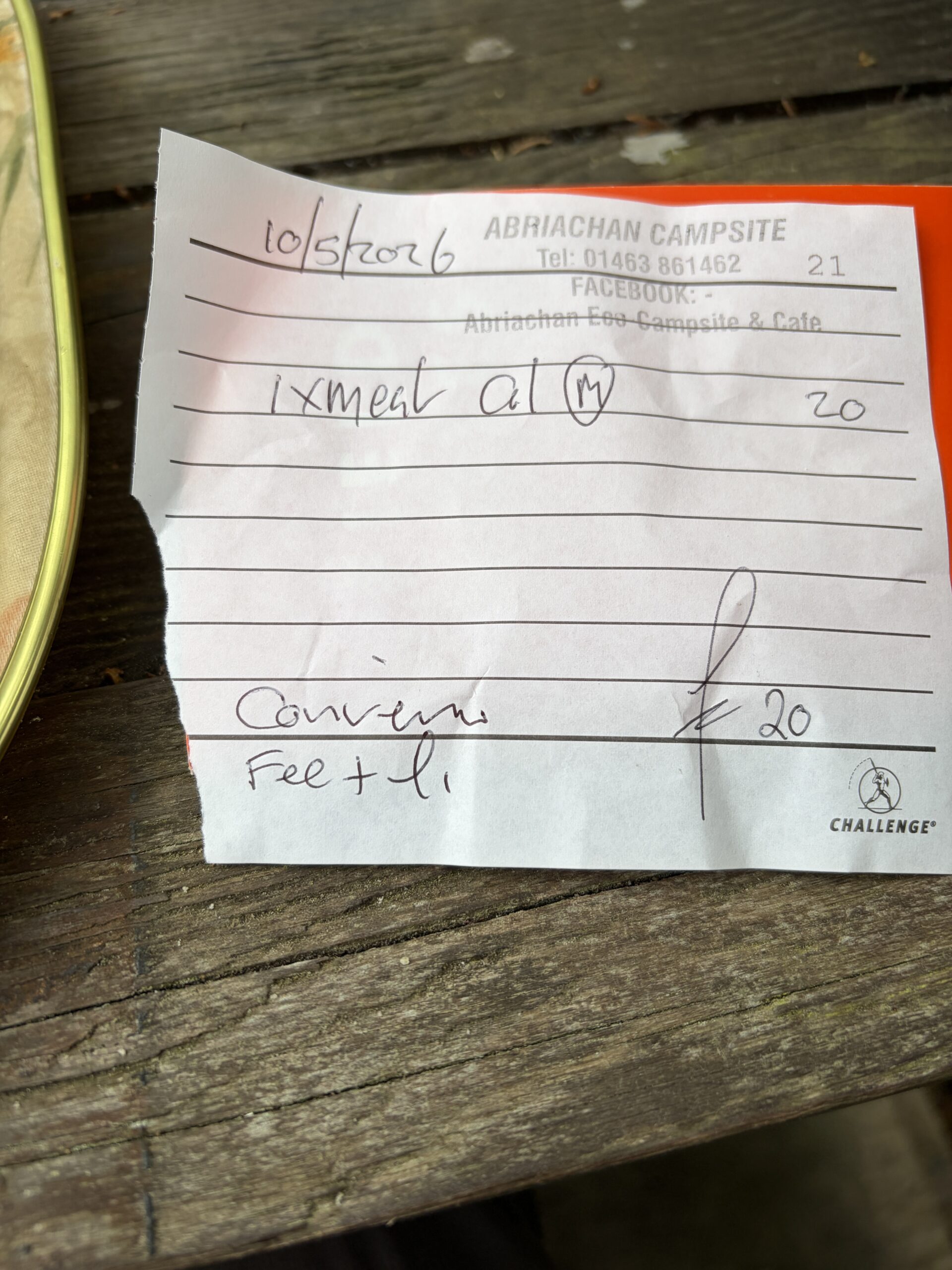
“If you pay in gold, leave it on the table. If you pay by card, come up to the house and the lady will take care of it.” He pointed to the bill face-down on a saucer, and then withdrew.
The tariff was 20 pounds; I left 30.
As I left I took a better look at the building where I’d been sitting. It had slogans painted on it, and an orange life ring, perhaps a relic from Howie’s maritime service.
I hoisted the pack and walked away from this benign Grimms fairy tale, as interpreted by the Whole Earth Catalog.
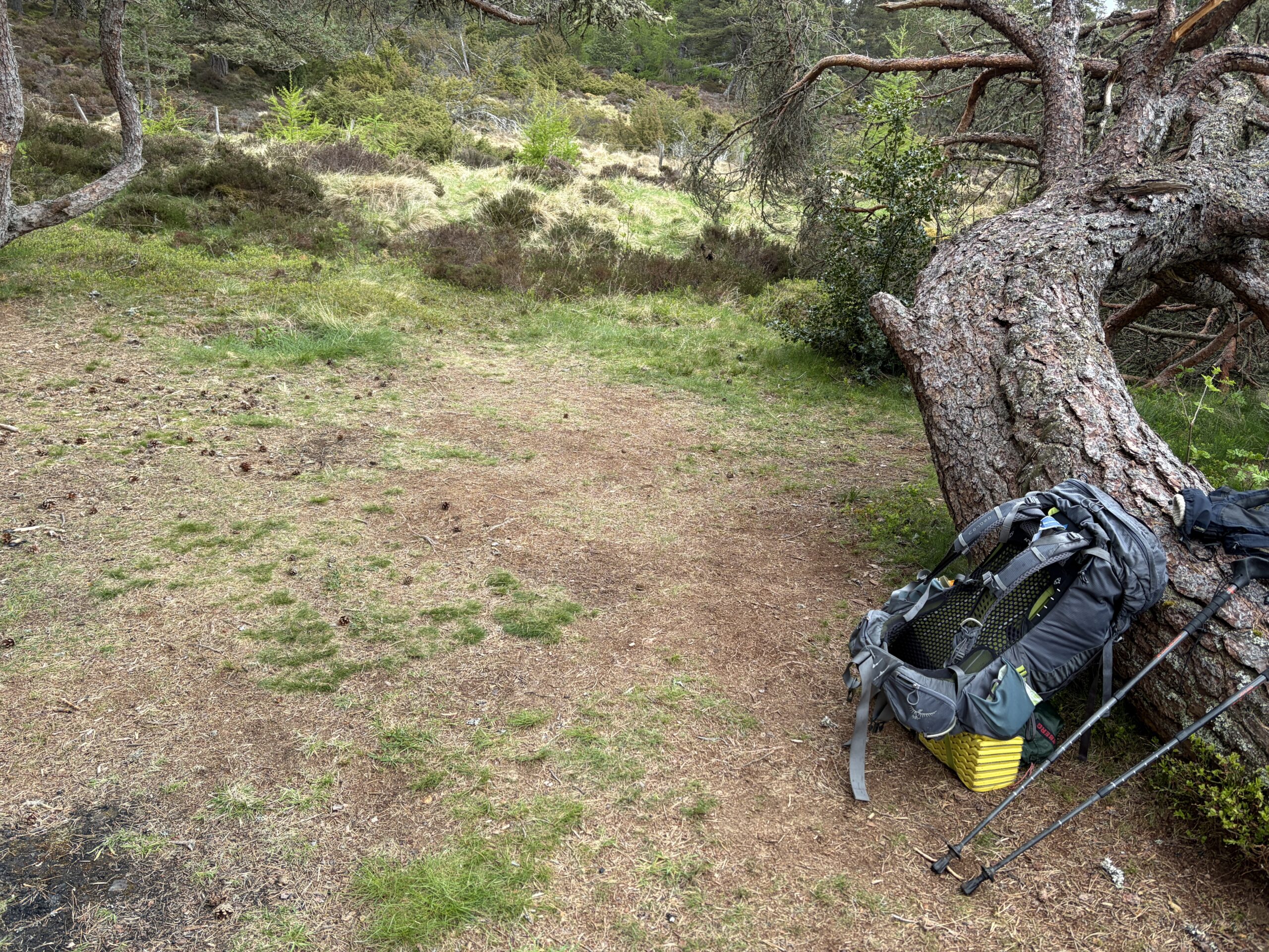
I wandered on a few more hours to my destination, finding no place to pitch a tent until one miraculously appeared.
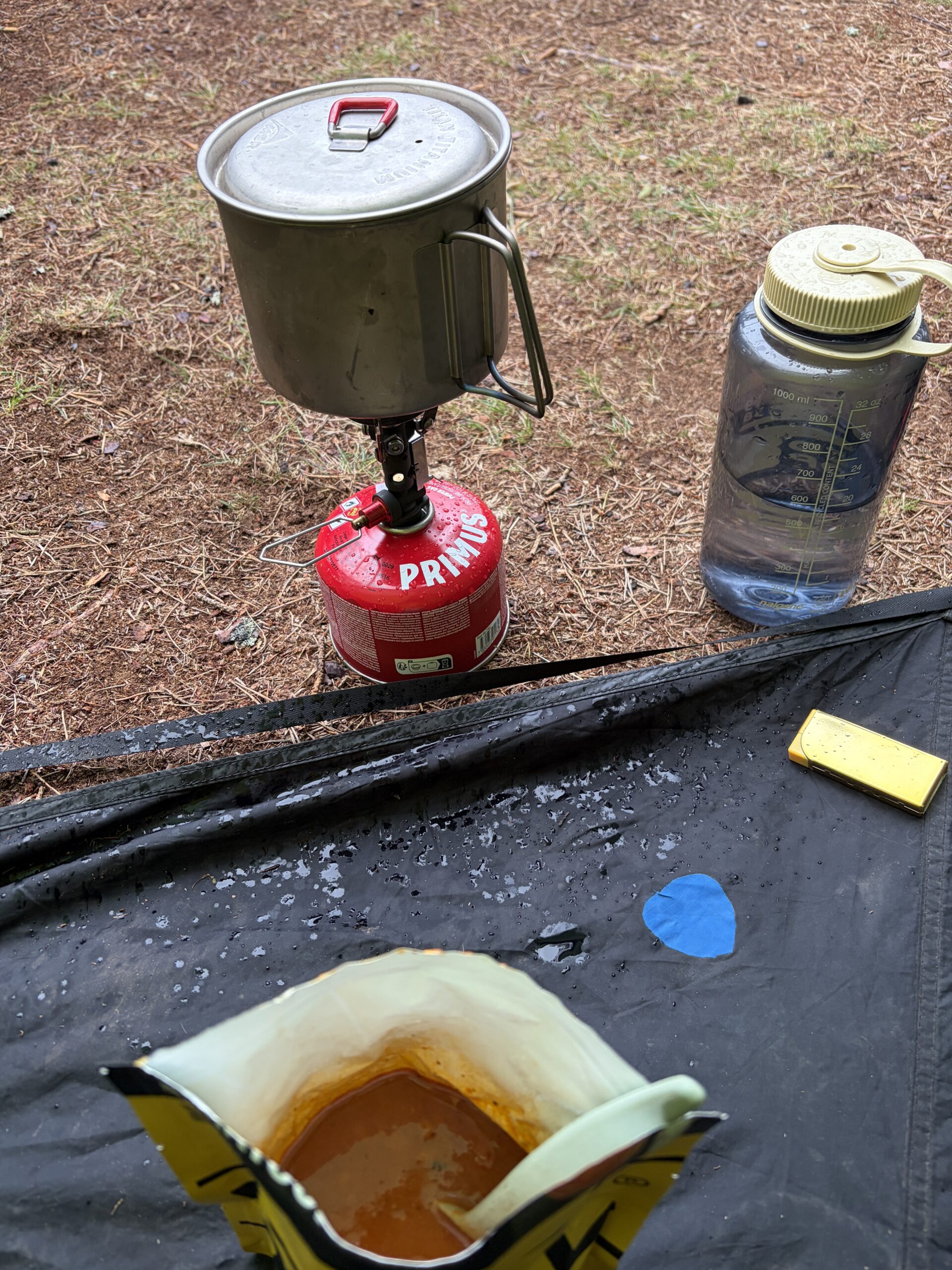
I put up the tent and crawled inside. It started to lightly rain. I wasn’t very hungry so I had only tomato soup, which I ate inside looking out, demi-al fresco.


Recent Comments