One of the many advantages of this trip is that it contains no rapids of any size–a thoughtful accommodation by the Gods of Outdoor Recreation that comes to an abrupt end 2.5 miles below the confluence of the Green and Colorado rivers.
What a traveler then encounters was described by Major Powell when he and one of his men, George Bradley, climbed partway up the canyon wall on July 19, 1869. (Back then the Colorado above the Confluence was called the Grand River.)
“What a world of grandeur is spread before us!” Powell wrote. “Below is the canyon through which the Colorado runs. We can trace its course for miles, and at points catch glimpses of the river. From the northwest comes the Green in a narrow winding gorge. From the northeast comes the Grand, through a canyon that seems bottomless from where we stand.”
The party explored and took geographical measurements for a few days before moving on. They soon learned what they were in for. Powell’s entry for July 23 begins: “On starting, we come at once to difficult rapids and falls, that in many places are more abrupt than in any of the canyons through which we have passed, and we decide to name this Cataract Canyon.”
Today, it’s well marked, and you have to sign in before you enter.
Our last campsite was at Spanish Bottom, on the right bank about three miles below the Confluence. We arrived at mid-morning, and after setting up had the rest of the day to do our own exploring.
We were at one end of The Maze, the remotest part of Canyonlands National Park. It is a place of confusing beauty and danger, a dozen sites of rock art, and almost no water. A permit is required to camp there, and fewer than 2,000 people do each year. Most go for a week
Our destinations were a geological formation called the Doll House and an Indian granary near it, far above the river. The “Doll House” is a curious name, as there’s no house and the stone spires are only vaguely doll-like (kachinas being the closest in appearance). Some indigenous groups called them “the Guards” and some settlers called them “the Soldiers”–both of which are more like it.
To get there we crossed a flat, scrubby area incised with dry creek beds–an ancient sandbar that was now a permanent plateau. The canyon wall and its flying buttresses of broken rock would not be an easy climb.
The ascent took 1 hour and 45 minutes. The day was hot and we stopped a few times; we also found a shady stretch in which to have lunch. In a few places someone had set or carved the stones into steps. I’m always touched by such hard and silent service for people the laborer will never meet.
This is the view down from about half way to the top. Our camp is around the corner where the river disappears in the upper left. The ascent was 1,100 feet in all.
The views from the top were worth every bit of effort. The revelation (although any glance at a map makes it obvious) is that the cliffs we’d been paddling along weren’t hiding plains or other unspectacular features behind their tops. Instead, there were numberless other canyons and cliffs, some more spectacular than the ones we’d seen.
As the Haitian proverb says, “Beyond mountains there are mountains.”
We didn’t have time or energy to explore the dolls of the Doll House, a half-day project at least.
Instead, we walked on to the granary.
On our way we encountered patches of ground that seemed to be covered with dead and mangy plant life. It was “biological soil crust”–a community of lichens, mosses, microfungi, and blue-green algae. Also known as cyanobacteria, the algae is among Earth’s oldest organisms, and was responsible for converting the original carbon-dioxide rich atmosphere into an oxygen-rich one.
This is what a National Park Service publication says about this groundcover.
In biological soil crust, cyanobacteria are dormant when dry. When wet, they move through the soil, leaving behind sticky fibers that form an intricate web. These fibers join soil particles together, creating a thick layer of soil [that acts] like a sponge, absorbing and storing water. Over time, lichen, moss, and other organisms grow onto the soil as well . . . Some crusts can be thousands of years old!
Cyanobacteria move through soil particles, leaving behind sticky fibers (white strings shown above) that clump soil particles together. These fibers stay sticky long after the cyanobacteria have died, creating a thick, continuous crust of soil. USGS Photo
We eventually got to the granary. It’s four mud-walled compartments under a deep overhang. Three are on the left, one on the right.
These structures were well-built and undefiled, and with their mouth-like openings seemed to be speaking to us through time. It’s worth taking a minute to learn about the people who made them.
They were the the Mesa Verde Anasazi, of the Pueblo III period (AD 1150-1300), who arrived here after AD 1170. They were dry-land farmers who raised corn and squash, and occasionally cotton.
(What follows is from a 2021 publication entitled “Archaic Foragers and Ancestral Puebloans of Canyonlands National Park” by Alan R. Shroedl and Nancy J. Coulam.) https://npshistory.com/publications/cany/cap-5.pdf
Because of the marginal farm land in the park, it is hypothesized that at least some of the isolated granaries in the Maze and Island in the Sky districts are associated with fields planted in localities distant from habitation sites.
The additional storage features at these site may not reflect excess surpluses but rather a need to mitigate against potential crop shortages in the future . . . In the mid-AD 1200s, paleoenvironmental conditions for corn agriculture worsened and households increased the number of storage facilities while reducing the amount of living room space . . . Such a storage strategy would ensure having enough seed corn to replant fields after a year of losses and also to maintain an adequate food supply until the next productive farming season.
Canyonlands National Park was depopulated by AD 1300 . . . Archeologists once thought the “Great Drought” of AD 1275–1300 caused the Mesa Verde people to abandon the region, but this drought was not as severe as that of the mid-1100s . . . It now appears that these paleoclimatic factors combined with widespread violence may have been what led people to emigrate from the park and the region.
The place was without a visible gouge of graffiti, not even from centuries ago. I chose to view this as not just good behavior, but also homage to all that it took for people to live in this environment 900 years ago.
We descended as the air was finally starting to cool. It took 1 hour and 22 minutes, faster than the walk up, but still hard on tired legs. It was a good way to end the trip.
In the morning the outfitter picked us up, and lots of other people, in a jetboat and took us up the Colorado River–Powell’s “Grand”–to a paved put-in where a van waited.
One of the reasons I wanted to go on this trip was to have the chance to sleep outside under the stars.
The most memorable night skies of my life were those I saw on trips through canyons in Utah in the summers of 1981,1982, and 1983. A friend from college, Eric Johnston, was a post-doc in chemistry at the University of Utah those years. I had the good fortune to accompany him, his wife Ann Lindberg, and various friends down various rivers in rafts and kayaks.
On July 20, 1981, we were in Desolation Canyon, on the Green River many miles above where Larry and I started. I finished the journal entry for that day this way: “The night is beautiful: warm winds, no bugs, the sound of the river, thousands of stars. We are camping in a place you could not add to if you thought a long time.”
Perhaps that was the reverie of youth talking, or maybe it was the wildfire smoke blown in on two of the days of this trip that made its night skies less memorable. Whatever the reason, I wasn’t awestruck by the number of stars this time. Instead, I had a rendezvous with the few constellations most of us know–the Big Dipper, Orion, the Pleiades.
On the next-to-last night out we camped on a new-formed sandbar whose surface was three feet above the river. All through the night we could hear pieces of it collapsing into the water, like icebergs calving off a glacier.
As I lay on my back, warm in a sleeping bag, I could crane my neck and see just behind me a trapezoidal notch in the sky formed by two cliffs. As my eyes adjusted I saw Orion couchant in the notch, not yet roused from his day-long sleep.
As the night progressed and I fell in and out of sleep, I saw Orion rise from the horizontal, disappear behind one of the rock formations, reappear in the diagonal, and finally present himself upright above my feet. I looked at him as I contemplated my place in the universe, grateful he’d made himself available.
In one interlude of wakefulness I also saw three shooting stars, which have always been for me symbols of human evanescence. Whenever I see one I think of a moment in a book I read long ago called “The Gypsies.” It was written by Jan Yoors, a Belgian (and later an American) who at age 12 in 1934 ran away from home and joined a kumpania of Roma (Gypsies). He lived with them for five years.
We lay on our backs and looked up into the starry sky. I noticed a shooting star and, eager to share this with Nanosh, pointed out to him where it had passed, far away. In a hushed, husky voice he told me to never do this again; for each star in the sky is a man on earth. When a star runs away it means that a thief takes flight, and if you point a finger at a shooting star the man it represents is likely to be captured.
The night sky is not motionless, but it does seem changeless. That’s what Robert Frost is saying at the end of his poem, “On Looking Up By Chance at the Constellations.”
Still it wouldn’t reward the watcher to stay awake
In hopes of seeing the calm of heaven break
On his particular time and personal sight.
That calm seems certainly safe to last tonight.
It did last, every night. I hope to be back to watch it last some more sometime.
An unusual feature of Labyrinth Canyon is a stretch of the Green River called “Bowknot Bend.” It’s a six-mile loop that long ago would have become a dry oxbow if the river didn’t have to cut through thousand-foot cliffs in order to take a more direct route.
Larry and I got there on our third day out. We left hiking shoes out and ready, as well as trekking poles, and other things we might want on a walk. We planned to hike up the right-hand wall of the canyon to the saddle, where you can see the two sides of the loop.
In his account, John Wesley Powell describes the feature this way:
About six miles below noon camp we go around a great bend to the right, five miles in length, and come back to a point within a quarter of a mile of where we started. Then we sweep around another great bend to the left, making a circuit of nine miles, and come back to a point within 600 yards of the beginning of the bend. In the two circuits we describe almost the figure 8. The men call it a “bowknot” of river; so we name it Bowknot Bend. The line of the figure is 14 miles in length.
The description and distances (plus or minus a mile) fit the feature we paddled around as well as the now-dry oxbow just downriver where we camped later that day. Powell’s statement that his party went around two large loops of river leads me to the conclusion that the second loop was cut off sometime after his 1869 trip, as the river no longer goes there.
In the map below, the squiggly line I’ve drawn shows where the second loop of river might have run. In any case, “Bowknot Bend” on contemporary maps denotes the bigger oxbow we paddled around, although technically it forms only half a bow.
Four other boats had pulled ashore on the right bank at the place where a trail led up a boulder-filled slope to the saddle. At least two of the boats carried people who’d been on our shuttle trip to the put-in–fit retirees, more than half of them women.
We walked up the trail, which was marked by occasional cairns. In a few places rocks had been arranged to create steps. In a few places we had to climb on all fours. There were two or three dangerous spots, but the people ahead seemed to have had no trouble, so we soldiered on.
When we got to the top the view was spectacular (and it had been pretty good on the way there).
“It’s the only place in America where you can stand and see a river flowing in two directions,” Larry said.
“Is that true?” The assertion seemed unlikely, although it occurred to me he might have read it in a book.
“Well, I don’t know,” he said sheepishly. “There are probably other places you can do it.”
We looked down on the outbound arm of the bow, where we’d be in a few hours. Three canoes passed by. They were tiny. No one looked up. On the far side of the river from them was a river bottom impenetrable with tamarisk.
On a red sandstone wall exactly where someone would stand to take pictures was a name and “9/24” scratched into the rock. We wondered what century it was from until we saw next to it an inscrutable drawing and the number “2024.” So it was from September 2024–the month before we were there. Amazing and appalling.
As we started to descend we ran into three people. One was a big man with wild Einsteinian white hair. He asked Larry as we passed, “Are you a computer programmer?”
“No,” Larry said.
“I thought you might be. We have the same shoes. I’m a programmer. Everyone in my office wears them.”
“No, not a programmer,” Larry said. “Keep guessing.” I was tempted to give him Larry’s impressive 25-word biography, but held my tongue.
Back in the canoe, we paddled around the Bend, looking for the remains of uranium mines and even an old airstrip that the guidebook said were on the right bank. We could see none of them. What we did see is what Powell saw and described.
There is an exquisite charm in our ride to-day down this beautiful canyon. It gradually grows deeper with every mile of travel; the walls are symmetrically curved and grandly arched, of a beautiful color, and reflected in the quiet waters . . .
Powell’s account says the party camped “on the south side of the great Bowknot” that night–somewhere below where we would soon pitch our tents. “As we eat supper, which is spread on the beach, we name this Labyrinth Canyon.”
Like Greek gods, Powell and his men that day gave two places the names they still bear on maps.
* * *
If you travel in silence down a Utah canyon, whether on water or foot, an ironic fact eventually reaches consciousness. While everything in sight is the product of breaking and falling, you never hear anything break or see anything fall. Silence and stillness are the canyons’ natural state.
How can that be?
The answer, of course, is geologic time. Change in this part of the world happens so slowly it’s imperceptible to the human observer. Major Powell, the geologist, never loses the sense of wonder that it’s so. Of the buttes and spires he passed he wrote: “The rain drops of unreckoned ages have cut them all from solid rock.”
But as soon as you’re convinced that nothing happens quickly you run into evidence that sometimes it does. That was the case at the place where we camped after paddling around Bowknot Bend.
We came ashore at the downriver end of a dry oxbow that, as I argued above, I think was cut off from the river sometime after the Powell expedition of 1869. We unloaded on an immense sandbar, the biggest we’d seen.
The upstream entrance to the ancient oxbow was so obscure that we hadn’t seen it, but there was no missing the downstream end. It drained a place called Horseshoe Canyon, which has a watercourse called Barrier Creek running down it. None of this registered with us; we were just glad to find dry sand.
After we’d set up the tents, chairs, and the table Larry carried a chair across the alluvial plain into the shade to read. I headed up the dry oxbow to explore. The stream bed was damp, but there was no standing water.
The sun was dropping behind a rock formation between the oxbow’s two limbs. The formation was flat-topped and had a pointed-oval shape. It was called “The Frog” according to the guidebook, which said the reference was not to an amphibian but to the soft underpart of a horse’s hoof, which is called the “frog.” The name made sense, given that we were in Horseshoe Canyon.
As I walked away from the river the creek narrowed. Newly cut walls of sandy bank were 12 feet high in places, with roots sticking out of them all the way down.
In several places, trees had eroded from the bank and fallen into the channel of the creek.
Clearly, there’d recently been a monstrous flow through these parts. I imagined what it must have looked and sounded like as rushing water and tumbling rock redesigned the stream’s course. Our campsite–if it even existed before that storm–would have been washed away, along with anybody on it.
Canyons are quiet and peaceful except when they’re tumultuous and violent. I was disturbed by my lack of situational awareness when we chose this wonderfully bare sandbar as our stopping place. Spooked, I walked back to the river on the bank, not in the stream bed, climbing through tangles of matted vegetation.
The darkening sky was still cloudless and there was no rain in the forecast. I didn’t suggest to Larry that we move the tents to the inland edge of the sandbar, from which we could scramble to higher ground if we heard a riverine freight train in the middle of the night.
Sitting around the fire, I hoped for fair weather for us tomorrow, and fair weather for everyplace up Horseshoe Canyon that night.
* * *
The canyons may appear empty, but traces of man are all around if you know how to look, and where. By and large we lacked that talent and knowledge.
We stopped at a couple of spots to look for an abandoned ranch building, a cliff dwelling, an Anasazi granary mentioned on the map. We encountered a lone woman on an oar raft and asked the way to Indian ruins in Jasper Canyon. “You’re past it. It’s back there,” she said, pointing upriver.
If we’d looked harder and gone farther from the river we might have found some of these sites. The most unusual one, however, I didn’t learn about until after the trip.
The Great Gallery of rock art was about 13.5 miles up from the mouth of Horseshoe Canyon, where we camped. That’s a long hike, and not doable roundtrip in one day. Going there would have required a radical restructuring of the trip.
The Great Gallery is 200 feet long and 15 feet high, and has more than 20 anthropomorphic figures painted on a rock face. (That makes it a “pictograph”; a “petroglyph” is incised into rock). It’s been dated to A.D. 400-1100. An antelope-skin bag containing tools for making arrowheads (chert blanks, antler flaking tool, sanding stone), as well as an emergency ration of marsh-elder seeds, eroded out of the sand in 2005. It was dated to A.D. 770-970.
By Surfsupusa at English Wikipedia
It would have been nice to see some Indian rock art. However, we did see one of Labyrinty Canyon’s better-known pieces of graffiti–the pictographic work of Denis Julien, a French Canadian fur trader from 1836.
Eight tags by Julien are known, although the authenticity of two is suspect. Many aren’t easy to find and one wasn’t noticed until 1931, almost a century after it was made. We’d missed one of Julien’s offerings the previous day, and were determined to find the next one. It turned out that wasn’t hard.
We knew we were close when we saw a canoe pulled up on a mudflat near piles of flow-deposited debris. As we landed two people appeared who’d just come down from the inscription. They gave us directions, which were not terribly clear but that we figured would get us close. The most useful tip was to look for a “plaque,” which turned out to be a sign on a post telling visitors the graffiti was on the National Registry of Historic Places and that adding to it was a federal crime.
We found it above a dry creek and climbed up to get a good look.
The main features are “D. Julien 1836 3 mai”–the capital “J” in an old orthography that makes it look like an “I.” Next to it are drawings of a boat with a mast (and possibly a diaphanous sail), and a sun-like image that might also be the body of a winged creature. There’s evidence of a few other bits of graffiti that someone had taken off with fair success.
This inscription was apparently first seen by a steamboat operator in 1893, with a photograph of it published in Outing Magazine in 1905. There’s another that reads “1836 D. Julien” in lower Cataract Canyon, which is now covered by the waters of Lake Powell.
What’s most surprising about the inscription we saw was that it was made before the one we’d missed the day before, which is dated “16 mai 1836.” That means Julien was traveling upstream on the Green River. The canyon both creates and channels wind; the idea there was enough to sail by is remarkable.
A surprising amount is known about Julien. He was born about 1772. His wife was an Indian who went by the name Catherine. The records of a cathedral in Missouri note the baptism of children in 1793, 1798, and 1801. In 1808, Meriwether Lewis, governor of the Louisiana Territory, described him as “an old and much respicted trader among the Iaways.”
In the Utah Historical Quarterly in 1996, historian James H. Knipmeyer wrote: “His name appears in the ledgers of St. Louis fur baron Pierre Chouteau in 1803 and 1805, the latter instance to trade with the Indians in present-day Iowa. From 1805 until 1819 he owned property south of Fort Madison. Mention of his trade with the ‘Ioways’ was also made in records for 1807, 1808, and 1810. His name is listed as a witness to the Iowa Treaty of 1815.”
He owned property in Prairie du Chien on the Mississippi River (in present-day Wisconsin) in 1821. In 1827 he was in a party that recovered cached furs on the land of the Ute Indians in western Colorado or eastern Utah. Where and when he died is lost to history.
What’s certain is that Denis Julien got around and left his marks. Today, they unwittingly raise the question: “When does an act of desecration become an artifact?” One answer is: “When it’s 188 years old.”
Elsewhere on the trip we passed tags from the 1940s that the map and guidebook found worthy of interpretation, but that I’d file under vandalism.
One of the things John Wesley Powell did nearly every day was climb partway up the walls of the canyon, and occasionally to the rim. There were several reasons.
He was the one who scouted the rapids and decided whether they’d be run, lined down with ropes, or avoided altogether by carrying both boats and gear around them. If the decision was to go in boats, he usually decided the route.
He also climbed the canyon walls to take barometric readings. From them, following a formula, he could estimate his altitude above sea level (or a known downriver site whose usual barometric pressure was known). Serial measurements could then tell him how far the expedition had descended–and how much deeper the canyon would go. He could also estimate the depth of a canyon by comparing the reading at the rim to one taken at the river.
Powell also climbed to collect rock specimens from different strata, look for fossils, and identify plants. Occasionally, he climbed just to look around and satisfy his curiosity.
Powell sometimes made these forays alone (and, of course, always with one arm). They were often dangerous. Edward Dolnick, in “Down the Great Unknown: John Wesley Powell’s 1869 Journey of Discovery and Tragedy Through the Grand Canyon,” recounts several.
Once while climbing with a crew member named George Bradley, Powell found himself standing on tip-toe on an outcrop and holding onto another outcrop overhead with his one hand. He was unable to proceed. Bradley, above him, took off his pants and lowered them. Powell let go of the rock, made a one-chance grab of the pants, and was pulled up to safety. Another time, Powell and a different companion climbed 4,000 feet to the rim of a canyon. Darkness caught them on the descent. They followed the light of the crew’s riverside campfire as they felt their way down.
I mention this as prelude to a brief account of one of the two climbs-to-the-rim that Larry and I did on the trip. The first could have ended badly. It did not, as I’m here to describe it.
On the fifth day out we came ashore on a sandbar on the left bank. The map and river guide suggested we might be near ruins of structures built by the Anasazi (now preferably called “Ancestral Puebloan”) people in pre-Columbian times.
We weren’t sure, but it was lunchtime so we got out and walked up a sloping white formation of sandstone, found a shady spot under a ledge, and ate. After a brief rest we decided we wanted to get to the top of the canyon wall. It was far from vertical, and as we stared at it we saw what looked like three routes up.
We picked one and set out.
The canyon wall wasn’t steep. In fact, it wasn’t a wall in the normal sense, but a moderate slope of stable rock. It was easy to stop and inspect interesting things underfoot, like iron-bearing nodules that were inclusions in the rock.
After climbing a while we moved off the pancaked layers and onto a streambed of pink, fine-grained rock. It looked to be from a different stratum or formation, but as it didn’t change with altitude that couldn’t be the reason. I concluded the coloring must have been from runoff after rainstorms, and in fact there was evidence it had recently carried water. Flat stretches were paved in damp sand; there were pink kettleholes full of dirty water.
We climbed up the streambed for a while and then exited to the right–the downriver direction–and got back on the stratified rock. Soon, we got to the top of the canyon. I was surprised to see that it was the top and not just a ledge with a second, higher slope above it. Major Powell rarely had it this easy, I thought.
We walked around. There were great views of the river, and distant buttes and pinnacles.
Edward Abbey climbed to the rim near here when he rafted the Green in November 1980. In his essay “Down the River with Henry Thoreau” he wrote:
We can see the great Buttes of the Cross, Candlestick Tower, Junction Butte . . . Ekker Butte, Grandview Point, North Point, and parts of the White Rim. Nobody lives at those places, or in the leagues of monolithic stone between them. We find pleasure in that knowledge.
We felt a similar pleasure. However, that didn’t eclipse the realization it was 1 o’clock in the afternoon–the hour of peak sun–and hot. It was time to get back on the river.
We wandered in the direction we’d come from and looked for the pink streambed. Neither of us had taken a bearing, either topographic or mental, of where we’d left it. But that hardly seemed to matter; once we found it all we’d have to do is walk down it to the river.
We found it and headed down. The problem was that the descent was nothing like the ascent. There were several bowl-shaped sections too big for a single step, and then to our surprise, a 40-foot drop, at the bottom of which was plunge-pool of algae-stained water.
We hadn’t seen any of this on the way up. This perplexed us. Could there be two pink streambeds? That seemed impossible, as we would have crossed the second one on our way to the top.
It was clear we couldn’t go down this streambed, so we crossed it and walked along the slanting rock face. We looked for a way to get back on the streambed below the 40-foot dry waterfall, but there was no way that wasn’t impossibly steep.
We went back to the canyon rim, looked around, and then started walking in the upriver direction. Perhaps there was a place where the river-facing wall sloped gently enough for us to walk down. Every time we thought we’d found one, however, it was interrupted by a ledge or cliff or something we couldn’t climb down.
We kept walking. We thought about going on until we reached a side canyon upriver we’d paddled past. However, it was at least a mile away, and there was no guarantee there’d be a safe way down to the river once we got to it. We decided it wasn’t worth the gamble.
If we’d walked in the downstream direction, this is what the intersection of the next side canyon and the river looked like. There was not remotely a way down.
At this point we were getting a bit anxious and decided to go back across the streambed and up to the top where we’d first taken in the sights. At least there we’d know where we were and could start our search anew.
Unfortunately, when we got there we had no flash of insight. We still couldn’t find a way into the lower part of the pink streambed without going down dangerously steep rock. In truth, we really didn’t know where we were.
Here it’s worth noting how unprepared, and lacking in situational awareness, we were on this outing.
Larry had an app on his phone that laid down a track as we moved–we were using it on the river–but he didn’t have it with him. I had a bottle of water and a knife. Larry had some water and a little food. We had no headlamps, trekking poles, extra clothes, or shelter.
We’d been wandering and climbing for more than an hour in the bright sun. Sooner or later we’d get tired and dehydrated–and eventually cold. We gave up on the streambed and began a concerted search for another way down the canyon wall. (We never did figure out whether we entered and exited the pink streambed below or above the impassable section.)
We examined what looked like routes back to the river only to find they were too steep, or ended at cliffs. We did file away a couple of marginal ones we could hazard if things got desperate.
What had happened to the three routes up we’d seen from the lunch spot? We were addled enough that we couldn’t remember where they were. But the bigger problem was that everything looks different looking down from how it looks looking up.
I won’t drag things out. Larry eventually found a route that appeared doable. A long fissure went down the rock’s steepest section. It was a place to find handholds, and also to catch an ankle. But the fissure’s presence was somehow reassuring.
Larry went first. We descended on hands, feet, and buttocks, our backs to the rock for maximum friction. Once Larry got to the bottom I rolled my water bottle down to him. We each stayed in control, and at the bottom there was a long plateau with an easier descent to the river. This is the view of the steepest part.
Over the course of the afternoon we made jokes about the bodies of two old men found dessicated above the left bank of the Green River. Or maybe never found. The New York Times Magazine had a story in 2018 about a 66-year-old man, a runner and hiker, who went on an outing in Joshua Tree National Park in 2010. He never came back. Dozens of people looked for traces of him for years.
“It looks kind of benign to a person who drives through it,” a 19-year-veteran of Joshua Tree Search and Rescue is quoted in the article as saying. “But there are so many areas where you can get lost and not even realize it until you’re lost. You can’t look back and figure out, ‘Where did I come from?’ ”
We weren’t nearly that confused. But we were a little confused, and inadequately prepared and self-aware–and lucky.
As we headed down river in the boat, I looked to the left and saw where we’d descended. It’s the diagonal line in the middle of the picture, the high end on the right and the lower end on the left.
It doesn’t look like much. The Major would have shaken his head.
Everyone who goes down the Utah canyons in a boat travels in the wake and shadow of John Wesley Powell.
Powell’s party–10 men at the start, six at the end–was the first to travel the entire distance of the Green and Colorado rivers’ canyon sections. It took them 99 days–May 24 to August 30, 1869–to go about a thousand miles. Their successful passage through the 277 miles of the Grand Canyon was especially remarkable. Most of the canyon was unexplored and unmapped; nobody knew whether it contained waterfalls or other unrunnable features.
There have been many accounts of the expedition, the most recent and definitive one, by the science writer Edward Dolnick, called “Down the Great Unknown: John Wesley Powell’s 1869 Journey of Discovery and Tragedy Through the Grand Canyon” (2001). Powell published an account and about half the crew members recorded their own.
There’s a John Wesley Powell River History Museum in Green River, Utah. Our mile-by-mile river guide labeled sites on the Powell expedition and was peppered with quotes from Powell’s account. The impounded section of the Colorado River that drowned Glen Canyon is called Lake Powell. A century after the 1869 expedition, Powell appeared on a postage stamp steering a boat (which he never did).
In insight if not in name, Powell lives on today in the century-old (and intensifying) struggle over development and water access in the arid West. “Powell became the first great spokesman in American history for the notion of limits,” Dolnick wrote. “The lesson of the West, this astonishingly optimistic man declared, was that not all things are possible.”
So, it’s worth saying a bit about who he and his fellow explorers were, and what they did.
Powell was born in upstate New York in 1834. His father was an emigrant from England and an impecunious itinerant preacher. The family lived in Ohio, Wisconsin, and Illinois during John Wesley’s childhood. As a young man he did a lot of rowing on the great rivers of the Midwest.
Powell was 35 years old at the time of expedition; the crew ranged from 20 to 36. Only Powell was married. Seven of the 10 men were Union veterans of the Civil War, including Powell’s younger brother, Walter, whose experience in combat and seven months in a Confederate prison camp caused permanent psychological damage. Powell himself was shot in the right arm–he was right-handed–at the Battle of Shiloh in western Tennessee on April 6, 1862. Two days later the limb was amputated. He returned to his artillery battery, but had a second operation in 1864 and resigned his commission in 1865.
He was left with a chronically painful stump of his upper arm, and was ever after referred to as “Major Powell.”
The expedition was financed privately, although the federal government provided army rations (mostly flour, bacon, dried apples, and coffee). Three members were paid to draw maps, use scientific instruments, and hunt and cook; the rest were volunteers. Not everyone could swim well and none other than Powell had experience in boats. There was only one life jacket, which was for Powell.
The expedition was unrelenting hardship.
Less than two weeks into the trip one of the four boats was smashed to pieces in a rapid. A ton of cargo, including one-third of the food, several scientific instruments, and four guns were lost. More was lost as time went on, including oars, which the crew replaced by carving new ones from driftwood.
Eventually, they had barely enough to keep proceeding.
In the middle of August–the trip had started on May 24–Powell wrote: “It is especially cold in the rain to-night. The little canvas we have is rotten and useless. The rubber ponchos, with which we started from Green River City, have all been lost; more than half the party is without hats, and not one of us has an entire suit of clothes, and we have not a blanket apiece.” They’d also lost most of the maps and scientific instruments, and were on reduced rations, except for coffee.
By the end, the crew had run 414 rapids and portaged around 62. On many portages they “lined” the boats through unnavigable water from the shore, using ropes. In others, they carried the oak boats and thousands of pounds of supplies along the shore.
Miraculously, nobody died. On a similar expedition mounted in 1889 by a Denver businessman scouting a route for a railroad, three people drowned in the Grand Canyon. The businessman died first, and five days later two crew members. The survivors abandoned the trip and climbed out.
Although no one died on the river, only six members of the Powell expedition made it to the end of the Grand Canyon.
One man had left two months earlier at the last contact with civilization. On August 28, 1869, three men, with Powell’s consent, left the party and walked out of the canyon rather go through what looked to be the most dangerous rapid yet. They were certain they’d die.
Later that day, the six remaining members made it through what they named Separation Rapid. One man had to rescue Powell and two others after their boat capsized. They traveled on, and reached a Mormon hamlet two days later. They were back in the world.
The three men who’d left the expedition were never seen again. It’s believed they were killed by Indians, or perhaps by Mormon settlers suspicious of interlopers.
On September 1, 1869, the Powell brothers headed overland to St. George, Utah, and the four others took two boats varying distances farther down the river. The Colorado River Exploring Expedition ended with both a bang and a whimper.
The surviving members of the expedition never reunited. There is no photograph of them together. Little equipment remained when the trip was over, and most of the rocks, fossils and Indian artifacts Powell collected were lost in capsizes. None of the boats survived, and although their design is known–they were based on Whitehall rowboats–no photographs of them exist, either.
The expedition, however, lived on in the accounts and memories of its leader and crew. In addition to Powell, two men kept journals of the trip while it was underway, and two others wrote accounts early in the 20th Century when they were old men. It’s a good guess it changed all their lives.
Powell paid them a touching and rhapsodic tribute in the preface of his 1895 account.
Many years have passed since the exploration, and those who were boys with me in the enterprise are–ah, most of them are dead, and the living are gray with age. Their bronzed, hardy, brave faces come before me as they appeared in the vigor of life; their lithe but powerful forms seem to move around me; and the memory of the men and their heroic deeds, the men and their generous acts, overwhelms me with a joy that seems almost a grief, for it starts a fountain of tears. I was a maimed man; my right arm was gone; and these brave men, these good men, never forgot it. In every danger my safety was their first care, and in every waking hour some kind service was rendered me, and they transfigured my misfortune into a boon.
To you [and here he named them all] my noble and generous companions, dead and alive, I dedicate this book.
Portrait of Powell (1889) by Edmund Clarence Messer in the National Portrait Gallery
Powell died on September 23, 1902, at the age of 68, at the Haven Colony in Brooklin, Maine–a summer retreat for wealthy Washingtonians, of which he’d been one for years. The house still stands.
Edward Dolnick ends “Down the Great Unknown” with a quote from a speech the secretary of the interior gave many years later at a ceremony honoring Powell. It says it all, and is worth repeating.
“Major Powell, throughout his life, was the incarnation of the inquisitive and courageous spirit of the American. He wanted to know and he was willing to risk his life that he might know.”
Among the many holes in my education is any formal instruction in geology.
You’d think that geology would be an unavoidable subject like algebra, biology, and American history, force-fed to even the reluctant student. After all, every one of us lives in a physical environment (no matter how altered by man) of dirt, rock, water, and altitude, and for some also hills, mountains, valleys, rivers, swamps, bays, and oceans. Why isn’t knowing their stories mandatory?
The answer, probably, is that we can deduce without help what seems like an adequate amount of knowledge. Water flows downhill, evaporates, and changes with the season. Some mountains are rocky and others are covered with vegetation, and that has something to do with weather. Dirt is darker, deeper, and more fertile in some places than in others.
Learning some geology (beyond a little reading of John McPhee) would have immeasurably enriched my time outdoors, especially on camping trips that I began taking as a child. It seems too late now–except that I was in my 30s when I learned enough chemistry to have it immeasurably enrich my understanding of the kitchen, liquor cabinet, and utility closet. So, maybe it isn’t too late.
What’s certain is that few experiences make you face geology and wonder about it more than a trip down a canyon. Wondering about it doesn’t get you very far, but facing it provides endless entertainment and surprise.
A mile into our second day the topography changed. Now, there were rock walls on both sides of the river.
The first walls we saw were red-ochre sandstone. In places dark drips colored them like Morris Louis paintings. Occasionally the stains were white–calcium salts, I guessed. Great expanses were covered with “desert varnish”–iron and manganese oxides formed by “the interaction of airborne dust and microscopic plants upon exposed rock under moist conditions,” our Canyonlands River Guide informed us. At certain angles they shimmered.
Sedimentation, erosion, and time are what made this part of the world.
Over the length of the trip, nearly two dozen formations and named strata, created between 300 million and 140 million years ago, were on display.
The river guide dutifully informed us at what mile a certain formation first appears, but this was often hard for the uneducated eye to discern. Sometimes a stratum appeared, disappeared, and then reappeared farther downstream. Here’s a schematic of the Green River’s streamside geology as it travels through Labyrinth and Stillwater canyons.
The great chronicler of these canyons is John Wesley Powell, who led an expedition down the Green and Colorado Rivers in 1869–the first recorded group to do so in one trip.
Powell was a geologist, geographer, and ethnologist as well as an explorer. Equally important, he was a felicitous writer. Decades after that trip, he wrote a popular account based on a journal he kept while it was underway. “The Exploration of the Colorado River and its Canyons” (1895) captures the wonder that canyon country inspires in those for whom it’s new.
I climb the cliffs and walk back among the strangely carved rocks of the Green River bad lands . . . Barren desolation is stretched before me; and yet there is a beauty in the scene. The fantastic carvings, imitating architectural forms and suggesting rude but weird statuary, with the bright and varied colors of the rocks, conspire to make a scene such as the dweller in verdure-clad hills can scarcely appreciate.
Unfortunately, neither Larry nor I had a fraction of Powell’s knowledge of geology. But we could observe, admire, and imagine as he did.
Occasionally you can get close enough to inspect the seam between different layers of rock. This greenish one may be the Chinle Formation, which the guide describes as “shale, siltstone, sandstone, conglomerate, and limestone.”
Here softer rock has crumbled into a hoop skirt, hemmed in tamarisk and wrapped around a stout body.
I call this “Priap’s Gate.”
Here’s a bald eagle perched with its back to the river.
The wonderful thing in the canyons, however, is that a just-as-interesting world exists in miniature if you get off the river and climb inland.
I did that one afternoon after we pitched camp. Our campsite was already in shade by the time I set out. We were next to the western wall of the canyon, the sun still visible but falling fast. Across the river, the top half of the canyon was still in the sun. A curtain of yellow light was rising up the wall and soon only the rim would be illuminated.
(Powell had a good eye for the sun’s daily drama in canyons, writing that “the heights are made higher and the depths deeper by the glamour and witchery of light and shade.”)
The wall on my side of the river was being excavated into an amphitheater by water periodically coming over the rim–or so I deduced. The slope was fine sand, sparse vegetation, and a jumble of boulders and fallen ledge. The walking was neither easy nor dangerous. My destination was a layer of magenta rock below the red sandstone that appeared to be everything above it.
I got there. The rock was less magenta that it appeared from below. There was no way to climb onto it without a lot of time and effort, neither of which I had. But that didn’t matter; the journey not the arrival matters.
Everything around me was in a state of generous revelation. It was art, and I was the only person in the gallery.
Pieces of the rock wall were peeling, with little obvious reason. Up close, the grain wasn’t uniform; it had layers of slightly different shade running through it. In places, the wall was full of holes made by the elements playing on weaknesses in its lithic genes (or so I again deduced).
I was observing a miniature of the world we were paddling through.
The downhill side of one fallen boulder was carved into what looked like a 3-D topographic map or a satellite view from space–a lesson in contour and weathering for those who’d missed it elsewhere. I was reminded of the advice offered by Leonardo da Vinci to “seek familiar forms in unfamiliar places.”
I saw life, too. A lizard darted up a stone, stopped until its brain caught up, and then took off again.
Presiding over everything was a juniper tree, standing alone in the slope of mineral debris, healthy and seemingly proud to represent large plant life.
I could smell it as I approached. The berries at the ends of its branches were covered in the waxy dust–“bloom”–that helps protect them from drying out. Their plumpness seemed a kind of defiance. I picked one, squeezed it without breaking the skin, and juniper essence filled the air.
I picked five more and put them in my pocket. You’re not supposed to take anything out of the canyon, but I made an exception for them.
We rented a canoe, paddles, life jackets, and a portable toilet from Tex’s Riverways, an outfitter in Moab, Utah, that’s been in business since 1958. The plan was to paddle through all of Labyrinth and Stillwater canyons, which have no whitewater beyond a few riffles, and thus can be run by non-experts.
In nine days, a jet boat would pick us up a few miles beyond the confluence of the Green and Colorado rivers at the last campsite before Cataract Canyon. Cataract has 14 miles of rapids in its 46-mile length; some are Class V, defined as “extremely long, obstructed, or very violent rapids which expose a paddler to added risk.” The jet boat would then take us up the Colorado from the confluence to a takeout from which we’d ride a Tex’s Riverways bus back to Moab.
We left Moab in a van with about 10 other people soon after 9 o’clock in the morning. Half the trip was on gravel roads through rolling desert scrubland.
The put-in was at a place called Ruby Ranch. There there were fenced and irrigated fields nearby and a few buildings visible in the distance. A dozen groups were loading boats–canoes and kayaks–at the the same time we were. Most of the trekkers were about our age (which is never a surprise), although there was one family with children, and three young women on stand-up paddle boards piled high with camping equipment.
Our boat was loaded to the gunwales; its cargo included 18 gallons of water. You can precipitate silt out of river water with alum (a procedure called “flocculation”) and then run it through a filter, but most people carry drinking water if they have room, which we did just barely.
We left a few minutes before noon.
For a while both sides of the river were flat above the fringe of tamarisk, which created an unappealing visual and physical obstruction. In fact, the spindly plant, which can grow more than 30 feet tall, formed a hem between water and rock in all but a few places the entire length of the trip. It’s invasive, of course.
Tamarisk goes back a long time and has always been trouble. In Book 6 of “The Iliad” Homer writes:
. . . But Menelaus lord of the war cry had caught Adrestus alive. Rearing, bolting in terror down the plain his horses snared themselves in tamarisk branches, splintered his curved chariot just at the pole’s tip . . .
Exactly when the plant arrived in the United States is uncertain, but by the 1870s it was being used for erosion control on ranches and, unbelievably, as an ornamental in cities. Its growth became uncontrolled in the second half of the 20th century.
When I went through Desolation Canyon on the Green, and Westwater Canyon on the Colorado, in the early 1980s there wasn’t nearly as much tamarisk as there is now. When Edward Abbey rafted through Labyrinth, Stillwater, and Cataract canyons a few years before that, the river bottoms where his party camped had “jungles of tamarisk [which] does not belong here, has become a pest, a water-loving exotic engaged in the process of driving out the cottonwoods and willows.”
In many stretches of the Green that work is complete. Tamarisk often makes leaving the river and getting to the canyon wall impossible, with sandbars the only place where you can pitch a tent.
As we floated along there soon began to be rock walls and cliffs on one side of the river or the other, but never both. Usually they were on the outside of curves, where the flow is faster; on the inside curves were mud and sandbars.
We passed a few other groups, including four red canoes from our outfitter, and two other canoes rafted up and pulling a white-and-pink inflatable sea monster. The current was almost imperceptible when traveling with it, but strong when going against it, especially in our craft.
We stopped on the left shore for a lunch of leftover pizza from the night before. Larry got out in his muck boots and immediately sunk so deep in the mud he could barely move. Keeping mud out of the boat would become a theme of the trip. So would finding places to camp that were dry and not on the far side of great wallows.
A friend of Larry’s who’d done this trip several times had given him a list of possible camping spots. By mid-afternoon we were starting to look for one. We rejected a site that would have required carrying our stuff 30 vertical feet up a bank to a sandy clearing. We eventually found one on an island off a red-rock bowl on the right bank.
The sand was flat and dry, and there was enough driftwood for a small fire on our fire pan, which was the size of a trashcan lid. Fires on sand or rock are prohibited.
We heard animal noises that night. Larry wasn’t sure what they were, but I think they were from beavers. I’d seen branches with telltale gnaw marks when I’d gone looking for wood.
In March 2024, my friend Larry Abramson and I learned that we had once again not won in the lottery to get a permit to paddle on the Smith River in Montana. Instead of just hoping for better luck next year, we decided to take a trip on a river where it was still possible to get a permit for the season ahead–the Green River in southeastern Utah.
In the early 1980s I’d taken raft trips through two of the Green’s white-water canyons–Desolation and Gray. We chose a stretch through two canyons–Labyrinth and Stillwater–where there was no white water. Larry did the planning and rounded up eight interested people. We’d take canoes and go in early October, when the weather was cooler and the bugs, we hoped, would be gone.
Over the ensuing months people dropped out by ones and twos until it was only Larry and me.
He picked me up at the airport in Salt Lake City on the last day of September. Our destination was Helper, a town 116 miles to the south. We’d spend a night there and then go on to Moab, where we’d spend another night before rendezvousing with the outfitter who’d take us to our put-in on the Green River.
Helper seemed like the right place to stop on my first road trip in the West in many years. The name was friendly, transparent, optimistic, and had a touch of jocularity. It sounded All-American, which is how I think of this part of America in general.
Larry had driven down from Missoula, Montana, where he and his wife, Anita Huslin live. He was in a 2021 Ford FX4 pickup truck they’d acquired since I’d last seen them a couple of years earlier. It was their first pickup since moving to Montana 12 years ago, and from it I concluded that they now thought of themselves as westerners.
I met Larry in the 1980s when I did contract reporting for National Public Radio and he was the assistant science editor. He went on to become the National Editor, education correspondent, Pentagon reporter, and fill-in foreign correspondent in Israel. He eventually took a buyout and became dean of the University of Montana School of Journalism. Recently retired from that, he was filling his time as a ski patroller and volunteer teacher–a good tail to a distinguished career.
I knew Anita from The Washington Post, where she worked for many years before also going to NPR, and thence on to other things. Alas, she would not be on our trip down Labyrinth and Stillwater Canyons. She had to work.
As we traveled south out of Salt Lake City we saw Utah Lake out of the passenger-side window as we passed Orem and Provo. The water eventually disappeared and was replaced by sere scrubland sculpted by gullies and ridges. To the southeast were tan cliffs with green and black horizontal stripes. Far to the southwest were mountains.
We got to Helper in the middle of the afternoon. It was bright and hot. We’d both expected that by the last day of September fall weather would be sneaking in, but the only evidence that summer was over—or almost—were occasional stands of trees trees turning yellow and orange.
We turned left off the highway to get to downtown Helper, but when we turned onto Main Street we found it blocked off, with a half-dozen cars and trucks in front of us. Right in front of us was a Sinclair gas station with four trucks from the 1940s in parallel bays, ready to be dispatched. We turned around. We eventually found our Airbnb on Locust Street, one of about 20 identical houses lining both sides of the street.
“Company town,” Larry said.
The house was a bungalow with a concrete front porch. There was a living room with a bedroom off it, and beyond that a kitchen with another bedroom (no door) off it. The rear of the house was a bathroom and a laundry room. The backyard, also concrete, had two porch chairs, and a cat on one of them. The rental folder said the house was built in 1911, but gave no more history.
We brought our stuff in and then headed out to explore Helper.
It had been a coal-mining town, once a big one. A little mining was still being done on the table lands around it. It got its name because trains coming from the south needed to temporarily take on a “helper” steam engine to get them out of Price Canyon, where the town is located.
At the top of Main Street, a triple life-size statue of a miner in faux obsidian guarded City Hall.
We hadn’t gone more than a few blocks before we came to a grassy park with heavy equipment on it—possibly the Department of Public Works’s yard, except that as we approached none of the pieces looked familiar. It was, in fact, an outdoor display of retired mining machinery.
The coal mines of the “Carbon Corridor” (which includes the towns of Price, Wellington, and East Carbon to Helper’s southwest) are deep mines, not open-pit ones. The machines on display included ones that ground the coal face with rotating or shearing teeth in fixed upper and lower jaws; one that picked up the pieces while simultaneously propping up the ceiling; another that passed the pieces backward to trams that took it to the surface; and ones performing myriad other tasks. Their designs were phantasmagoric; some looked like deep-sea fishes brought to the surface, where they grew to million-X size.
There were several commemorative monuments in the park. One listed “Coal Mines of Carbon County Utah,” with 79 listed, along with their dates and the number of fatalities in their years of operation. The biggest death toll was 277 for Castle Gate #2 and #4, which operated from 1888 to 1970.
More than 200 of those deaths were from the area’s worst disaster, which occurred on March 8, 1924. There were two explosions, the first caused by a miner igniting a carbide lamp that went out, the second by an inspector who did the same thing after the first explosion blew out everyone’s lamps. Later, I saw a broadside on the door of a closed theater advertising a “short documentary,” shown several months earlier, commemorating the centennial of the tragedy.
Driving into town we’d seen people with folding chairs walking toward Main Street and wondered if there was going to be a parade. Now, as we walked on from the machinery museum we passed people returning from downtown, some carrying chairs. We asked a policeman in a cruiser on a side street what was going on.
“It’s cross-country race for the junior high team,” he said.
“It goes down Main Street?”
“Yes, and down this street, too,” he said, indicating the one he was parked on. “They go around three times. This happens twice in the fall.”
We asked about mining operations. He gestured up a ridge on the far side of the highway we’d come in on.
“There’s still some up there, but most of the old mines are sealed. Some have fires in them that are still burning. The biggest mine has a long shaft that comes out of the ground miles down there.” He pointed to the south.
“Is it worth going to see?”
He thought a moment and seemed to be weighing our adventurousness. “Only if you want to see a big pile of coal.”
We soon noticed runners among the people walking toward us, singly and in groups, many carrying water bottles. The gangly adolescents wore singlets with maroon ram’s horns on the chest, probably the school mascot. The girls were taller than the boys.
A few blocks farther on we passed a small park with a playground. Vertical “FINISH” banners stood motionless on either side of the chute. A man was cleaning up what had probably been post-race drinks and snacks. There was an orange water jug on a picnic table.
We turned down a side street to get to Main Street and passed a brick building with a painted advertisement high up on the wall: “Elpe Hotel Rooms 50c and up” and below it was “Try the new natural juice color Orange Crush 5c. In Kringle bottles More Cooling . . . More Refreshing.” The paint was unfaded and seemed restored, although on original lettering.
From the moment we’d entered Helper it was obvious this was a town obsessed with historical preservation.
In less than a block we came to an old hotel that was no longer accepting guests. Through the windows next to the front door you could see a room full of shiny old motorcycles.
Beside the hotel was a commercial garage with the door open. An old blue sports car had its hood up, and a light for working under it was on the ground with its yellow cord snaking across the concrete floor. Behind it were two other sports cars (both 1957 Corvettes, we soon learned), one yellow and one black.
A door off the garage opened into the motorcycle showroom. We wandered in, hesitant and perplexed as to what this business actually was.
A man inside was giving a family a tour of the room, whose walls were covered with signs for gasoline, oil, tires and soft drinks—Mobiloil, Flying A, Texaco, Goodyear, Coca-Cola–well-preserved and from the middle of the last century. When the family departed, thanking the man profusely, we stepped up and introduced ourselves. He was trim, with thinning gray hair and a black tee-shirt with “Get used to different” on it—a good piece of advice, it turned out.
His name was Bob De Vincent, 74, retired from a career as an electronics technician for “the Bell System,” which dated him. He was working on the blue Corvette, and also keeping an eye on the roomful of restored motorcycles—big, small, police, military, sidecarred, three-wheel—that belonged to his younger brother, Gary.
The more we talked with Bob the more opaque this business became. It wasn’t a commercial showroom, although Gary did occasionally sell one of his restored beauties. And advance team for “American Pickers” had been through the week before and loved the place, but they said it wasn’t right for the TV show because not enough things were for sale. The exception were racks of black tee shirts with “Vintage Motor Company” in archaic script on their fronts.
There was also a lot of junk downstairs, in a cellar that went the length of the building. Shelf after shelf held motorcycle parts–gas tanks, carburetors, fenders–and a variety of non-automotive items, including wooden crates that once held dynamite.
I asked what Bob’s brother did that allowed him to acquire such a collection and sell very little of it, but Bob didn’t take the bait.
Cemented to the back wall of the first floor was the most interesting and mysterious item–a sign that appeared to have been written during the Great Depression. It said:
This is only an Emergency Station . . .
No person or persons will be allowed more than 2 meals & 10 hours rest. Meals will be served as follows . . . One meal when checking in & one meal when leaving providing that eight hours have elapsed between meals. (as this is only an emergency station. you are requested to keep moving toward your destination as soon as possible . . .
Persons checking in for the night will be called to make trains.
Was this a service the Lincoln Hotel provided out of sympathy and charitable feelings? Or was it a government service that had been subcontracted out? Bob De Vincent didn’t know, and neither did Roman Vega, the 52-year-old curator of the Helper Museum, whom I called later.
The townsite was originally owned by a Mormon named Teancum Pratt, who settled there in 1881. Pratt had two wives and 11 children with each, and served time in prison for polygamy. He was a farmer and miner who died in 1900 when he fell down a mine shaft.
A marker in the outdoor mining-equipment museum noted that in 1900 Helper had a population of 385 with 16 nationalities represented. “By the 1920s, at least 27 languages could be heard on Helper Main Street,” it said. The population peaked in 1939 at 5,500, and is now about 2,100.
As in eastern coal country, there was lots of labor unrest. In 1903 and 1904, Italian miners went on strike. Mary Harris “Mother” Jones made a visit to support them, but the strike was broken. The Italians were blacklisted from mines in Castle Gate, 12 miles to the north, and many moved on to farm jobs. They were replaced by Greeks.
In 1923, the boxer Jack Dempsey trained in a town eight miles to the west, which was briefly renamed Dempseyville. When he decided against investing in a local mine the name was changed to Coal City. Harry Truman had whistle stops in Helper in 1948 (campaigning for himself) and in 1952 (campaigning for Adlai Stevenson).
By the 1970s, however, most of the mines were closed, and the railroads were less important, too. “When I left in the late 80s all these buildings were empty and some were starting to fall down,” Vega, the museum curator, said of Main Street. “There was a big homeless problem.”
In the early 2000s Helper reinvented itself as an artist colony, with summer courses and eventually a year-round population of painters, sculptors, and fiber-artists. Today, there’s an arts festival in the summer, a film festival held immediately after Sundance, a vintage-car show, and a Christmas festival and parade. Paintings by local artists hung in a gallery above the restaurant where Larry and I had two meals. (It also had once been a hotel.)
Vega returned to Helper in 2013. He’d served at the Army Logistics University in Fort Lee, Virginia, where one of his tasks was to work in the museum. Back home, he volunteered at the Helper museum for three years. When the director quit after the pandemic lockdown, he was appointed.
“It’s been really great to see the city kind of reinvent itself,” he said.
Everyplace we walked in Helper the past was on display in its restored finest. There was lots of old neon and earnest advertisements, with a little contemporary messaging (whose point, to me, wasn’t clear) thrown in.
At the end of Main Street was the Continental Oil Company–Conoco–station, which had become an Airbnb. A tow-truck was ready for dispatch. In the office, a four-blade desk fan was ready to turn. The price of gasoline was 38 cents a gallon.
I looked back down Main Street.
In the distance stood the timeless cliffs that were part of the town’s reason for being. The main drag, straight as a spinal column, celebrated a life that had been dead for most of a century. At the far end, a car was heading toward me. I’d soon have to step aside.
Helper was a living thing caught in amber, and still moving.
I’ve finished my crossing of Scotland from the west coast to the east.
The last couple of days, as always, featured a lot of asphalt road. The landscape of the east coast lacks the wildness of the west, but is still beautiful.
It rained the last day and there was a cold wind off the North Sea. But the weather had been great for most of the two-week walk, so no grounds for complaint.
I won’t make my usual joke about the Hill of Morphie, the last climb.
Then, finally, there was the North Sea in front of me, and the long bluff down to it, at St. Cyrus. I was tired and cold, so my smile is a bit forced.
You’re supposed to go down to the beach, take off your boots and walk into the water. I got halfway down when I realized I would probably miss the bus to Montrose (the check-in and banquet site) and have to wait at least an hour for another one if I continued on. I was cold and wet, and decided I’d do the foot-dipping ritual someplace else the next day.
When I got back to the top, a woman in an SUV rolled down the window and asked if I was one of the cross-country walkers. I said yes. She offered me a lift to Montrose. She said she was waiting for a woman who was also on the Challenge who’d gone down to the beach for pedal ablution.
Soon that woman appeared—Jean Turner, the senior Challenger with whom I’d walked a couple of days earlier.
Jean is a stickler for protocol. “I won’t tell anybody,” she said, chiding me for my plan to do the foot ritual after the check-in that would officially seal my crossing as successful. By that time, Irene Robertson, the woman driving the car, was picking up on the spirit of the Challenge. Jean had met her by chance earlier in the day and Irene had volunteered to meet her at St. Cyrus.
“We can find a place close to the road in Montrose,” she said.
Irene drove to a public beach. I got out in the rain and walked down some metal steps that were being splashed by the high tide. I didn’t take off my boots, but I let the North Sea salt them. I was official, more or less.
At the banquet that night, it was great to see some of the people I’d met on this crossing, and a few I remembered from previous ones. And to see and thank the wonderful coordinators, Ali, Sue, and Mick. This is Mick talking at the banquet that night (the first of three, on sequential days, as Challengers came in on different schedules).
I spent the next day in Montrose writing a blog post, and in the afternoon took a bus to Donnattar Castle near Stonehaven. It goes back to the 1200s. William Wallace (“Braveheart”) visited once. It’s the where the Scottish Crown Jewels were hidden from Oliver Cromwell’s army. Franco Zeffirelli filmed a version of “Hamlet” there.
It’s the castleiest ruined castle you could imagine, especially on a cold and misty day.
So what is the after-action report?
The weather was exceptionally good. People were talking about this as you met them along the way—the locals, that is. It had been rainy and cold almost right up to when the event started. In fact, there were two days when it was about 80, and many Challengers found that challenging.
316 people started the walk–106 were first-timers–and 55 “retired” before the end—a slightly higher percentage than usual. Of the 49 Challengers in their 70s (my age group), one-third retired. In the biggest age group (the 60s), one-fifth of the 104 starters dropped out. Overall, foot problems were the most common reason; no one needed to be rescued.
The 20 vetters reviewed 268 different routes. (That’s fewer than the number of starters because some people went in groups.) Each route required an average of three reviews—edits and re-edits—which is a tremendous amount of work. There were walkers from Mexico and Malawi; 22 percent were from outside the United Kingdom. The youngest Challenger was 18, the oldest 85.
The seventh person who finished this year marked the 10,000th completed walk since the event began in 1980.
I was pleased with my route. I thought it was going to be too tame and repetitious of previous walks, but it was neither. While I didn’t summit mountains, I did a lot of climbing and had lots of long days. These are the distances for the first 12 days. The final two days were 14.4 miles and 16.6 miles.
Screenshot
I got to plenty of isolated places. Not the most isolated on offer, mind you, but nevertheless places where you could look forward, back, and to the the side and see no person, structure, or vehicle.
As on all outdoor expeditions, I regret that I don’t know any geology. There’s a lot of it out there.
I met interesting people, both Challengers and passersby. I was especially happy to spend time with Jean Turner, who at 84 was the senior woman walker, completing her 18th Challenge this year.
Jean’s a retired general surgeon and mother of six who spent much of her career filling in for surgeons in the Hebridean and Shetland islands, where there was rarely more than two (and usually only one) surgeon. Her instinctive care for the welfare of others has continued long after she stopped practicing at age 65. She’s one the most admirable and remarkable people I’ve ever met.
I met her on my first crossing 10 years ago, and ran into her by chance at Mar Lodge, a tea-cookies-parcel-pickup stop on a large estate about halfway through the crossing. We walked together one afternoon and she kindly answered lots of questions about her life.
Among the other people I met were Brian and Jackie, from Richmond, Va. Brian represents Hoka running shoes, and Jackie is a registered nurse. We had lunch at the Shielin of Mark before heading pathless up to Muckle Cairn to pick up a trail.
Brian and Jackie got engaged on the Challenge, in Glen Feshie, where Brian had been before. (“I knew I wanted to pop the question there. It’s so beautiful.”)
It was a surprise. Everyone applauded them at the first-night banquet in Montrose when their engagement was announced. I ran into them in the Glasgow airport as we were all heading home.
In my stopover in Glasgow after the walk I went to the Apple store and explained the problem with the keyboard I’d made such an effort to get mid-Challenge, but couldn’t get to work.
The guy there got it to work in about three minutes—no surprise.
The problem was that when I turned on the Bluetooth function on my iPad mini, a keyboard came up—but it was the old keyboard, which I’d thrown away in Spean Bridge. The new keyboard couldn’t override it, and wouldn’t even announce itself until one clicked on “info” on the keyboard listed and told the iPad to “Forget this device.” Of course, the manual (in seven languages) that came with my “magic keyboard” didn’t mention that.
This walk was harder than I expected, even after trying (pretty unsuccessfully) to make it easier than previous ones. My feet hurt (they always do), and so did my shoulders. More willpower was required than I expected.
Will I do it again? Probably not.
As wonderful as the event is, it requires months of planning and consumes nearly all of May, when lots of other things are going on. (I missed my 55th high school reunion this time.) Plus, there are other places to see before my taste for travel dwindles away entirely.
Nevertheless, it’s not an exaggeration to say that The Great Outdoors Challenge changed my life, although exactly how is hard to explain. I’m deeply grateful to have encountered it.
For a modest fee, you can get a pin—“badge” is what they call it in Scotland—noting the year of your crossing. I lost the one for 2015, my second crossing, a few years ago when I was crashing through brush on an island on the Eastern Shore of Virginia.
This is the hat I crossed with. The chair is one designed by Charles Rennie Mackintosh, an architect, designer, and artist–the Leonardo of the Glasgow School of Art and the “Glasgow Style” of Art Nouveau. The green Walking Man is from Germany, a gift of a friend.
I asked the coordinators if they happened to have a badge from 2015. They did, and kindly brought it to Montrose. It was in the bag with my other post-Challenge swag (tee shirt, hiking socks, post card).
In the airport waiting to go home, I rearranged the badges and pins. Now the Walking Man is heading across six years of The Great Outdoors Challenge to rest in a Scottish chair.
I didn’t bring either sunglasses or sunscreen on this crossing. I wish I’d had both.
The high latitude—Mallaig, where I started, is one degree south of Juneau, Alaska—and long days were perfect for sunburn. After several days I was developing one on my arms. I mentioned this to a woman named Cathy, whom I met taking a break on a gravel track heading toward Mar Lodge.
Cathy, 65, is a former cytotechnologist, seamstress, and inveterate hillwalker from Lanarkshire, south of Glasgow. She had decanted sunscreen from a large bottle into a small tube (“it’s not easy and involves a lot of sucking”), and offered me some. I accepted.
Just then, two younger women, Belgians, appeared. They weren’t on the Challenge, and in fact knew nothing about it.
As I was covering my arms with sunscreen, Cathy pulled the bandana that was around my neck aside to show them my TGOC tee shirt (from 2019). We both explained what the event was about.
As I moved on to my face, Cathy stopped and said: “You have a big smear over here,” pointing to my right cheek. Soon she made a similar gesture to my right ear. I worked on that. The Belgian women leaned in to inspect. “And there’s some right in the middle,” she said, pointing between my eyes.
When I was done, they all straightened up.
“Isn’t it nice to travel with women?” the tall Belgian said.
*************************************************
But no risk of drowning.
But you only need to tap your brakes at rhino crossings.
A slightly indignant appeal to reason.
I wonder who the Supervisors are.
“Chicken Maryland” please don’t come home!
Times change. These are at the end of the same bridge.
All roads lead to lichen.
*********************************************
You sometimes meet interesting people on the farm tracks. Graham, whose farm is along River North Esk, was opening a gate to move his rams—“tops,” he called them—to a field of luxuriant grass. I figured that a trailer full of rams would be an explosive cargo, but he said it wasn’t
“They’ve done it before and kind of have a pecking order now. Of course, it’s different in the fall when the hormones are running.”
The gestation time for lambs is “five months minus five days,” he said. He aims for births about April 15, but higher up the glen where the grass comes in later, the target is April 25.
I met David on the north shore of Loch Lee, tapping the grass and bushes along the dirt road with a long prod. I couldn’t imagine what he was doing. He was looking for the nests of ring ouzels, a species of thrush.
If he flushes one, he notes the spot by GPS coordinates and ties a small ribbon on a nearby bush. Someone will return and count the chicks and band them—a task that requires years of training. The data goes to the British Trust for Ornithology, which has many citizen science projects.
David is a volunteer. He comes up to Scotland twice a hear to do some ornithology project. The ring ouzel population is in steep decline. The last time he found a nest was in 2019.
These are the remains of the Corrour Old Lodge on the 57,000-acres Corrour Estate. The lodge is above Loch Ossian and once had smaller buildings, and possibly large tents, for patients with tuberculosis. Its roof was removed in the early 20th century and it went to ruin. Taxes back then were calculated on the area of roofs and sometimes buildings were unroofed simply to avoid them.
There are places where you can see the remains of more modest dwellings. Sometimes all that’s left is a rough rectangle of stones from the exterior walls, with a line of stones remaining from the wall that divided the building into two parts–one for the people and one for the animals.
Along the way there are bothies—small buildings usually owned by the estate but maintained for use by hikers by the Mountain Bothy Association, a volunteer organization. Some are former crofter houses but most are shielings—residences of shepherds tending sheep in higher parts of glens during the summer.
Bothies differ in repair, cleanliness, and appeal. Many hikers prefer to camp in the grass around them, which is generally flat, and go inside only if it rains. They all have fireplaces, but no peat and rarely any wood to burn in them.
This is the Shielin of Mark bothy.
The evidence of Scotland’s warrior history isn’t hard to find. The empty and open Highlands was where tens of thousands of airmen in World War II learned to fly (and hundreds lost their lives in crashes).
In Achnacarry in the Western Highlands commandos from many Allied countries trained in harsh conditions. One of the few outdoor remnants of that activity is the concrete base of a mock landing craft. A photograph from the time shows soldiers emerging from it into water and mud in a simulated amphibious assault.
Every village has a memorial to its dead in the Great War. Most have a plaque for the World War II dead that was added later. This is at Kinloch Rannoch.
I’d seen this one before, in Tarfside, near the end of the walk. It’s hard to know what to make of the description of death in the charnel house of the Western Front as “their bit.” No claim of heroism here, just duty.
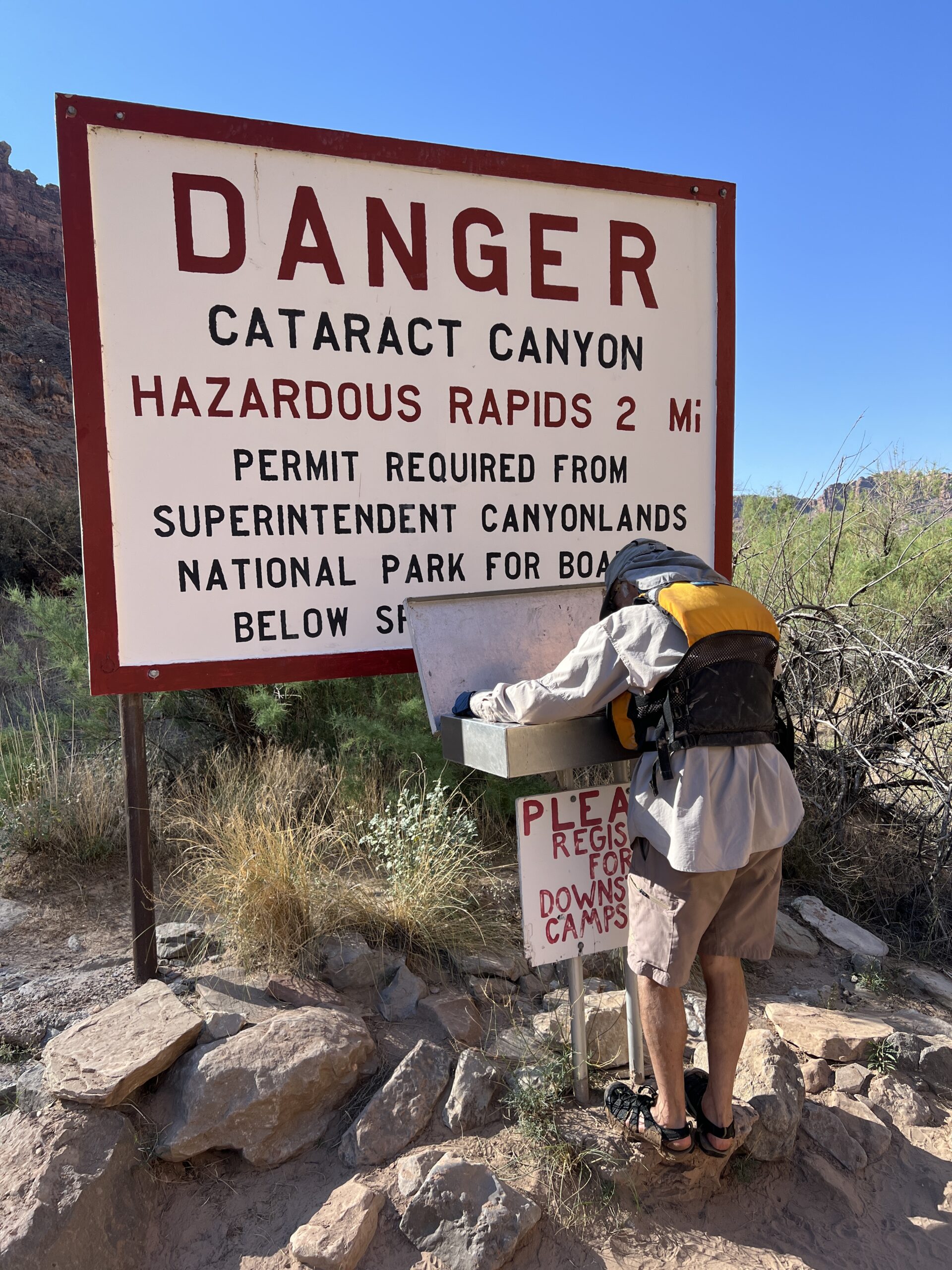
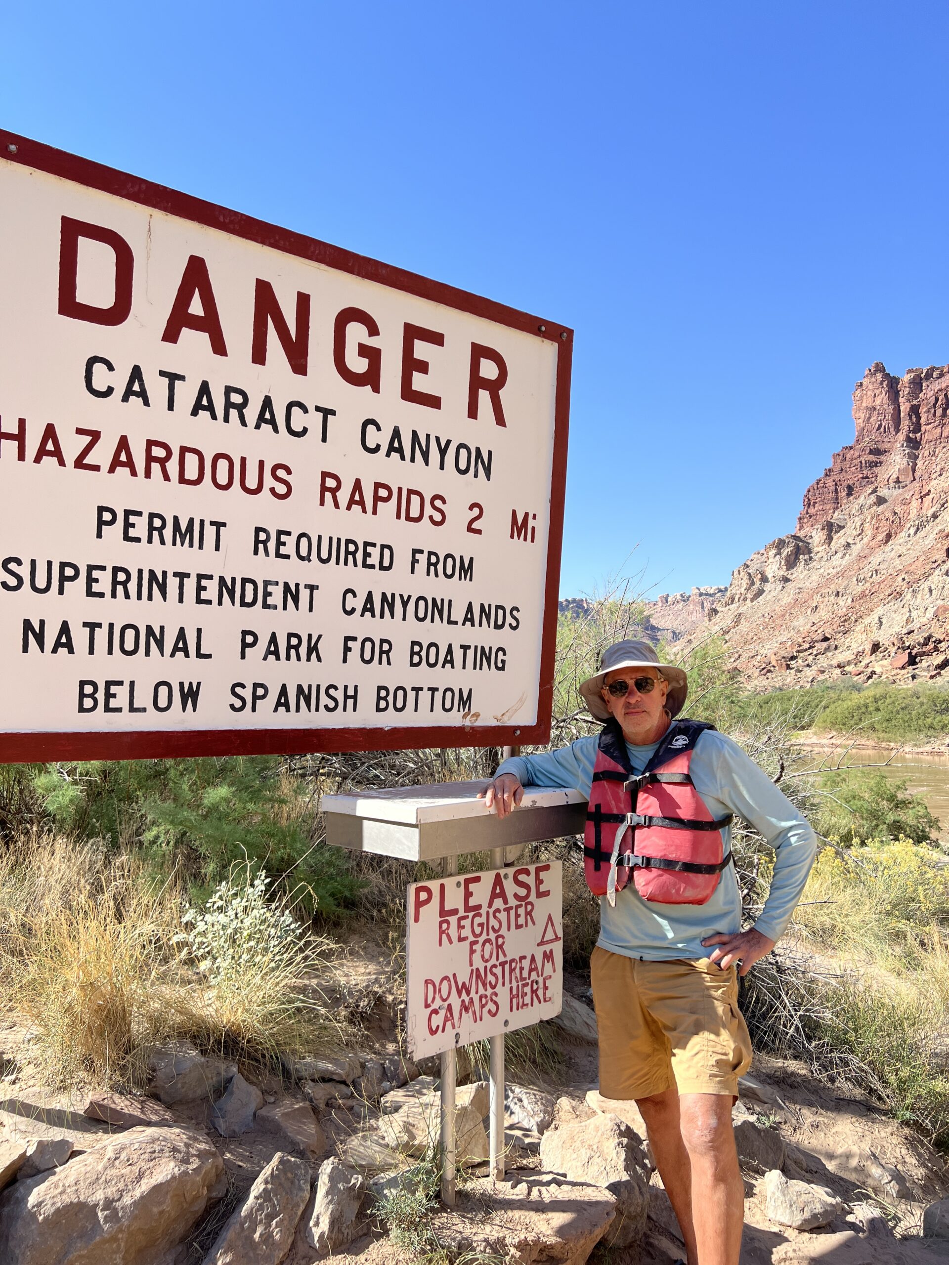

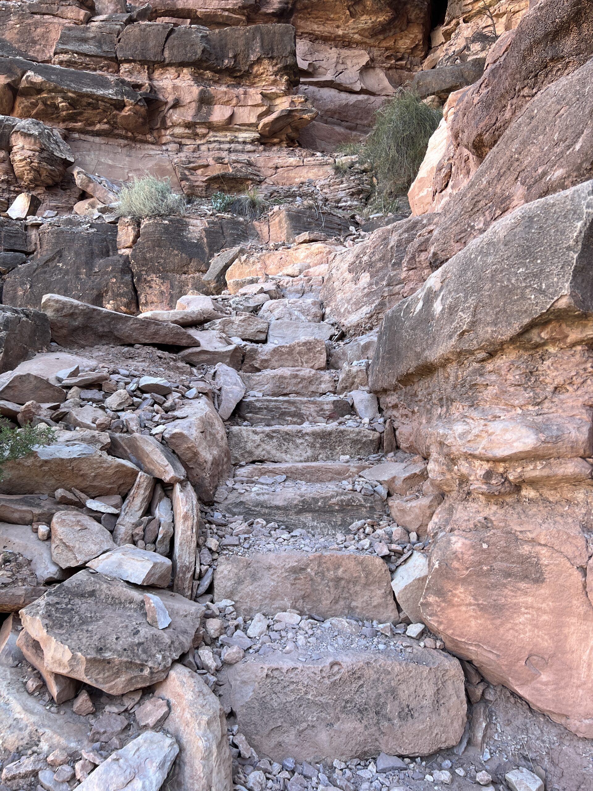
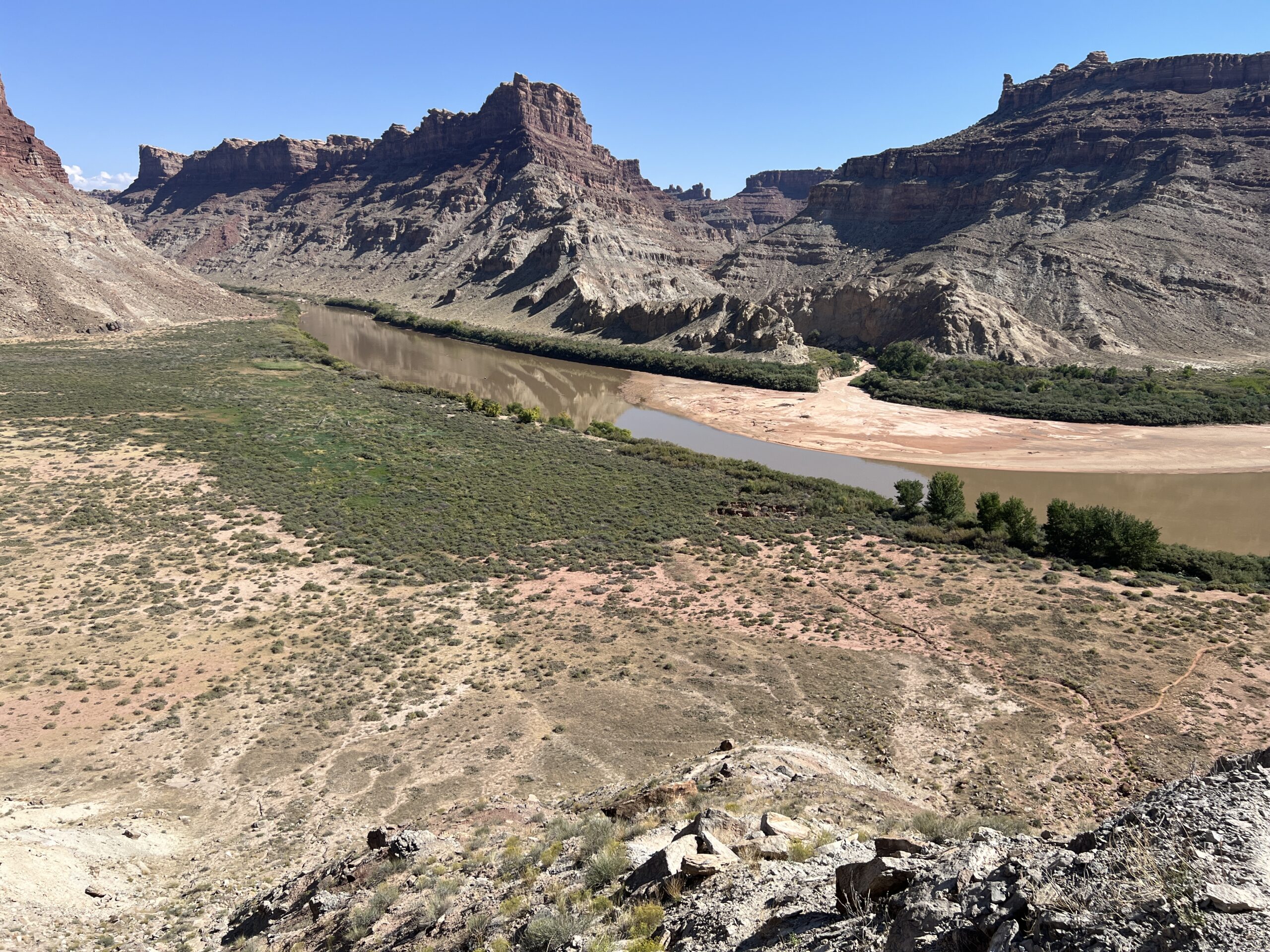
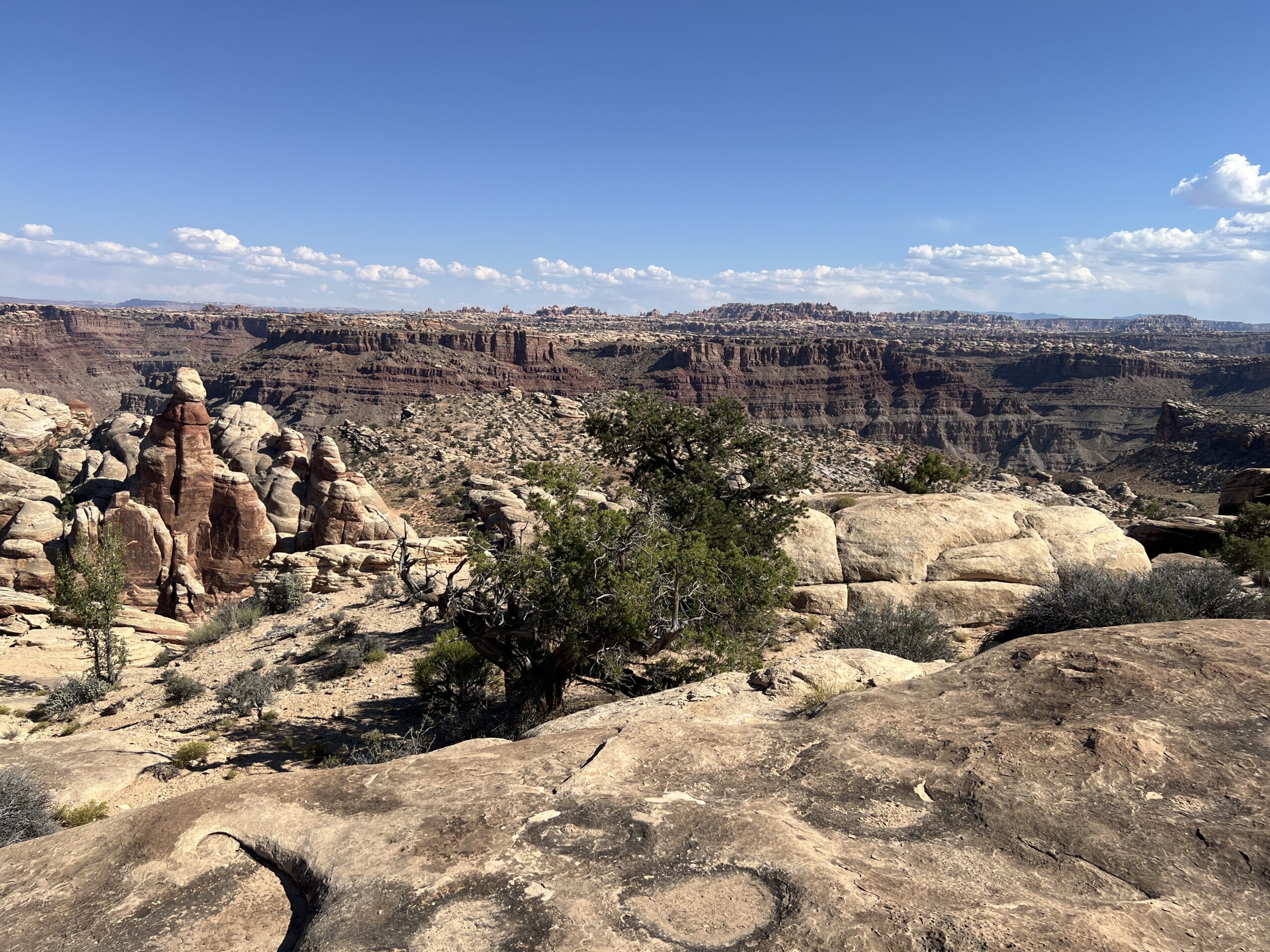
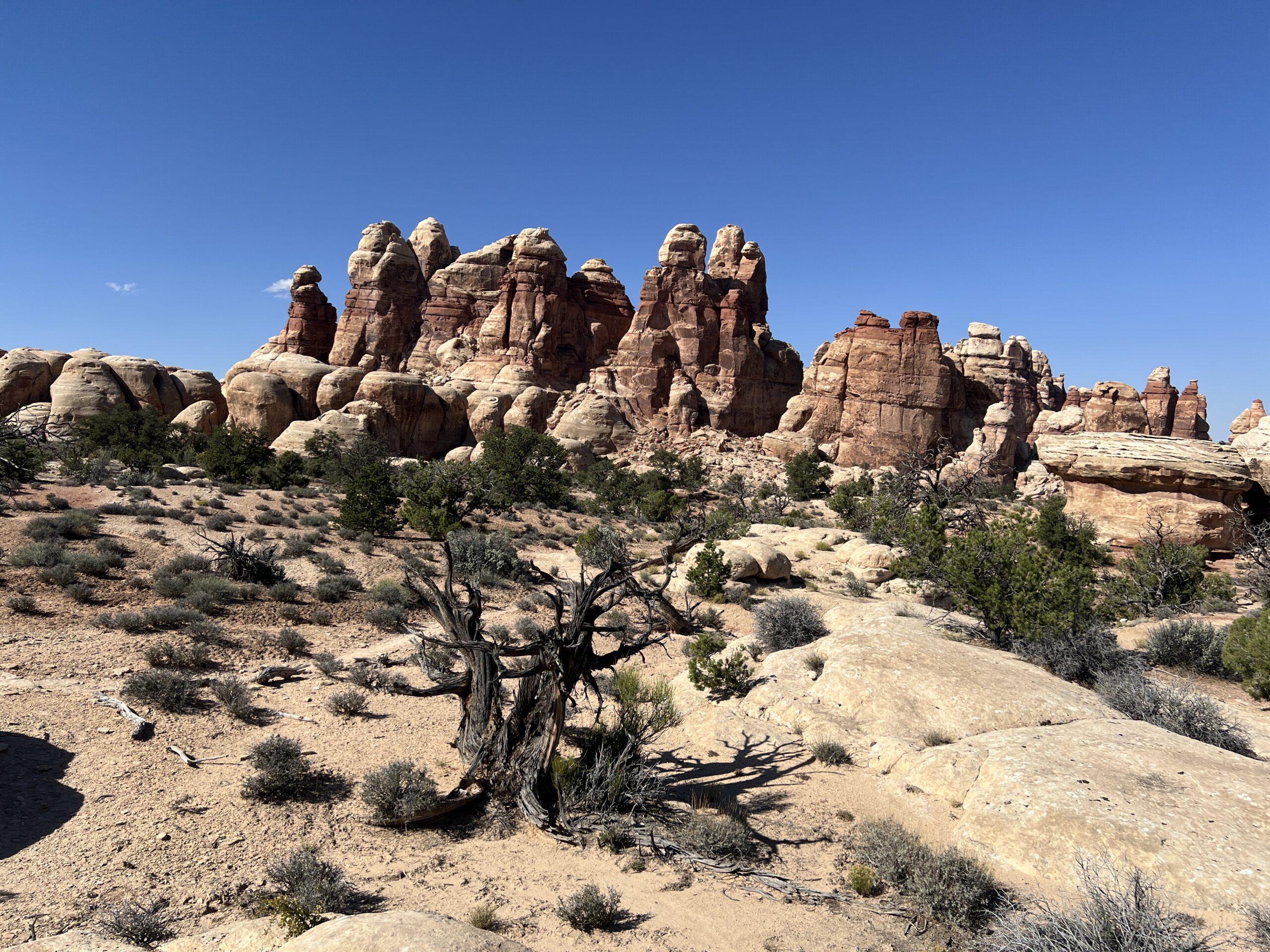

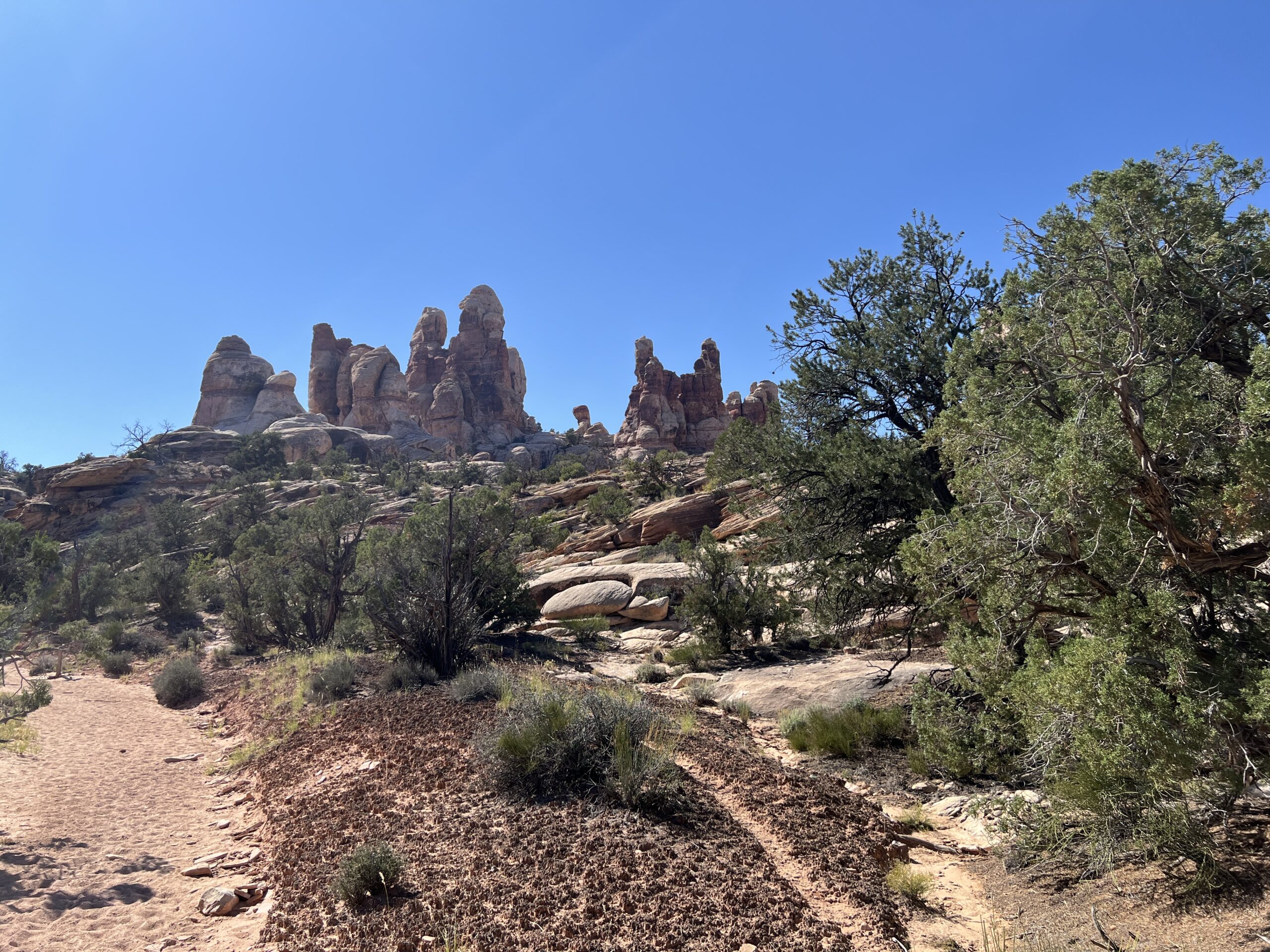

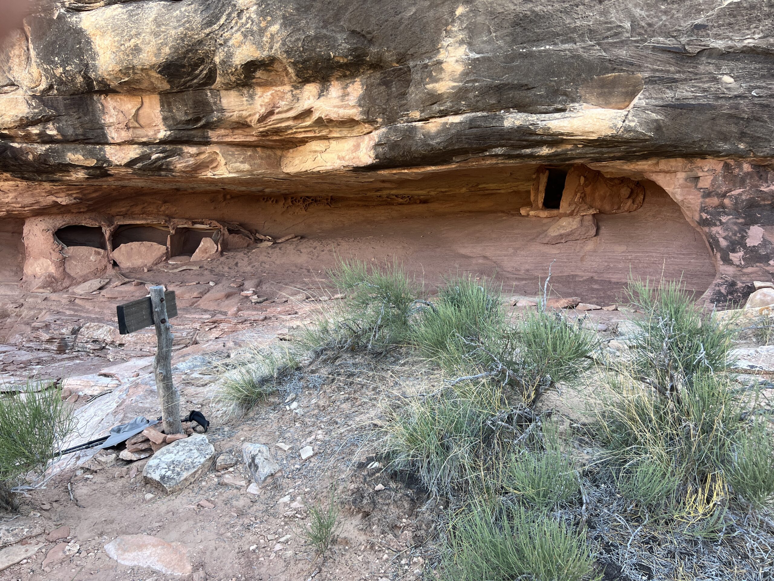
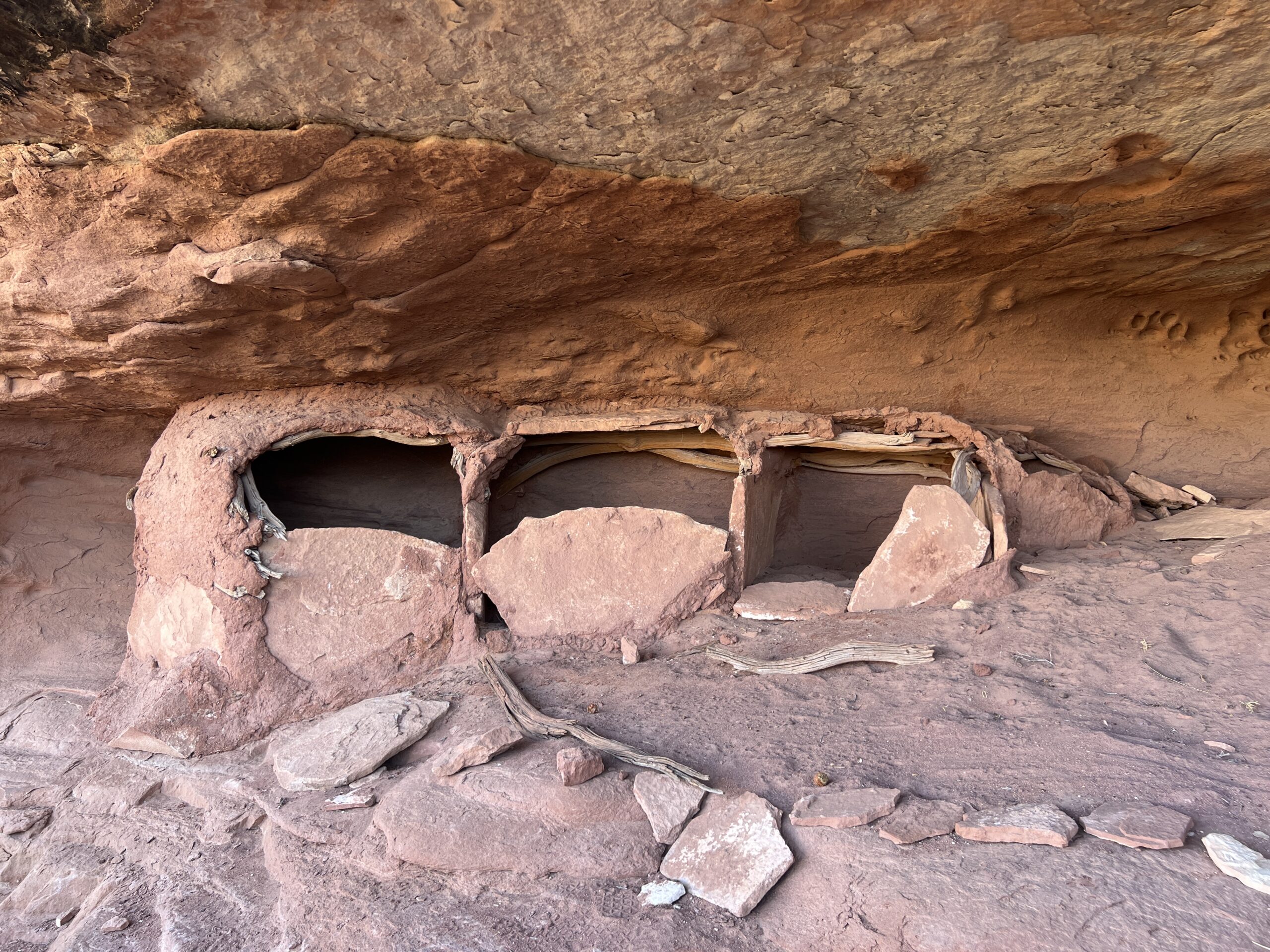
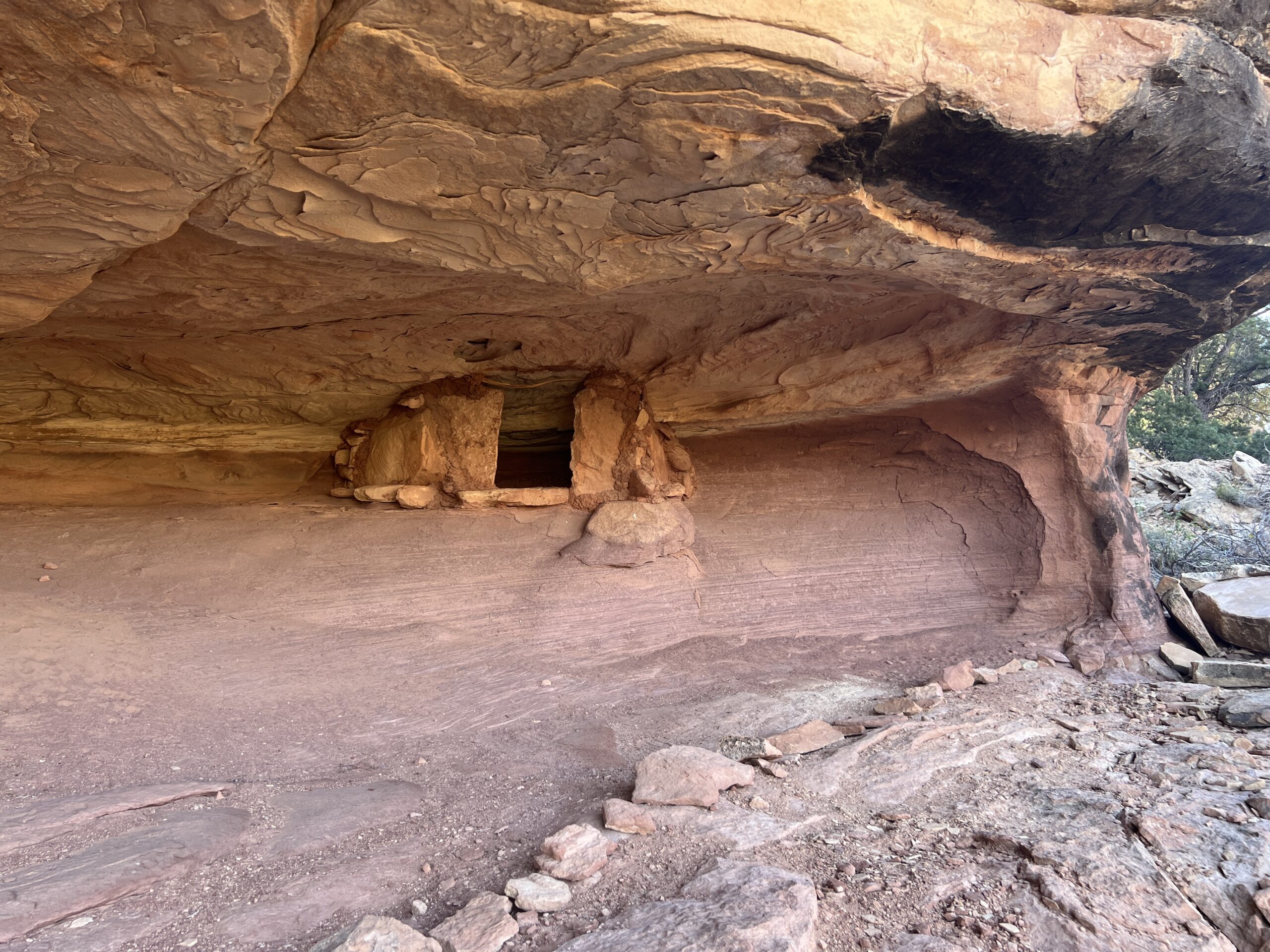
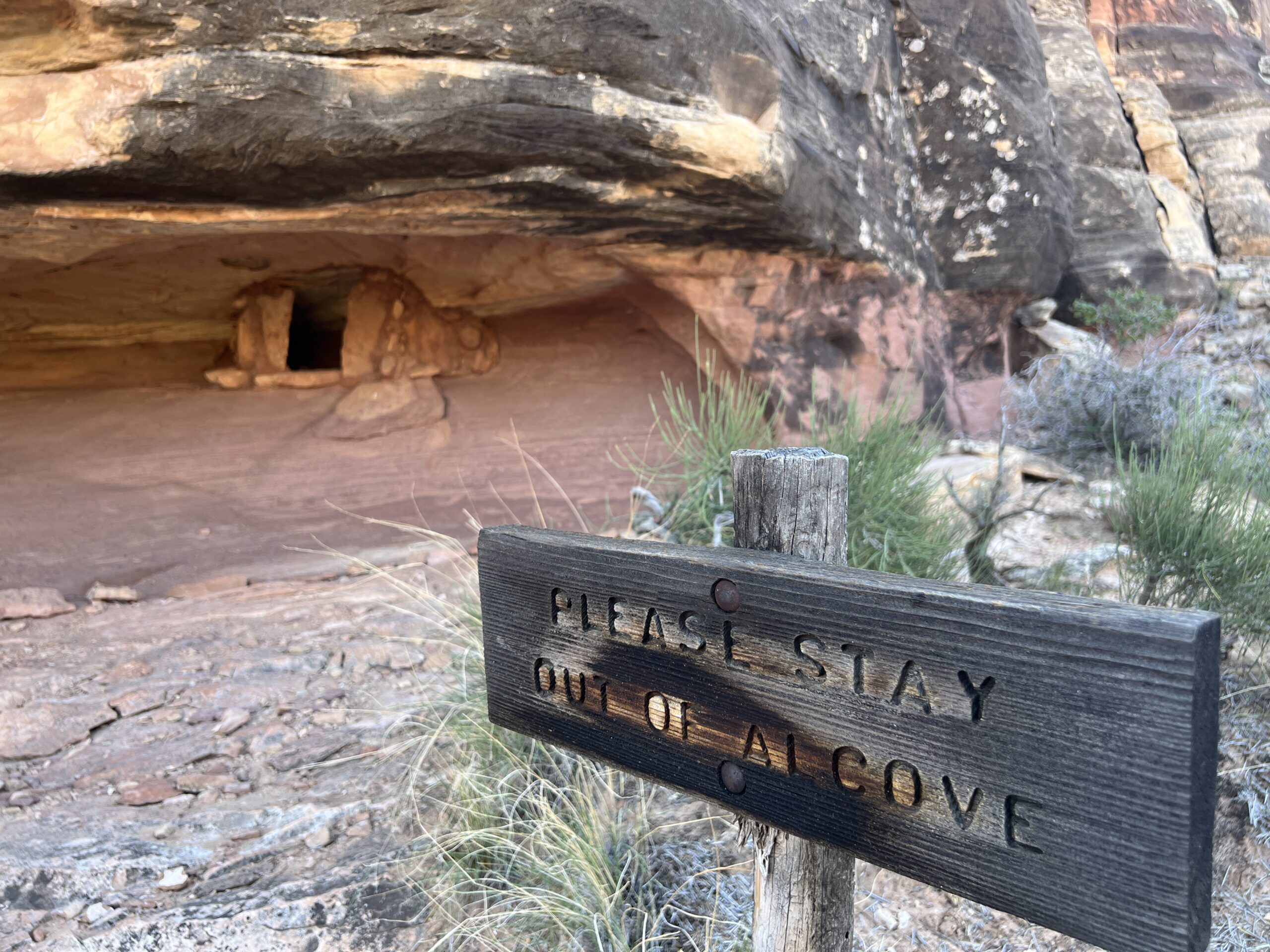

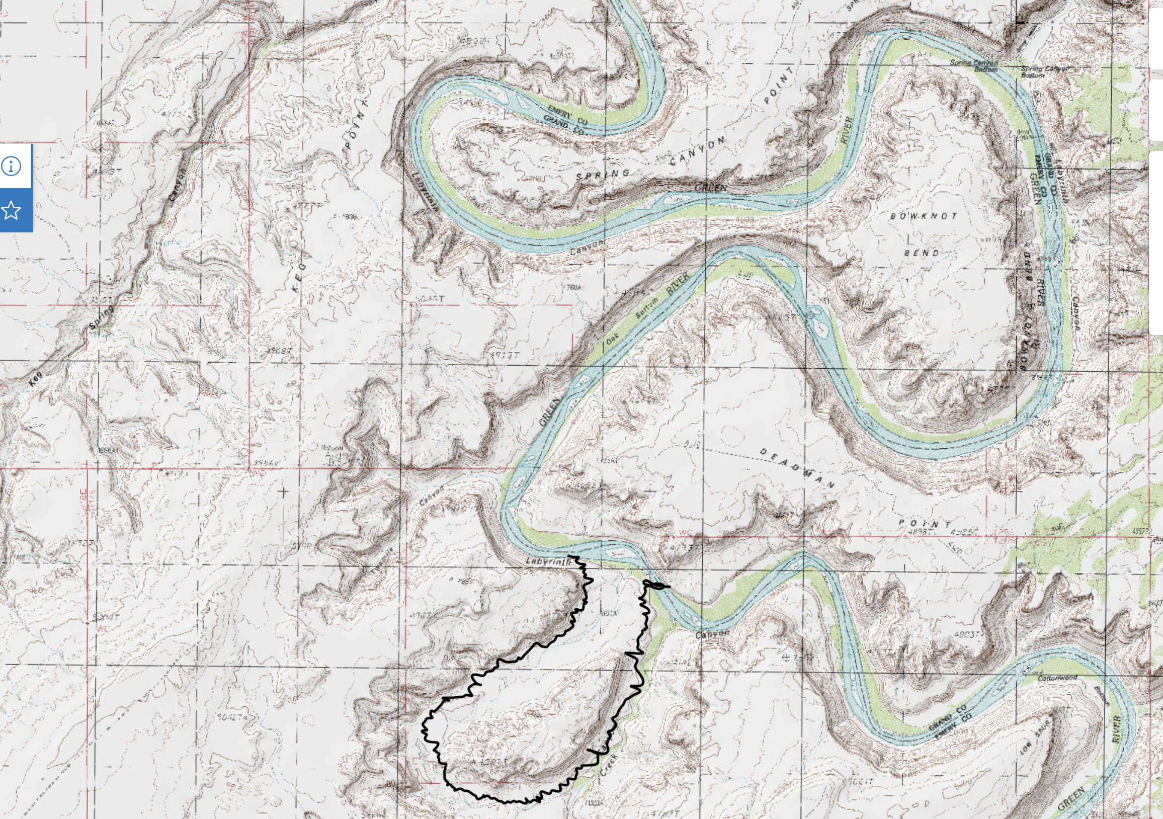
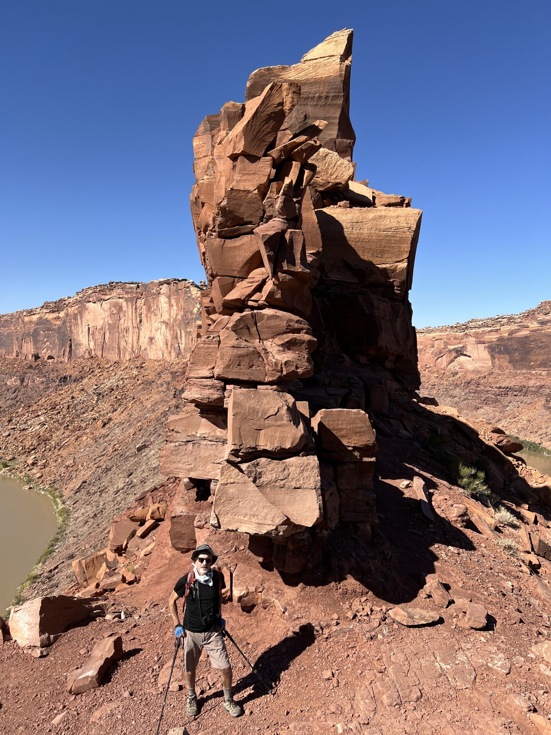
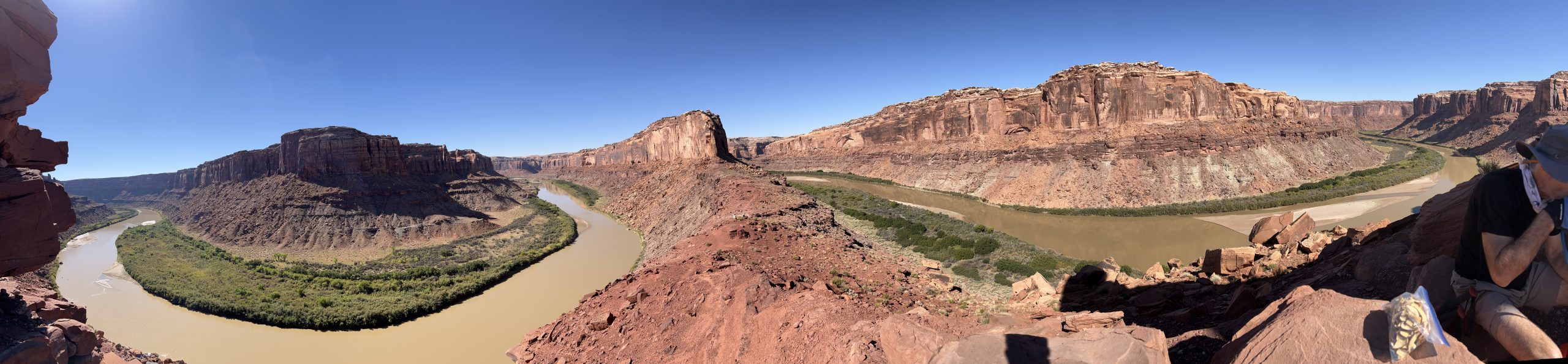

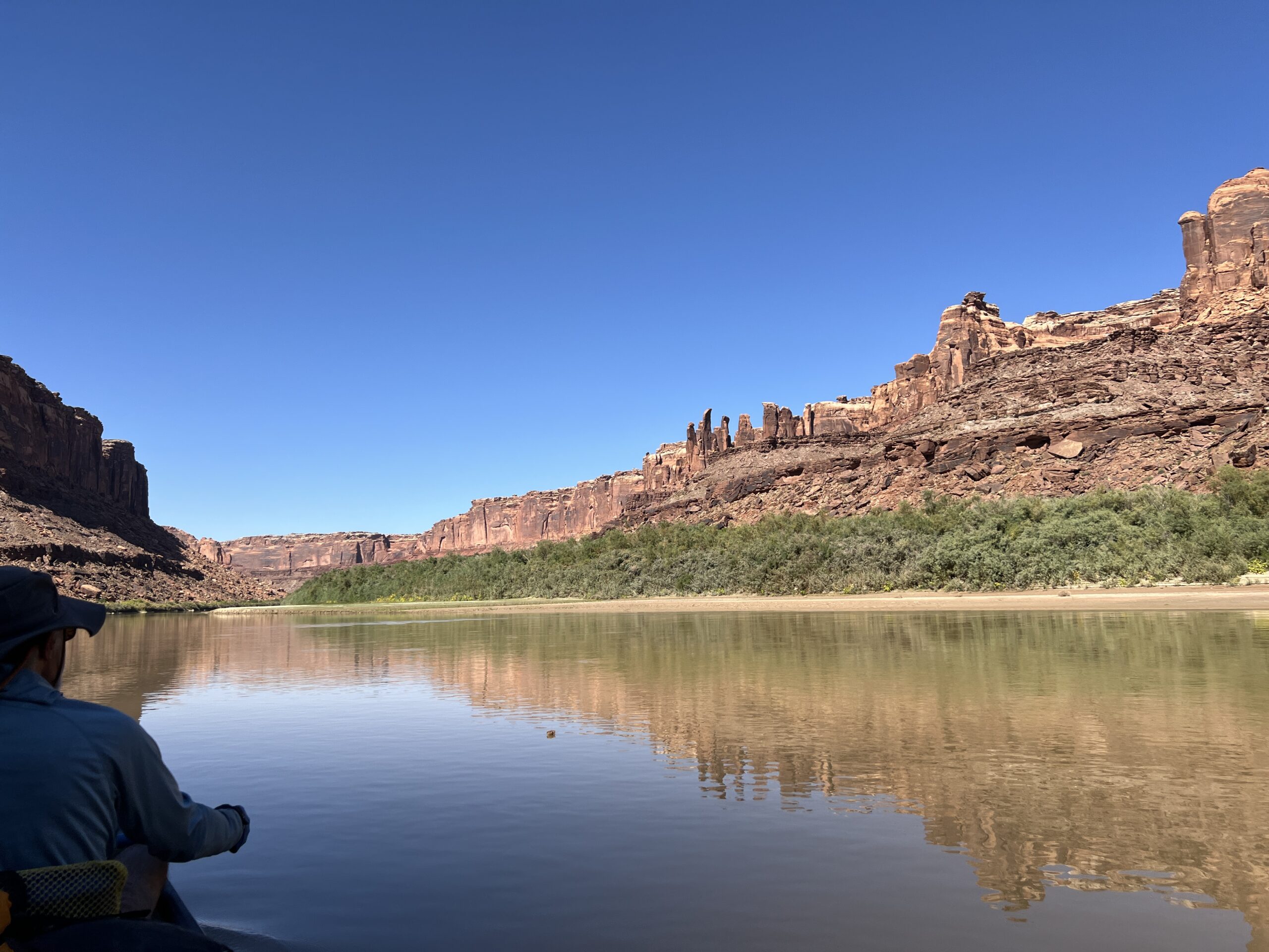
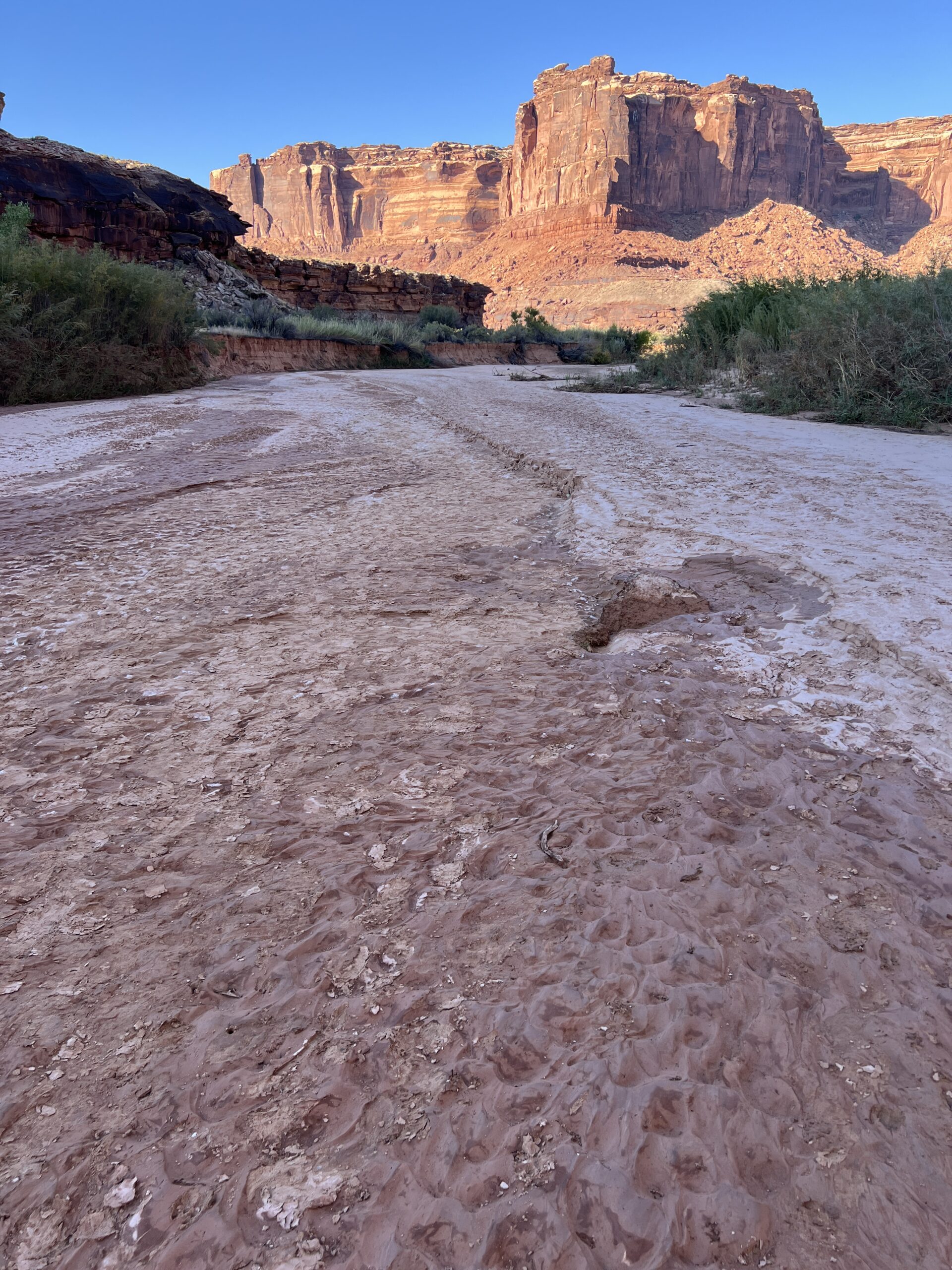
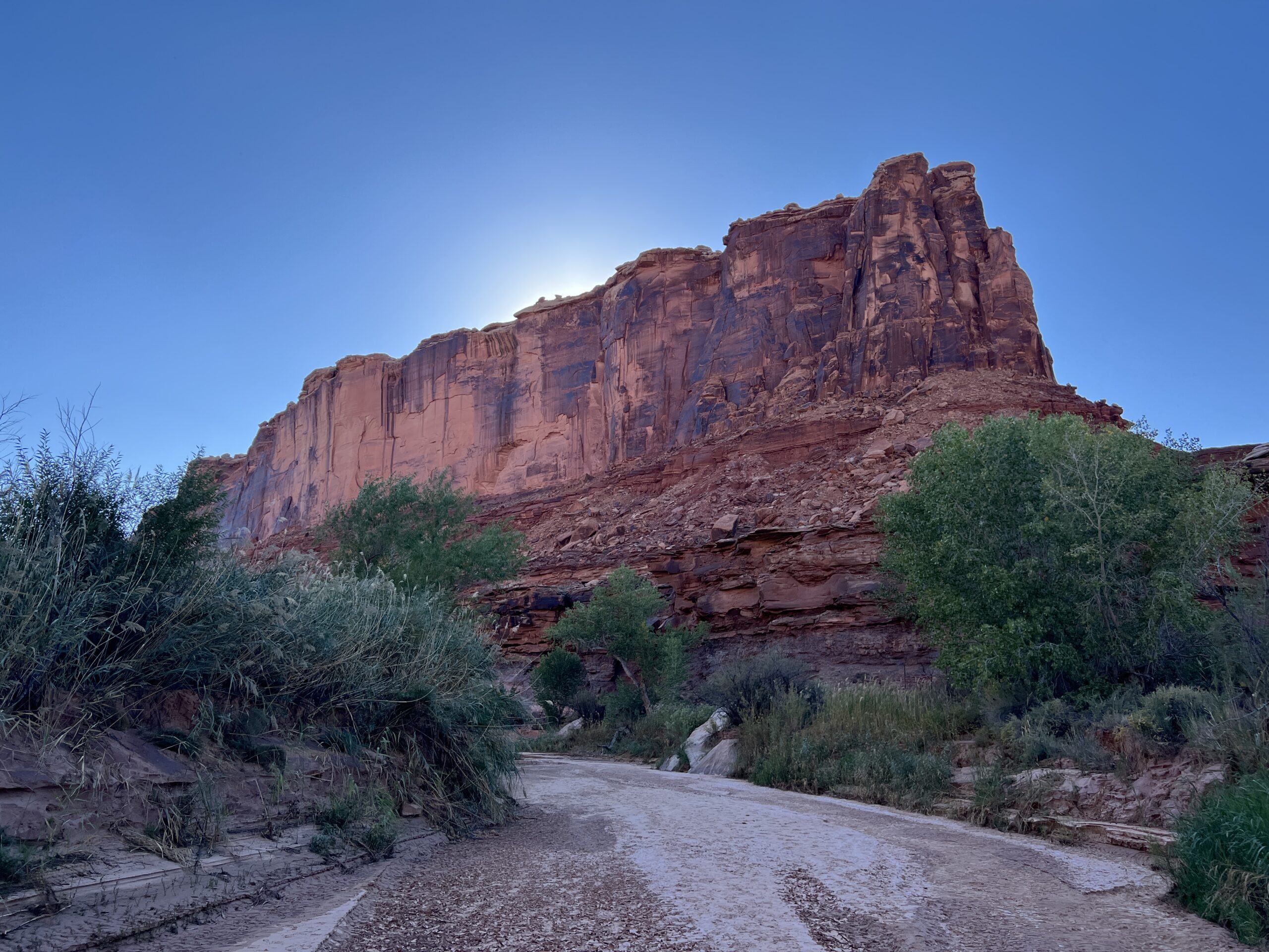
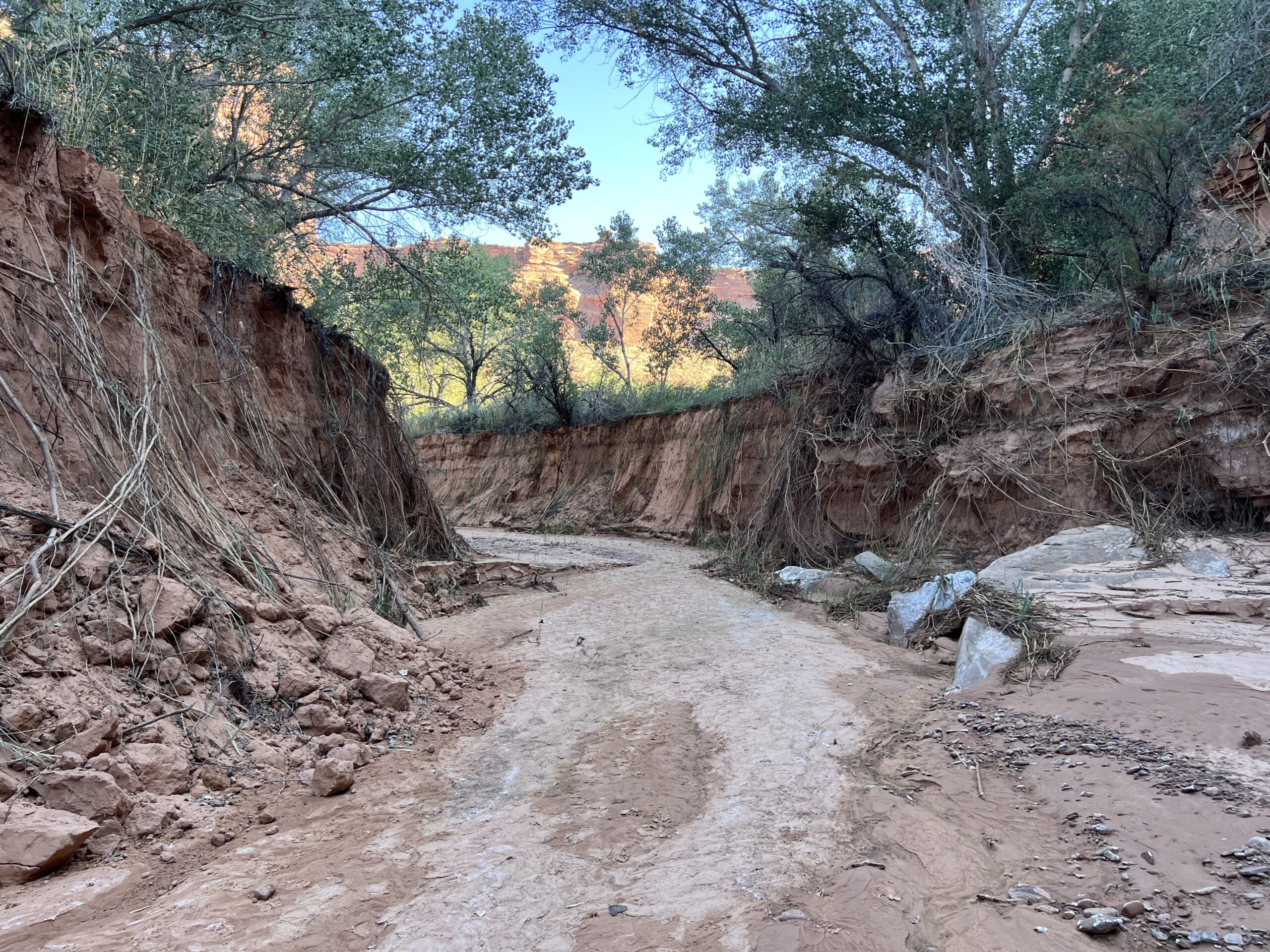
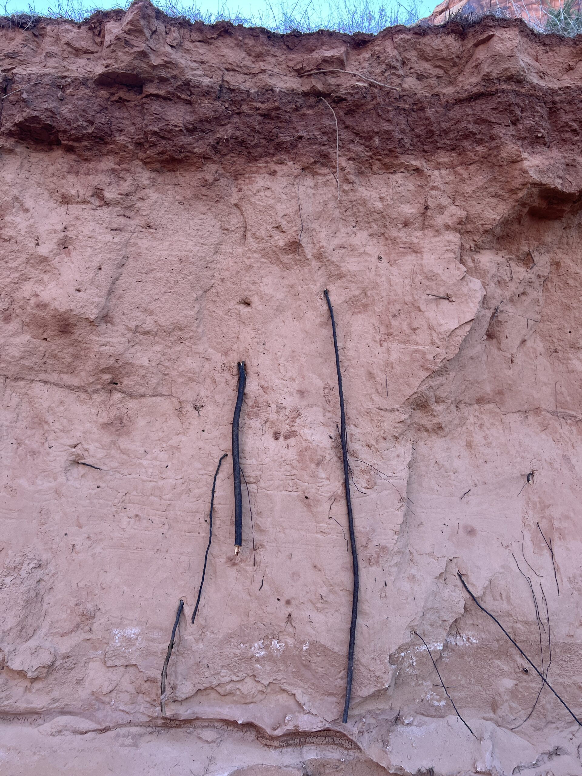

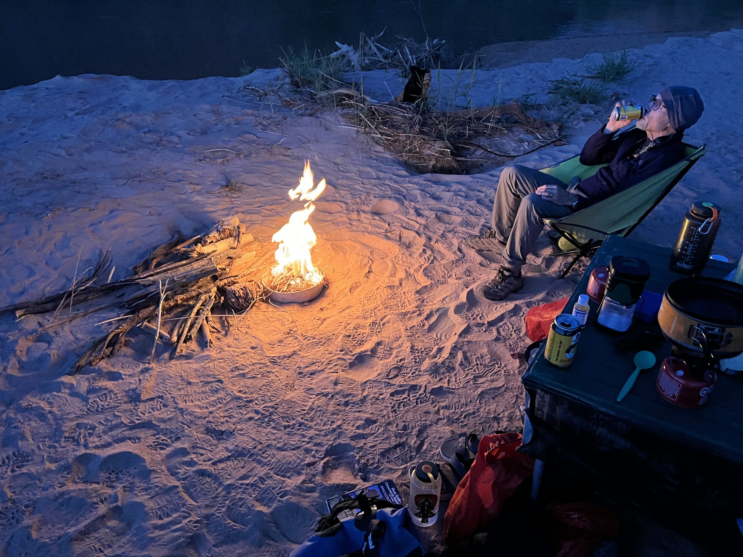
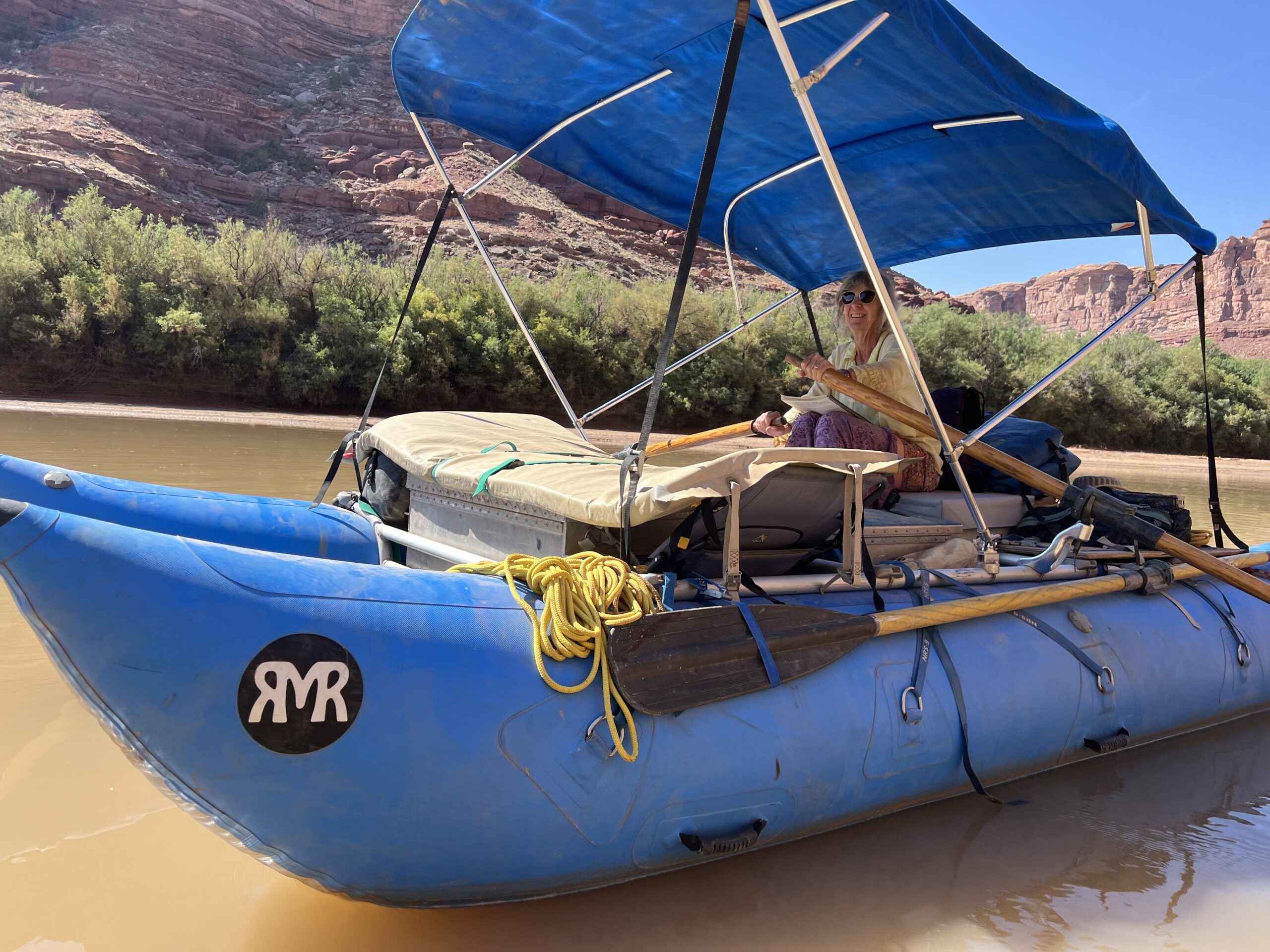
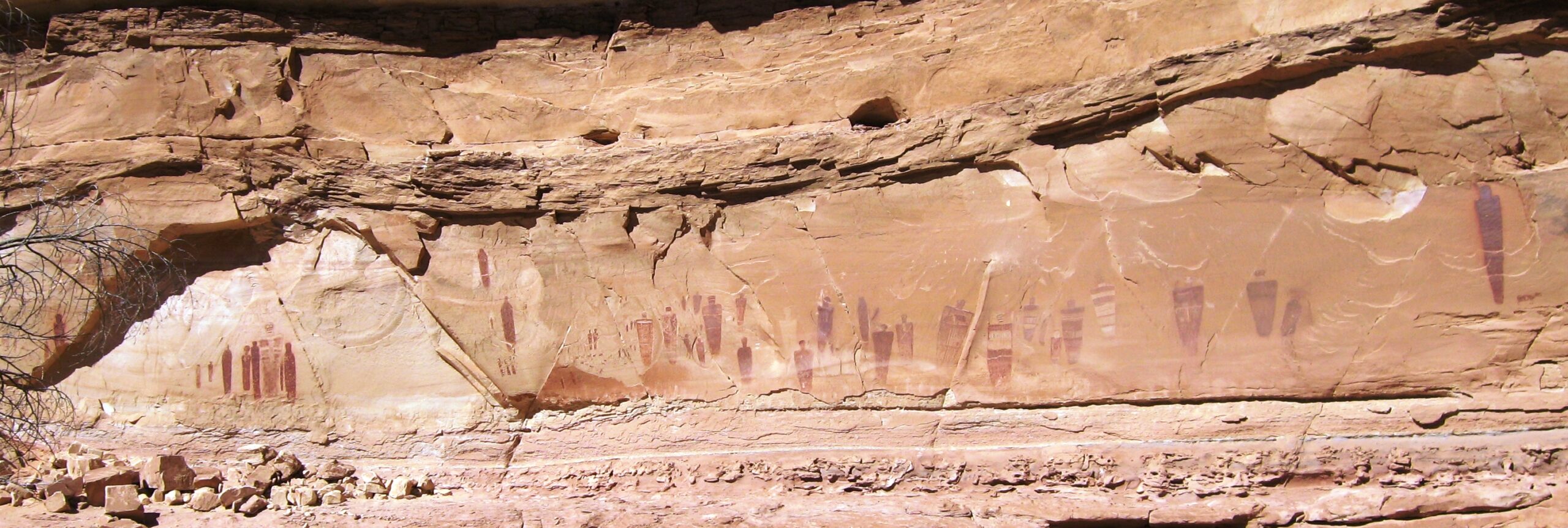
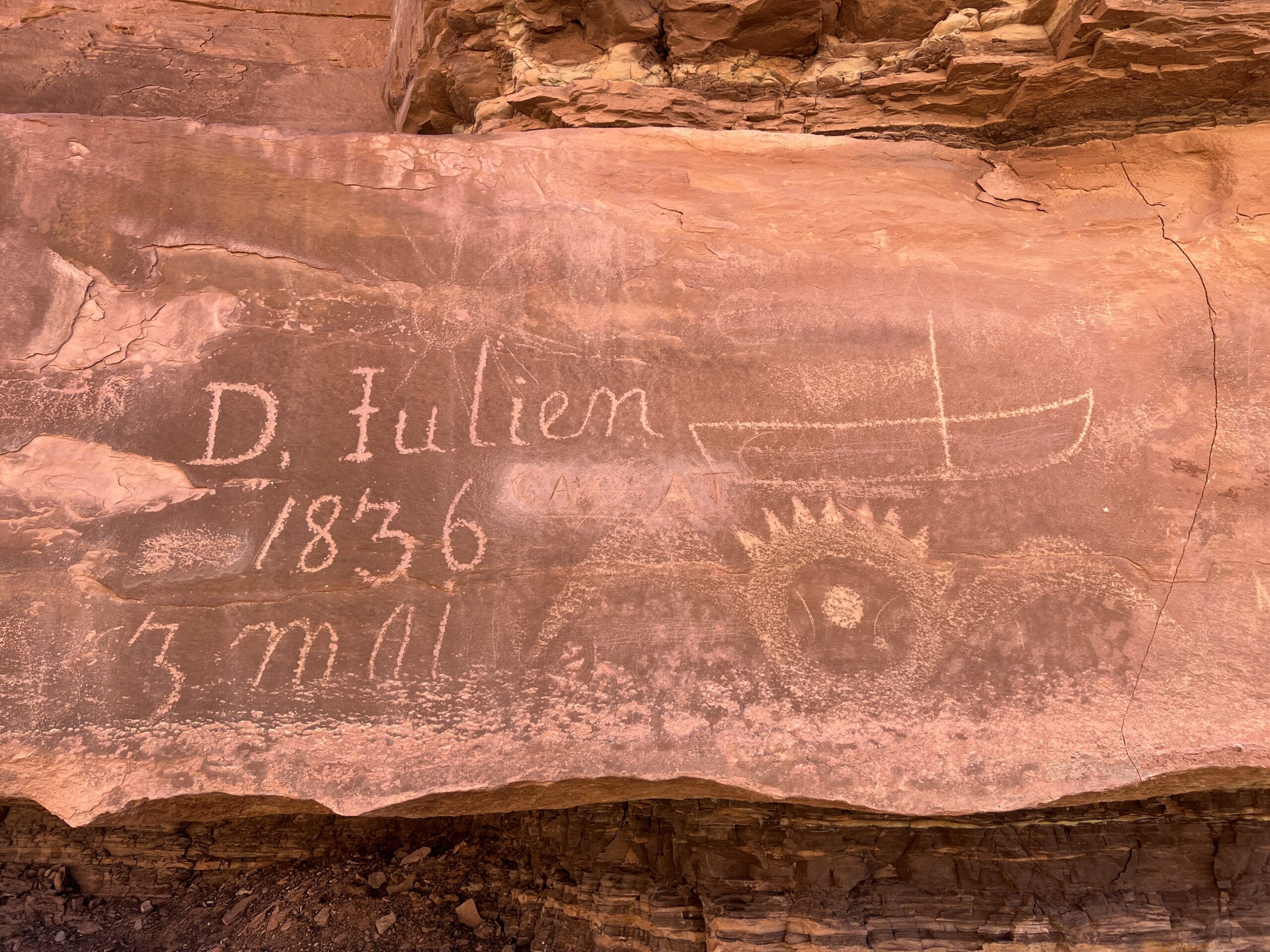
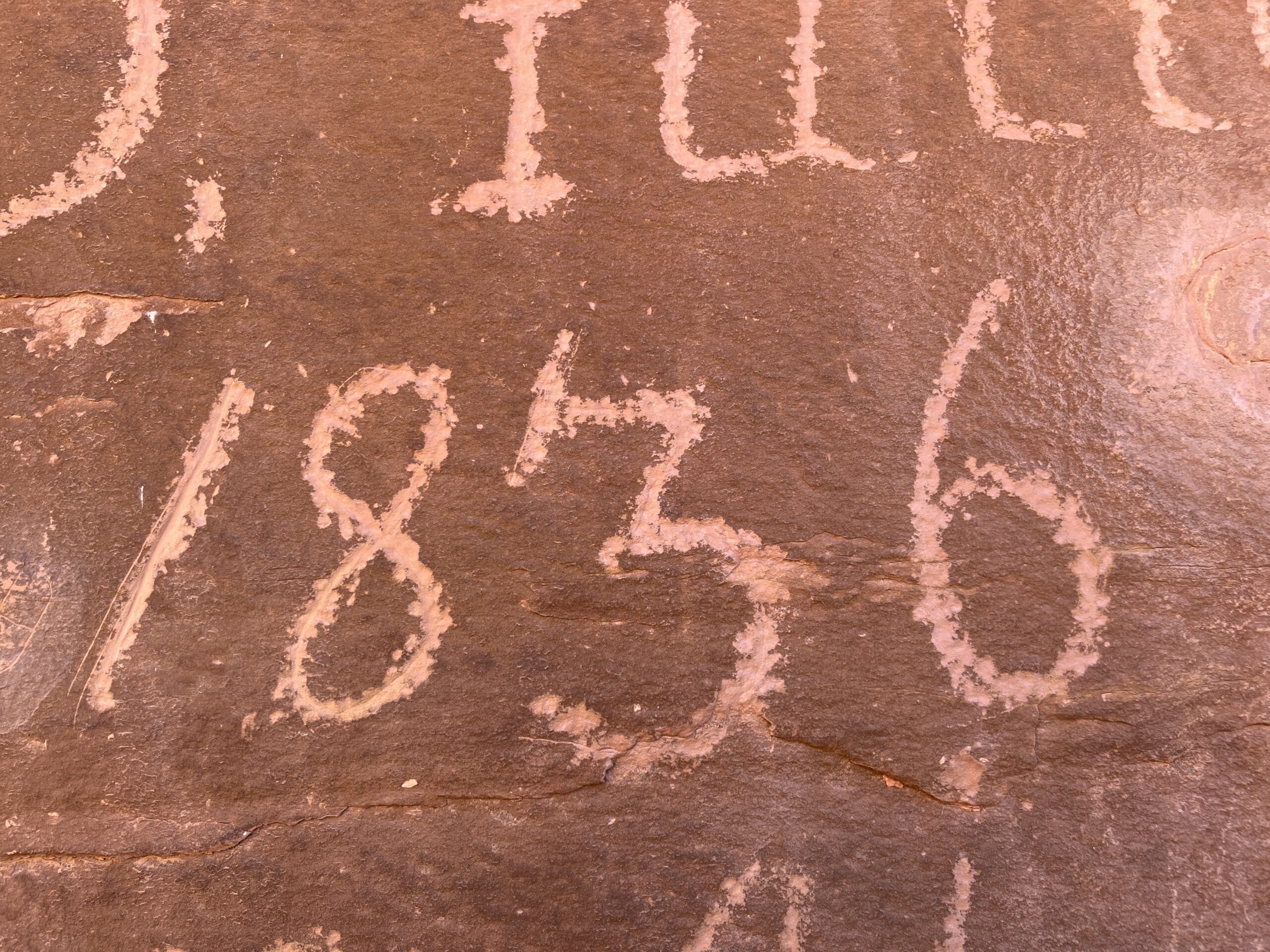
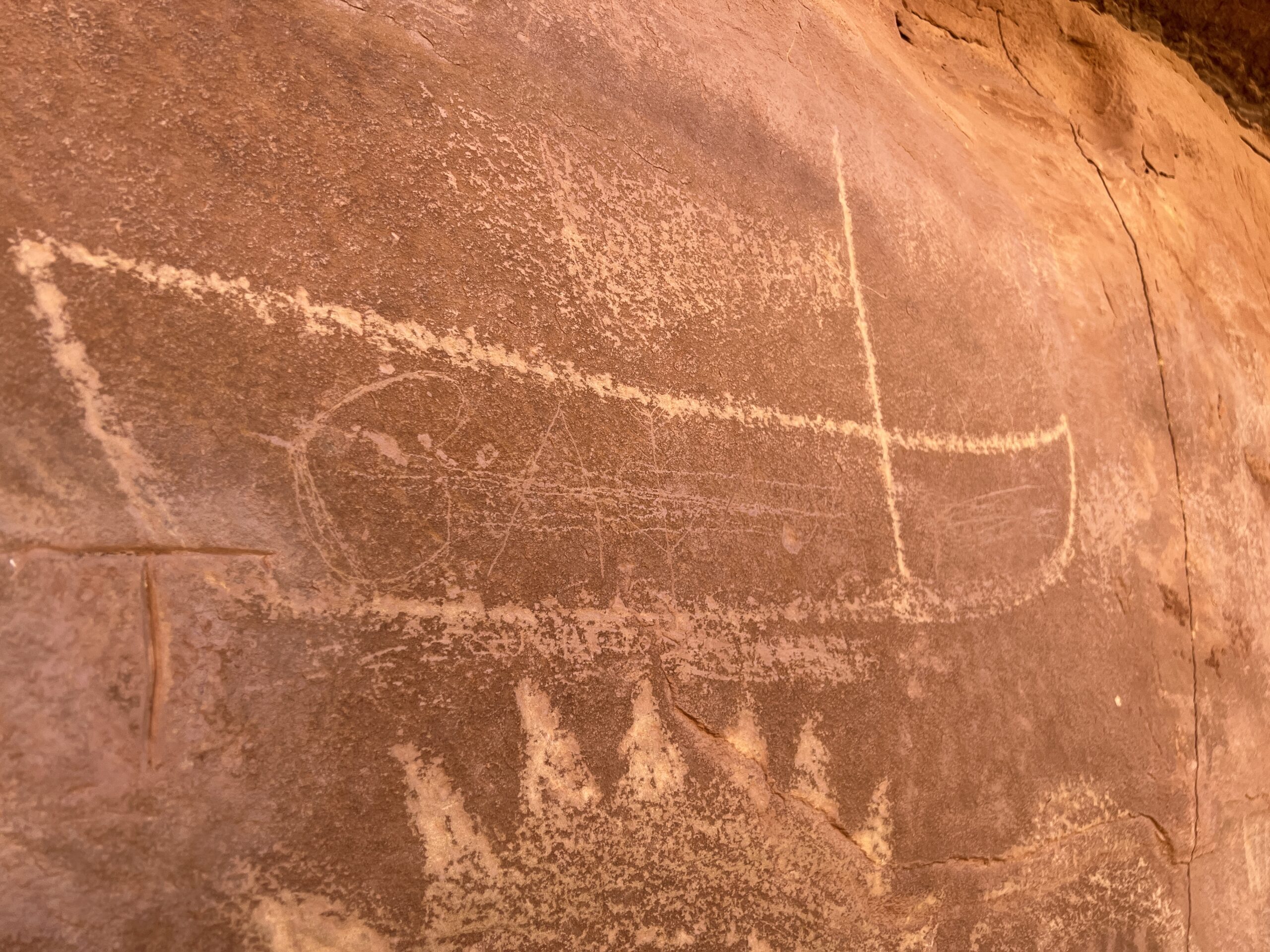
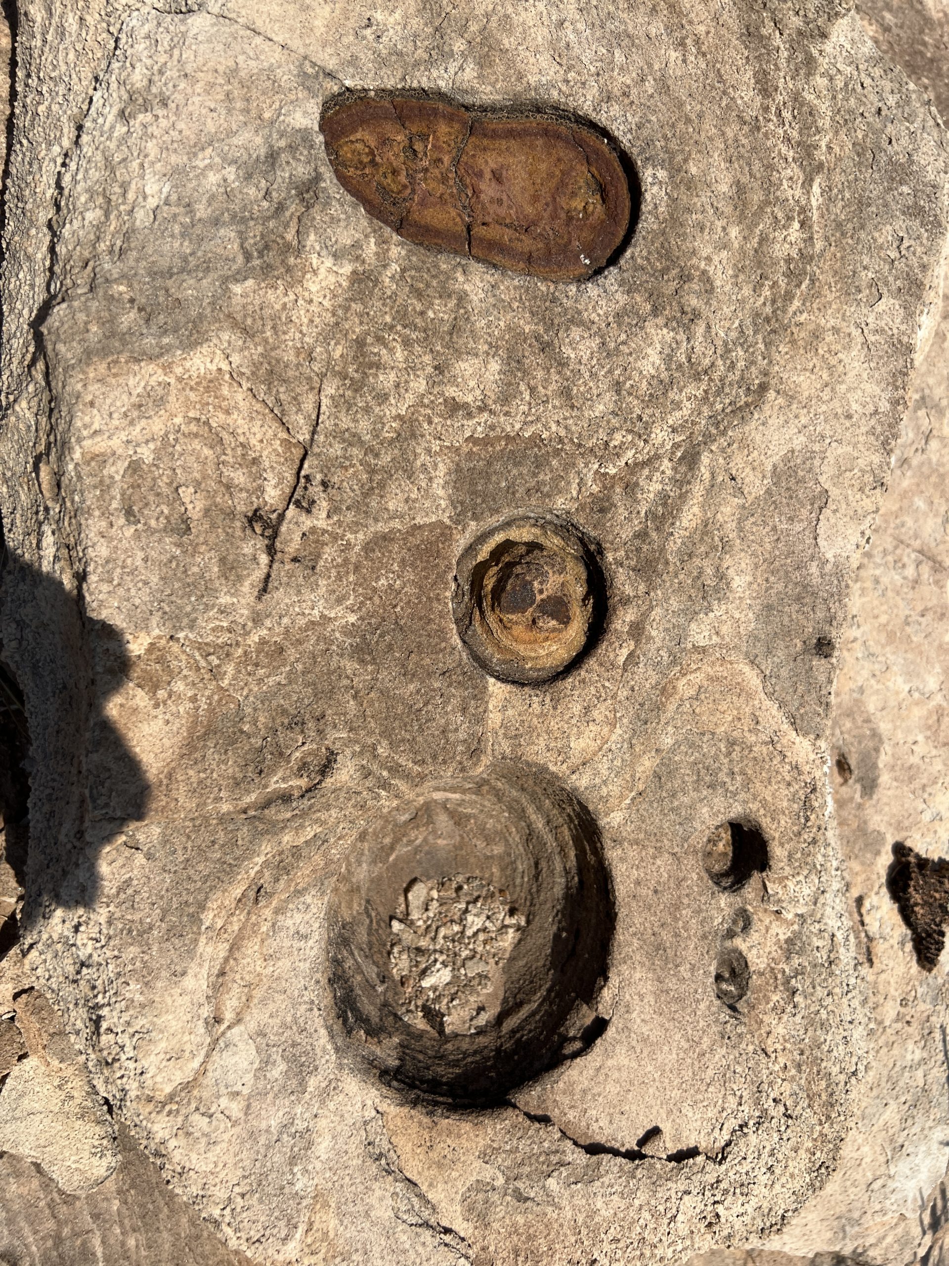
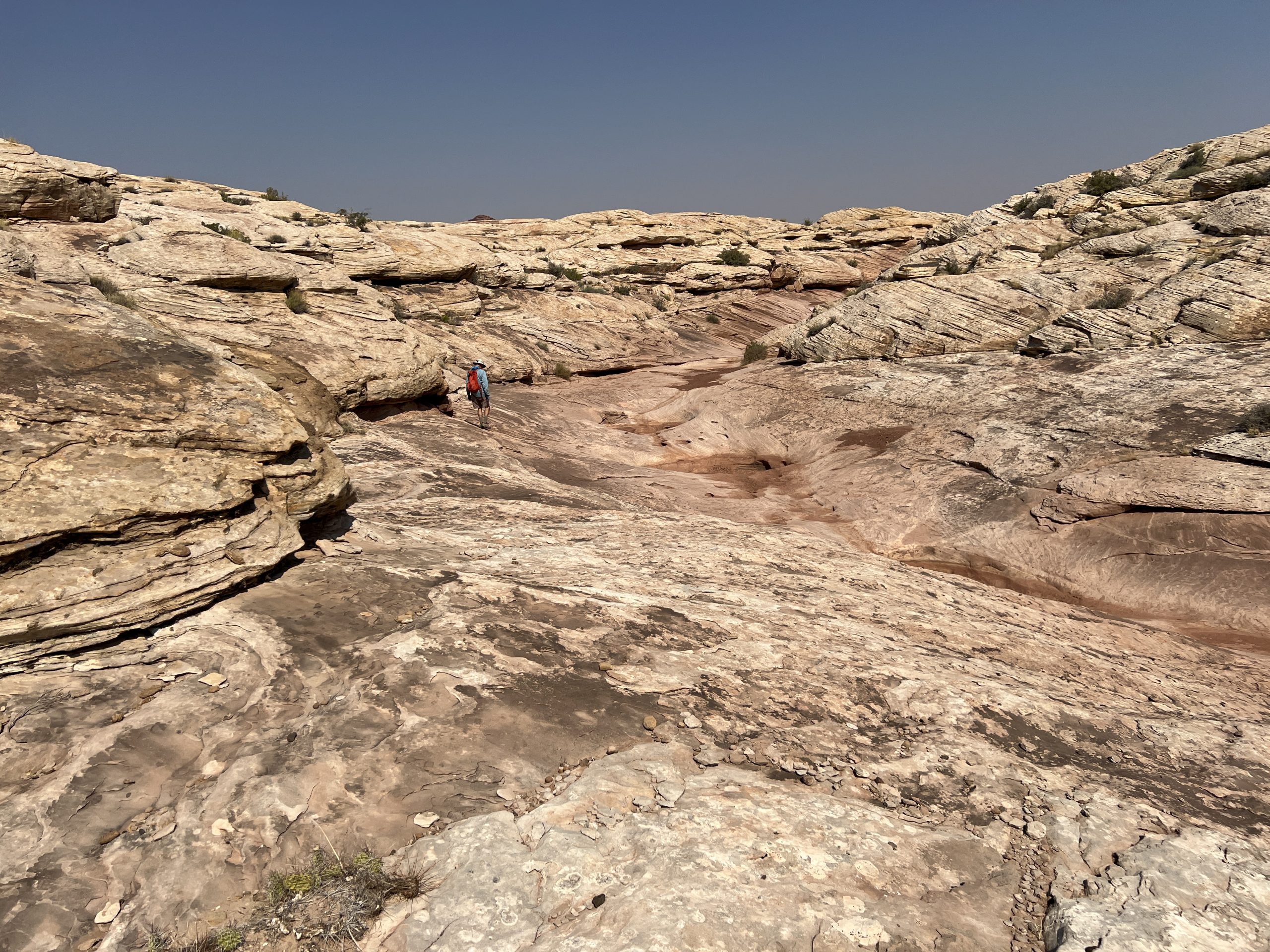
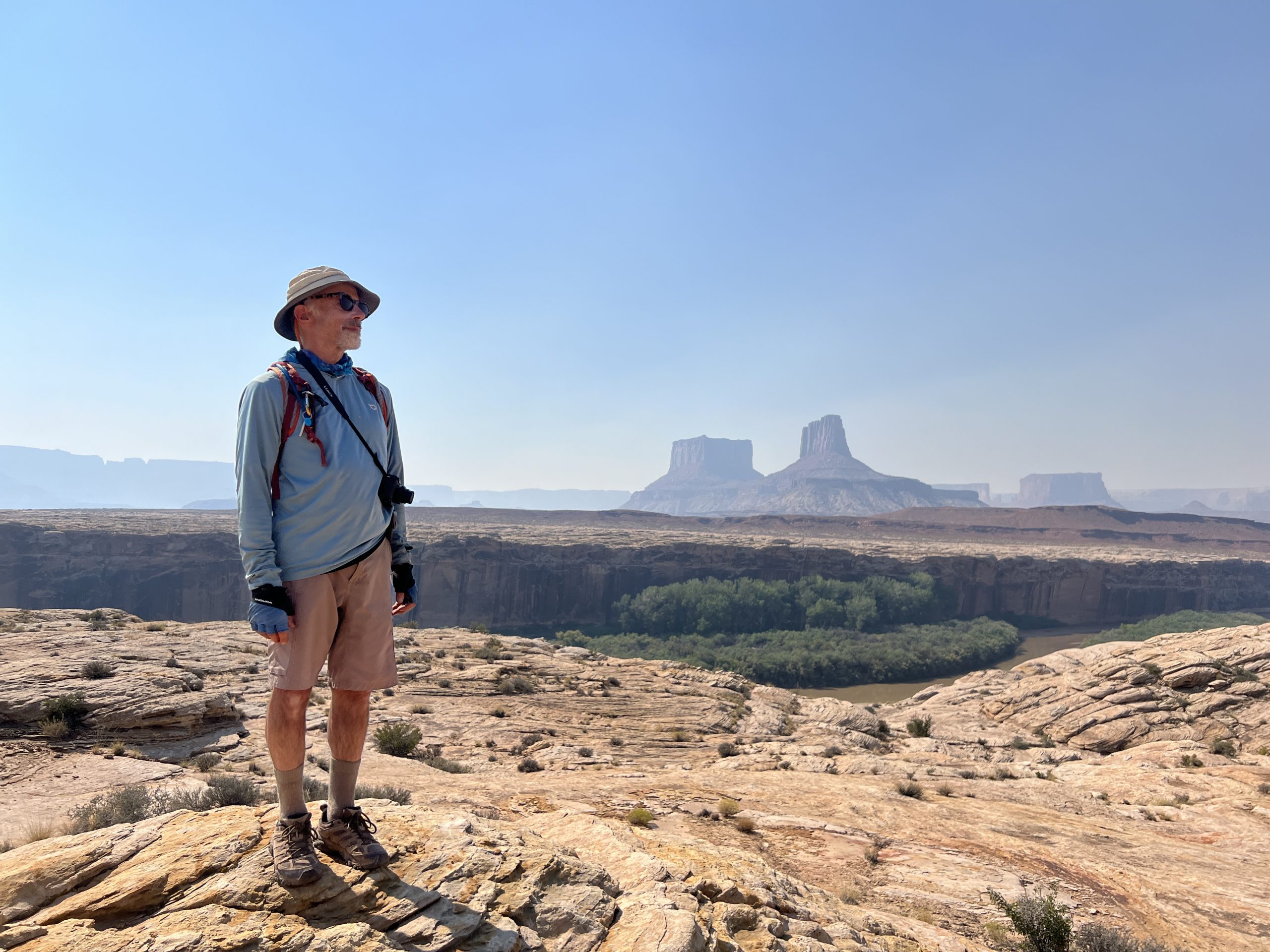
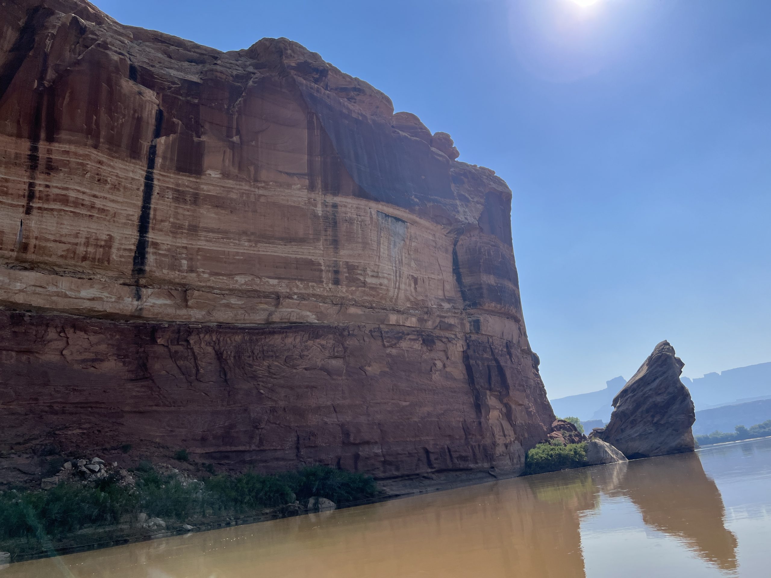
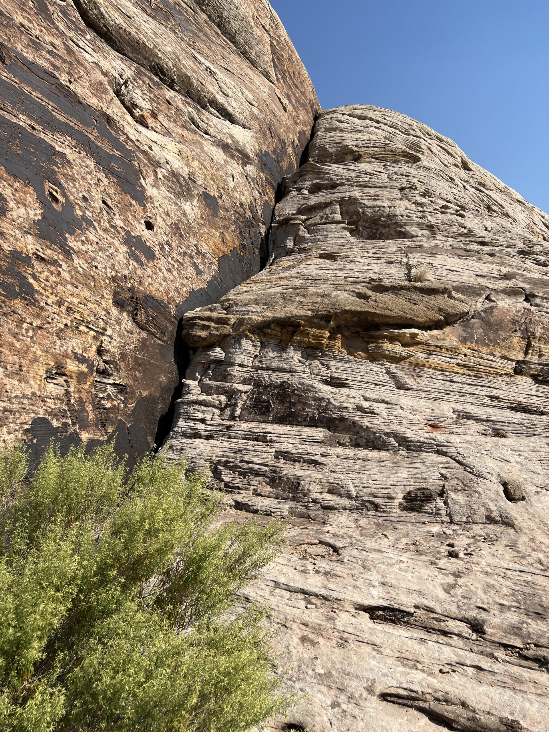
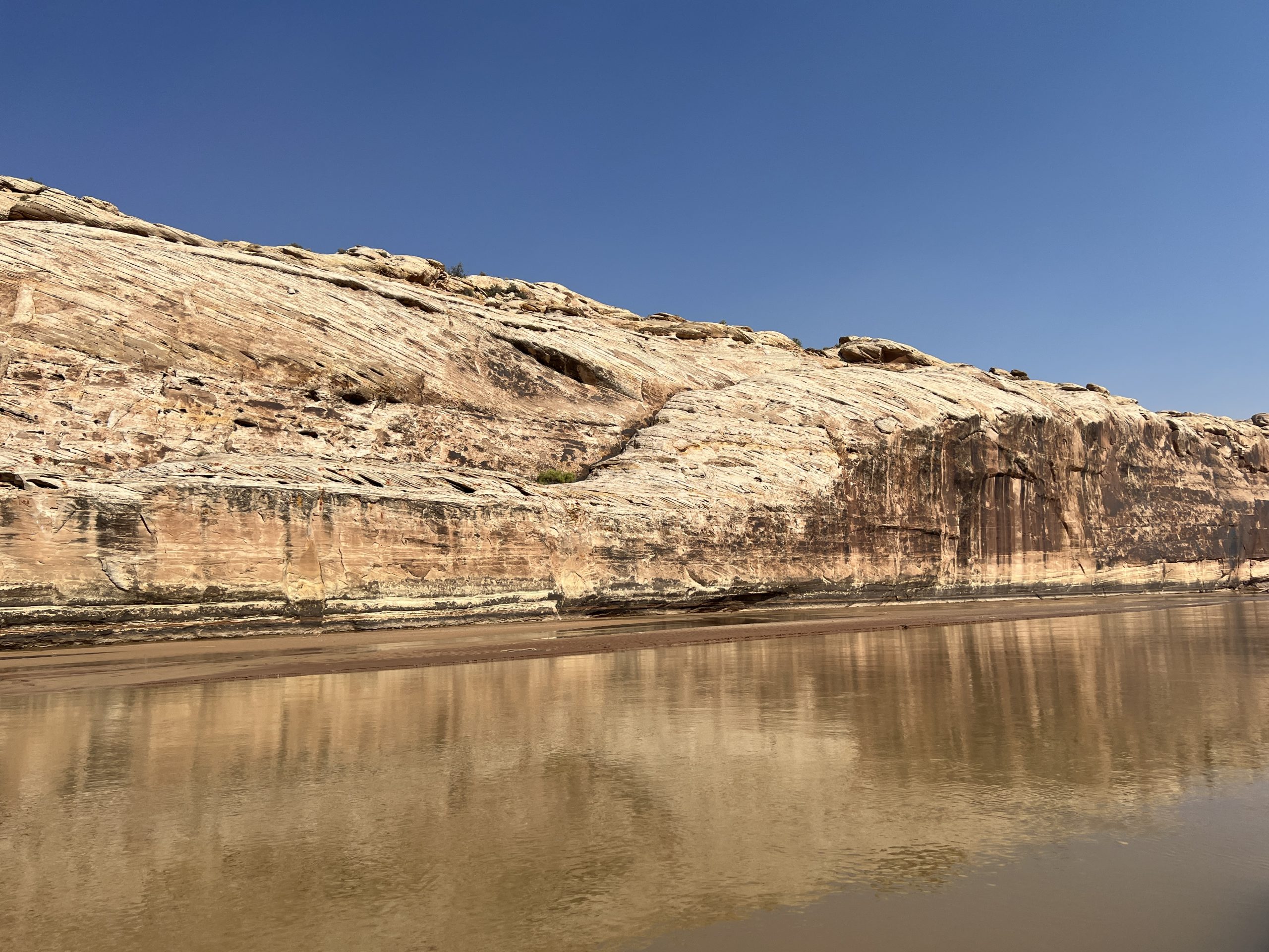
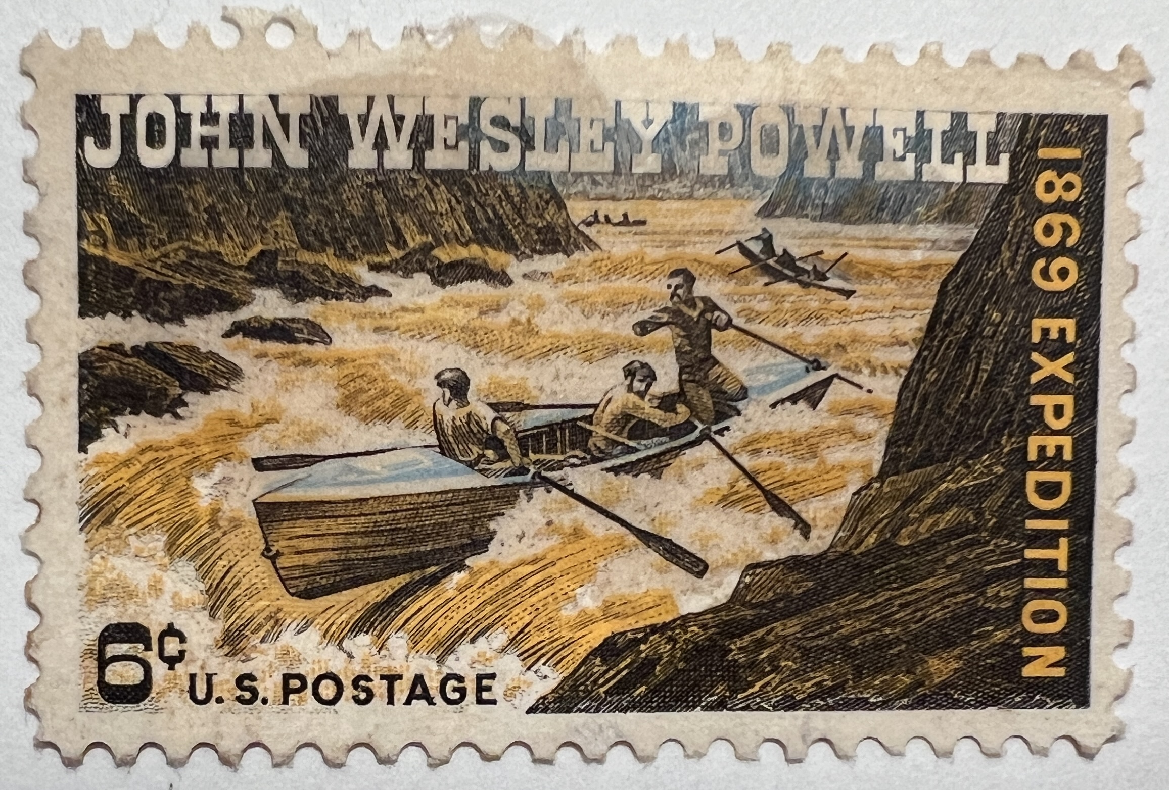

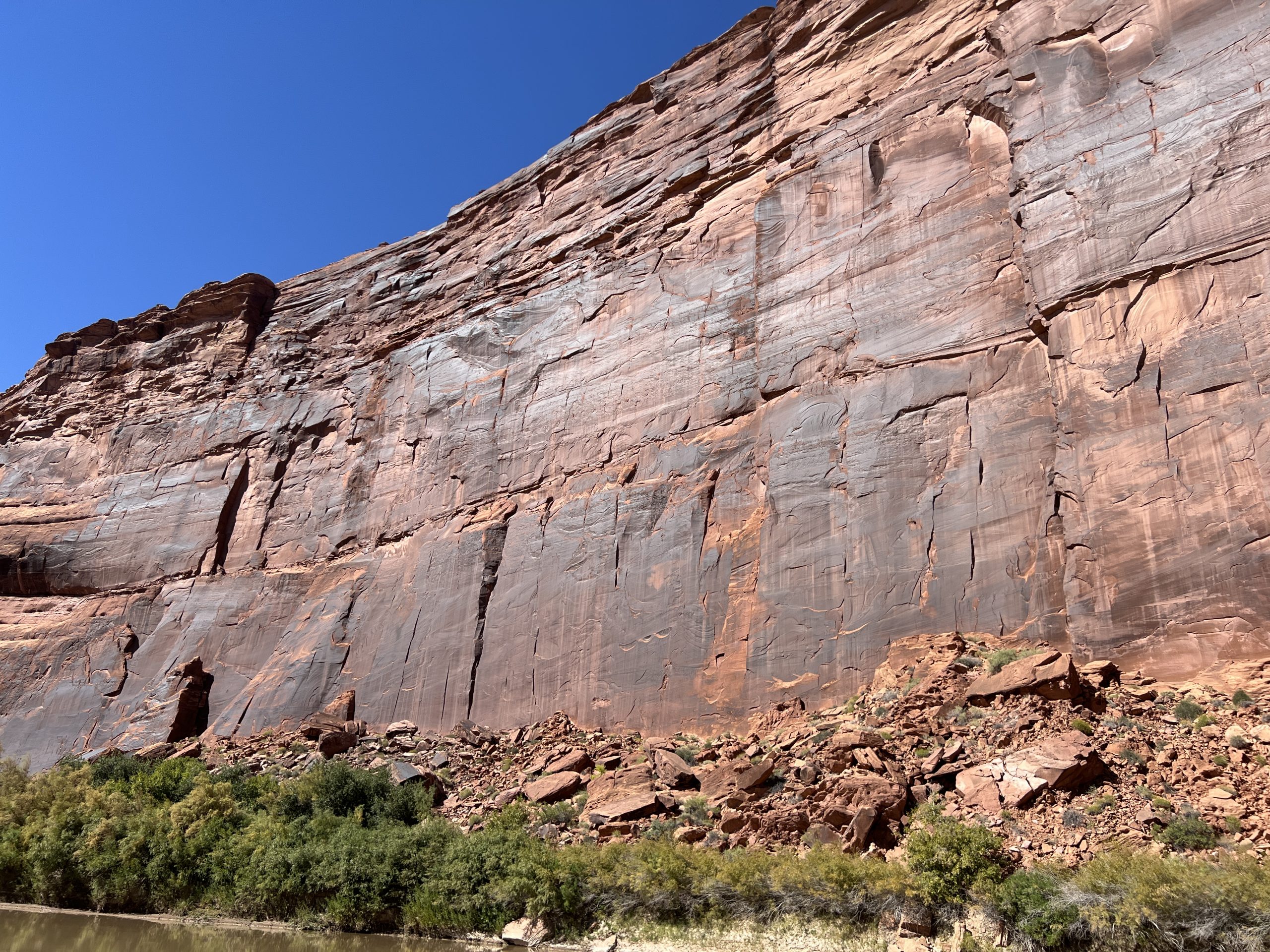
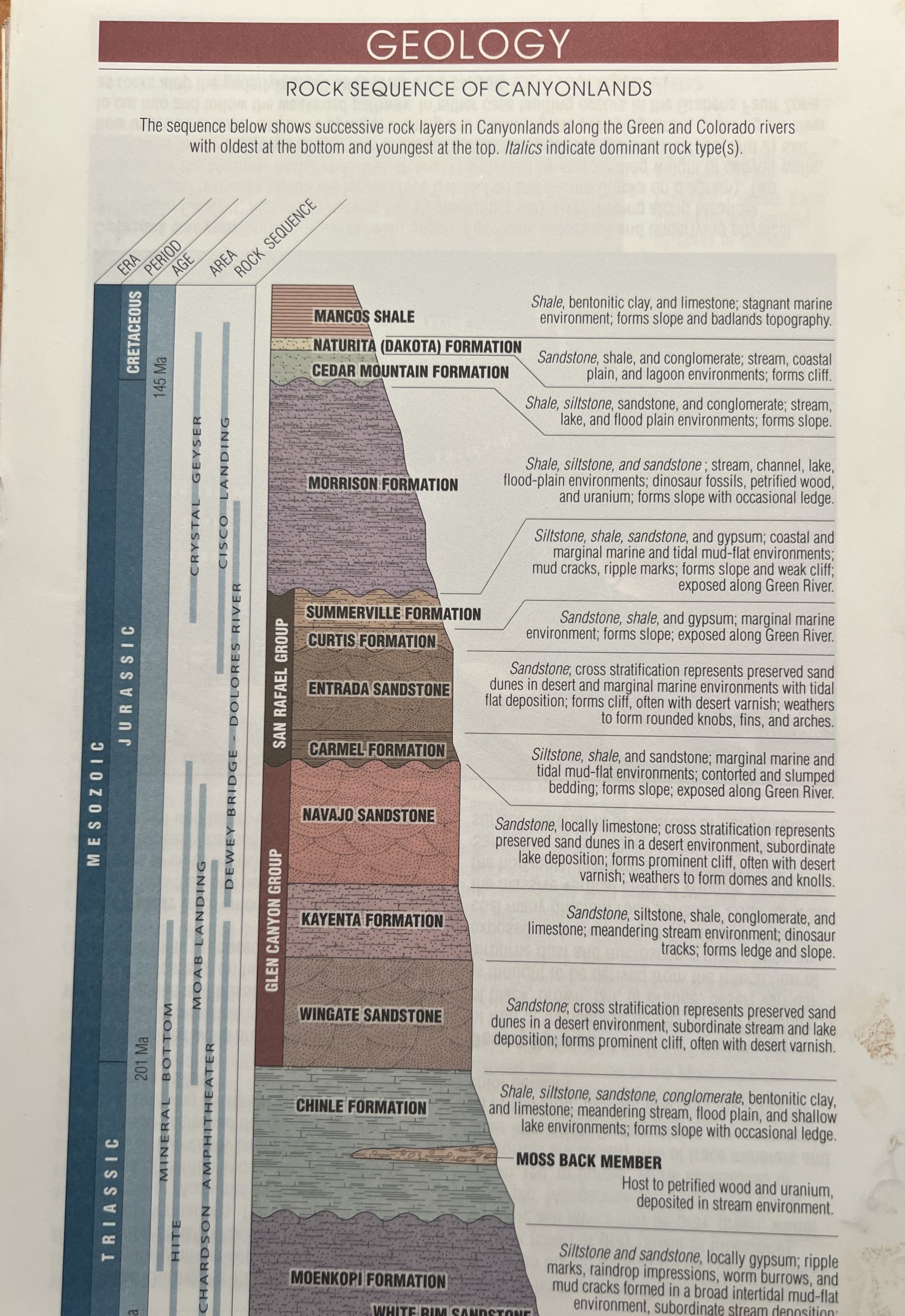
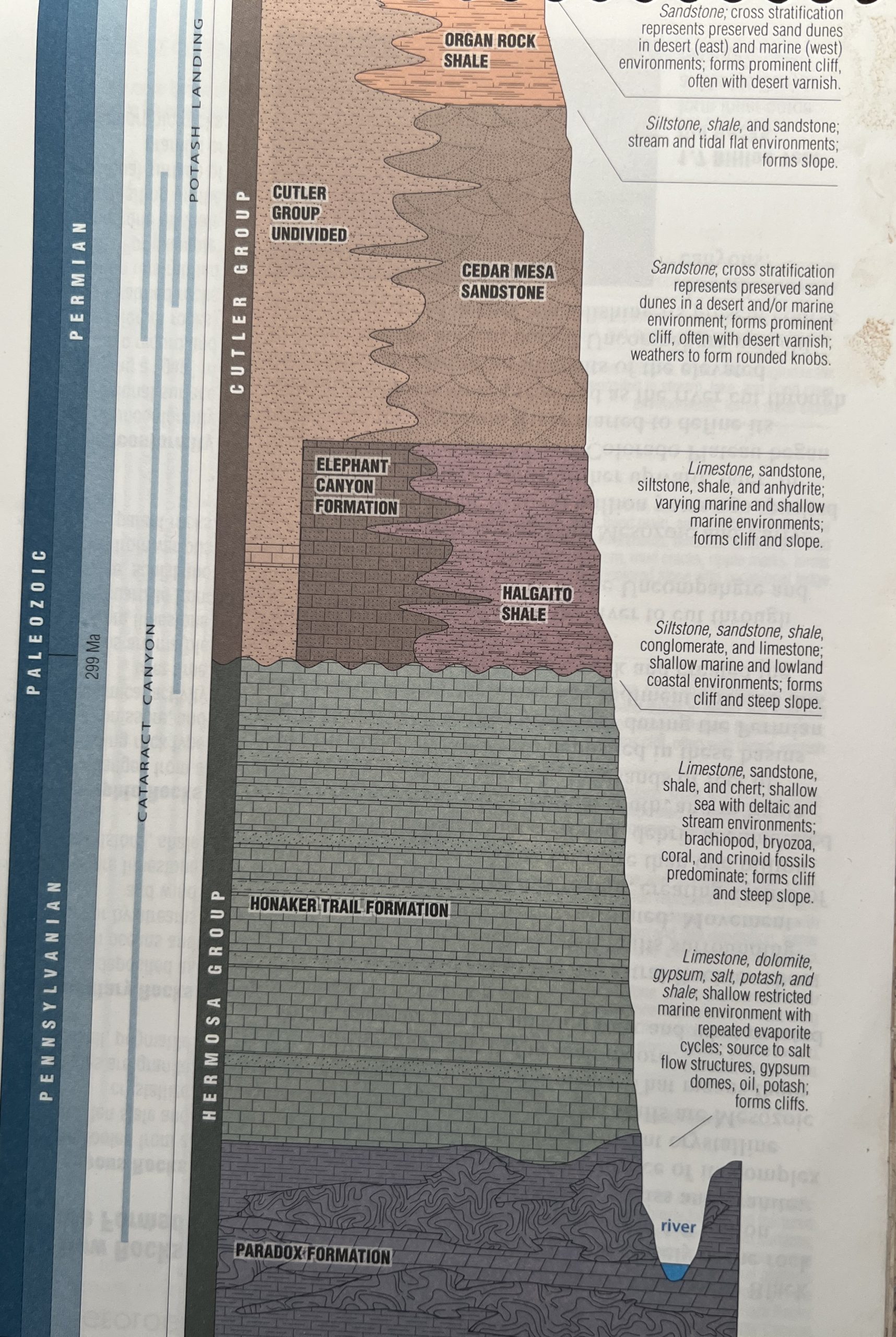
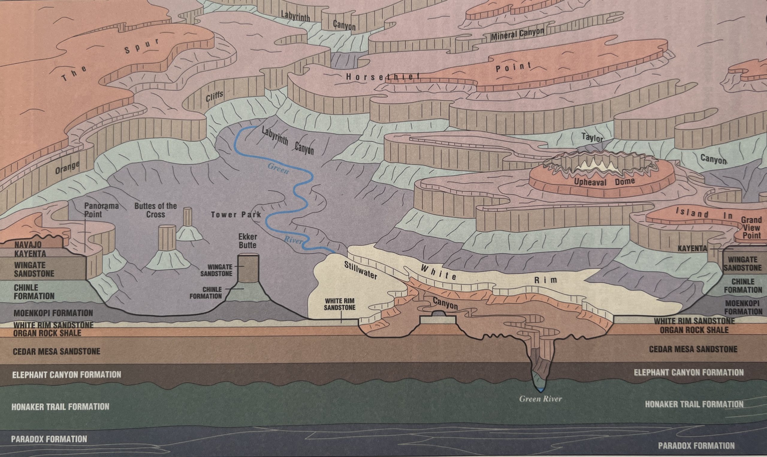
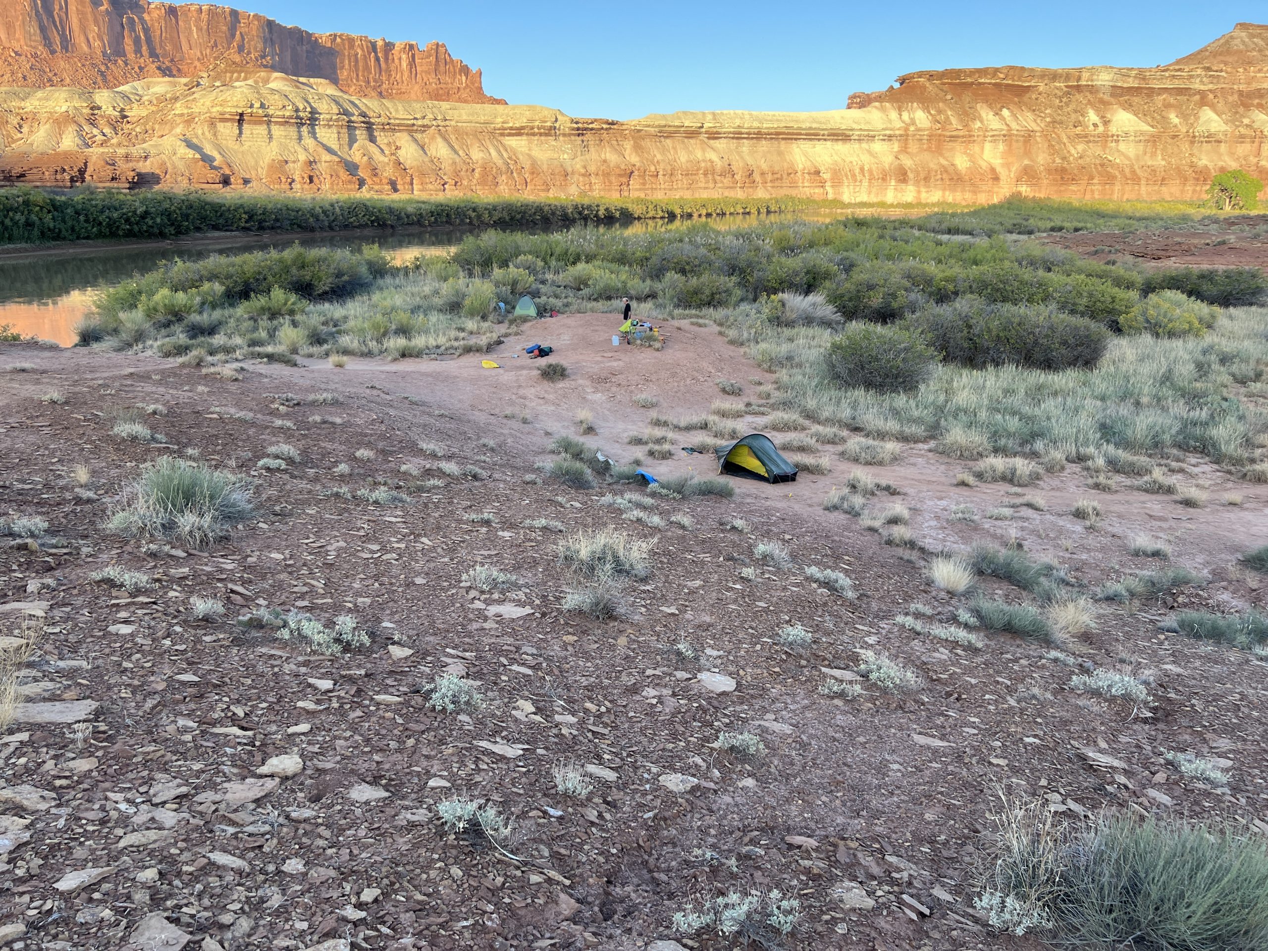
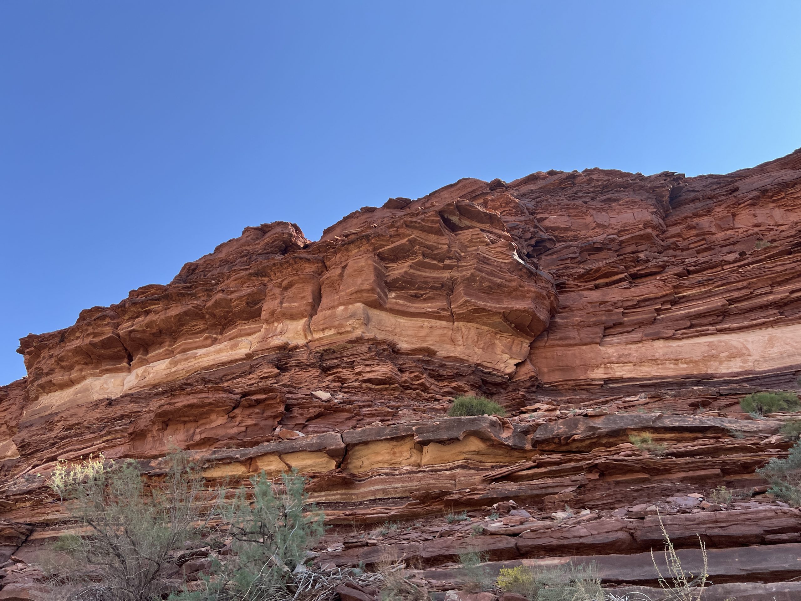
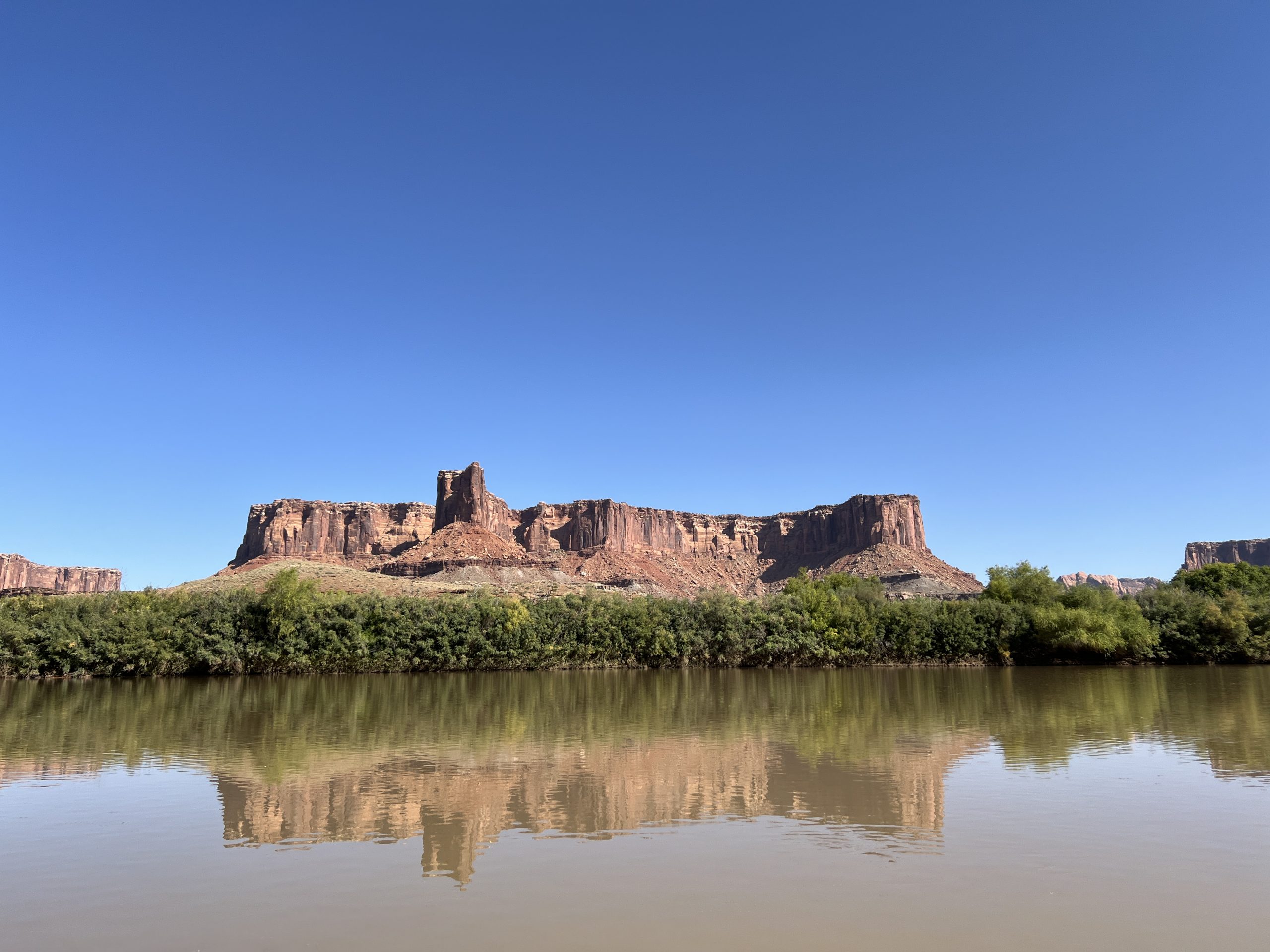
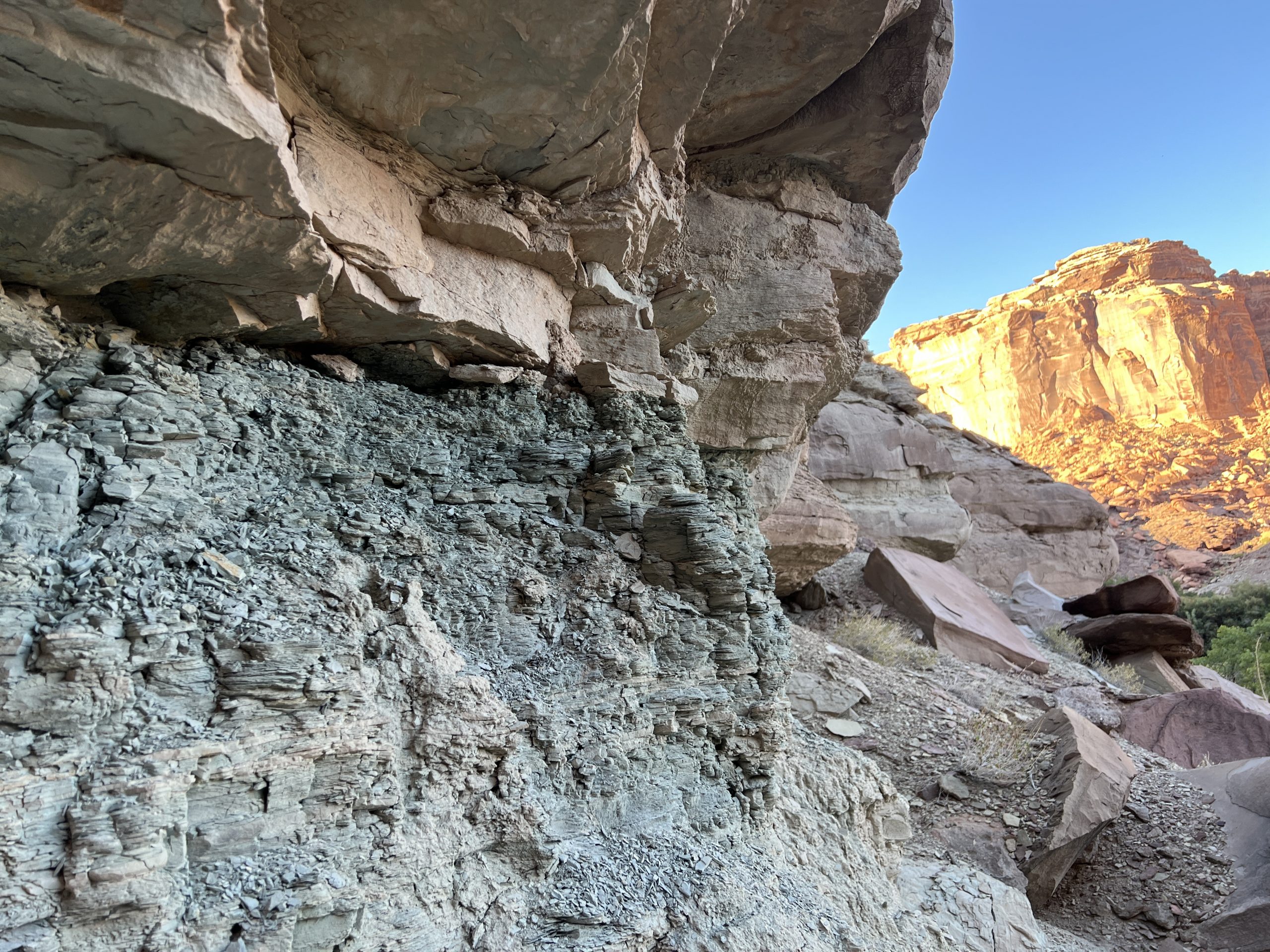
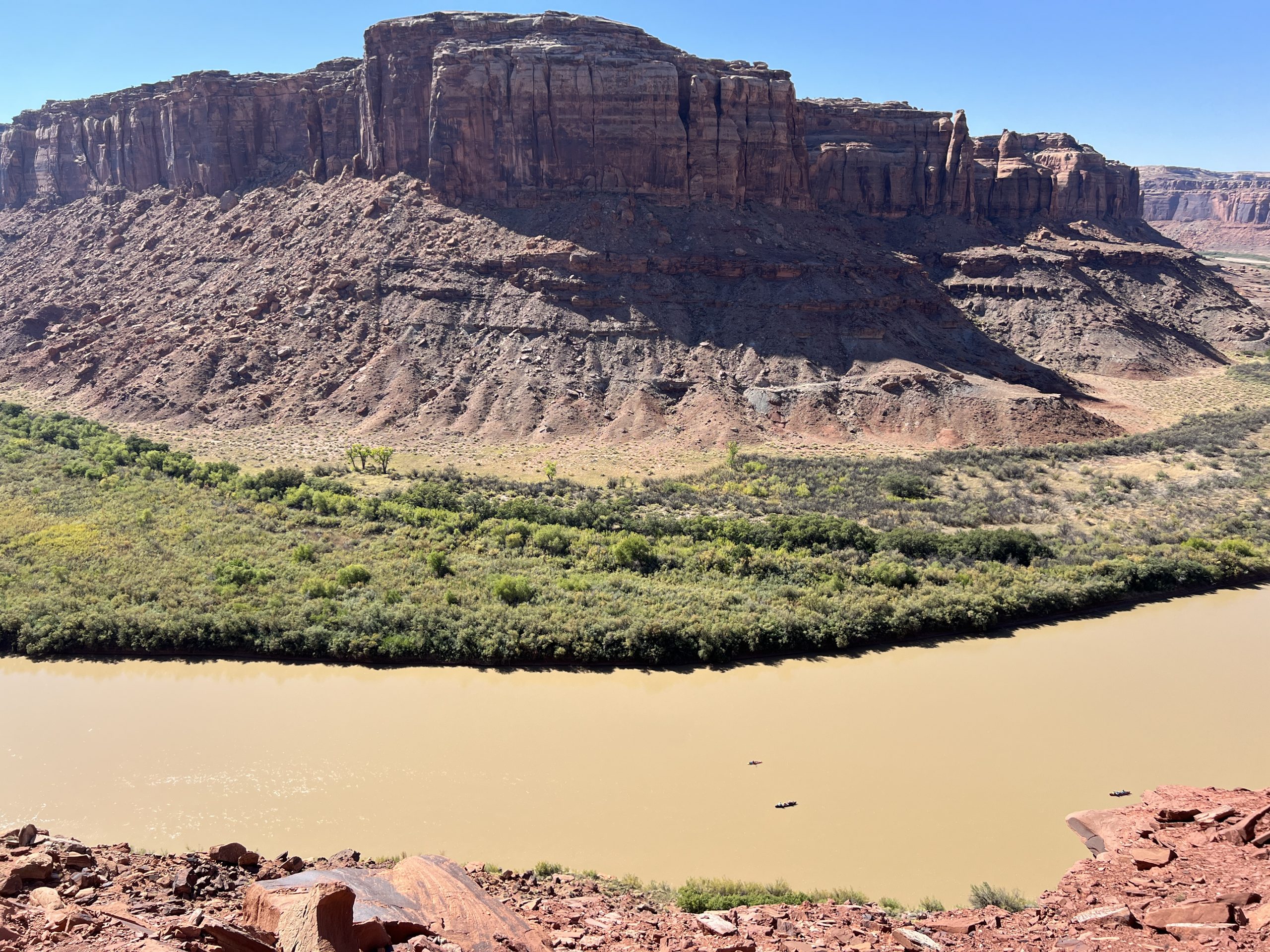

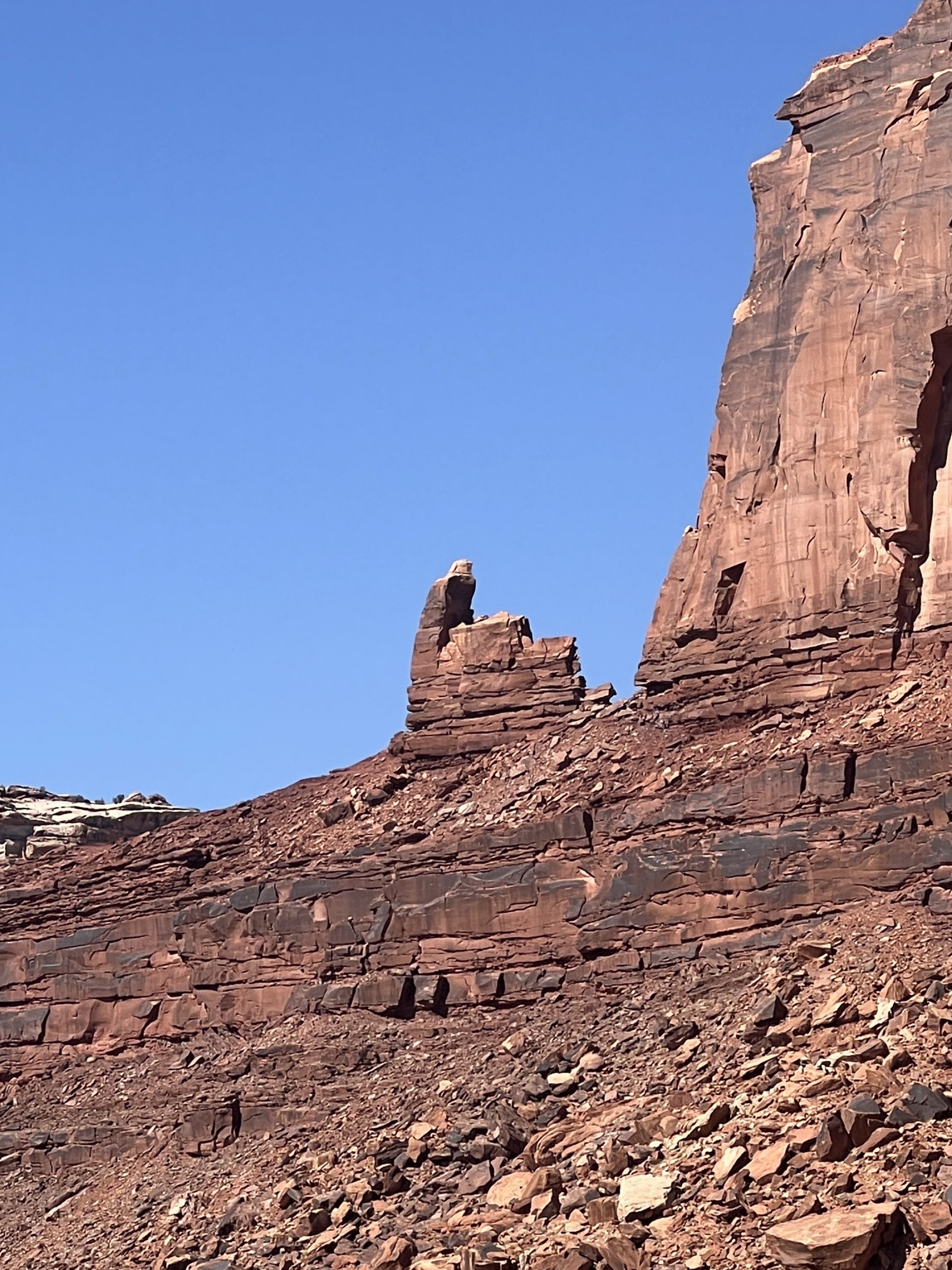
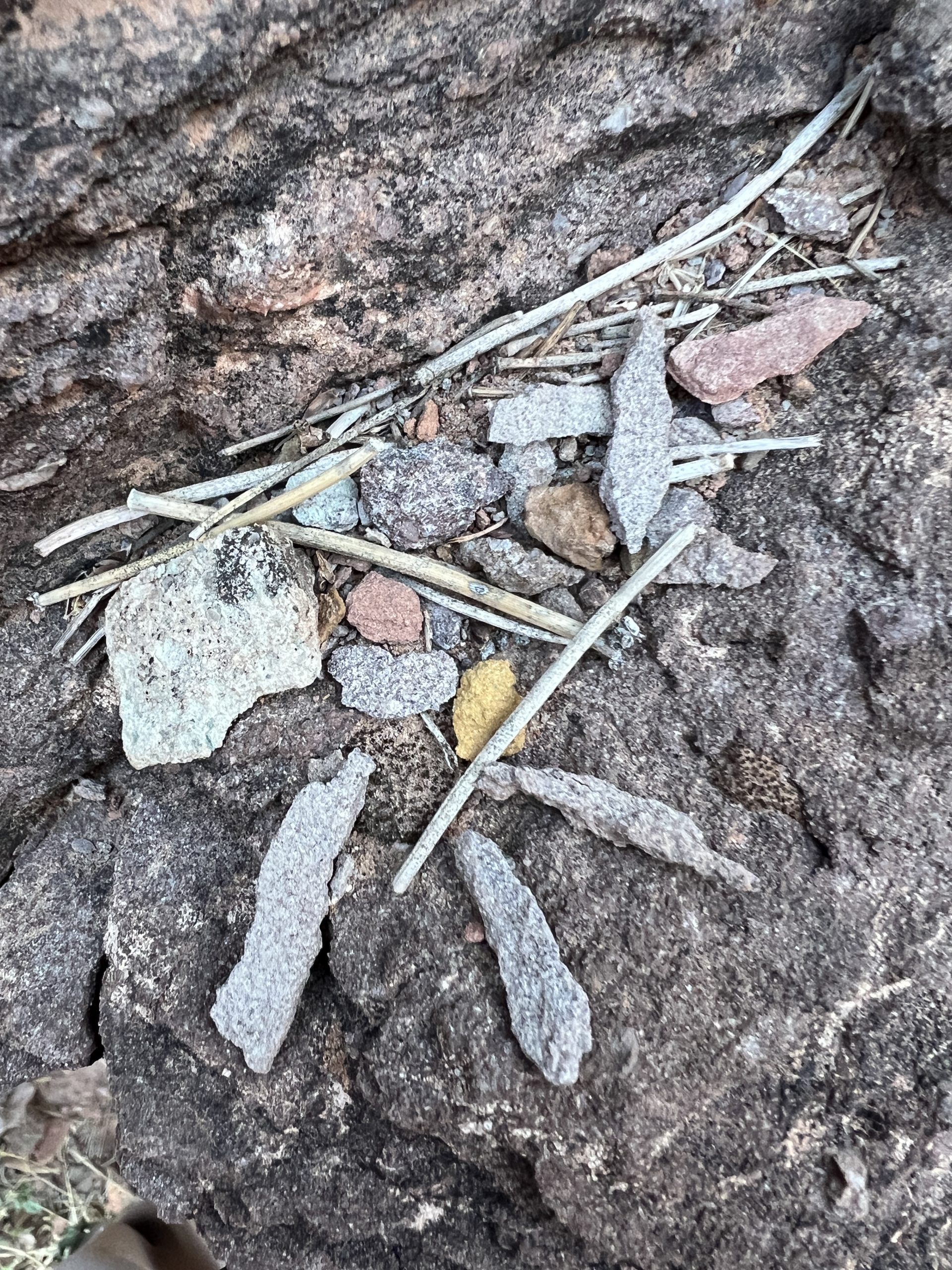

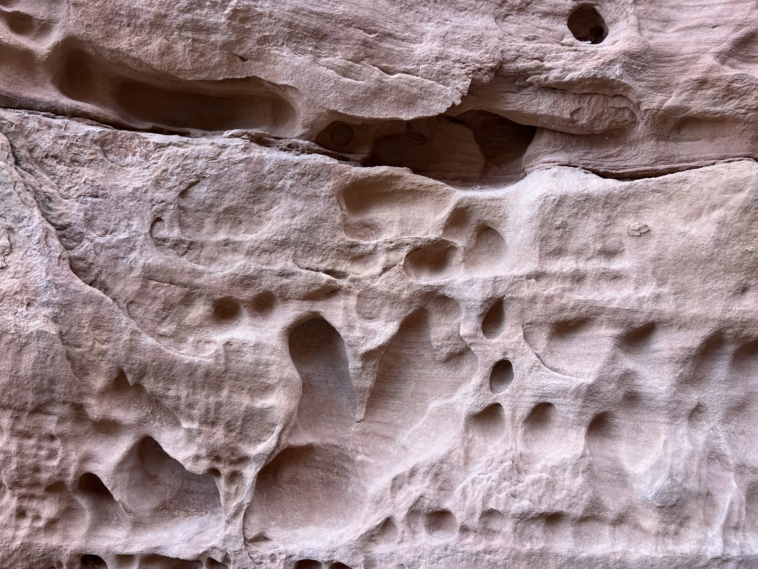
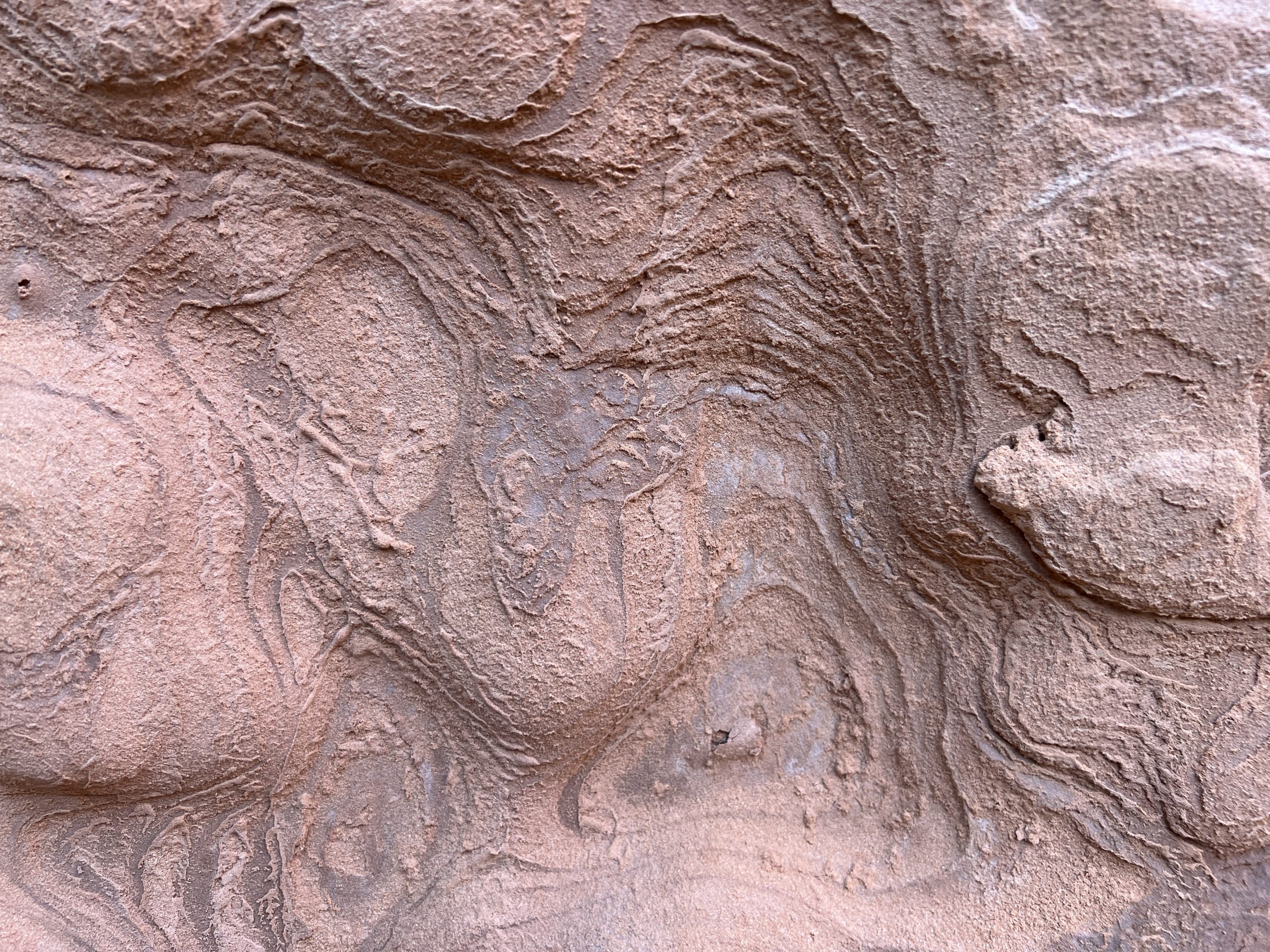
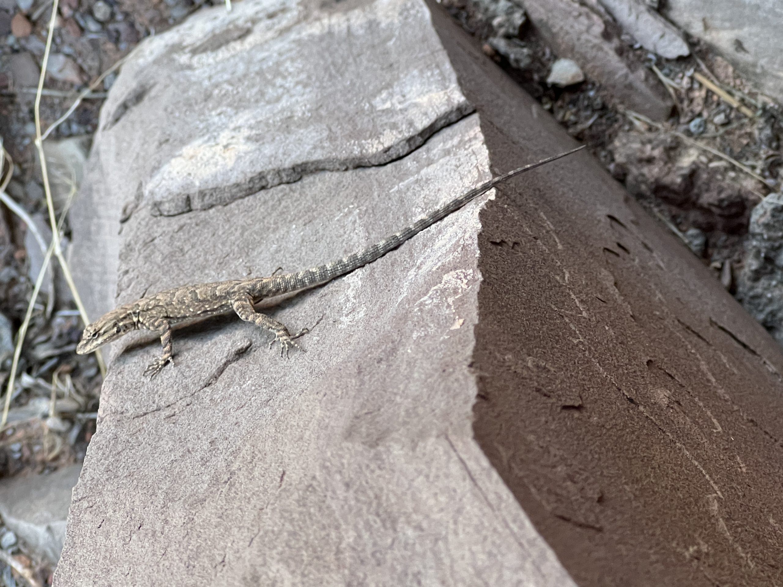

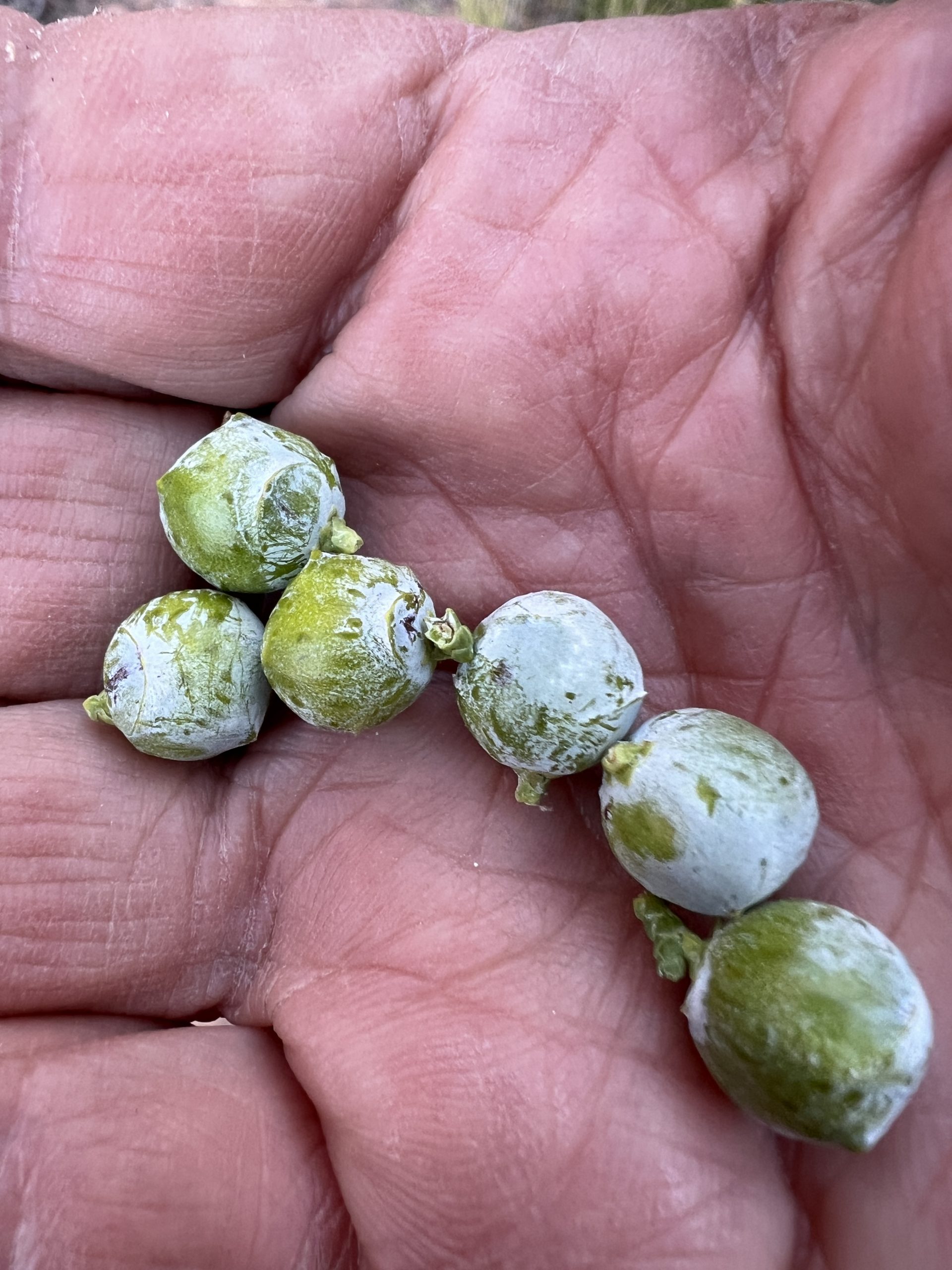
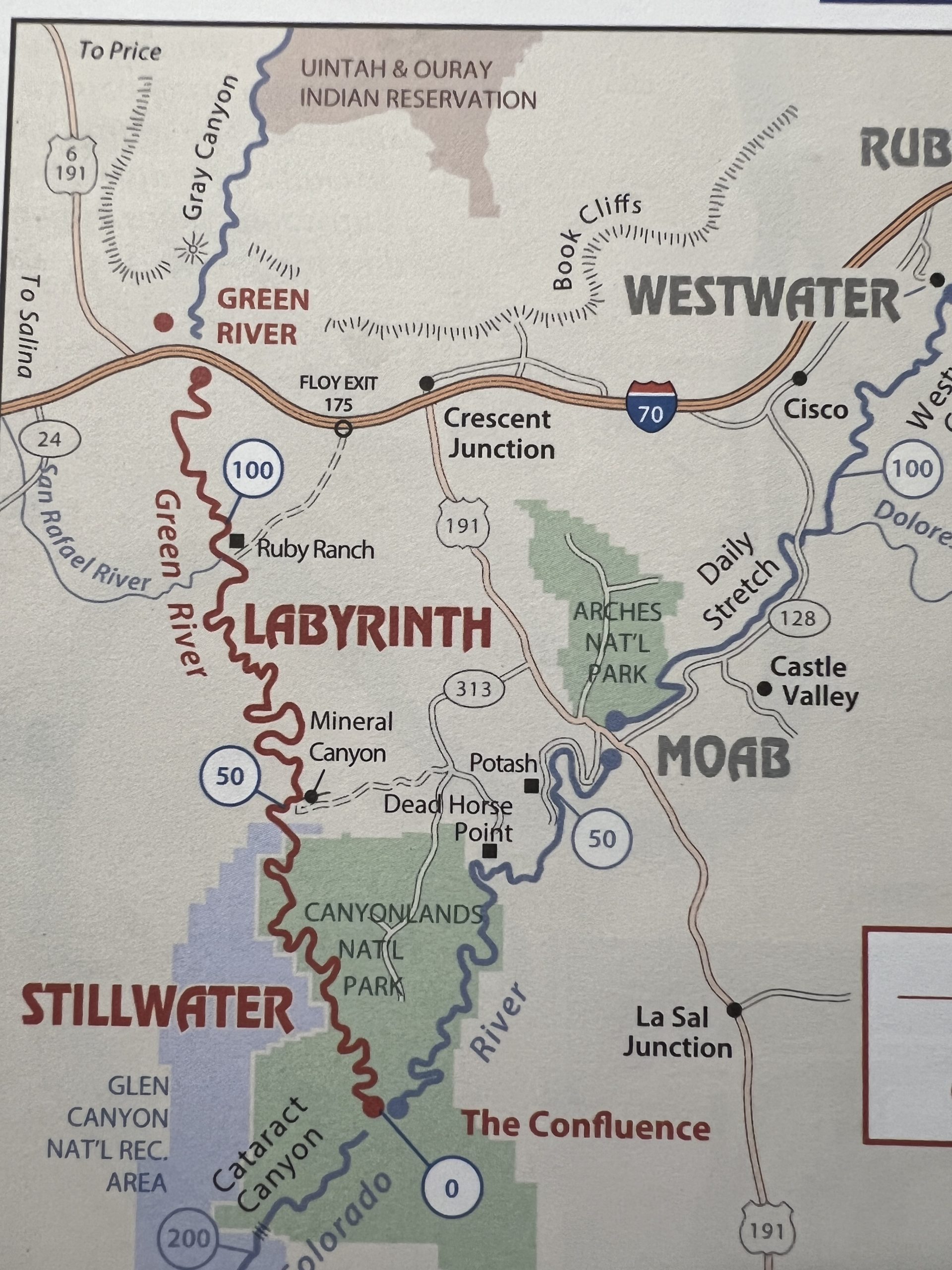
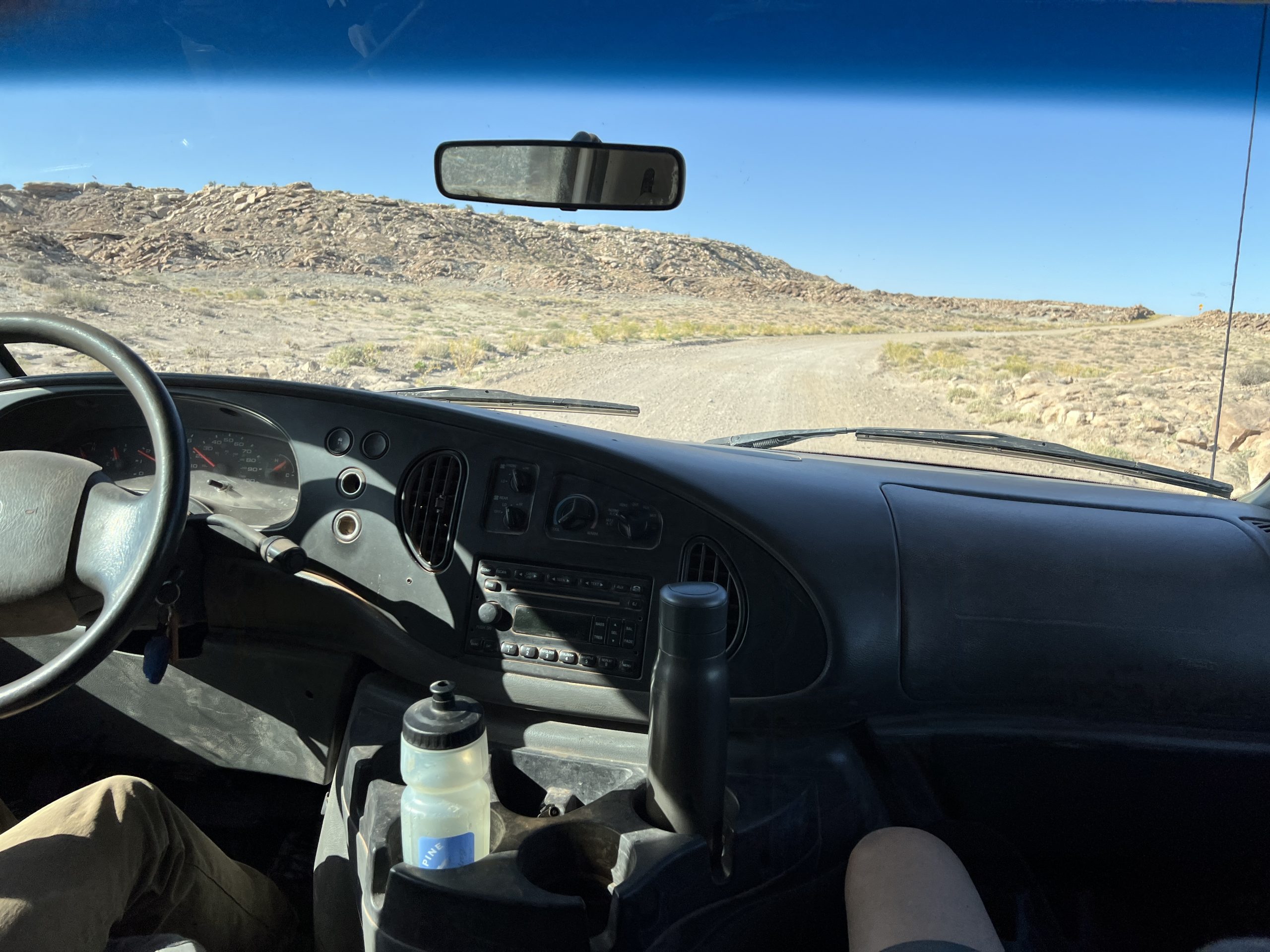
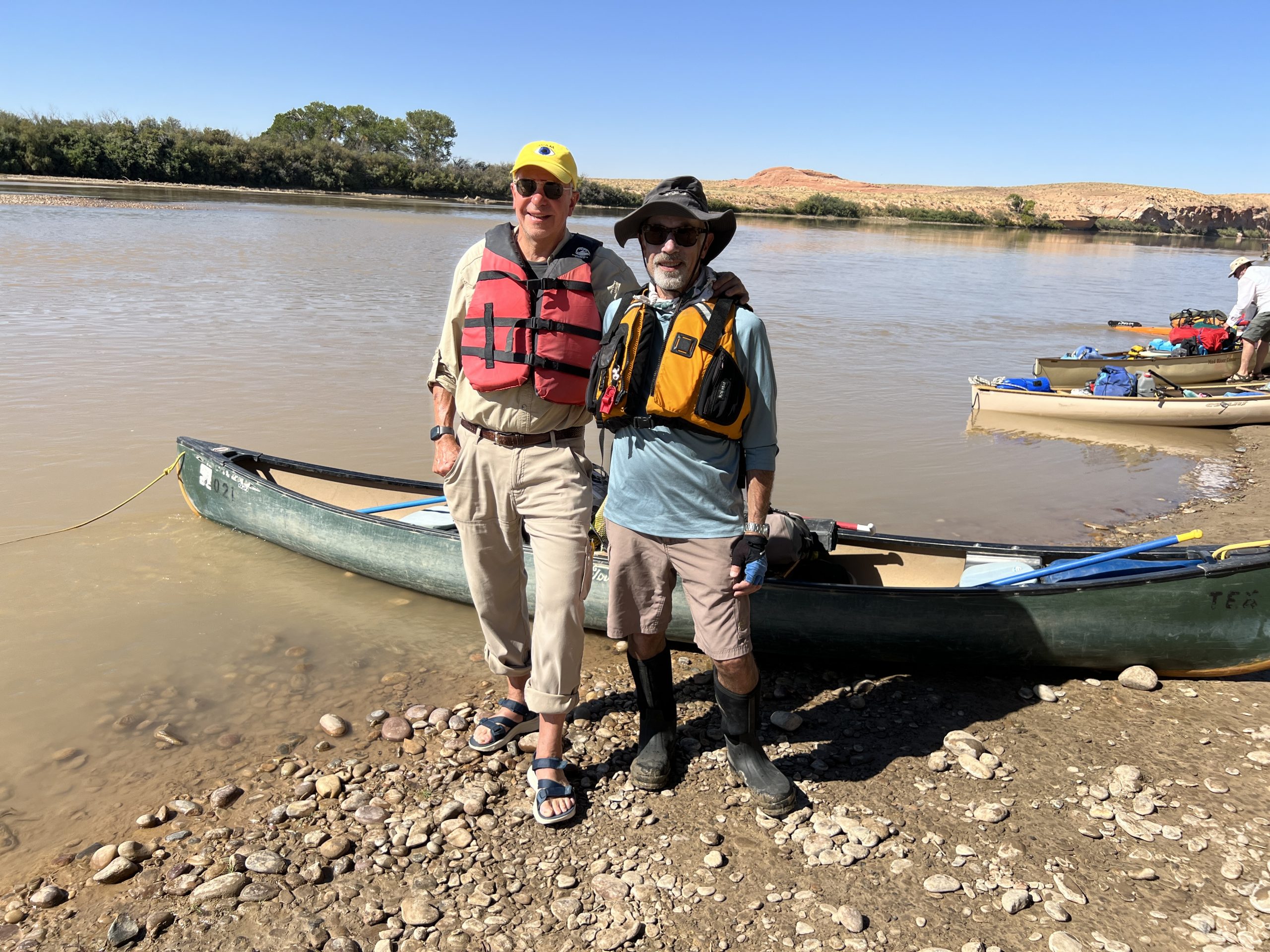

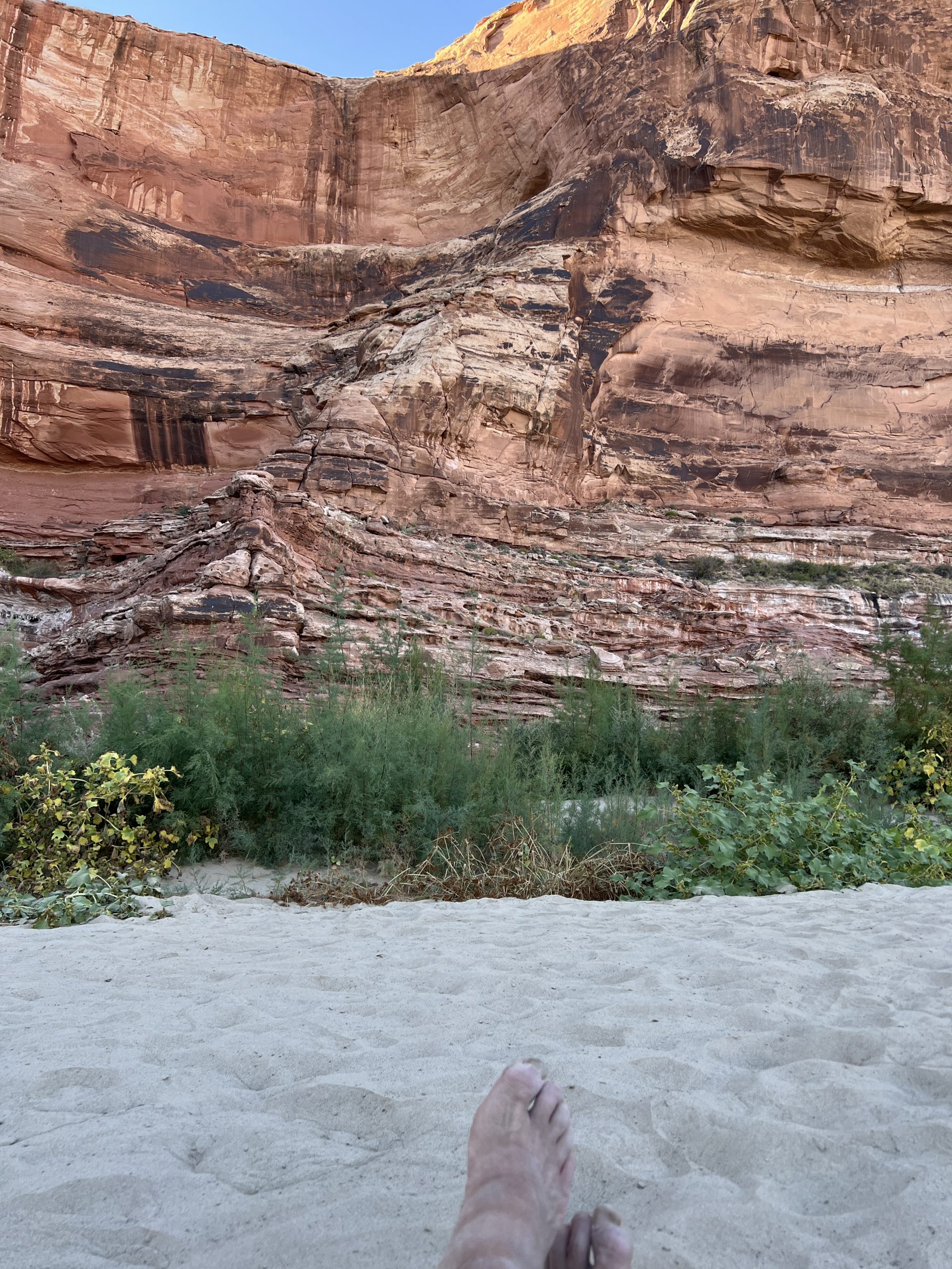
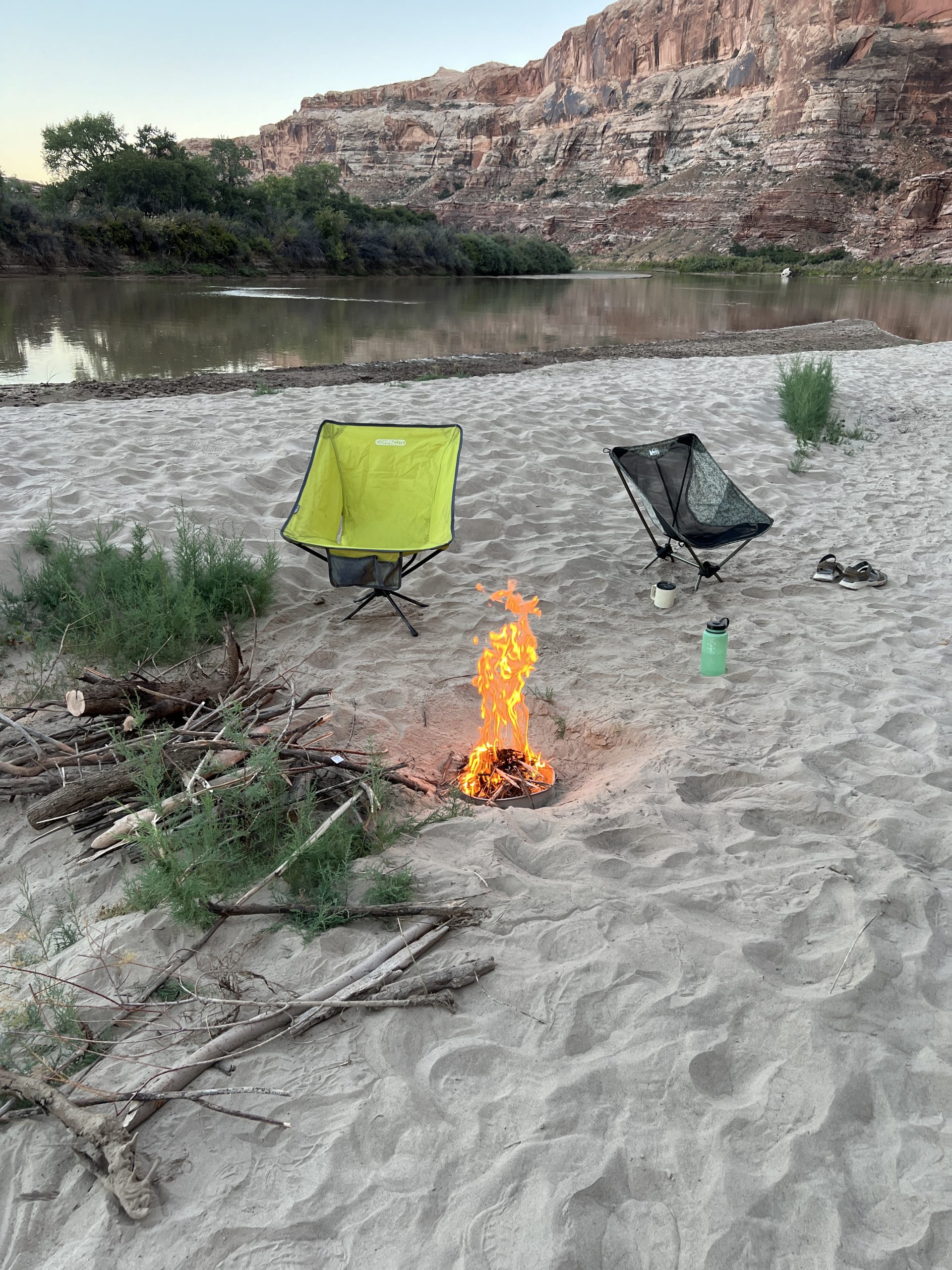
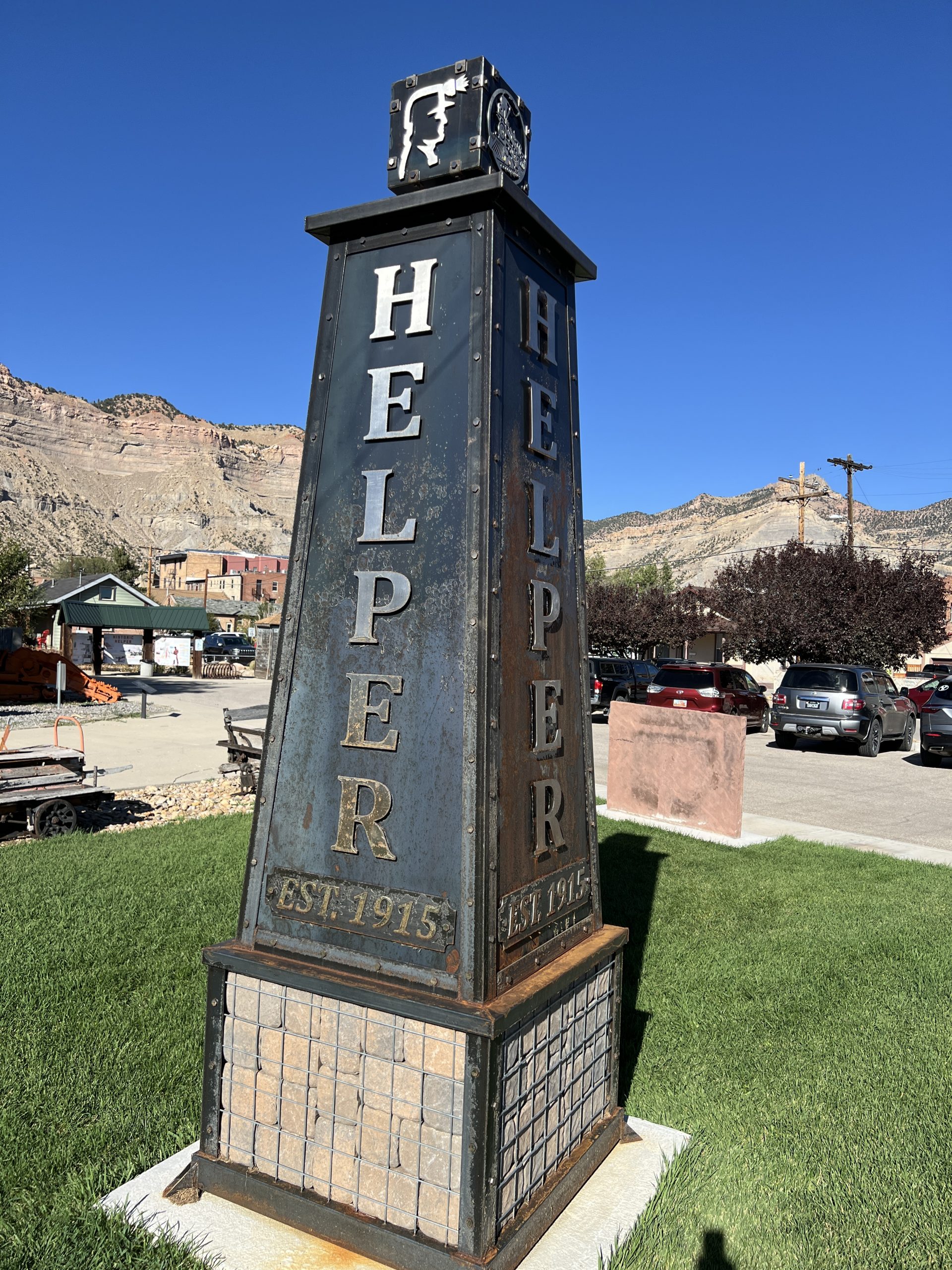
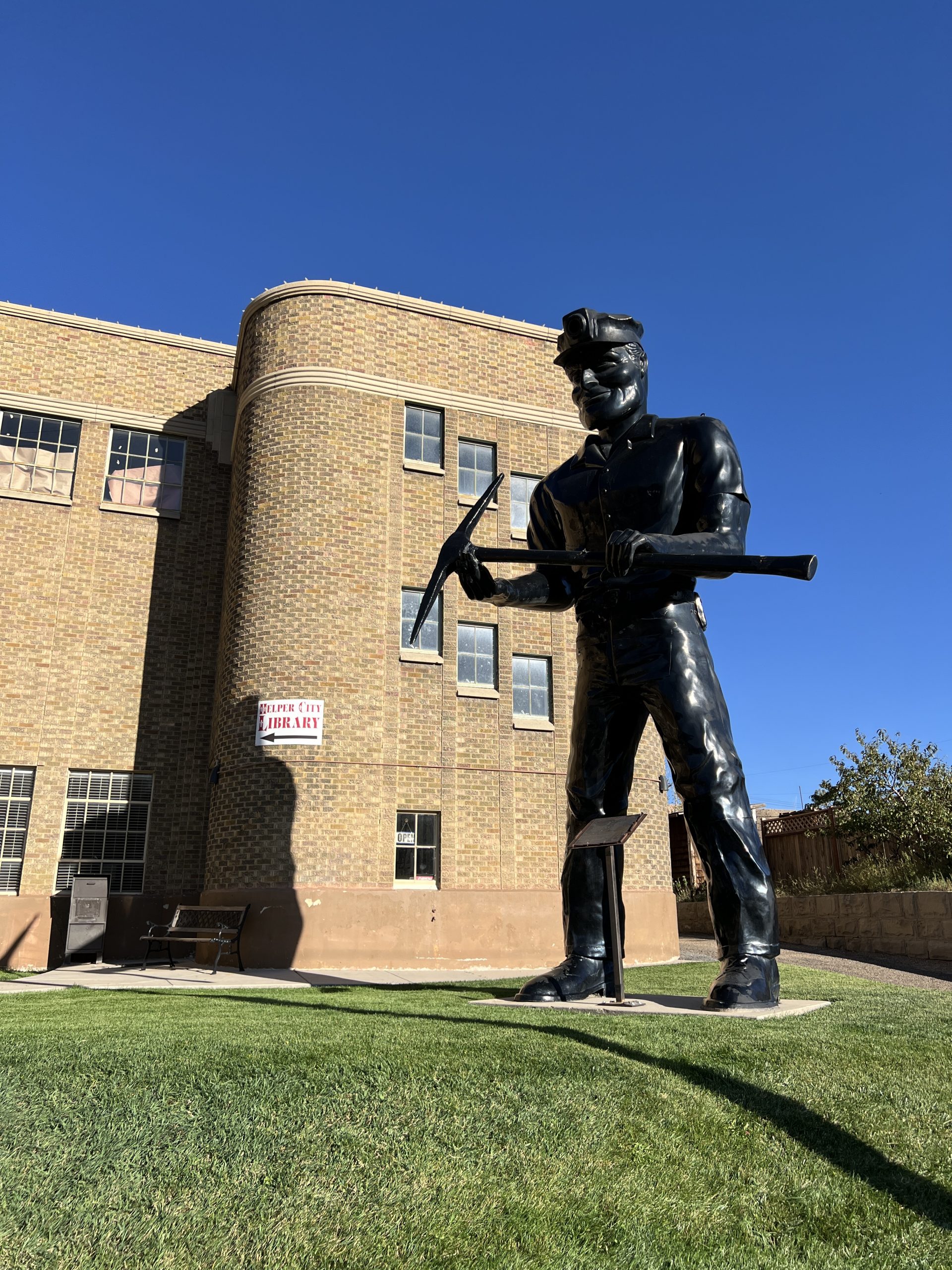
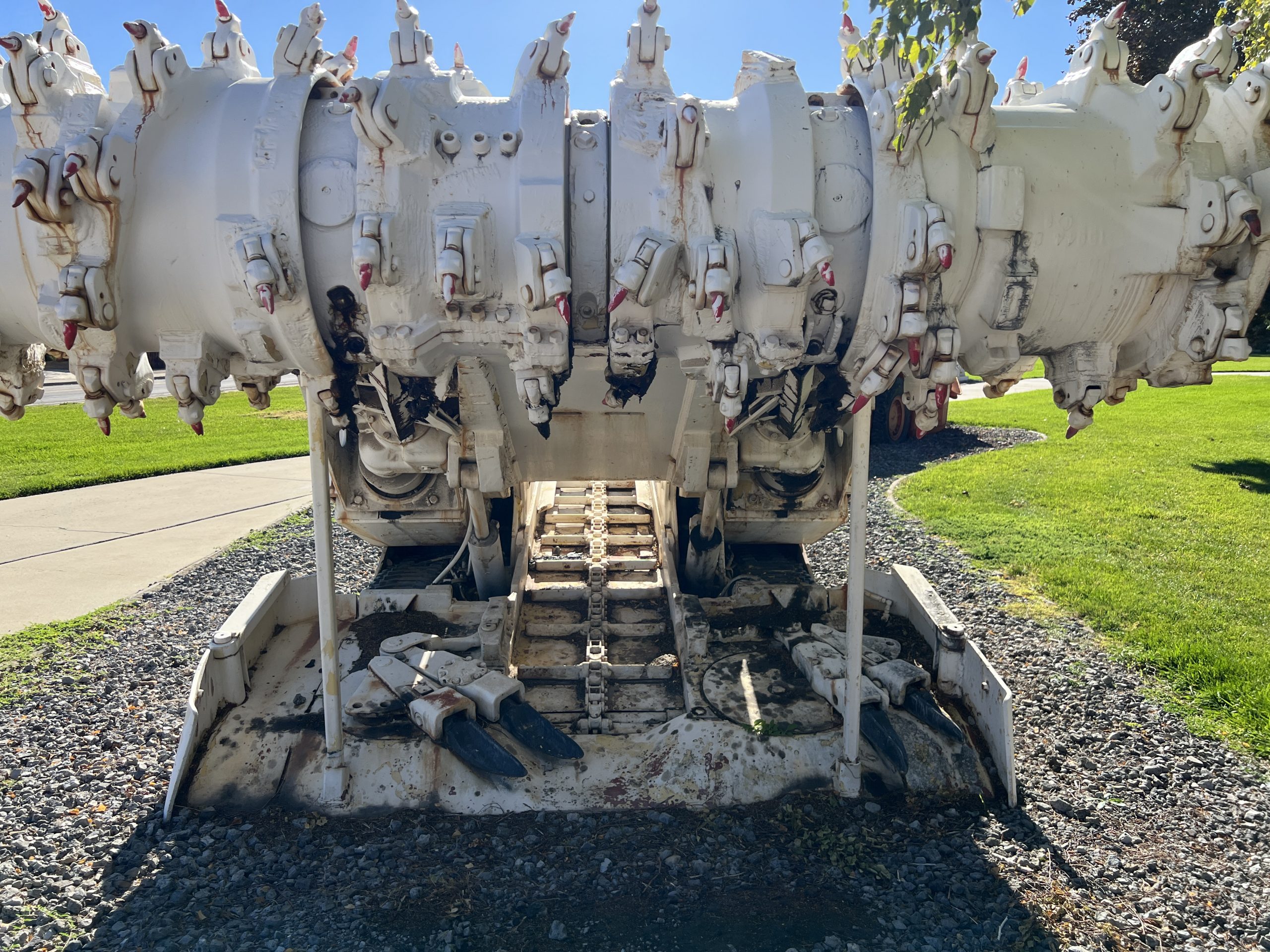
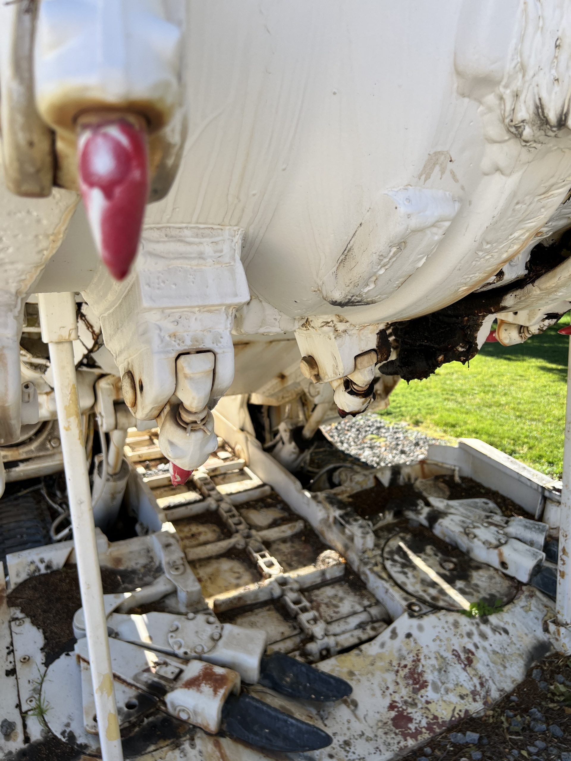
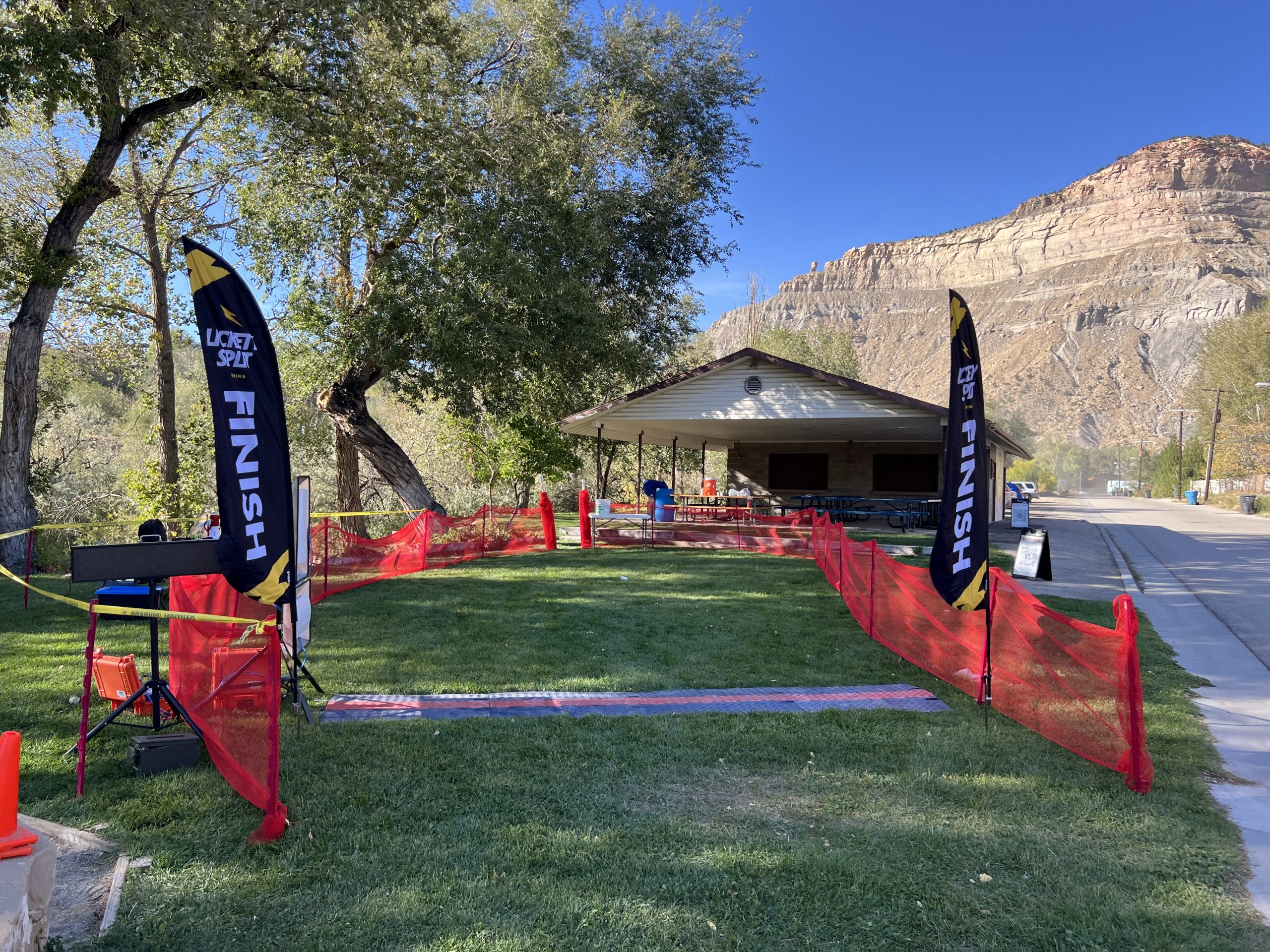
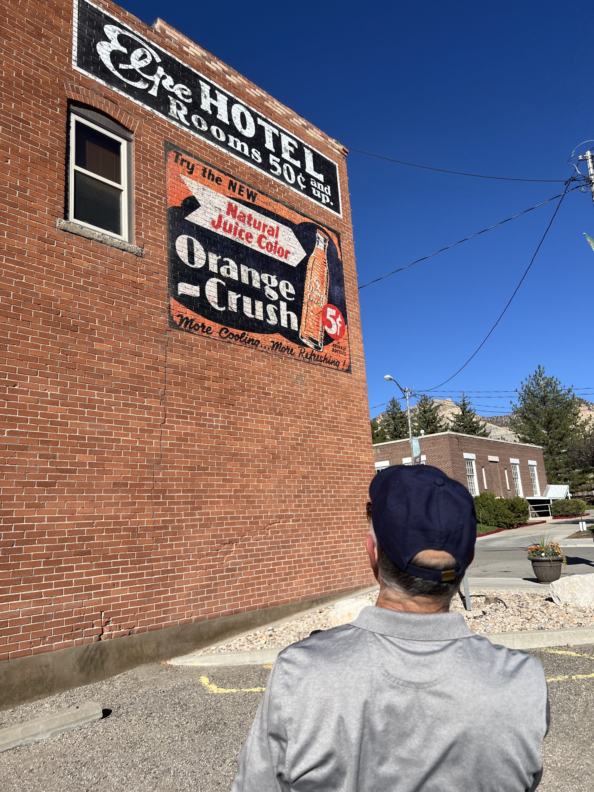
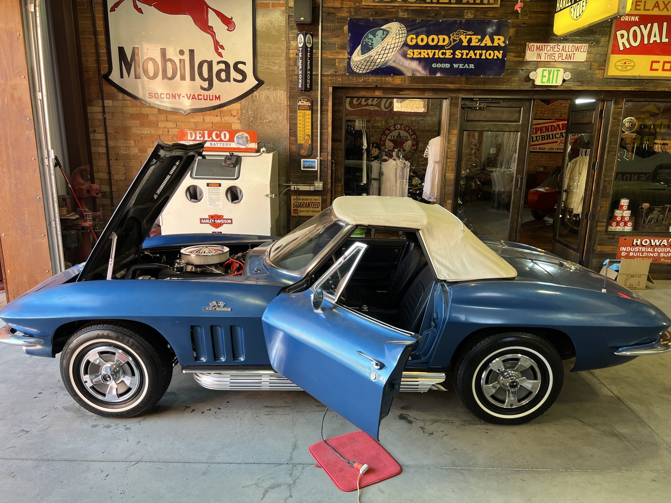
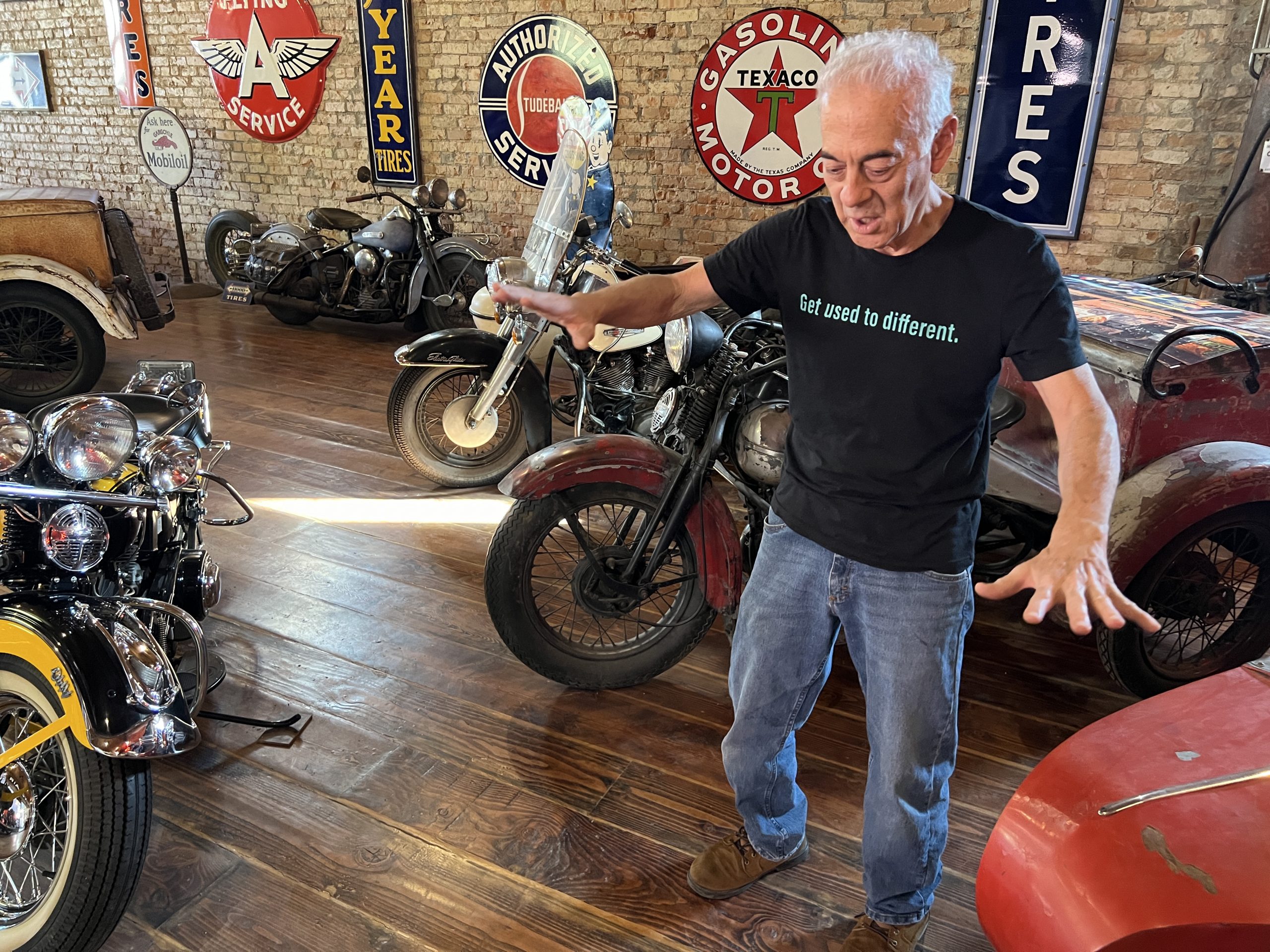

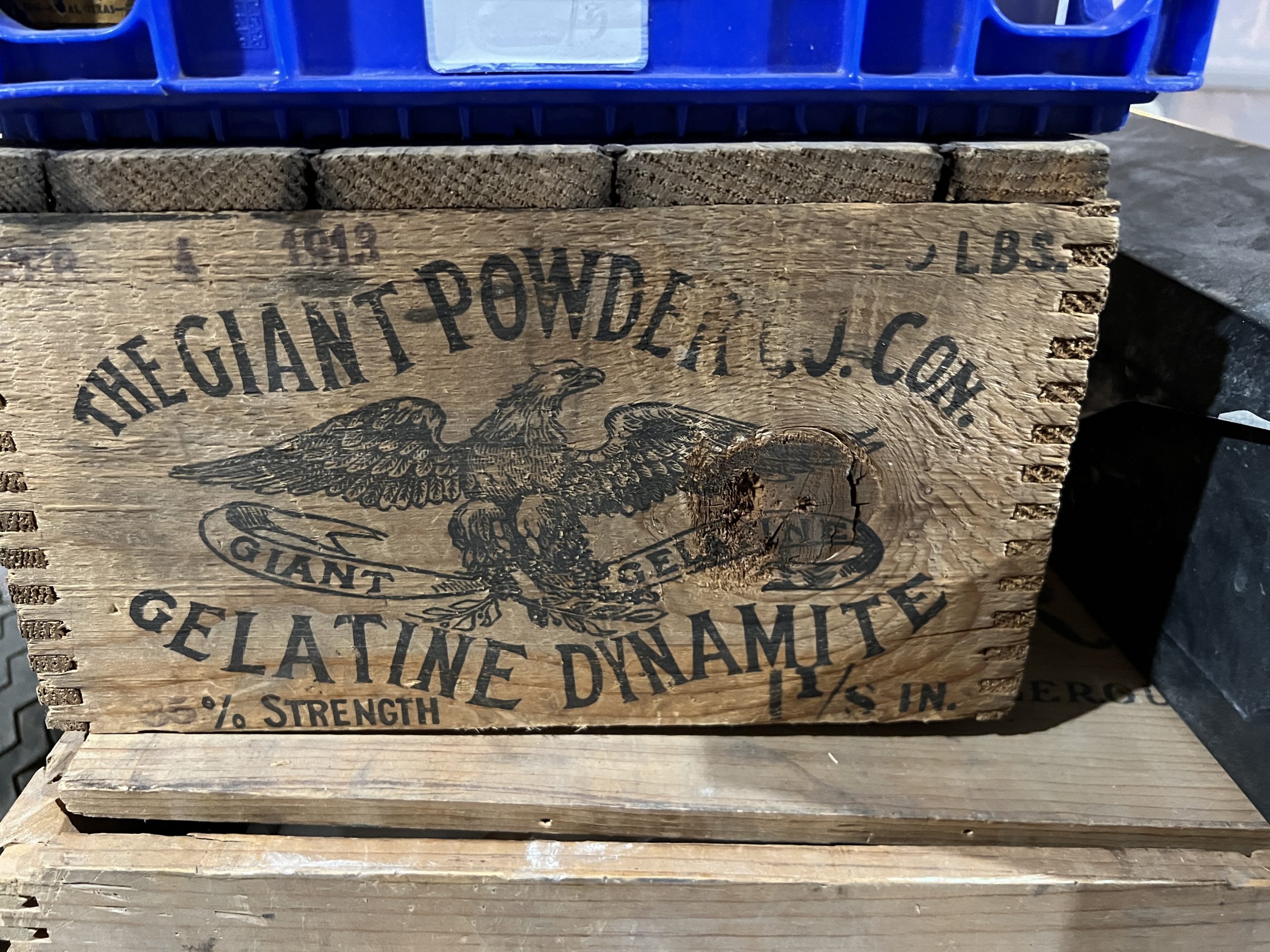
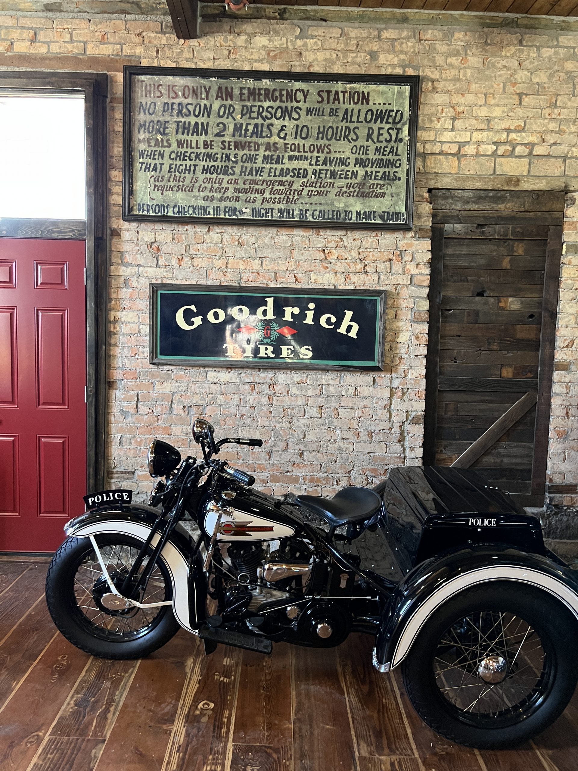

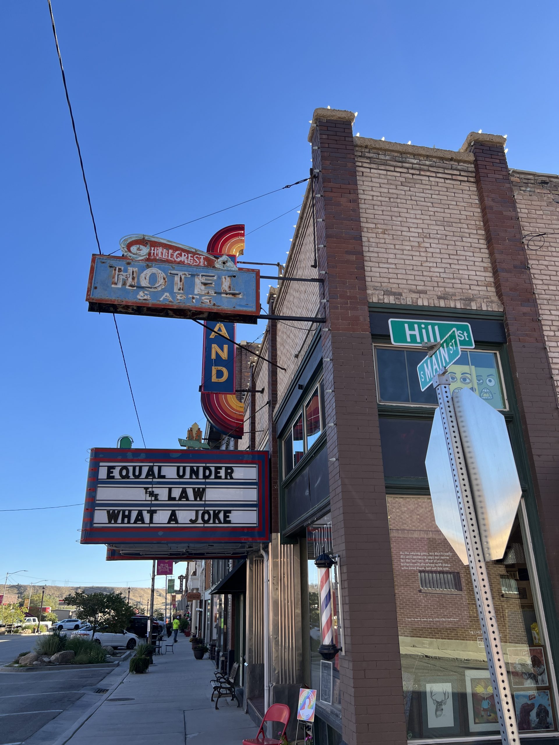
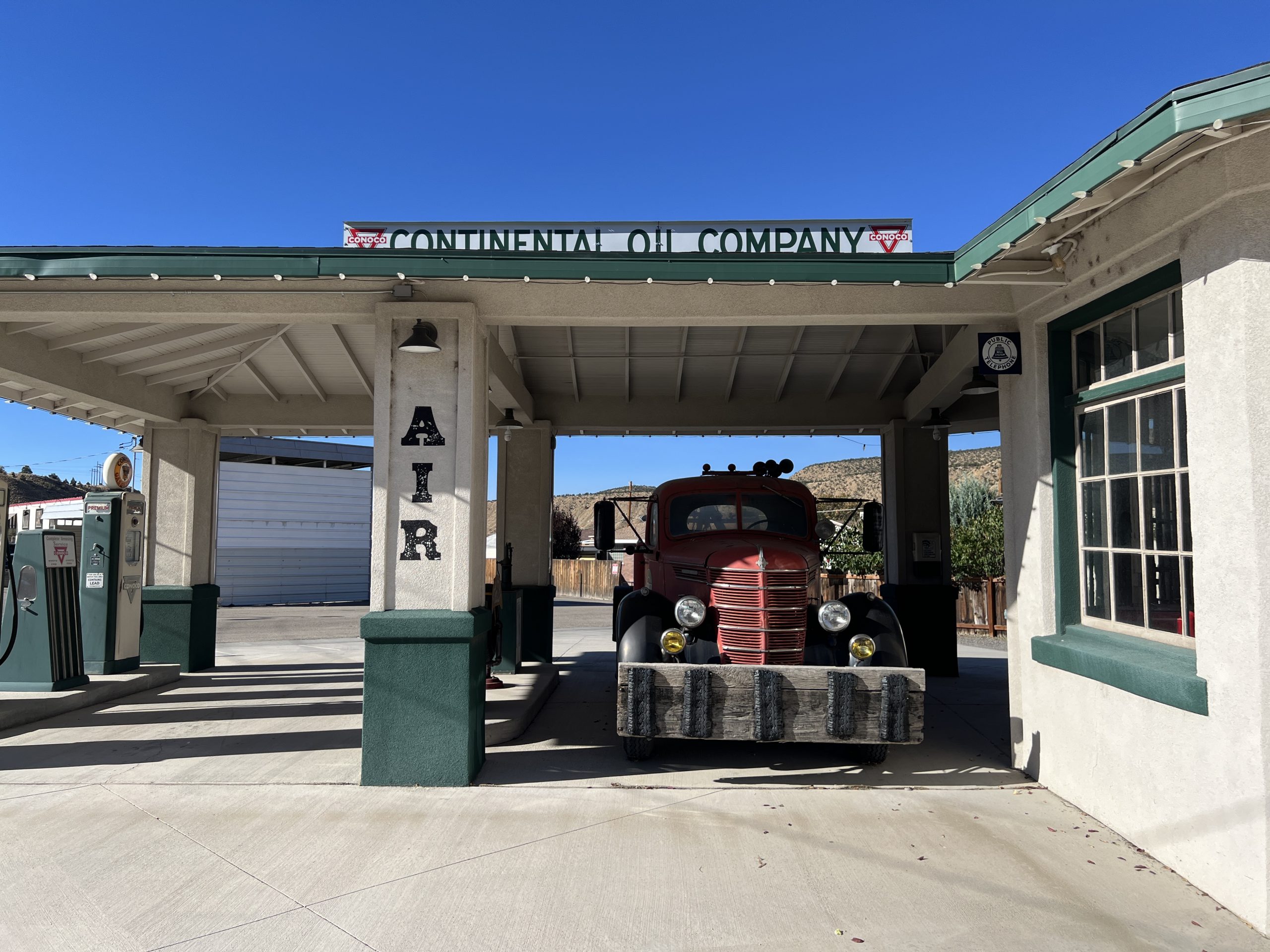
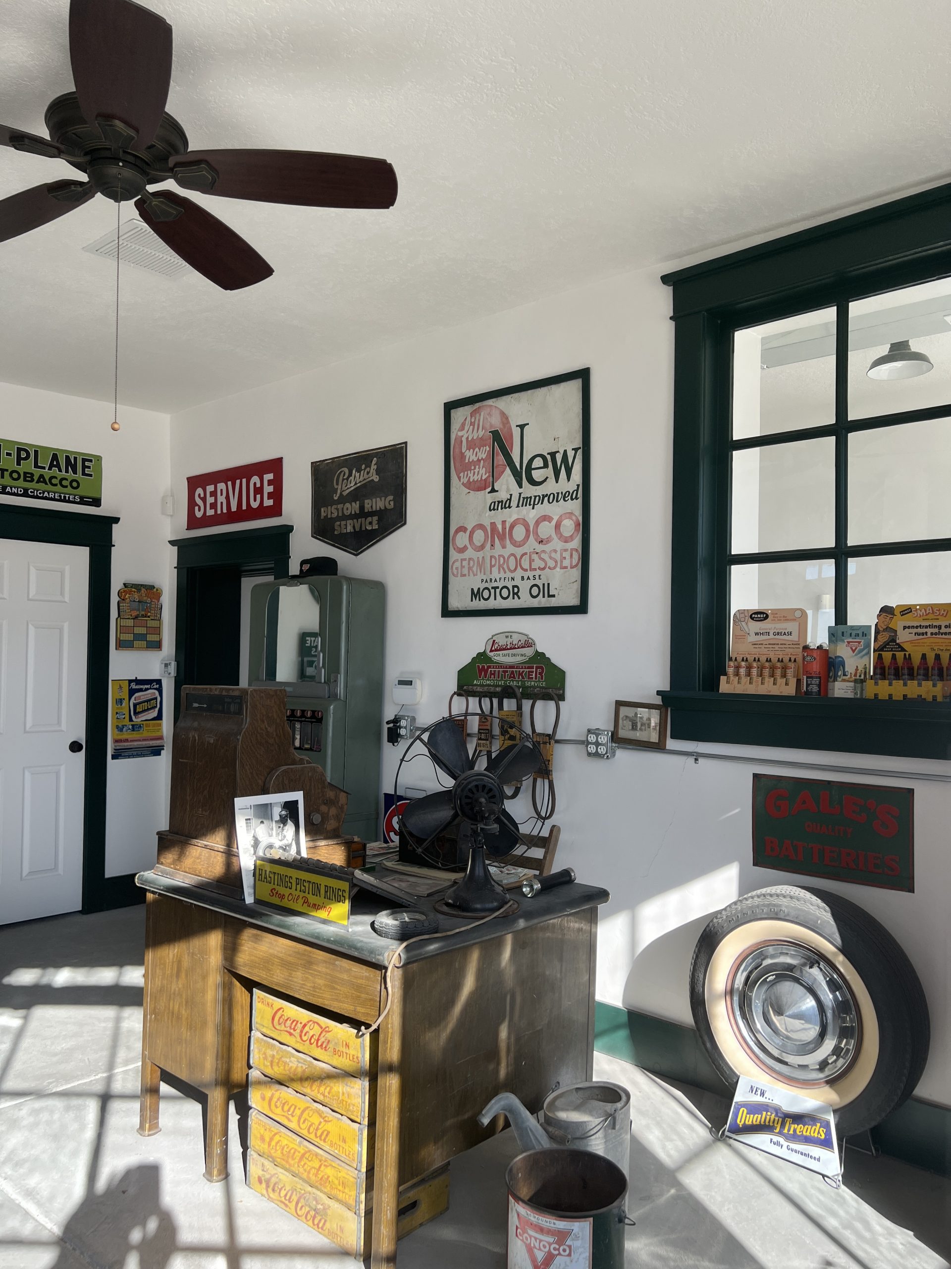
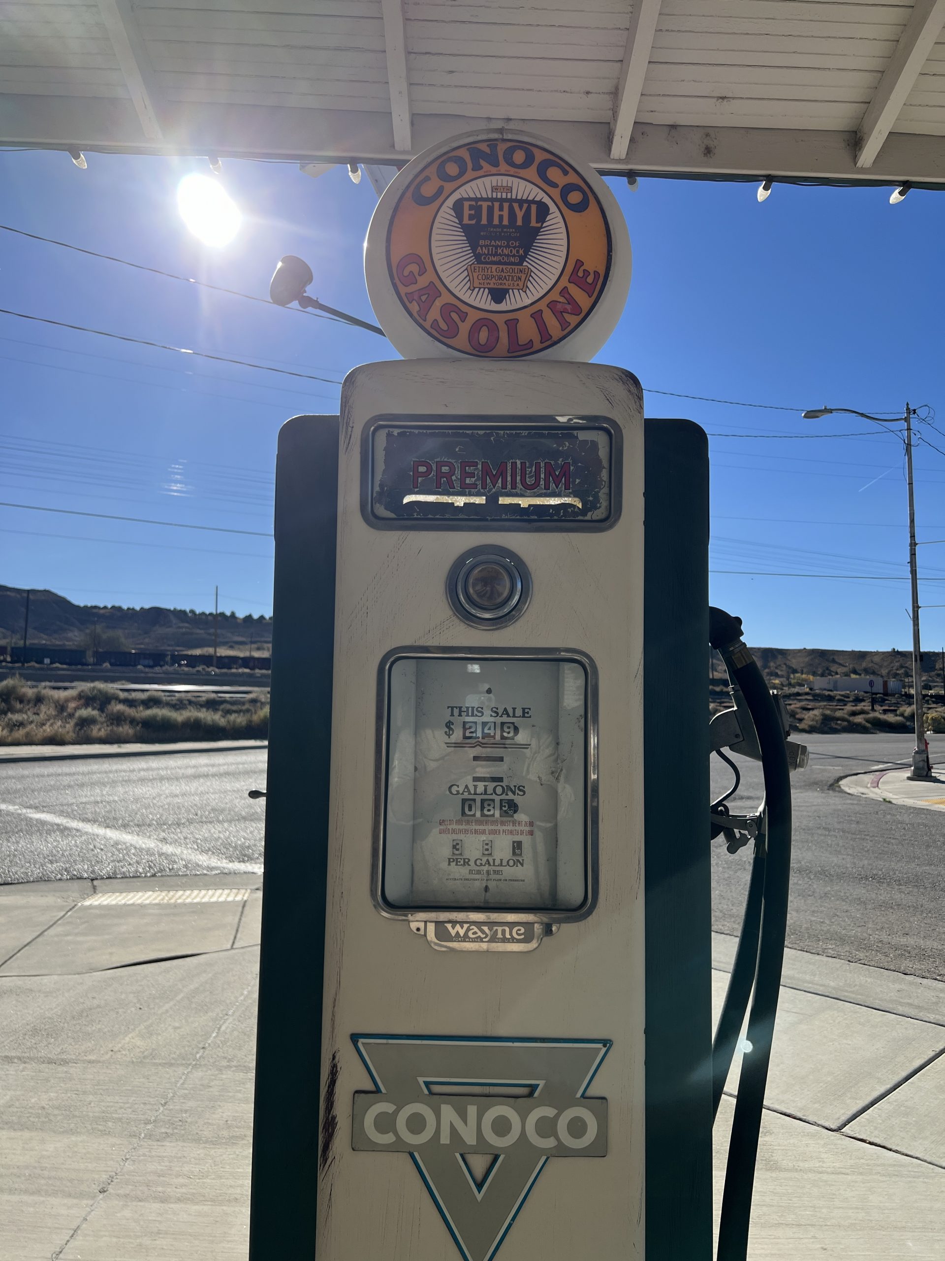
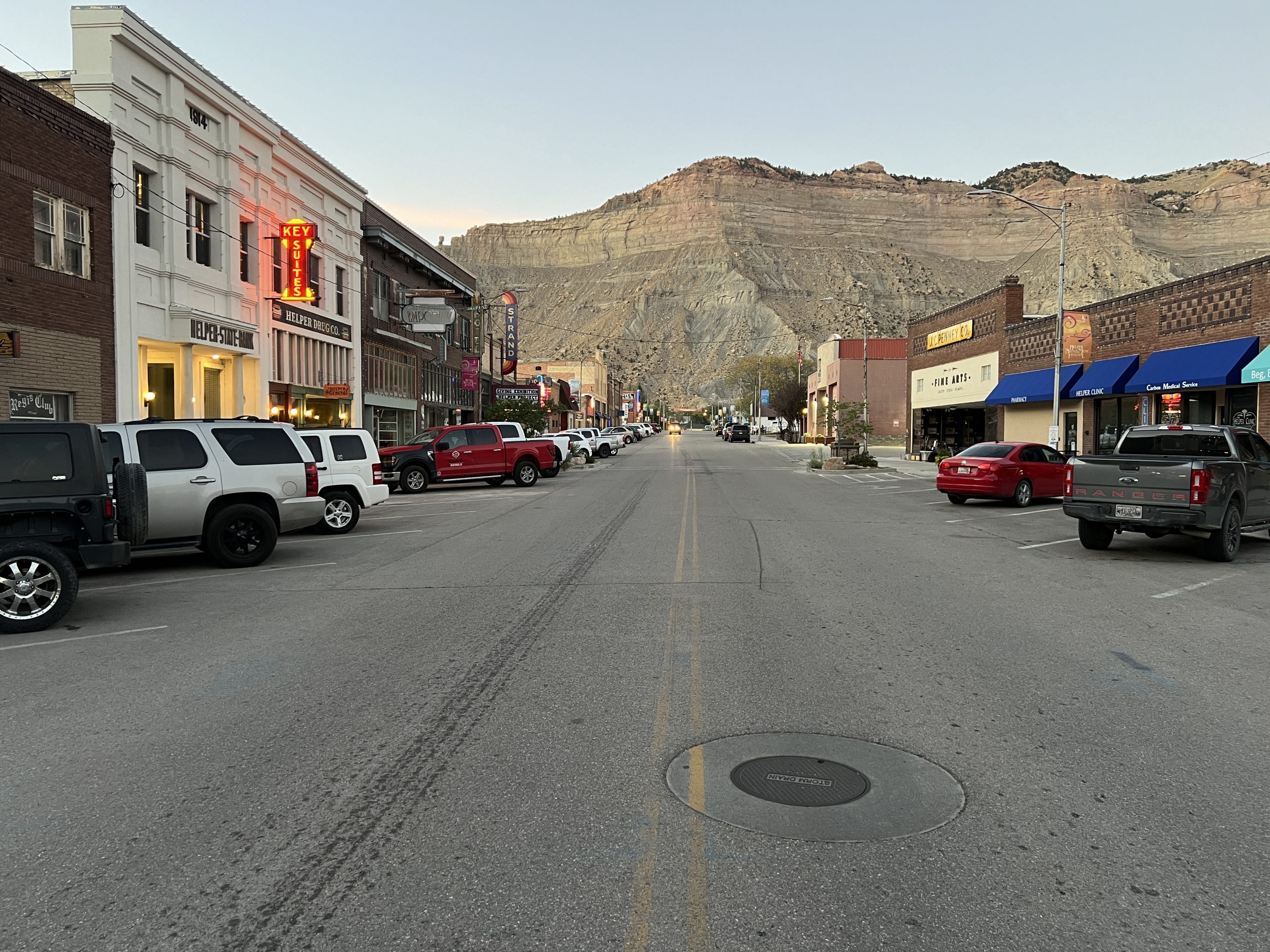
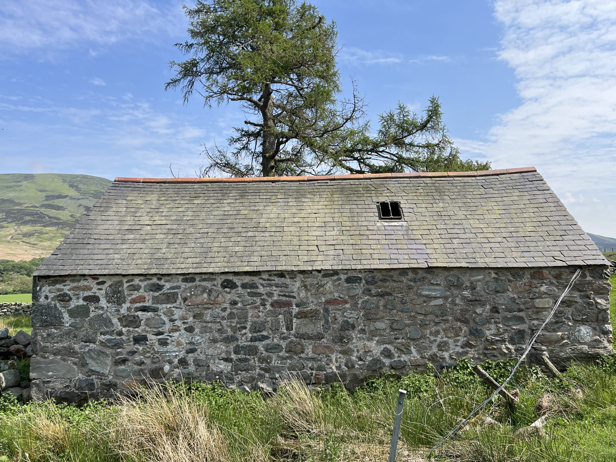
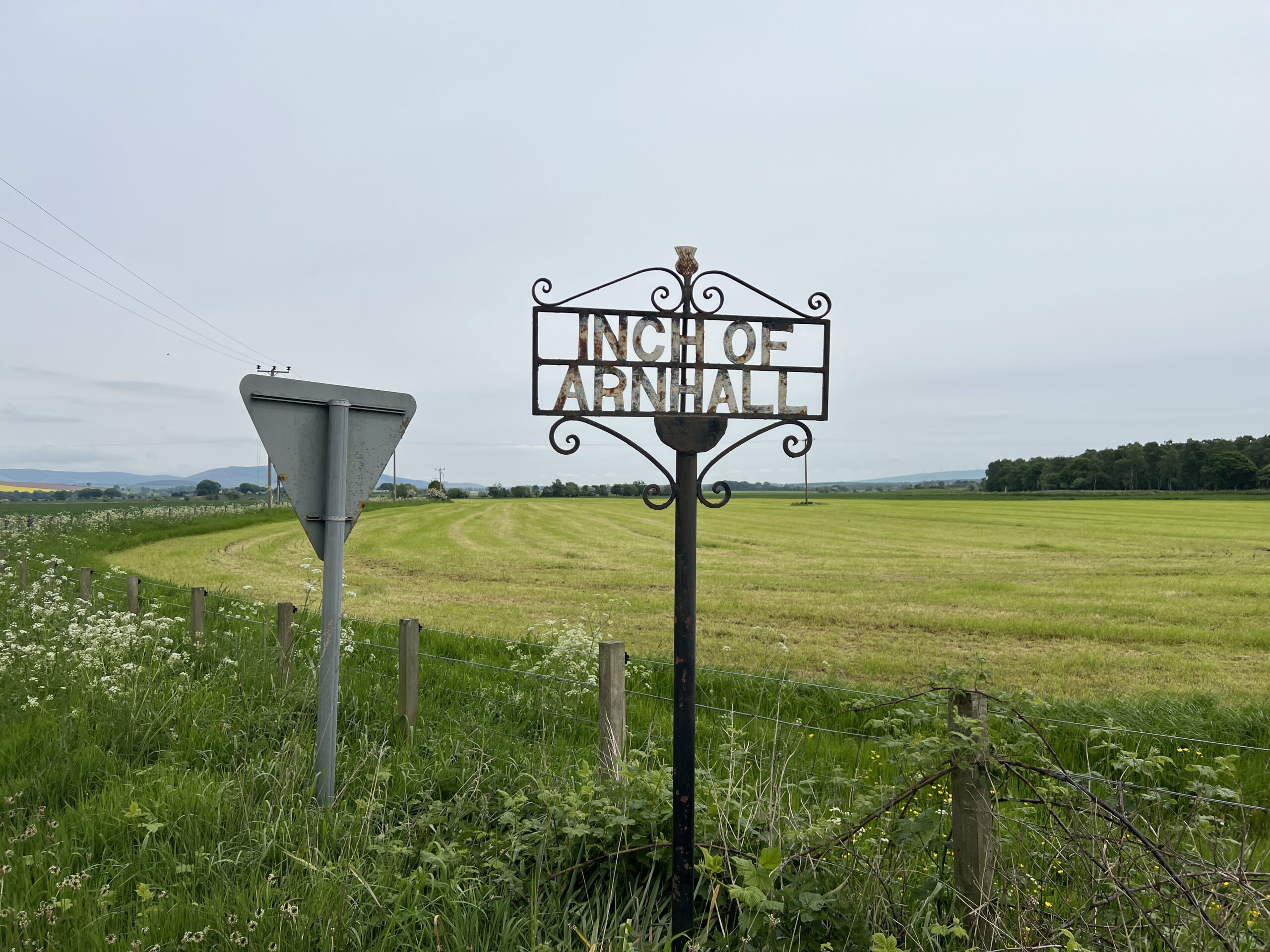
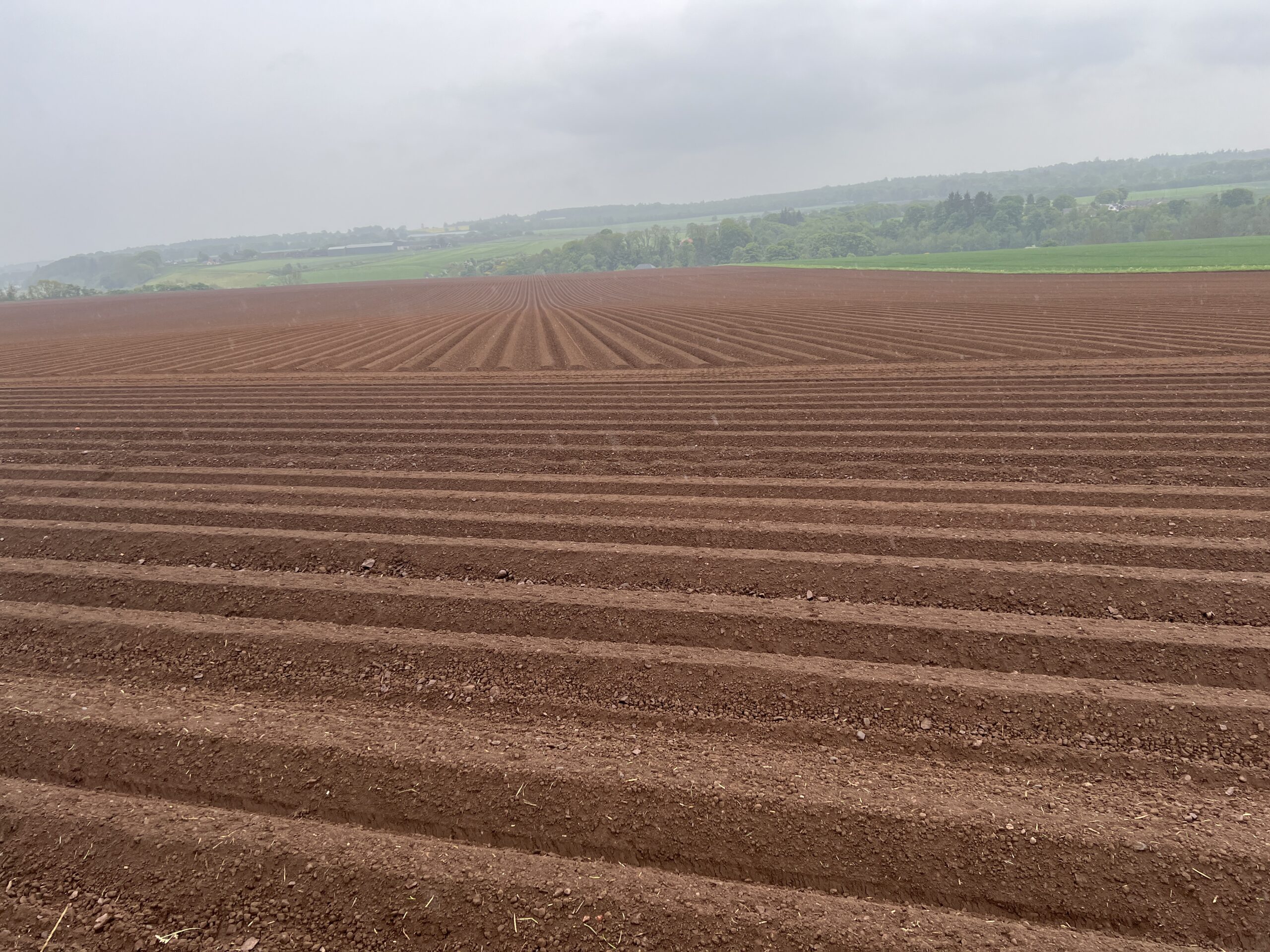
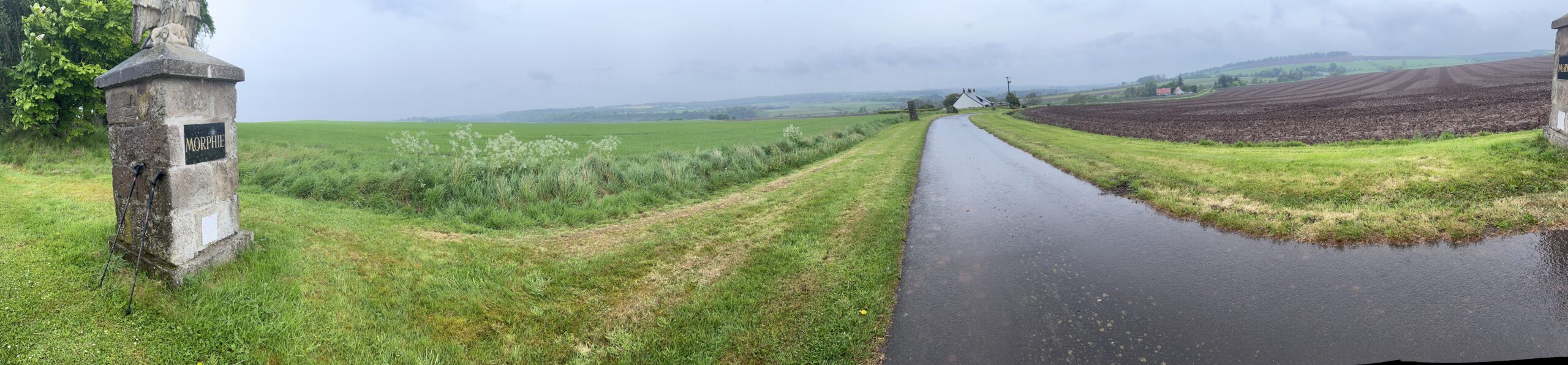
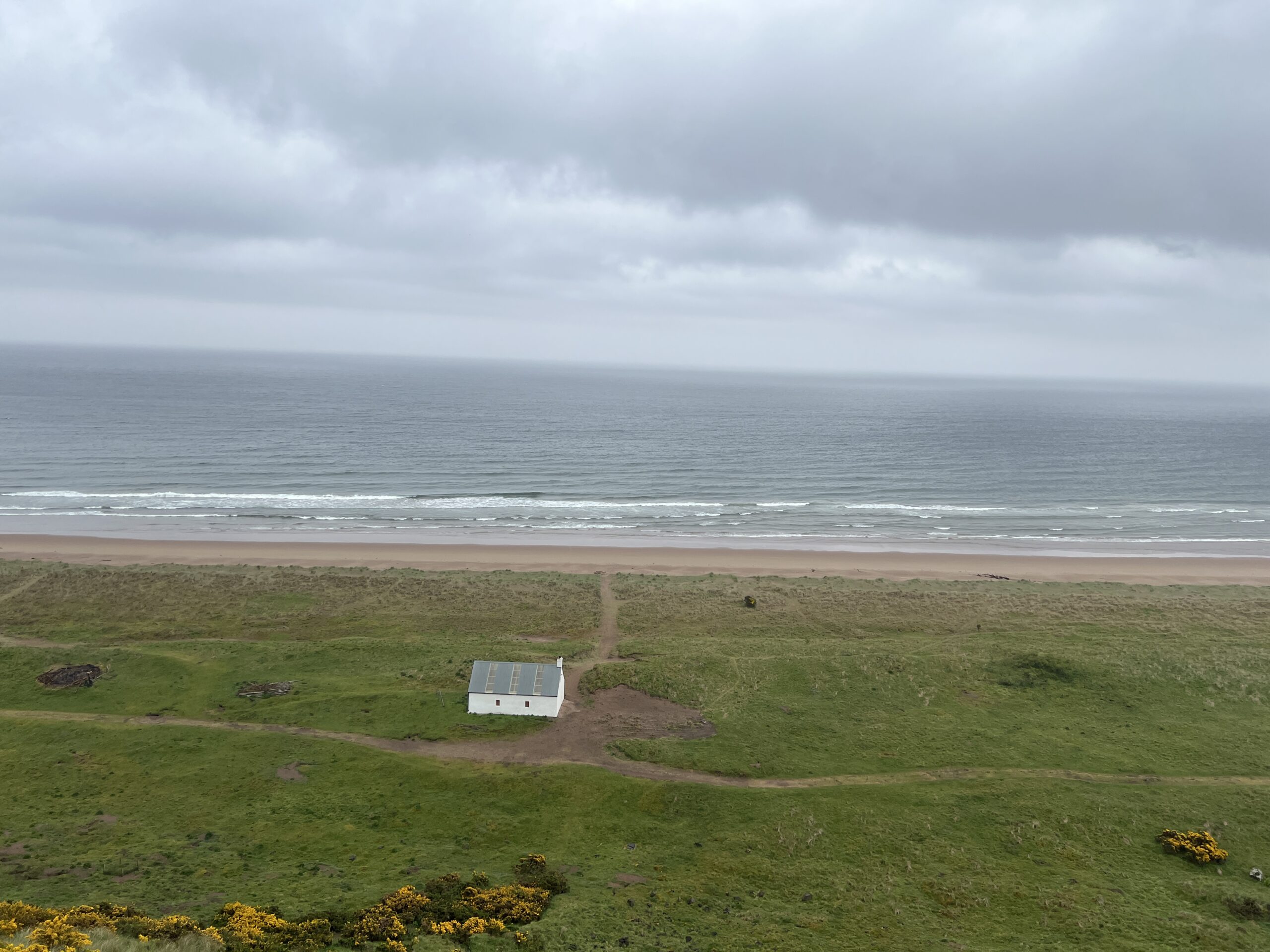

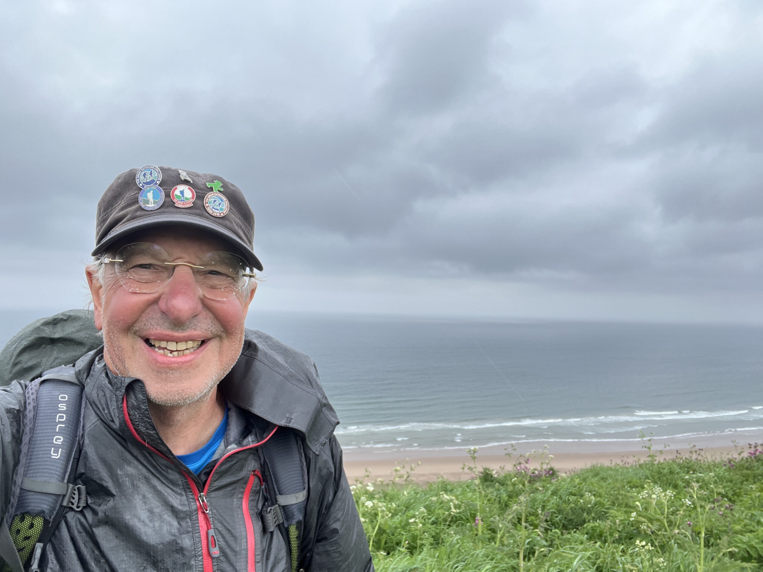
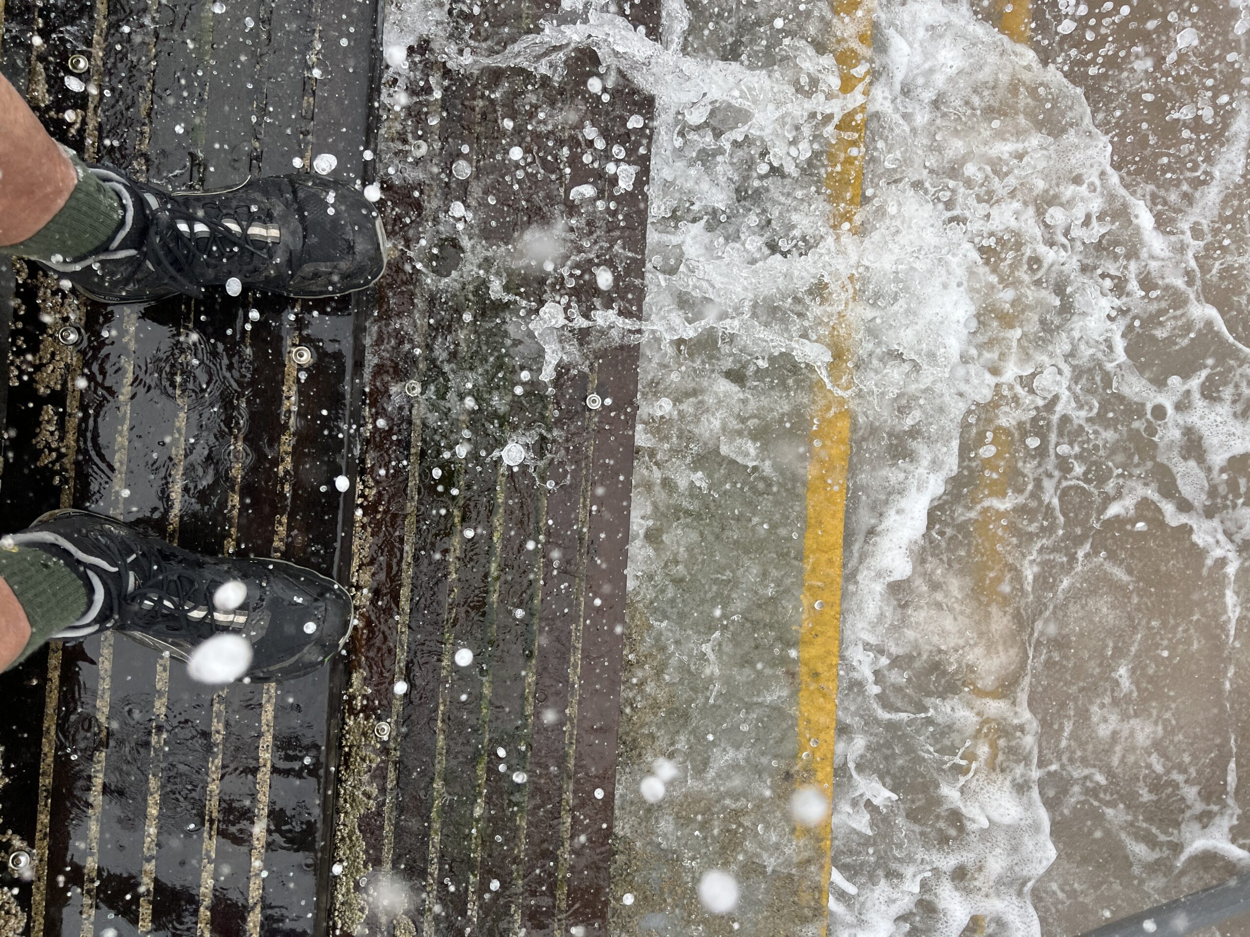
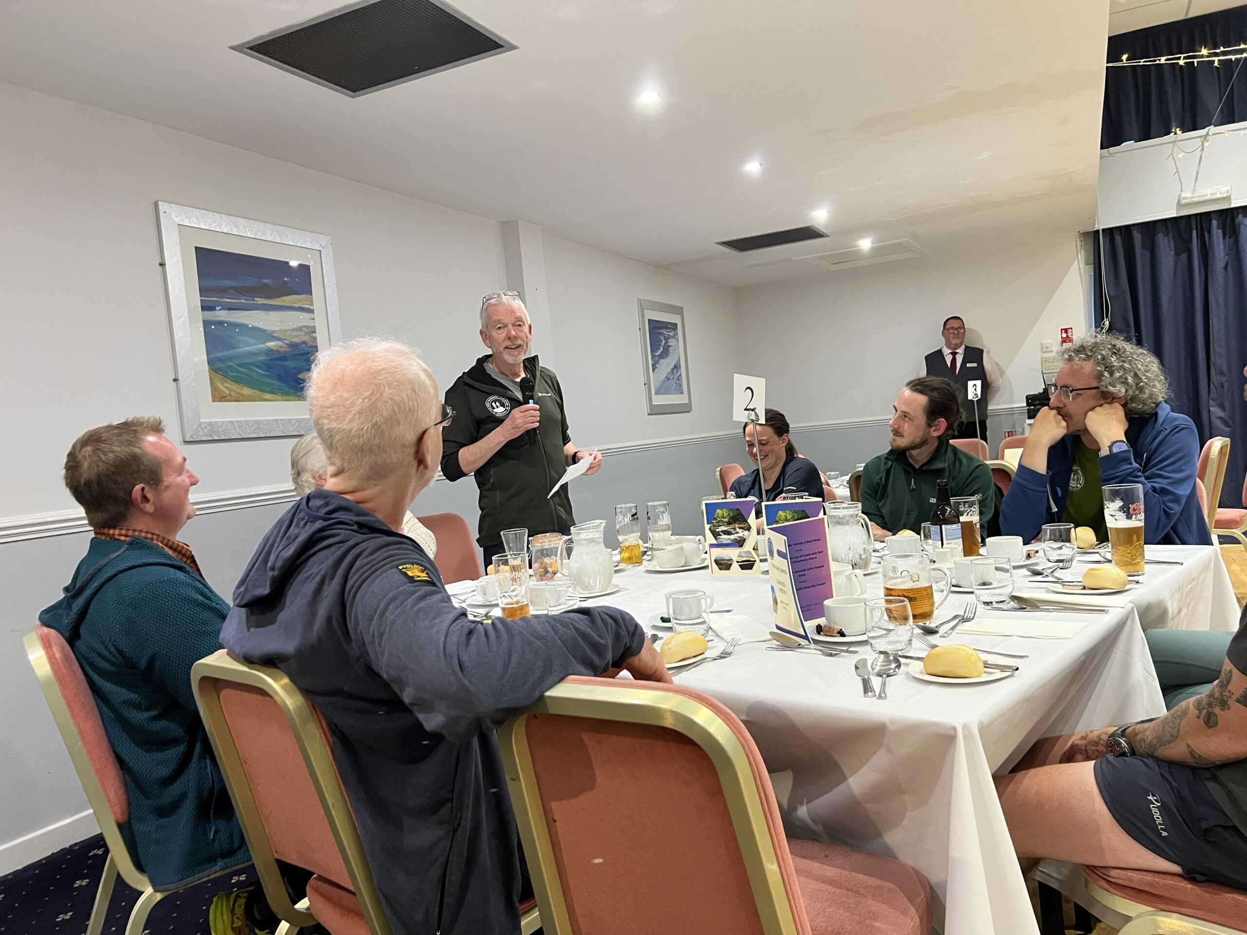
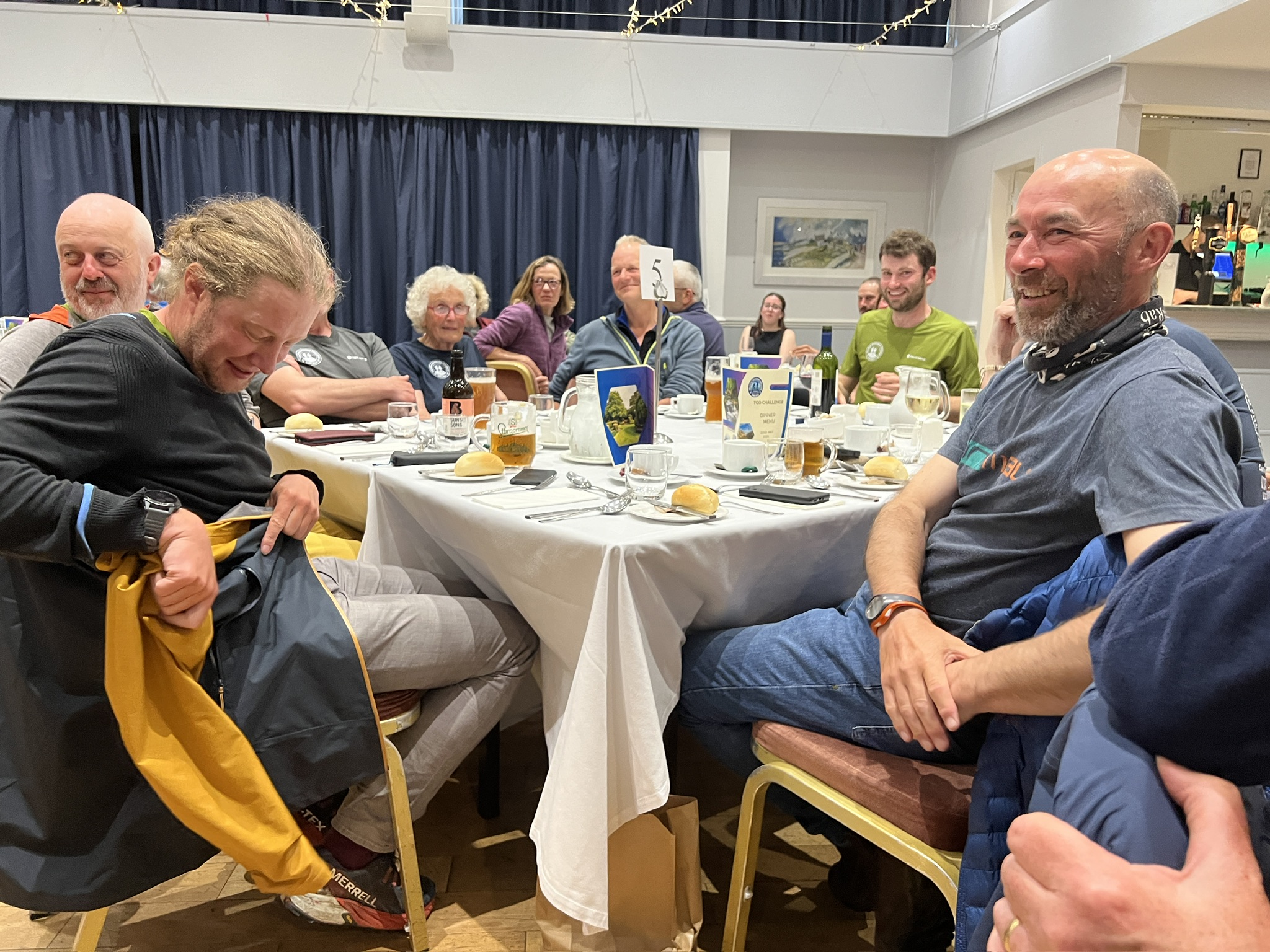
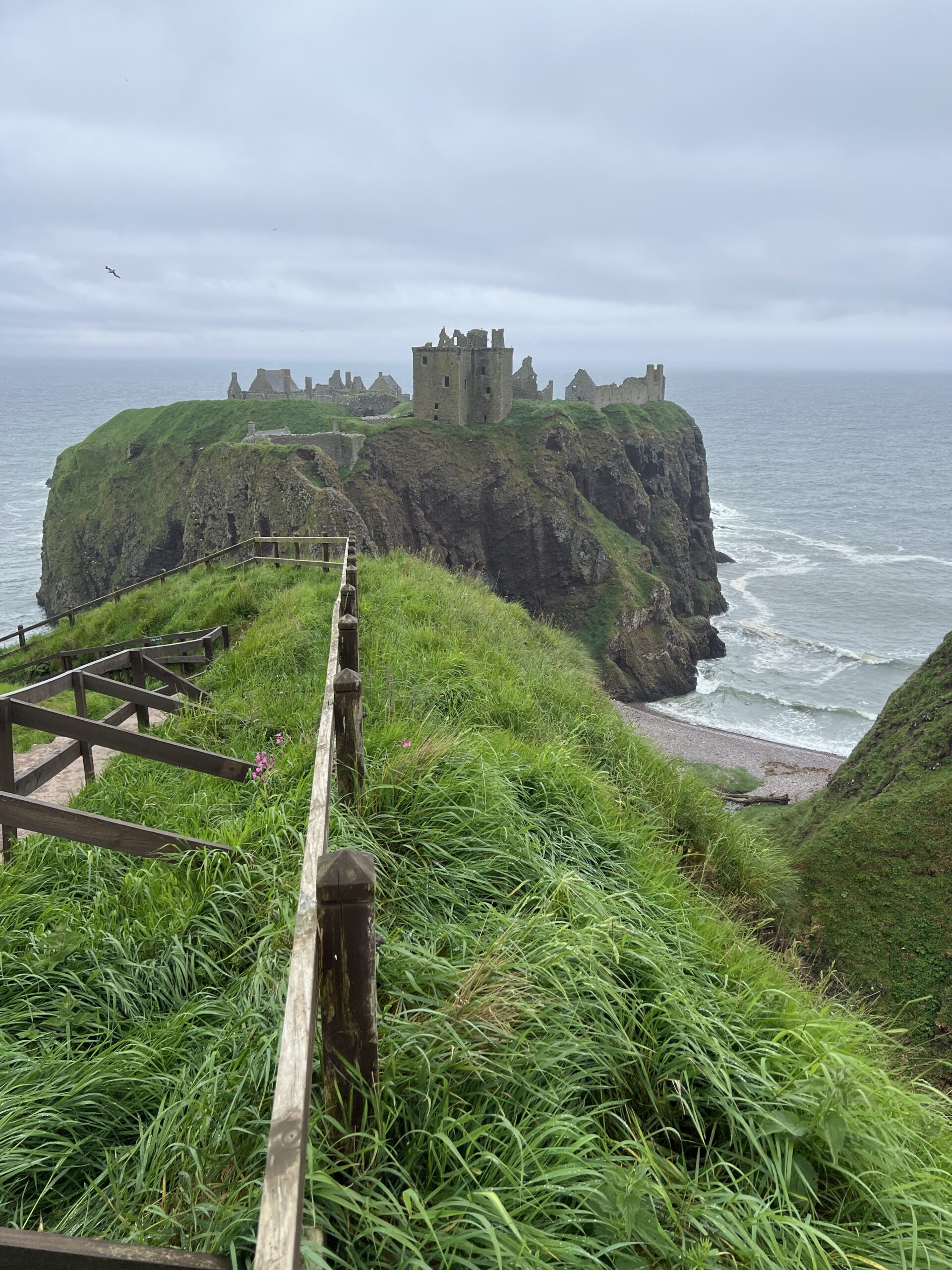
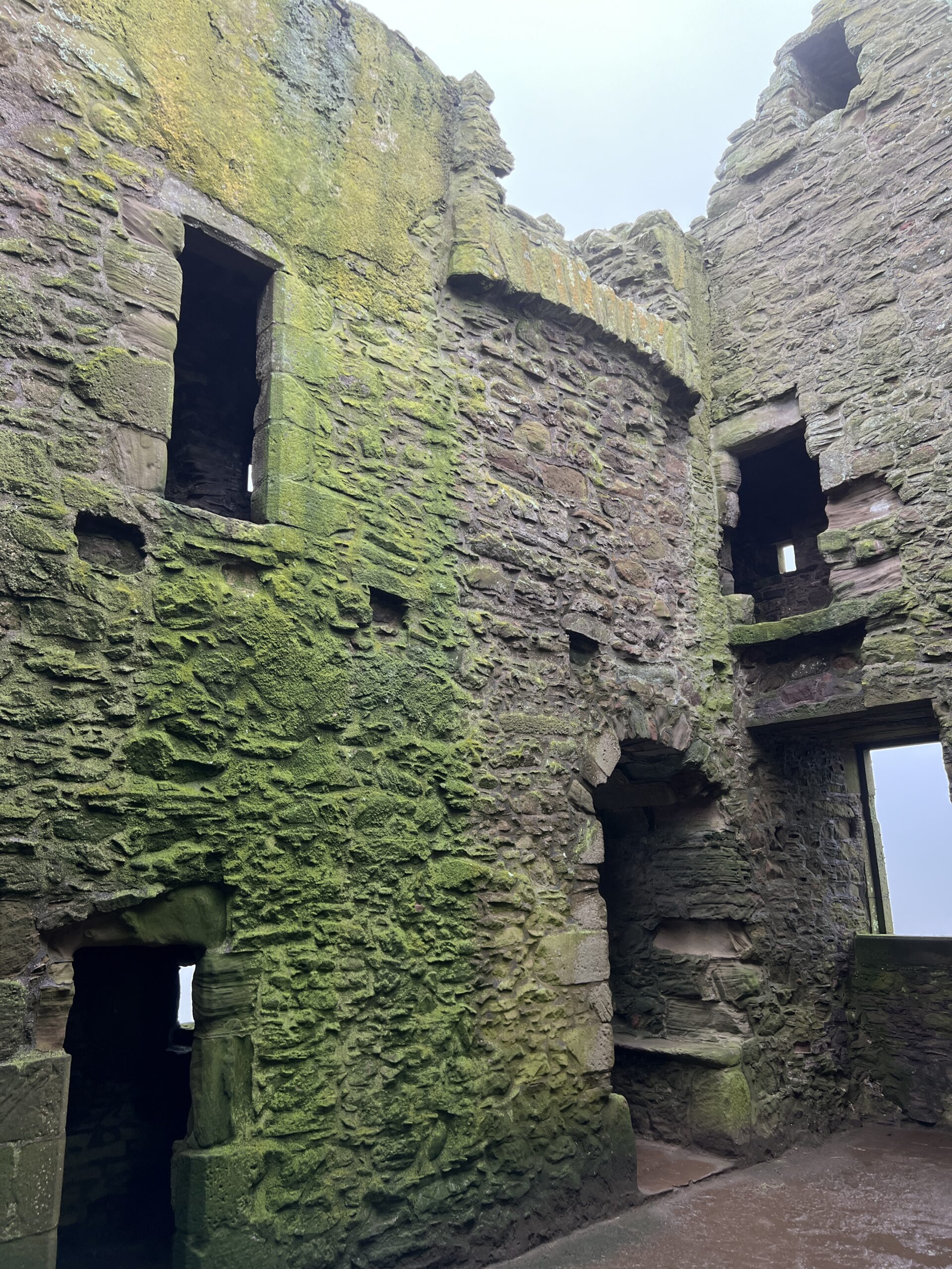
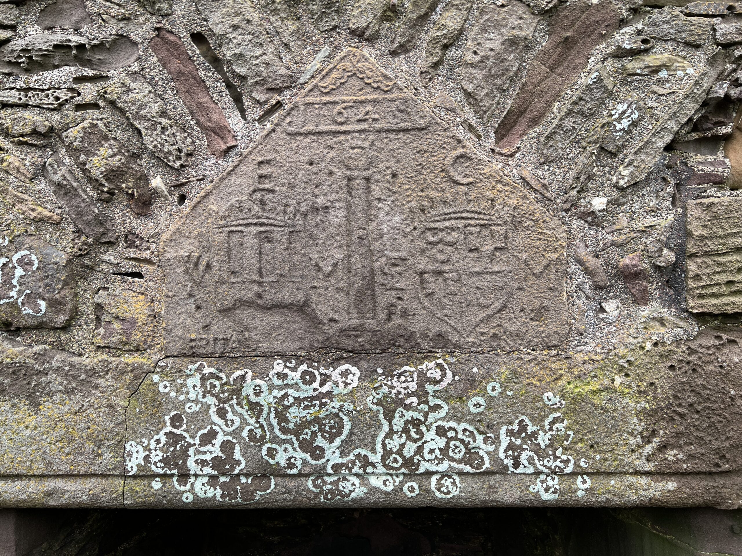
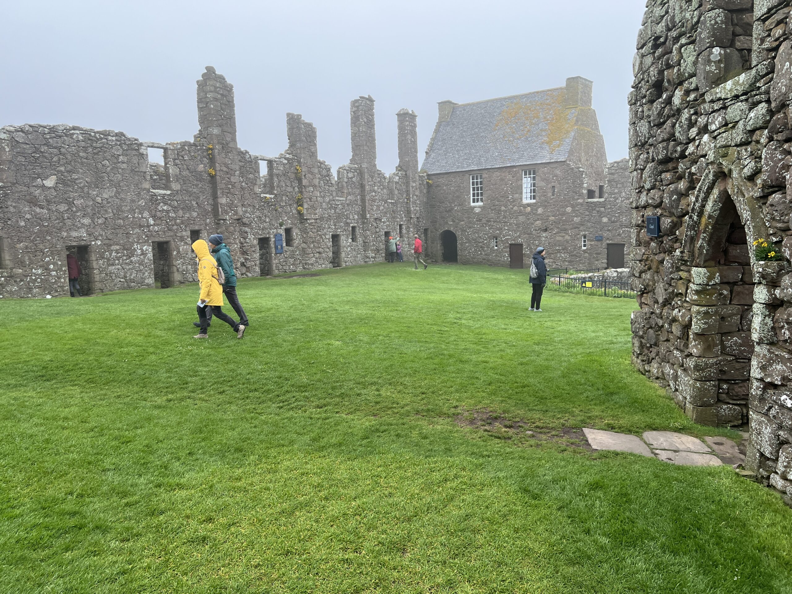

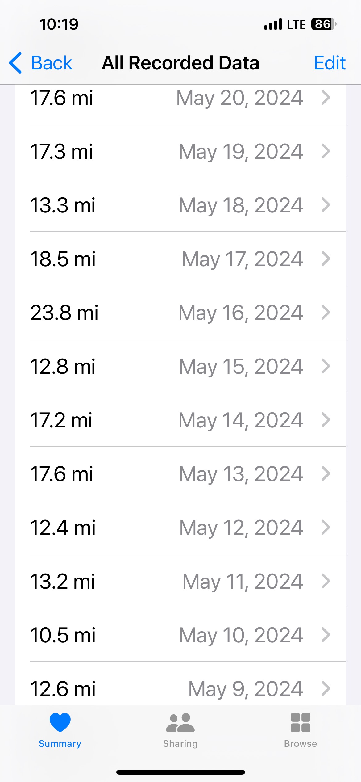
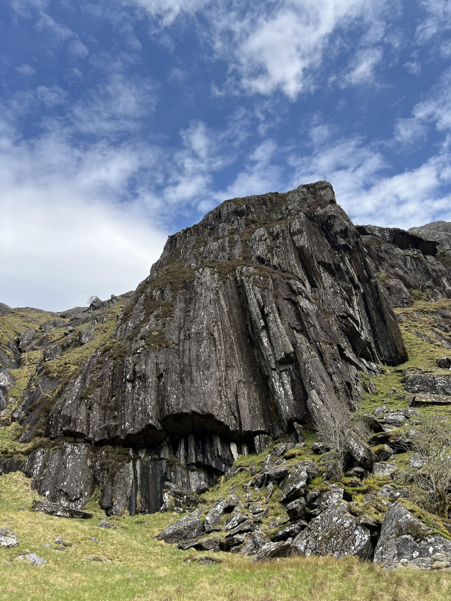
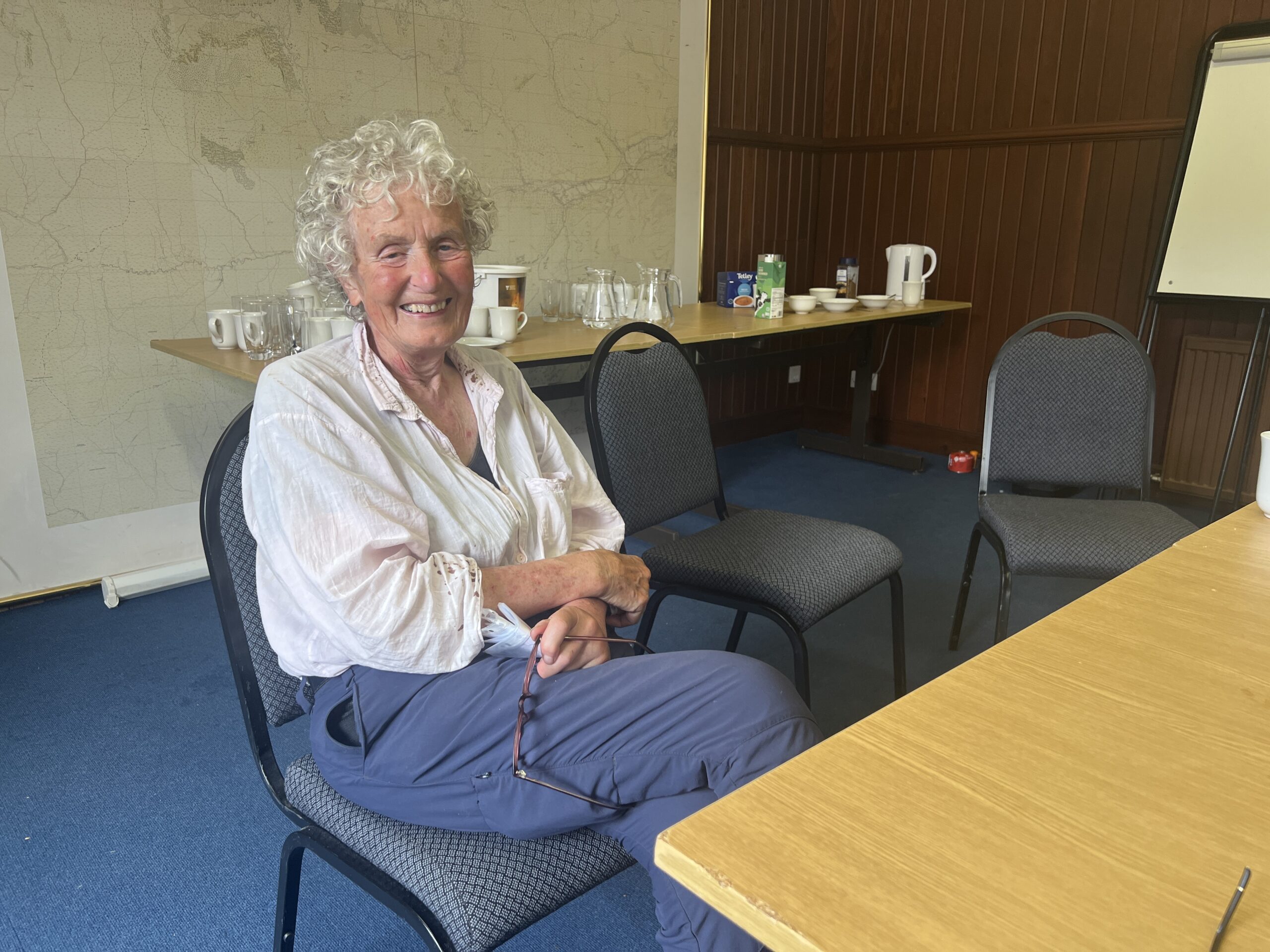
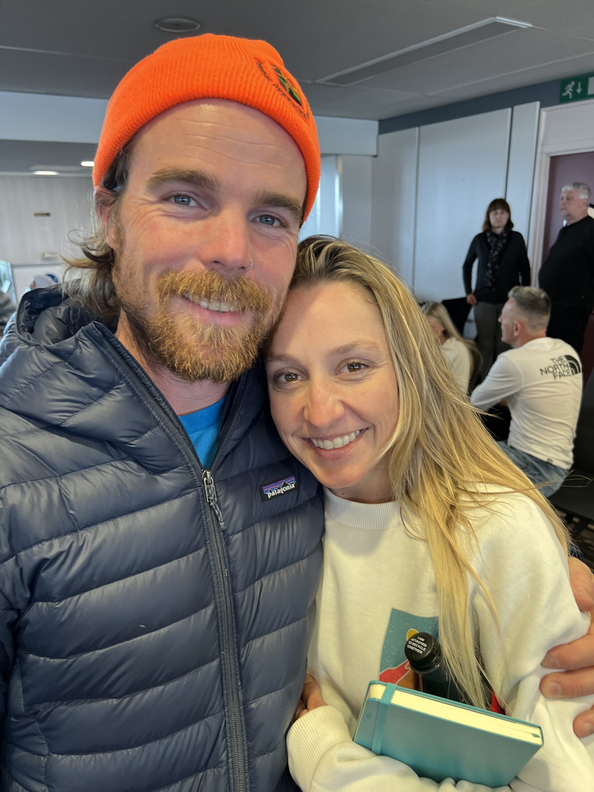
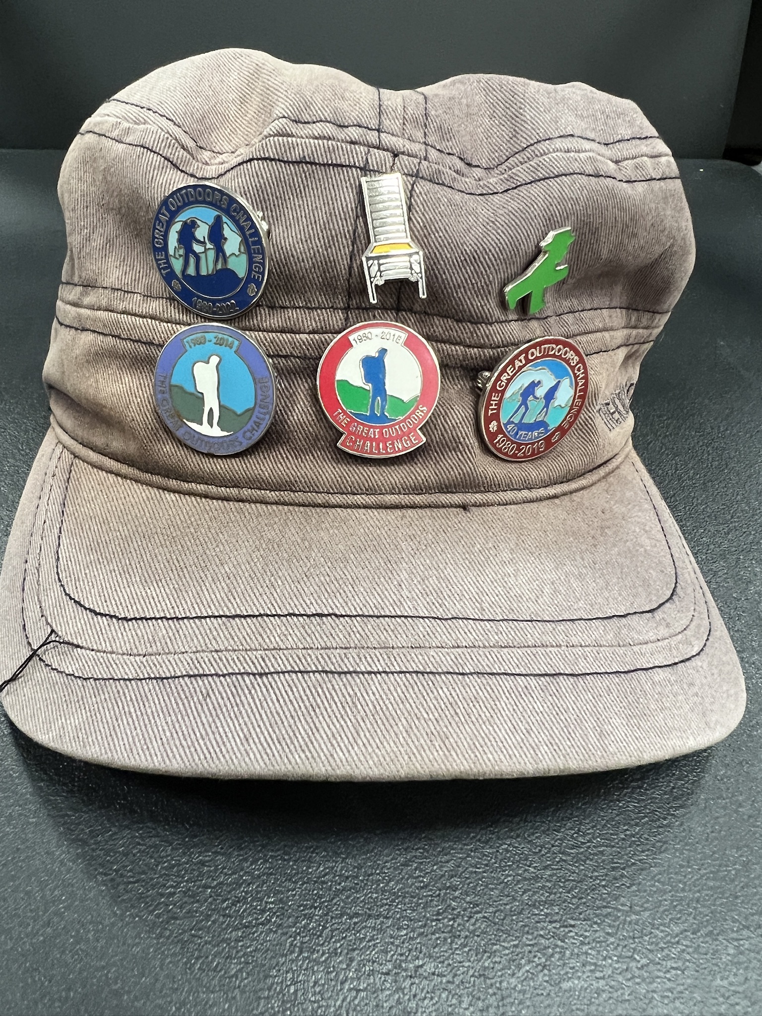
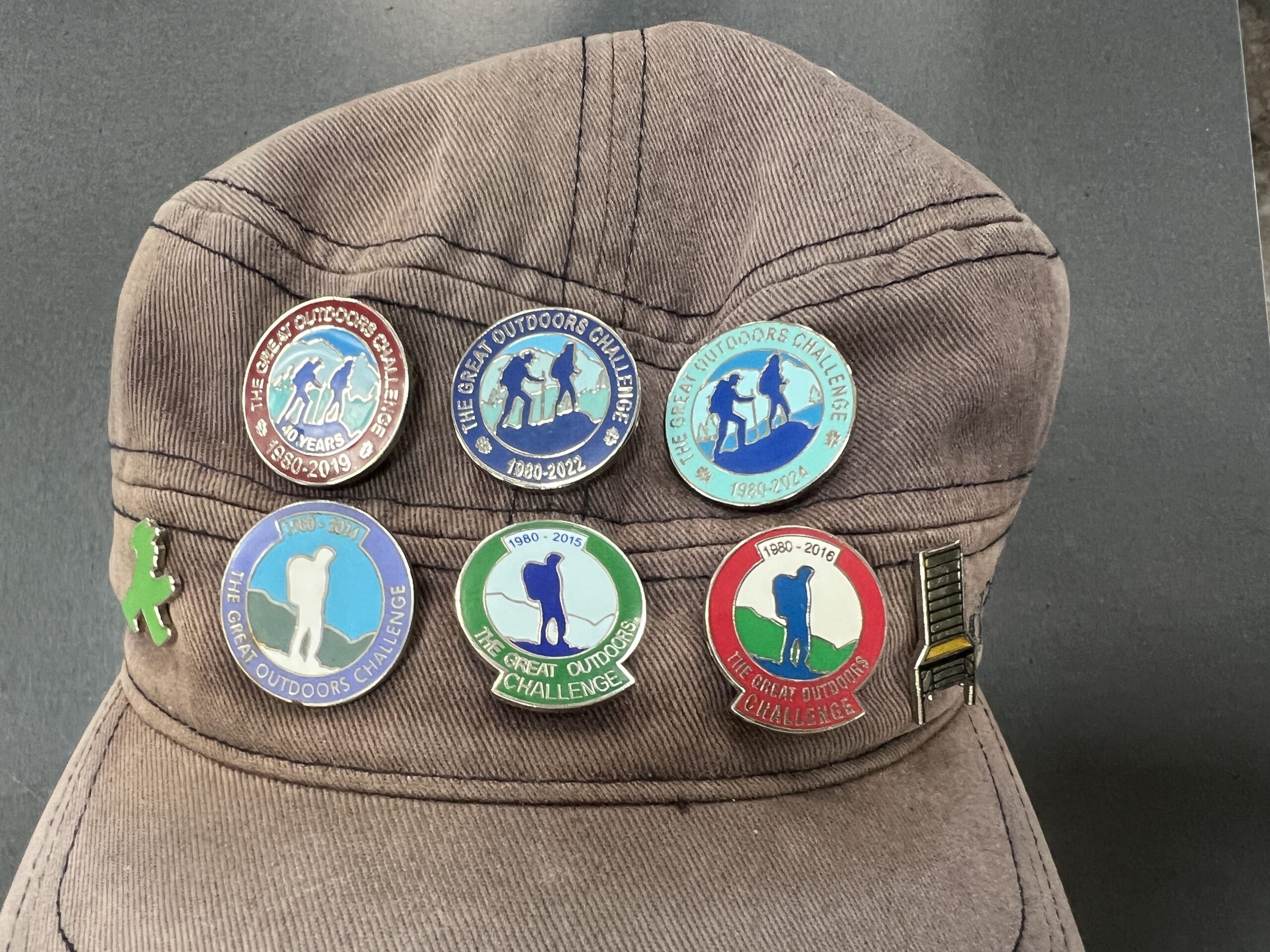

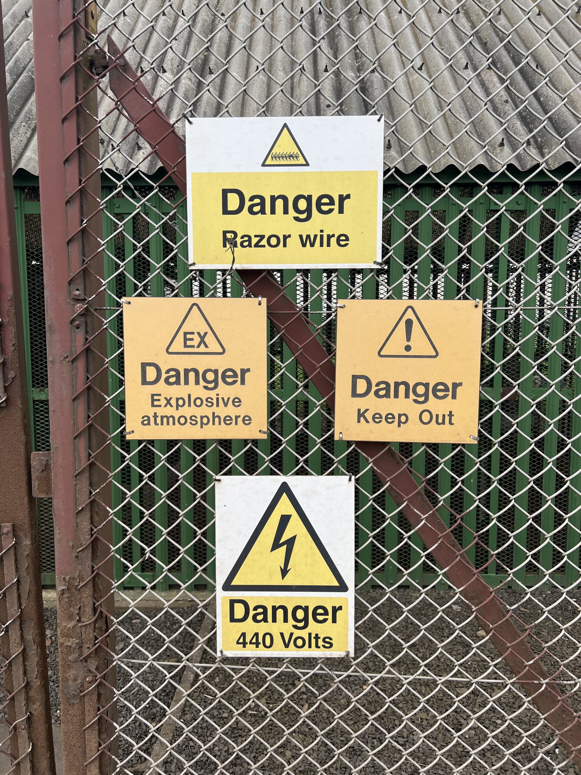


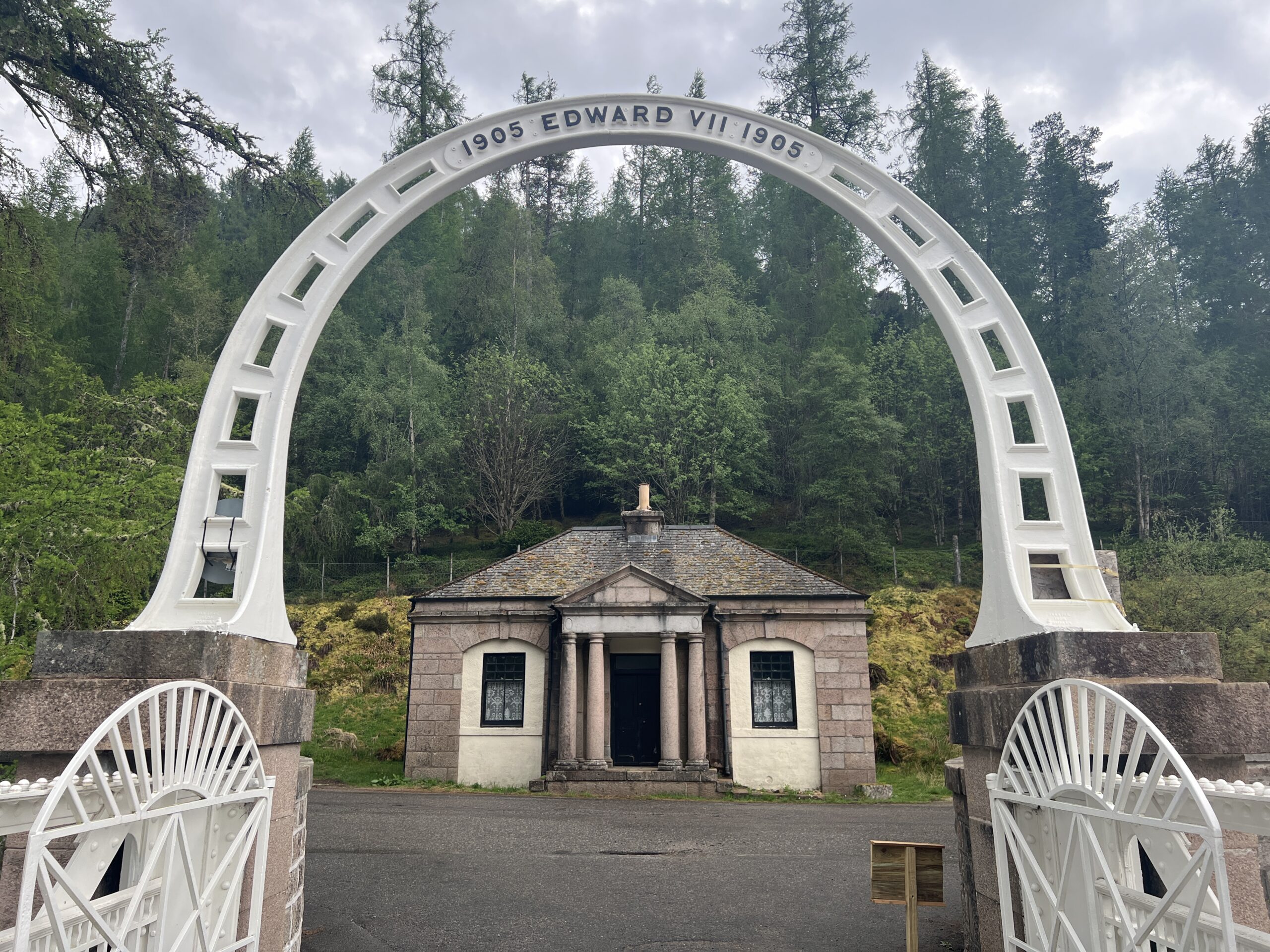
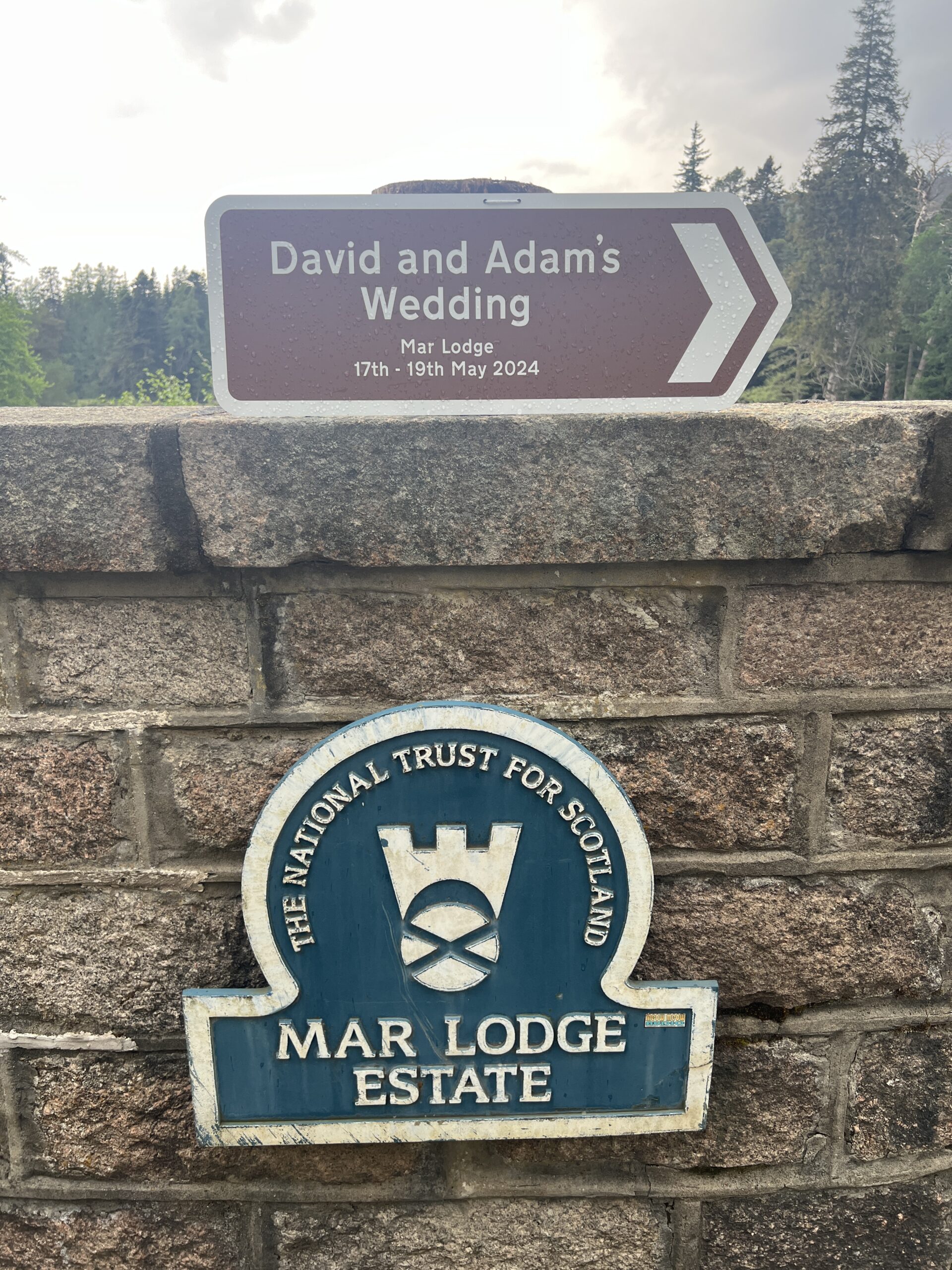
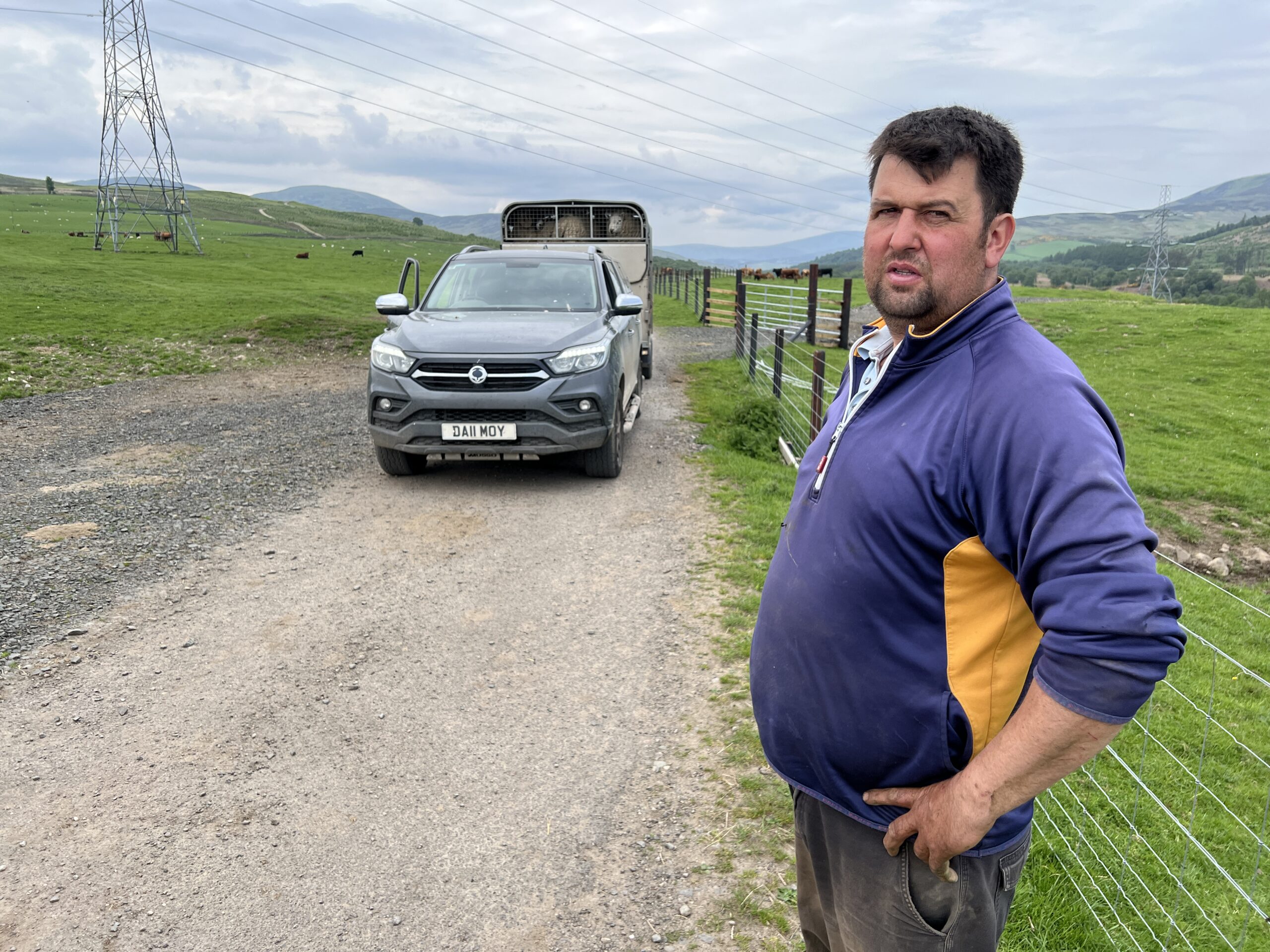


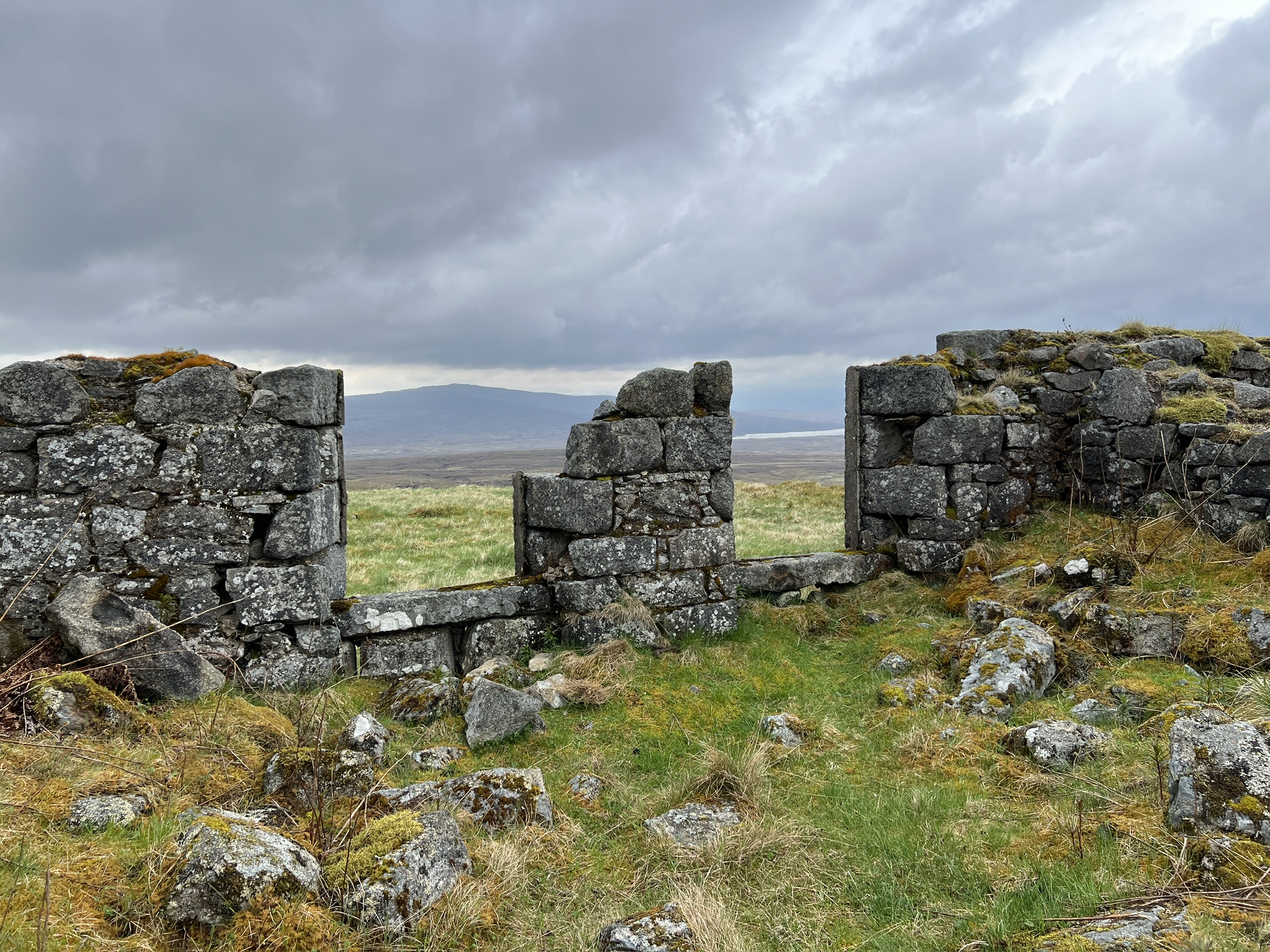
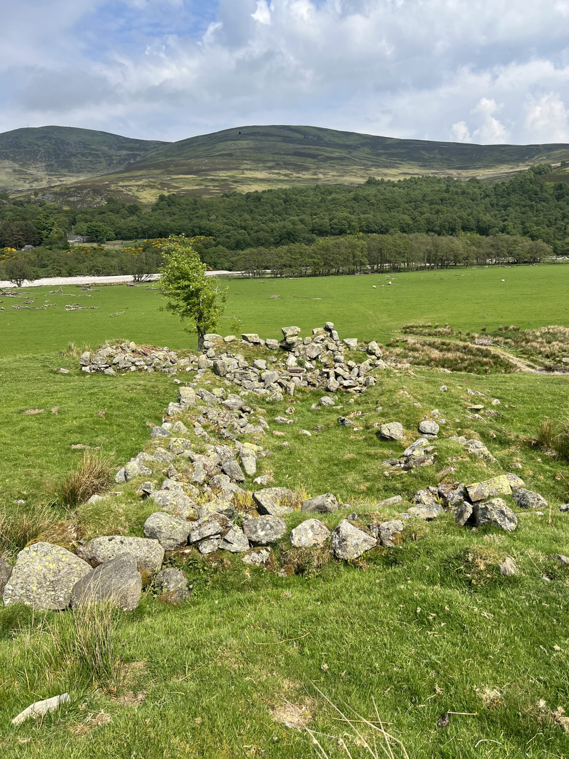
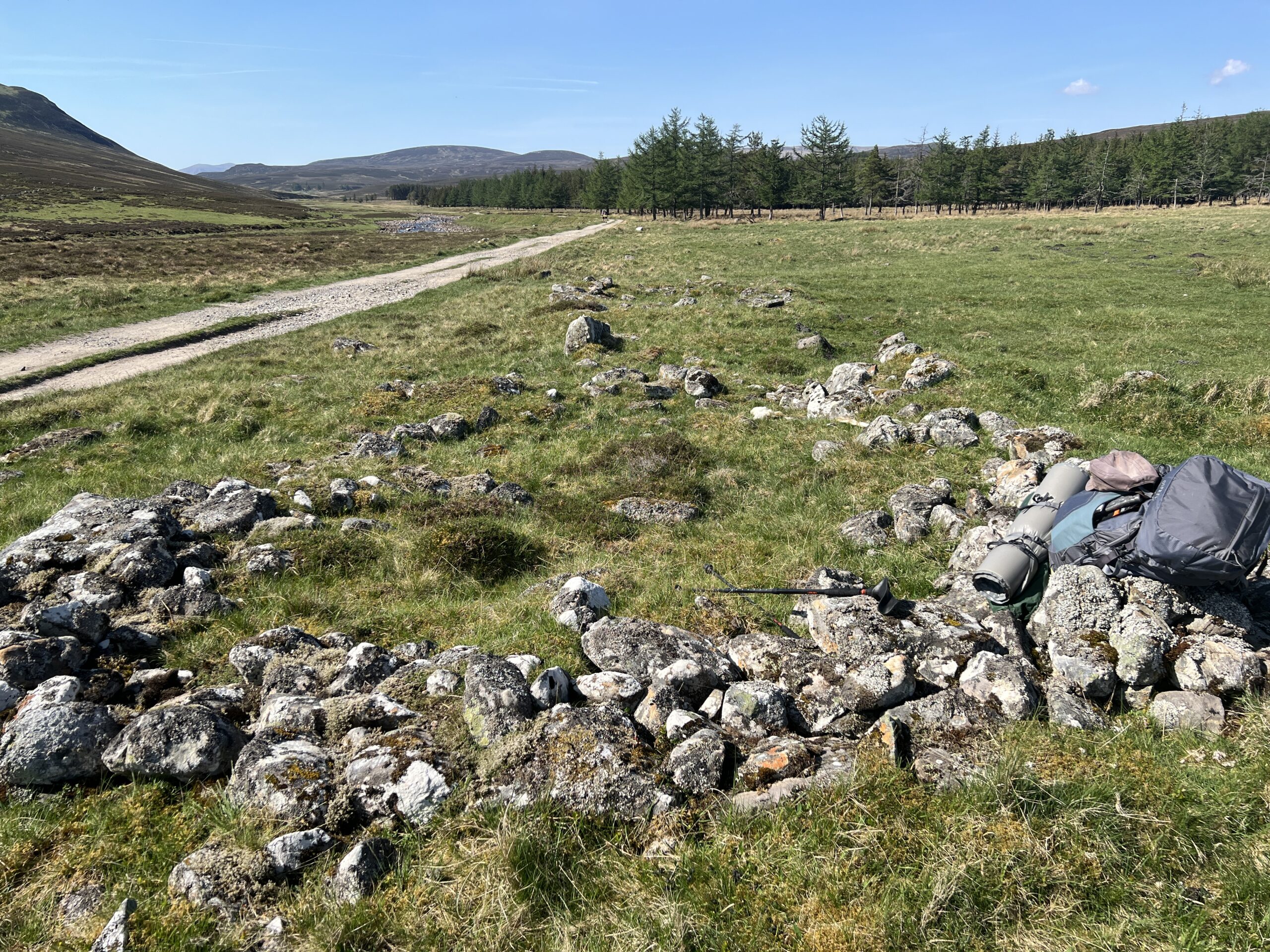
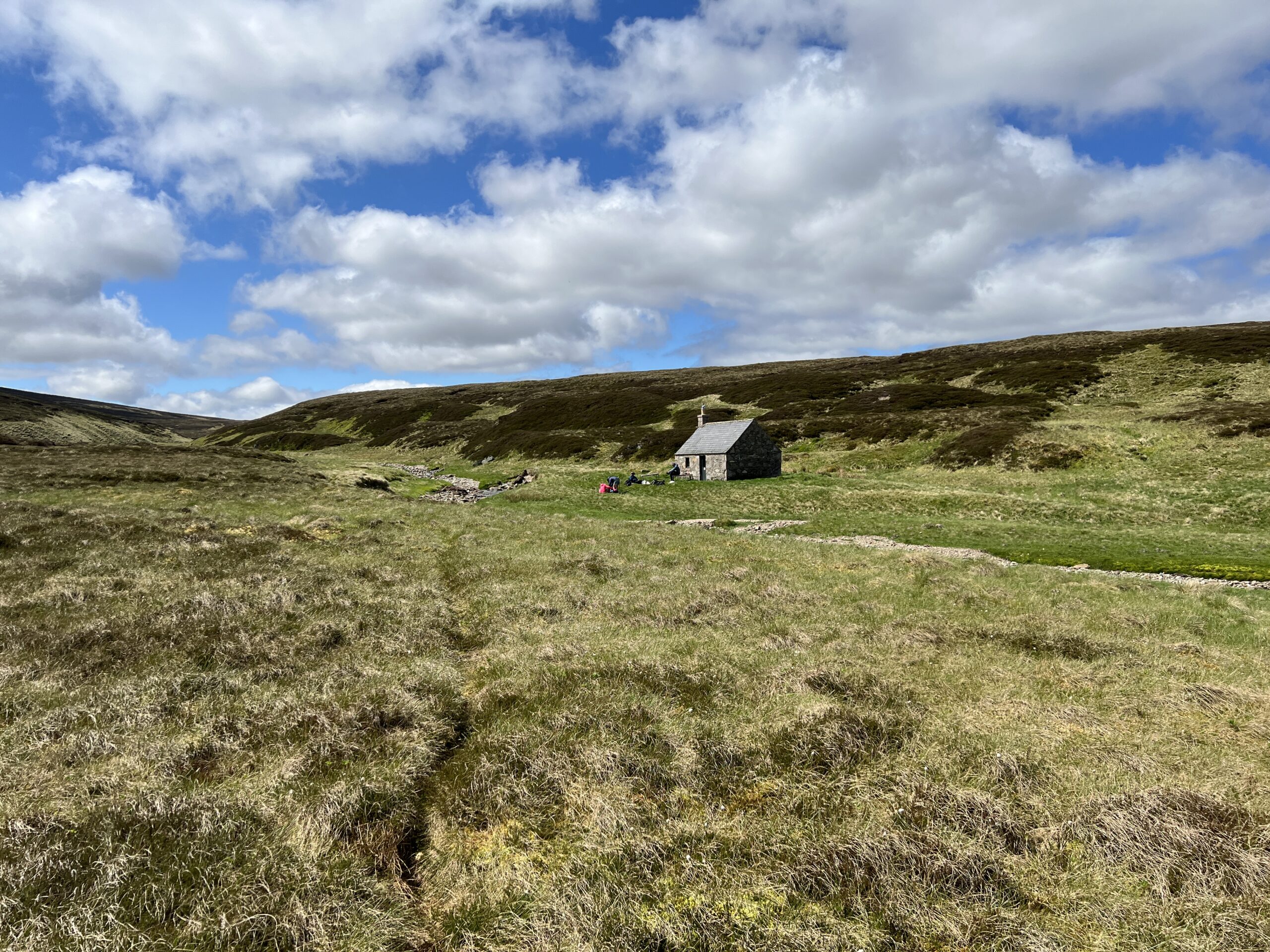


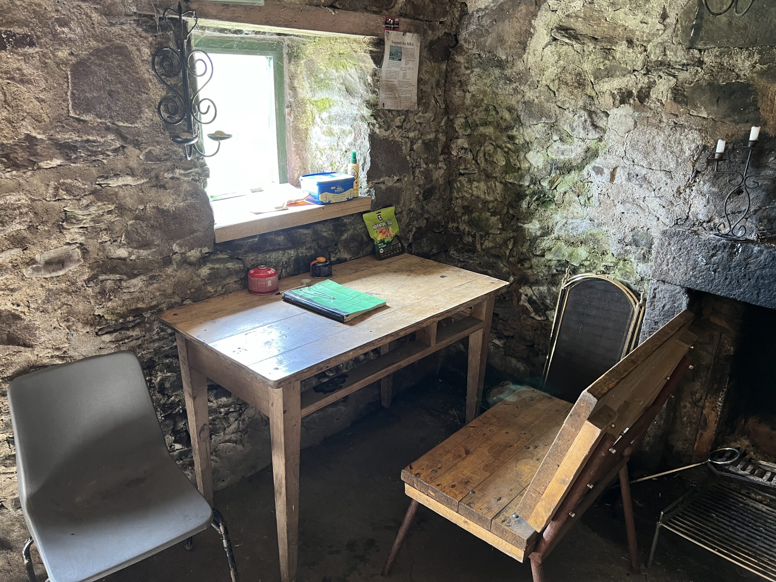
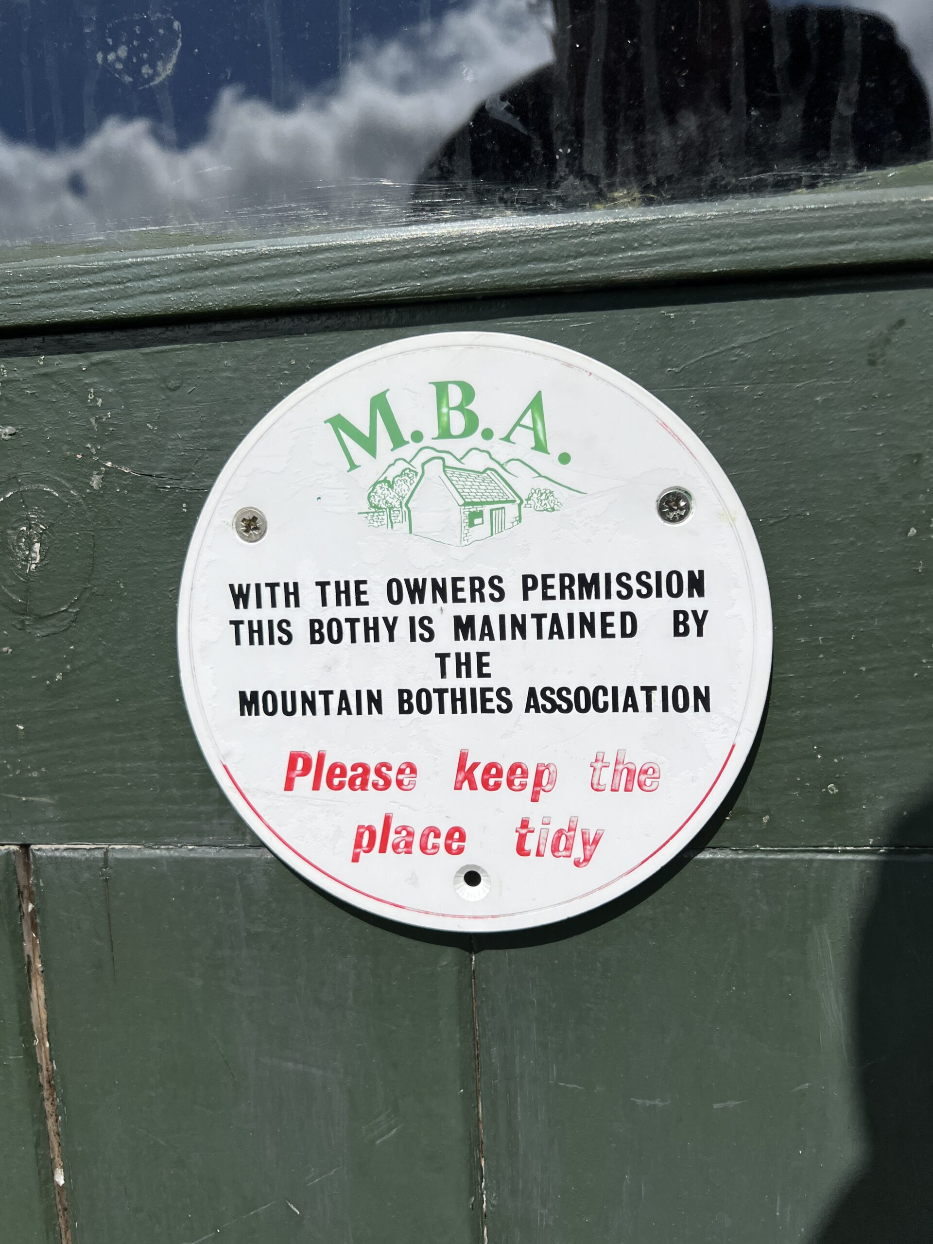

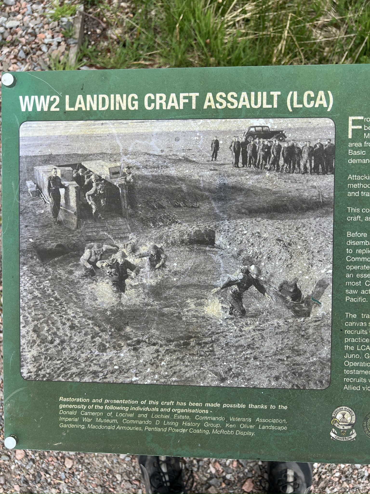


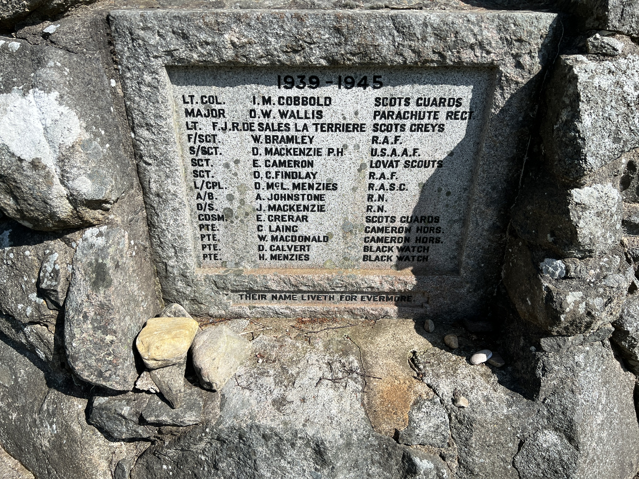
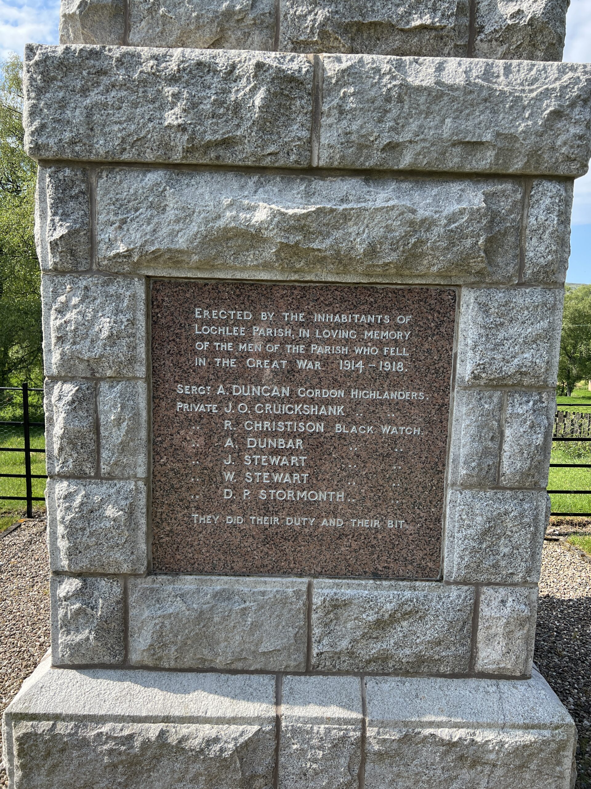
Recent Comments