A blog about a hike across Scotland (and possibly other things)

Month: June 2014

For now . . .

That’s going to be it.

I have no idea how many people read this blog or followed it to the end.  (I guess that’s both the good news and the bad news about blogs.)  For me, it’s been a valuable thing to do.  As a friend of mine once said, “the purpose of journalism is to see and to tell.”  This gave me a chance to do journalism again.

Thanks for giving me some of your time.

I’m going to hold onto this site.  I’m sure I’ll eventually have something more to say on it.  Just can’t say when.

One hundred years of memory

This August will mark one hundred years since the start of the Great War, now known as World War I.

Most historians believe the Great War set the conditions that made the next war, World War II, inevitable.  Some believe it was even more important.  They argue it established the entire trajectory of the 20th Century, from politics to race relations to music.  National Public Radio recently broadcast a series of stories on “counter-factual history” that explored how history might have unspooled in a radically different way if the war had never started.  It’s worth listening to:

http://www.npr.org/series/286403203/what-if-wwi-had-never-happened

But of course it did happen.

Germany had at least 1.8 million military deaths, Russia had at least 1.7 million, France 1.4 million, Austria-Hungary 1.2 million, Britain 703,000.  Of the 557,000 Scots who enlisted in the British forces, 26 percent were killed.

At the top of Edinburgh Castle is a memorial building for Scotland’s Great War dead.  Inside, there is a plaque, relief or window for almost every military occupation or large unit.  Accompanying each is a book listing the name, home, death date, and sometimes a little more information, of each of the dead.  The building is as exquisite as it is sad.  It is so sacred that photographs of the inside are not allowed.

iPhone pictures Nov 2014 582

In a park between the castle and the train station there was a statue honoring the volunteers who answered “the call.”  At its foot, were wreaths of poppies (artificial in this case), which is the British flower of remembrance.

iPhone pictures Nov 2014 566

A relief depicted people of all ages and walks of life falling in behind the soldiers, doing their part.  (The Moscow subway is full of similar iconography, except the soldiers it honors are those of the Great Patriotic War, which is the Russian name for World War II.)

iPhone pictures Nov 2014 568

I took some pictures of monuments to the Great War dead during my time in Scotland.  This is one I walked past in Tarfside; I wrote about it in one of the posts from the hike.  You can click on this picture (and others) to enlarge it and read the inscription.  It says:  “They Did Their Duty and Their Bit”.

iPhone pictures Nov 2014 447

Some monuments are in the middle of nowhere.  This one is between Campbeltown and Southend, on the Kintyre peninsula, surrounded by farm fields.

iPhone pictures Nov 2014 686

Many are large, elaborate, regimented, and information-dense.  This one is in Dunoon, a town with a ferry terminal where I landed on my way to visit Paul and Deborah Richard in Argyll.  It honors the dead from the whole Cowal Peninsula. There are 130 names on the left-hand column and 90 on the right-hand column.  Paul and I didn’t count the middle two columns.

iPhone pictures Nov 2014 597

You don’t have to look hard to find people with the same last names.  What the monuments don’t tell you is their relation to each other–if there was one–that might hint further of a family’s loss.

Most, but not all, of the monuments list the dead by rank–officers above NCOs above enlisted men.  Some towns and villages objected to this.  They wanted the dead listed by name only, with no hint of caste or implied importance.  Because many monuments were paid for “by subscription”–with money from contributors–that effort sometimes succeeded.  But not here.

Scotland had a huge diaspora in the early 20th Century.  Some immigrants fought under other flags.  The Dunoon tablet lists soldiers serving in the U.S. Army, the Indian Army, the Australian Expeditionary Force, the New Zealand Expeditionary Force.  But they were remembered as Scotsmen.  In the lower right-hand corner are the names of two nurses:  A. A. Scott and Helen Yeats.

Along the bottom of the tablet are the words, “Death is Swallowed Up in Victory.”  It’s hard to know what to make of this sentiment.  You have to believe something.

There are private monuments to the Great War’s victims, as well.

This one is at the water’s edge a few hundred yards from Paul and Deborah’s house.   They bought the property from a man whose mother had two brothers killed in the war.  The monument appears to have been a fountain as well, catching water from the slope behind it.  There’s a lion’s head over a giant clam shell, with a copper drinking cup on a chain, at the base.  But the water no longer runs.

iPhone pictures Nov 2014 816

The brothers died in the disastrous attempt to control the Dardanelles strait and go on and capture Constantinople, the seat of the Ottoman Empire.  The campaign failed.  Thousands of Australian and New Zealand troops were slaughtered running into machine gun fire.  The start of the campaign, April 25, is Anzac Day, a national day of mourning and remembrance in both countries.

iPhone pictures Nov 2014 814

For me, the most touching memorial was in Skipness, a village with a row of houses and a church halfway up the east coast of the Kintyre Peninsula.  It kind of says it all.

iPhone pictures Nov 2014 764

There are three names on the monument, and no ranks.  Two of the men have the same last name.  Brothers?  Cousins?  One of them was an immigrant to Australia.  But this is where he’s missed.

iPhone pictures Nov 2014 765

It has a clock that still runs.  The clock guarantees that people will look at the monument every day.  It tells them the time, and that life is fleeting.

Scenes of Kintyre

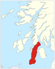
I spent a two nights and three days exploring Kintyre, a peninsula on the west coast of Scotland that hangs like a flaccid circumcised penis over Ireland.

220px-Kintyre-Scotland.svg

This time I wasn’t going to walk and I wasn’t going to camp.

I borrowed a bike from two of Paul and Deborah’s friends–Fiona and Pieter–who live up the road from them in Colintraive, on the Kyles of Bute. They are an Englishwoman and a Dutchman who chucked fast-lane jobs in Switzerland to become felters in Scotland.  They use local wool to make felt for practical (blankets, rugs, vests) and decorative (lampshades, wall hangings) purposes.

I booked nights in a B&B and a hotel, traveling light in an overstuffed day pack.  I brought the binoculars this time.

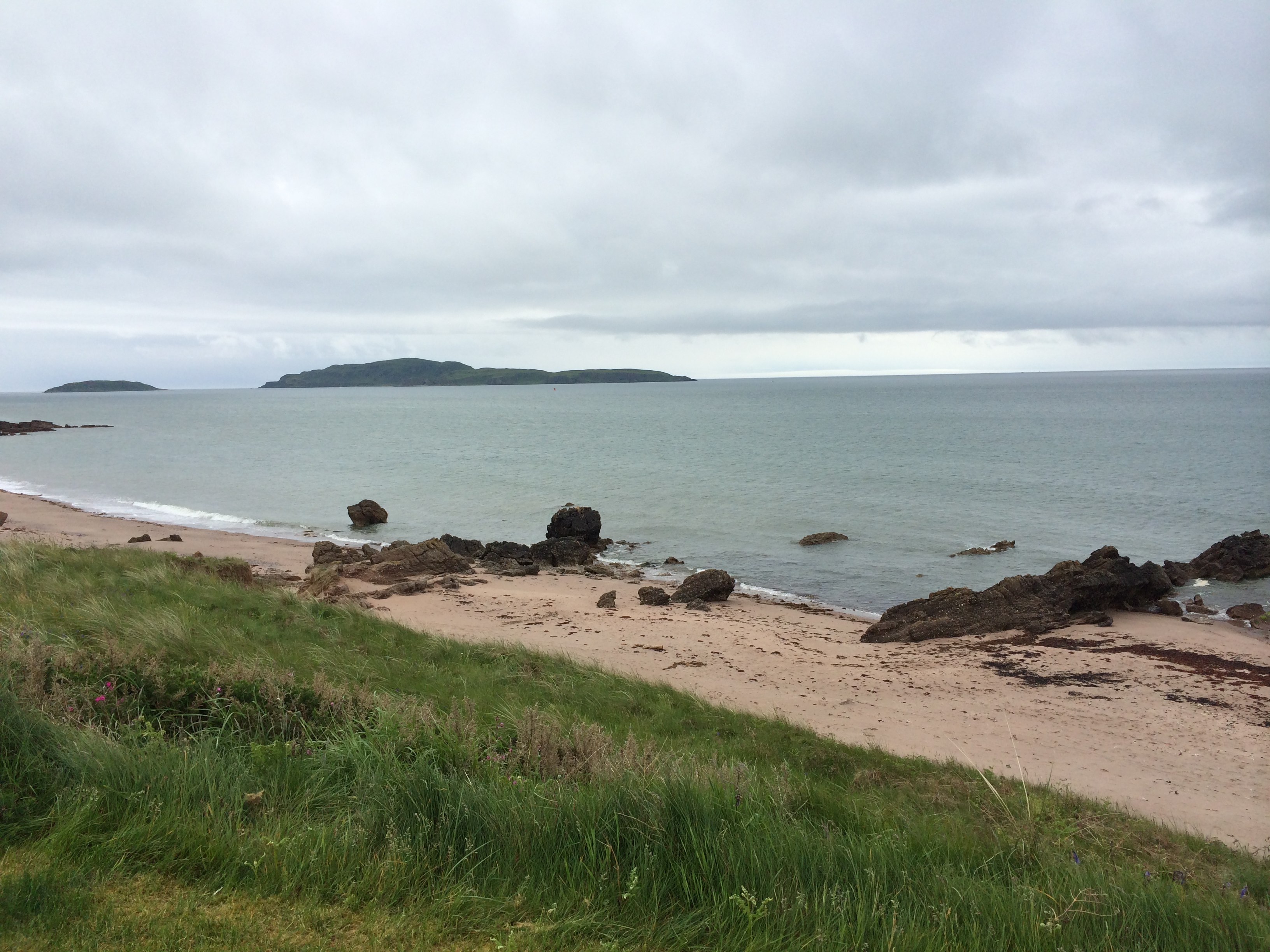
Deborah and Paul drove me and the bike to Southend, a village at the peninsula’s meatus.  We had lunch and then drove up to the top of a headland called the Mull of Kintyre.  Paul McCartney and Wings had a hit song of that name in 1977; Sir Paul has owned a farm nearby since 1966.

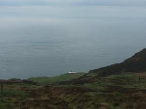
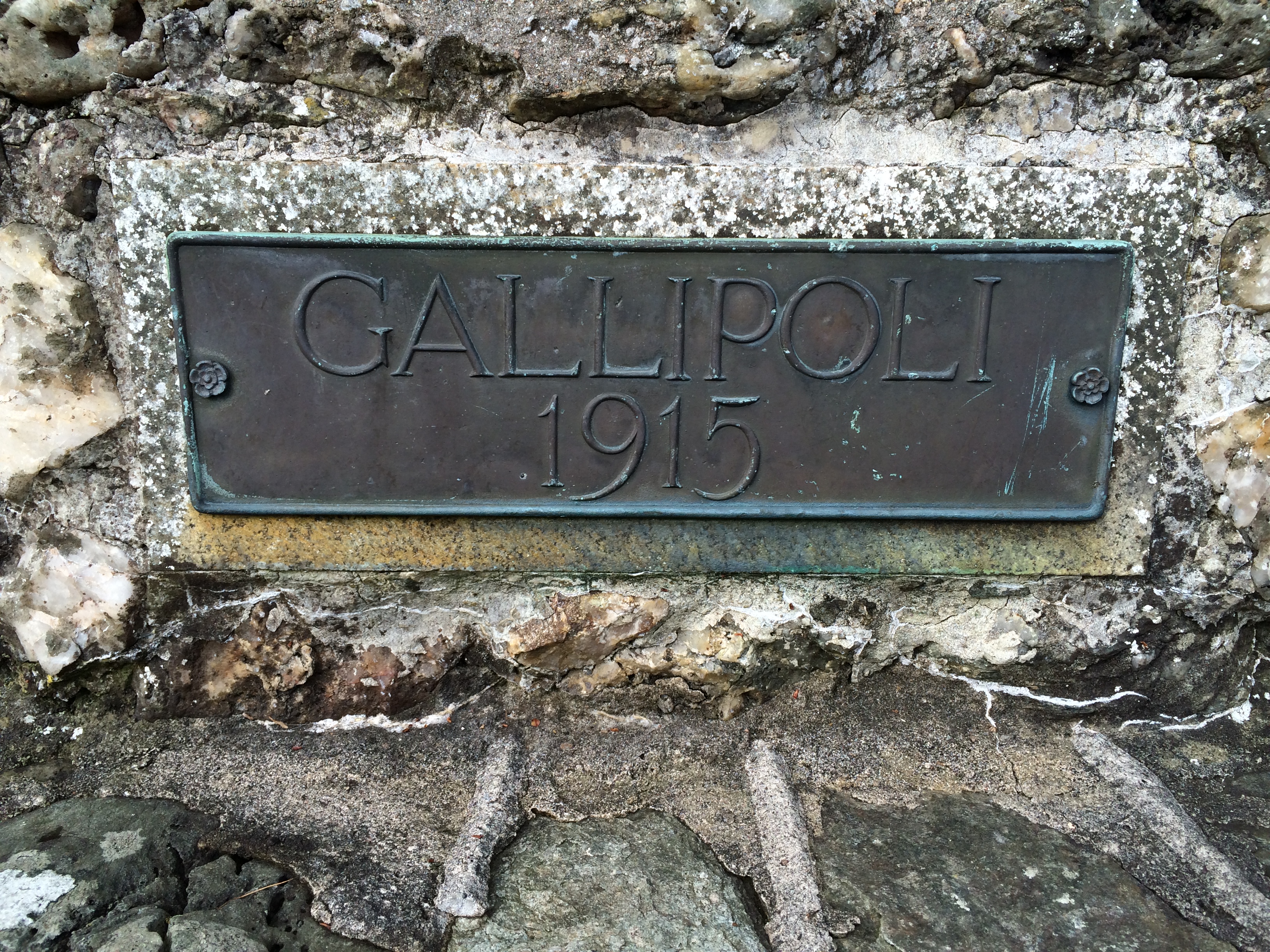
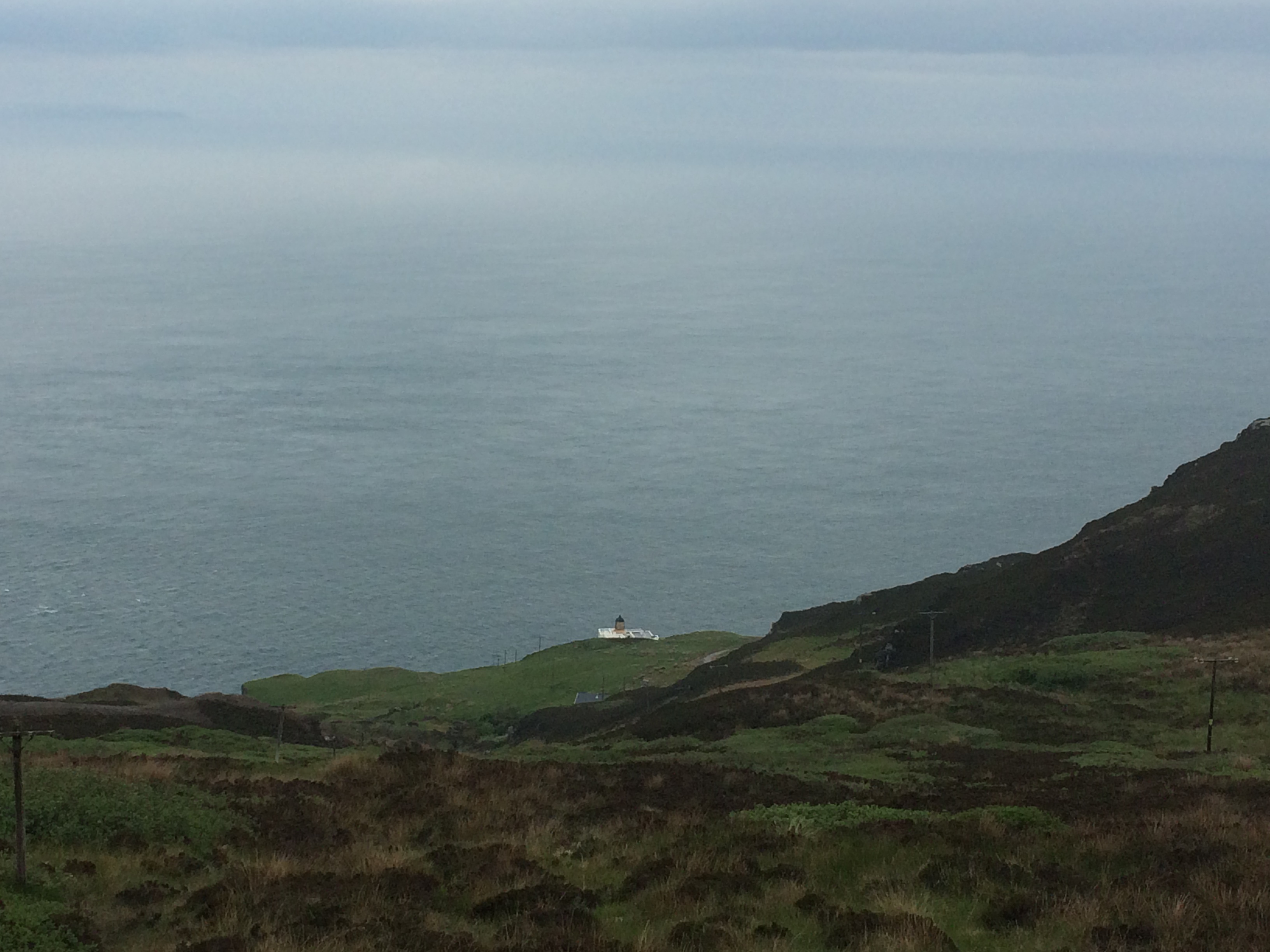
On a clear day you can see Ireland from the mull, but when we were there the top was in a cloud.  We walked out of the cloud and down the other side a short distance to get a glimpse of the lighthouse, built in 1788.

iPhone pictures Nov 2014 682

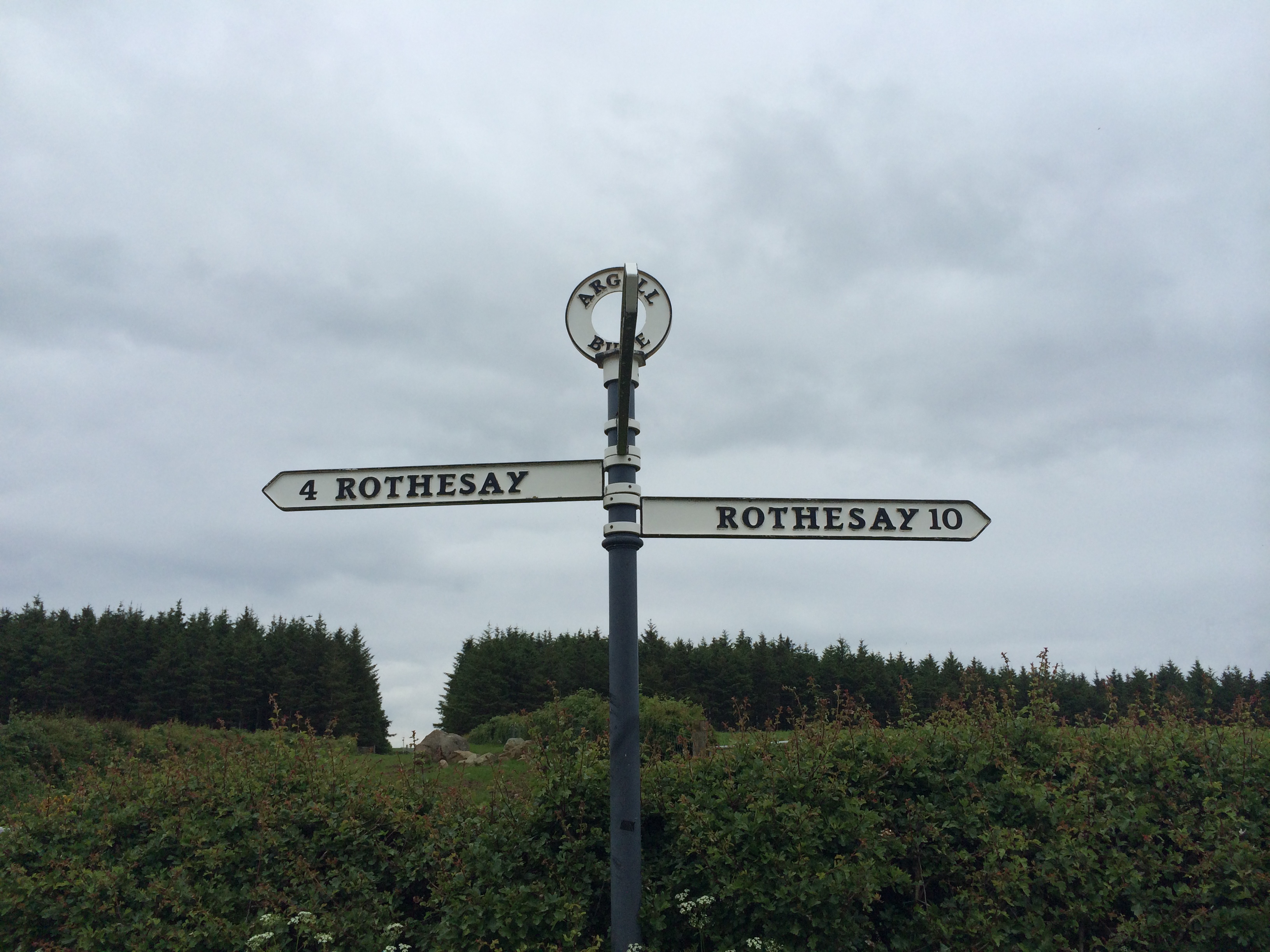
I was going to ride down the hill back to Southend, but it seemed unwise on a foggy day (and on a one-lane road).  So my friends deposited me on the flat and headed home.  I rode back to Southend to explore.

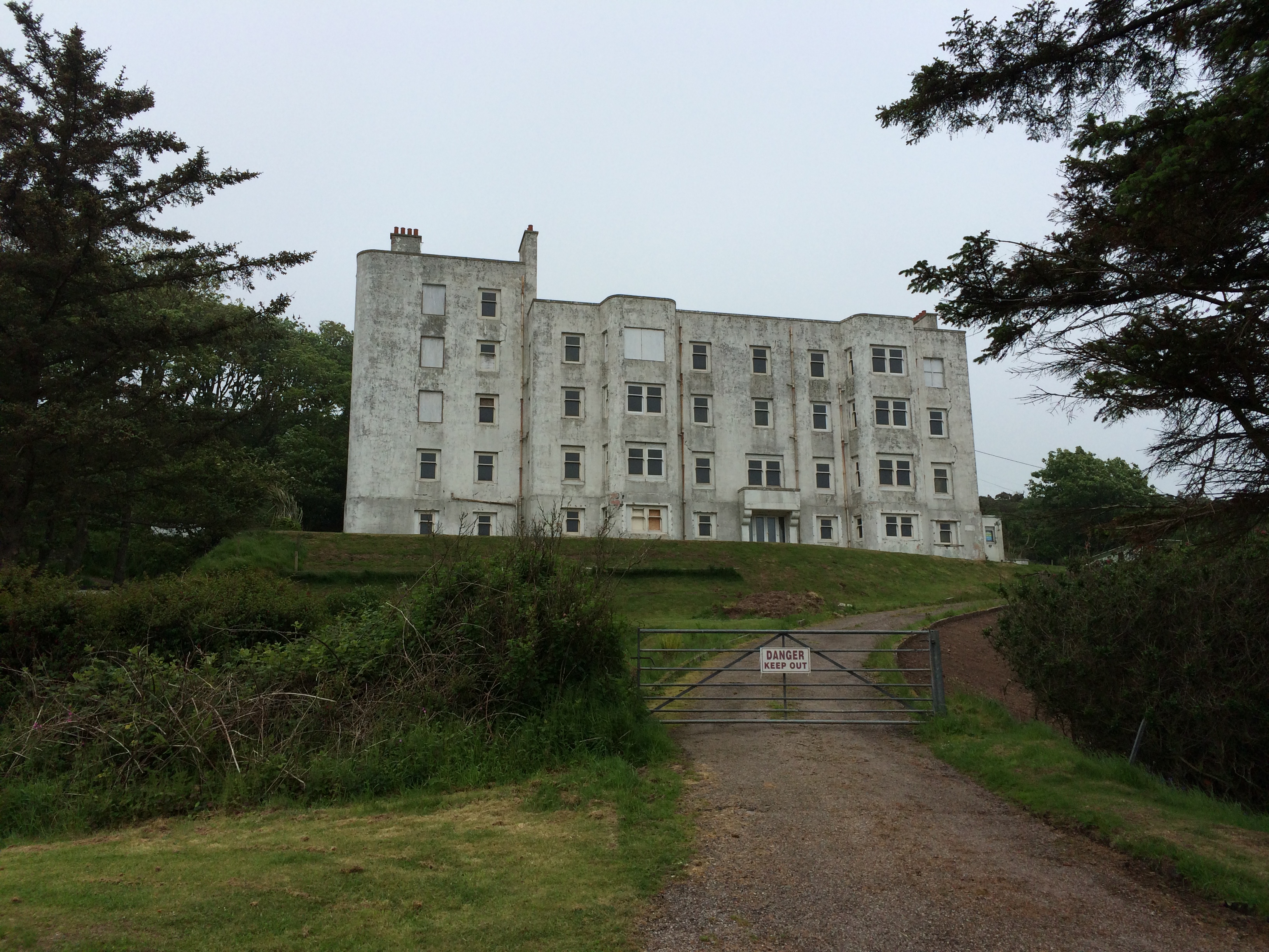
The biggest building there by far is the unoccupied Keil Hotel.  It was finished in 1939, and before it could open the British government requisitioned it as a Navy hospital.  It was also painted white as a navigational aid, as many of Britain’s lighthouses were extinguished during the war.  The five-story building opened as a hotel in 1947, closed in 1990 and was stripped of pipes, wiring, etc.  An attempt is underway to renovate it but it’s right on the verge of being a lost cause.

iPhone pictures Nov 2014 687

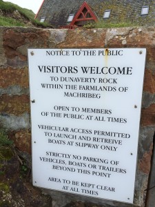
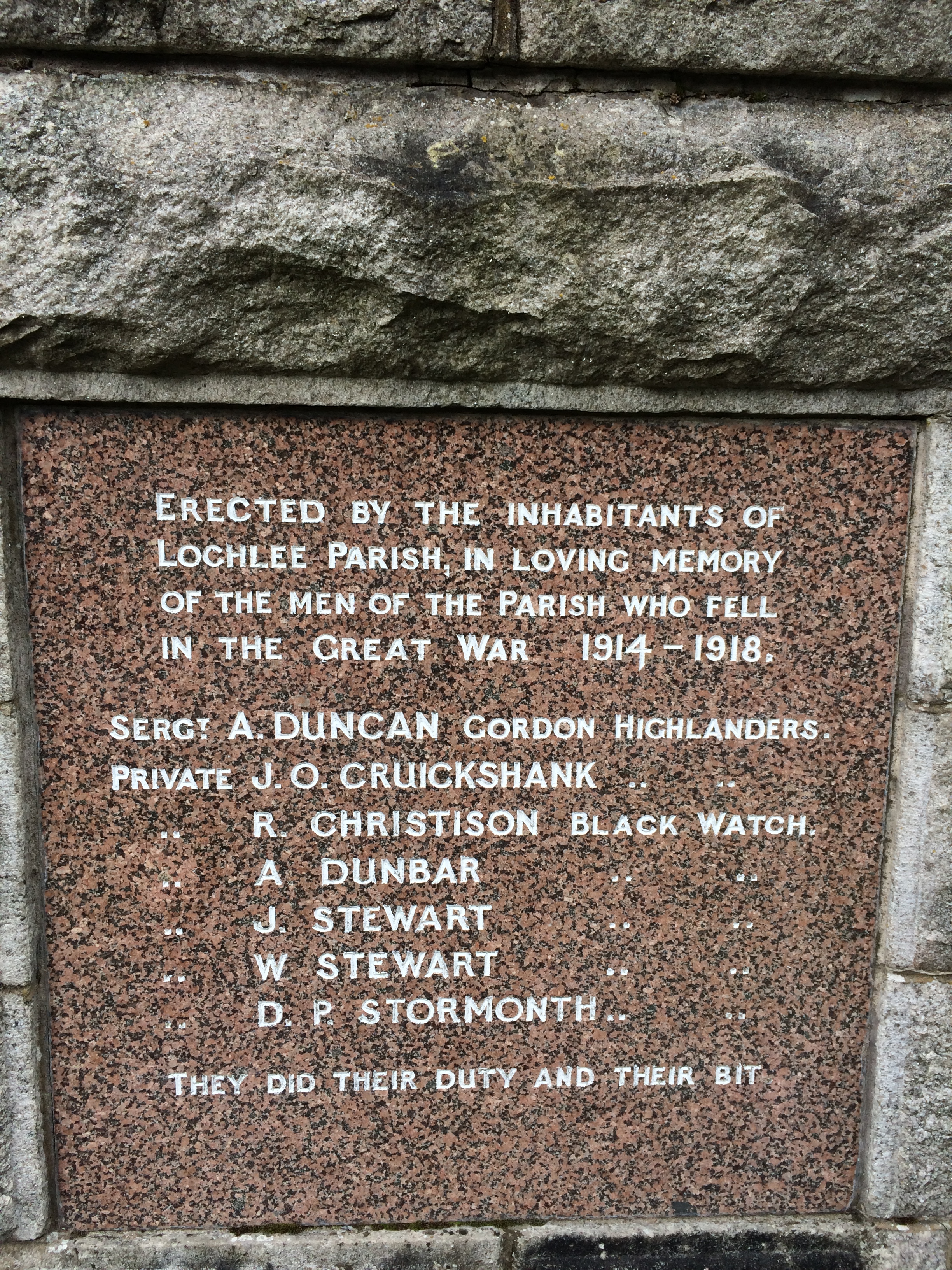
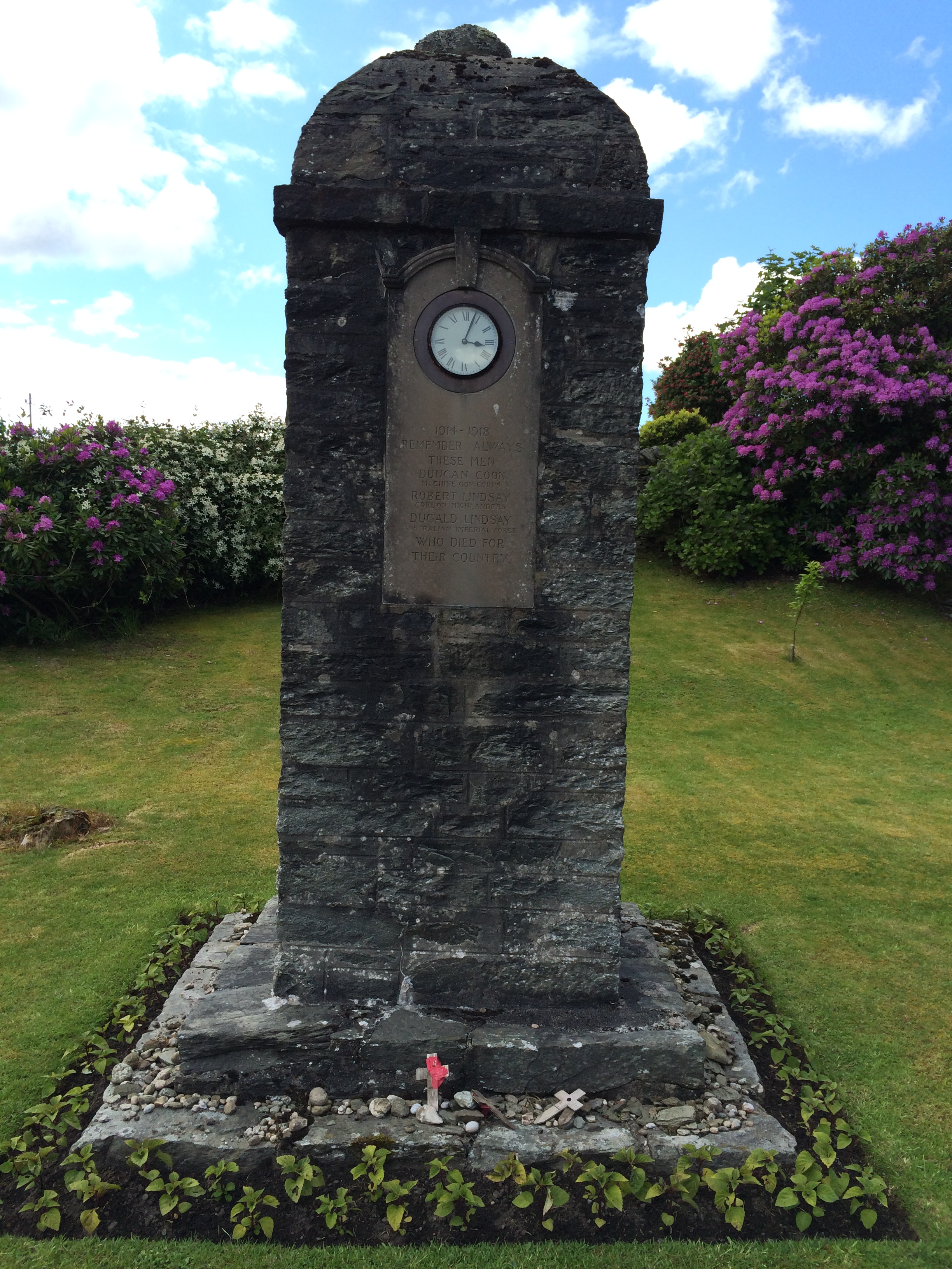
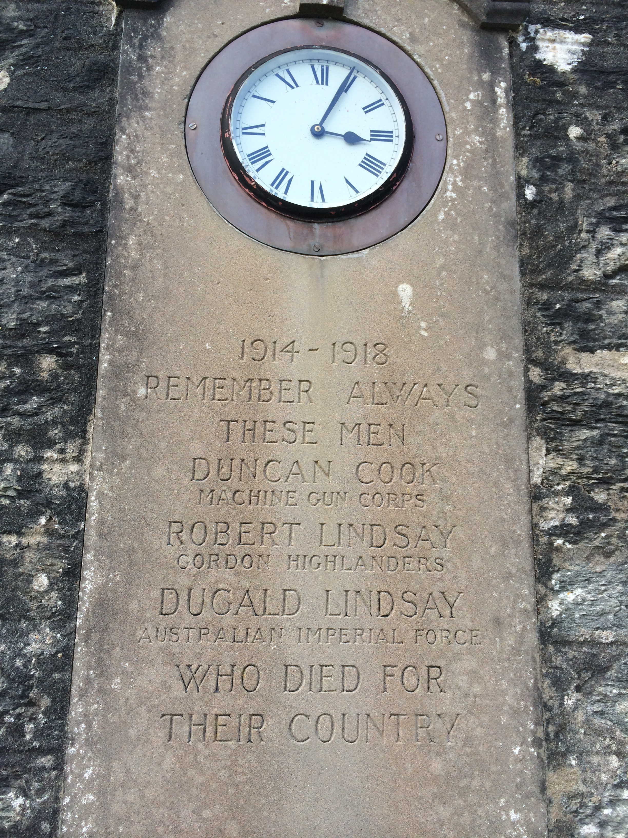
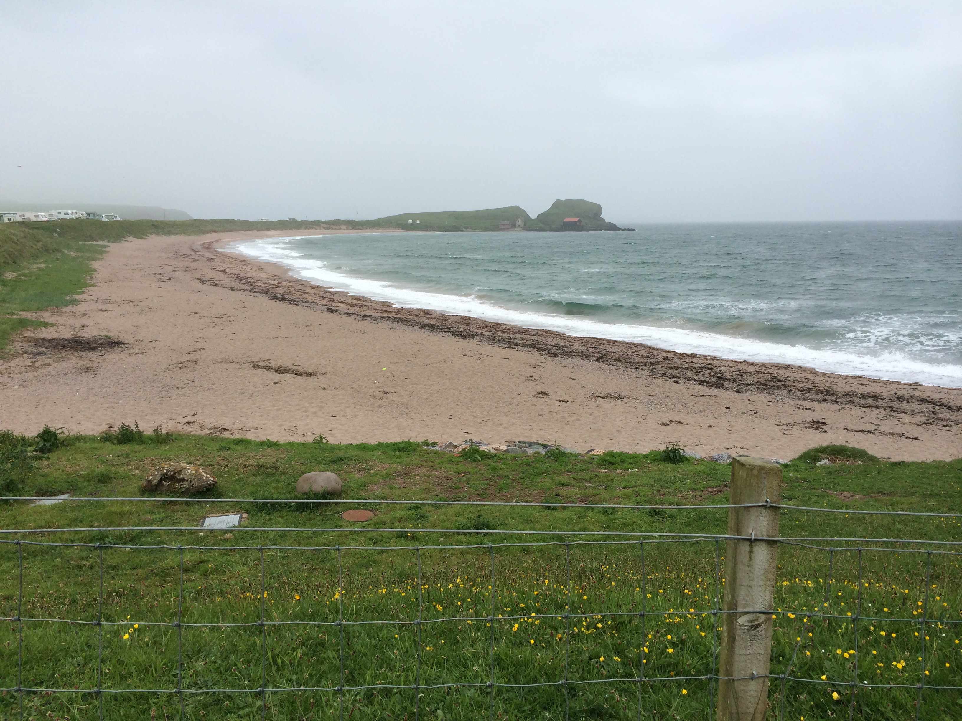
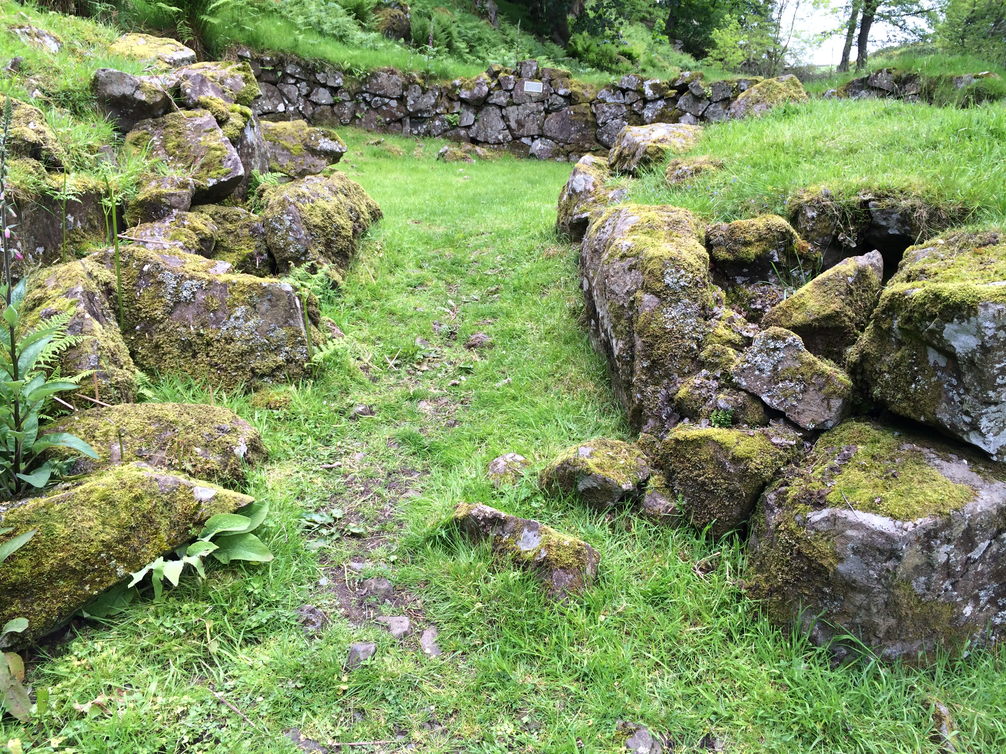
Looking the other way you can see Dunaverty Rock.  It is the site of a castle built by Vikings in AD 712 and where the Scottish King Robert the Bruce sought refuge in 1306.  It was the scene of various battles, sieges and massacres.

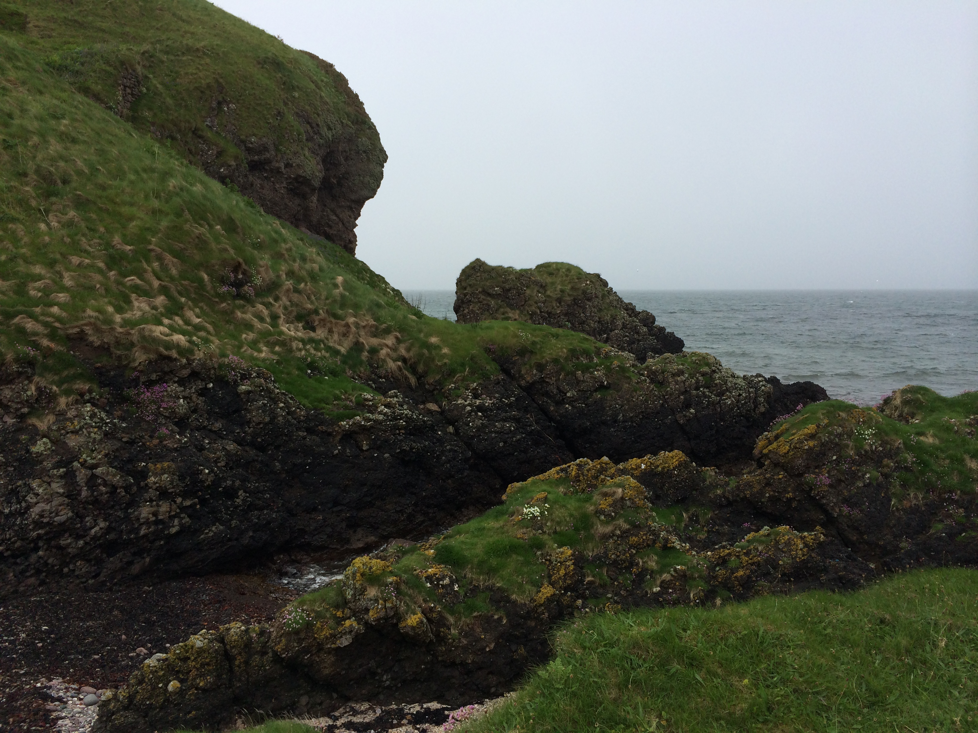
The most notorious was in 1647 when an army of Covenanters blocked the water supply to the castle to force the surrender of a garrison loyal to the English king.  In one version of the story, the 300 people in the castle were promised “quarter”–protection and mercy–but were killed, including the women and children, when they surrendered and gave up their arms.  The Covenanters were reportedly convinced to spare the life of one boy.

iPhone pictures Nov 2014 689

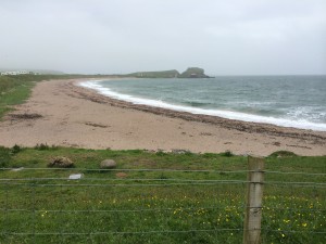
Some were thrown off the rock into the sea.

iPhone pictures Nov 2014 691

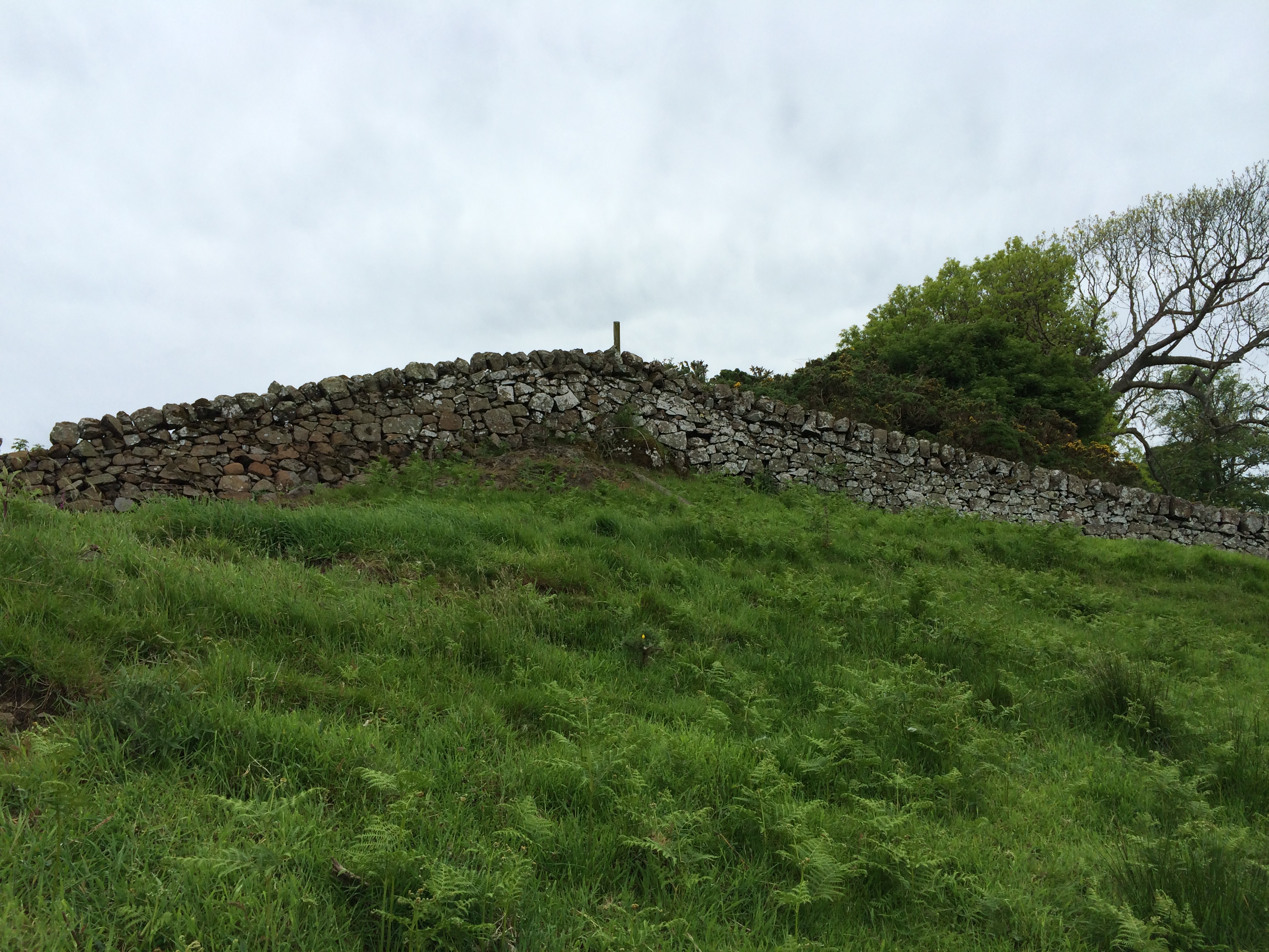
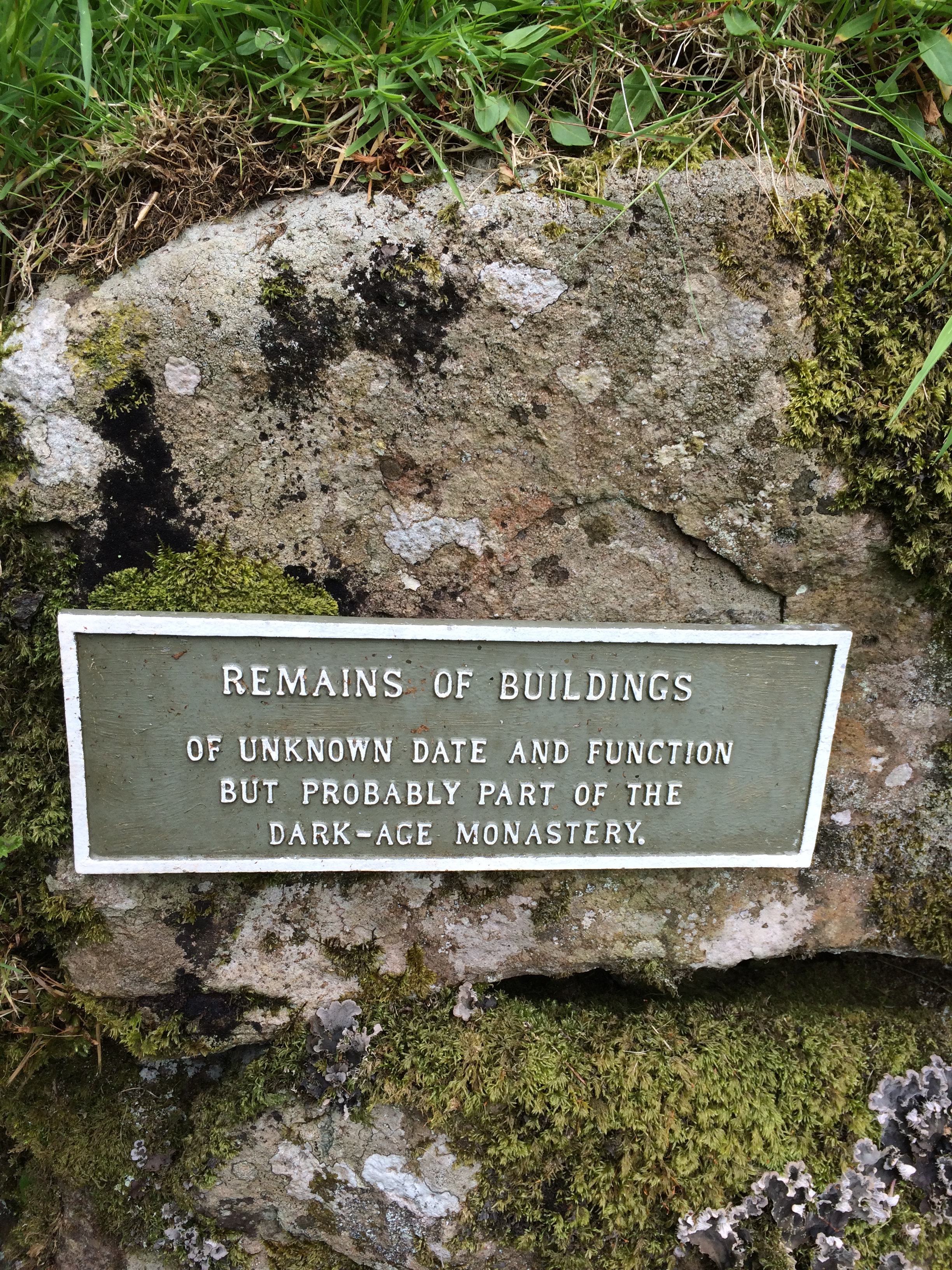
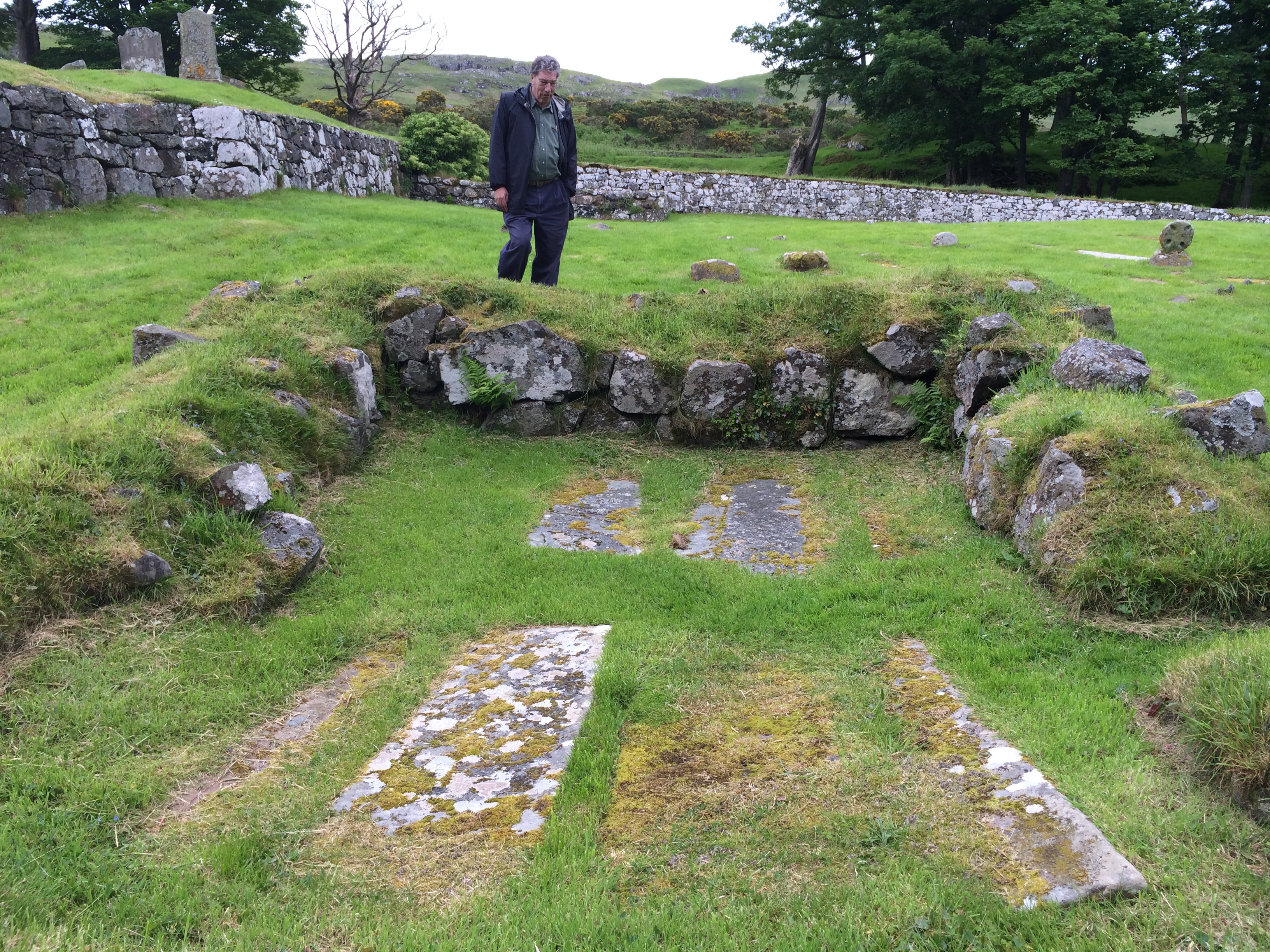
Very little of the castle exists.  But there’s a sign testifying to how much progress the place has made in the last 400 years.

iPhone pictures Nov 2014 690

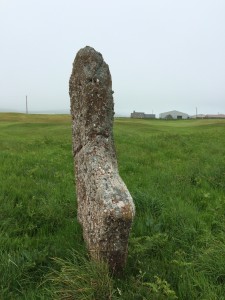
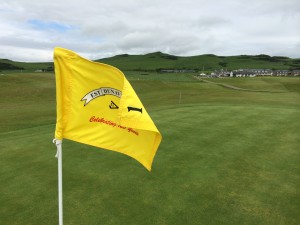
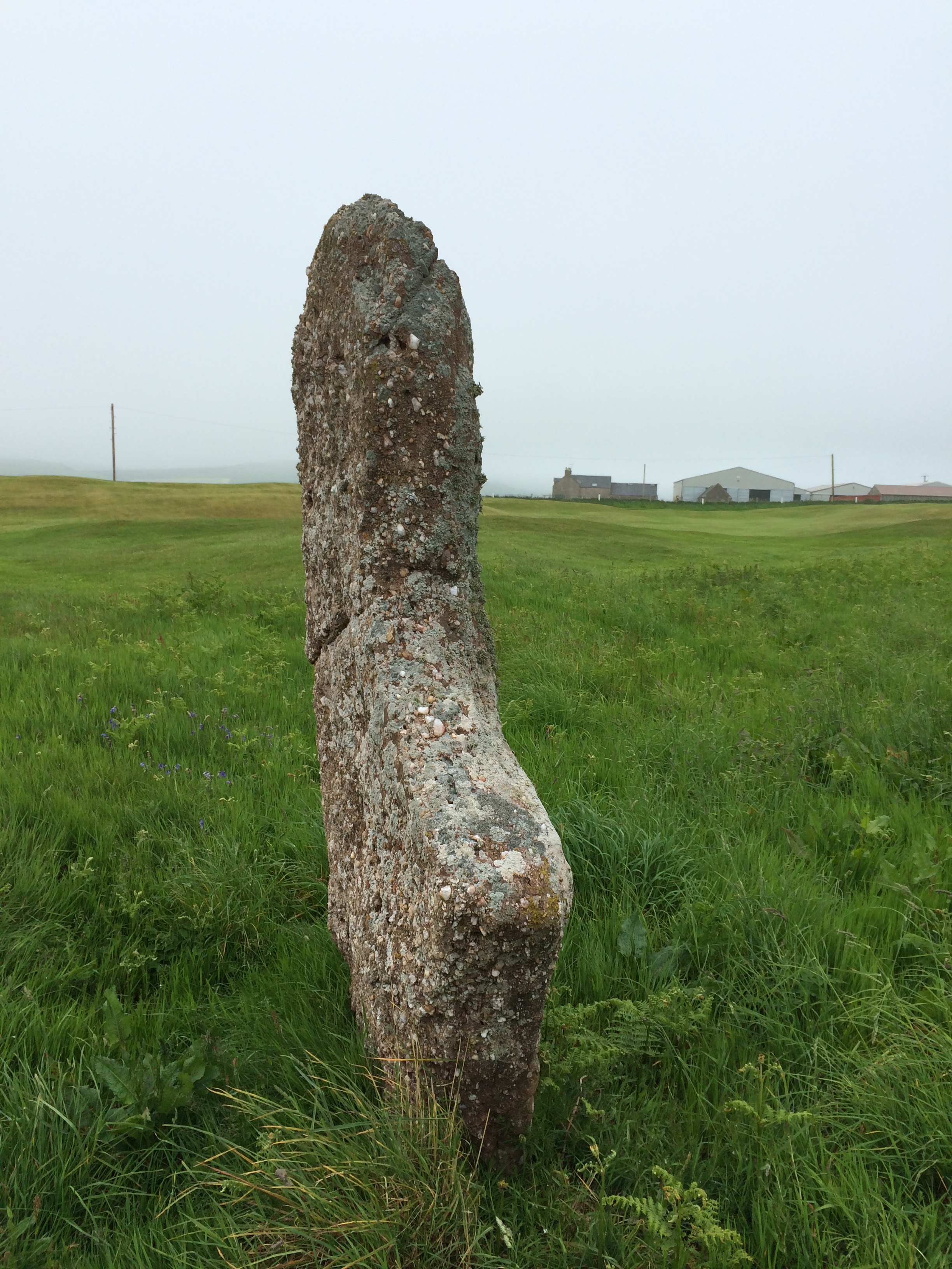
I rode out on a 125-year-old golf course next to the castle to see a standing stone that was marked on the map.  I haven’t been able to find out much about this particular one, but many standing stones go back as far as 3000 BCE.  As I was looking around it occurred to me I could play golf on this trip, too.   What an opportunity–hitting the pill around a links course that has a prehistoric monolith in the rough!

iPhone pictures Nov 2014 693

I stopped at the clubhouse, where the man running the shop, Jim, was vaping and shooting the breeze with a couple other guys.  There were only a couple of groups on the course.  He said the full kit–a set of clubs (“I’ve got some really good ones, if you’re left-handed”), a pull “trolley” and the greens fees–would be 36 pounds, roughly $55. It was too late to play that afternoon.   As I rode the 12 miles back to Campbeltown where I was spending the night, I tried to figure out how to fit it in.

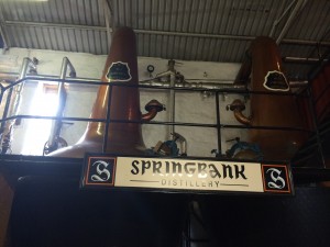
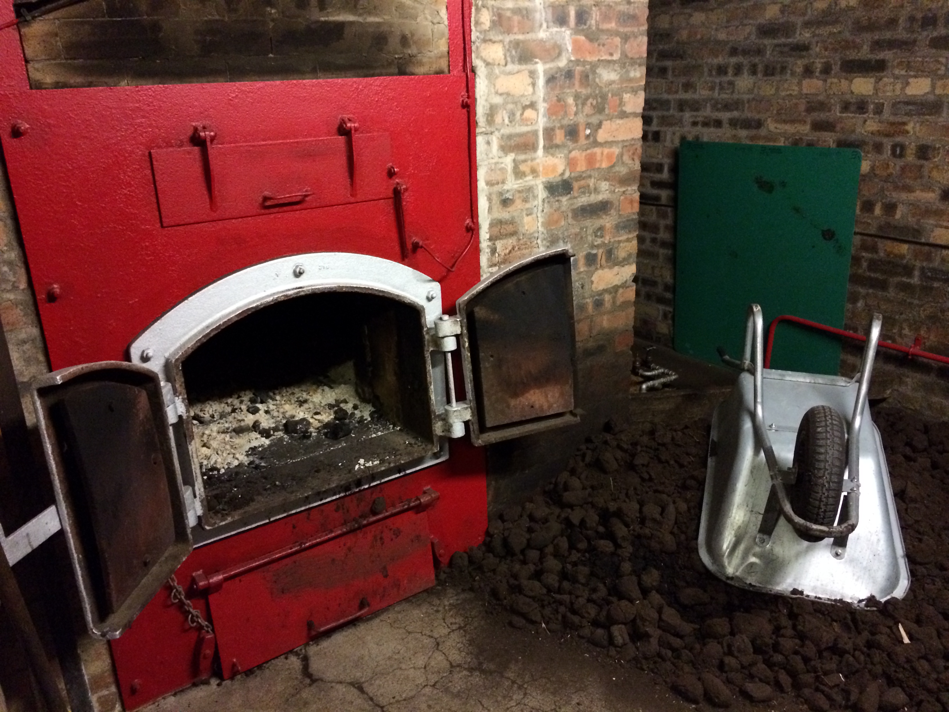
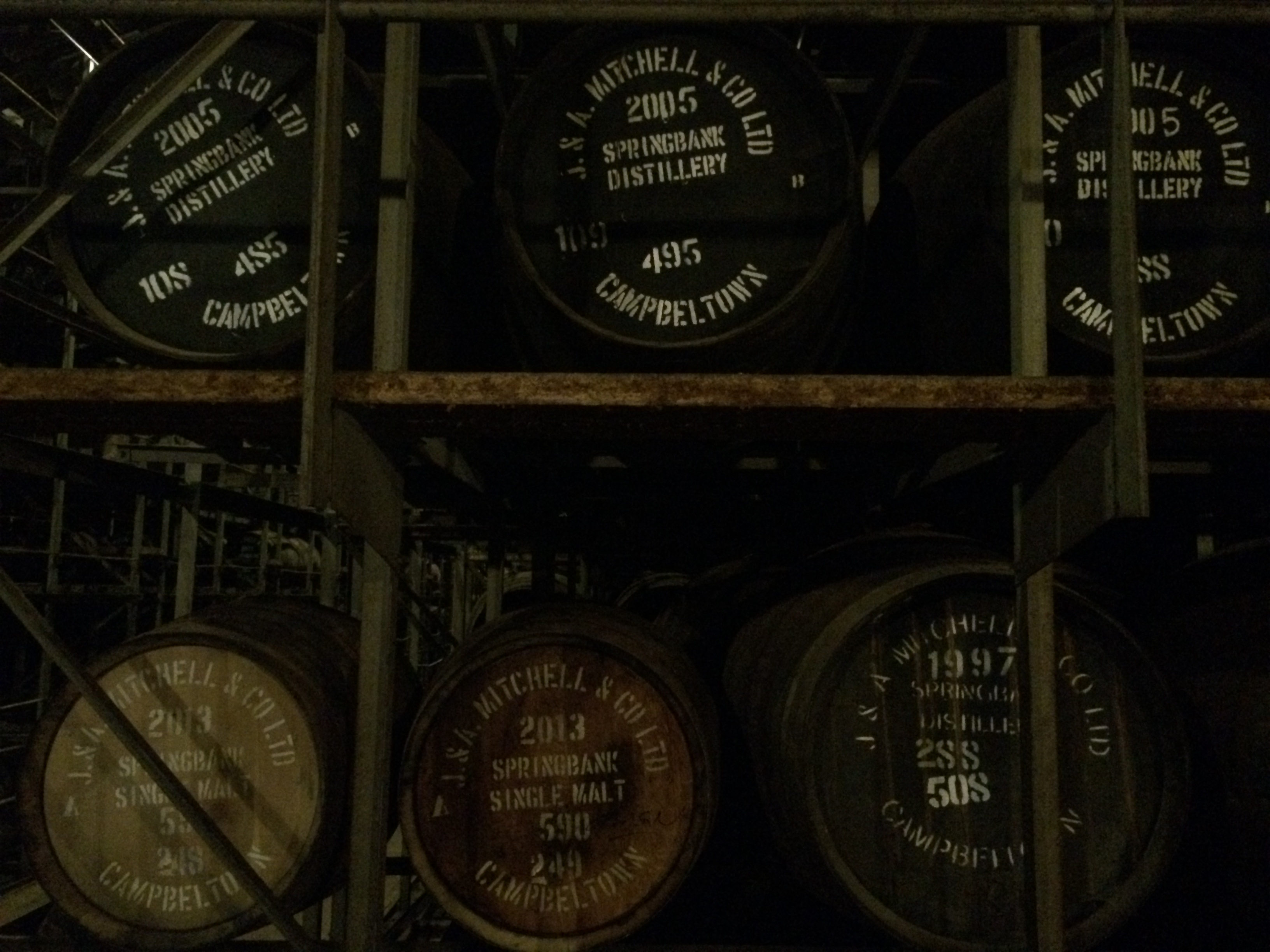
One of the things I wanted to do was tour a distillery in Campbeltown, where three brands of single-malt whisky (including the well-known one, Springbank) are made.  It is one of two distilleries where every step of the process, from malting the barley to filling the bottles, is done in one place.

Tours were at 10 and 2.  I decided to take the morning one, then catch the noon bus back to Southend, play golf, return to Campbeltown on the 4.15 p.m. bus, and then get on the road to the next destination, Carradale, 16 miles to the north.

When I went to the whisky shop in town to buy tickets for the tour I was told it was delayed until 10.30.  A bus with 41 tourists was running late.  This wasn’t what I expected for the first tour on a Monday morning.

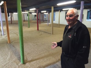
Also signed up for the morning tour was a German named Roger, who had toured Talisker on the Isle of Skye the year before and was heading to Islay the next day to take in three or four more.  We waited at the distillery gate for more than half an hour.  Finally, a ruddy-faced man named Jim came out and said he’d show us around.   The bus wasn’t going to arrive until 11.  So instead of having 43 people on the tour, we had two.

As you can probably imagine, making whisky is a complicated process (although the distilling team consists of only six people).  It starts with soaking barley in water and then spreading several tons of it on the floor, where it is turned six times a day as it starts to germinate, turning the starch into sugar.

iPhone pictures Nov 2014 696

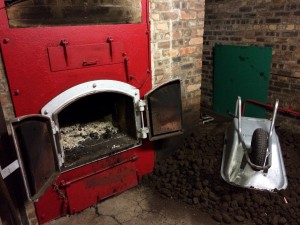
Germination is stopped by drying it.  For two of its three types of whisky, the distillery does this with heat that also contains smoke from burning peat.  One type gets six hours of smoke exposure, the other 48.  That’s one of the reason they taste different.

iPhone pictures Nov 2014 698

There are many more steps leading to distillation, which is done twice.  (Actually a fraction of the run is distilled a third time and added to the final product, which is why Springbank is marketed as “distilled two and one-half times”).

iPhone pictures Nov 2014 715

At one point the liquor is clear “spirit,” more than 70 percent alcohol.  Very powerful, but not tasteless.

iPhone pictures Nov 2014 718

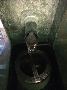
Then it goes into oak barrels that have been previously used in bourbon making, or had once held Spanish sherry for six years.  The spirit sits in the barrel, unturned and untouched, for at least 10 years.  It gets its color and some of its flavor from the essences extracted from the wood.

iPhone pictures Nov 2014 725

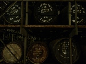
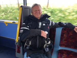
I missed the vatting and bottling steps because I had to catch the bus.  There were six people on it.  I struck up a conversation with one of them, a man named Mike Healey.

He had just retired from the Glasgow School of Art.  The hotel I’d stayed in in Glasgow was right next to the school, so I knew about it.  He taught graphic art and lived with his wife in Southend, where she’d been a primary school teacher.  He’d been a visiting professor at the Maryland Institute College of Art for a year in the early 1980s.

He’d won a scholastic prize when he’d graduated from the Glasgow School of Art that paid for a year of travel in the United States to meet artists.  He crossed the country five times on buses.  One of the artists he visited was Norman Rockwell, who invited him to stay at his house in Stockbridge, Massachusetts, for a week.

“Rockwell was a modest man and a perfect gentleman.  He lived in a rented house.”

Rockwell was painting a picture of the Liberty Bell with a birthday ribbon tied around it, in preparation for the Bicentennial.  His studio was large and had all sorts of props and costumes in it.

“He’d bring whole groups of people in from the town to pose for his pictures.  It was like a theatrical stage really.  A photographer would take pictures and he would do a lot of the work from pictures.”

When Mike went to the United States he assumed he would end up living there.  He enjoyed his time, although it was a lonely year.  When he left he knew he wasn’t going to live in the United States.

“It’s really about six countries, isn’t it?”

iPhone pictures Nov 2014 727

I should have asked Mike to play golf (he said he did occasionally), but unfortunately that didn’t occur to me until I was here:

iPhone pictures Nov 2014 730

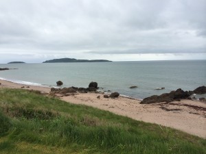
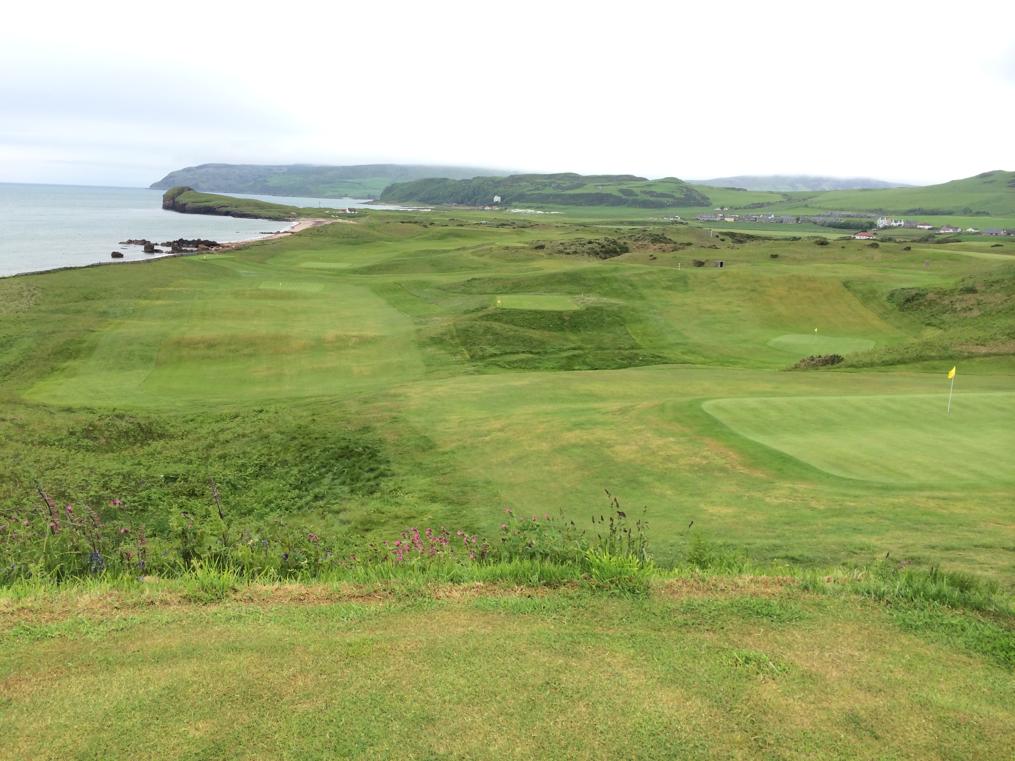
I also spent a fair amount of time here:

iPhone pictures Nov 2014 739

The views were spectacular, the greens small, the wind nearly constant.  There are no electric carts.  There were hardly any players.

iPhone pictures Nov 2014 740

The big island in the distance, Sanda, was once owned by Jack Bruce, the bass guitarist for Cream.

iPhone pictures Nov 2014 737

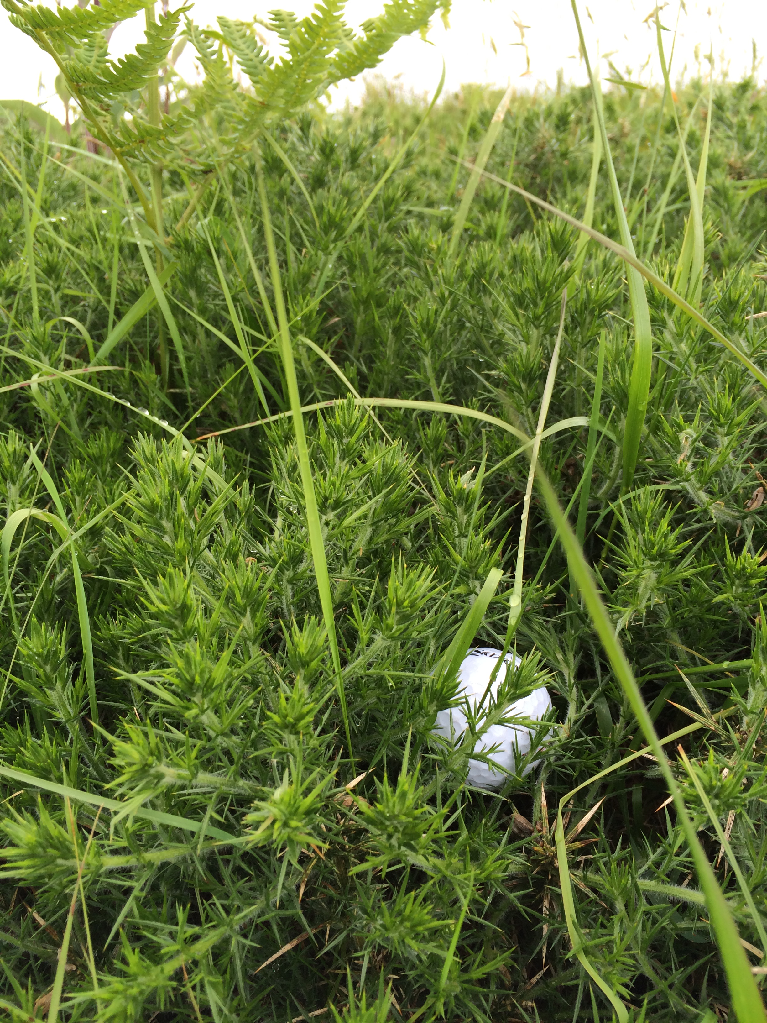
I only played 15 holes (although I played two balls on some) because I had to catch the bus back to Campbeltown.  I went out with eight balls and turned in the bag with one left.  So I might not have made it around 18 holes even if I’d had the time.  It was lots of fun.

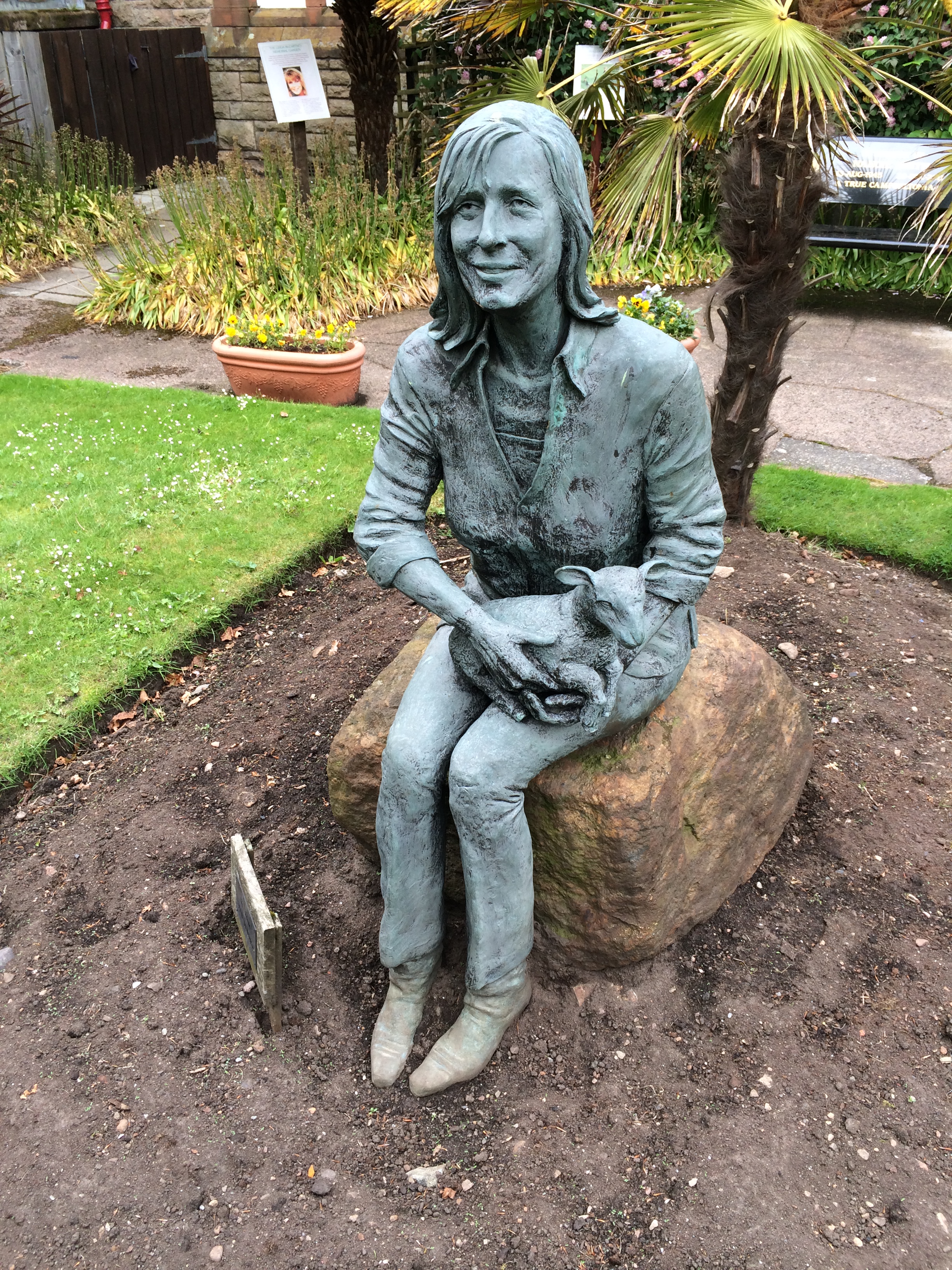
Before I left Campbeltown I stopped by the garden for the town museum to see the statue of Linda McCartney, who died in 1998.  She, her husband and their children spent a lot of time in Kintyre and were much loved (and protected) by the locals.

iPhone pictures Nov 2014 744

I finally got on the road.  There were a lot of hills as I cycled the road up the east coast of the peninsula.  It was a sunny day and felt like about 4 o’clock when I reached Carradale, although it was actually after 8.

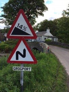
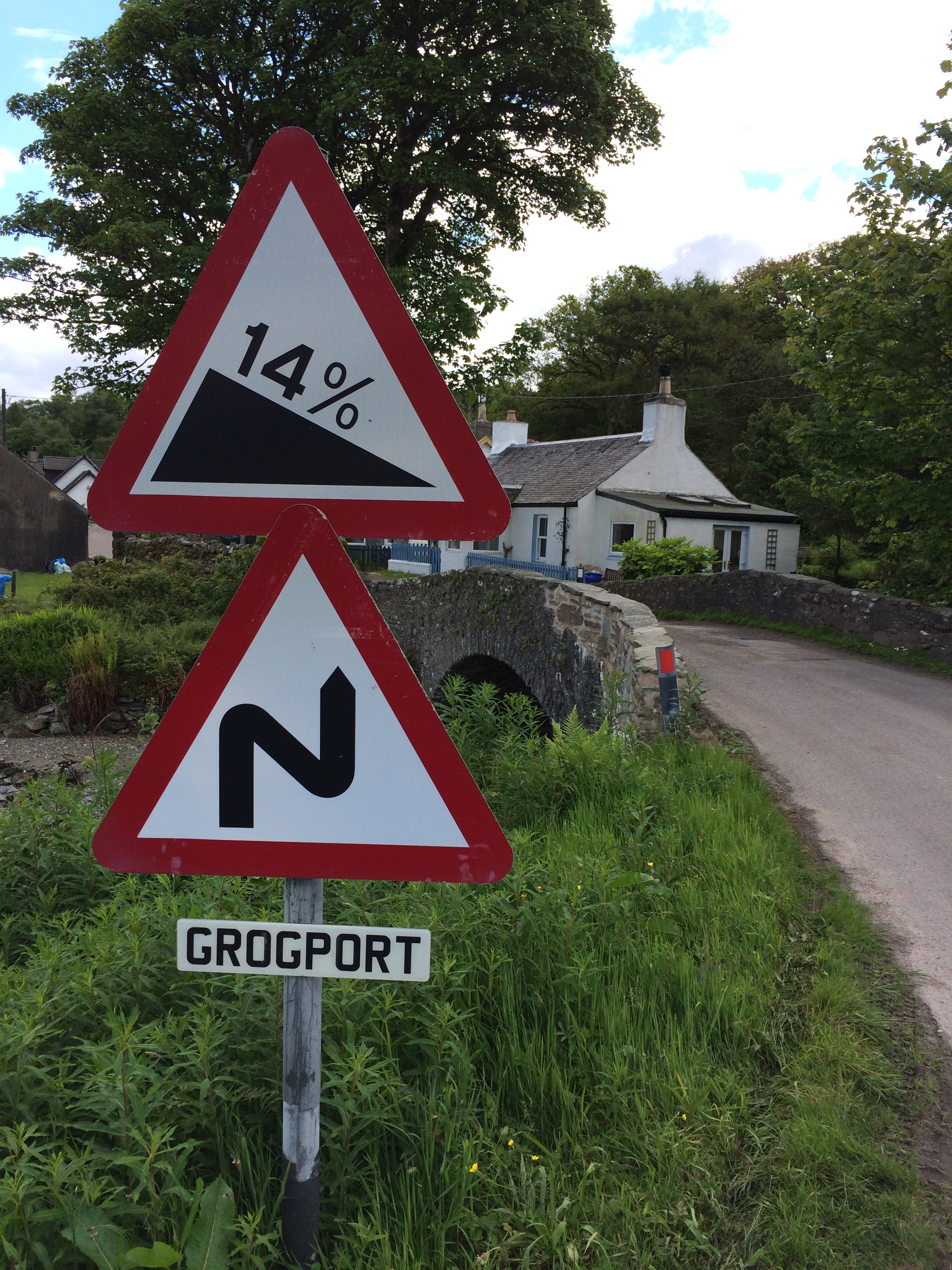
I didn’t get underway until after noon the next day, as I needed the hotel’s wifi and it took a lot of time to upload pictures.  It was again sunny and beautiful when I hit the road.  I went through a tiny burg with an interesting name.  Let’s hope that at least one of these signs is wrong.

iPhone pictures Nov 2014 747

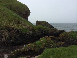
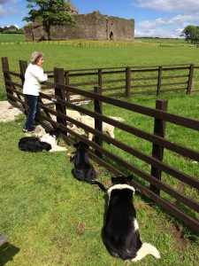
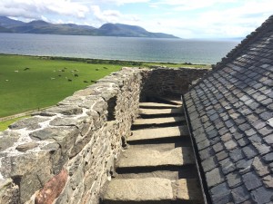
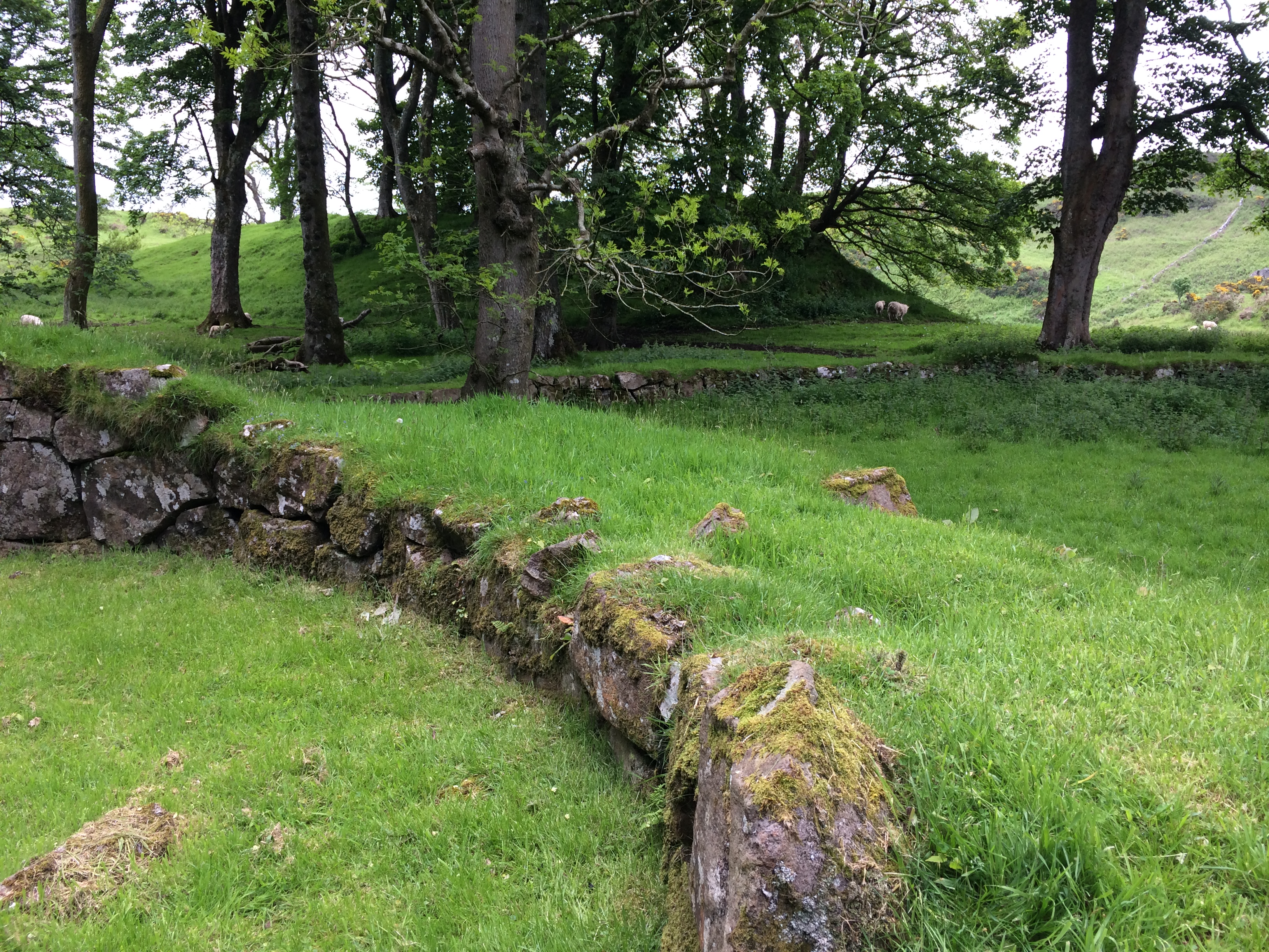
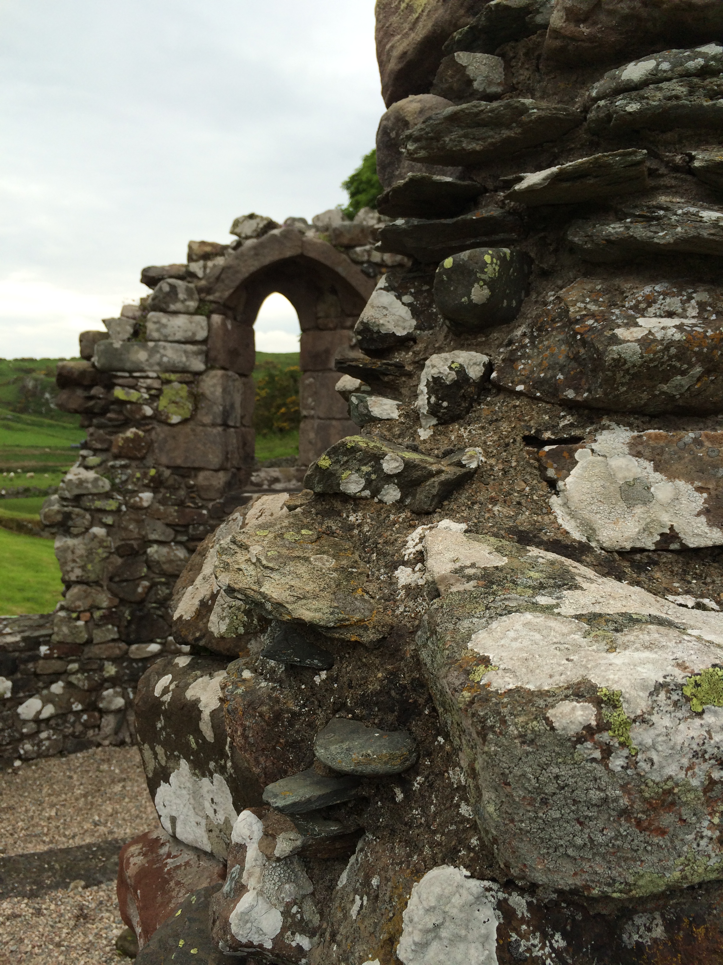
I made an unexpected detour on the way to visit the ruins of Skipness Castle, which was built in the 1200s and still had some local workers occupying a few rooms in the late 1800s.

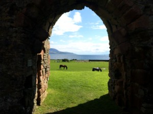
It faces a body of water called Kilbrannan Sound, with the Isle of Arran (Scotland’s, not Ireland’s) in the distance.  Between the ruin and the water were fields with sheep and horses grazing.  At one corner was a seasonal seafood restaurant with picnic tables outside.  I got lunch there and watched three border collies watching and following two orphaned lambs in fenced pen.

iPhone pictures Nov 2014 770

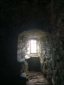
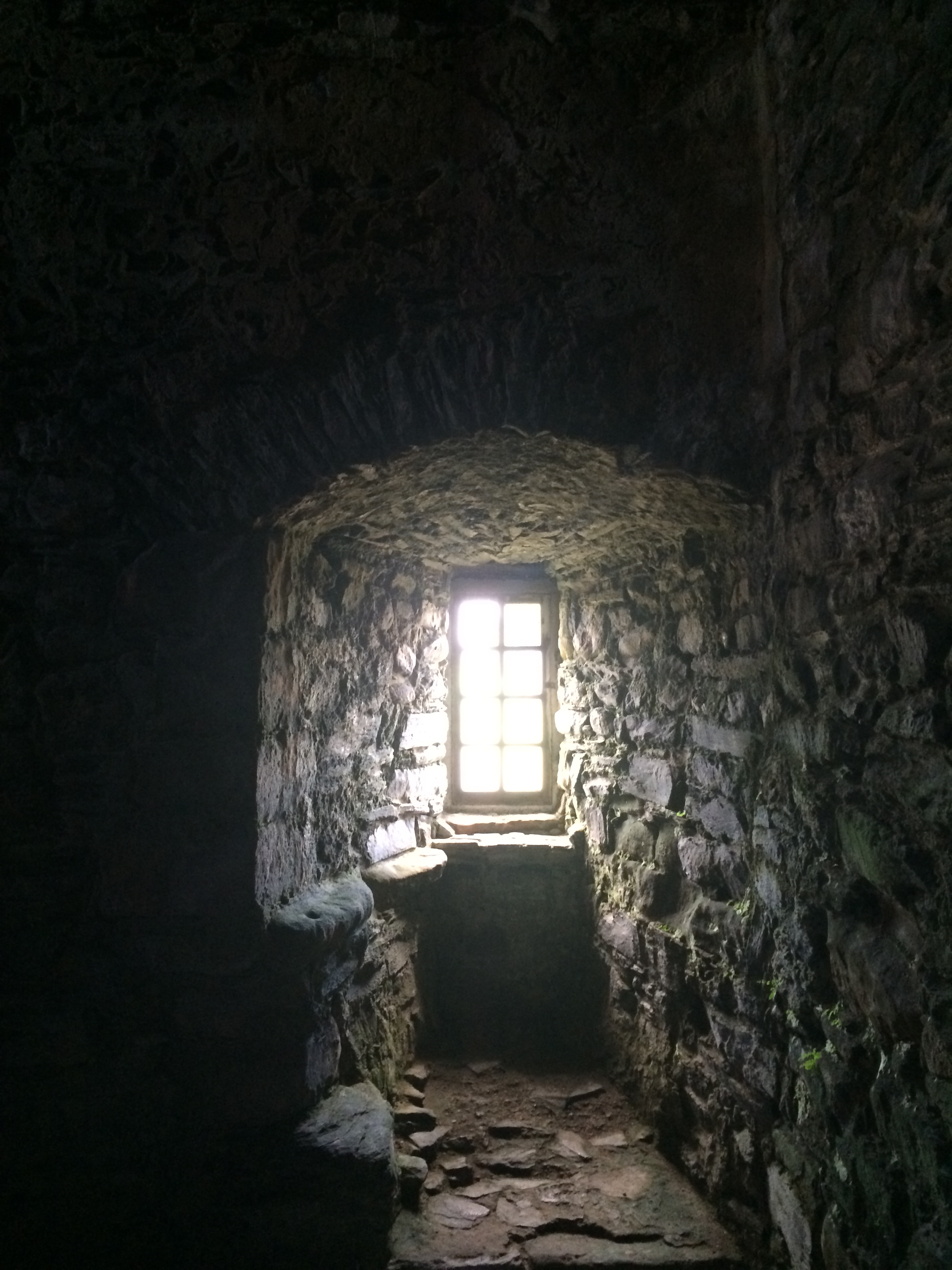
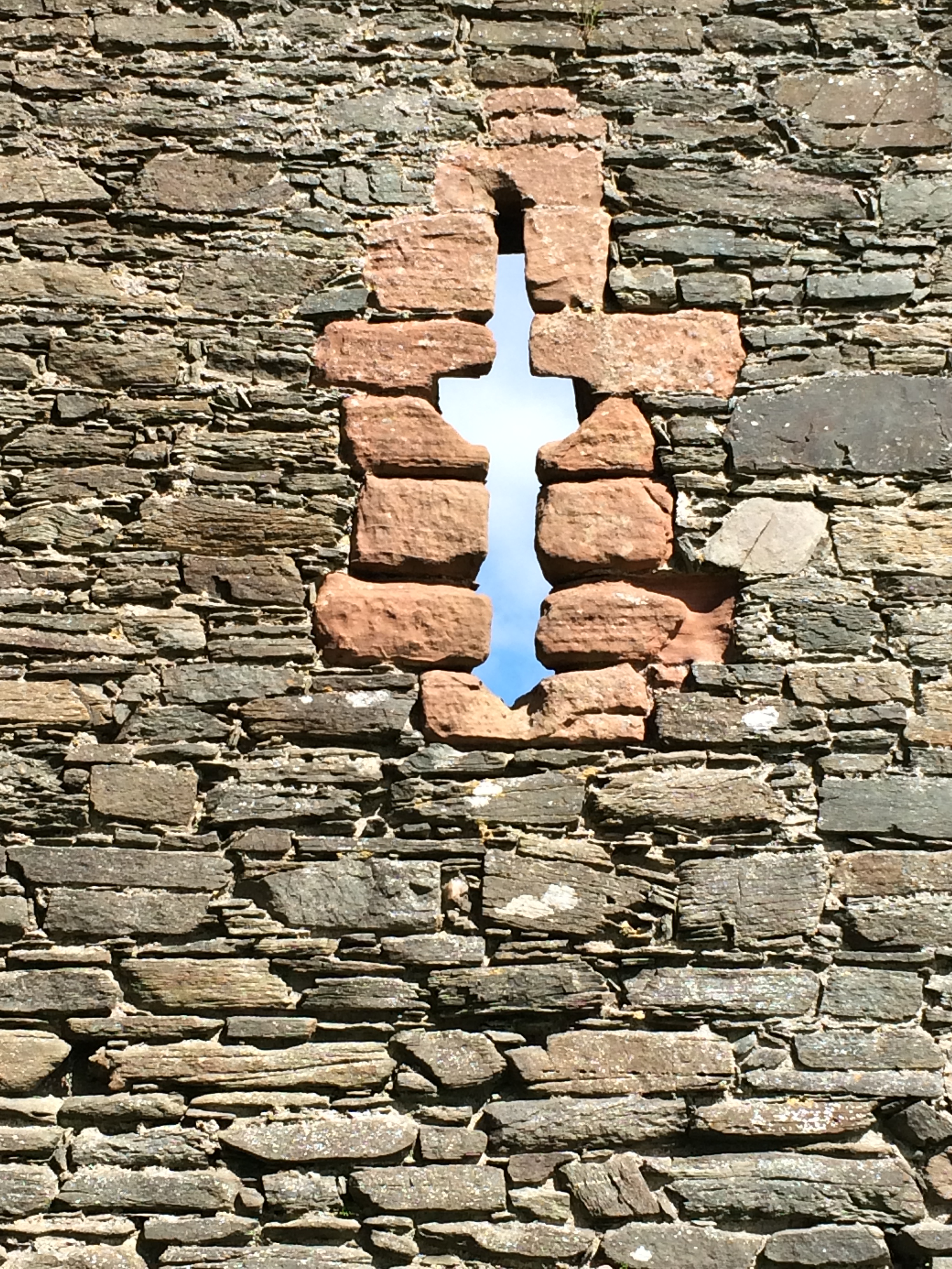
The castle was, well, just about everything one could hope for in the ruined-castle department.  You could walk all the way up to the parapet and stroll around like the ghost of Hamlet’s father.

iPhone pictures Nov 2014 786

There walls were feet thick with little windows.

iPhone pictures Nov 2014 784

This is a view out the front door.

iPhone pictures Nov 2014 796

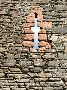
It’s hard to know whether this shooting port has intentional religious meaning as well.

iPhone pictures Nov 2014 801

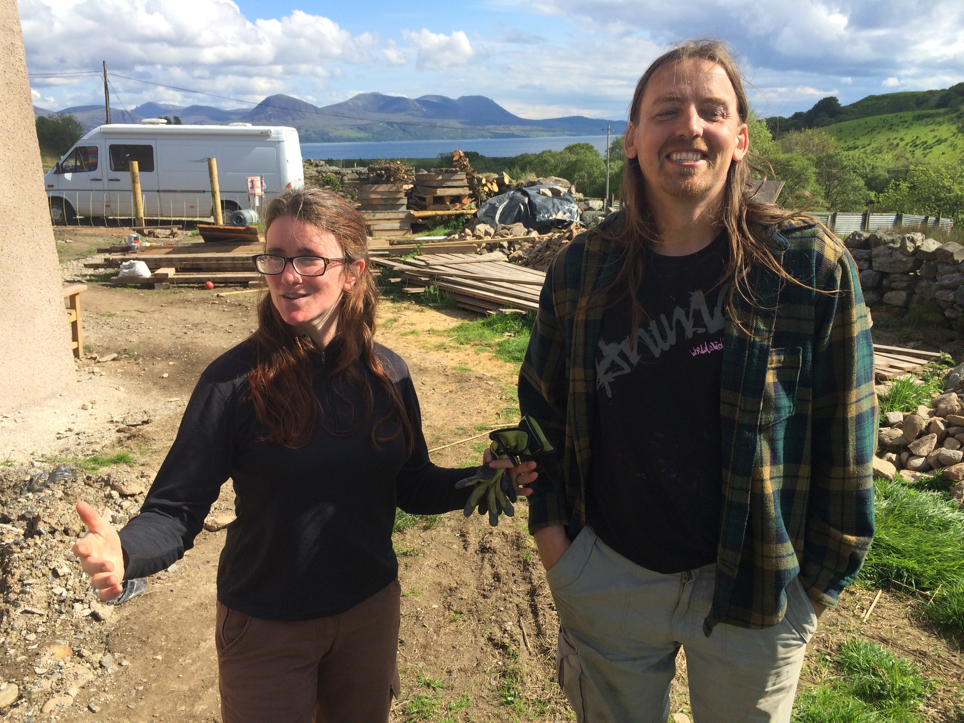
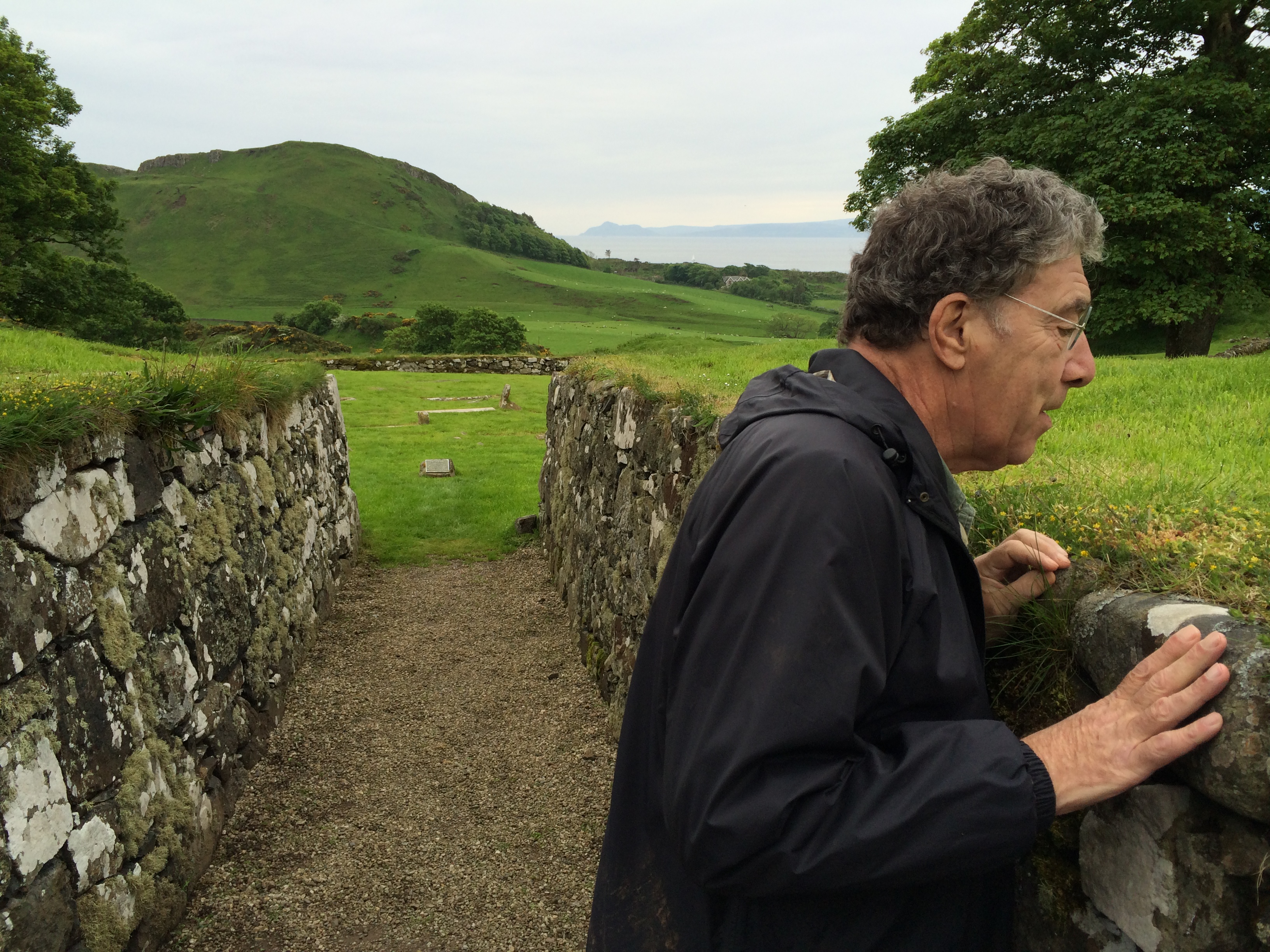
I rode back to the junction where I was going to ride northwest over the hills to the western shore of Kintyre, there being no road all the way up the east to Tarbert, where the ferry terminal is.  I had left my pack at the junction with this delightful couple, Ali and Steve Ashford.

iPhone pictures Nov 2014 812


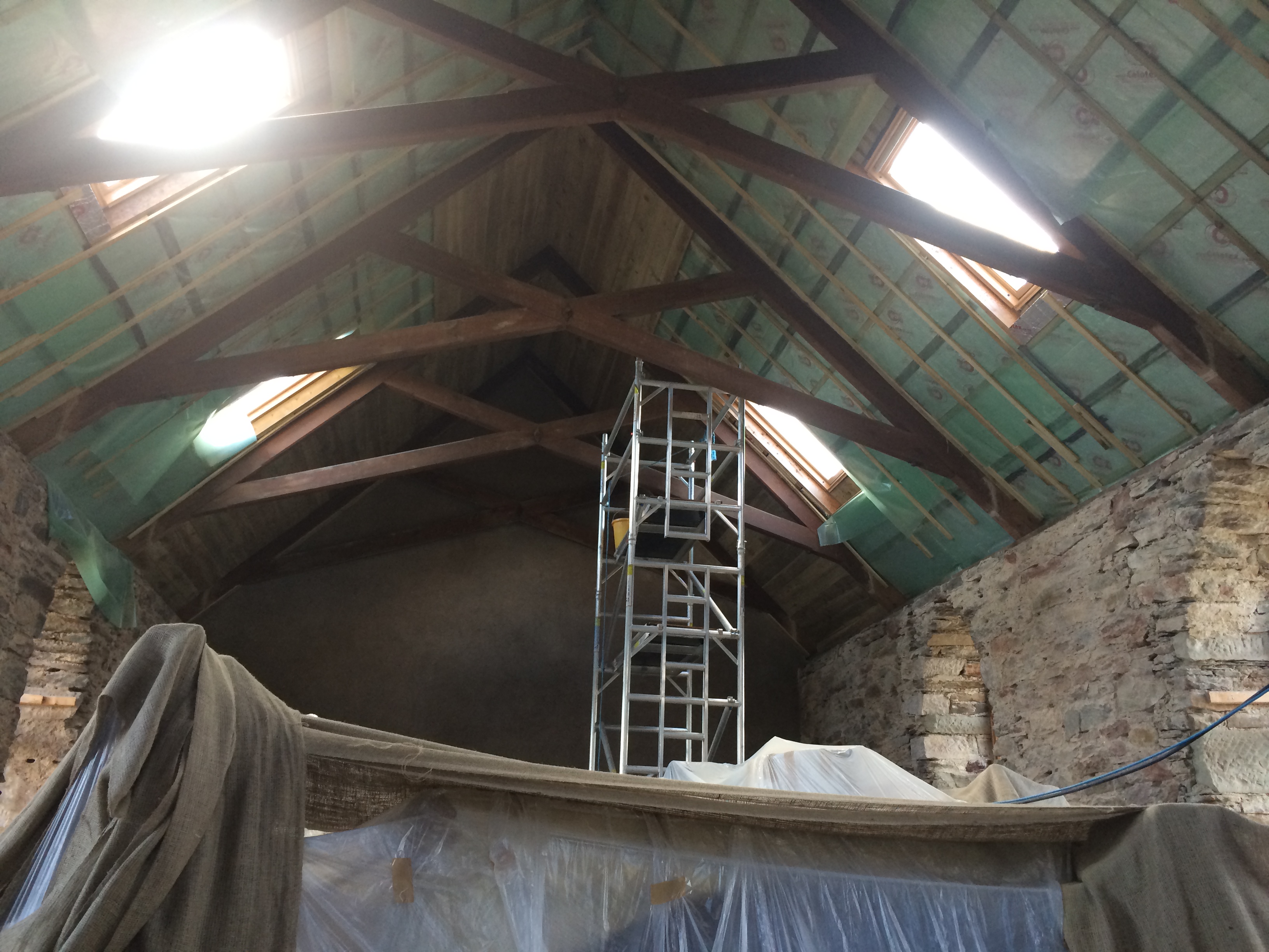
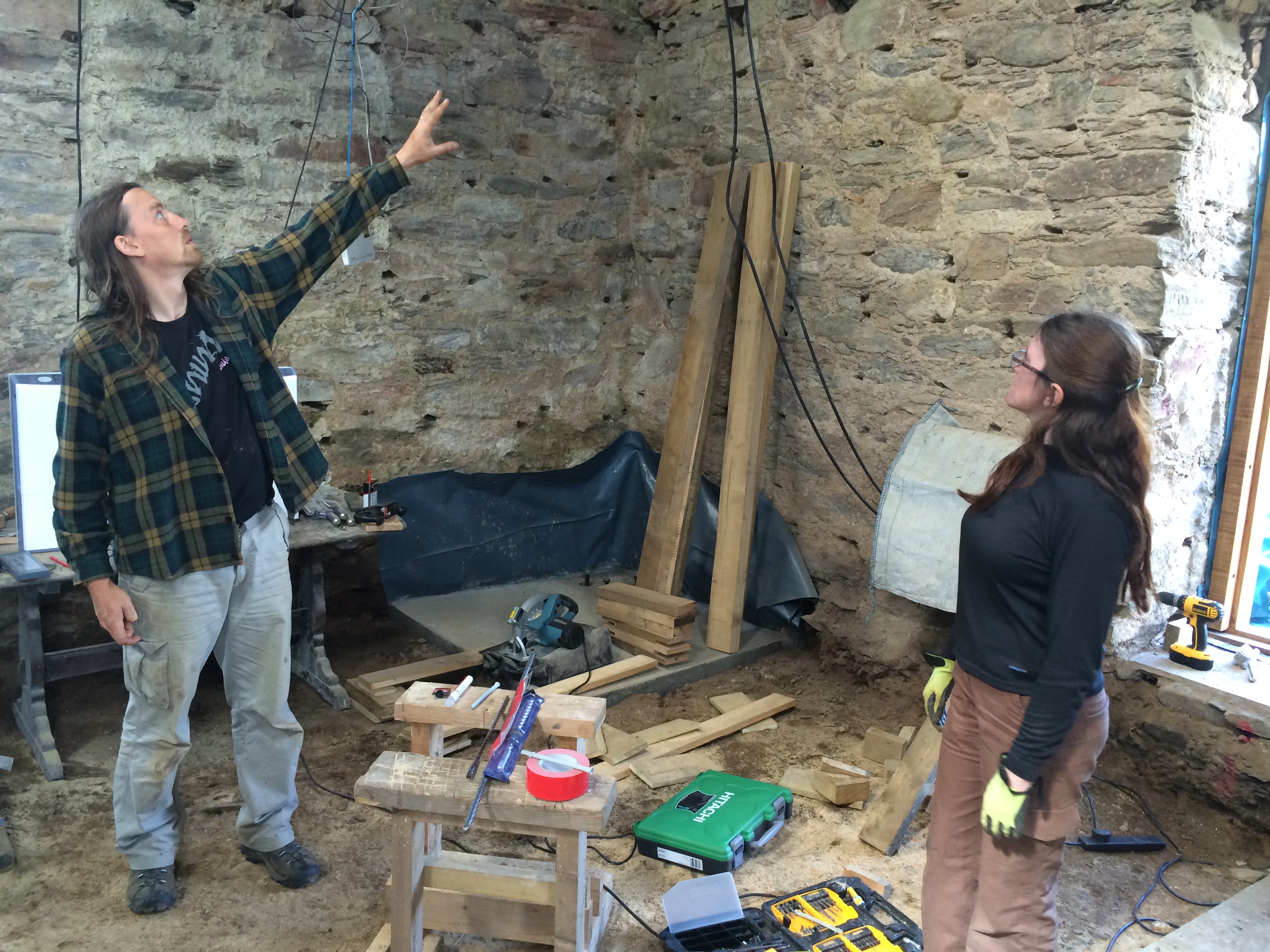
The are musicians who had moved up from England and bought a stone church that had been built in the 1750s and had closed in the 1970s.  There are a fair number of desanctified churches in Scotland for sale; they are the fourth owners of this one.  Previous owners hadn’t gotten far in renovations because the owner of the estate wouldn’t give them access to water.  He thought he should control the church even though he didn’t own it, Ali said.

iPhone pictures Nov 2014 804

The estate has been sold and the new grandee is a Swede.  He gave the couple access to a stream for water.  They are renovating it themselves, living in a camper on the grounds with their Mexican hairless dog.  The work is complicated as well as hard because the building is on a historical register that limits exterior changes, but all sorts of modern code requirements must still be followed.  Ali and Steve think they’ll be able to move in in about a year.  Stupidly, I didn’t take a picture of the outside.

iPhone pictures Nov 2014 805

I hope to see it, and them, again sometime.

I had 10 miles to go to get to Tarbert.  (I’d gone 19).  The ferry to Portavadie, where Deborah and Paul were going to meet me, left Tarbert at quarter past the hour.

I left the old church at 5.15 and rode four miles over the hump. I got to the coast road with six miles to go and 30 minutes until the 6.15 ferry left.  I thought I could make it, but if I didn’t that was fine, as I’d told Deborah and Paul I would probably be on the last one, at 7.15.

I pedaled along and got to Tarbert and a dock with a ferry, but no signs of any people except for a forklift operator, at 6.04.  He told me the ferry that was working was a half-mile on.  I got there at 6.09 and pulled in behind three cars.  The boat was already lowering its ramp.

My phone had about 5 percent battery life left.  I called my friends a couple of times at their house–no answer.  I e-mailed Deborah. (Paul doesn’t carry a cell phone).  I resisted taking a picture of a salmon fish farm (with the poor caged fish going around in circles and jumping out of the water) that we passed in the crossing. I wanted to save what little juice was left to call when I got to the other shore.

As the boat approached land the landing, I saw two people standing on the road.  They looked familiar.

I walked off and said, “How did you know I was on this boat?  I’ve been calling and texting you?”

“Did you get the e-mail I sent last night?” Deborah said.

“No.”  (I don’t know what happened to it; maybe it went to the iCloud address).

“We were reading the summer schedule, which hasn’t started yet.  This is the last boat.”


St. Blane’s

The west coast and western islands of Scotland are pocked with the remains of churches, monasteries, forts and settlements of uncertain purpose.  Many are on the absolute edge of the land.  It’s hard to know whether the people who used to live in them had barely managed to crawl ashore from someplace else or had barely managed to hold on as someone tried to drive them into the sea.

Actually, both happened.

Some of the oldest settlements with a historical (as opposed to purely archaeological) record were of people who sailed to the western islands from Ireland and Scandinavia.  At the same time, this is the place where the written word (and some argue, the core of western civilization) retreated to as the “Dark Ages” descended over Europe.

My host, Paul Richard, and I visited a place where this history resides–the remains of St. Blane’s monastery on the island of Bute.

Paul is the former art critic of The Washington Post (46 years) who left five years ago.  He has been coming to Scotland since the 1960s.  He and his wife bought seven acres and a stone house between the road and the sea in 1994.  They live there six months a year.

Paul is a born teacher, lecturer and guide.  In addition to immense knowledge of art and literature, he reads widely in science and history.  He’s the kind of person who can recite the first 20 lines of a poem from T. S. Eliot or excerpts from an interview with Marcel Duchamps as a way of illustrating a point, not showing off.  Rick Weiss, a former member of the Post science pod, and I used to joke that we got course credit for eating lunch with Paul, working toward a Master’s in General Erudition.

Paul and I drove over to Bute, which runs northwest to southeast  across from Paul and Deborah’s house across a body of water called the Kyles of Bute.  (There are actually two kyles, one on each side of the island’s northern end).  Getting there requires a 12 minute ferry ride.

The northern end of Bute is virtually uninhabited.  We headed for the south.  It faces the Irish Sea, and is where people have been arriving and departing for six thousand years.

We stopped for lunch at a tea room in a concrete box on the beach in Ettrick Bay. It apparently has a good reputation, as all of Paul and Deborah’s friends know it.  We had soup, salad and dessert.

Our waitress was a handsome woman, very little over 20. She had striking blue eyes. Paul, who is good at meeting strangers and likes the occasional rakish aside, asked her at one point: “Are you a Butean?”

“No, I’m, a Brandane,” she said.

I don’t think she got the play on words. But she did demonstrate the use of this unusual designation. People who are native to Bute are Brandanes, a reference to St. Brendan, who is supposed to have come to the island more than 500 years ago. The origin of this word is even harder to infer than is Glaswegian for people who come from Glasgow.

On the edge of the beach outside the restaurant was a plaque honoring a blacksmith from Bute, Andrew Blain Baird, who flew the first all-Scottish airplane there in 1910.  The Scots like historical markers (and that is just one of the reasons I like the Scots).

We continued south and came to a sign that seemed to announce we were entering a zone of unusual continuity, a geohistorical Möbius strip.  (Of course, the sign makes sense for a road that’s a loop).

iPhone pictures Nov 2014 661

The remains of St. Blane’s monastery was down a long country road, which continued on.  A couple of cars were parked on the shoulder.  The sky was gray and the land was green, Scotland’s unofficial national colors.

We walked up a slope along a “drystane dyke,” an unmortared stone wall.  It was about four feet high, wide at the bottom and with a single course of large stones on the top.  The two sides lean against each other and hold each other up.  Between them is a core of rubble–stones too small to do anything but fill space.  Every 10 feet or so a flat stone protrudes, a step for someone wanting to climb over.

iPhone pictures Nov 2014 604

A section of the wall was down, giving a glimpse of how it was built.

iPhone pictures Nov 2014 605

Going up the slope we passed a boy of about 12.

“Do you know you’re about to enter a monastery?” Paul asked.

“Yes,” the boy said.

“Would you like to be a monk?”

“No thank you, sir.”

iPhone pictures Nov 2014 606

At the top, the ground formed several rough terraces.  Along the highest one was a wall of cliffs, which were mostly hidden by trees and vegetation growing from cracks.  At the base of the cliffs were jumbles of rock and a few fragments of wall–all that remained of the monks’ cells.  Overhead, ravens raucously came and went from the trees.  I took them to be the spirits of the monks, still defending their privacy.

iPhone pictures Nov 2014 607

The place was full of mystery, and mysteries.

The monastery was on the edge of sea.  But the sea could only be seen with difficulty by its inhabitants.  Was this a strategy against homesickness and distraction?  Nobody who sailed by could imagine there was a monastery behind the cliffs.  Was this what allowed it to survive for so long?

Where did the monks sleep as they moved these huge rocks to build their cells?  What did they eat and how did they cook?  How did they put up with the cold in winter, the midges in summer, and the rain year round?  And what makes such walls eventually fall down?

iPhone pictures Nov 2014 614

What was the purpose of a large ringed enclosure, which a sign called “the cauldron”?

iPhone pictures Nov 2014 615

When was the vallum–a wall separating the monastery from the secular world–built?  And was it necessary even before there were people outside who might have wandered in?

iPhone pictures Nov 2014 618

And all this to let the long-gone inhabitants spend lives in silence and self-denial, praying and copying texts to keep and spread the Word.

Paul did point out that while it seems like a primitive life, these people were among the few  who could use the most powerful information technology of the day–reading and writing.  This was the Silicon Valley of Europe!

Exactly who St. Blane was and how he got there is a little unclear.

The version told on a panel at the site says that a man named Catan founded the monastery in the late 6th Century and became enraged when his sister, Ertha, became pregnant out of wedlock.  He put her and her newborn son to sea in an oarless boat.  It drifted to Ulster in the north of Ireland.  There, the boy–Blane–stayed for seven years before returning to Bute, where he eventually succeeded his uncle as abbot.

The version in a witty travel book about the island by a writer named David McDowell is slightly different.  In it, Catan sent his nephew, Blane, to Ireland to be trained in the faith at Bangor Abbey.

“Seven years later, in about AD 600, he returned allegedly in a boat without oars, a fact which smacks of either the miraculous or the improvident,” McDowell writes.

The monastery was burned by Viking raiders in 790, and rebuilt by their converted descendants about 930.  The walls of the church that still stand, however, are from about 1135.

Two families–Scottish–were inspecting the ruin.  Paul engaged them in conversation.  One included this girl in an American flag sweater.

iPhone pictures Nov 2014 624

Inside the church on the grass floor were several flat gravestones, rubbed smooth.  Outside the walls was a graveyard on two levels, the higher for men and the lower for women.

iPhone pictures Nov 2014 642

The place was quiet and devoid of trash and graffiti, but full of presence.  It was a place where objects become symbols or remind you of other things.

The empty window of the church was an eye through which the people of the present could see what the people of the past saw.

iPhone pictures Nov 2014 630

A gravestone brought to mind some lines from Emily Dickinson.

                                                         And so, as kinsmen met a night,
                                                         We talked between the rooms,
                                                         Until the moss had reached our lips,
                                                         And covered up our names.

iPhone pictures Nov 2014 637

Between the upper and lower graveyards was a sunken path walled in stone.

iPhone pictures Nov 2014 652

On one of the facing stones the lichens had made a map of the clans of Scotland.

iPhone pictures Nov 2014 649

Dangling down was an inspiration for a drawing a monk might have made in the margin of an illuminated manuscript.

iPhone pictures Nov 2014 653

And on the top, a miniature Zen garden.

iPhone pictures Nov 2014 650

We stayed about an hour and then walked back down the hill into the world as we knew it,  and to the present day.


After-action report

The soreness in my feet is almost gone.  So that probably means too much time has passed to offer a brief wrap-up of the The Great Outdoors Challenge 2014–the hike I took across Scotland.  But of course that won’t stop me.

Nearly all of this information comes from John Manning, the coordinator of the Challenge for the last three years.  He kindly provided me an early look at his much more detailed Final Report.

Three-hundred twelve people started the hike and 263 finished it.  The number who “retired” (as they term it here) was 49–an unusually high number.  There isn’t a clear reason.  The average age of the people who started was 57 and of those who didn’t finish, 59.  So age doesn’t seem to have been a big factor.

Of the retirees, 14 were uninjured and stopped because of personal or family exigencies, because a walking partner was stopping, or because they weren’t having fun.  Eleven people stopped because of blisters, six because of knee injuries, three with colds, and the rest with a variety of complaints, such as achilles tendinitis and shin splints.

There were three falls, “at least two of which resulted in broken bones,” Manning reported.  One person fell 300 feet down a mountainous slope, avoiding death of grievious injury (I heard someone say) because of the cushioning effect of his pack.  He had bruises and several lacerations and was able to hike to safety, with the help of others, over eight hours.

Jim Taylor, the 91-year-old man I had the privilege of spending parts of two days with, finished one day ahead of me.  It was his 20th crossing.  He said it was harder than before.  (He once did 32 miles in a day).  He got a traditional Scottish whisky-drinking cup and the record as the oldest Challenger.  Then he took the bus home.

Me, I’ve stuck around to see a little more Scotland.  And to tell a little more about what I see, if anyone is listening.

© 2024 A wee walk

Theme by Anders NorenUp ↑