A blog about a hike across Scotland (and possibly other things)

Category: Scotland 3 (Page 1 of 2)

To Fraserburgh and the end

The last day was by the map the longest of the walk, about 18 miles.

I’d hoped to make enough progress for it to be shorter.  Unfortunately, large amounts of time were consumed trying to load, rotate, save, and  upload photographs and posts via narrow-band Internet connections.  I never seemed to get off before noon–an appallingly late hour, and one by which most Challengers were halfway done for the day.

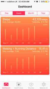
It was also the longest day as calculated by the pedometer I discovered on my new iPhone a few months ago.  The average day was about 37,000 steps.  The one from Gardenstown to Fraserburgh was 42,000 steps.

image

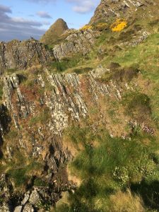
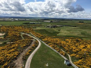
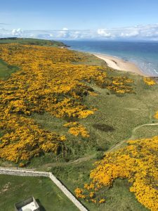
I left Gardenstown on the road, as advised by Bob Watt (of the previous post), but hoped to get to the cliff tops eventually.  I wanted particularly to get to a point of land called Troup Head that is famous as a nesting spot for gannets, puffins and other exotic marine birds.  But there was no easy way to get there, and I was unwilling to do much experimenting. So I left it for another day.

I eventually got to the road down to Pennan, a cliff-bottom hamlet where much of the movie “Local Hero,” starring Burt Lancaster, was filmed.  All the guides mention this, and there is apparently a red phone booth there that figures prominently in the story.  Many people visit Pennan just to get a photograph of the phone booth.  I’ve never seen the movie and didn’t want to go down and back up a steep hill, even without the backpack.  So I passed it by, too.

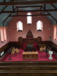
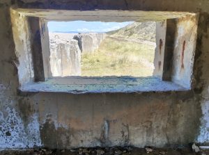
But I did take the time to look around a church for sale at the junction of the road I was on and the one down to Pennan.

image

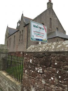
There are many unused and desanctified churches for sale in Scotland.  I was happy to find this one unlocked.

image

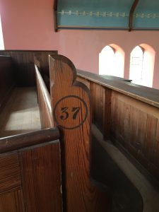
The pews were numbered.

image

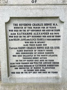
I walked on the road for quite a while, eventually passing a ruined church and graveyard on a road that went to the shore.  The gravestones and memorial plaques in such places have just enough information to tell a nation’s story as well as a family’s.  Much tragedy is recorded on them.  They are hard to read, but repay the effort.

The family that built this chapel, now as empty as a shipping container, had only one child who could be said to have lived to full adulthood.

image

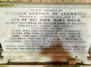
Here’s a plaque whose commemorated people include a 60-year-old casualty of World War II and an inspector of rubber plantations in French Indo-China.

image

I could show you more.  But I won’t.

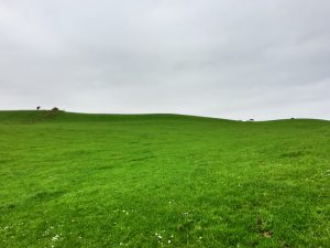
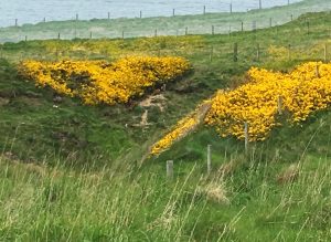
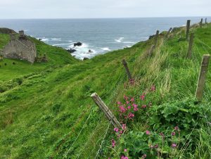
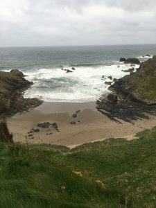
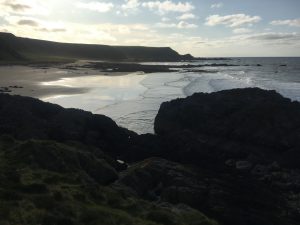
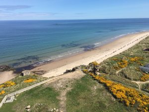
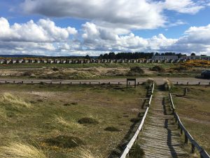
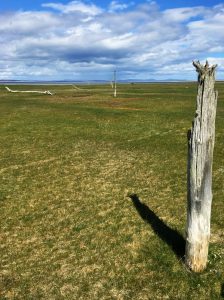
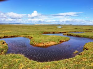
I was within view of the shore.  I had to cross a lot of fields, lush with emergent hay and animals, to get there.

image

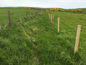
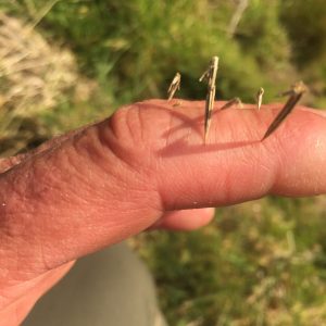
I got to some new fencing that I found out with my hand was electrified.  I thought my trousers might be sufficient insulators to get me over, but they weren’t.  But I concluded that like all unpleasant thing, electrified fences eventually come to an end.  I made it there, climbed over a gate, crawled under the electrified wire, and proceeded.

image

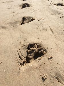
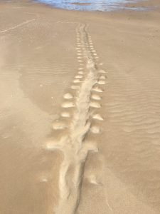
I managed to notice without alerting them four fox cubs outside their den under a gorse bush on a bank.  I was downwind and able to watch them for 10 minutes through the binoculars.  If you blow up this photograph you may be able to make them out.   When I started to walk, they noticed me.  One of them couldn’t suppress curiosity and looked at me with pointed ears from the mouth of the burrow, finally disappearing.

image

I found myself between two barbed-wire fences, walking a path I couldn’t change.  There couldn’t have been a  better place to be trapped.

image

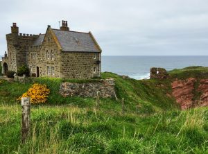
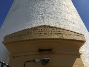
I passed a house that had the remains of Dundarg Castle and Fort in its backyard.

image

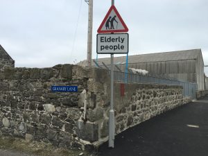
About six o’clock, I got to Rosehearty, the town just to the west of my destination.  (“Just” being six miles.). I hadn’t eaten since breakfast, so I asked a man if there was a place to get a meal.  He was on the street, celebrating having just won £50 on a scratch-off lottery card he was holding.

He directed me to a local pub.  I had smoked salmon and leek risotto, and moved on.  I got to Fraserburgh, and after a little trouble found my way to the guest house where I’d booked a room.  It was about 8.30 p.m.

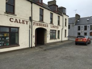
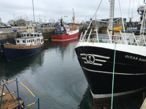
The next day I got up and went to the harbor.  Fraserburgh has a commercial fishing fleet.  Like Burghead, MacDuff, and some of the other places I’d passed through, it was a no-nonsense, hard-bitten place that was actually more beaten down than it looked.  But it at least had a little fishing left, unlike those smaller towns.

image

image

I watched two men put styrofoam coolers on a pallet board.  Just before a forklift whisked it away I asked the man to show me what was inside.

image

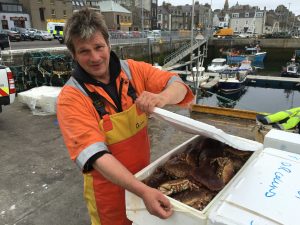
He called them “crab prawns.”  They looked like plain crabs to me.  I asked when they were caught.  He said, “this morning.”  I told him at least he had a bank-holiday weekend coming up.  He said:  “No holiday for us.  If the weather stays good, we’re going out.”

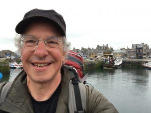
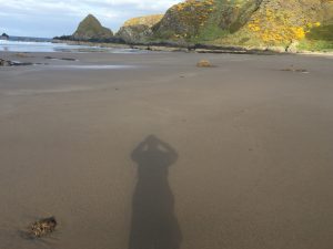
Here I am, on the dock.

image

I took a bus to Aberdeen, and from there a train to Montrose, and checked in with Challenge Control at the Park Hotel.  I was officially done.

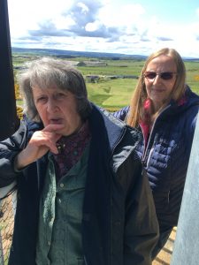
I visited with my friends Mark and Carol Janes, whom I had been trailing like an anemic G-man along the Moray Coast.  I’d stopped at three places–a golf course bar, a bake shop, and a gas station convenience store–where they’d stopped just hours before.

image

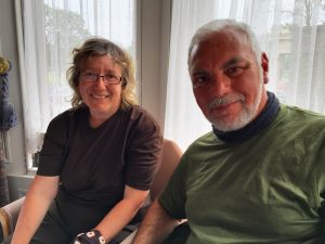
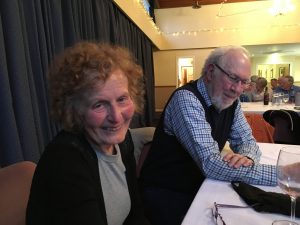
That evening I had the privilege of eating dinner with Jean Turner and her husband, Allan.  Jean, at age 76, was the senior walker of The Great Outdoors Challenge.   She is a retired surgeon, as is her husband.  She grew up in Portsoy on the Moray Coast, and was most helpful in my research last winter.  Allan is a Hebridean Islander and native Gaelic speaker.  They are people with great stories.

image

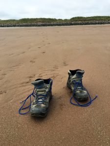
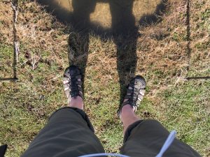
I hadn’t waded into the North Sea in Fraserburgh.  It would have required climbing down a ladder into the oil-slicked water of the harbor.  So the next morning I walked to Montrose’s beach and took off my boots.

image

I walked into the water.

image

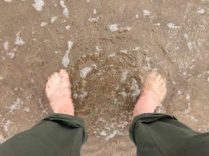
Then I really was done.

Signs along the way

Where else do you want to go?

image

Who needs law when you have hazard and shame.

image

And we know what’s bad drivers they are.

image

I bet there’s only one of these in the world.

image

Or barreled fish.

image

Celebrate your sobriety!

image

Scottish garden basket.

image

So even the trees can celebrate a new monarch.

image

For those not scared off by guard dogs.

image

A sign you won’t see in the United States.  (“Grotesque stereotyping,” “a microaggression.”)

image

Gardenstown

I camped the night before the last day of the walk on the outskirts of Gardenstown. I spent several hours walking off a bad Chinese meal from the only restaurant open in MacDuff, a village seven miles to the west. (I’ve concluded that at Chinese restaurants, the more choices there are the worse the food is. When there’s a lot on the menu, everything must come pre-packaged).  I’d been told to eat at the Knowes Hotel, but its restaurant was closed, awaiting a chef.

It was a very long evening, and it took a while to find an acceptable camping spot.  I should remind readers that the Scottish Outdoor Access Law allows people to cross private property (even off paths), and camp on private property away from houses and livestock. It’s an amazing public-use ethic Scotland has, and I doubt the Challenge could exist without it.

I pitched the tent at 10 p.m.  I’d left the footprint in Portsoy, so I was glad it wasn’t raining and that none was predicted.

This was the view about 10.30 p.m.

image

When I arose the next morning, I got the attention of two horses in a field to the left, who in unison trotted with high-stepping feet around their pasture before periodically stopping to stare at me.  It was a show.

Once underway, I found myself behind two women walking a dog.  I was just close enough behind them to get and keep the dog’s attention, too.  They picked up the pace to get him out of curiosity range.

I was badly in need of a cup of coffee, having only had a cup of instant with my Cup o’ Noodles breakfast.  I followed the women and the dog, assuming they’d go through the thick of things in Gardenstown.  I don’t know why I assumed that.

They wound around a surprisingly suburban purlieu of streets and courts with houses that seemed all of the same vintage.  They finally stopped and engaged in conversation two people who were outside adjacent houses.  I asked them if it were possible to get a cup of coffee in Gardenstown that time of day.

They said a snack bar at the harbor–a steep walk downhill–might be open. A more likely place was a gas station and convenience shop a few blocks away (and only a little uphill).

I followed their directions and found a Spar shop with a couple of pumps.  A man was checking the gas supply through a small manhole cover as I walked by.  He greeted me in a strong accent I could barely understand.

I went into the shop and got a cup of coffee from the push-button, multi-drink machine.  It was cool outside and threatening rain, and I didn’t really want to stand outside drinking the coffee.  So I picked up the shop copy of a book of old Gardenstown photographs from the turn of the 20th century and started leafing through it.

A few minutes later, the man who I’d seen outside came in, greeted me again, and beckoned me to come outside.  “Bring the book if you’d like,” he said.

I went out and he took me to a small building next to the shop.  He opened the door to a one-room, homemade museum to Gardenstown fishermen and assorted other bygone things.

The curator, and proprietor of the shop, was named Bob Watt.  (I concluded it was a common name in the region when I saw seven men named Watt on the World War I monument in Fraserburgh).  He was 53-years-old, but could pass for 43.  He was intensely social in a nervous kind of way.  I introduced myself, and he addressed me by name in nearly every sentence.

image

If you tap on the picture to blow it up you’ll see behind Bob, where the wall meets the ceiling, little burlap squares with BF and a number written on each one.  They are the registry numbers for fishing boats that used to be owned by Gardenstown fishermen.  Gardenstown boats were registered in the Banff district (which is what BF stands for).  They’re all gone now.  These are headstones for them.

image

Bob left school at 16.  He worked on someone else’s boat for three years before he and his brother bought one of their own.  It was 50 feet.  Five people worked it.  The last boat he and his brother owned was 70 feet.

Their workweek began at midnight on Sunday.  “The people here are very religious,” Bob said.  Fishermen had to wait until the first minutes of Monday before they could go to work.  They went a hundred miles into the North Sea for prawns, cod, hake,  and monkfish.  They fished around the clock until Friday, when they came into Fraserburgh and sold the catch.

The fish were gutted, and the heads were taken off the prawns.  For years the work was done on tables on an open deck in all weather.  “It was hard,” Bob said.  He found a picture in his collection of the kind of boat he worked on late in his career.  It had a sheltered deck, where fish-cleaning could be done under cover. “It made the job as good as it could be.  We thought it was heaven.”

I asked how they could catch and hold fish for as long as five days and still have it be worth selling.  “We packed it in boxes, with ice on the bottom and ice in the top.  They were all down in the hold in tiered stacks.  When we got back it was fresh as paint.”

Bob  hadn’t been a fisherman in about 20 years.  I asked him why he stopped.

“I fell overboard,” he said.

“Did you get hurt?”

“No.”

“Did you know how to swim?”

“Yes.  But it was very rough.”  He made an undulating gesture with one hand.  “It was a dangerous situation.”   He obviously didn’t want to talk about it.

I tried to imagine what it would have been like to be in 45-degree water with no life jacket, trying to catch a line thrown from a bucking ship and hold onto it long enough to be hauled on board.  Possibly in the dark.

After that, Bob couldn’t sleep on the boat.  He’d wake up because of nightmares.  Six months later, he left fishing.  The gas station and snack  shop came up for sale and he bought it.

I asked if at least the money was good.

“Oh, yes, good money.  But it was hard work.  Hard, hard.  A hard job.”

Bob hoped the little museum would entice tourists–bicyclists in particular–to linger at the store and learn a little about the town.  He hadn’t yet put the sign out on the sidewalk for the season.  He’d done some oil paintings of local scenes, quite good, and had color photocopies of them on display.  He’d sold the originals.  He was proud to have been a fisherman, and was proud of Gardenstown.

I inquired about the walkability of the cliff tops between there and the next hamlet, Pennan.  He wasn’t sure but advised against trying.  He drew me a map showing how to get out of town and onto the road that ran closest to the coast.  His accent was strong.  I can’t remotely reproduce it.  But he pronounced “farm” as “farum”–a word with two equally stressed syllables.

I thanked him and told him it was a pleasure to meet him.

“I hope to see you back again sometime, Dave,” he said.

image

Bushwhacking 2

The goal of the walk along the Moray Coast was to stay next to the water to the greatest extent possible.

image

At the coast’s western end that’s easy enough, as the shore is sandy or rocky beach, or in a few places, mudflats.

image

At Burghead, about one-third of the way across, cliffs appear intermittently between stretches of beach.  From Buckie onward, cliffs that dominate, with pocket beaches in between.

image

As a consequence, walking beside the water involves a calculated risk.  Several actually.

At high tide, there may not be enough shoreline to walk on at the bottom of a cliff face.  At high or low tide, the walking surface may be slippery.  There may also be streams coming down into the firth that are too deep to wade across.

I eventually figured out I didn’t have the time and energy to risk having to backtrack from an obstructed water-side route, and so shouldn’t walk on the shore unless I was pretty sure I could get up onto the cliff-top easily should the beach suddenly disappear.  I learned this lesson in a most convincing way just east of the village of Cullen.

I got to the end of a beach.  Although it was late afternoon, the sun was out, and it was warm and not windy, I decided to see if I could get around this headland.  Note the steep diagonal with the lighted ground behind it in the distance.

image

It quickly became obvious that going around the conical rock along the water’s edge wasn’t going to be possible.  So I started climbing over and around a series of grass- and scrub-covered rock buttresses that came down from the cliff top.

image

I got to a place where the descent down the buttress to the next piece of  walkable ground was too steep to consider.  There were two choices.

One was to go back to the beach and head inland from there.  This is the look back.  (It appears darker than it was because the picture is shot toward the sun).

image

The other was to go up the knife-edge of the buttress to the top of the cliff.  This is as close as I’ll ever get to the Hillary Step on Mount Everest.

image

You will note that some of the route is covered with gorse, a bush whose yellow flowers smell like coconut and which is covered with needle-like spines.

I decided to go up rather than go back.

It took careful choosing-of-steps, and would have been dangerous in wind or rain.  Trekking poles were helpful (indeed, I would say essential).  At one point I looked to the left and saw my shadow cast on the side of the next buttress, across the crevasse.

image

This was the view down.

image

It was impossible to avoid going through gorse bushes in some places, with the attendant effects.

image

When I got to the top I hoped to find a gentle slope covered with grass, heather, or something else easily crossed.  Instead, I found more gorse.  And it was head-high in some places.  This was a problem.  It seemed I might not, in fact, be able to make my way through it to a farm field I could see in the distance.  Descending the route I’d taken to the top wasn’t really an option.  Or at least not one I wanted to take.

I’m happy to report I made it out.

Like a rat in a maze, I followed little clearings until they were obstructed by impenetrable gorse, backtracked and tried another.  I was lucky.  In the end there was always a route with a little walkable ground not covered with gorse where I could sidle through.  It would have been hard to bull one’s way through the thicket, although I supposed I would have tried that if I had to.

I was never so happy to see a trackless field of hummocky grass as when I got to the edge of this one.

image

I stuck to the cliff tops from then on.

Local hero

When I was done talking with Donnie Stewart (with whom I could have happily talked for another couple hours), I was turned over to Iona Kielhorn.

She is one of the people who takes people up Covesea Lighthouse, which  is just west of Lossiemouth.  It is a simple and handsome white column, designed by Alan Stevenson, the uncle of Robert Louis Stevenson.  Four generations of the Stevenson family of architects and engineers built 97 lighthouses in Scotland over 166 years.

image

This one was finished in 1846.  It became an unmanned beacon in 1984, and now doesn’t operate.

image

Like all old lighthouses, it’s a model of good design and mechanical efficiency.  It’s constructed from local sandstone, with a brick lining, and an air space between the two to allow the moisture-absorbing sandstone to breathe.

It was lighted with liquid paraffin, carried up the 140-odd steps in containers that look like covered watering cans.  A bigger inconvenience was that the weight driving the rotation of the light had to be wound up every two hours to keep it turning.

When the light had to be illuminated  depended on the length of daylight.  On June 21, it had to be operational starting at 9.15 p.m., and burning and turning until at least 3.13 a.m.  On the longest day of the winter, however, it had to be on at 3.29 p.m., and stay lighted and turning until 8.53 a.m.

There were two lighthouse keepers, living with their families in attached houses at the base of the lighthouse.

image

Aided by a Fresnel lens made in Paris, the white light could be seen 24 miles away on a clear night.  For part of the 360-degree rotation the light shone through a red lens.  This provided a direction toward the opening of Lossiemouth Harbor to which boats could steer.

image

Ms. Kielhorn and another guide, Lynne Hawcroft, took me onto the outer walkway at the top.  (Iona is on the left.)

image

The views were great. Both prop planes and jets were taking off from the Lossiemouth air base.

image

image

image

So who’s the local hero?

Iona Kielhorn is the granddaughter of Ramsay MacDonald (1866-1937), the first Labour prime minister of Britain.

MacDonald was born and reared in Lossiemouth.  His mother was a housemaid and his father was a farm laborer on the estate where she worked.  They weren’t married–and didn’t get married.

The stigma of being an illegitimate child must have been considerable in Victorian England (although Wikipedia reports that among the rural population the out-of-wedlock birth rate was about 15 percent at the time).

“Jamie”–his first name was James–left school at age 15 to do farm work, although he was “clearly brilliant,” Iona said. He didn’t last long.  He was recruited to be a teacher while still a teenager. At one point, he studied chemistry and mathematics in hopes of becoming a scientist.  But he never finished secondary school and had no college degree.

He eventually found his way to London, where he got interested in politics, knew George Bernard Shaw, and was one of the founders of British socialism.

I asked Iona how it was that the child of a single-mother charwoman could break out in the way he did.

“I would say he benefited throughout his life from the help of strong women,” she said.  “His grandmother told his mother:  ‘You don’t have to marry this MacDonald if you don’t want.  I will help you raise the child.’  His wife, too, was very strong.  And wealthy.  Plus, he was a handsome man.”

MacDonald had a complicated route through the factionalism of the early years of British socialism, gaining recognition as a journalist and political essayist, and eventually becoming a member of Parliament.  He and his wife had six children, whom they parked with his mother in a house he built in Lossiemouth while making extended visits to Australia, the United States, and Canada.

He opposed England’s participation in World War I.  The Moray Golf Club banned him from membership for life. Lossiemouth locals painted the word “Traitor” on his house.

“We eventually washed it off.  We should have left it up,” said Iona.

He became prime minister in 1924.  His term was short-lived, but is credited with showing that Labour could run a government responsibly.  He led a socialist government again from 1929 to 1931.  He resigned amidst the squabbling in the political left about how to address the economic crisis following the stock market crash.  He was asked by the king to form a National government–a coalition of all parties.

He agreed.  Elections were held and the National government won a huge majority.  Very few Labourites joined the government (but many Conservatives did).  Macdonald was expelled from the Labour Party, never forgiven.

At some point, after three stints at 10 Downing Street, the Moray Golf Club said they would have him as a member.  He refused to join.  He died two years before the outbreak of World War II.

I asked Iona Kielhorn if Lossiemouth still views him with suspicion.

“It’s coming up on the 100th anniversary of his banning.  I live in his house, and everyone wants to get in and see it.  I have them eating out of my hand now,” she said puckishly.

And right next to the circulation desk at the Lossiemouth Library is his bust.

image

Donnie Stewart’s story

While researching this trip I wrote several museums and libraries along the route, inquiring whether there were any old people who lived in the area during the war who might be willing to talk with me.

I hoped I’d find someone who remembered watching the training exercises for the Normandy invasion that occurred along the coast in the winter of 1943-44. In hindsight that was unlikely, as the people near the rehearsal sites were evacuated, and the activities, in any case, were considered secret.

My inquiry paid off in another way, however.  It led me to 84-year-old Donnie Stewart.

The librarian for the Lossiemouth branch of the Elgin Library, Jane Thomas, with considerable generosity and effort, arranged for me to interview Mr. Stewart.  She also agreed to open the library 45 minutes early so we could talk before the public arrived.  As an added bonus, she arranged for me to get a tour of the 19th-century Covesea lighthouse outside Lossiemouth.

image

I walked out of the Skerry Brae Hotel, where I’d spent the night in a £30 room, with just enough time to get to the library by 9.15 a.m. I was, of course, carrying a backpack. The first car that came by pulled to the side.  A man rolled down the window and called me by name. It was Mr. Stewart and his seven-year-old springer spaniel, Pepper.

So we got to the library at the same time–and a few minutes early.

image

Mr. Stewart was born in 1931 in Lossiemouth, descended from four generations of fishermen. He was the youngest of five children. His father was colorblind, which prevented him from being a boat skipper. However, he owned a quarter of the boat he fished on.  One of his father’s brothers had  gone to California, working first in Needles on the railroad, and later in Los Angeles in the oil industry.

Mr. Stewart’s father started out fishing on sailboats. Those craft  were replaced by steam drifters that required crews of 9 or 10 men. They, in turn, were replaced by diesel-powered boats, which were more practical and needed only a crew of five.

They fished for herring with drift nets. “Herring fed at midnight. You put your net out at tea time, and came back at breakfast time and it was full,” Mr. Stewart said.

Most of the herring fishery collapsed with the loss of the German and Russian markets in World War I.  The catch switched to haddock and cod, caught with seine nets. A good day was 100 boxes, with each box weighing seven stone, or 14 pounds. The men gutted the fish on the boat, leaving the heads on.

Herring had been sold through futures contracts, but haddock and cod were auctioned every day (except Sunday) at 3 p.m. on the dock. The fish was then shipped south by train and truck.  The price was higher on Thursdays, when most of it went to Glasgow, whose large Catholic community couldn’t eat meat on Friday.

Mr. Stewart’s family had fish every night except Sunday, when they had sausages. I asked if he got sick of it.

“What would you want to do, starve? With five children, if you didn’t eat it it would soon vanish off your plate.”

Mr. Stewart’s brother, Peter, volunteered for the RAF in 1938 “as soon as he recognized that Hitler meant business.” He was a flight sergeant, a radio operator and a gunner on a Wellington bomber. He died in 1942, bombing Cologne, and is buried in Germany.  Another brother, Jim, was on a minesweeper, accompanying convoys to Malta.  A sister was in the British equivalent of the WACs as a clerical worker.

For Donnie and his friends, however, the war meant excitement and freedom. “We viewed it as entertainment,” he says today, with candor and chagrin.

“Boys had a great life. We went out after breakfast and were out all day. School was an interruption. We knew all the men at the harbor and how much they were making. We went to weddings and funerals. We didn’t want to see our parents. Grown ups said ‘No’.  Plus, the house was cold.  There was only one coal-burning fire.”

In the late fall of 1940, when there was a massive effort to line Scotland’s northeast coast with concrete tank barriers, he and his friends helped collect flat stones for their foundations. They weren’t paid; it was to be part of the action.

Some of the excitement was tragic.

In July 1941 a Junker 88, aiming to bomb the nearby aerodrome (whose construction in 1938 had brought full employment to Lossiemouth), dropped four bombs on the town.

One blew off the back of a house, one fell in the street and one fell unexploded in a quarry. But one landed on a house and killed four people–two locals and two people who’d moved up from Portsmouth, England, to be safe.

Plane crashes were common. “Three hundred and eighty-four people died learning to fly out at the Lossie aerodrome,” Mr. Stewart said. One crash was especially memorable.

“We sat and watched this plane take off from the aerodrome near the golf course. We watched it swing around, and then the starboard wing fell off and landed on the 17th fairway. The rest of the plane went on for 400 meters and crashed on that rock,” he said, pointing as we drove along the shore on the way to the library.

It was high tide and there were no flames. A man tried to swim out to them and was drowned.  The entire crew of five died. Three of them were Australian.

“I met the nephew of one of them a few years ago,” he said. “He had come to see where Uncle Ed had died.”

He told a story about one of his classmates at Elgin Academy, where he later went to school. The boy, Danny, and a friend “played down at the rocks as we did. They found a strange object and tried to open it up. After a few tries, the other boy decided to use the traditional method, and battered it with a stone. It exploded, because it was a booby trap, dropped by the Luftwaffe along the East Coast in large numbers. The other boy died and Danny became partially but increasingly deaf.”

Twelve days after VE-Day, on May 8, 1945, a Wellington bomber testing its engines crashed in the town, killing a woman, her five sons, and two other people.

Donnie Stewart never went to war. He did spend two years in National Service after the war, earning four shillings a day. (“Egg and chips at the time cost 2 shillings 6 pence, a half-day’s pay.”)

He went to the University of Aberdeen and eventually earned a master’s degree in metallurgy. He worked at British Petroleum, and he also taught at Strathclyde University. He got early retirement, thanks to Mrs. Thatcher, and moved back to Lossiemouth when he was 60.

His wife died several years ago. He has one child and one grandchild.  And Pepper.

image

The tragedy at Slapton Sands

This post isn’t about Scotland.  It’s about events I learned of while researching the rehearsals for D-Day carried out on the Moray Firth, whose southern shore I walked on The Great Outdoors Challenge.

The events described aren’t well known to Americans, and were briefly suppressed by the United States Department of War after they happened.   The memorial to the American men who died in Lyme Bay off Slapton Sands on the south coast of England was organized by an Englishman who was a child living nearby when they happened.

The memorial now includes an amphibious tank that foundered during the exercise, and was recovered decades later.

640px-Sherman_tank_at_memorial_for_those_killed_in_Operation_Tiger

“Exercise Tiger” was one of the last and more elaborate rehearsals for the Normandy invasion.  It involved 30,000 men and was a multi-day event that started on April 27.  Among the participants was Force U, headed by American Rear Admiral Don P. Moon, of the U.S. Navy.  Part of the Western Task Force, his vessels were a mix of American landing craft and British warships.  They were added to the D-Day plans late in the day, and were undertrained for the occasion.

Moon was born in Kokomo, Indiana, in 1894. He graduated from the Naval Academy in 1916. He caught the end of World War I at the dawn of his career.

The commander of the Western Task Force was Rear Admiral Alan G. Kirk.  His authority did not extend to activities off Cherbourg, France, across the English Channel from where his ships would be operating. The Germans had a naval presence there.  Instead, authority to respond to that threat rested with the British naval authorities for the harbor at Portsmouth.  Kirk had requested a change of command structure, as his vessels were the ones at risk, and was turned down by British Admiral Bertram Ramsay.

On the day of the exercise, several vessels were late leaving Portsmouth Harbor.  Moon postponed the amphibious landings an hour, but gave the order to do so just five minutes before the landings were to begin.

The British cruiser shelling the beach, HMS Hawkins, received the message, but many of the landing vessels did not. As a consequence, troops were being discharged at the same time shells were landing. This resulted in friendly-fire casualties; the exact number is disputed. Ramsay said in his diary that the exercise was “a flop,” with “much to criticise.”

Then worse things happened.

Soon after midnight, eight LSTs (landing ship, tank) with thousands of soldiers were offshore, awaiting to play their part in the mock invasion. Two British ships, the Scimitar and the Azalea, were supposed to be protecting them.  However, the Scimitar collided with an American landing craft in Plymouth Harbor just before departure and suffered a two-foot hole in its bow.  The commander-in-chief of Plymouth Harbor ordered the ship into the yards for repair.

Neither he nor the captain of the damaged vessel notified Commander Bernard Skahill, the commodore of the convoy of fully loaded LSTs offshore. Skahill saw the Scimitar going in the wrong direction “but he assumed it was part of the complicated maneuvering necessary to get all the ships out of port and into formation,” according to “Neptune: The Allied Invasion of Europe and the D-Day Landings” (2014) by Craig L. Symonds.

About 10 p.m. that evening, nine German E-boats left Cherbourg. The so-called Schnellboote–fast boats–had 7,500-horsepower Daimler-Benz engines and were faster and longer than PT boats. Each had a 40 mm gun, carried four torpedoes, and were camouflaged to operate at night. Their departure was noted by British radar technicians, but neither Skahill nor the captain of the Azalea were notified until after midnight. But the Plymouth Harbor commander realized the convoy was under protected, and dispatched a destroyer, Saladin, as a relief escort at 1.37 a.m.

Shortly after 1 a.m. the German boats attacked the waiting LSTs.  Many people on board the landing crafts thought it was part of the rehearsal when they saw green tracer rounds.  At 2.07 a.m. a torpedo hit LST 507, knocking out the electricity and starting fires in the gasoline-powered tanks, with small arms ammunition “cooking off.”  The ship had nearly 500 soldiers, and more than 100 crew. The metal pins holding the life rafts to the bulkeads had rusted in place. Men began jumping overboard.

Another LST (531) was hit 11 minutes later, and less than a minute later, a second time. It sank in minutes.

The life vests given the soldiers were like bicycle tubes wrapped around their chests, although most men wore them at their waist so they wouldn’t interfere with their packs. When they triggered the CO2 cartridges, the vests inflated, tipping many wearers over and putting their heads under water. The water was extremely cold, and people who held onto the two-man rafts (20 people on one) eventually lost consciousness from hypothermia.

The first two LSTs sank. A third LST was hit in the crew quarters and galley after the skipper made an avoidance maneuver after seeing the torpedo, which otherwise would have hit it amidships.

Skahill, the commander of the convoy, ordered the remaining vessels to head to shore. But the skipper of the vessel Skahill was riding on objected.  “In an act of near mutiny, he got on the 1-MC loudspeaker and explained the situation to the men on board. Their shipmates and fellow soldiers were dying out there, he announced.  Who wanted to go back to get them? A rousing cheer went up, and Skahill capitulated. The [vessel] returned to the scene,” Symonds wrote.

There is no better example of the Navy principle that a ship’s captain is the person responsible for what his vessel does, even when the commander of the fleet of which it is a member is aboard the vessel, too.

At that point, however, only a few people were still alive.  A few were rescued. The destroyer dispatched from Plymouth, Saladin, and the LST began retrieving bodies, but stopped when orders from shore told them to return to shore.

Over the next few days the bodies were collected. Among the dead were slightly more than a dozen people who knew the exact details of Operation Overlord, including when and where it was to occur. There was much anxiety until all those bodies were recovered. D-Day planners worried that someone with the knowledge might have been captured alive by the Germans and could reveal the plans under interrogation or torture.

The official Navy death toll was 639 people–198 sailors and 441 soldiers. The memorial at Slapton Sands lists the death count as 739. There are other estimates, some higher and including large numbers of friendly fire casualties on shore.

What is certain is that the number of American servicemen who died at Slapton Sands was more than the number who died on Utah Beach–one of two landing spots for American forces–five weeks later.

The debacle was kept secret–probably on Eisenhower’s orders–so it wouldn’t undermine morale and support for the invasion. Survivors were kept in hospitals, isolated from other members of the invasion force. Families of the dead were not notified until after D-Day, and their loved ones were officially listed as among the dead from D-Day.

The tragedy led to a coordination of radio communication between the British and American forces, and an improvement in the life jackets.

“Another failure,” according to one author, “was that almost everyone involved with Exercise Tiger had conceived of it as another rehearsal and had behaved accordingly. There had been so many practice landings that the sailors and soldiers–even the officers–had trouble making the mental adjustment to actual combat . . . [M]any clung to the idea that this was a rehearsal right up to the moment they found themselves in the water.”

Admiral Moon had no role in the events that occurred that night. Nevertheless, in Navy tradition, he was deemed responsible because he was commanding officer of the flotilla that had been attacked.

The day after the debacle he was brought before the chief of the Western Task Force, of which his vessels were a part.  Rear Admiral Arthur Struble looked out a window and saw a British submarine sail by with a broom tied to its periscope signifying a “clean sweep.” He said: “Well, I see somebody did his duty.”

One of Moon’s staff officers, Captain John Moreno, recalled: “that Struble thereupon turned on Moon with ‘the coldest glance I’ve ever seen . . . [and] brutally snarled, “All right, Moon, tell me what happened” ,’ ” according to historian Joseph Balkoski.

Moon’s forces performed acceptably on D-Day.  By early August, however, Moon was called to command the invasion force for an attack on southern France called Operation Dragoon. He told his superiors that he and his men were unprepared, and requested a delay.  He was turned down.

Moon had worked 15-hour days, seven days a week, for months. He suffered from such obvious exhaustion that he had been referred to both the medical officer on his ship and the Eighth Fleet medical officer. The losses at Slapton Sands weighed heavily on him.

On the morning of August 5, 1944, in his cabin, he wrote a message that said in part: “With the mind stalled & crazy . . . things once easy are not in sight. Command is wrong under such a condition . . . Overwork thru the years–I have given the Navy everything I had–too much–it has broken me. My country, what am I doing to you. My wife & dear children . . . I am sick, so sick.”

He wrapped his .45 automatic in a towel, put it to his temple and pulled the trigger.

Admiral Don P. Moon

The rehearsals

I got the idea to walk this route when I learned that parts of the Moray Coast had been used to practice amphibious landings in World War II in advance of the Normandy invasion.

It turns out very little has been written on this subject.  Winston Churchill devoted two sentences to it in his six-volume history of World War II.

“One British division with its naval counterpart did all its earlier training in the Moray Firth area of Scotland. The winter storms prepared them for the rough-and-tumble of D-Day.”

Information from various sources, however, reveals that exercises occurred from December 1943 to March 1944.  They involved principally the 3rd Infantry Division of the British Army, as well as Navy and RAF  forces.

These “combined operations” we’re unusual and unpredictable, given the different command structures and cultures of the military services.  People paid with their lives getting the kinks worked out (as a later post will describe).

Some sources say the two shores of the Moray Firth were chosen because they resemble the beaches of Normandy where the invasion of France was to take place.  How true that is I don’t know.  I’ve never been to Normandy.  I know, however, that the beaches I walked on where the rehearsals occurred do not have high bluffs over them, as I’ve seen in some photographs of the Normandy beaches.

What this area clearly offered, then and now, are long beaches (several over five miles); tides that leave huge expanses of sand when the water is out;  cold, rough water; and relatively few people.

image

On November 11, 1943, the village of Inver on the Tarbat Peninsula that forms the north shore of the Moray Firth was told it had one month to finish the harvests and move all inhabitants and animals. The affected area was 15 square miles and had about 900 residents. There were 56 children in the Inver primary school, which closed November 26.

A “displenishing sale” was held at the nearby town of Dingwall, where 1,050 cattle, 8,000 sheep, 60 horses, and 50 pigs were sold. (Chickens weren’t sold; they were taken or eaten before the evacuation). The prices were low because of the season and a prohibition against widespread advertising of the sale for reasons of war security.

Tarbat was a the site for live-fire with tank weapons, as well as a limited amount of shelling from ships.

About the same time, a sparsely populated area just west of the mouth of the River Findhorn, including a hamlet named Kintessack, was given by three weeks to evacuate.  Eighteen Italian prisoners of war were brought in to help with the threshing of grain and the digging of potatoes and sugar beets.

Personal accounts of the exercises are rare.

A 2007 doctoral dissertation by historian Tracy Craggs (University of Sheffield) quotes a veteran named Peter Brown, who recalled a mock assault in November 1943.  He was immersed after jumping out of the landing craft.

” ‘Our objective in this exercise was a wood about fifteen miles inland across rough countryside. By the time we got there and had dug a slit trench I was in a pretty poor state. My clothes had partially dried but as darkness fell and it got colder I could not stop shivering and began to think I would not last the night. However about three in the morning the exercise was called off and we were able to light a huge bonfire and this, together with a generous rum ration, probably saved my life’. ”

(I personally doubt the beach assault was followed by a 15-mile walk inland.  Fifteen-hundred yards is more likely.  But who knows?)

The historian writes that “in January, three days were spent at Burghead Bay during Exercise `Grab’, with the intention `to practice assaults on beaches and the capture of initial objectives by assault battalions’. There was also emphasis on night operations, including breaching minefields, compass work and direction finding, as well as time spent on the range.”

It was a difficult time of year to undertake such maneuvers, with winter seas and only six hours of daylight.  It’s intimidating enough now, when the weather is pretty good and there’s useful light for about 19 hours a day.

image

Exercises at Burghead on December 22 and January 9 had landing craft leave from Fort George, cross the firth, and return to the southern shore  to simulate a crossing of the English Channel.  There was apparently much seasickness.

The biggest exercise was on March 30-31, also at Burghead, where 204 Sherman tanks, 32 Stuart tanks, and all the infantry of the 3d Division, plus cruisers and destroyers, took part, according to the pamphlet “Evacuation:  Tarbat Peninsula 1943-4” (undated) by Dr. James A. Fallon.

There were surprisingly few casualties.  One occurred in February and involved so-called “duplex-drive” tanks, which were outfitted with watertight collars that allowed them to float and move with a propeller connected to the engine. Two tanks swamped and one person drowned.  In all, five tanks were lost in the rehearsals, according to records.

In April, the troops moved to the south coast of England, where larger, more complicated, and in one case disastrous, rehearsals were held involving American and Canadian forces as well as British.

In May, the local people were allowed to return to Inver.  The government paid for damages to houses and farm buildings.  In many places, however, the ground had been compacted from tanks and took years to recover.  Purebred herds that had taken decades to build were gone.  Farmers removed unexploded shells from the ground for a long time, according to a pamphlet “The Evacuation of Inver” put together by the village’s schoolchildren a number of years ago.

It was all chocked up to “doing your bit” for the war effort.

There were other, subtle disruptions, too.  The Inver school reopened at the end of August, and the logbook for September 1, 1944 notes:  “Attendance is disappointing. Some of the boys absent themselves from School for no apparent reason.”

A newspaper account sent to me by Tim Negus, one of the volunteers at the Findhorn Heritage Center, whom I met when I passed by, included this observation from a woman who was a schoolteacher when the area near the Findhorn was evacuated.

“All stoppers from the sinks were removed.  I understand that the troops carried their own personal stoppers wherever they went.  But I hasten to add the soldiers took the stoppers only.”

A number of years ago, Tim tried hard to find someone who remembered the assaults.  They would have been visible from the village of Findhorn, which was not evacuated.

“It must have been like a hundred Guy Fawkes Days,” he said.  But he could find nobody who recalled seeing them.

It turns out a plaque on the beachfront at Nairn may tell the whole story.

Silent we came

Silent we left

To strike a blow for freedom

image


The defenses

In the spring of 1940, with Nazi Germany and the Soviet Union in a non-aggression pact, France overrun, and Norway in German hands, Great Britain feared it might be invaded from the north, along the eastern coast of Scotland.

Few military planners believed German forces would advance south to England from such a landfall. But with Northern Scotland occupied, the important ship-harboring Scapa Flow in the Orkney Islands in German hands, and British forces damaged from the losses evacuating Dunkirk, some speculated the pressure to make peace with Hitler might be irresistible.

To help prevent that, a massive campaign to protect Britain’s coasts was begun. In Scotland, and especially along the Moray Firth, much of it remains.

By the summer that year, planners concluded that 125 miles of coast needed defending by means of physical obstacles and armaments. These included concrete cubes, ranging from 3.5 to 5 feet high; tall metal scaffolding; pillboxes for men with small arms; large pillboxes with 4-inch naval artillery pieces; tank ditches;  mined beach exits; poles to prevent beaches and mudflats from becoming landing grounds for enemy gliders; floating barriers with old herring nets attached to foul the propellers of landing craft; and tons of barbed wire.

The part of the coast I’m walking along has some of the longer unbroken stretches where such defenses were built.  They include 4.5 miles east of Nairn, 7 miles along Burghead Bay, and 2 miles on the west side of Lossiemouth and 9 miles on the east.

The most obvious of these today are the concrete cubes.  You can see them in the distance here.

image

Many are exactly where they were poured 75 years ago. Some are crumbling because of salt in the concrete.  Erosion and evolution of the shoreline has brought some onto the beach and into the water.

image

Some were reinforced with steel bars, and have loops protruding from the tops, where barbed wire would be attached.

image

There is a wide variety of pillboxes, most specified by military architects, although some apparently with local design modifications. There were supposed to be two every 1,000 yards. Some were “bulletproof,” others “shell-proof,” and specs said they should have a perimeter of barbed wire at 40 and 60 yards to prevent the approach of flame throwers.

image

A motley crew of builders constructed the defenses. They included civilian contractors, British army units, members of engineering battalions from the Polish Army in exile, and village boys.

One of the last, Donnie Stewart (about whom I’ll write a later post), was 10 at the time. The war brought great excitement (and some tragedy) to Lossiemouth, the village where he grew up. In the fall of 1940, he and his schoolmates spent a lot of time watching the defenses being constructed. The concrete was mixed on site and shovelled into wooden forms. The boys’ job was to find flat stones to put at the bottom of the forms to keep the concrete from leaking out too much.

Mr. Stewart recalled that one day the officer supervising a crew chewed his men out in an incomprehensible tongue for scratching their initials into the wet cement at the top of a cube. He concluded years later they were probably from a Welsh labor battalion.

Some of the blocks show evidence of having their height raised by a second pour. That was apparently by order of an Admiral Dreyer, who visited the Burghead-area defenses in August 1940. The source for this, and most of the information in this post, is the book: “If Hitler Comes / Preparing for Invasion: Scotland 1940” (2013) buy Gordon Barclay.

image

The effectiveness of the barriers was formally tested in May, 1941. It was found they delayed the advance of tanks by only 70 to 90 seconds, and were easily destroyed with one or two shots from a tank’s guns. In May, 1942, the order came down to stop building them.

Fifteen miles between Findhorn and Kingston (which I passed through yesterday) was supposed to have wire-and-steel scaffolding barriers. None were built, although 85 percent of the material was delivered to the beach. You can’t see any of it now.

The anti-glider poles are still visible in some places, as in this tidal mudflat area.

image

Poles put on the beach didn’t prove stable if they were just placed holes dug in the sand. To solve that problem, the crews buried a steel barrel filled with concrete and then placed a  pole in it. You can still find pole stubs, with the outline of the barrel at the level of the sand.

image

On some popular beaches the concrete barriers were eventually removed. Jean Turner, a retired surgeon whom I met last year and who grew up in the coastal village of Portsoy, recalled that when she was girl “we used to use the spaces between them as changing rooms and picnic spots.” (Jean, at 76, is this year’s senior Challenger.)

Less picturesque and romantic than ruined castles, they will nevertheless be here for a long time to testify to the belligerent history of this beautiful coast.

image


The mouth of the Findhorn

The walk from Nairn to Forres was along an empty beach that turned to grassy mudflats cut through by meandering streams.

image

Along the beach in many places were wooden poles in states of decay. Some were mere stubs, a few were 15 feet tall.

I had seen these since Fort George. At first I thought they were poles erected early in World War II to prevent  gliders from landing safely during an invasion. I had read that such poles remained visible, 75 years after they were placed.

It turns out, however, that most of what I saw in rows going out into the firth were remnants of the armature of salmon nets. Vast numbers of Atlantic salmon once came down the coast seeking their natal rivers–the Ness, Findhorn, Spey–that flowed north out of the hills and mountains of the central Highlands.

image

The right to set nets along specified stretches of the coast has been bought up by estates and sporting companies in recent decades, I was told.  Those owners, in turn, have closed the commercial fishery in favor of a sport one.  All that remains of the working salmon industry are the poles.

The beach was lovely.  When a high dune appeared on the water side of the hard-packed marsh, I climbed it and descended to the sand on the other side.

image

image

I hadn’t seen a soul since passing two women on their daily, four-hour dog walk hours earlier.

image

There are always things to see on a beach. I’m happy to report I didn’t pick up a single stone.

image

I knew the long dune was a peninsula of high ground on a tidal marsh.  I also knew it would end long before the land did.  The map showed a channel of water through the mud flats. As the tide was more than half-way out, I figured the channel would be crossable, or at least wadeable. (The black target-like icon is my position when I went over the dune).

image

Near the end of the dune I encountered a colony of seals. There were at least a hundred up on the beach. They took to the water in batches and looked at me with great curiosity.  Here are some seal tracks, going to sea
image
and coming back to the beach.

image

Wanting to save a little time, I didn’t go all the way to the end of the dune. I climbed back up on it, expecting to see mudflats with a channel running through it. Instead, I saw a vast bay, completely uncrossable, despite what the map suggested.

There was only one conclusion: I had to walk all the way back.

image

This was discouraging news for someone with a pack on his back. I felt like sitting down and calling an Uber. Or the Coast Guard. Or something.  But there was no choice. I started walking–this time into the wind.

The mudflatted area (now covered in water) also had poles in it. I later found out they, in fact, were the anti-glider defenses. They were so remote that they hadn’t been scavenged for firewood or fence posts after the war, as had happened to those closer to settlements.

There were many tributary channels feeding the head of the bay when I finally reached it. I stepped and jumped over as many as I could, until I finally decided that as an alternative to backtracking even farther I’d start wading.

This was a bigger decision than it might seem because it required taking off the boots and getting them into the pack, which wasn’t easy. However, it felt good to cool off my feet.

image

This stretch of coast was bisected by the mouth of the River Findhorn where it met the Moray Firth. I’d planned to walk up to the western edge of the mouth and then turn upriver a mile or two to a bridge.

However, having done a lot of walking I hadn’t planned on, I decided to take a more direct route–namely, on logging roads through a huge forest. It saved me at least a mile.

At one point there was a traffic jam–two logging trucks and one walker, all stopped.

image

I eventually got out and crossed the River Findhorn at the Broom of Moy, which is quite close to the Snab of Moy, Wester Moy, and Moy Ho.

image

The next day, I walked downstream on the other side of the river, back toward the mouth of the Findhorn.  I eventually got to the village of Findhorn, which lay right across the place where I’d been the day before.

I went to the local museum, where two volunteers–Sue Finnegan and Tim Negus–were most helpful in showing me around and answering lots of questions. Sue was one of many people I’d corresponded with by e-mail while doing research months earlier.  Tim knew a huge amount of local history and archaeology.

image

Nearby, Sue’s husband, also named Tim, was manning the Ice House, a historical structure rehabilitated in the early 2000s.

In the old days, at the end of each winter ice would flow down the Findhorn, piling up on the shore. Enterprising people built a stone building, most of it below grade, with a hole in the roof, through which tons of ice was shoveled. The ice lasted nine months. Fishermen caught salmon, packed them in ice in wooden boxes, and shipped them to London. This worked until more than half-way through the 20th century.

Tim took me up on the berm behind the ice house and pointed out another, rounded-top ice house next to it.

image

Alas, it was soon time to close up.

He lowered the Scottish flag, and I walked on.

image

« Older posts

© 2024 A wee walk

Theme by Anders NorenUp ↑