A blog about a hike across Scotland (and possibly other things)

Month: May 2015 (Page 1 of 2)

The end

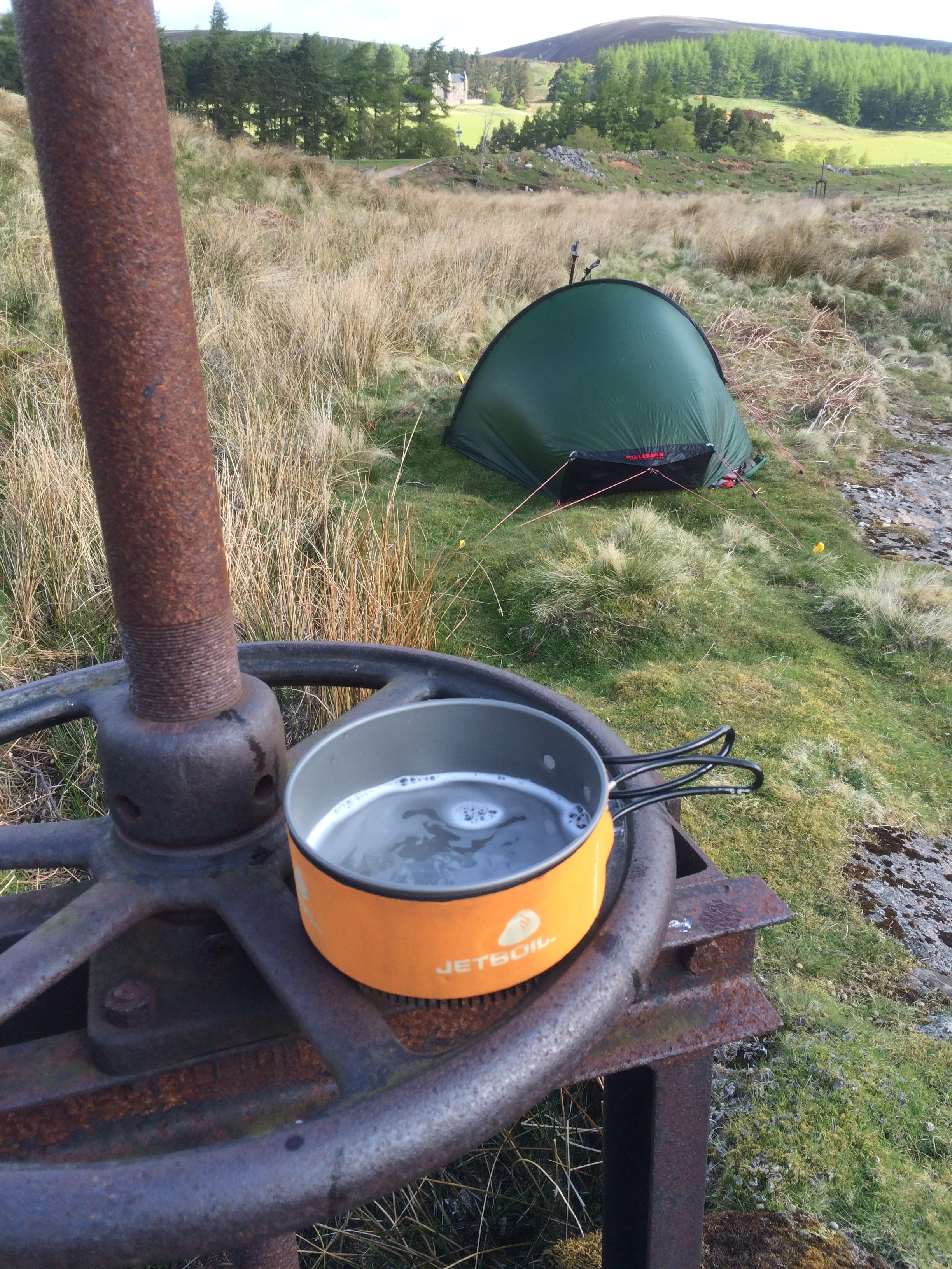
I camped the last night once more on postage stamp of ground where it was hard to tell which end of the tent was higher than the other.  (That’s a problem when it comes time to lie down.)

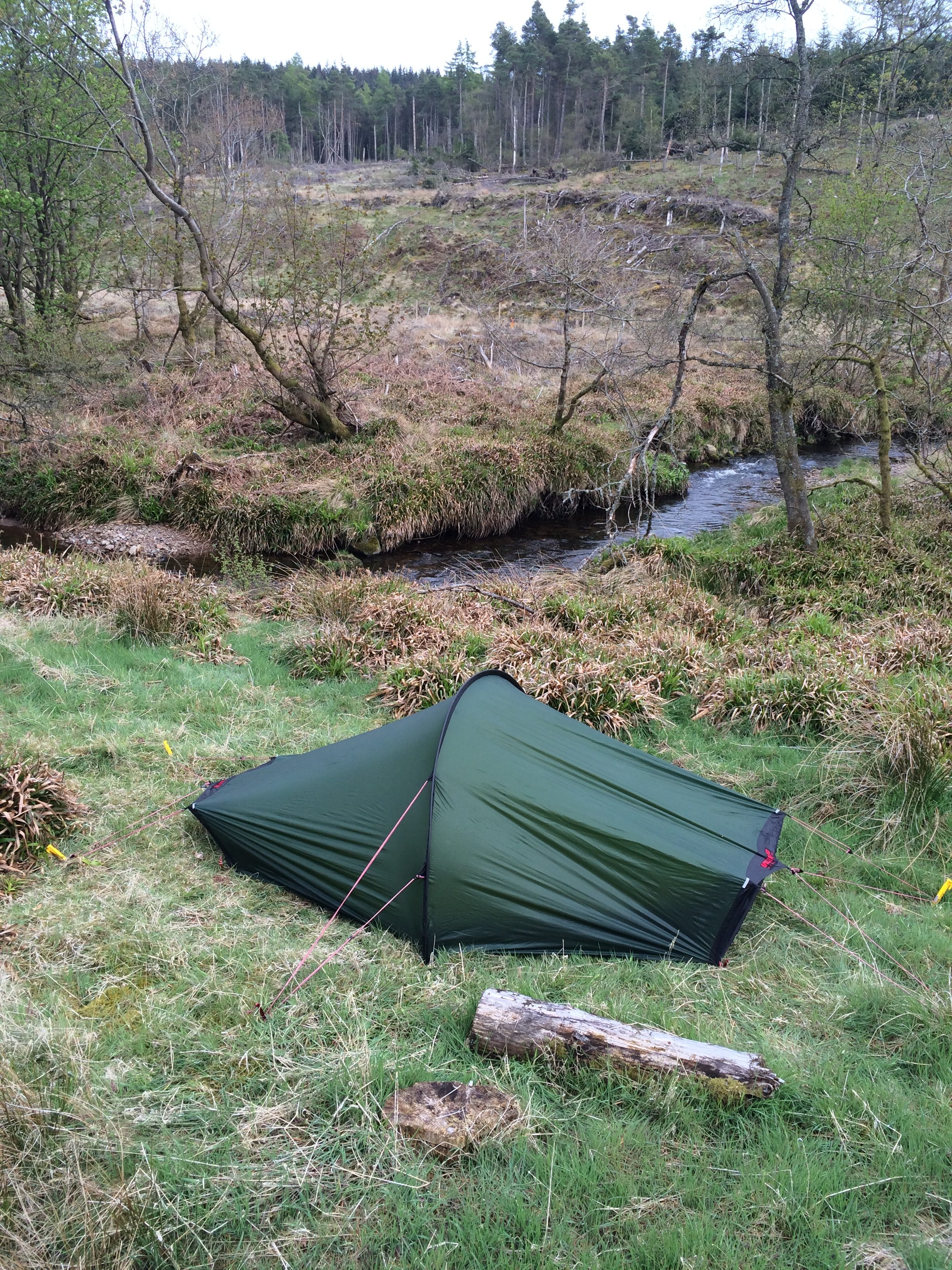
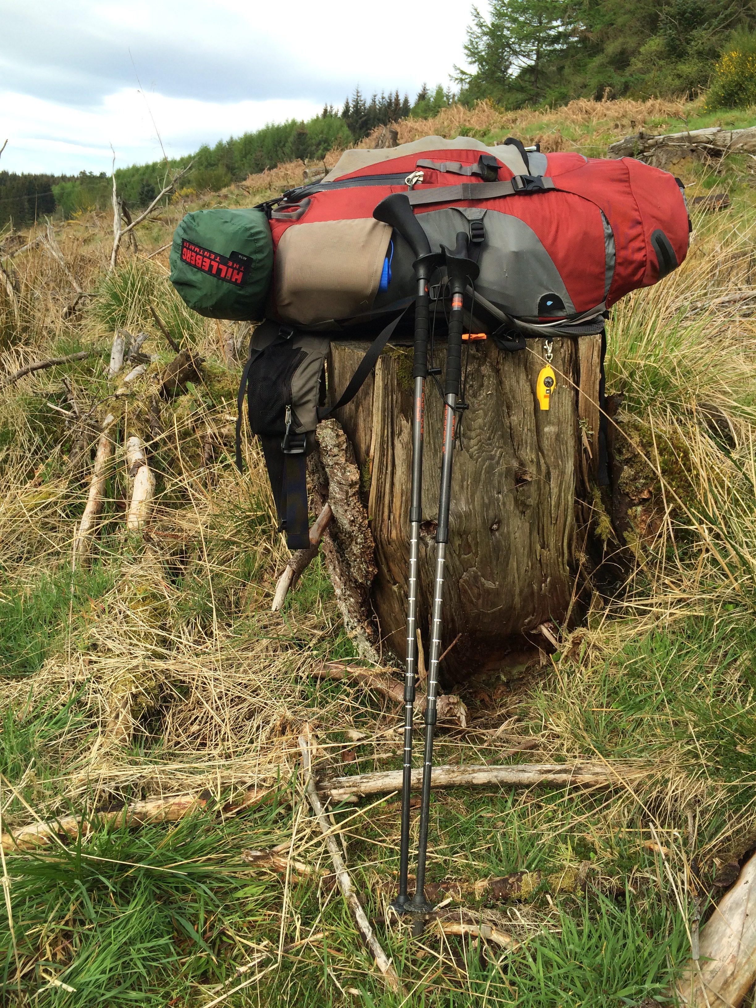
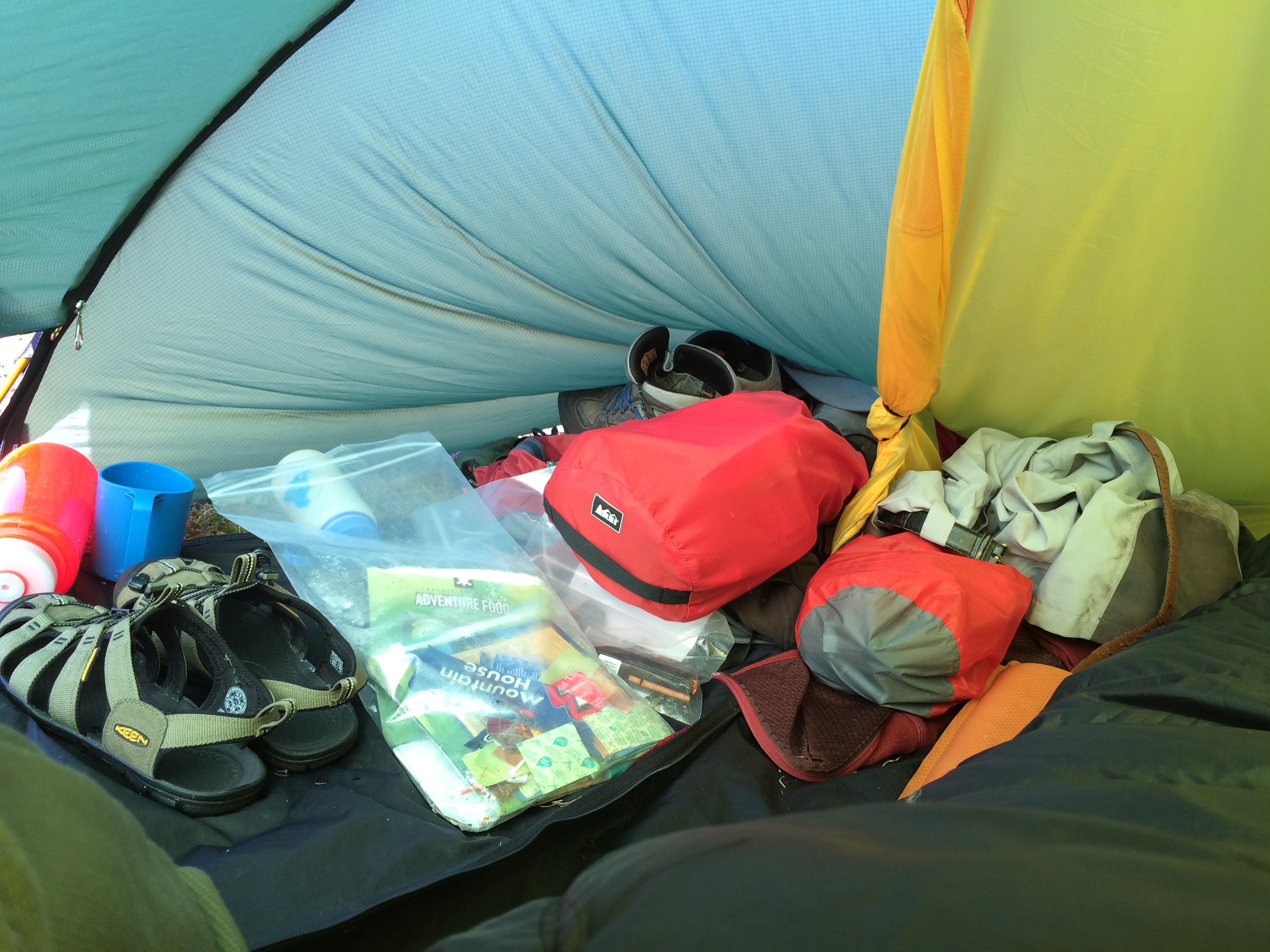
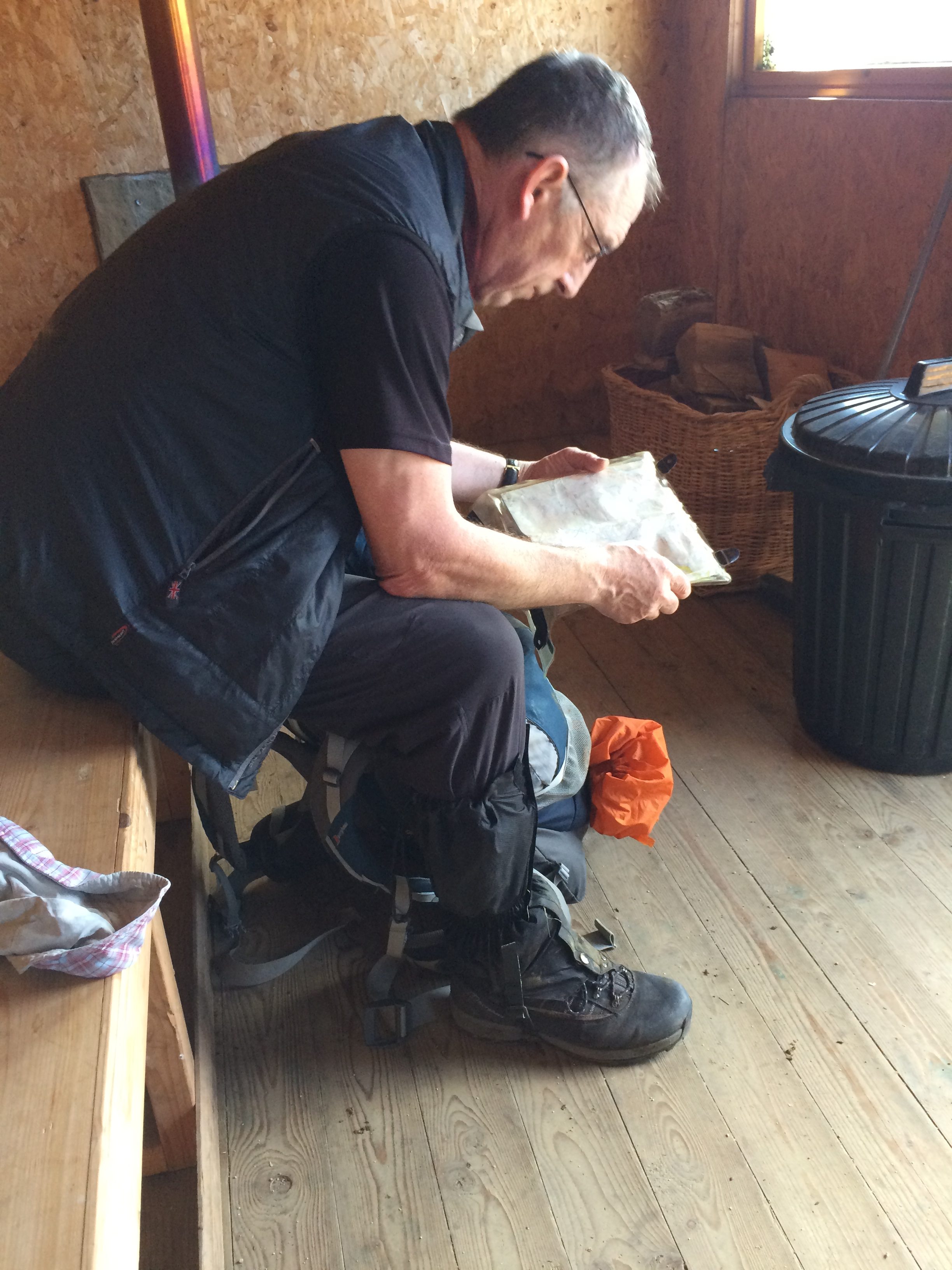
Once more I put things back into their respective bags, and put the bags back in the pack in their appointed place in their appointed order.  It was a little sad.


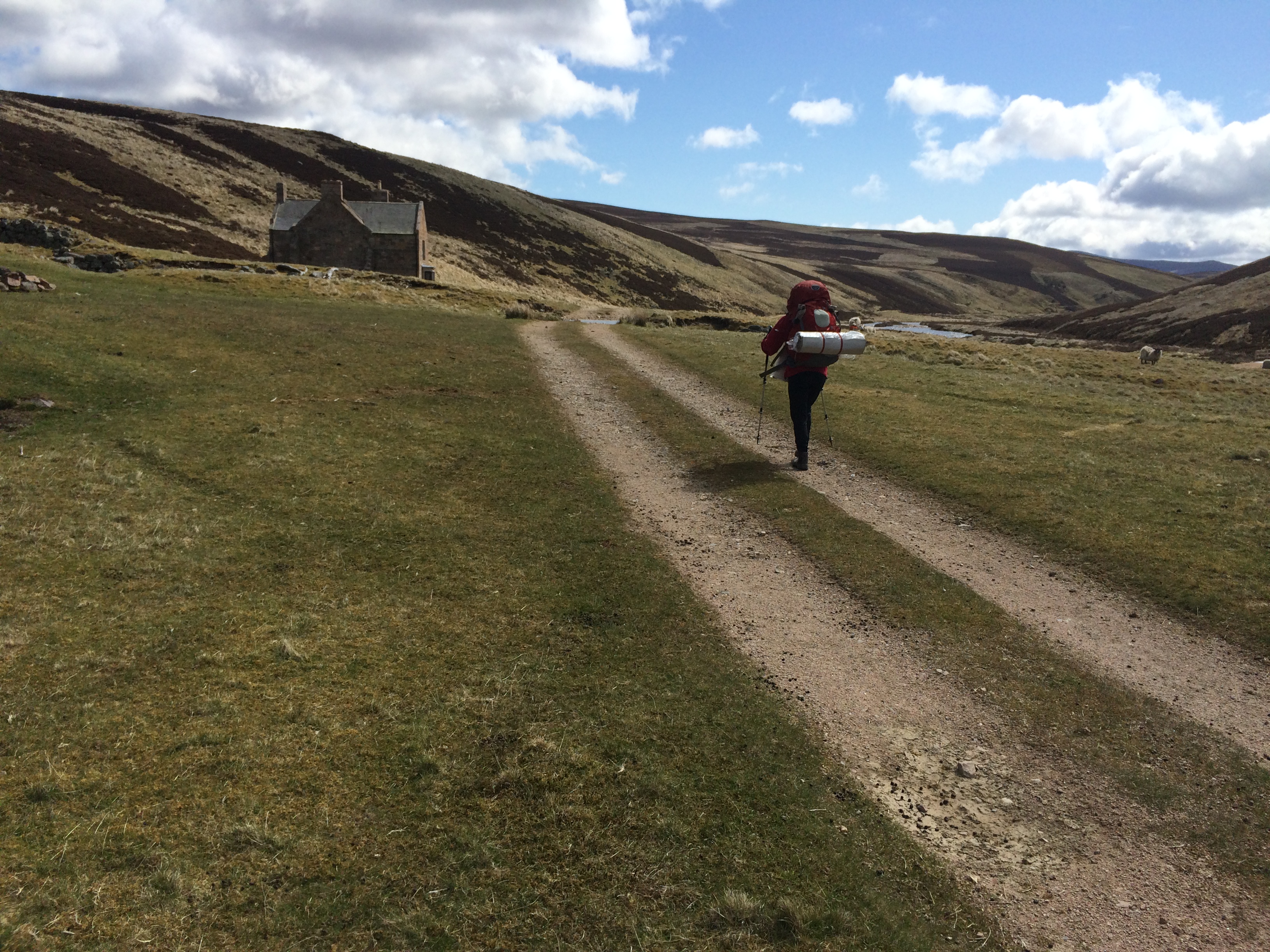
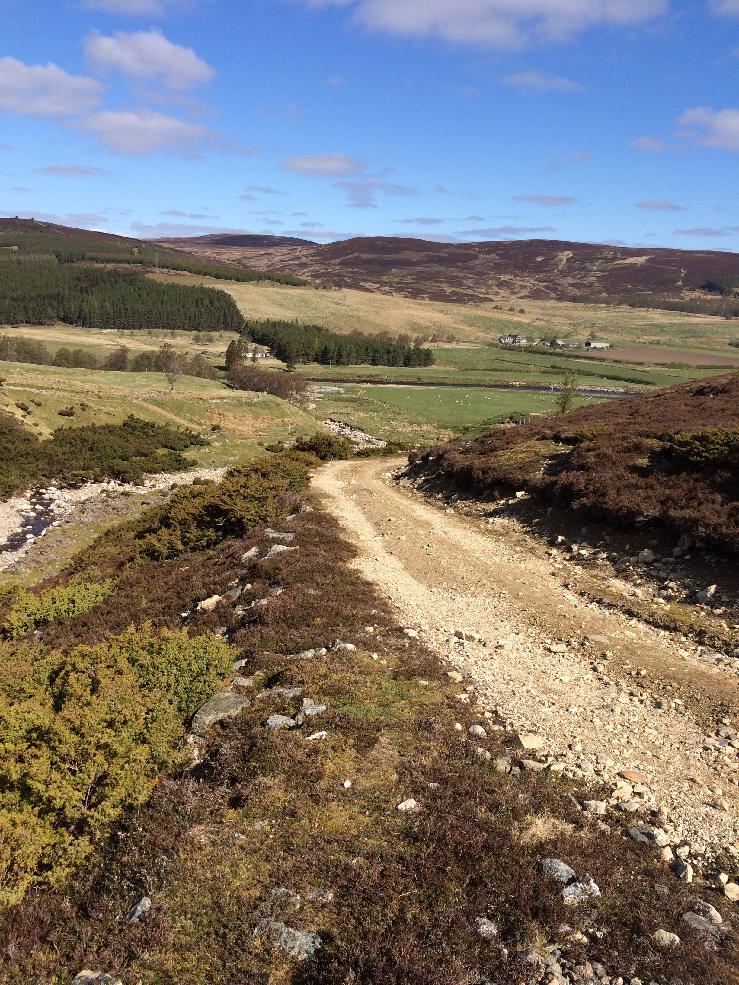
Then I headed on down the road, 9.8 miles to the sea.

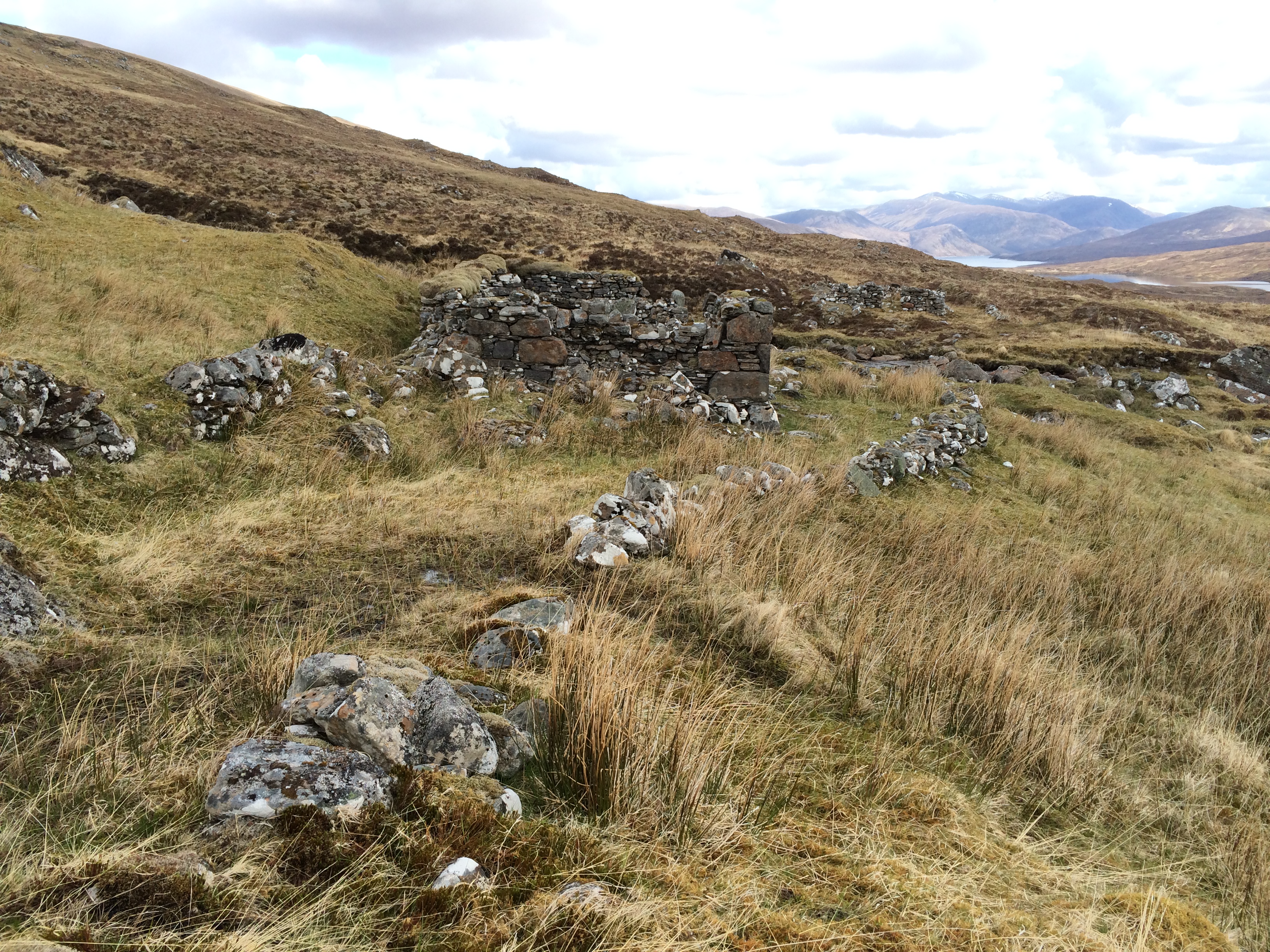
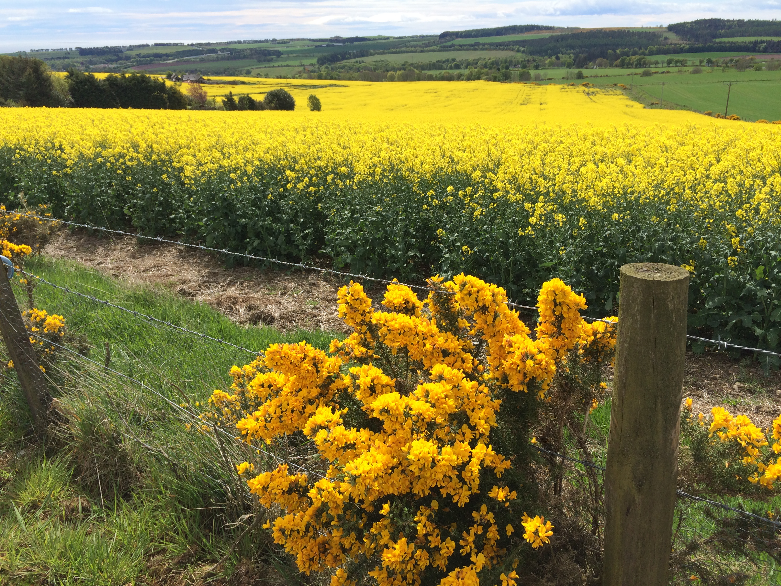
This part of Scotland is bucolic and manicured rather than empty and haunted.  Most of the walking was on roads. There was little traffic. The sun was out and it was beautiful. For the first time, I zipped off the legs of my pants.

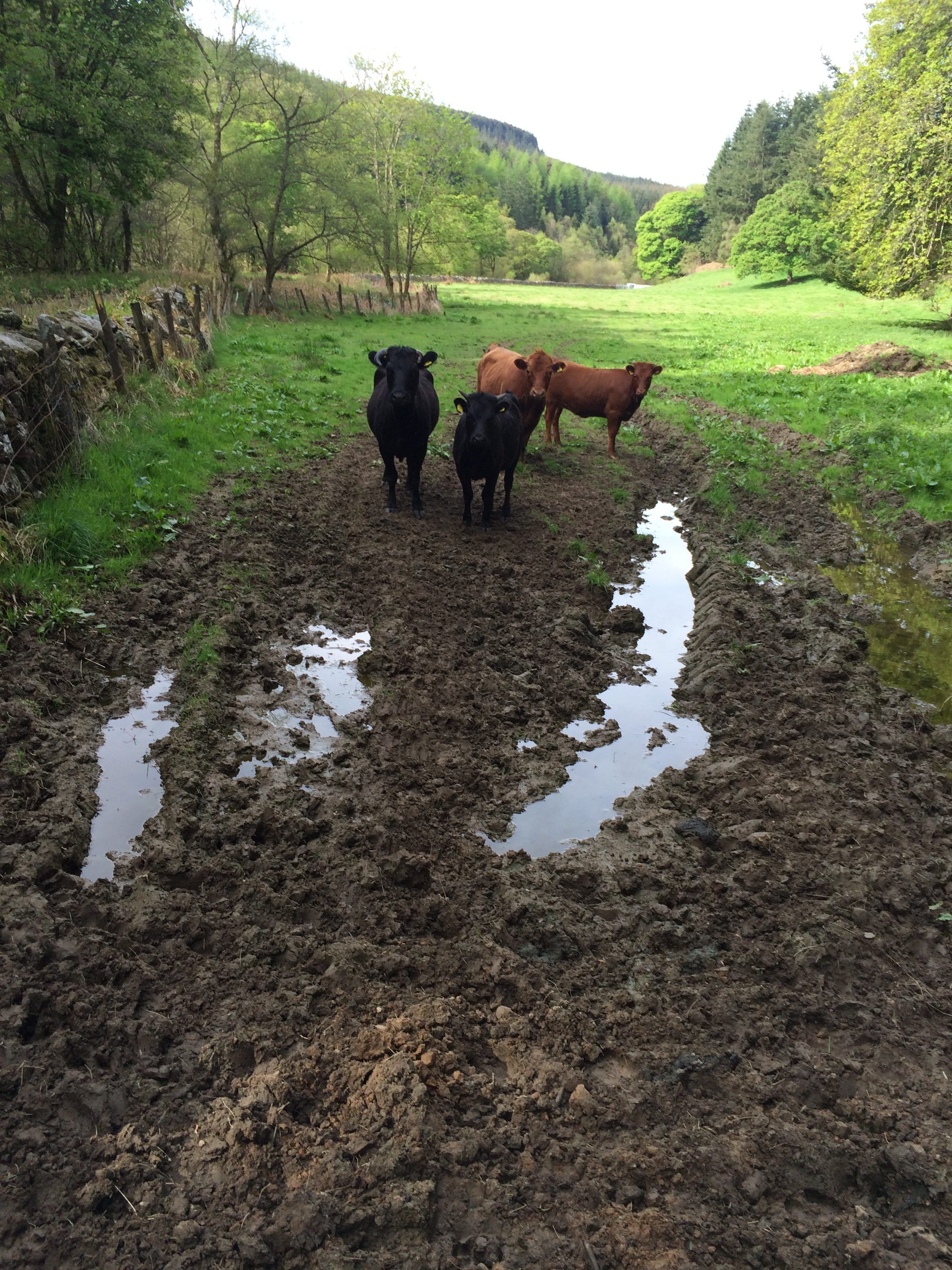
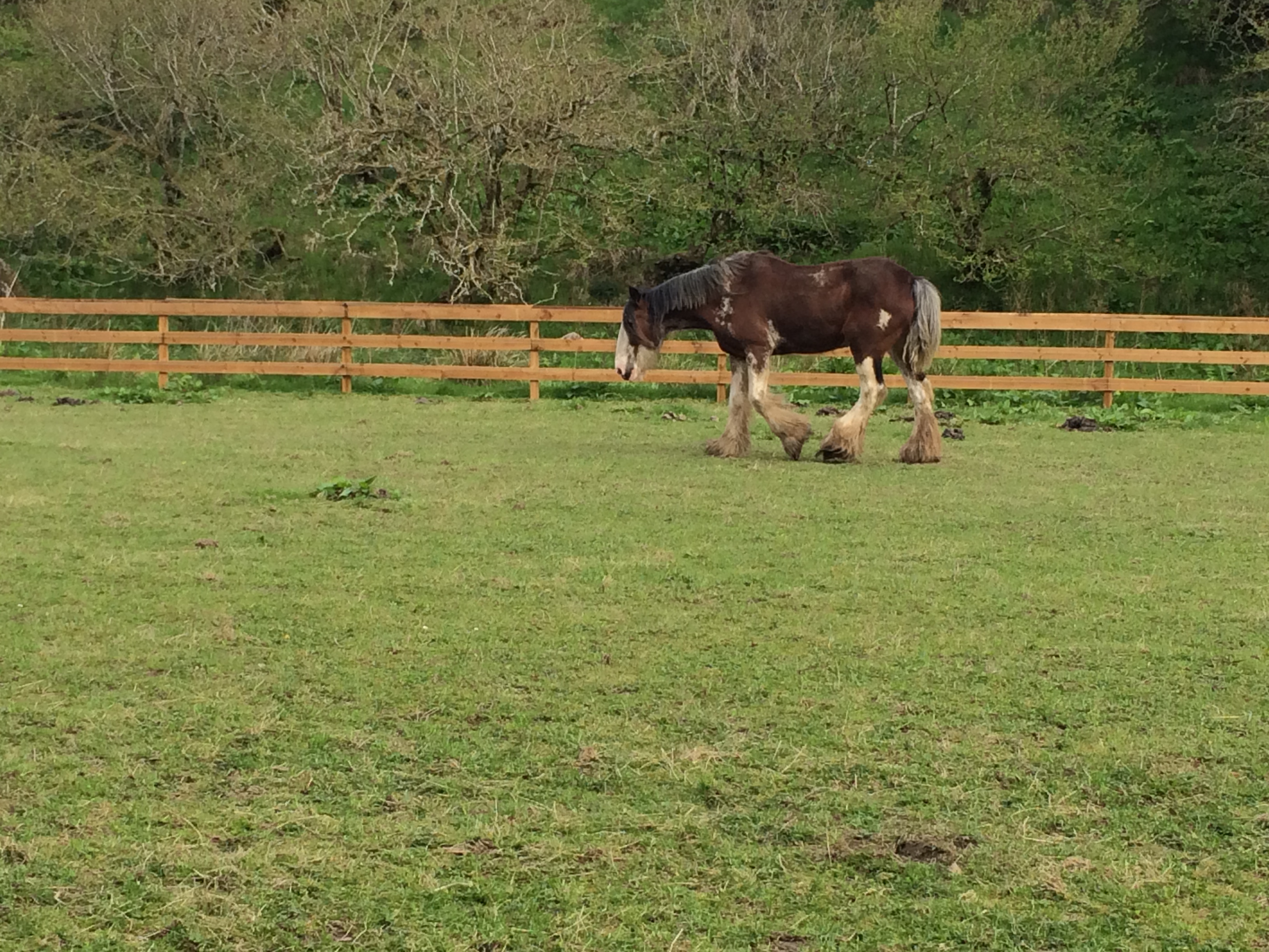
I passed a farm in which a bunch of cows were running around in what appeared to be delight.  They got to the end of a pasture and went through a maze gate into the next field, all but one female.  She didn’t like the maze, but also didn’t like being left behind, and bellowed plaintively.  The rest of the group ran to the end of the field.  One of them, a young male, began bellowing himself when they reached the far fence.  He wasn’t happy that his mother was unhappy, so he led the group back.  He’s the dark brown one turning around.


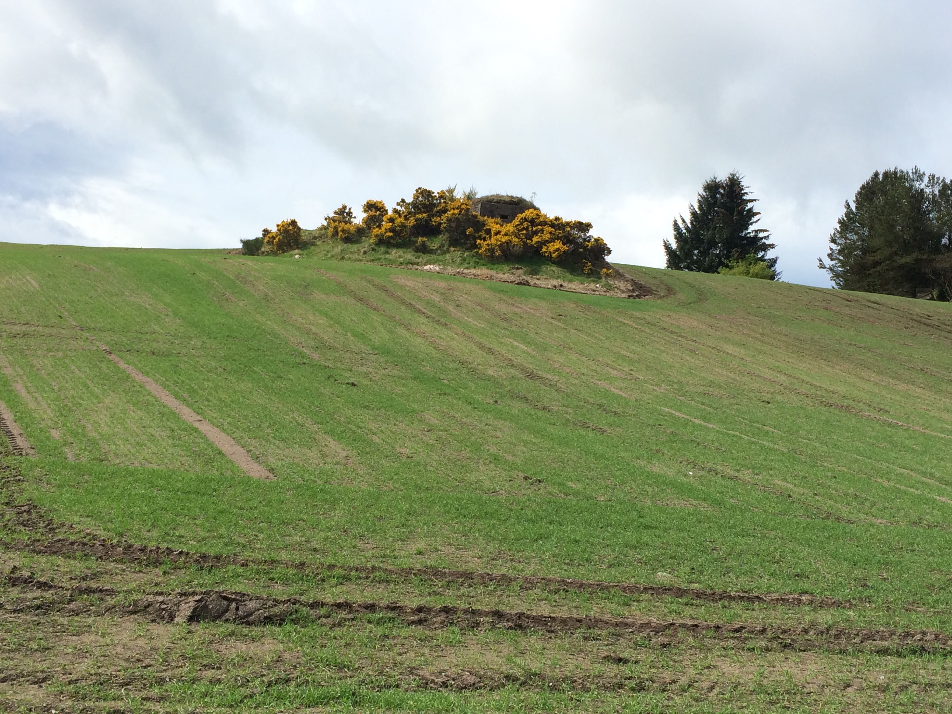
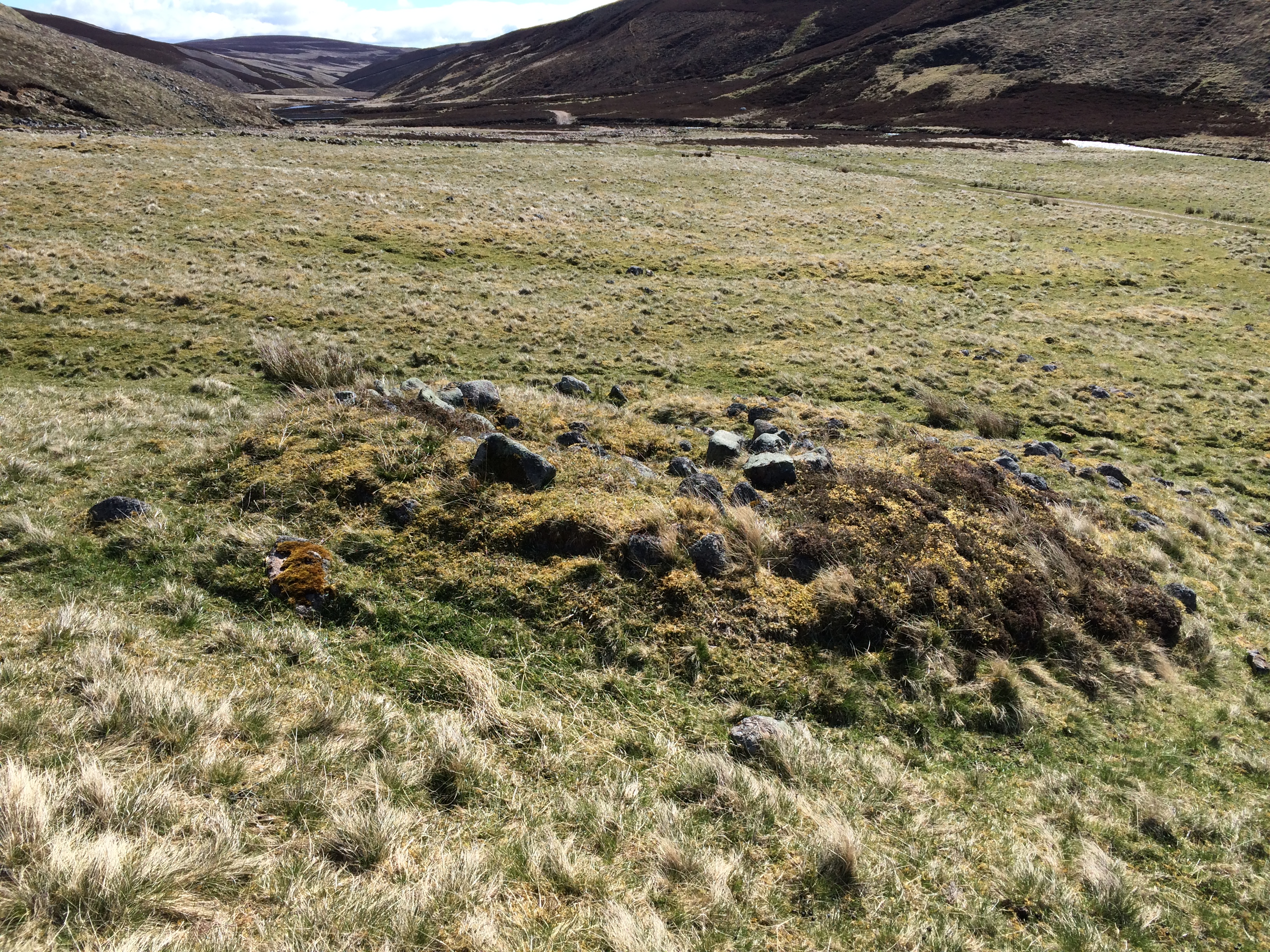
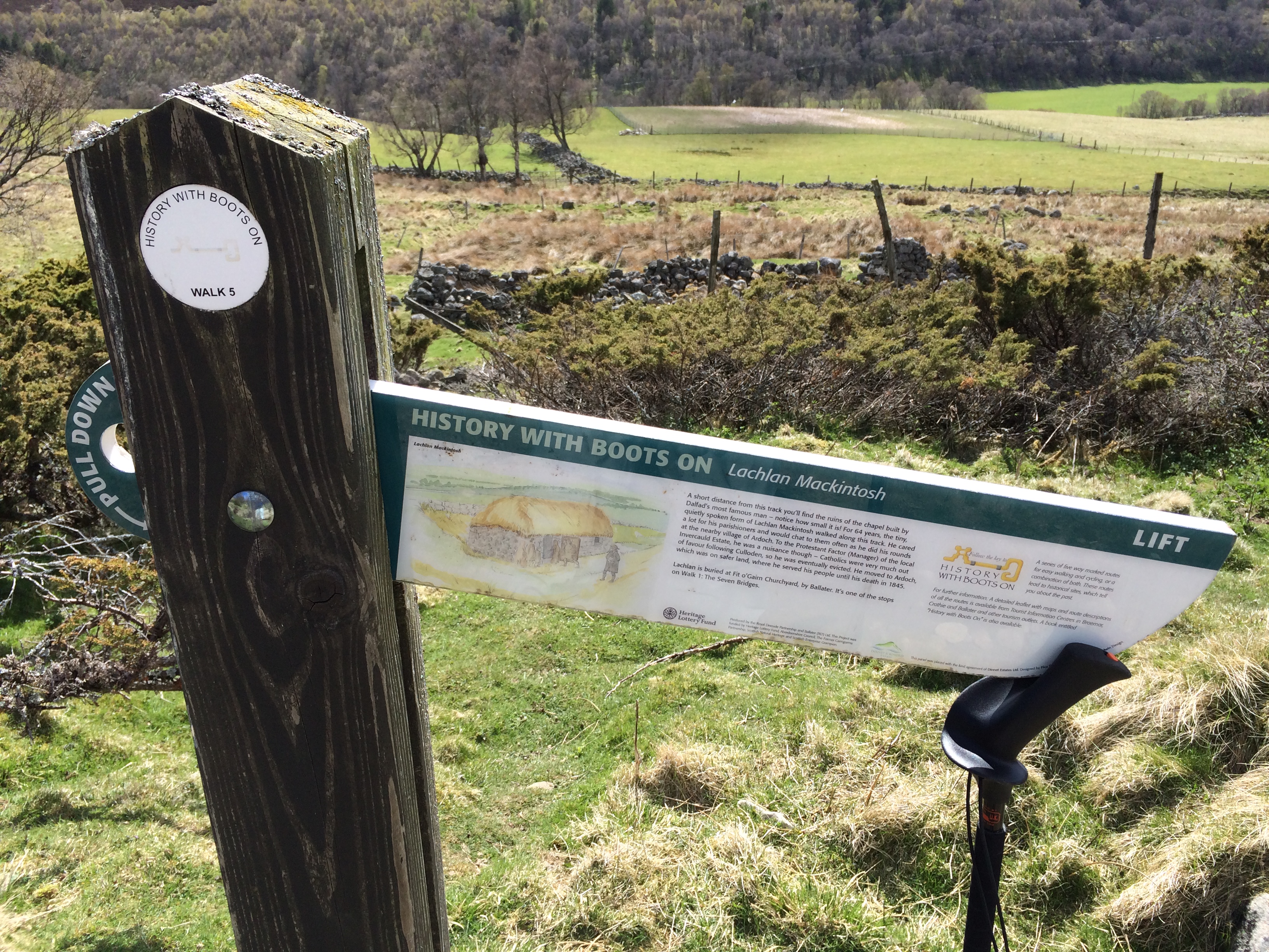
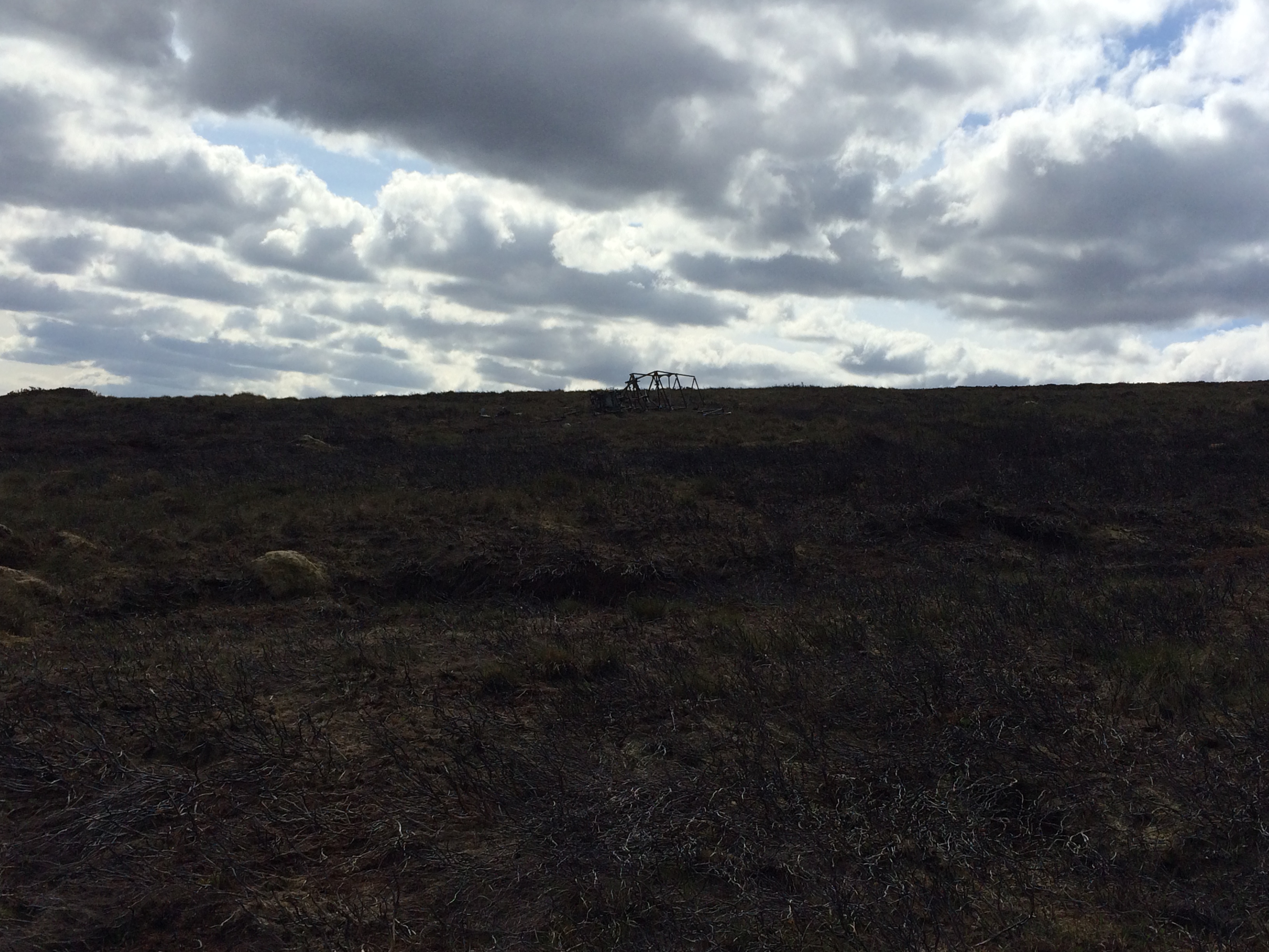
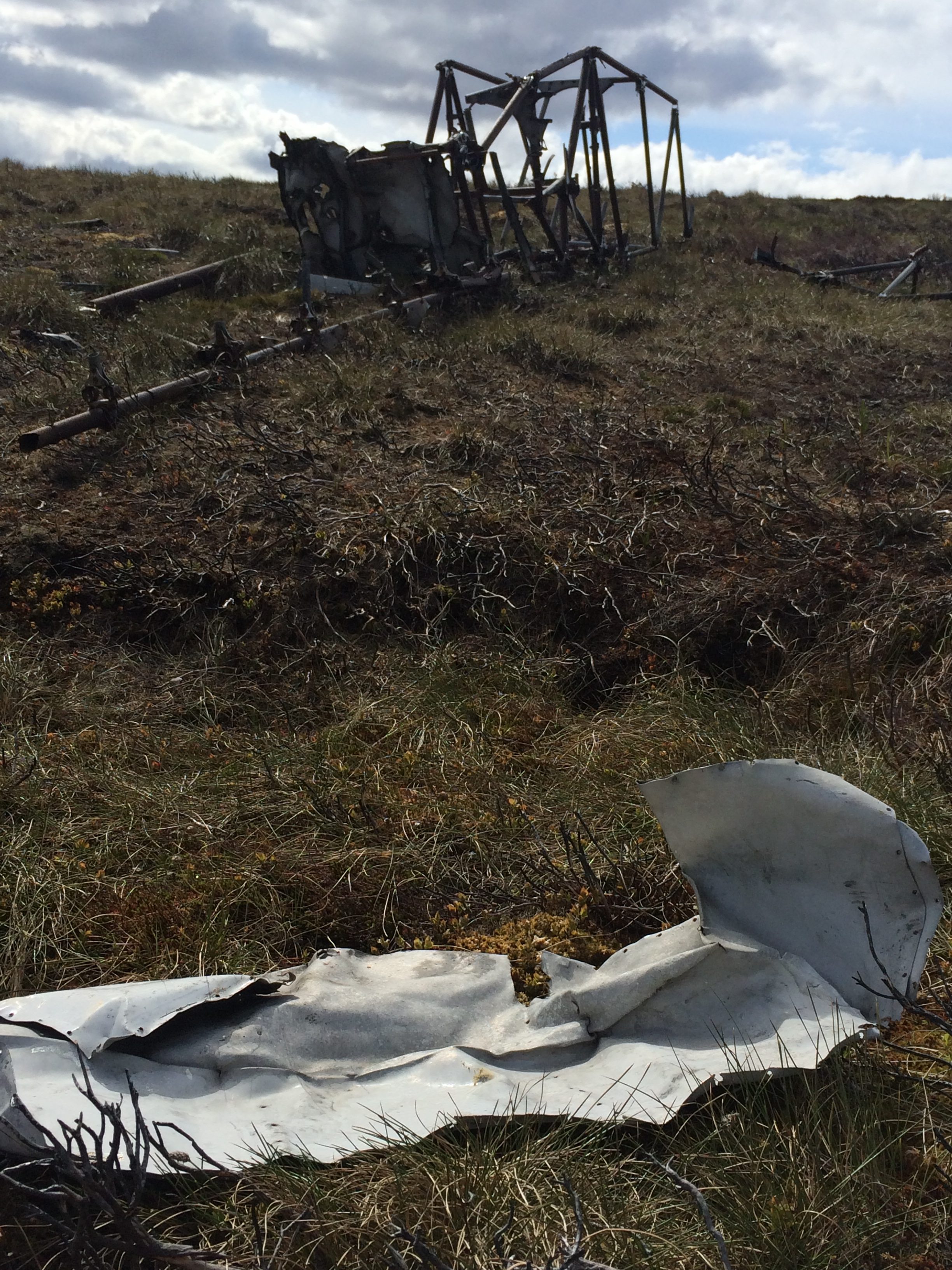
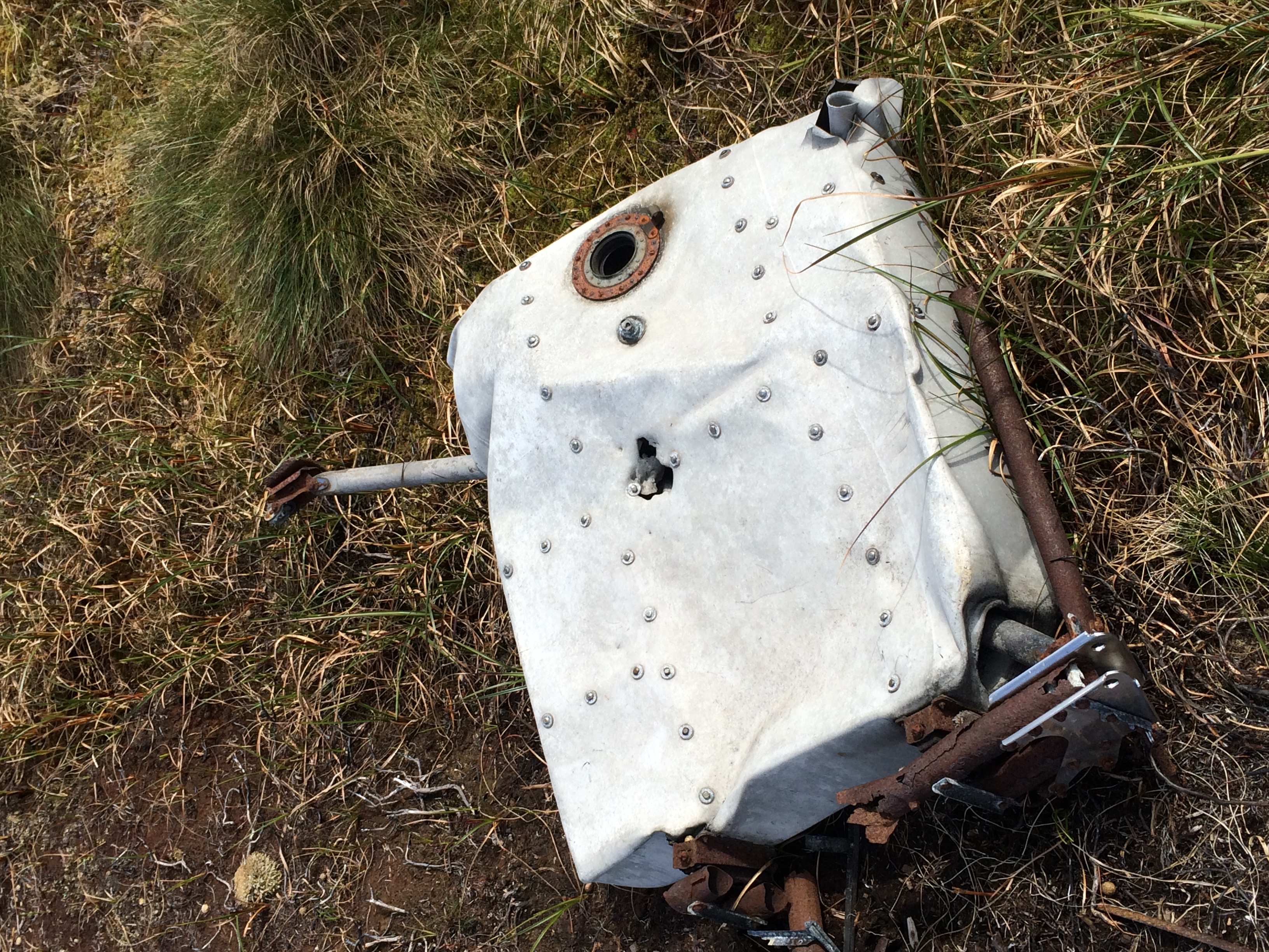
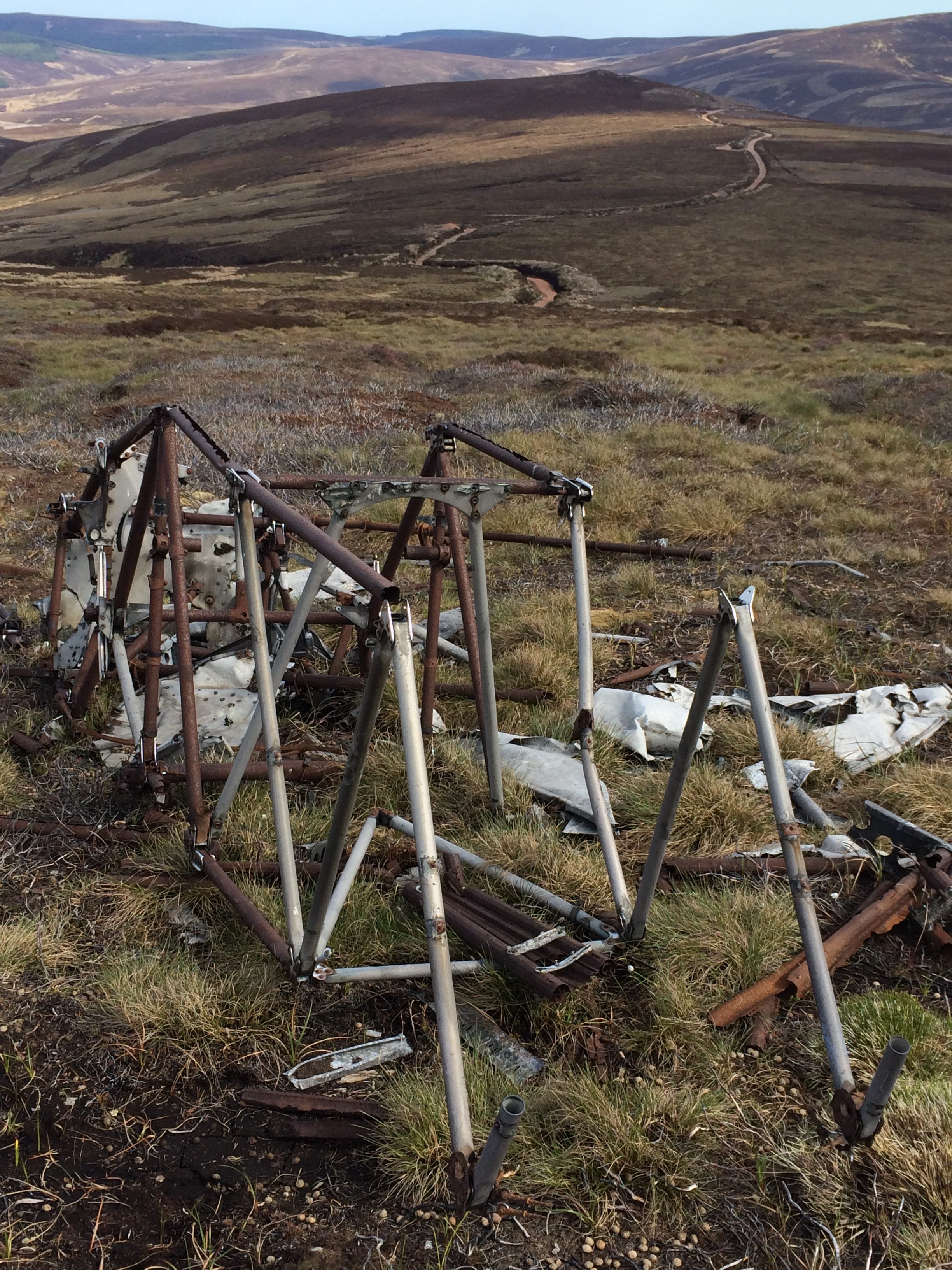
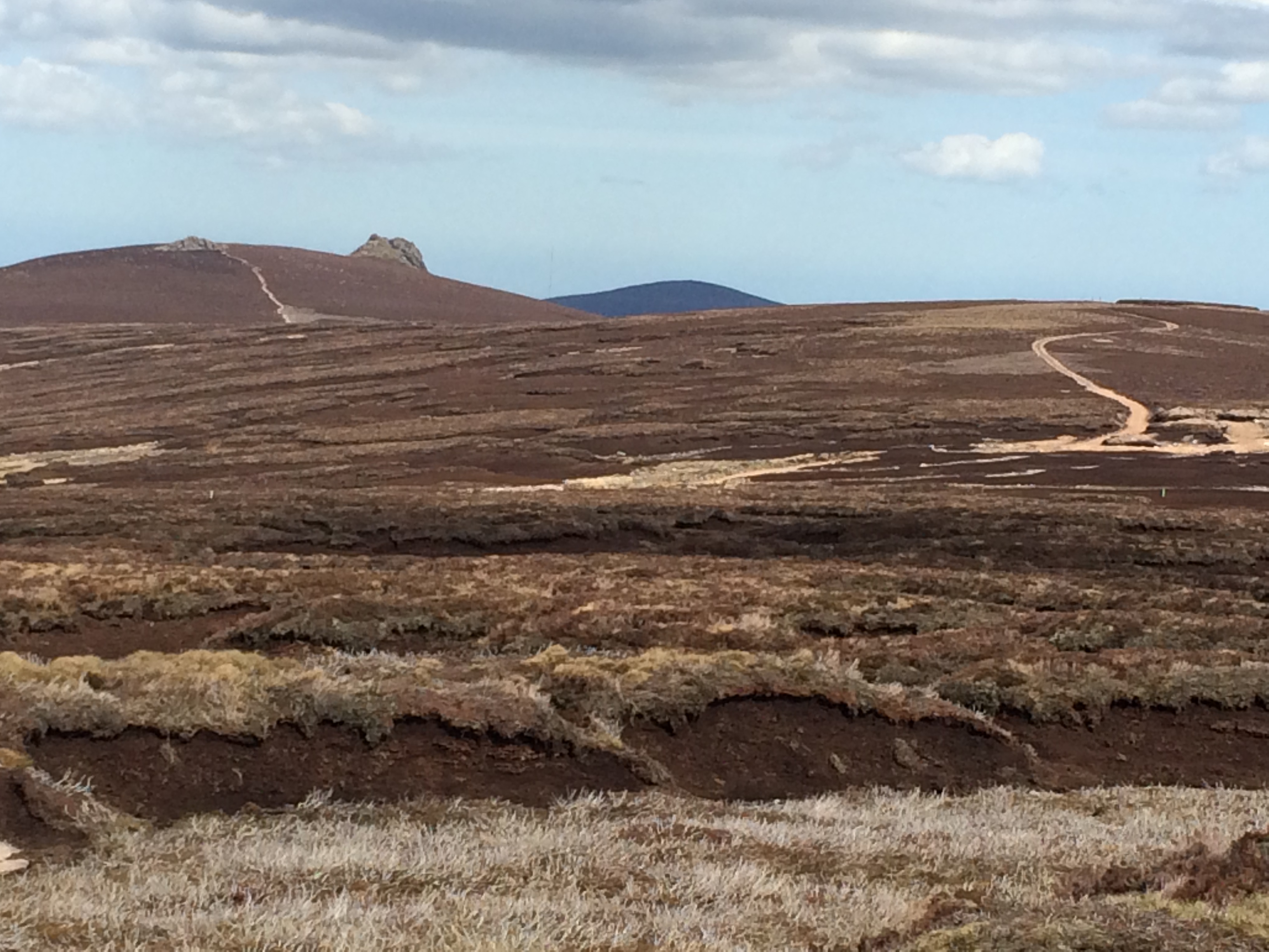
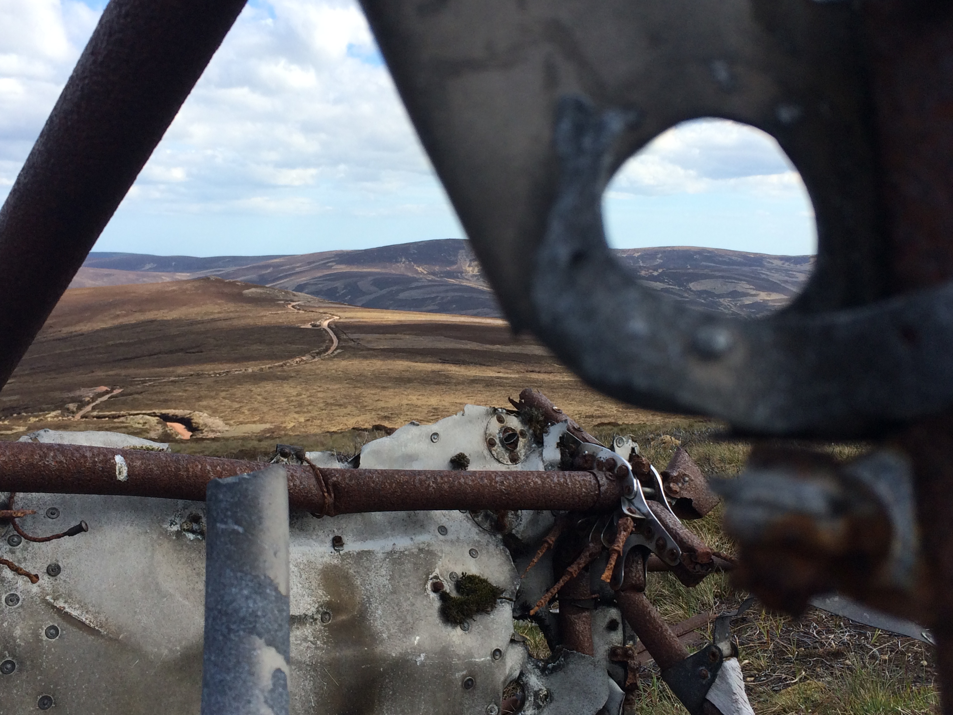
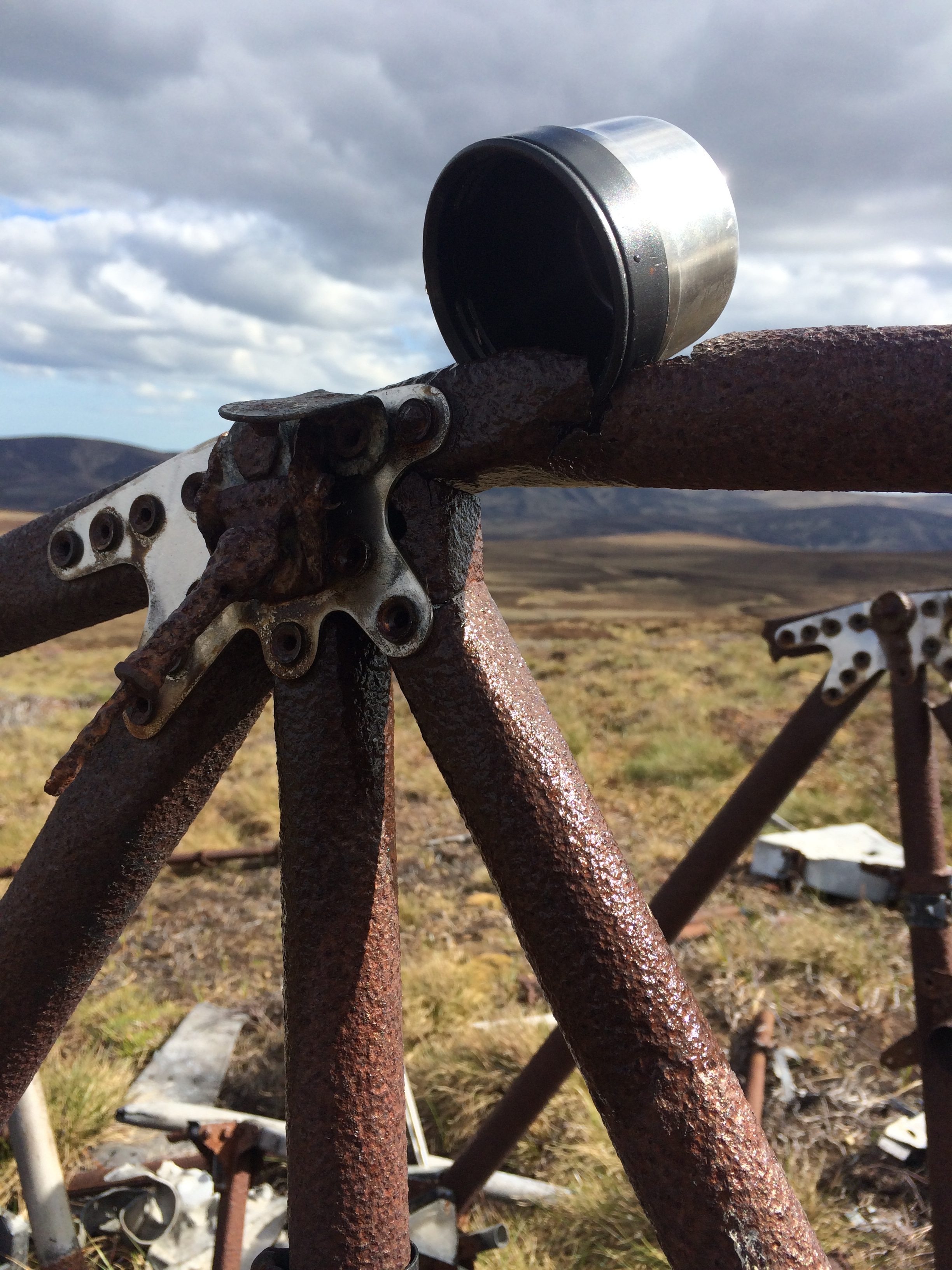
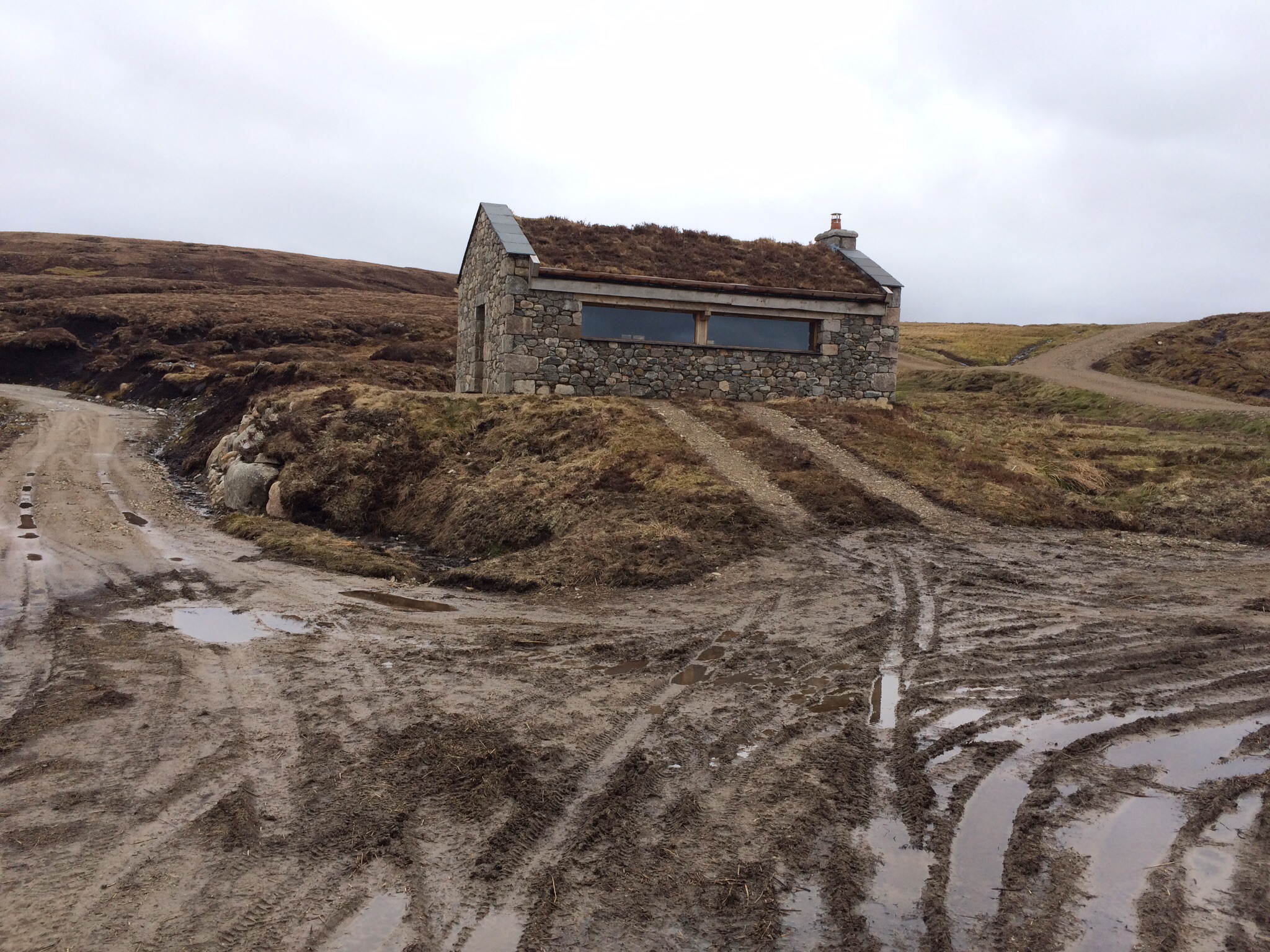
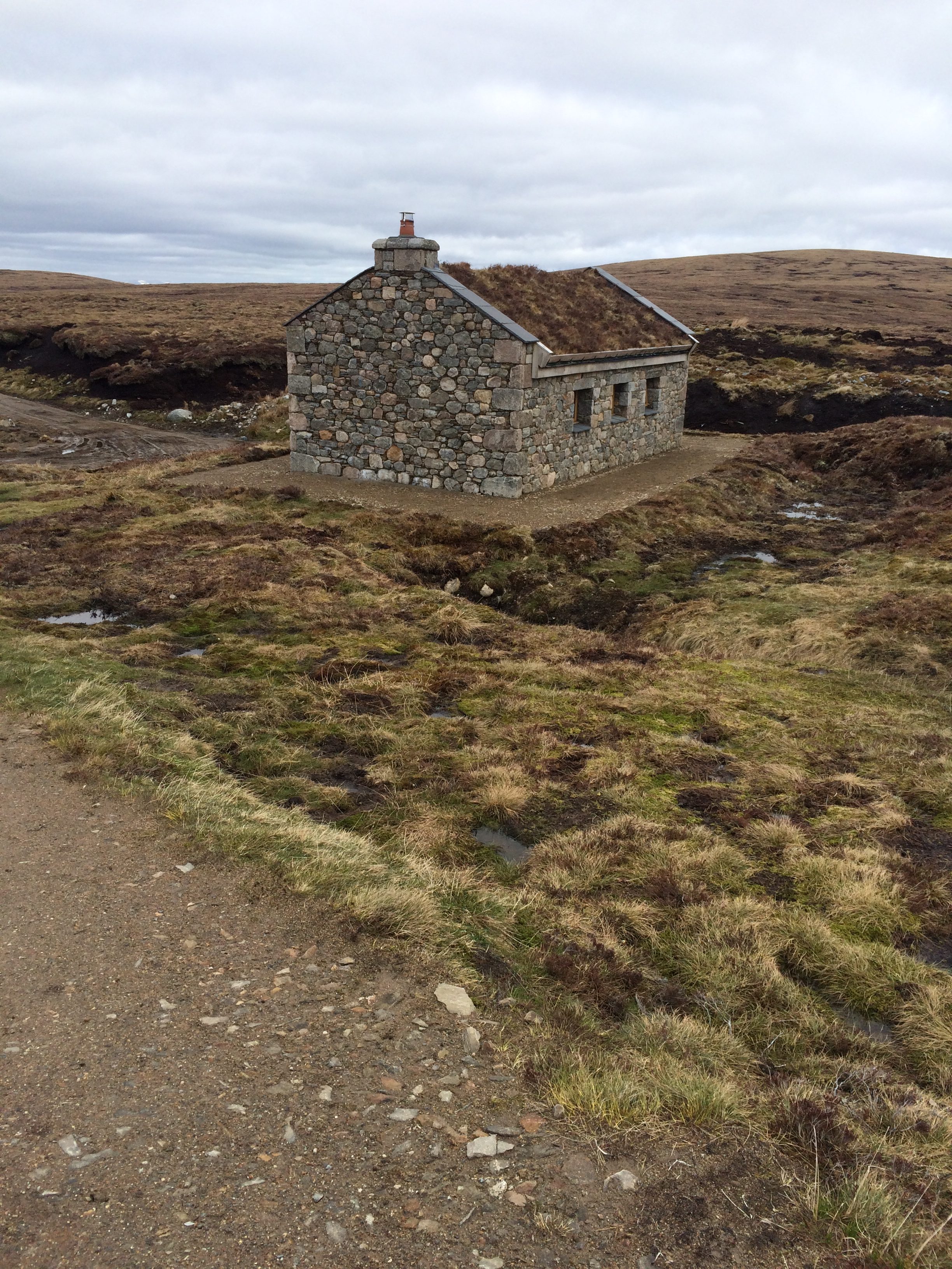
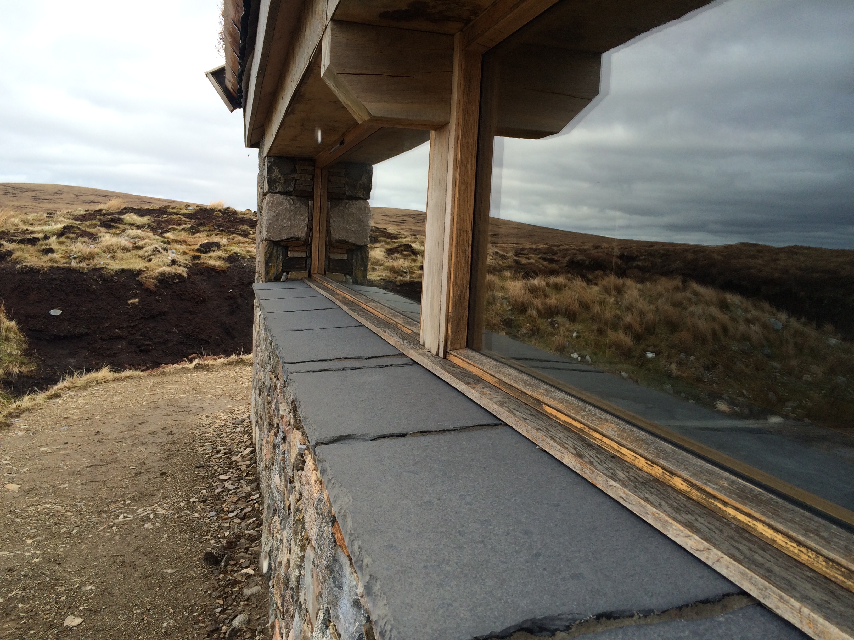
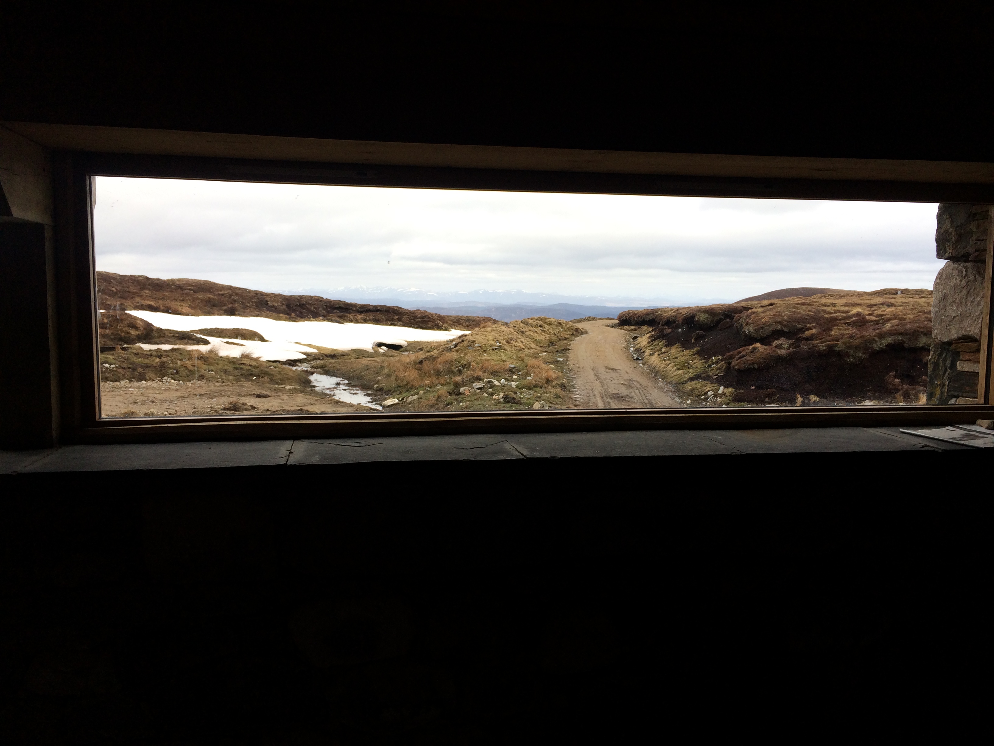
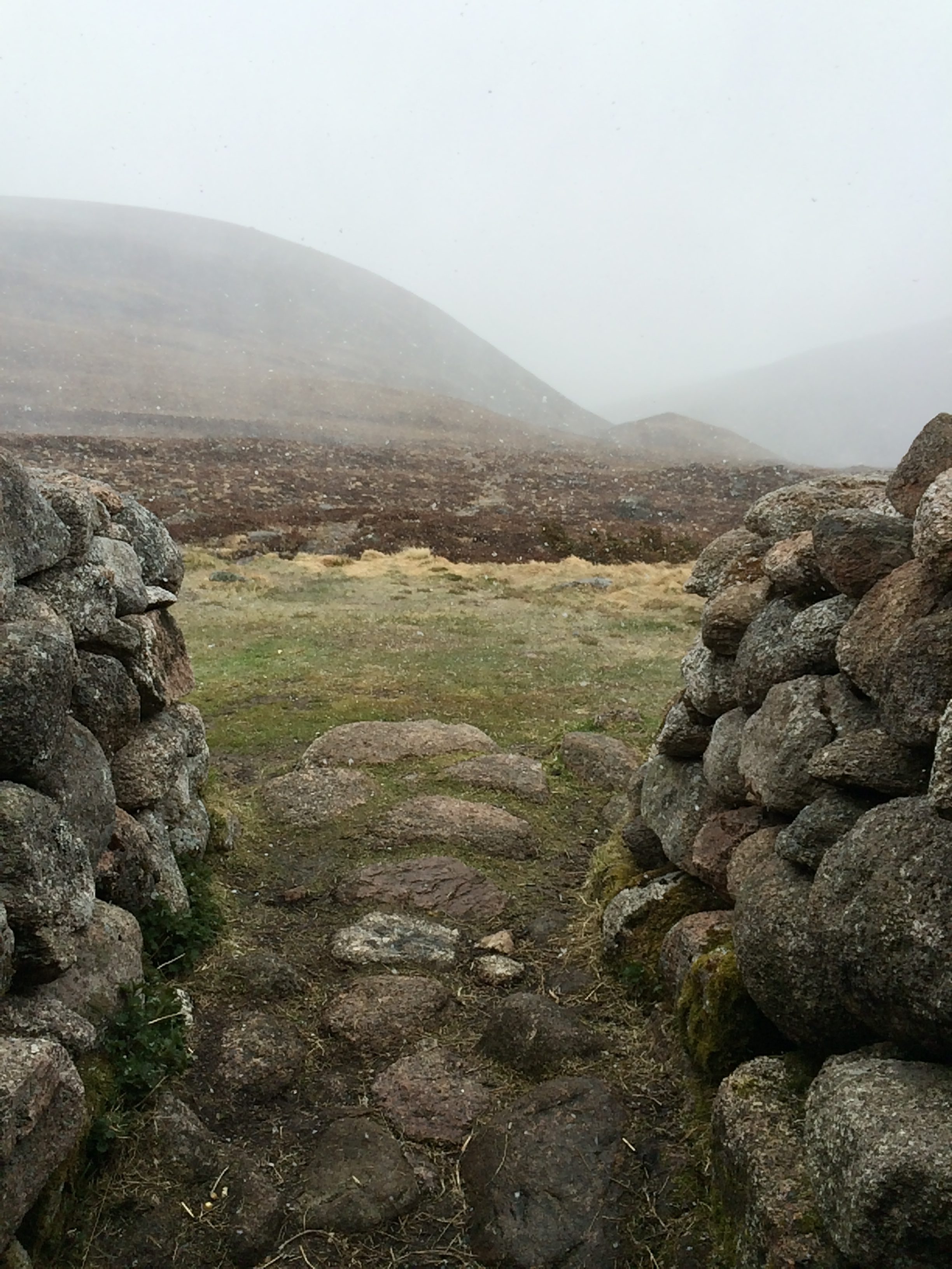
I went by a strange structure, of which I’d seen one other on the walk.  It looked like a coast-watching station, although it wasn’t in view of the water.  No idea what it’s real function is.

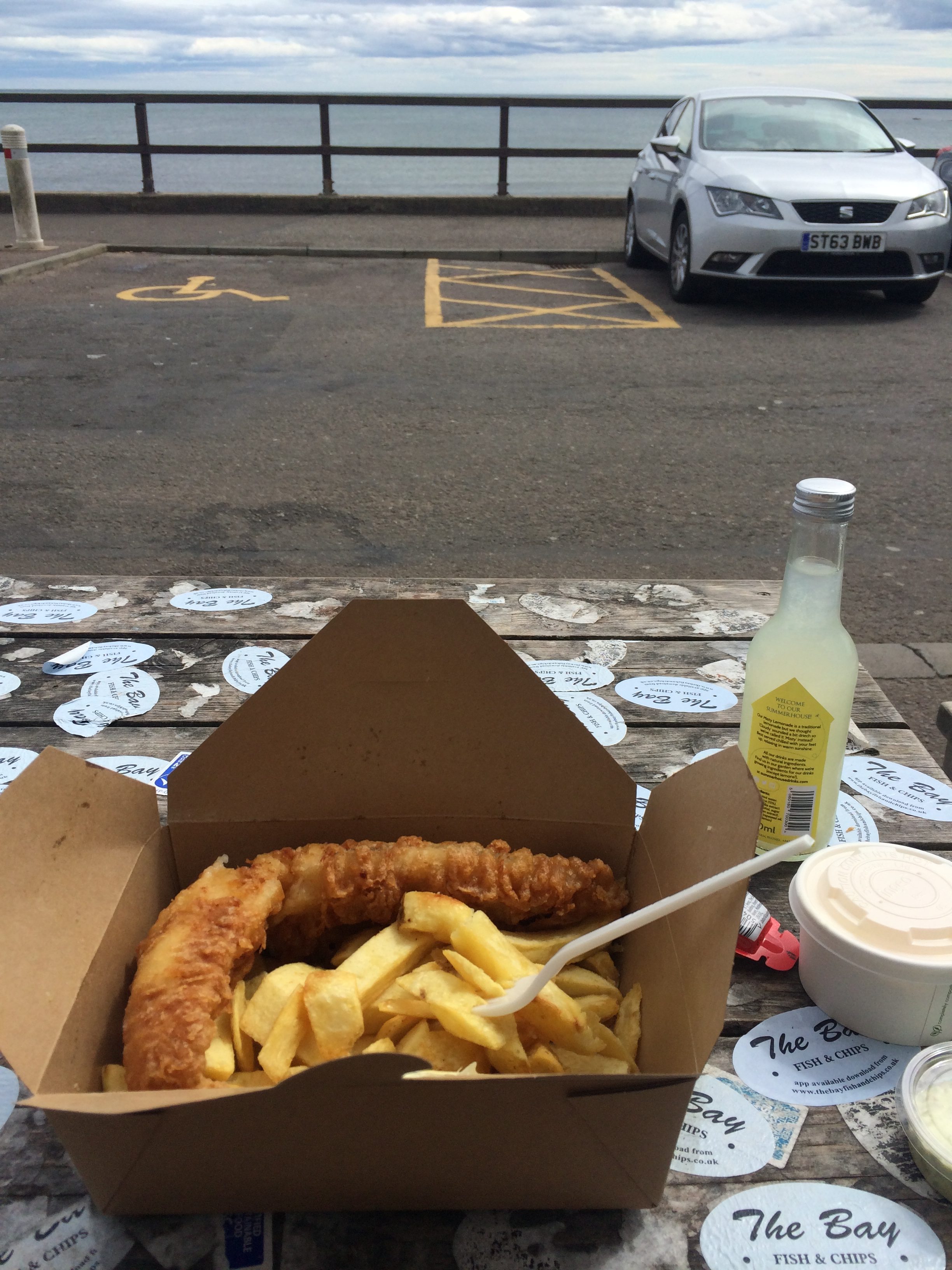
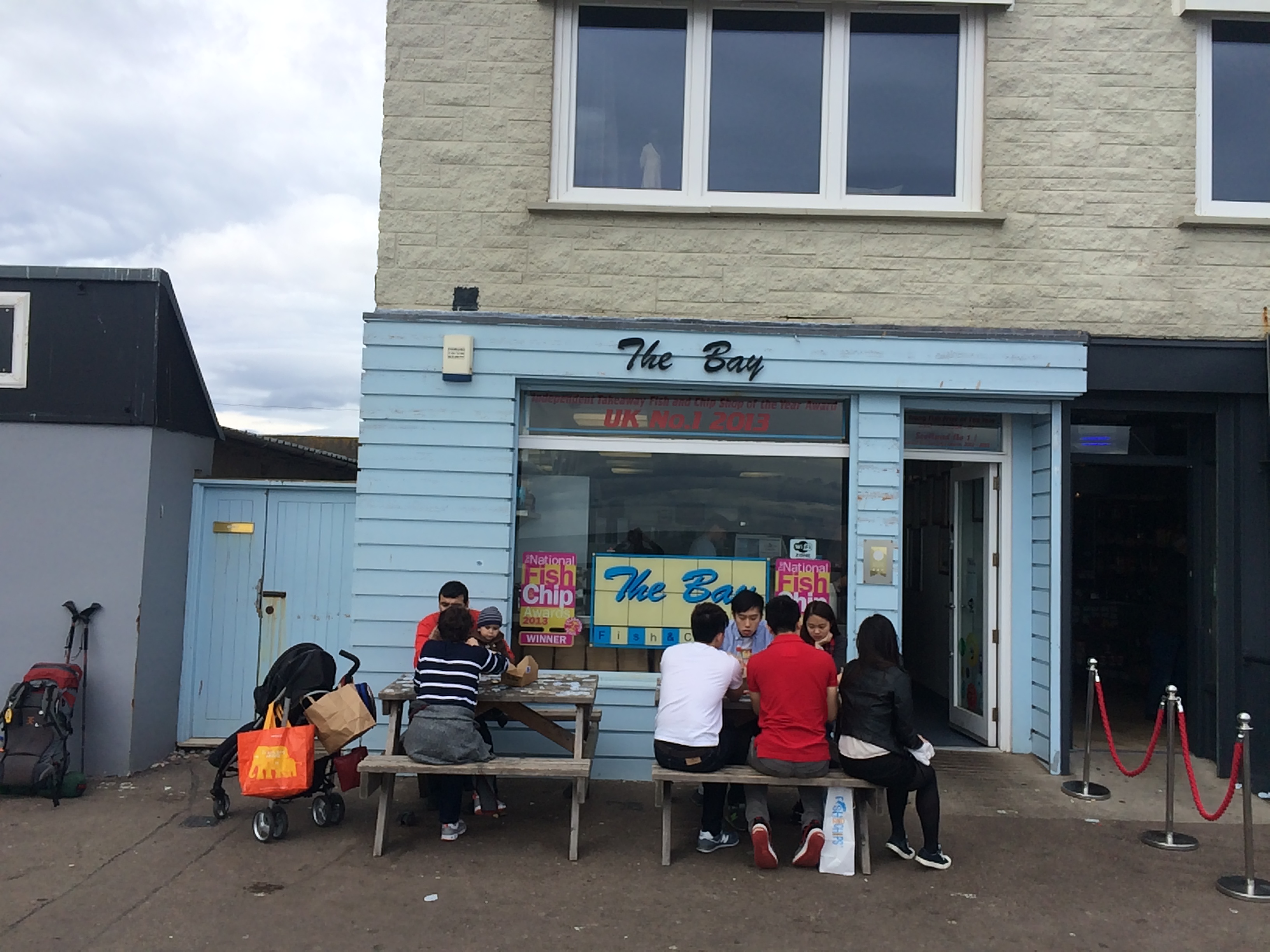
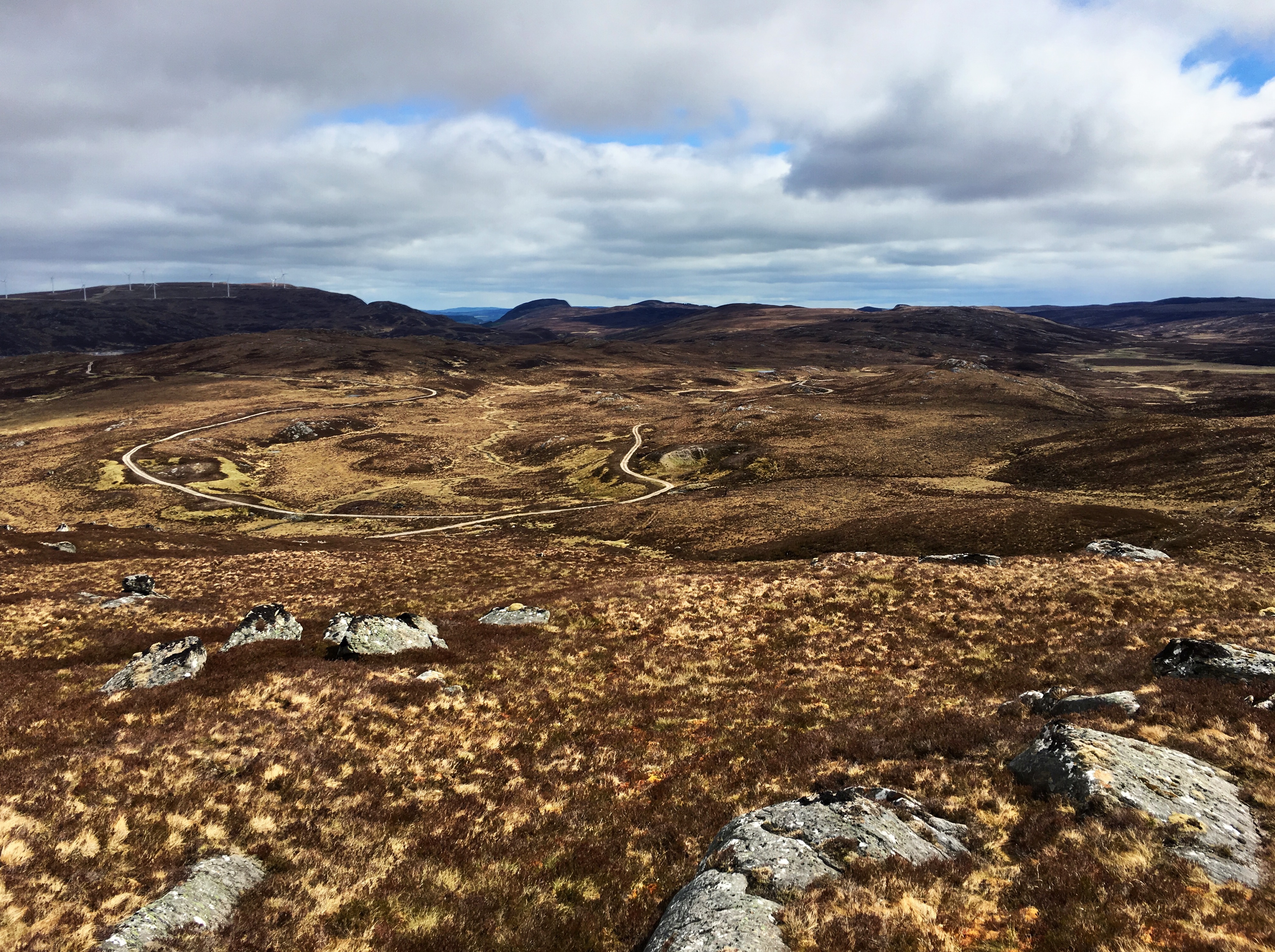
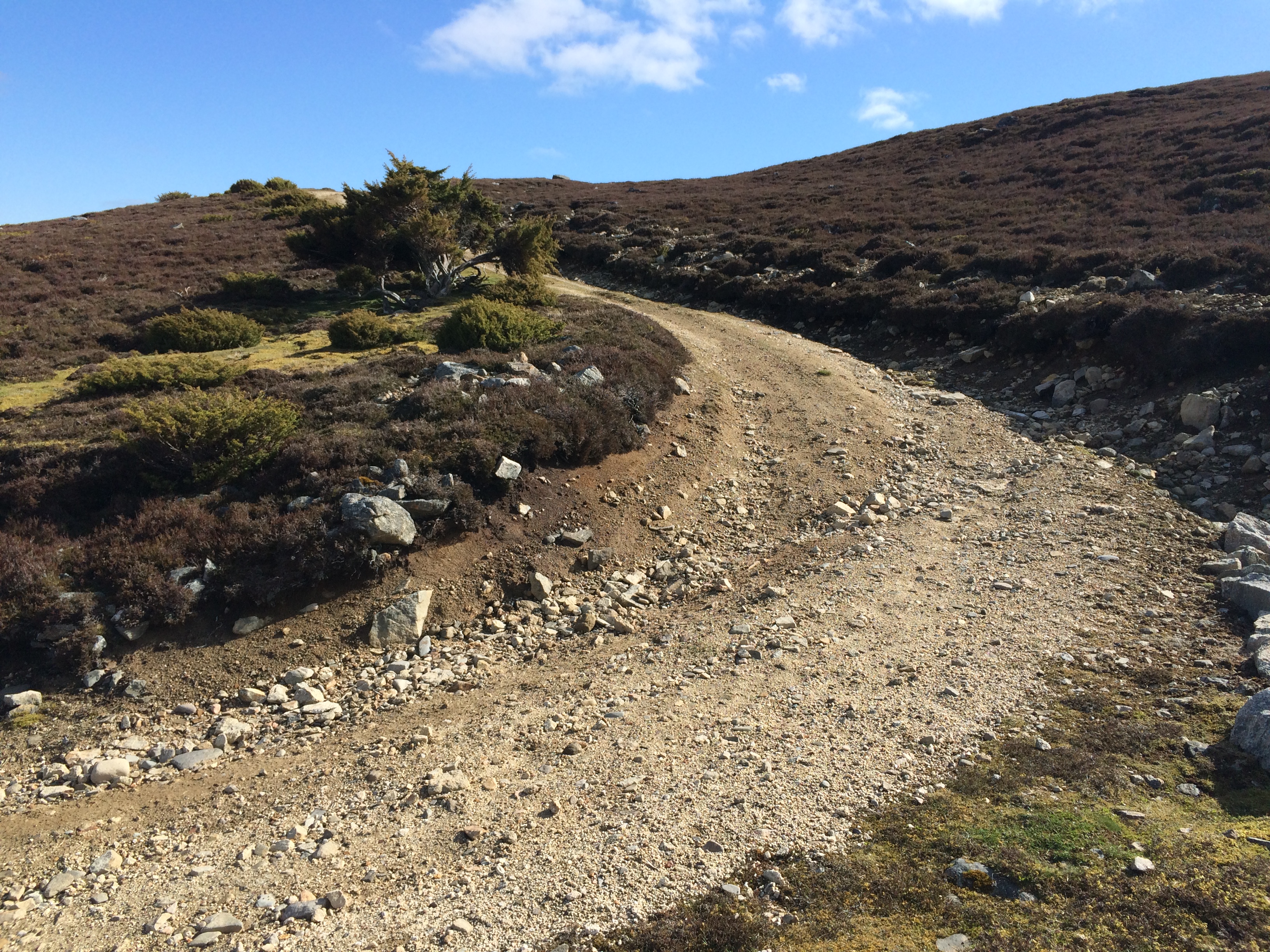
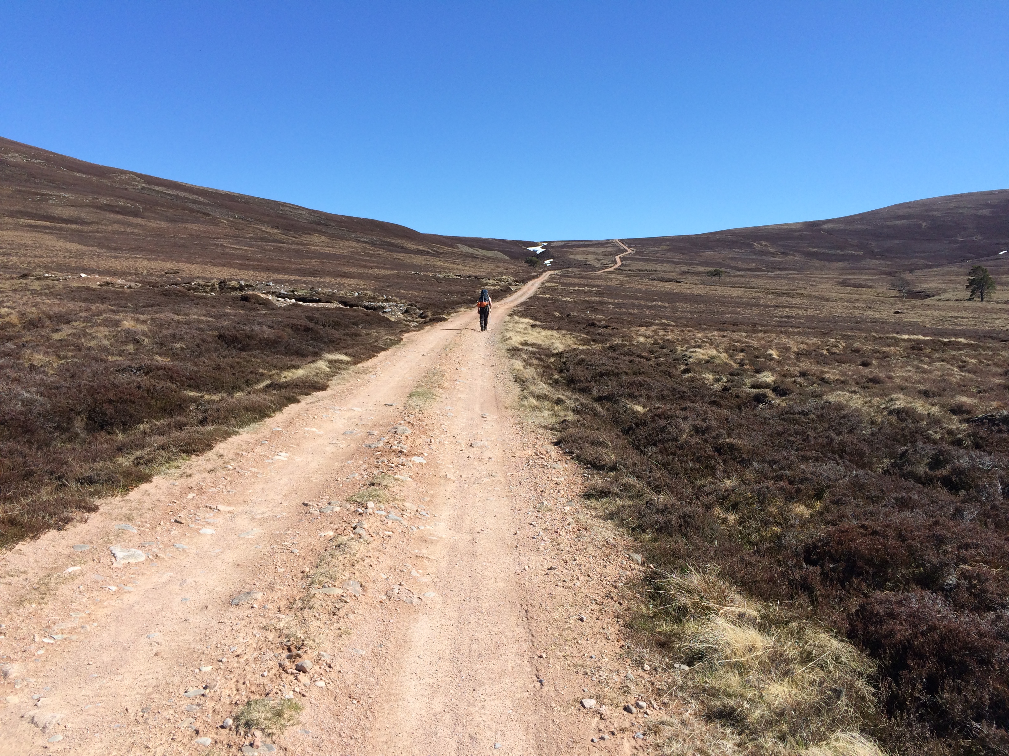
I went over a few hills, but the vertical ascent for the day was only 837 feet, so it wasn’t hard.  Coming down a single-lane road I stopped at a collection of trash cans (“bins”) for farmhouses up a dirt road.  A man drove by in a car and stopped.  I thought for a moment he might object to me offloading a bag of empty freeze-dried food envelopes.  But he wanted to congratulate me on almost making it.  He’d obviously seen other Challengers.  He told me that when I got to Stonehaven, I should go down to the beach and get fish and chips at a place called The Bay.  It was the best in town.

So I did.


I was originally supposed to end at Dunnottar Castle, a medieval castle 2.5 miles south of Stonehaven.  It’s where the Scottish crown jewels were hidden from Oliver Cromwell’s army, and also where Franco Zeffirelli filmed “Hamlet” in 1990.  But the five-mile roundtrip would have taken too long, so I headed to the train station.

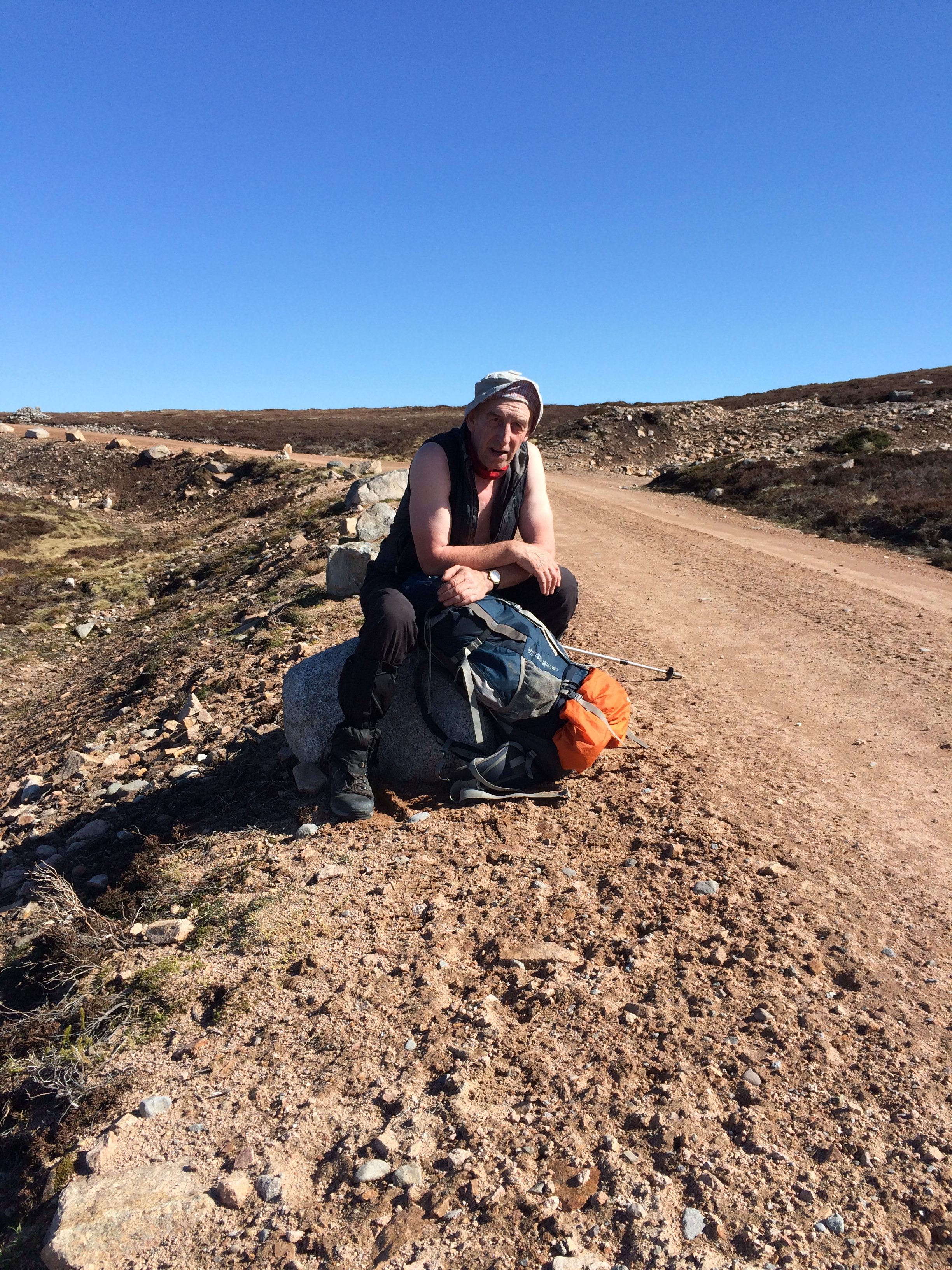
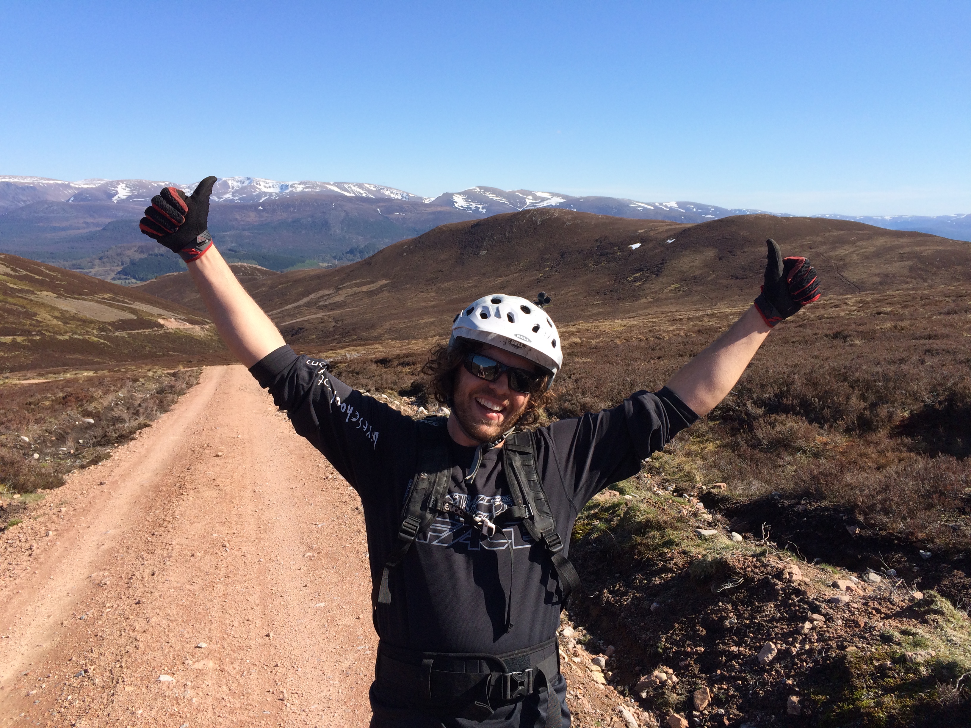
But first I had someone take a picture of me.


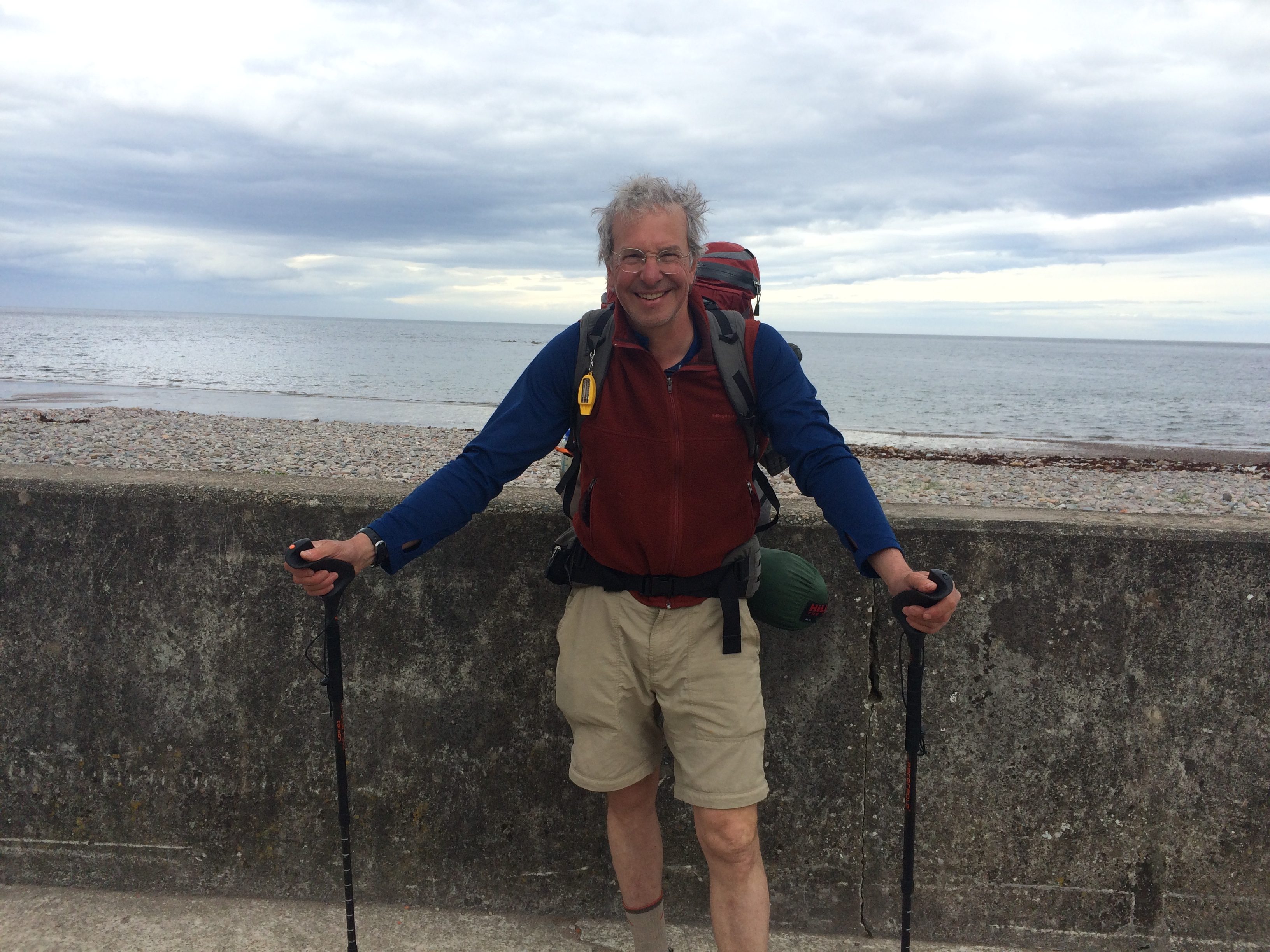
I took the train to Montrose and at 3.45 p.m. on Friday became the next-to-last person to check in after completing the Challenge.  Some things don’t change.

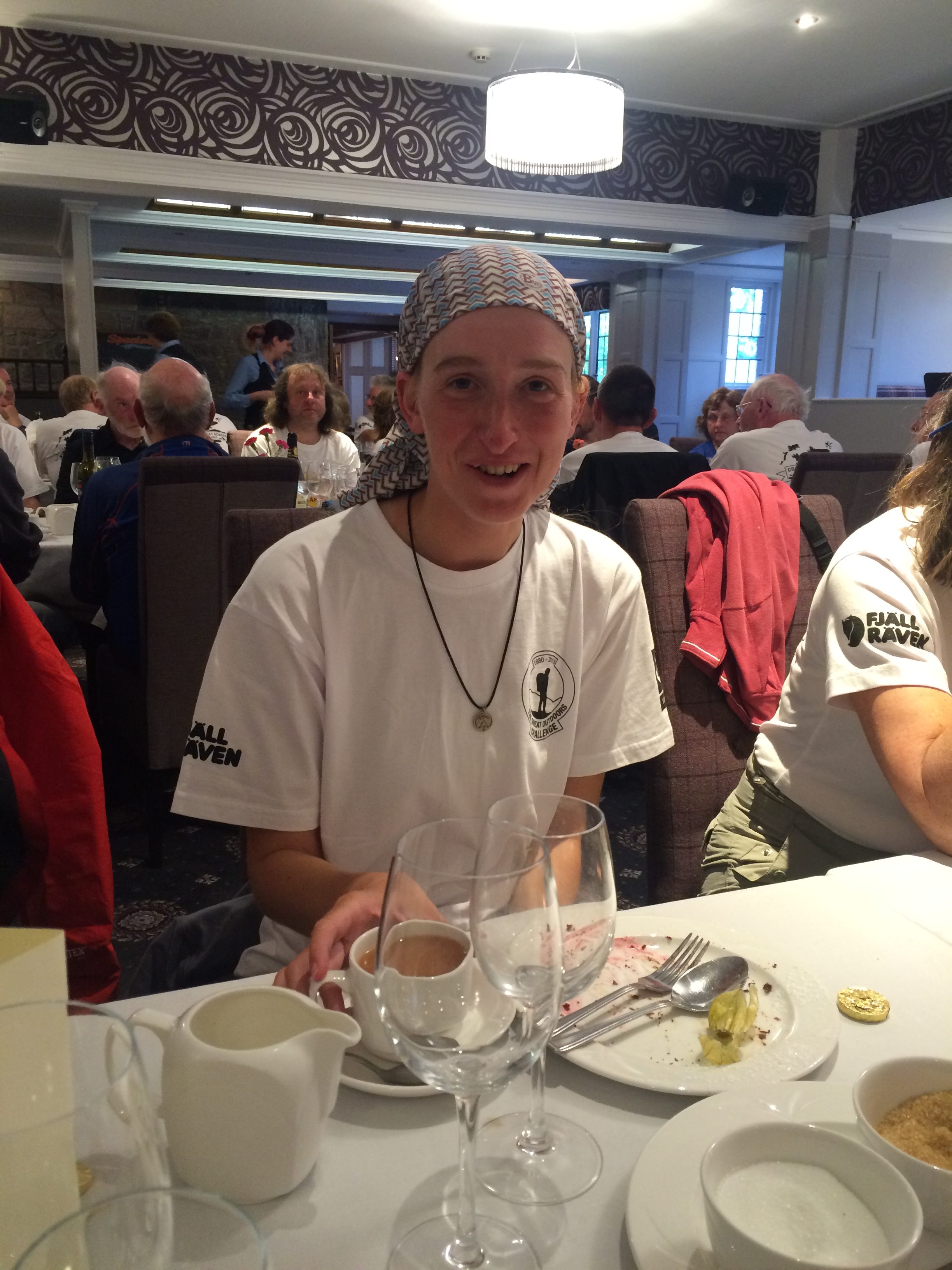
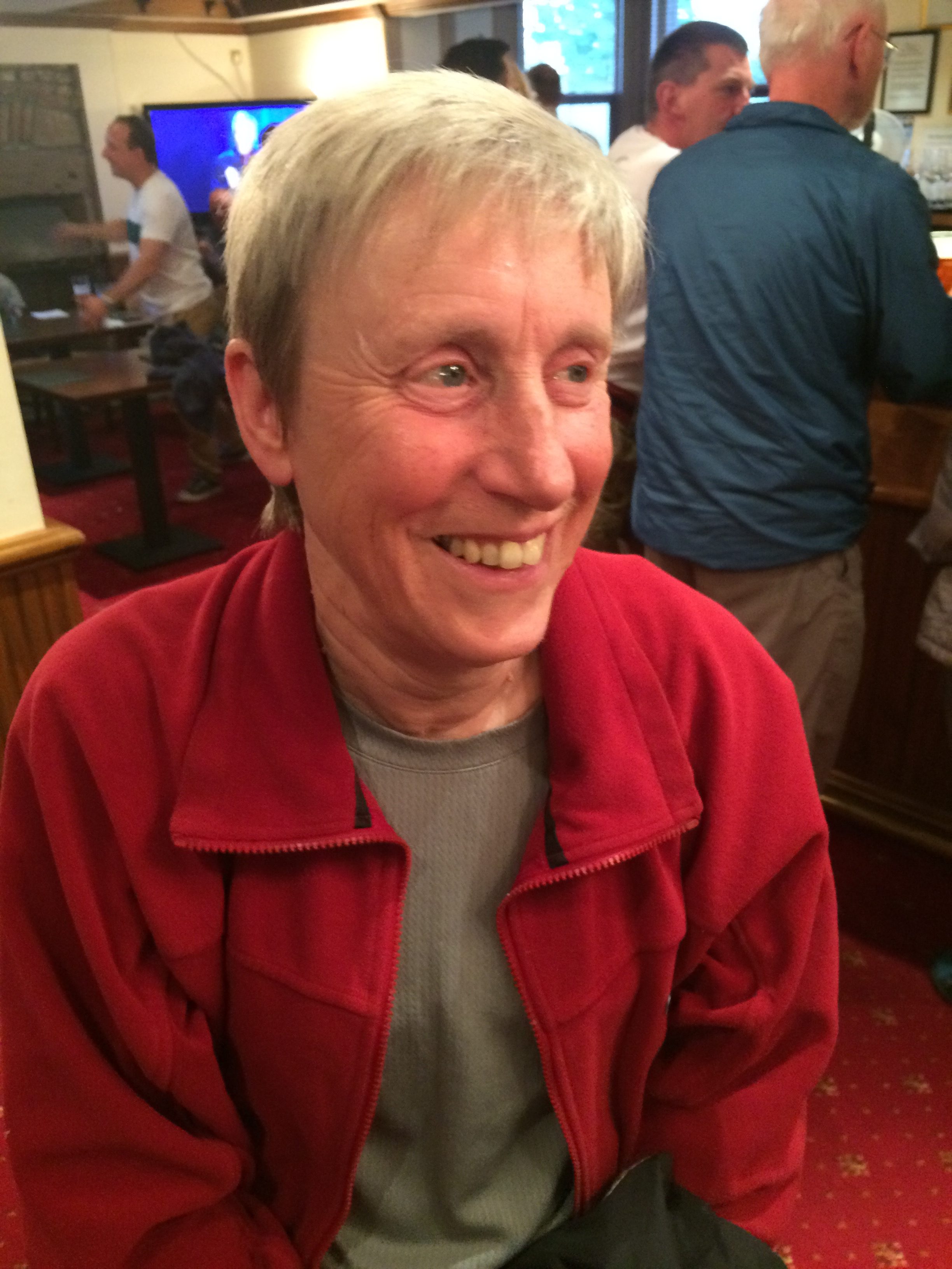
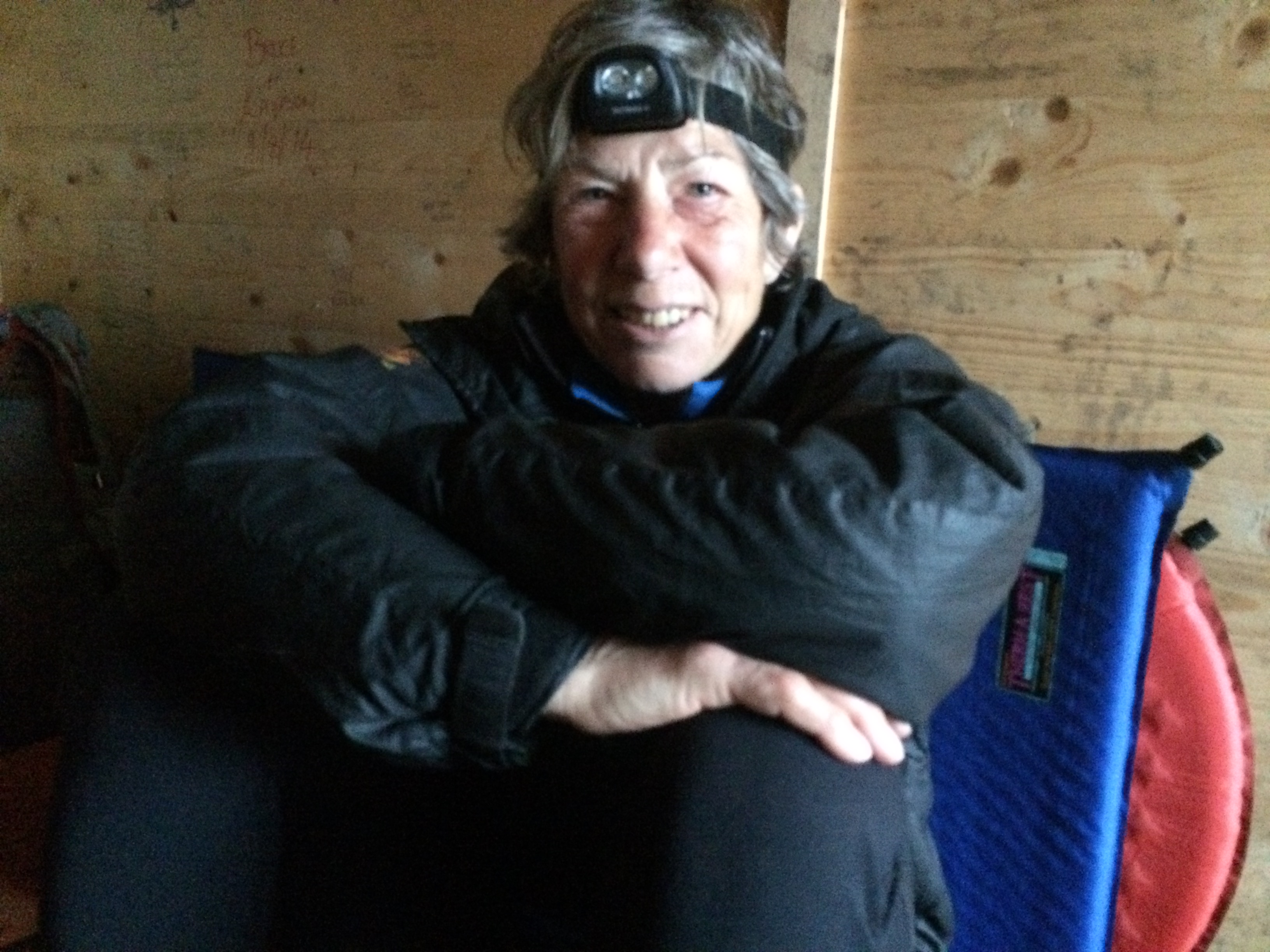
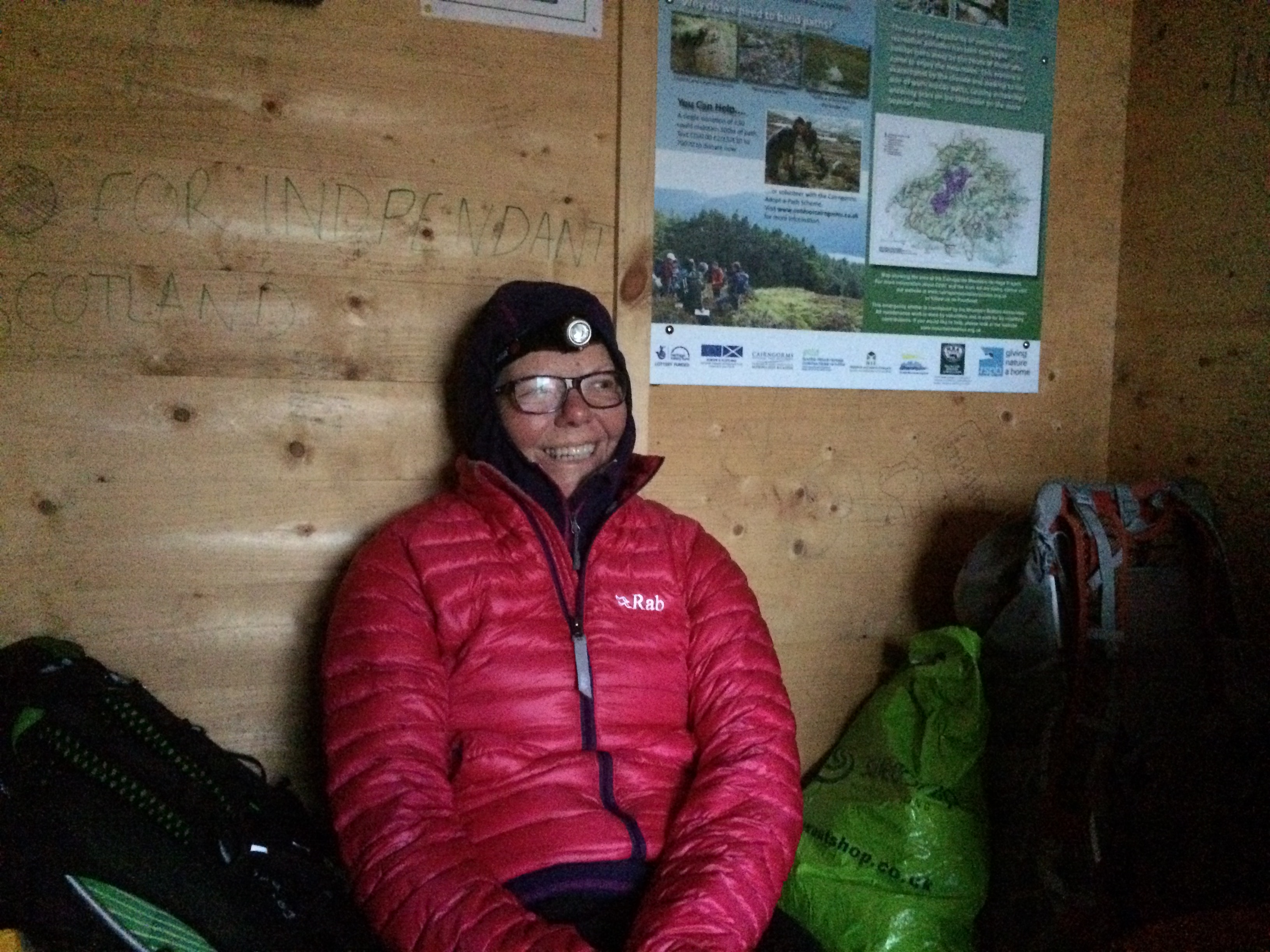
That night at the celebratory dinner at the Park Hotel I sat across from a woman I have to tell you about.

Her name is Heather Werderman.  At 31, she was one of the younger people on the Challenge this year.  She walked at least part of the way with a German man who was with her at dinner.

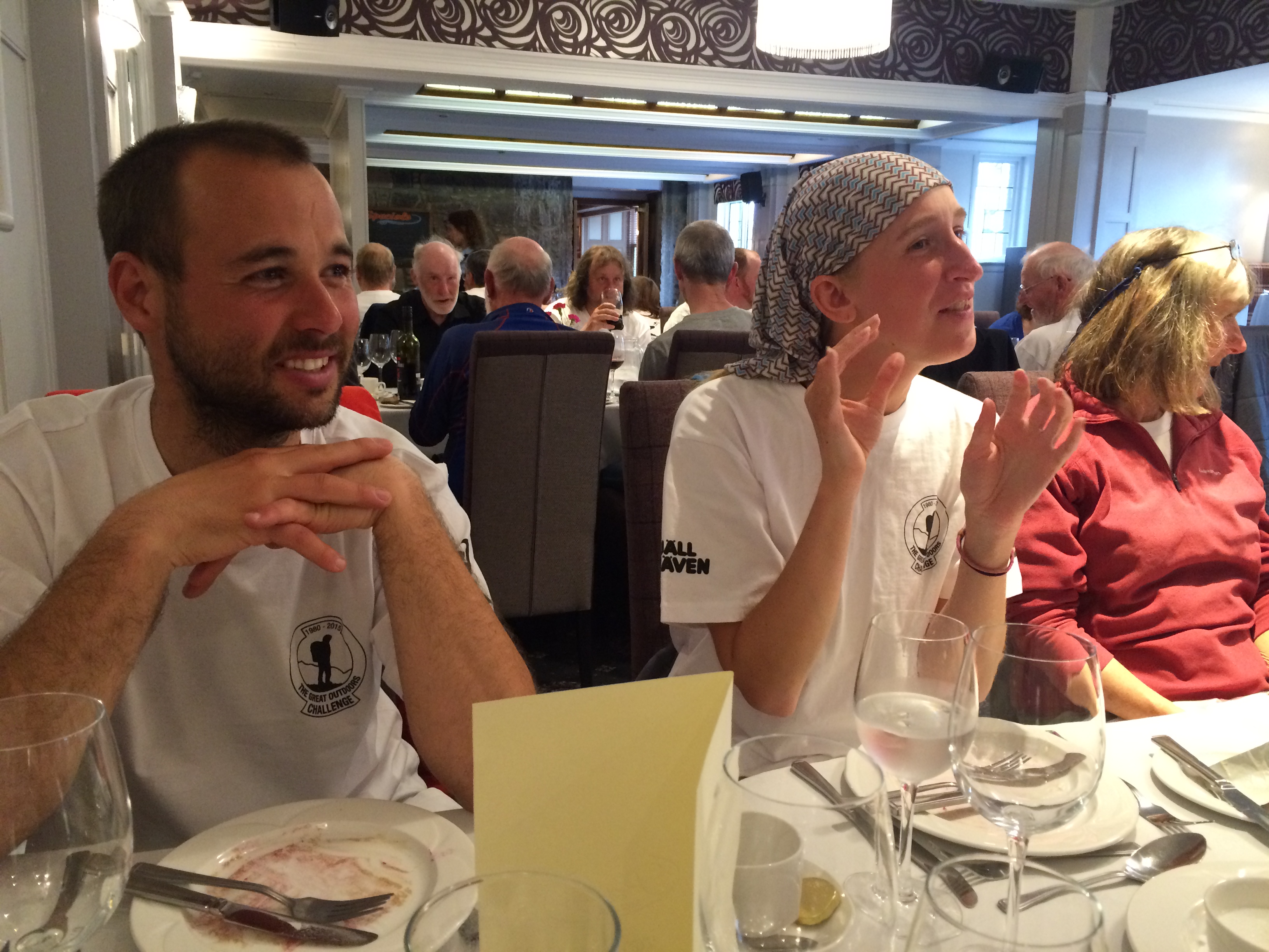
Heather is at the extreme end of the minimalist backpacking movement (although she says there are people to the left of her).  Her pack weighed 9.5 pounds without food or water.  Mine weighed 40.75 pounds with four days of food.  (I didn’t carry water).  How does she do it?

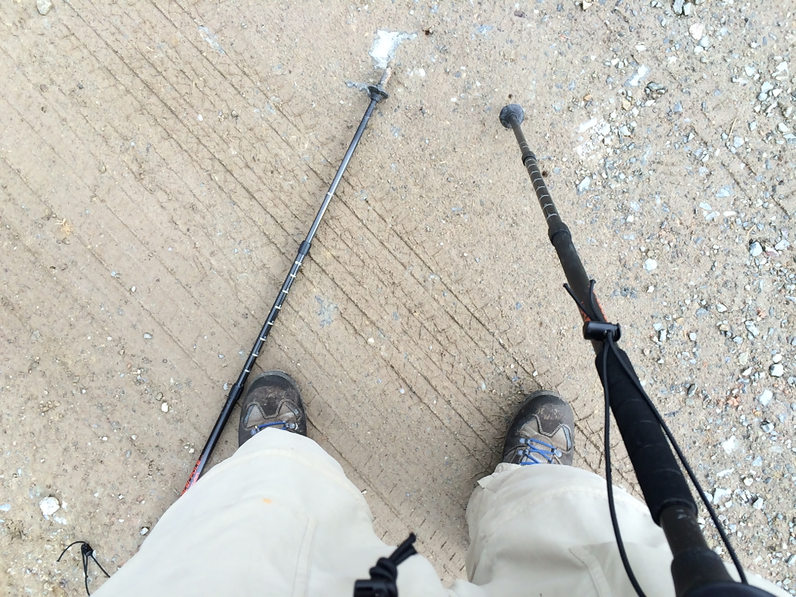
She doesn’t carry a tent.  She has a tarp that weighs 1.3 pounds that she erects as a roof with her trekking poles. Under it she puts a  ground sheet that can be staked with the edges up so that water flows under it.  She has a sleeping bag that weighs just under one pound and comes only to her shoulders.  She wears a down hood  when it’s cold.  She carries no stove, eating cheese, cereal and snack foods.  (Pop Tarts are a favorite). She has a cell phone and carries a rechargeable battery, which is her luxury item.

She goes hungry a lot.  She can never climb into her shelter on a cold and wet day and have a cup of hot tea.  When she finished the Appalachian Trail in 2011 she weighed 103 pounds, down from her base weight of 127 pounds.  She is one of about 300 people who have done the “Triple Crown” of American hiking:  the Appalachian Trail; the Pacific Crest Trail; and the Continental Divide.  The last doesn’t have a trail much of the way, and requires map-and-compass navigation at an average altitude of 11,000 feet.  The distance is 2,700 to 3,000 miles, depending on the route.  It took her five months, some of it hiking in hip-deep snow.

Two people have done all three trails in a single calendar year–a feat that requires walking about 30 miles a day, with only a few days off.

Heather walks April through October.  Before the Challenge, she was hiking in Spain; after it she was going to Sweden.  In the winter she returns to her home in Bristol, Tenn, and gets IT contract jobs, which she bids for on the internet.  The work is not esoteric and the jobs are not high-paid, she said.  But they are enough to underwrite her lifestyle.

“I like to be nomadic.  I like to meet people like that,” she said.  Then she added this:  “I hate walking.  I don’t enjoy it for the physical exertion.  I just like to see something different every day.”

Long-distance hiking for her is a combination of obsession, worship, and mortification of the flesh.  She couldn’t be more different from me.  Yet I recognize some of all three impulses in my choice to do The Great Outdoors Challenge once, and then again.

In any case, it’s over for this year.  Who knows if I’ll do it again.  I don’t.

There will be one or two more posts of a family-historical nature, not about the Challenge.  But they might interest you.

Thanks for listening.

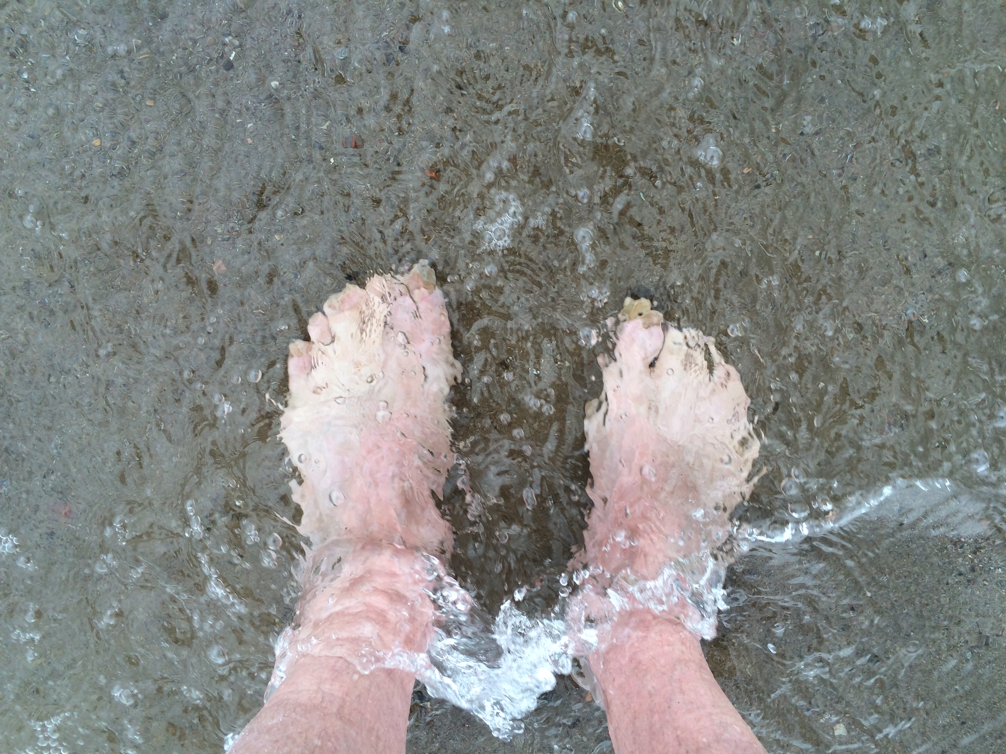
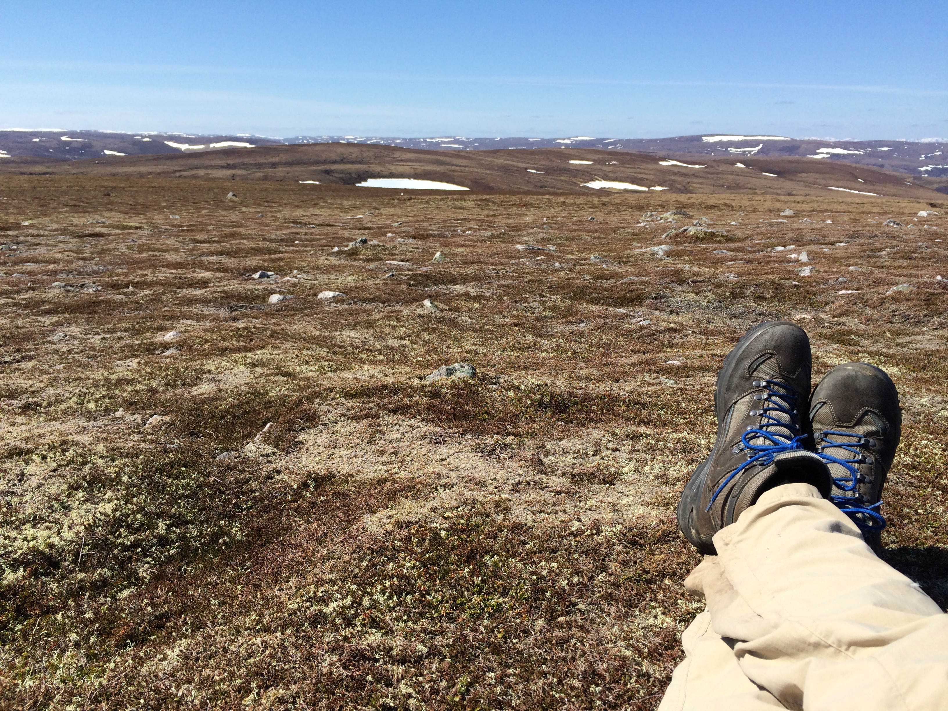
Oh, I almost forgot.  In Stonehaven I did go down to the water and put my feet in the sea.

The Clearances

The emptiness of the Highlands, especially the western half, is eerie.  I walked alone most of the first 10 days of The Great Outdoors Challenge.  By alone I don’t just mean I didn’t meet Challengers, but that I saw no one.  I more than once walked an entire glen–which is to  say, a river valley–and saw no person, no car, no house.

What I did see was the remains of former habitations–the collapsed stone walls of cottages, barns, and animal enclosures used by people hundreds of years ago.


The abandonment (and, in some cases, the physical collapse) of these buildings didn’t occur by accident.  It was the consequence of a economic policy that replaced subsistence tenantry with industrial-scale sheepherding.

The Highlands was once filled (“filled” being a relative term, of course) with people growing oats, potatoes and kale, and keeping sheep, goats and cattle.  They paid small rents to huge landowners, many of them English aristocrats who didn’t speak their language.  They lived in small settlements, often no larger than four or five families.

Many houses were divided, one-half for the people, one half for the animals. The duplex design can still be seen in the remains.

And here.  (The plastic containers hold mineral supplements for sheep.)

The roofs were of thatch or turf, and many had no chimneys, the smoke from an open fire exiting through a hole in the roof.

People disappeared from the Highlands over the course of 75 years, with the principal periods of eviction being 1782-1820 and 1840-1854, according to “The Highland Clearances” (1963) by John Prebble, which is the source of most of the information in this post.

The removal of people and the introduction of sheep (and a small number of shepherds, who were mostly people from the south) was termed “Improvement.”  It was defended as a program of economic rationality. As wool was a valuable cash crop and sheep were animals that required little husbandry, the change allowed estate owners to charge higher rents.  (The owners rarely ran the “sheepwalks” themselves, instead renting land to farmers and companies that did).

The new economic model was also justified by some (usually the evictors) as a way of saving Highlanders from their poor and miserable existence.  Sometimes evicted families were provided plots of land on the coast and urged to become fishermen.  However, the tenants knew nothing about fishing, the seaside land was less fertile than the river valleys they came from, and the weather was often harsher.

One of the best-documented episodes of this period was the eviction of more than 5,000  people from the valley of Strathnaver that began 201 years ago this month.

George Granville Leveson-Gower, an Englishman with five titles known principally as “Lord Stafford,” had an estate of 1,735 square miles in the shire of Sutherland on the peninsula in the far north of Scotland that juts into the North Sea.  It is well northeast of where I started from.

map by Forbes Travel & Leisure

The evictions were carried out by Stafford’s commisioner, William Young, and his factor, Patrick Sellar.  In mid-December 1813 at a place called Golspie, Young declared in English that the first evictions would begin on Whitsunday, in mid-March.  The announcement was translated into Gaelic by the local minister.

Sellar enforced the orders.  People who hadn’t moved by the deadline had their houses burned.  “In previous removals the evicted had been allowed to take their house-timbers with them for use in the building of new homes,” Prebble wrote.  “Now it was learnt that the moss-fir was henceforth to be burned when it was torn from the cottages.  The people were to be paid the value of the wood, or the value which Sellar set upon it, but this was no compensation at all in a land so sparsely timbered as Sutherland.”

Sellar’s action caused such outrage that two years later, in April 1816, he was put on trial for murder and other crimes stemming from the evictions.

The deaths included an old woman, Margaret Mackay, who was carried from a burning cottage in a blanket,  whose scorched fabric was publicly displayed as a symbol of the outrages.  Another was Donald  MacBeth, an old man with cancer who lived with his son.  The son had to go away for several days and removed part of the roof of the house, hoping that would convince Sellar and the house-burners to hold off further destruction until he returned and removed his father. It did not. The son returned to find his father huddled outdoors against a wall of a smoking ruin; he died soon after.

The evidence did not persuade the jury of 15 men, none of whom were tenants.  They acquitted Sellar in 15 minutes, Tallahatchie County-style.

The evictions resumed, but without the burning and wrecking of buildings until people were out.  Sellar was generous enough to invite the tenants back to harvest their grain when it was ready.  However, without barns for storage they had to carry the crop on their backs through snow that fell early–in October–in 1816.  “Others came down from the north to dig what they could from beneath the snow and eat it there, cooking a few potatoes among the ruins of what were once their homes,” Prebble wrotes.

[My post-Challenge host, Paul Richard, brought to my attention this passage from the book “Stone Voices:  The Search for Scotland” (2002) by Neal Acheson.  It shows the Scots have long memories.

[“Not long ago, I met somebody who witnessed a remarkable scene in an Easter Ross churchyard.  A Canadian family was visiting the place, probably in search of ancestors.  They came across a tomb which seemed to surprise them.  The head of the family, a middle-aged man in a baseball cap, urged his wife and daughters to walk away.  When they were out of sight, he glanced around, unzipped his trousers and pissed at length on the grave of Patrick Sellar.”]

And so it went, all across the Highlands.  The Clearances are the reason for the huge Scottish diaspora in Canada, the United States, Australia and New Zealand.

I walked by many abandoned buildings during the Challenge.  Many date from after the Clearances.

It’s the older ones I find most moving, in part because it’s so hard to feel the presence of the long-departed occupants. These ruins are being reclaimed by the land.  But it will be a long, long time before they are gone.

Early in the walk I stopped at the remains of two buildings separated by a stream you could jump over.  It had been a tiny hamlet, or possibly single homestead.

The uphill wall of one structure was covered with moss.  The moss represented decades of growth that would one day return the ruin to peat-over-stone, like so much of the rest of the Highlands.

Today, however, it looks like a family of seals that has hauled itself out of the sphagnum sea to take the sun.


Scenes along the way

There’s no theme to the pictures that follow, but together they may give a more complete look of the countryside and culture I’ve been walking through.

Wind farms are the most contentious issue in the Highlands.  They produce non petroleum-based electricity from a renwable resource, and thus are green.  However, they require major construction  (roads, turbine platforms, transmission lines) that disturb the peat, releasing large amounts of carbon dioxide.  The electricity they produce is not cheaper.  They alter the landscape; when you’re around them they draw the eye even when you don’t want to look.  They make a glen no longer empty even if there are still no people in sight.

People who own the huge estates in the Highlands make money from them.  Their construction employs people.  Some think they are an expression of Scottish independence.  And just as many others (especially hillwalkers) think they’re an abomination.

And in contrast, this view (note Dylan in Gaelic):

Turnips are very popular with the barnyard set.  You can order them by the bucket.

Sheep are everywhere.  When you walk past them they look at you as if you were the first person they’d ever seen.  And then they run away.  The brain is not their most important organ.  A sheep is basically an intestine covered in wool.  But this time of the year they proudly stand for family portraits.  And the lambs are pretty cute.

Wool has so little value that sometimes it’s just left on the ground after shearing.

There are other animals, too, of course.  This one is looking for his dog or his beer wagon.

This woman was exercising a horse she rides in competition.  Possibly dressage.

A hazard of parking your tractor outside too long:  lichen on the instrument panel.

Sweets are popular in Scotland.  I’ll take a pound of smush for the road.

This is home away from home.  It’s a studio.

This part is the office.

A house with one daffodil blooming.

On one part of the path there were historical markers of a sort I’d never seen.  A wooden panel with a legend on it is nestled between two upright planks, to which it is hinged.  You swing it out and read it.  When you’re done it swings back into its wooden sandwich and is protected from the elements.  The program is called “History with Boots On.”

Fifteen seconds ago it was perfect.

You gotta love a country that looks like this.

And this.

And this.  (In the foreground is gorse, which smells like coconut and is as barbed as cactus.  In the distance is a field of rapeseed.)

And this.

One thing I learned:  it’s impossible to lean trekking poles against yourself and manipulate an iPhone or take notes without one of them falling.  Usually the left.

On the moors the sky is big, but at your feet the visuals are delicate, miniature, and abstract.

The name of this house (and it’s also a place-name on the map) is Snob Cottage.  You’ll see the sign if you blow up the picture.  It must mean something different in Gaelic.

Late in the day,  exhausted and moving slow after several wrong turns, I encountered this sign.  I was on the right track.


Bad luck and good luck

This should be called “stupidity and good luck,” but that doesn’t sound as good.

I spent the night at Spittal Cottage (labeled “ruin” on the map; there was no cottage in sight), making camp in a light drizzle at 7.30 p.m. I know I’m giving the impression it’s raining all the time. That’s not true.  There have been many sunny days. But a drizzle in the evening, and something a bit harder overnight, are common.

Another Challenger, an American named Robert, arrived about an hour after me, discouraged after having lost a day outside Tarfside for reasons I didn’t understand. Neither of us wanted to stand outside in the rain and have anything more than a neighborly conversation. He was up before me and stuffing his pack the next morning  at the time I was just getting out of the sleeping bag.

Like me, he was a day behind. Nevertheless, he was still hoping to finish that day and get to the dinner in Montrose. Challengers can finish the walk on Thursday or Friday.

Thursday is the more common day, and the dinner that night is larger. He calculated the distance to be 30 kilometers and “definitely doable.” By my route it was 34 kilometers (21.4 miles), with 3,000 feet of climb. My conclusion: definitely not doable.

Especially not the way I was going to do it.

I had breakfast, packed everything and headed up a short path to a paved road, which I was to be on for less than a mile. It was 8.35 a.m., my earliest start yet, which allowed me to fantasize about making unheard-of time and getting to the Thursday dinner myself. (That was the orginal plan, before I took an unscheduled rest-and-writing day in Ballater.)  I wanted to finish on Thursday so I could see Roger Hoyle, the man who told me about the Challenge in October 2013 and provided me routes and endless advice. He was gone by the time I finished on Friday last year, and would be gone on Friday this year, too.

Up on the road, I turned right and confronted a sign announcing a 14% grade, which I proceeded to walk up. At the top of the hill, after the road leveled off, I was surrounded by the familiar view of heather-covered moor and grassland. Then I remembered I was supposed to spend the day in Fedderesso Forest, an impenetrable tree plantation with a confusing maze of roads. I fired up the phone, looked at the map and saw I should have turned left onto the road. So it was back down the 14%, and so much for an early start.

I walked on, up and down, through a farm, across a stream and onto a hillside above the stream. I had lost the trail but knew where I wanted to go: the wall of green pine ahead of me. I figured I’d just go along the shoulder of the hill until I hit the woods, then walk uphill along the edge until I found the trail in. (Going through the woods off-trail would be impossible. The trees were densely packed, with branches growing to the ground).

Unfortunately, the hillside was a bog. It didn’t look like that from a distance, and doesn’t look like that in a picture. But believe me, it was supersaturated sphagnum moss with tussocks of grass dotting it in a million islands.

It’s hard enough stepping from hummock to hummock, and judging which patches of moss appear to firm enough to briefly hold weight. I also had a serious desire not to get my feet wet. My boots are lined with Gore-Tex, which is to say they aren’t waterproof. Immersion over the instep is sure to result in damp socks, which is a drag early in the morning.

But a bog on a hillside–it’s like a slanted swimming pool. Not supposed to be possible! I named it the Bog of Curses. Halfway across I abandoned my shortcut and headed straight up the hill in hope of finding the lost track. Which I did. I turned and made good time, on the right track into the woods.

This little escapade of freelancing taught me a useful Challenge lesson (and not for the first time):  Don’t cut corners. Stick to a path, which is the product of collective intelligence. A path is the original example of crowdsourcing, by human beings and animals.

Not checking the route at every junction, I took another wrong turn for a while before getting back on track. There were steep pitches and the road was virtually washed out in places. In others, the surface was a jumble of granite stones.

It was drizzling, which is okay to walk in for a while without a raincoat, as it often stops.  But it became steady enough that I heaved off the pack, dug out the pullover rain jacket and put it on.

I had decided not to put soup in the thermos for lunch because I didn’t want the extra weight (the tent was wet and adding enough), so I had nothing to look forward to for a break other than yet another oat bar and a little water.  Which I took out and was unwrapping on a downhill section, happy to have the pack off, when I saw two people trudging up the road.

“How you doing today?” I asked the man as he approached.

“Can’t complain too much.”

“That about describes it for me, too,” I said as I looked at him and the woman next to him.

Then, simultaneously:

“Colin and Marion!”

“Dave!”

I had gotten the man’s name wrong; Colin is his son, he is Alan. But it was close enough.

image

They were the first friends I made on the Challenge last year. I walked with them for parts of three days. I wrote a post about them. Alan has done many things, including worked as a custom-hire guide for wealthy people touring Scotland. Colin, a military veteran, is a helicopter pilot in a mideastern country. And Alan’s wonderful wife (his second) is named Marion and like me is descended from John Brown the Martyr, a Covenanter killed in the early 1700s by an officer of the English Army for not going to the right church.

Neither is doing the Challenge this year. Marion has done many, the last one several years ago in a women-only group. Now, she and several other veterans put on a dinner and breakfast (for a modest price) at an old church in a hamlet called Tarfside. It’s such a welcome break that half the the walkers route themselves through Tarfside on the days food is served.

I was there last year–that’s when I met Marion–but my route didn’t take me there this year. Alan was helping her this year and I was sorry I was going to miss them both.   And here we all were chatting in the drizzle!

They were going for a walk up a hill they’d never climbed, and then were going to go to Montrose to the dinner. They’d gone trekking in Nepal this spring, on a route around Annapurna (and up to 17,800 feet).  They missed, the earthquake by two weeks. In dinner fees and contributions, they’d raised 1,000 pounds for Nepal relief at the Tarfside festivities.

It was so great to see them. But we had places to go, so after a quick download of news we trudged off in different directions.

If I hadn’t made all those mistakes, I would have missed them.


Bones of steel

I spent the night on a small, barely acceptable piece of ground along a stream just below Birse Castle. The Castle (which looks too modern to be a castle) was half-hidden in the trees in the distance.  (Here I’ve set up a washstand on the screw of an disused device for blocking water in a channel).

The day involved my last piece of compass navigation. I was in an area where there were two hills named Cock Hill. Each had an ATV track to the summit but not one connecting them. I took a bearing on the map and navigated by it, but it wasn’t necessary. The day was It was sunny day and everything was possible by line-of-sight.

Climbing the heather and sphagnum moss was hard. I hadn’t done it for a long stretch since the first few days of the walk, which seem long ago.

The track took me along a ridgeline, past two buildings and numerous wooden blinds behind which one shoots grouse flushed from the heather by beaters. Here is one of the labels on a blind.

The road eventually headed downhill toward what I really wanted to see: the remains of an airplane that crashed on May 5, 1939–76 years ago this month.

When I submitted this year’s route, my “vetter,” a man named Colin Tock, noted in his comments that I would go by two crash sites of World War II-era trainer aircraft. One was far off the path, but this one was in view of it.

“About 5,000 aircraft crashed in the Scottish hills and mountains during WWII, but it would be impossible to include them all on the website,” a man named Gordon Lyons wrote me several months ago. He maintains a website called Air Crash Sites–Scotland.

http://www.aircrashsites-scotland.co.uk/index.htm

The website records the location of about 300 crash sites from World War II, “the majority of which still contain some wreckage,” he wrote.

This site is one of the earlier ones of that era. The flight originated in Montrose, a town on the coast where there was a military air base. (It’s also where Challengers officially sign out after finishing their walks, and where celebratory dinners are held on two successive nights.

The airplane was an Audax Harrier, a two-seat craft that was a common training plane.  It had a Rolls-Royce engine, “and had a maximum speed of 170mph,” according to one description I found on the web.  “For armaments, it was equipped with two .303 machine guns–one forward and one aft. I could also carry four 20lb bombs.”

Here is what it looked like:

aviator.org

And here is what its remains look like from the trail.

The most visible remnants today are parts of the airframe of the fusilage. There is a faint trail to it; it’s impossible to tell if it was made by human beings or animals.

Most prominent is a frame of rusted steel and corroded aluminum tubes and joints that together make a slighly humped elongated rectangle. There is a sheet of aluminum bulkheading what I took to be the aft (and downhill) end of the airplane.

It appears to have crashed pointed uphill about 45 degrees to the fall line. The fact that much of the frame of the fusilage exists intact suggests to me it was a relatively soft landing for an unplanned one. Both people on board survived.

Scattered around it are pieces of metal tubing in various states of disintegration. Tubular struts about the size seen in bicycles appear to have been the chief engineering strategy of the design. A round piece of aluminum (one-third missing) was on the ground in the middle of the fusilage, covered with rabbit droppings. A square metal box with a round port, which appears to be a fuel tank, was nearby.

The front of the frame had two upturned pieces of tube, which gave it a praying mantis look.

There was a light breeze and the sun was out.

To the left was the top of Clachnaben, one of the few hills I’ve seen with a rocky summit. At one edge of its top was a rock formation that looked like a head of spiky hair blown straight up by the wind, and to the south, a pink stone road I would soon be walking down.

You could sight the landscape through the wreckage.

To the east were perhaps 30 wind turbines, their three-armed blades moving as if there was barely enough wind to turn them.

I heard an occasional bird call, but other than that it was silent except for the wind. It made a mournful whistling sound as it blew over two pieces of rusted tubing at the top of the frame.

I’d brought my little plastic bottle of whiskey and the metal cup from my thermos. I took a wee dram and poured it over the highest and most complex joint of the frame–five tubes coming together. It darkened the rust of one of the tubes before evaporating. I took a wee dram myself and drank to the memory of Pilot Officer J. D. Lenahan and Flight Officer Rolf E. Atkinson.

They were lucky when their plane came down here. But their luck did not last.

P/O Lenahan died on September 9, 1940, near Coventry, England, when his plane was shot down in the Battle of Britain. He was 20.  F/O Atkinson died on September 27, 1942, when his bomber with a crew of seven disappeared on a night raid on Flensburg, in northern Germany.  No trace of the plane has ever been found. He is listed on the Runnymede Memorial, which holds the names of 20,000 Commonwealth airmen lost and without graves.

I hope the bones of the aircraft they learned to fly in sits on this hillside a long time, in honor of them and their brothers.


Eight old pence

One of the interesting things about The Great Outdoors Challenge is that it preferentially attracts older people, for a variety of reasons. Of course, there are many exceptions. But I’m not one of them.

You get to meet people of one’s own cohort who’ve lived very different (but oddly familiar) lives. I met Brenda Manders.

We ran into each other where Glen Avon meets Glen Builg, late in a day in which BB-size hailstones had fallen three or four times.

It was sunny, however, when I crossed a bridge over Burn Builg, looked left and saw someone coming. I waited and Brenda approached.

She is a 59-year-old woman, a semi-forcibly retired accountant who lives in Nottingham, England. She was born in 1955 and is roughly my baby-boom equivalent, not counting the difference in sex, nationality, and lots of other things.

Brenda came from what she called “a very working class family.” Her father was a mechanic who, like her mother, left school at age 14. His father was a farm laborer, and Brenda’s father followed him. He learned how to maintain and repair tractors, which were a new addition to agriculture in the 1930s. He was young at the outbreak of World War II and got into it near the end. His mother was unhappy because his brother was already serving. Brenda’s father spent time in Egypt, repairing airplane engines. Both men survived.

After the war his brother opened an electrical appliance shop in Lincolnshire, where they were from. Brenda’s father worked there for a while before returning to being a farm mechanic. The shop, amazingly, still exists, with the Manders name on it.

Brenda has an older brother and one six years younger. When she was young they lived on farms in “tied cottages”–houses that came with the job (and were taken away when a farm laborer’s contract expired or wasn’t renewed). Universal moving day on English farms is April 5, which was also Brenda’s father’s birthday. Brenda moved more than once on her father’s birthday. They moved a lot because, she said, he didn’t think he was paid enough for his skills.

Brenda’s mother entered “service” at 14, becoming a scullery maid and all-around chore-doer for a unelectrified manor house in Lincolnshire. “She could do nothing for herself until everything she had to do for the family was done,” Brenda said. One of the last chores of the day was shutting up the chicken coop.

She worked in service, making almost nothing (but getting room and board), for seven years. “This was considered a good situation,” Brenda said. When she got married she stopped.

Food rationing still existed when Brenda was an infant, but she doesn’t remember it. I asked her if she remembered hardship. Her mother made her clothing, but that wasn’t hardship. My own mother made some of my sister’s clothing, and my sister made some of her own clothing. Neither was hardship; it was learning and using women’s skills.

But Brenda did remember one thing.

After moving many times, her parents decided they wanted a house of their own. It would require saving money, of which they didn’t have much. Her parents got everyone together in a family council. Brenda’s younger brother was an infant; Brenda was around six and her other brother was older.

“We’re going to save money this year to buy a house,” her father said. “We won’t be able to increase the amount of money we give you children. We’re going to have to economize.”

“I asked my father what ‘economize’ meant. He said: ‘It means that if you have a piece of toast, you can have either margarine or marmalade on it, but not both’.”

At the time, Brenda and her older brother got eight pence a week as an allowance. “It was enough for a few sweets,” she said. These were “old pence”–before English money went on a decimal system. There were 12 pence to a shilling, 20 shillings to a pound.

In one year, her parents saved 100 pounds, enough for a down-payment on a 900-pound post-war terrace house. It had two floors. The downstairs had a parlor (where all the good furniture was and which was used only on special occasions); a living room; and a kitchen. Upstairs were three bedrooms.

The house had cold running water, but no indoor bathroom. There was an outhouse in the back. A few years after they moved in, Brenda’s parents got a small second mortgage to have an indoor bathroom built. They lived there for 35 years before moving.

Brenda left school at 16. “My father didn’t think it was a good idea for me to stay in school if I didn’t know what I would do with it. Of course, parents don’t think that way now. They want all the education they can get for their children.”

My own mother would have sympathized. Her father didn’t consider college necessary (even though both of his sisters had gone to college). So she went to secretarial school.

Brenda went to work. She eventually decided she wanted to become an accountant. One of her employers allowed her to go to school one day a week. The rest of the courses she took at night and by correspondence.

“It was very hard,” she said.

Brenda is not married. She has no children. She saved early. The only money she ever borrowed was for a mortgage.

She has experienced three “redundancies,” which is the euphemism for layoffs. She has always liked walking and camping. After one layoff, she walked the Pennine Way in England. After the last one, she took a break and then couldn’t face the prospect of going back to work full-time. So she didn’t. Now, she takes contract work. She’s squeaking by, and has some pensions to look forward to.

“Luckily, I would prefer to wild camp as spend a night in a hotel,” she said. She started the Munros–Scotland’s 284 hills higher than 3,000 feet–in the 1980s. She has 30 left.

Unfortunately, I don’t have an up-close picture of Brenda. Only this one, when I stopped to explore an abandoned farm and she walked on.

Postscript:  I saw Brenda at the post-Challenge dinner and took a picture of her.  Here she is:


Walking with Stevie

Some people approach the Challenge with an excess of planning and conversation. (That, I suppose, would be me.) There are many, however, who do it without brouhaha, and with a certain amount of spontaneity. At the extreme, there are people like Stevie O’Hara, who do it silently, like a hard piece of manual labor.

Stevie–“Scottish, from Irish stock”–is 56 years old and making his fourth crossing. I met him briefly the third day when I stopped at a hostel for tea and lunch with a couple other people. He was wearing a wool hat and dirty gaiters and carrying a tiny pack. He had a big jaw and wide-set eyes and looked like a mountain man. He didn’t say much.   He’s on the left.

I ran into him a couple of days later when I was preparing to leave my camping spot beside the River Findhorn at a place called Easter Strathnoon. We were both going up and over the watershed and down into the valley of the River Dulnain on the other side. This is the view up from the river.

I met him at the gate blocking the track up the hill. (All the gates are unlocked; you just open them and relatch them after you go through). He was taking off his long underwear and generally getting ready for a strenuous climb. I considered waiting for him. However, I intuited he was a fast walker, and that waiting would either obligate him to walk with me, or would be pointless because he would outpace me in a few minutes. So I just said I’d see him on the trail.

I walked a while and looked back. He was a black spot at the bottom of the hill. You can’t see him, but this is the view.

Very soon, of course, he caught me. We talked for a while then, and later on. What follows is from those conversations.

Normally, Stevie walked alone. On the Challenge last year, however, he’d walked for a while with a woman named Heather, a nurse, and found it pleasant. Just yesterday he’d walked with the two Germans who left after me from Strathcarron (and whom I still haven’t met).

“I’m learning new habits I never had before,” he said.

Stevie lives in a place called Wishaw, in the Clyde valley, 15 miles southeast of Glasgow. He said he runs “a wee small ground-works company” that builds foundations and driveways. It’s basically him and a few young men he hires when things get busy. The business allows him to take off when he wants. (“That’s why I started it.”) Nevertheless, he admitted this is a busy season. “There won’t be any more holidays this summer.”

Stevie’s father was a bus driver, and his father’s father, too. He learned to love the outdoors when the family would rent a cottage in the mountains for two weeks and he would run around with his shoes off. From an aunt, he said, “I learned to love wild birds.” He described some he’d seen in the last few days, including a once-endangered red kite.

When he was young he walked with his brother and a cousin. Often, “it was a rush to get to the next town and the next bar.” As he got older and they got busy, he walked alone. He was married once; “It wasn’t for me.” He has no children; “That’s my one slight regret.”

Stevie caught up to me at a new, green bothy. We sat inside looking at maps. Mine was newer than his, and it showed that the track went the summit of a nearby hill, but not over. Stevie was disappointed it went that far. “I was hoping for a bit more navigating.”

He was working on climbing all the Munros, which are the 284 hills in Scotland that are over 3,000 feet. Early in the Challenge he’d climbed four in one day. He’d started walking at 8.30 in the morning and finished at 10.20 at night. He climbed into the tent, made a cup of tea and fell asleep.

He looked at my backpack. “You’re not going over many Munros with that rucksack, mate.” I explained I was carrying seven pounds of electronics. It’s my standard excuse for this unusual form of American obesity.

Stevie may have become more sociable, but he nevertheless took off alone toward the summit of Carn Dubh ‘Ic an Deoir. I followed a while later.

There were great views from the 750-meter top. There was a pyramidal cairn of rocks in the lee of which I had a lie-down in the sun. When my eyes were open, this is what I saw.

There was also a cement piling with a triangulation point put by the Ordnance Survey, which is the British mapping agency. It is used to take cartographic measurements. I put my Ordnance Survey map on it and took a bearing for the road down the other side, where I was heading. It probably wasn’t necessary, as the road would likely be in view the whole way down. But if fog rolled in, I would know what direction to go. (And I hit it exactly, following the compass.)

I turned east and walked up the glen until I reached a building called the Red Bothy. I’d had lunch and didn’t have to stop. But I have a “leave-no-bothy-unexplored” rule, so I walked around it. There, in the lee, in the sun, was Stevie.

He’d taken off his boots, fired up his cooker, and had had some noodles and sausage (and a lie-down).

I sat down in the sun and we talked briefly. But I didn’t want to get too comfortable, so in a few minutes I got up. It was my turn to head off alone.

“I have to get more of this track behind me,” I said.

He nodded understandingly: “You go’ qui’e a big ki’.”

Quite a big kit–that would describe it.

I left at 2.25 in the afternoon. I crossed the River Dulnain and started another long walk up a hill on a gravel road. The top of that watershed was the border of the Cairngorms National Park, and in the distance, the Cairngorm Mountains, Scotland’s biggest range.

Stevie passed me at 3.33 p.m. He had taken off his shirt and was carrying his pack bare-chested. “Cracking on,” as they say. And then, on the final pitch right before the turn down the other side, I found him sitting on a rock pylon beside the road. There was another a reasonable distance away and he gestured to it. I sat down.

We looked back at the summit of Carn Dubh ‘Ic an Deoir. If you enlarge the picture you can see the faintest hint of a nipple on top, which is the cairn. That wasn’t where we’d started from that morning, and we still had quite a ways to go. We agreed the Challenge was challenging.

After a few minutes, Stevie said: “I like being in the moment, but it’s on reflection that it’s fucking brilliant. Maybe in the pub tonight, or in a few weeks, you forget the pain and remember only the beautiful days. And this might be one of them.”

We stayed together going downhill. A mountain biker on his third outing on a bike just arrived from Colorado passed us on the way up an ascent it was painful to contemplate. He was making a loop; we saw him again a couple of hours later at the bottom.

Stevie and I walked into Aviemore, where I had a B&B room booked and he had no plans other than to meet his friend Heather, a Challenger arriving by another route. Stevie doesn’t plan ahead much. He buys his food along the way, often walks farther than his announced itinerary, hopes there are rooms available if he wants one.

We stopped at the Cairngorm Hotel, a stone building that looks like a small castle. He bought the beer and I bought the potato chips, and we sat outside at a table and toasted the long day behind us. He decided he might fancy a bed that night, and went inside and booked a room. He convinced the desk clerk to give him a discount because the room was over the bar and likely to be noisy.

He came back outside to await making contact with Heather. He offered to buy another beer, but I said I needed to be off to find my B&B.

I saw Stevie three days later in Ballater, my next in-town port of call. He and Heather were in the pub at the Alexandra Hotel.  It was just after last call.


Beautiful bothy

The  other day coming up from Cairn Poullachie over a watershed to Glen Mazeran I came across a stone building, obviously just finished or refurbished.  It was something right out of Dwell magazine.  It wasn’t on my map and I know nothing about it.

It had a turf roof and exquisite stonemasonry.

This is the exterior window.

And this is the view from it.

The road it was on also wasn’t on my map, whose last update was about five years ago.  There has been a lot of construction of gravel roads in the Highlands.  Some of it is to allow construction of windfarms and transmission lines.  Many, however, are built to give owners of the estates better access to remote country for hunting deer and grouse.  “Stalking” (as it’s called here) is now the major source of income for many estates.  Sheep and wool, the money-maker for more than 200 years, are now worth almost nothing.

This building is almost certainly built as a place where sports, paying thousands of pounds for a few days of guided stalking, can have a fancy lunch, brought up by workers from the estate.

The table is 21 feet long.

It smelled of pine sape and appeared not to have been used yet.

There were fancy interior details.

Polished wood framed the sides of the windows.  This piece included a burl.

I brewed up some tea, set out the map and figured the bearing for a trail that was on the other side of the watershed.  The road didn’t go over the top.

Outside, to the left of the door,  was this stone.

I searched for Angus Shaw in the Commonwealth War Graves Commission website but didn’t find one from Croachy.  There were several Angus Shaws who died in the war, including one from Islay, off the West Coast, who was in the Scottish Horse brigade and died in December 1915.  There is, however, an Angus Shaw from Croachy listed on a nearby village memorial.

For those who grieved his death, this beautiful building will keep his memory alive for another century.


The hardest day

I was awake until 1 a.m. uploading posts, which probably wasn’t the best way to prepare for the first day of my walk around the Cairngorm Mountains.

The Cairngorms are Scotland’s biggest mountain range (although the country’s highest mountain, Ben Nevis, is not in them). They are Scotland’s winter playground and the main ski destination. One of Scotland’s two national parks is in them.

The Cairngorms are like New Hamphire’s White Mountains–not terribly high, but with changeable and unpredictable weather, and a history of death among the ill-prepared and unlucky.

I had to buy stove fuel and mail a package in Aviemore, where I’d spent the night at a B&B, so I got a late start. It was almost noon by the time I headed east down the road toward Coyluymbridge and Glenmore and then into the mountains.

I took a cycling and walking path called the Old Logging Road that paralleled the auto route. It was flat and pretty nice. I passed a clay pigeon shooting range, a sledding area, a reindeer park, a cycling trail, an orienteering area, and the visitor center for the park. The last outpost of civilization was the National Outdoor Training Center, which is a place where you can spend nights and get instruction in various mountaineering sports and skills. It was about 2 o’clock and lunch service had stopped. Sale of “bar food” (as the sign said) wouldn’t begin until 5. I asked a friendly woman at the desk of the center whether there was any way to get hot food. Not unless I walked back from where I’d come from and went to the cafe at the park visitor center.

Of course, by then it was raining. The prospect of walking back 15 minutes (even without my pack), spending at least 30 minutes getting lunch, and walking back to where I was just didn’t seem worth it. I knew I had a long way to go. So I settled for two small packages of potato chips (“crisps”), then shouldered up and headed on.

It was the usual two-rut track, climbing slowly and eventually turning more stony, which is hard on the feet even through hiking boots.  The road briefly turned downhill and crossed a stream.  Three tents were set up.  Two were closed.  In the entry to the other was a man working on his feet.  He didn’t look up and I didn’t stop.

The trail became steep.  The wind picked up, blowing straight out of the west along the backside of the first rank of high mountains. I put on more clothing.

The higher I climbed, the harder the wind blew.  The steeper the track became, the harder the wind blew.  It was directly into my right side and a few times it made me stumble sideways.  It was cold.  But at least it had stopped  raining.

I flushed two grouse, who must have been  very disturbed by my presence because it was no weather for flying.  On many tracks this year I’ve flushed one (or, more often, a pair) every couple hundred yards or so.

A peculiar attribute of these round-top hills is that you can rarely see the top from below.  In practice, that means that when you get to what appears to the highest spot it turns out to be only the brow of a ridge.  There is  another ascent,  set back just far enough to be invisible from below.  That was the case on this climb.  It went on forever.

I got the pack down and put on a fleece hat and mittens.  It was in the low 40s or high 30s.  The cold drained the battery on the iPhone, so there aren’t many pictures.

Finally, the ground leveled off.  To the west was the knife-edge ridge of mountain whose top was in the clouds.  Undoubtedly, in the right conditions some Challengers would peel off and climb it.  But not today.  The track was littered with pink granite boulders.  The grass tussocks were blown flat.

The track headed downhill.  I was hoping the bottom would be the Fords of Avon, which was my destination.  But I hadn’t looked at the map closely enough.  I had another climb.  And it was clear as I descended that the stream at the bottom wasn’t big enough to warrant a name on a map announcing it was fordable.

The ascent wasn’t nearly as steep, but it was directly into the wind.  There was a hidden summit, but only one.  Then a descent with a hidden bottom.  But finally I saw a river and three green tents around a pile of rocks on grassy mound.

The rocks turned out to be the buttressing of a “refuge,” which is a wooden box about one-third the size of a shipping container and not tall enough to stand up in.  It contains nothing but a logbook, a dust broom and two shovels.  It is meant to be emergency shelter for hikers and skiiers–enough to save a life, and nothing more.

I looked inside and saw a man and three women, who had stoves out and had finished cooking and eating.  It was raining again.  I exchanged a few sentences with the man about the wind at the top.  He estimated it at 50 mph, which was my guess.

It was difficult to set up the tent, which I put close to the rock pile, although I was not truly in the lee.  I brought my stove and food inside the refuge and made dinner.  The man by then had retired, but the two women were still there and we introduced each ourselves.  They were Stella and Viv.  They soon retired.

By the time I was on the tea course, however, they were back in the refuge.  The wind had plastered the fly onto the roof of their tent, and water was working its way under and into it.   Plus the floor  wasn’t waterproof.  They decided to spend the night in the refuge.

So we talked because it was a little early to go to bed and there was nothing else to do.  But then what’s better than talking when you know nothing about the person you’re talking to?

Both the women are from Devon, in southwest England.  They met in 1982 when they both became Hash House Harriers, which is a kind of running, eating and drinking activity.

Viv Horton, 70, was a retired teacher of social work at the University of Plymouth.  Stella Rasdall, 69, is a nurse, was one of the first hospice nurses in England (back in the day of Brompton’s cocktail) and is now a counselor in a primary care medical practice.  Both are on second marriages, with their own children, step children, and grandchildren.

Stella on left, Viv on right.

This is their first Challenge, although like so many Challengers they have a long history of hard and daring activity behind them.

Viv, who has a sharp eagle-like face, worked in Kazhakstan in 2000-2002 for Voluntary Service Overseas–Britain’s equivalent of the Peace Corps.  She did “community development” among women with dependent children living in dormitories of factories that had closed down after the collapse of the Soviet Union.  About half were ethnic Russians, the rest Kazakhs and Uzbeks.

When she was finished, she and another women bicycled from Kazakhstan to Northern Italy (with a train trip througfh Uzbekistan, which was considered unsafe).  It took two and one-half months, and was done,  Viv said, to help them process what they had done and to ease the return to the developed world (“as it calls itself,” Viv noted).  Stella joined them in Istanbul, and pedaled with them to Thessalonika, Greece.

Stella’s husband had done the Challenge in 2003.  Viv and Stella had come to Scotland to do some hillwalking last year and met some Challengers.  Stella proposed they do it together.

“I hold her entirely responsible that I’m stuck in a hut on a cold night,” Viv said.

Inevitably, we talked about why a  person would decide to do this.  Not surprisingly, like most Challengers I’ve met they gave thoughtful answers.

They stipulated the walk was hard.  Viv said she’d passed part of that day thinking of people who had harder and unchosen (or semi-chosen) physical trials.  Prisoners of war forced to march or work when they were ill and starved.  Solo sailors going around Cape Horn and being dismasted.

“It is extraordinary the resilience and tenacity and perseverence that people can bring to bear,” Viv said.

“There is also the ‘Rage, rage against the dying of the light’,” said Stella.

“And older people can be quite competitive,” Viv said.

“In a way, you’ve got more stamina when you’re older, or more determination, more patience,” Stella said.

“And you have the kind of confidence that things will work out that comes with age,” Viv said.

I asked about this.

“If you’re essentially an optimistic person, and have gotten to a certain age, you’ve had all sorts of ups and downs.  You realize you’ll be okay.  That you’ll be warm and dry.”

This is an interesting and even profound observation.  At the least, it’s a good explanation for why the Challenge appeals to so many older people.

I thanked them for talking to me, and retired to the tent.  It blew a gale during the night.  The nylon fly rattled against the tent roof with a metallic sound.

When I got up all the tents were gone except one, which was empty.  Just before I left it started to snow.  Just to show who was boss.


Ros Rowell’s story

After crossing Loch Ness I had a long climb up an old asphalt road that announced at the bottom it was not suitable for caravans or heavy loads. This took me out in to some landscape that I can’t recall at the moment; probably farms. Eventually, though, in the middle of the afternoon I got to a sign one wouldn’t expect to see in the middle of nowhere: artist’s studio.

Equally curious as wanting an excuse to rest, I turned into the driveway, opened and closed the gate and proceeded to a green rectangular building that had an “Open” sign pointing to a door that was, in fact, partly open. When I looked inside, however, there was no one there. Another sign said that if the artist is not in the studio, knock at the house, which was a white building a few feet to the left.

This I did, and soon enough a woman with braids came out and asked if I wanted to see the studio. She craned her head in a diplomatic way to see if there was a car in the driveway, which there wasn’t. I explained that I was walking and that, frankly, I was looking for a reason to take a break.

And so began my two-hour visit with Ros Rowell, an example of why it’s always better to stop than pass by.

Ros is a year younger than me and an example of someone who did what I and some of my friends sometimes fantasized about in college–going back to the land, or as it might be called now, going off the grid.

She grew up in northeast England–County Durham, North Yorkshire–which she said is a place more Nordic than English. And, in fact, she looked vaguely Nordic, although maybe that was the braids talking. She’d moved a lot when she was young–I found out nothing about her childhood–and eventually went to the University of Edinburgh, where she got a “First”–honors of some sort–in zoology. She went on to earn a doctorate in parasitology, doing research in malaria. The project she was working on was funded by the U.S. military, which had an interest in malaria because of the Vietnam War. (It still does, for other reasons).

“I actually came to feel it was unethical,” she said. “It was the era of Bob Dylan. I wasn’t sure I wanted to get involved in it.”

Ros is a free-associative talker, driven by the desire to tell more and make more connections. This despite the fact that she said several times that her health has “never been brilliant” and that she’s now slowing down. In truth, I was keeping her from preparing for a show at a new gallery and the arrival of a group of child art students in the next few days  (although she did continue to work as we talked).

Ros had the opportunity to do further malaria research in Gambia, but turned it down. She had met a geology student named Alan Hutchinson. They lived together in Edinburgh and had “an allotment”–a piece of ground they could grow vegetables on–five miles from town. They used to “cycle tea bags and peelings up to it for compost.”

They finally decided to go whole hog (and sheep and goat, as well). They bought a croft with a several acres in 1983 for 14,000 pounds. It was called “Edinuanagan” (although the spelling is different on the Ordnance Survey map I’m using).  It translates to “slope of the lambkins.”  The house had two rooms.  When it was built is unknown, but long ago.  At least three families have shown up at the door wanting to see the place where one of their ancestors had lived.

It was originally a “black cottage,” with no chimney and the smoke finding its way through the thatch roof. The exterior stone walls are two to three feet thick. It sits on an incline, and in the first year water sometimes ran over the floor.

Alan worked on the oil rigs in the North Sea. They raised animals and vegetables and worked on the house. Occasionally, Alan would take bags of goats milk to Inverness to sell.   The times were difficult.

“You can’t live off cabbages and potatoes and onions indefinitely. As my mother said, ‘If it worked, everybody would be doing it.’ ”

They stayed, however.

Ros had gotten her teaching credential, and she taught primary school in Inverness.   She rode a motorbike or the bus to work. In 1985, she had a child, Callum.   Four years later, they had another, a girl named Mairi. They put up a building and ran a hostel for a while. They finally got a car. Before that, they’d shop in Inverness by biking in the 15 miles and filling a backpack. Or sometimes getting the man at the grocery to fill a box and put it on the bus.

“It is more difficult to run things with two children when you don’t have a car,” she said.

Here they are with the two children.  On the right is a picture of the croft as they bought it.

Her daughter became ill, requiring trips to Glasgow. Ros stopped teaching school. Alan by then was off the oil rigs, working as a forester. They added on rooms to the croft. Their land became a small agricultural experiment station.

“You can probably find this pattern all over America. Have you found it?”

“Of course. Vermont is full of it,” I said.

“It seems like just a story now,” Ros said. “It’s a long time ago.”

Ros began painting in 1990. She is essentially self-taught. She paints in watercolors and in fauvist oils. Her watercolors of Loch Ness and the glens–valleys–are especially popular.   Art, she said, is partly a way of coping with trouble and loss–illness, the drowning of a neighbor’s son, the death of an 11-year-old friend of her children who was hit by a car coming home from school.

She gave me two cups of tea, and biscuits, while she drilled the backs of picture frames and tied cord on for hanging.

Her son, Callum, studied “human-computer interaction” at the University of Edinburgh and has a good job. He has Gaelicized his last name to Macuisdean, which means “son of Hugh” (which Ros said is what Hutchinson means). He is engaged to be married to a woman who grew up in Greece, the daughter of a German father and English mother who had gone back to the land there. She said her parents “have spent their lives building the ideal retirement villa”–which would describe Ros and Alan’s holding perfectly.  She told Ros: “I knew Callum was wonderful, but what clinched it was coming home and meeting the parents.”

Ros added:  “They’re having a Quaker-pagan wedding.”

Mairi is well now, and is an artist. She is engaged to marry a Californian, who is studying in Edinburgh.

Before I Ieft to slog on down the road, Ros gave me a tour of the place. It includes a greenhouse; a warm, plastic-enclosed “tunnel” (she called it) where all sorts of things grow, including figs.

They have an ancient Massey-Ferguson tractor and an implement that digs potatoes.

On a long, sloping outdoor garden they grow potatoes and lots of other things:  black, white and red currants; pink gooseberries, Saskatoon berries, sloe, raspberries, strawberries, and grapes (from which they make wine).

And she makes art.


She believes in Scotland, although “nationalism” is a concept that doesn’t appeal to her much.

“I’m a socialist. I’m a northerner. I believe in the commonweal.”


« Older posts

© 2024 A wee walk

Theme by Anders NorenUp ↑