A blog about a hike across Scotland (and possibly other things)

Author: davidbrown (Page 8 of 14)

I am a writer living in Baltimore. I worked as a reporter at The Washington Post from 1991 to 2013, writing mostly about medicine, public health, epidemiology and the life sciences, and occasionally about history and art. I am also a physician, a graduate of Amherst College, and a native of Framingham, Massachusetts.
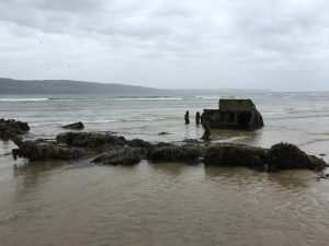
Further on up the road

One of the great things about The Great Outdoors Challenge is that there’s no dedicated path.  That fact is its own challenge (also great) to first-timers, off-islanders, and all who hope to have direction provided. One time or another you can count me among them.

Instead, what Challengers walk on is what other people created when they had more important things to do than walk for pleasure.

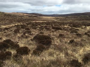
It’s interesting that it’s possible to walk across a country, including a largely uninhabited quadrant of one, on such paths. As it happens, five of the 12 miles I walked today was across open ground and on no path at all.

image

But that’s rare.

The paths have many histories. Some are drovers trails along which stockmen moved cattle from the Highlands to markets in the south once a year. Some are stalkers trails that hunters wore around the brows of hills so they could spy deer without being seen or smelled. Most, of course, are just ways to get from one place to another. Social trails (including paved ones), although that designation doesn’t express their seriousness and necessity.

Wherever we are, it seems there’s good reason to be somewhere else fairly soon. Even for the most unfree, unable or unadventurous that’s true. “Somewhere else” can be close. Just not here.

It’s impossible not to think about this when you’re walking along. Most of the time your only companion is the slightly cleared area in front of you. And when she isn’t there, you’re missing her.

Here are some of the trails I went on today.

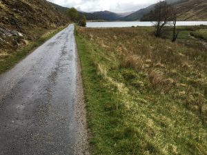
There’s the paved road that led from the end of the loch where I camped.  As with most rural roads in Scotland it is one lane, with passing spots.

image

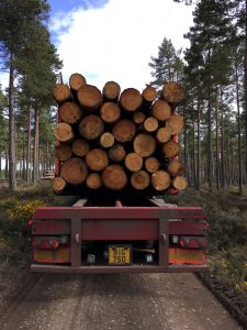
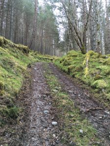
There was an impossibly steep road up through a forest. It’s hard to imagine a vehicle going up or down, although it’s built for that purpose and I was told trucks loaded with just-felled trees use it.

image

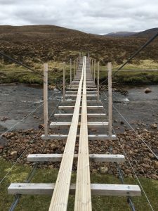
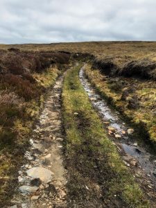
Here’s a little path that keeps your feet from getting wet.

image

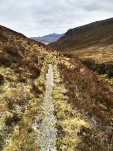
The paths that get to me, though, are those just wide enough for people walking single file, and often worn into a shallow trench that makes even that width confining.

image

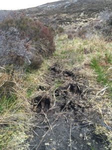
Some of these are undoubtedly animal trails, with the animals capable of making them in this part of the world being cattle, sheep,  horses, and of course deer.

image

But even if they began with animals, you can be certain that numberless people for numberless generations have walked them, too.

People going to buy or sell, to borrow or repay, to visit or seek solitude, to find a mate or leave one, to pursue or flee, to come back in a few hours or never come back.  And for thousands of other reasons, and reasons in between.

image

At one point the side of the hill I was walking on changed from a gentle slope to nearly a cliff edge (albeit a cliff of vegetation, not rock). The path, having someplace it wanted to get to, continued straight along the verge.

image

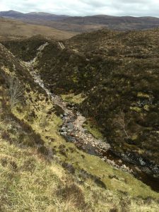
Far below, a stream of clear tannic water flowed over pink granite boulders.  Along it were bright patches of grass surrounded by brown heather, like an ancient bolt of velvet that had lost almost all its nap.

I thought about the hundreds of thousands of people who had walked on it for centuries. Not only the ordinary folks but the exotic ones, too. The Rob Roy types, rustling cattle; the “heather priests,” who spent their lives traveling from one settlement to another; the Covenanters and the Jacobites, and their English tormentors; the tenants driven to the coast in the Highland Clearances; the writers like Robert Burns and Wordsworth, who put the place in words.

Just about then on the iPod shuffle–a great addition to a Challenge, I have to say–came a song from Bruce Springsteen’s “Seeger Sessions” concert in Dublin.

Further up the road, further up the road
Where the gun is cocked and the bullet’s cold
The miles are marked in blood and gold . . .

Further up the road, further up the road
I’ll meet you further on up the road.
Where the way is dark and the night is cold,
I’ll meet you further on up the road.

There’s a break near the end where an echoey penny whistle plays the melody. It sounded like it could have been coming up the glen.

The concert was in Ireland and the song isn’t Scottish, but it was music for the moment nonetheless.

image

A little of Joan’s story

The manager of the hostel where I stayed the first night out has an interesting story. I just caught a bit of it in the morning before I left. I was uploading a post and pictures. I was of course the last of the guests to leave.

His name is Joan Saura. His father was from Catalonia. Joan is the Catalan equivalent of Juan, or John.  As in Joan Miro.

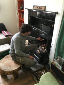
However, Joan, who is 35, is Swiss. He grew up in Lausanne. He speaks perfect English with a French accent. At home he spoke French, Catalan and German. He studied ancient history and philosophy at the University of Toulouse. As he laid the fire in the living room of the hostel, his iPod mix was playing “Big Rock Candy Mountain.”

image

Joan spent the winter at the hostel, hiking the hills in the crusty snow and helping out. He isn’t paid, but he doesn’t pay either. The owner of the hostel, who inherited it last year, is away. Until June, Joan is the boss. He was a good host, giving a tour of the place, explaining how the balky shower worked, and of course making room for an unscheduled guest. He doesn’t hesitate to set limits, however. He makes the guests dry and put away the hostel dishes they use for their meals. “It is self-catering,” he tells them.

Joan spent more than 3 1/2 years nearly bicycling around the world. He left Switzerland and rode east for 1 1/2 years, taking copious notes. He sojourned in places along the way, including a month in Kazakhstan. He pedaled to the base camps of several large mountains in Nepal. It wasn’t as hard as he expected. On one ascent he met a 72-year-old man smoking cigarettes and biking the same route.

Eventually, he got to the Sea of Japan. He took a boat to British Columbia, with the idea of riding the Pan American Highway to Patagonia. He took a nine-month rest in Mexico. In Panama, he hurt his knee and had to stop. He’s still rehabbing and is told he will be able to ride again. He came to Scotland in November 2015.

He makes his living writing twice-a-month pieces for the Swiss newspaper Le Temps, and contributing travel stories to a Chinese website, travelplus.com. (He writes in French and the articles are translated).

“Oh, so you’re a journalist?”

“No, not a journalist. I never studied journalism. I am just a writer.”

For his Chinese audience he is mining a vast stack of notebooks (“perhaps forty,” he said) for stories of strange events and unusual people. Georgia and the Caucasus were particularly fertile territory. A friend asked him to do it. “It is very exotic for the Chinese to hear about such things,” he said.

He realizes, however, that he’s coming to the end of that string. Not because he’s run out of stories but because they’re getting a little old. “The Chinese want new things,” he said. He’s not sure what’s going to come next.

He has a website, cyclosophe.com.

I told him he had a pretty interesting story himself, and perhaps should write a book.

“Perhaps I could. But I only want to write a book if I have a great drive to do it.” As for his interesting life, he said, with charming nonchalance: “Everyone has an interesting life.  It is a matter of curiosity and time to discover it.”

I couldn’t have said it better myself. The problem was it was noon, and I was out of time.

image

“The first days are the hardest days”

Well, that began with a bang. (And I’m sure I’ll be whimpering in the morning.)

I did 13 miles today and it feels like 26.  I could be in for trouble.

The hospitable couple who ran the B&B where I stayed (the Cromasaig) kindly delivered me to Torridon 10 miles away, where the walk officially began. I first had an errand to attend to, so I walked the half mile from the hostel where I had to sign out to the village. And back, of course.  So I guess that makes 14 miles today.

On the way I passed the medical clinic run by the National Health Service.  The staff is two women physicians.

image

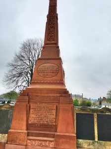
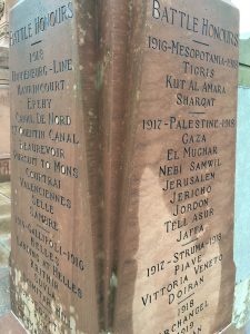
Not far beyond was the memorial to the dead of the Great War, which had names on four sides and just enough room to include some of the dead from World War II.

image

I got off at 11.30, which is late (which is no surprise).

image

The first mile or so was on road, to a hamlet called Annat. I walked by the “new cemetery,”  which I wager has four or five times the number of living souls as Annat does today.

image

A name caught my eye. (There’ll be a little more about that in a future post.)

image

And then it was off the road and into the hills.

image

I can’t do justice to the landscape in words, so I’ll use mostly pictures.   Here’s a last look down into Annat.

image

As you can see, it’s land in a spare palette, which personally appeals and is conducive to ruminative walking, and on a good day, meditative walking as well.

image

I thought for a while I’d see nobody. But I was wrong. Soon enough, I met Vanessa and David, and their 19-month-old border collie, Shep. Vanessa is doing the walk; her husband is accompanying her for the first two days. Dogs aren’t allowed on the Challenge, but Vanessa got permission to have Shep come along for these first days in a sheep-free zone. The couple has sheep and Shep is a working dog, which I guess means he’s on holiday.

He’s a gorgeous dog, too fast for an acceptable picture.  He’d run a quarter mile ahead just to sniff me once ran more and get some effusive human nonsense. He’s sleeping well tonight.

I ran into three guys doing a different northern route, who headed off after a brief chat.

image

I wasn’t planning on having lunch, as I’d gotten a late start and had a three-egg breakfast under my belt. But sometime between 3 and 4 in the afternoon I decided I was wrong. I shucked the pack, took off my boots and had oatcakes and Gruyere, with date-heavy gorp and water after. It was the right decision.

Soon enough I was joined by Andrew, who remembered me from two years ago. (He looked familiar, too.)

image

“We met outside Newtonmore when you were sitting disconsolately at the side of the road,” he recalled. “There was a sign ahead with three slashes and you asked, ‘Does that mean three miles to Newtonmore?’ I said, ‘No, it’s three hundred yards.’ I made your day.”

My recollection is that we also walked by the remains of a medieval castle, with the only part remaining the tower-like keep. He said this was true.

He gave me a brief history of the creation of the list of Munros, the hills in Scotland over 3,000 feet. I thought height was the only requirement for listing, but it turns out the creator, Hugh Munro, had a character requirement, as well. (Munro was a Victorian.) There were 277 when he made the list.  There are now 282. Or thereabouts.

Andrew had climbed a few Munros the previous two days, and was debating whether to go up a steep scree in front of us hill to bag another.  From a neighboring summit he’d spied a patch of grass near the top where he thought he could pitch a tent out of the wind.

I did not have a similar debate. I was going down after several climbs.

image

Descending is easier than ascending, but it nevertheless requires considerable muscle power. I was feeling a bit wobblish from jet lag and general exertion. The trail was made of stones and boulders, and in places carpeted with what looked like rejected product from a ball bearing factory.

I took a spill in one such place, coming down hard on my right thenar eminence. Without trekking poles it would have been as lot uglier.

We’re at the latitude of southern Alaska. The sun isn’t setting until 9.15 p.m. (and of course each day later).

image

It was after 8 when I finished the last descent onto a road beside a railroad track. The plan was to camp near a hostel about two miles ahead. As I walked, it occurred to me there might be room in the hostel. Which there was, just barely.

It was nice to not have to set up a tent, get water and cook dinner in the fading light. I was quite sore and a bed–even a top bunk–would be nice. Plus there was a shower.

This change of plans didn’t cause me much guilt. But it’s not like the old days, I’d been told.

Tom Forrest, the husband of the couple who ran the bed and breakfast where I spent the previous night, was one of the original Challengers. In fact, he did it back when it was called The Ultimate Challenge, in the early 1980s.

Back then, people were required to walk 250 miles and choose either a route on the tops or in the glens. If you chose the former you had to go over at least 12 Munros. Only two nights indoors were allowed. You had to carry all your food or cache it in advance. Tom said he once did it in five days, which required 50-mile, 16-hour days.

Tom is a tough guy. He spent 23 years in the equivalent of the Special Forces in the British Army. He was one of the first people to hit the ground in the Falklands War, doing a HALO (high-altitude, low-oxygen) jump from 34,000 feet. He retired from the military after being wounded by an IRA bomb.

image

He thinks the Challenge has gone soft. Too many people, too much partying, not enough time on hard ground.

“It’s lost its character,” he said. “I think they ought to bin it”–trash it–“and start over.”

I was born after the day when people walked five miles to school and back, uphill each way. The Challenge is good enough, and hard enough, for me just as it is.

Back again again

If you really want to hear about it, the first thing you’ll probably want to know is that my flight out of Dulles was cancelled after a three-hour wait on the runway with a broken circulating fan, where I had to spend the night after the airline ran out of hotel rooms, what it was like to see my Leatherman confiscated because a I forgot to put in in checked luggage, how I had to buy a £25 hat because I had left that behind too, that my phone keeps telling me I have no cellular service even though I bought a Vodafone SIM card, what it’s like to be 24-hours behind schedule and make a connection to a three-day-a-week bus with less than 10 minutes to spare, and that my Bluetooth keyboard thinks an ‘at’ sign is a quote mark, and a quote mark is an *, and all that David Copperfield kind of crap, but I don’t feel like going into it, if you want to know the truth.

The important thing is that I’m back in Scotland for another whack at The Great Outdoors Challenge, the annual west-to-east walk across the country with backpack and mental baggage.

I’m taking a different route from the two previous ones (of course)–a history-rich beach walk along the Moray Coast.  I wouldn’t have thought it possible to walk a hundred miles straight east along salt water in Scotland, but it is.  Or at least I hope it is, because that’s my plan.

A map may help.  The one below shows my three crossings, which have become successively more northerly.  (Ignore the intermittent double-lines in the middle one; it shows the ‘foul-weather alternative’ required for some parts of that route).

image

This year I’m leaving from a place called Torridon and going through deep and steep Highlands for four days, surfacing on the Moray Coast in Inverness.  From there it’s by trail and bushwhack to  Fraserburgh at the corner of the Moray Firth and the North Sea.

I appear to be carrying more than ever, although the how and why is hard to understand.

I’m carrying fewer clothes, and have downsized to a lighter three-season tent.  I traded a thermos for a pair binoculars, as the Moray Coast is famous for birds, cliffs, dolphins and seals.  True, I’m carrying four days of food (including cheese and oatcakes for lunch instead of the tiresome granola bars), which adds weight.  So does the small bottle of malt.  I’m offloading a lot of paper tomorrow, which I hope makes a different.  But it’s hard to figure.

I wish this were the true weight.

image

But it wasn’t.  It ate heavily in Glasgow.

image

At the Glasgow Airport I met a father-and-son team from Catonsville, Md., who are doing the Challenge for the first time after learning about it from the travel story I wrote in The Washington Post last year.  I’m told there are an unusual number of Americans on the walk this year.

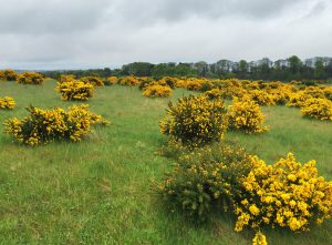
On the train, I met an American named Paul D’Ambrogio, who is a neuroscientist at the University of Stirling and has lived in Scotland for 17 years.  This is his second Challenge.  His wife was going to join him for part of it but twisted an ankle, so he’s going alone.  We had an interesting couple of hours as we sped through a landscape of new-growth grass and flowering gorse–vivid green and vividder yellow.  It was snowing here two weeks ago.

I made it to the Kinlochewe Hotel in time to make 7.30 p.m. reservation for one.  The bus drove off.

image

I had rope-cultured mussels and wild boar-and-apple stew–Highland surf ‘n’ turf (or more precisely, loch ‘n’ load).

Then I shouldered the barely portable pack and walked the mile to the B&B.

image

Now vee may perhaps to begin. Yes?


Pat Russell

The cradle rocks above an abyss, and common sense tells us that our existence is but a brief crack of light between two eternities of darkness. Although the two are identical twins, man, as a rule, views the prenatal abyss with more calm than the one he is heading for (at some forty-five hundred heartbeats an hour). I know, however, of a young chronophobiac who experienced something like panic when looking for the first time at homemade movies that had been taken a few weeks before his birth. He saw a world that was practically unchanged-the same house, the same people- and then realized that he did not exist there at all and that nobody mourned his absence. He caught a glimpse of his mother waving from an upstairs window, and that unfamiliar gesture disturbed him, as if it were some mysterious farewell.

 Vladimir Nabokov

“Speak, Memory” (1951)

This post is not about my walk across Scotland.  But walking across Scotland brought me to it.

It’s about a Scotsman who was once in love with my mother and wanted to marry her when she was barely out of her teens.  His name was John Patrick Oliphant Russell.  He was called “Pat.”

My mother only mentioned him to me once or twice.  My father late in life described him as “a Scottish man who wanted to marry your mother and was killed in the war.”   I’ve been able to find out a bit about him, and I visited his childhood home, in Fife on the east coast, after finishing The Great Outdoors  Challenge.

My interest in Pat Russell and my mother arises not from the mystery of what was before but from the mystery of what might have been, and the tragedy of what actually happened. It’s not exactly what Nabokov was talking about, but not entirely unrelated.  In any case, the quote is too good to pass up.

In 1938 my mother, born Sally Jane Mosser, went to Newfoundland to work for the Grenfell Mission.  She may have gone another time, too–the year before or the year after–but I don’t know for sure. That I don’t is an inexcusable oversight for a reporter.  But it’s too late now.

Wilfred Grenfell (1865-1940) was an English physician and missionary.  He is described in the Dictionary of Canadian Biography as “one of the last of the spiritual adventurers, the manly Christians who carried the code of service into the remote places of the earth at a time when such a philosophy of life was still possible.”  His father was an Anglican minister and schoolmaster who died by suicide.  Wilfred was called to missionary work after attending a tent meeting in 1885 while in medical school in London.  The preacher was the American evangelist, Dwight L. Moody.

Grenfell had a complicated and adventurous life, full of failure and success.  Originally a doctor-and-preacher on a hospital ship serving North Sea fishermen, he became aware of the poverty and ill health of the residents of Newfoundland and Labrador, both white and native.  Those two places were part of “British North America,” the remnants of the British Empire’s New World holdings.  They didn’t become part of Canada until 1949.

Grenfell launched a program to improve the lives of the coastal people, eventually building two hospitals, clinics, a saw mill, a fox farm, a cooperative store, an orphanage and other improvements.  To publicize his efforts and raise money, he wrote books and articles about life in the subarctic.  One of his narratives, “Adrift on an Ice-Pan,” recounted how he fell through the ice with his dog team south of St. Anthony, Newfoundland, on Easter Sunday in 1908.  They all scrambled onto a floe and were carried to sea.  Before he was rescued, Grenfell sacrificed three of his dogs to warm himself with their hides, and fashioned a flag pole from their leg bones to wave for help.

Grenfell_1940_Issue-5c (1)

Grenfell believed the people of Newfoundland and Labrador needed a lot more than medical care.  They needed, for starters, more income.  In 1905, he invited Jessie Luther, a social worker and artist who’d worked at Hull House in Chicago, to organize women in St. Anthony to make hooked rugs for sale.  “Grenfell mats,”  which depict scenes of coastal life, are today valuable pieces of folk craft.

One of the places they were sold was in a store in St. Anthony visited by coastal steamers, some of which were carrying tourists by the 1930s.  My mother helped run the store.

There were a lot of young people from far away working at St. Anthony.  From my mother’s photo album, there seem to have been roughly equal numbers of young women and young men, although you can’t tell that from this picture.  (My mother is in the bow on the left).

image

One of the young men was Pat Russell.

image

Pat was the second child of David Russell and his wife, Alison Blyth.  David Russell was president of Tullis Russell, a paper manufacturer founded in 1809.  They were very wealthy.

Tullis Russell had a history of enlightened management, providing pensions and health care to employees before that was common practice.  The Russell family considered the workforce of a thousand people to be an extended family.  That tradition led, in 1994, to the sale of a controlling interest of the company to its employees.

For years, Tullis Russell was a model for employee ownership of industrial companies.  David Erdal, its former president (and David Russell’s grandson) who midwifed the sale, wrote and lectured advocating that form of ownership.  Unfortunately, global economic forces caused reversals in recent years, and the company’s paper-making business  declared bankruptcy on April 27, about a week before I arrived in Scotland.  Tullis Russell survives, however, as a maker of coatings for paper and other surfaces, with sites in England, South Korea, and China.

When I contacted David Erdal last winter and inquired whether anyone who knew Pat Russell was still alive, he answered: “Alas, Pat’s generation are all dead.”  But he kindly told me some of the things he’d heard from his mother, Sheila, who was Pat’s younger sister.  Erdal’s  sister, Alison Johnston, also provided memories of what she’d heard.

Erdal said there was an odd dynamic in the family.  His mother and her brother, also named David Russell, were the older children of their respective sexes and treated as favorites.  The other two children, Pat and Anne, “were less fortunate.”  Erdal’s sister recalled hearing from their mother that Pat came home on a visit one summer and was not warmly welcomed.  He said to his sister:  “I don’t know why I come.”

Pat was an outdoorsman, an athlete, a bit of a wild man.  According to a family story, he once dived naked into a Highland stream and caught a salmon with his hands.  (That would be a feat on two counts). He wore kilts, and joined the Army reserve force before the war.  Scotland has a long history of producing warriors.

image

This is a picture of my mother in Newfoundland with Newfoundland puppies, probably in the summer of 1938,   when she was 20.  She graduated from high school in 1936 and then went to the Katharine Gibbs School to become a secretary.  What year, I’m sorry to say, I don’t know.

image

The details of their relationship are unknown.  Her photo album has views of St. Anthony and pictures of activities that summer, some of which include Pat Russell.  There are also pictures of Pat doing things in other seasons.  Here he’s making a fire in the snow.

image

In the album there’s also a picture of Pat’s father, who was knighted for  “service to industry,” and known thereafter as “Sir David.”  Erdal thinks the photograph was taken on Iona, the Hebridean Island where the Russell family had a summer house.  Sir David was a rare bird.  He was a Presbyterian mystic.  He paid for much of the restoration of a ruined monastary on Iona, where the Irish monk St. Columba brought Christianity to Scotland.

image

There’s a picture of Pat’s home, called “Silverburn,” in the town of Markinch in Fife.

image

I assume Pat sent these Scottish photographs to my mother.  If she had gone to Scotland to visit him and taken them herself, I think I would have known.

In a different album, one not dedicated to her time with the Grenfell Mission, are other pictures of Pat Russell.

They show him on a visit to Kennebunk Beach, Maine, where my mother’s paternal grandparents had a summer cottage whose inhabitants included a maiden aunt and lots of sojourning children and grandchildren.  There are pictures of Pat eating a sandwich, changing a tire, and posing with my mother’s grandmother.  He’s handsome, handy, and presentable–a perfect candidate for son-in-law.

The one thing my mother mentioned about this visit was that it lasted a long time.  After a few days, she was at a loss for what to do to entertain Pat.

I tracked down a mention of this visit in the diary of Kenneth Roberts, which is in the Rauner Library at Dartmouth College.  Roberts was one of my mother’s uncles (married to her father’s sister, Anna). He was a famous historical novelist who once appeared on the cover of Time magazine.  Some of his books are still in print.

He was also an angry and insecure man who never said anything nice about someone if he could find something unpleasant to say.  He had no children.  My mother was his favorite niece, and he invited her to become his live-in secretary in Maine.  She wisely declined.  Another niece, Marjorie Mosser, accepted the invitation, married late and had no children.

On July 5, 1939, Roberts wrote:  “After dinner Sally came over, bringing a young Scotsman named Pat, who’s here for a month to woo her, as the saying goes.  He was a quiet, colorless, chunky young man, who talked as though he had a mouthful of blueberry pie.”

image

In my mother’s picture album there’s also a page with the date “1939” at the top that includes three pictures of Pat Russell.

The one in the upper left, we can be certain, was not taken at the Grenfell Mission.  Four people are seated at a bar in front of a painted backdrop of a saloon.  They have their hands on large bottles of liquor, and the front of the bar has the slogan “Learn to Mix Your Own with Old Mr. Boston,” a low-price line of liquor.  My mother is the woman on the right.  On the left is her friend, school classmate, and fellow Grenfell alumna, Debbie Bankart.  They don’t look entirely comfortable.

Farther down the page are two pictures of Pat in uniform, one a candid shot of him striding along with two other soldiers.

image

Pat Russell was in the 334 Battery of the 101 Light Anti-aircraft/Anti-tank Regiment of the Royal Artillery.  Shortly before his death, he was transferred to the 1st Battalion London Scottish Regiment.

Pat’s brother David was in the 7th Battalion of the Black Watch.  He fought at El Alamein in Egypt, where he was wounded and won the Military Cross for “conspicuous gallantry.”  He was also wounded in Sicily and at La Havre, before being “invalided out” of the service. He is lucky to have survived.

David Erdal wrote to me:  “David had had a leg blown off by a mortar shell landing at his feet.  He had been triaged into the ‘hopeless’ cases.  But the surgeon had asked who he was, and because they were old friends, had taken him out of the ‘virtually dead’ group and saved his life.”

He was known as “Major Russell” for the rest of his life.

Sometime early in the war my mother met my father, who was in medical school at Tufts, in Boston.  My mother was a secretary to an assistant dean at the school.

My father had graduated from Harvard College in 1939.  When the United States entered the war he tried to enlist in both the Navy and the Army, but was turned down because he had only one kidney.  (The other had been removed the year after he graduated because of chronic infection following a sports injury.)  He finished medical school and an internship on accelerated war-time schedules, and in 1945 did aviation medicine research at the Donner Laboratory in Berkeley.  He served stateside in the U.S. Army Medical Corps from 1953 to 1955.

image

I once asked my mother how many men had proposed to her.  (Can you imagine such a question!)  She wouldn’t answer.  But I’m pretty sure Pat Russell did.

The last picture of him in her photo album appears to have been cut from a group shot.  He’s wearing a kilt and a tam. It’s dated 1944.  My mother and father were married on March 13, 1943.

image

Pat Russell died on September 7, 1944, on the Adriatic Coast of Northern Italy.  He was part of the fierce fighting to break the Gothic Line, which was the German army’s last major line of defense as it retreated northward.  The line had 2,376 machine-gun nests, 479 anti-tank, mortar and assault gun positions, 130,000 yards of barbed wire and many miles of anti-tank ditches, according to Wikipedia. He was killed not far from the town of Morciano (marked in red).

Pat Russell, Italy mapI hired a researcher through the Forces War Records website to search for information about the circumstances of Pat’s death.   He didn’t find much.  All the unit diary had was this entry for 6.30 a.m. on what appears to be September 7, although the date is missing:

“Enemy counter attack commenced and DFs called for.  Some prisoners taken and some equipment.  Attack beaten off, but some casualties received.  Amn running short.  Coys [companies] and Tac HQ shelled and mortared for rest of day.  D Coy received heavy casualties. B Coy withdrew from MENGHINO.  Capt RUSSELL wounded and later died.”  The entry on September 9 lists the battalion’s casualties over four days as “approximately” 11 officers and 220 enlisted men, with 3 German officers and 50 German enlisted men captured.

013

David Erdal, however, was able to provide some details.

“In September 1944 Pat’s parents received on a single day two separate telegrams, some hours apart. One informed them that David had been ‘gravely wounded’; the other that Pat had been killed. I understand that his unit had been pinned down by a German sniper in the mountains in Italy, and since he was acknowledged as a crack shot he had volunteered to go forward to try to kill the sniper. However, the sniper wounded him in the shoulder, a particularly painful wound. Nobody could rescue him, so over quite a long period of time he bled to death.”

It must have been an agonizing death.  And one that at some point he knew was inevitable.

David’s sister, Alison, added another detail.  The family’s nanny and retainer, a woman named Annie, took the phone call that day from Miss Spence, Sir David Russell’s secretary at the paper mill.  The secretary said a telegram had arrived announcing Pat’s death.  “Annie burst into tears.  Granny went to comfort her, and Annie had to tell her that it was not a relative of Annie’s that had been killed, but her son.”

Pat’s parents grieved for him for the rest of their lives.

They kept his bedroom at Silverburn as it had been when he left for war.  Sir David took one quarter of the shares of the Tullis Russell company–the fraction Pat would have inherited–and put it into a charitable trust.  It still supports local charities and educational institutions, “in memory of Captain Patrick Russell.”

How did my mother learn of Pat’s death?  Did his parents write, or possibly call? How did she get a picture of him from 1944, a year after her marriage?  Still almost a newlywed, how did she mourn?

She took the answers to these questions to her grave.

In 1973, Major David Russell, Pat’s surviving brother, gave Silverburn to the local government and the National Trust for Scotland.  A municipal golf links, where the brothers used to play, separates the estate from the beach.

TGOC, Scotland and Jampel reunion 2015 486

From the golf course the land slopes up a low ridge, at the base of which is the remains of a flax mill built in the mid-19th Century.

TGOC, Scotland and Jampel reunion 2015 490

There’s a large walled garden with a gate.

TGOC, Scotland and Jampel reunion 2015 491

There’s a rookery.

TGOC, Scotland and Jampel reunion 2015 494

There are lawns where you can lie around or play with a soccer ball, as these people are doing.

TGOC, Scotland and Jampel reunion 2015 496

At the top of the ridge where the land levels out again is the Russell house, unchanged from the picture in my mother’s photo album from the 1930s, except for the boarded-up windows.

TGOC, Scotland and Jampel reunion 2015 505

There’s a walled driveway that Pat went down for the last time a long time ago.

TGOC, Scotland and Jampel reunion 2015 507

Pat Russell was 26 when he died.  He was six weeks younger than my mother, who died in 2008 at the age of 90.  My mother had a full and happy life.  How happy Pat’s life was I can’t say, although I bet it was reasonably happy.  But it wasn’t full.  It wasn’t even half-full.

Andy Rooney, who’d been a reporter for Stars and Stripes in World War II, on the eve of Memorial Day in 2005 said of the soldiers who’d died:   “We use the phrase ‘gave their lives,’ but they didn’t give their lives. Their lives were taken from them.”

Like a lot of simple observations, it’s one we tend to forget.

Pat Russell is remembered here, in Fife, at the family burial plot.

OLYMPUS DIGITAL CAMERA

But he lies here, in the Gradara War Cemetery, in the province of Pesaro, Italy, not far from where he was killed. There are 1,191 men buried with him.

gradara

May neither he nor they be forgotten.

The end

I camped the last night once more on postage stamp of ground where it was hard to tell which end of the tent was higher than the other.  (That’s a problem when it comes time to lie down.)

Once more I put things back into their respective bags, and put the bags back in the pack in their appointed place in their appointed order.  It was a little sad.


Then I headed on down the road, 9.8 miles to the sea.

This part of Scotland is bucolic and manicured rather than empty and haunted.  Most of the walking was on roads. There was little traffic. The sun was out and it was beautiful. For the first time, I zipped off the legs of my pants.

I passed a farm in which a bunch of cows were running around in what appeared to be delight.  They got to the end of a pasture and went through a maze gate into the next field, all but one female.  She didn’t like the maze, but also didn’t like being left behind, and bellowed plaintively.  The rest of the group ran to the end of the field.  One of them, a young male, began bellowing himself when they reached the far fence.  He wasn’t happy that his mother was unhappy, so he led the group back.  He’s the dark brown one turning around.


I went by a strange structure, of which I’d seen one other on the walk.  It looked like a coast-watching station, although it wasn’t in view of the water.  No idea what it’s real function is.

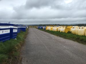
I went over a few hills, but the vertical ascent for the day was only 837 feet, so it wasn’t hard.  Coming down a single-lane road I stopped at a collection of trash cans (“bins”) for farmhouses up a dirt road.  A man drove by in a car and stopped.  I thought for a moment he might object to me offloading a bag of empty freeze-dried food envelopes.  But he wanted to congratulate me on almost making it.  He’d obviously seen other Challengers.  He told me that when I got to Stonehaven, I should go down to the beach and get fish and chips at a place called The Bay.  It was the best in town.

So I did.


I was originally supposed to end at Dunnottar Castle, a medieval castle 2.5 miles south of Stonehaven.  It’s where the Scottish crown jewels were hidden from Oliver Cromwell’s army, and also where Franco Zeffirelli filmed “Hamlet” in 1990.  But the five-mile roundtrip would have taken too long, so I headed to the train station.

But first I had someone take a picture of me.


I took the train to Montrose and at 3.45 p.m. on Friday became the next-to-last person to check in after completing the Challenge.  Some things don’t change.

That night at the celebratory dinner at the Park Hotel I sat across from a woman I have to tell you about.

Her name is Heather Werderman.  At 31, she was one of the younger people on the Challenge this year.  She walked at least part of the way with a German man who was with her at dinner.

Heather is at the extreme end of the minimalist backpacking movement (although she says there are people to the left of her).  Her pack weighed 9.5 pounds without food or water.  Mine weighed 40.75 pounds with four days of food.  (I didn’t carry water).  How does she do it?

She doesn’t carry a tent.  She has a tarp that weighs 1.3 pounds that she erects as a roof with her trekking poles. Under it she puts a  ground sheet that can be staked with the edges up so that water flows under it.  She has a sleeping bag that weighs just under one pound and comes only to her shoulders.  She wears a down hood  when it’s cold.  She carries no stove, eating cheese, cereal and snack foods.  (Pop Tarts are a favorite). She has a cell phone and carries a rechargeable battery, which is her luxury item.

She goes hungry a lot.  She can never climb into her shelter on a cold and wet day and have a cup of hot tea.  When she finished the Appalachian Trail in 2011 she weighed 103 pounds, down from her base weight of 127 pounds.  She is one of about 300 people who have done the “Triple Crown” of American hiking:  the Appalachian Trail; the Pacific Crest Trail; and the Continental Divide.  The last doesn’t have a trail much of the way, and requires map-and-compass navigation at an average altitude of 11,000 feet.  The distance is 2,700 to 3,000 miles, depending on the route.  It took her five months, some of it hiking in hip-deep snow.

Two people have done all three trails in a single calendar year–a feat that requires walking about 30 miles a day, with only a few days off.

Heather walks April through October.  Before the Challenge, she was hiking in Spain; after it she was going to Sweden.  In the winter she returns to her home in Bristol, Tenn, and gets IT contract jobs, which she bids for on the internet.  The work is not esoteric and the jobs are not high-paid, she said.  But they are enough to underwrite her lifestyle.

“I like to be nomadic.  I like to meet people like that,” she said.  Then she added this:  “I hate walking.  I don’t enjoy it for the physical exertion.  I just like to see something different every day.”

Long-distance hiking for her is a combination of obsession, worship, and mortification of the flesh.  She couldn’t be more different from me.  Yet I recognize some of all three impulses in my choice to do The Great Outdoors Challenge once, and then again.

In any case, it’s over for this year.  Who knows if I’ll do it again.  I don’t.

There will be one or two more posts of a family-historical nature, not about the Challenge.  But they might interest you.

Thanks for listening.

Oh, I almost forgot.  In Stonehaven I did go down to the water and put my feet in the sea.

The Clearances

The emptiness of the Highlands, especially the western half, is eerie.  I walked alone most of the first 10 days of The Great Outdoors Challenge.  By alone I don’t just mean I didn’t meet Challengers, but that I saw no one.  I more than once walked an entire glen–which is to  say, a river valley–and saw no person, no car, no house.

What I did see was the remains of former habitations–the collapsed stone walls of cottages, barns, and animal enclosures used by people hundreds of years ago.


The abandonment (and, in some cases, the physical collapse) of these buildings didn’t occur by accident.  It was the consequence of a economic policy that replaced subsistence tenantry with industrial-scale sheepherding.

The Highlands was once filled (“filled” being a relative term, of course) with people growing oats, potatoes and kale, and keeping sheep, goats and cattle.  They paid small rents to huge landowners, many of them English aristocrats who didn’t speak their language.  They lived in small settlements, often no larger than four or five families.

Many houses were divided, one-half for the people, one half for the animals. The duplex design can still be seen in the remains.

And here.  (The plastic containers hold mineral supplements for sheep.)

The roofs were of thatch or turf, and many had no chimneys, the smoke from an open fire exiting through a hole in the roof.

People disappeared from the Highlands over the course of 75 years, with the principal periods of eviction being 1782-1820 and 1840-1854, according to “The Highland Clearances” (1963) by John Prebble, which is the source of most of the information in this post.

The removal of people and the introduction of sheep (and a small number of shepherds, who were mostly people from the south) was termed “Improvement.”  It was defended as a program of economic rationality. As wool was a valuable cash crop and sheep were animals that required little husbandry, the change allowed estate owners to charge higher rents.  (The owners rarely ran the “sheepwalks” themselves, instead renting land to farmers and companies that did).

The new economic model was also justified by some (usually the evictors) as a way of saving Highlanders from their poor and miserable existence.  Sometimes evicted families were provided plots of land on the coast and urged to become fishermen.  However, the tenants knew nothing about fishing, the seaside land was less fertile than the river valleys they came from, and the weather was often harsher.

One of the best-documented episodes of this period was the eviction of more than 5,000  people from the valley of Strathnaver that began 201 years ago this month.

George Granville Leveson-Gower, an Englishman with five titles known principally as “Lord Stafford,” had an estate of 1,735 square miles in the shire of Sutherland on the peninsula in the far north of Scotland that juts into the North Sea.  It is well northeast of where I started from.

map by Forbes Travel & Leisure

The evictions were carried out by Stafford’s commisioner, William Young, and his factor, Patrick Sellar.  In mid-December 1813 at a place called Golspie, Young declared in English that the first evictions would begin on Whitsunday, in mid-March.  The announcement was translated into Gaelic by the local minister.

Sellar enforced the orders.  People who hadn’t moved by the deadline had their houses burned.  “In previous removals the evicted had been allowed to take their house-timbers with them for use in the building of new homes,” Prebble wrote.  “Now it was learnt that the moss-fir was henceforth to be burned when it was torn from the cottages.  The people were to be paid the value of the wood, or the value which Sellar set upon it, but this was no compensation at all in a land so sparsely timbered as Sutherland.”

Sellar’s action caused such outrage that two years later, in April 1816, he was put on trial for murder and other crimes stemming from the evictions.

The deaths included an old woman, Margaret Mackay, who was carried from a burning cottage in a blanket,  whose scorched fabric was publicly displayed as a symbol of the outrages.  Another was Donald  MacBeth, an old man with cancer who lived with his son.  The son had to go away for several days and removed part of the roof of the house, hoping that would convince Sellar and the house-burners to hold off further destruction until he returned and removed his father. It did not. The son returned to find his father huddled outdoors against a wall of a smoking ruin; he died soon after.

The evidence did not persuade the jury of 15 men, none of whom were tenants.  They acquitted Sellar in 15 minutes, Tallahatchie County-style.

The evictions resumed, but without the burning and wrecking of buildings until people were out.  Sellar was generous enough to invite the tenants back to harvest their grain when it was ready.  However, without barns for storage they had to carry the crop on their backs through snow that fell early–in October–in 1816.  “Others came down from the north to dig what they could from beneath the snow and eat it there, cooking a few potatoes among the ruins of what were once their homes,” Prebble wrotes.

[My post-Challenge host, Paul Richard, brought to my attention this passage from the book “Stone Voices:  The Search for Scotland” (2002) by Neal Acheson.  It shows the Scots have long memories.

[“Not long ago, I met somebody who witnessed a remarkable scene in an Easter Ross churchyard.  A Canadian family was visiting the place, probably in search of ancestors.  They came across a tomb which seemed to surprise them.  The head of the family, a middle-aged man in a baseball cap, urged his wife and daughters to walk away.  When they were out of sight, he glanced around, unzipped his trousers and pissed at length on the grave of Patrick Sellar.”]

And so it went, all across the Highlands.  The Clearances are the reason for the huge Scottish diaspora in Canada, the United States, Australia and New Zealand.

I walked by many abandoned buildings during the Challenge.  Many date from after the Clearances.

It’s the older ones I find most moving, in part because it’s so hard to feel the presence of the long-departed occupants. These ruins are being reclaimed by the land.  But it will be a long, long time before they are gone.

Early in the walk I stopped at the remains of two buildings separated by a stream you could jump over.  It had been a tiny hamlet, or possibly single homestead.

The uphill wall of one structure was covered with moss.  The moss represented decades of growth that would one day return the ruin to peat-over-stone, like so much of the rest of the Highlands.

Today, however, it looks like a family of seals that has hauled itself out of the sphagnum sea to take the sun.


Scenes along the way

There’s no theme to the pictures that follow, but together they may give a more complete look of the countryside and culture I’ve been walking through.

Wind farms are the most contentious issue in the Highlands.  They produce non petroleum-based electricity from a renwable resource, and thus are green.  However, they require major construction  (roads, turbine platforms, transmission lines) that disturb the peat, releasing large amounts of carbon dioxide.  The electricity they produce is not cheaper.  They alter the landscape; when you’re around them they draw the eye even when you don’t want to look.  They make a glen no longer empty even if there are still no people in sight.

People who own the huge estates in the Highlands make money from them.  Their construction employs people.  Some think they are an expression of Scottish independence.  And just as many others (especially hillwalkers) think they’re an abomination.

And in contrast, this view (note Dylan in Gaelic):

Turnips are very popular with the barnyard set.  You can order them by the bucket.

Sheep are everywhere.  When you walk past them they look at you as if you were the first person they’d ever seen.  And then they run away.  The brain is not their most important organ.  A sheep is basically an intestine covered in wool.  But this time of the year they proudly stand for family portraits.  And the lambs are pretty cute.

Wool has so little value that sometimes it’s just left on the ground after shearing.

There are other animals, too, of course.  This one is looking for his dog or his beer wagon.

This woman was exercising a horse she rides in competition.  Possibly dressage.

A hazard of parking your tractor outside too long:  lichen on the instrument panel.

Sweets are popular in Scotland.  I’ll take a pound of smush for the road.

This is home away from home.  It’s a studio.

This part is the office.

A house with one daffodil blooming.

On one part of the path there were historical markers of a sort I’d never seen.  A wooden panel with a legend on it is nestled between two upright planks, to which it is hinged.  You swing it out and read it.  When you’re done it swings back into its wooden sandwich and is protected from the elements.  The program is called “History with Boots On.”

Fifteen seconds ago it was perfect.

You gotta love a country that looks like this.

And this.

And this.  (In the foreground is gorse, which smells like coconut and is as barbed as cactus.  In the distance is a field of rapeseed.)

And this.

One thing I learned:  it’s impossible to lean trekking poles against yourself and manipulate an iPhone or take notes without one of them falling.  Usually the left.

On the moors the sky is big, but at your feet the visuals are delicate, miniature, and abstract.

The name of this house (and it’s also a place-name on the map) is Snob Cottage.  You’ll see the sign if you blow up the picture.  It must mean something different in Gaelic.

Late in the day,  exhausted and moving slow after several wrong turns, I encountered this sign.  I was on the right track.


Bad luck and good luck

This should be called “stupidity and good luck,” but that doesn’t sound as good.

I spent the night at Spittal Cottage (labeled “ruin” on the map; there was no cottage in sight), making camp in a light drizzle at 7.30 p.m. I know I’m giving the impression it’s raining all the time. That’s not true.  There have been many sunny days. But a drizzle in the evening, and something a bit harder overnight, are common.

Another Challenger, an American named Robert, arrived about an hour after me, discouraged after having lost a day outside Tarfside for reasons I didn’t understand. Neither of us wanted to stand outside in the rain and have anything more than a neighborly conversation. He was up before me and stuffing his pack the next morning  at the time I was just getting out of the sleeping bag.

Like me, he was a day behind. Nevertheless, he was still hoping to finish that day and get to the dinner in Montrose. Challengers can finish the walk on Thursday or Friday.

Thursday is the more common day, and the dinner that night is larger. He calculated the distance to be 30 kilometers and “definitely doable.” By my route it was 34 kilometers (21.4 miles), with 3,000 feet of climb. My conclusion: definitely not doable.

Especially not the way I was going to do it.

I had breakfast, packed everything and headed up a short path to a paved road, which I was to be on for less than a mile. It was 8.35 a.m., my earliest start yet, which allowed me to fantasize about making unheard-of time and getting to the Thursday dinner myself. (That was the orginal plan, before I took an unscheduled rest-and-writing day in Ballater.)  I wanted to finish on Thursday so I could see Roger Hoyle, the man who told me about the Challenge in October 2013 and provided me routes and endless advice. He was gone by the time I finished on Friday last year, and would be gone on Friday this year, too.

Up on the road, I turned right and confronted a sign announcing a 14% grade, which I proceeded to walk up. At the top of the hill, after the road leveled off, I was surrounded by the familiar view of heather-covered moor and grassland. Then I remembered I was supposed to spend the day in Fedderesso Forest, an impenetrable tree plantation with a confusing maze of roads. I fired up the phone, looked at the map and saw I should have turned left onto the road. So it was back down the 14%, and so much for an early start.

I walked on, up and down, through a farm, across a stream and onto a hillside above the stream. I had lost the trail but knew where I wanted to go: the wall of green pine ahead of me. I figured I’d just go along the shoulder of the hill until I hit the woods, then walk uphill along the edge until I found the trail in. (Going through the woods off-trail would be impossible. The trees were densely packed, with branches growing to the ground).

Unfortunately, the hillside was a bog. It didn’t look like that from a distance, and doesn’t look like that in a picture. But believe me, it was supersaturated sphagnum moss with tussocks of grass dotting it in a million islands.

It’s hard enough stepping from hummock to hummock, and judging which patches of moss appear to firm enough to briefly hold weight. I also had a serious desire not to get my feet wet. My boots are lined with Gore-Tex, which is to say they aren’t waterproof. Immersion over the instep is sure to result in damp socks, which is a drag early in the morning.

But a bog on a hillside–it’s like a slanted swimming pool. Not supposed to be possible! I named it the Bog of Curses. Halfway across I abandoned my shortcut and headed straight up the hill in hope of finding the lost track. Which I did. I turned and made good time, on the right track into the woods.

This little escapade of freelancing taught me a useful Challenge lesson (and not for the first time):  Don’t cut corners. Stick to a path, which is the product of collective intelligence. A path is the original example of crowdsourcing, by human beings and animals.

Not checking the route at every junction, I took another wrong turn for a while before getting back on track. There were steep pitches and the road was virtually washed out in places. In others, the surface was a jumble of granite stones.

It was drizzling, which is okay to walk in for a while without a raincoat, as it often stops.  But it became steady enough that I heaved off the pack, dug out the pullover rain jacket and put it on.

I had decided not to put soup in the thermos for lunch because I didn’t want the extra weight (the tent was wet and adding enough), so I had nothing to look forward to for a break other than yet another oat bar and a little water.  Which I took out and was unwrapping on a downhill section, happy to have the pack off, when I saw two people trudging up the road.

“How you doing today?” I asked the man as he approached.

“Can’t complain too much.”

“That about describes it for me, too,” I said as I looked at him and the woman next to him.

Then, simultaneously:

“Colin and Marion!”

“Dave!”

I had gotten the man’s name wrong; Colin is his son, he is Alan. But it was close enough.

image

They were the first friends I made on the Challenge last year. I walked with them for parts of three days. I wrote a post about them. Alan has done many things, including worked as a custom-hire guide for wealthy people touring Scotland. Colin, a military veteran, is a helicopter pilot in a mideastern country. And Alan’s wonderful wife (his second) is named Marion and like me is descended from John Brown the Martyr, a Covenanter killed in the early 1700s by an officer of the English Army for not going to the right church.

Neither is doing the Challenge this year. Marion has done many, the last one several years ago in a women-only group. Now, she and several other veterans put on a dinner and breakfast (for a modest price) at an old church in a hamlet called Tarfside. It’s such a welcome break that half the the walkers route themselves through Tarfside on the days food is served.

I was there last year–that’s when I met Marion–but my route didn’t take me there this year. Alan was helping her this year and I was sorry I was going to miss them both.   And here we all were chatting in the drizzle!

They were going for a walk up a hill they’d never climbed, and then were going to go to Montrose to the dinner. They’d gone trekking in Nepal this spring, on a route around Annapurna (and up to 17,800 feet).  They missed, the earthquake by two weeks. In dinner fees and contributions, they’d raised 1,000 pounds for Nepal relief at the Tarfside festivities.

It was so great to see them. But we had places to go, so after a quick download of news we trudged off in different directions.

If I hadn’t made all those mistakes, I would have missed them.


Bones of steel

I spent the night on a small, barely acceptable piece of ground along a stream just below Birse Castle. The Castle (which looks too modern to be a castle) was half-hidden in the trees in the distance.  (Here I’ve set up a washstand on the screw of an disused device for blocking water in a channel).

The day involved my last piece of compass navigation. I was in an area where there were two hills named Cock Hill. Each had an ATV track to the summit but not one connecting them. I took a bearing on the map and navigated by it, but it wasn’t necessary. The day was It was sunny day and everything was possible by line-of-sight.

Climbing the heather and sphagnum moss was hard. I hadn’t done it for a long stretch since the first few days of the walk, which seem long ago.

The track took me along a ridgeline, past two buildings and numerous wooden blinds behind which one shoots grouse flushed from the heather by beaters. Here is one of the labels on a blind.

The road eventually headed downhill toward what I really wanted to see: the remains of an airplane that crashed on May 5, 1939–76 years ago this month.

When I submitted this year’s route, my “vetter,” a man named Colin Tock, noted in his comments that I would go by two crash sites of World War II-era trainer aircraft. One was far off the path, but this one was in view of it.

“About 5,000 aircraft crashed in the Scottish hills and mountains during WWII, but it would be impossible to include them all on the website,” a man named Gordon Lyons wrote me several months ago. He maintains a website called Air Crash Sites–Scotland.

http://www.aircrashsites-scotland.co.uk/index.htm

The website records the location of about 300 crash sites from World War II, “the majority of which still contain some wreckage,” he wrote.

This site is one of the earlier ones of that era. The flight originated in Montrose, a town on the coast where there was a military air base. (It’s also where Challengers officially sign out after finishing their walks, and where celebratory dinners are held on two successive nights.

The airplane was an Audax Harrier, a two-seat craft that was a common training plane.  It had a Rolls-Royce engine, “and had a maximum speed of 170mph,” according to one description I found on the web.  “For armaments, it was equipped with two .303 machine guns–one forward and one aft. I could also carry four 20lb bombs.”

Here is what it looked like:

aviator.org

And here is what its remains look like from the trail.

The most visible remnants today are parts of the airframe of the fusilage. There is a faint trail to it; it’s impossible to tell if it was made by human beings or animals.

Most prominent is a frame of rusted steel and corroded aluminum tubes and joints that together make a slighly humped elongated rectangle. There is a sheet of aluminum bulkheading what I took to be the aft (and downhill) end of the airplane.

It appears to have crashed pointed uphill about 45 degrees to the fall line. The fact that much of the frame of the fusilage exists intact suggests to me it was a relatively soft landing for an unplanned one. Both people on board survived.

Scattered around it are pieces of metal tubing in various states of disintegration. Tubular struts about the size seen in bicycles appear to have been the chief engineering strategy of the design. A round piece of aluminum (one-third missing) was on the ground in the middle of the fusilage, covered with rabbit droppings. A square metal box with a round port, which appears to be a fuel tank, was nearby.

The front of the frame had two upturned pieces of tube, which gave it a praying mantis look.

There was a light breeze and the sun was out.

To the left was the top of Clachnaben, one of the few hills I’ve seen with a rocky summit. At one edge of its top was a rock formation that looked like a head of spiky hair blown straight up by the wind, and to the south, a pink stone road I would soon be walking down.

You could sight the landscape through the wreckage.

To the east were perhaps 30 wind turbines, their three-armed blades moving as if there was barely enough wind to turn them.

I heard an occasional bird call, but other than that it was silent except for the wind. It made a mournful whistling sound as it blew over two pieces of rusted tubing at the top of the frame.

I’d brought my little plastic bottle of whiskey and the metal cup from my thermos. I took a wee dram and poured it over the highest and most complex joint of the frame–five tubes coming together. It darkened the rust of one of the tubes before evaporating. I took a wee dram myself and drank to the memory of Pilot Officer J. D. Lenahan and Flight Officer Rolf E. Atkinson.

They were lucky when their plane came down here. But their luck did not last.

P/O Lenahan died on September 9, 1940, near Coventry, England, when his plane was shot down in the Battle of Britain. He was 20.  F/O Atkinson died on September 27, 1942, when his bomber with a crew of seven disappeared on a night raid on Flensburg, in northern Germany.  No trace of the plane has ever been found. He is listed on the Runnymede Memorial, which holds the names of 20,000 Commonwealth airmen lost and without graves.

I hope the bones of the aircraft they learned to fly in sits on this hillside a long time, in honor of them and their brothers.


« Older posts Newer posts »

© 2025 A wee walk

Theme by Anders NorenUp ↑