A blog about a hike across Scotland (and possibly other things)

Category: Journalism (Page 2 of 2)

Most of these are travel stories that appeared in The Washington Post.

Hillwalking across Scotland

 September 26, 2015

Loch Calavie, a small lake near Scotland’s west coast where the author camped alone on a gravel beach. (David Brown/For The Washington Post)


Two ridges of heather and grass rosed up on either side of a narrow lake, like weathered hands scooping a drink of water.  The blue sky was furrowed with clouds as bright as the patches of snow on the mountains in the distance.  A gravel beach, wide enough for a few tents, etched a parenthesis in the distance.

It was my first day out on a walk across Scotland, and I’d stumbled upon one of the most beautiful camping spots I’d ever seen. As I pitched the tent and made dinner, the light fading with arctic slowness, I kept hoping somebody would arrive to share the place with me. But nobody did. It was all mine, for better or worse.

That’s how it was for much of the next 13 days. Backpacking across Scotland, if you go alone, as I did, is an exercise in beauty, solitude and expectancy.

I made this trip in May as part of an annual event called The Great Outdoors Challenge. Named for the British outdoor magazine that sponsors it and organized by a small army of volunteers, the Challenge helps about 300 people traverse the country, from west to east. The hikers (or “Challengers,” as they call themselves) don’t all take the same route, or even a few established ones. There are no equivalents of the Appalachian Trail or the Pacific Crest Trail to follow. Instead, they custom-build routes from local hiking trails, farm and forest roads, ATV tracks, military roads built in the 18th century, and drovers’ and hunters’ trails that are even older.

Everyone leaves from one of 13 designated starting places on the west coast and finishes 13 or 14 days later on the east, traditionally by wading into the North Sea. They then make their way to Montrose, a seaside town where a celebratory banquet is held in a hotel.

You have to apply, pay a small fee and convince the organizers you’re fit before you’re accepted into the Challenge. The chief advantage of participation is the advice provided by a dozen veteran hikers, who review and approve every route — more than 200 different ones this year. These experts tell you which footbridges have been washed away, what streams are too dangerous to ford after heavy rains, where the good camping spots are, what sights not to miss.

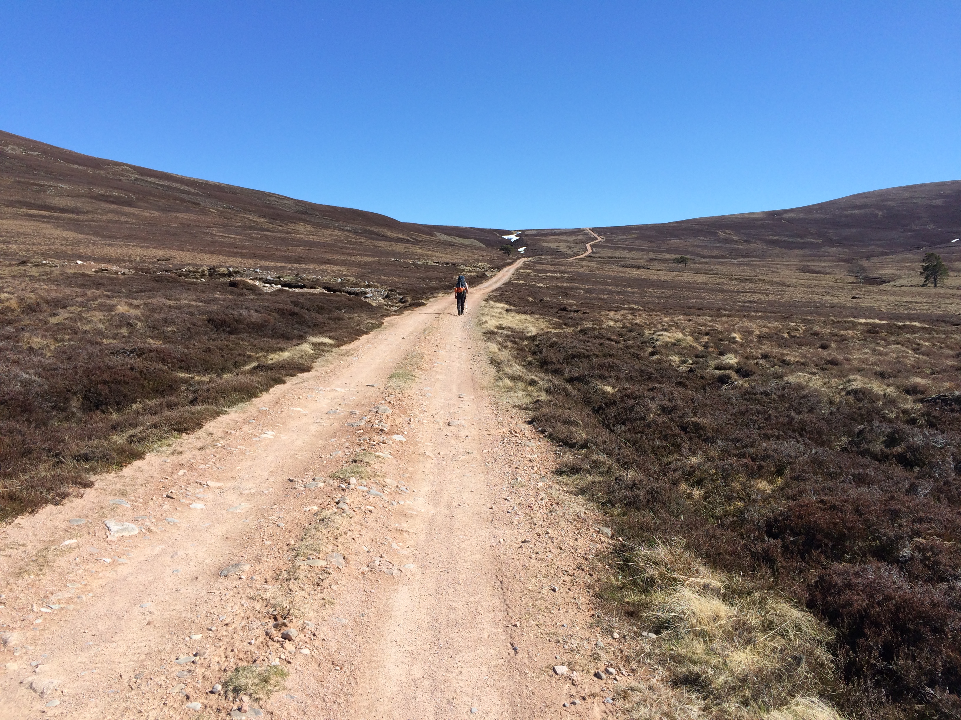
My route was about 200 miles long. Even though it took me to a B&B or hostel about every third night, I was mostly on a camping trip — and a long one. I had to carry what I needed on my back, and be prepared for anything, including snow.

There are easier ways to hike in Scotland. The Challenge is simply an extreme version of what is Scotland’s national pastime: “hillwalking.” The country’s Outdoor Access Code allows people to walk and pitch tents on both public and private land. (There are a few exceptions, such as the British royal family’s Balmoral Estate.) All a walker has to do is stay away from crop fields, animals and buildings.

I walked 10 to 17 miles a day, with each day’s uphill sections averaging about 2,000 vertical feet. It took a lot of planning and was hard enough that I took an unscheduled rest day halfway through. But the payoff was huge. There aren’t a lot of places where you can walk sea-to-sea across a country that is beautiful, exotic and English-speaking. Scotland is one.


Although many people follow a route by GPS on a handheld device for the Challenge, carrying paper maps is also strongly advised. (David Brown)


I flew to Glasgow and took a train to Strathcarron, my starting point. It’s a hamlet at the end of a finger-shaped “sea loch” consisting of a hotel and two blocks of whitewashed houses.

That part of Scotland is the same latitude as southern Alaska, so only a few weeks before the summer solstice, daylight wasn’t going to be a problem. I couldn’t say the same for the 40 pounds on my back. As I headed down the road and then into the hills on the first morning, I excused the weight by telling myself I had seven pounds of electronics — I was writing a blog — as well as four days of food. Over the next two weeks, however, I learned that some people somehow made the crossing with only half what I carried.

The Highlands were deforested centuries ago, which gives them a big-sky look that rivals Montana and Wyoming. But while lack of water shapes the American West, it’s the abundance of water that has made the Highlands.

It rains a lot. Sometimes for minutes, sometimes for days. The ground can be boggy even on hillsides, as hikers taking off-trail shortcuts soon discover. There isn’t a lot of bare rock (other than ruins of cottages) because things get grown over by moss, grass and heather. The end product of all the vegetation is peat, the Highlands’ wood-substitute. Huge banks of it sometimes erode into what look like surfable waves — frozen black fronts, topped with a grassy curl.


Ruins of tenants’ cottages fill the Highlands of Scotland. (David Brown)  


One advantage of all the water is that you don’t have to carry any. Wherever you are, there’s a cold, clear, drinkable stream within a hundred yards or so. Not to mention lots of lakes, such as Loch Calavie, the gem I stumbled upon the first night.

With few trees and no jagged mountains, the Highlands are hard to get lost in. Of course, it’s different if you’re in fog or a snowstorm, but luckily the weather was clear for most of my time there. The first four days I walked down valleys and over ridges, scattering sheep, rabbits and grouse, and seeing almost no one.

The emptiness lent sweetness to the moments when a person did appear on the path, offering a few minutes of conversation, an exchange of gorp or hard candy and, occasionally, hours of companionship. Hillwalking creates a fraternity even for solo walkers (which 140 of the 298 participants this year were). That, in turn, gives Challengers permission to inquire about a fellow walker’s life, and to synopsize their own.

If you don’t want company, you can just walk on, no excuses necessary. But if you do, the Challenge can become a Canterbury Tales of interesting characters and encounters.

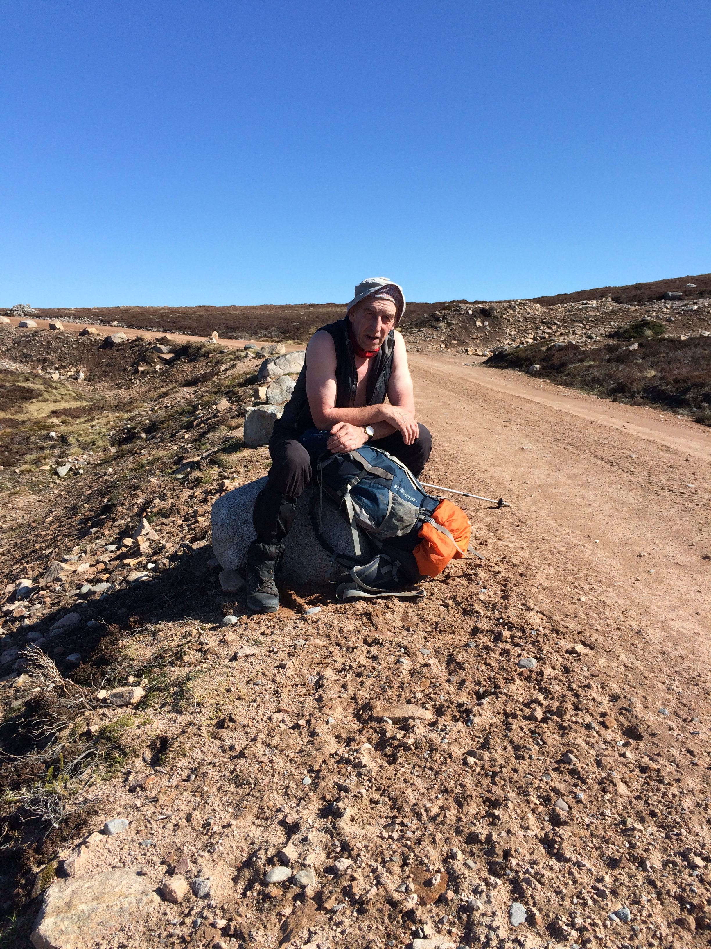
I walked through a rare patch of forest in the drizzle with a 75-year-old retired surgeon — a woman — whose career had been solo gigs on Hebridean islands and other far-flung spots, filling in for doctors needing a break. I spent a morning with a woman my age — 60s — who told me about growing up in postwar England, where margarine and marmalade were rationed and her house had an outdoor privy. Nothing, however, epitomized trail society better than my day with Stevie, a 56-year-old paving contractor from a town south of Glasgow.


Stevie walking ahead.

I’d camped on the bank of the River Findhorn. Sheep grazed in a pasture that went up a ridge to where the umber heather began. I encountered Stevie when I got to the gate to the farm road that went up and over the ridge to a river valley 15 miles away. He was changing clothes and getting ready for a strenuous climb. Muscular and taciturn, he carried a backpack half the size of mine.

I thought about waiting, but I figured he’d be a fast walker, so I told him I’d see him on the trail. For the rest of the day we played tortoise-and-hare, catching and passing each other and exchanging snippets of conversation.

His father had been a bus driver, he told me, and his father’s father, too. He learned to love the outdoors when the family would rent a cottage in the mountains for two weeks in the summer and he would run around with his shoes off. From an aunt, he said, “I learned to love wild birds.” He described some he’d seen in the last few days, including the once-endangered red kite. He was married once (“it wasn’t for me”) and has no children (“my one slight regret”).

When he was young, he walked with his brother and a cousin. Often it was nothing more than “a rush to get to the next town and the next bar.” As he got older he went alone, often with only a rough idea of a route. A few days before we met, he’d gone over four 3,000-foot summits in a day, stumbling into his tent after dark with just enough energy to make tea before falling asleep.

Recently, however, he’d started enjoying the company of others. He’d walked with two Germans for a day early in the Challenge. When we got to Aviemore, our mutual destination for the day, he hoped to rendezvous with a woman he’d met on the walk the previous year. “I’m learning new habits,” he said with surprise in his voice.

Nevertheless, when he wanted to go on, he did. No waiting for the American with the obese pack.

By midafternoon I figured I’d seen the last of him until I got to a long abandoned stone cottage called the Red Bothy. In the lee of the building he was having a lie-down with his boots off. We chatted briefly until I said I had to get more miles behind me. He nodded understandingly: “You go’ qui’ a big ki’.” Quite a big kit— yes, that would describe it.

He caught up to me an hour later where the road went over a divide into the watershed of the snowy Cairngorm Mountains. We sat on stone pylons in the sun and looked back at a hill we’d come over separately in the morning. It seemed an impossible distance away.

“I like being in the moment,” Stevie said, getting suddenly philosophical. “But it’s on reflection that it’s frigging brilliant. In a few weeks you forget the pain and remember only the beautiful days. And this might be one of them.”

I couldn’t have agreed more.

We got up and walked, but this time he didn’t go ahead. We descended into Aviemore together and then went our separate ways.

I saw Stevie three days later in Ballater, my next village port-of-call. He and the woman he’d been hoping to meet were in a pub near my hostel, and he greeted me like an old friend. Which, in the strange time-dilation of the trail, I was.


Stevie looking back.

There are few obvious dangers on a wall across Scotland.  The Highlands require no technical climbing; the ground is padded like a gym mat; the spring and summer days are forgivingly long.  There are no bears and only one species of poisonous snake.  But that doesn’t mean there isn’t discomfort, as I found in the Cairngorms on the hardest day of my walk.

Like New Hampshire’s White Mountains, the Cairngorms aren’t terribly high, but they have harsh and changeable weather that is occasionally fatal to the ill-prepared and unlucky. At 2 in the afternoon, in the rain and with many miles already under my belt that day, I headed over one of the range’s plateaus to a place called the Fords of Avon.


For four hours I climbed a stony and windy trail that got stonier and windier the higher it went. Gusts staggered me. I ended up wearing almost all the clothing I’d brought — fleece, rain jacket, hat, mittens.

A peculiar attribute of Scotland’s round, bare hills is that you can rarely see the tops from below. What appears to be a summit turns out to be only the brow of a ridge, with another ascent beyond. That was the case on this climb. It seemed to go on forever.

When the ground finally leveled off, I estimated the wind was blowing about 50 mph and the temperature was in the high 30s. The grass tussocks were blown flat and the trail was littered with pink granite boulders. The descent, as I looked ahead, was going to have its own ups and downs.

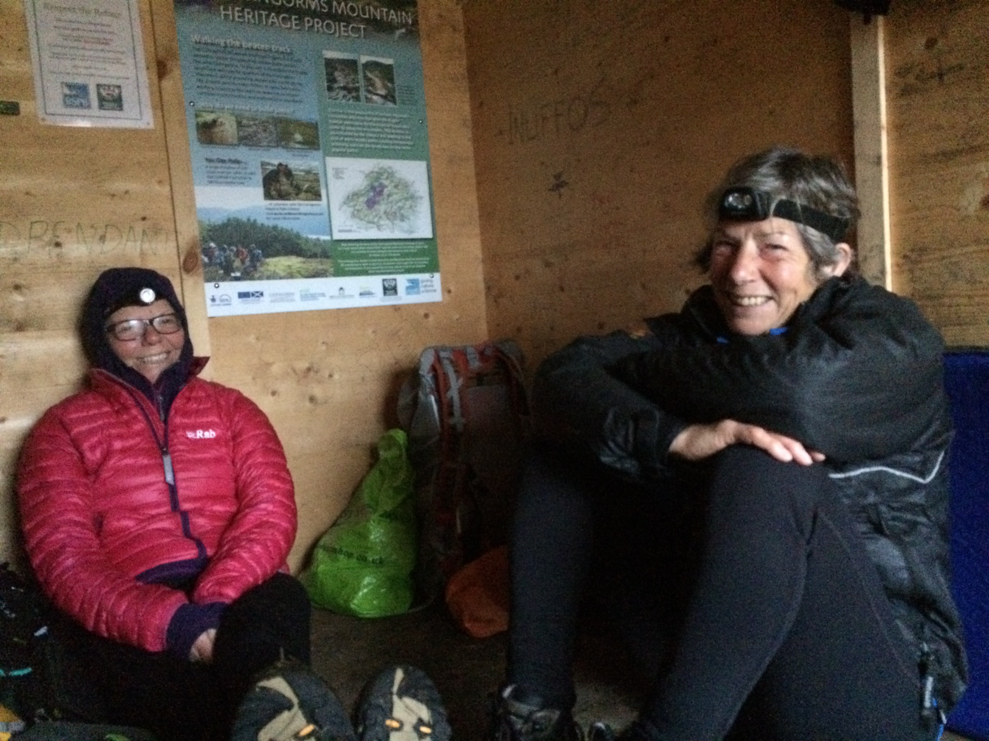
When I got to my planned camping spot at 7:30 it was still raining, and blowing so hard it was difficult to pitch a tent. I was “proper knackered” — totally exhausted. Three or four tents were clustered around a wooden box one-third the size of a shipping container that serves as an emergency shelter for hikers and skiers. Inside, people were finishing dinner. Among them were two first-time Challengers — a 69-year-old nurse, Stella, and a 70-year-old retired professor of social work, Viv.


Stella and Viv

At some point in the evening, the conversation got around to why so many older people are eager (and able) to walk with a backpack for two weeks.  Of the 298 people who started the Challenge this year, only 30 didn’t finish.  The median age of participants is over 55 years, with a range from 22 to 85.  The theories offered were thoughtful and observant.


“There’s the ‘Rage, rage against the dying of the light.’ ”

“When you get old you have a kind of freedom. You stop being essential to other people’s lives.”

“In a way, you’ve got more stamina when you’re older. Or more determination and patience.”

“If you’ve gotten to a certain age, you’ve had all sorts of ups and downs. You have confidence that things will work out. That you’ll be warm and dry in the end.”

Which was all true, even that day.

Rapeseed and gorse.

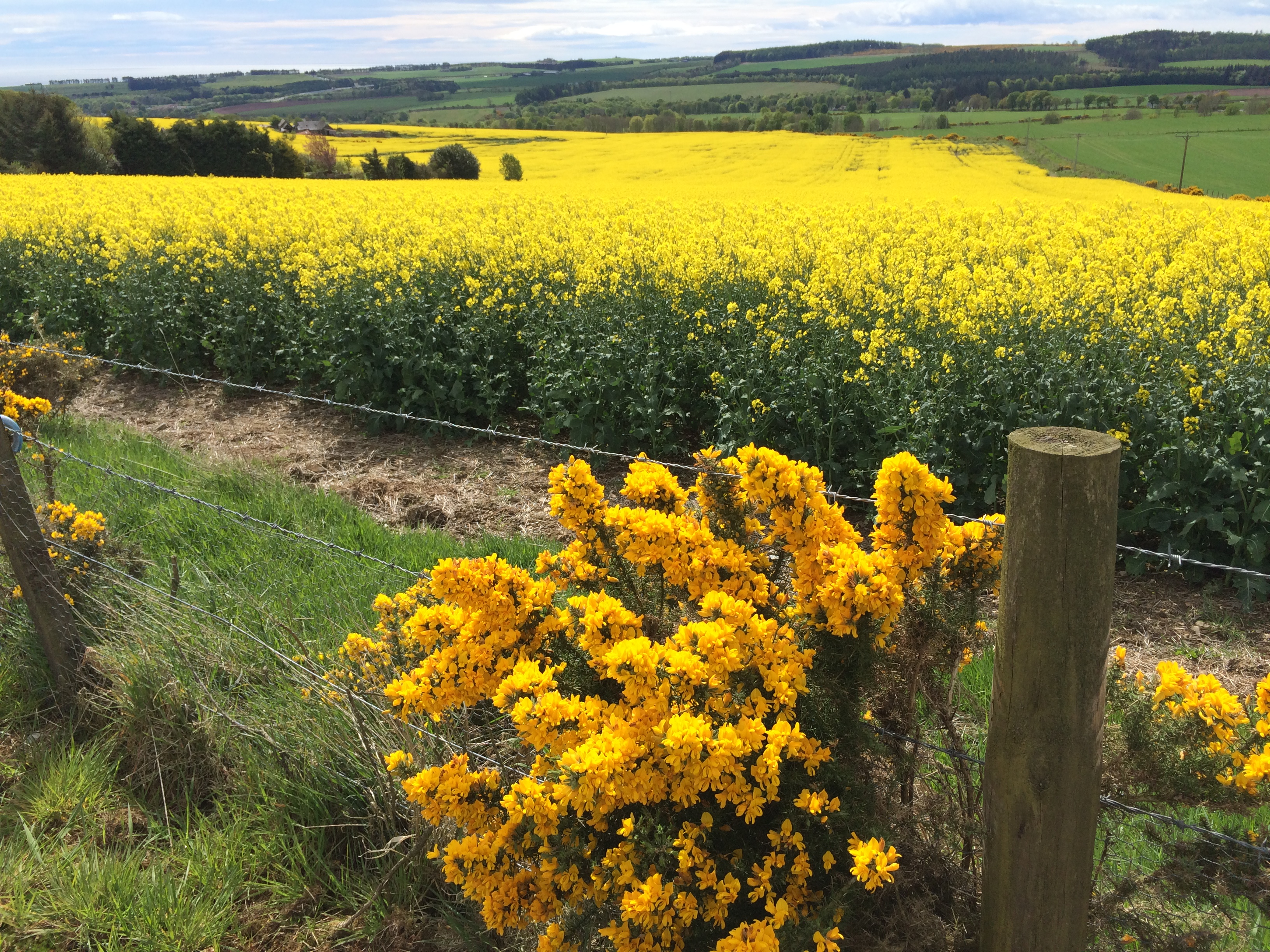
Eventually, walking east, the land gets less wild, less hilly, less monochromatic. Lichen-covered ruins become rare, more towns appear, and there’s no avoiding paved road some of the time. Horses and cattle join sheep in the pastures. Fields of rapeseed and a thorny bush called gorse produce yellow flowers as bright as you’ll see anywhere.

Eventually you come over a hill and ahead see not more hills, but the North Sea.

As I descended the last hill to the town of Stonehaven, my route’s destination, I stopped to slip a bunch of empty food packages into a trash bin at the end of someone’s driveway. (It’s never too late to lighten the load!) A car coming up the hill stopped. I thought the driver might chastise me, but instead, he wanted to congratulate me (he’d seen other Challengers) and suggest I go to a particular fish-and-chips shop in town to celebrate. Which I did.

That night at the dinner in Montrose I sat across from a 31-year-old American woman who is an “ultralight” hiker. Her loaded backpack without food weighs 10 pounds. She carries no tent (only a ground sheet and tarp), no stove and a tiny sleeping bag. She hikes six months of the year, supporting herself with IT jobs in the offseason.

She couldn’t be more different from me. Yet in her desire to test limits in a beautiful landscape I recognized a kindred spirit.

At my age of 63, there are a lot of things that are no longer likely or possible. I’ll probably never go up Mount Kilimanjaro or run another marathon. I won’t spend a winter crewing on boats in the Caribbean. Won’t learn to play the piano. Might learn another language, although that’s a long shot.

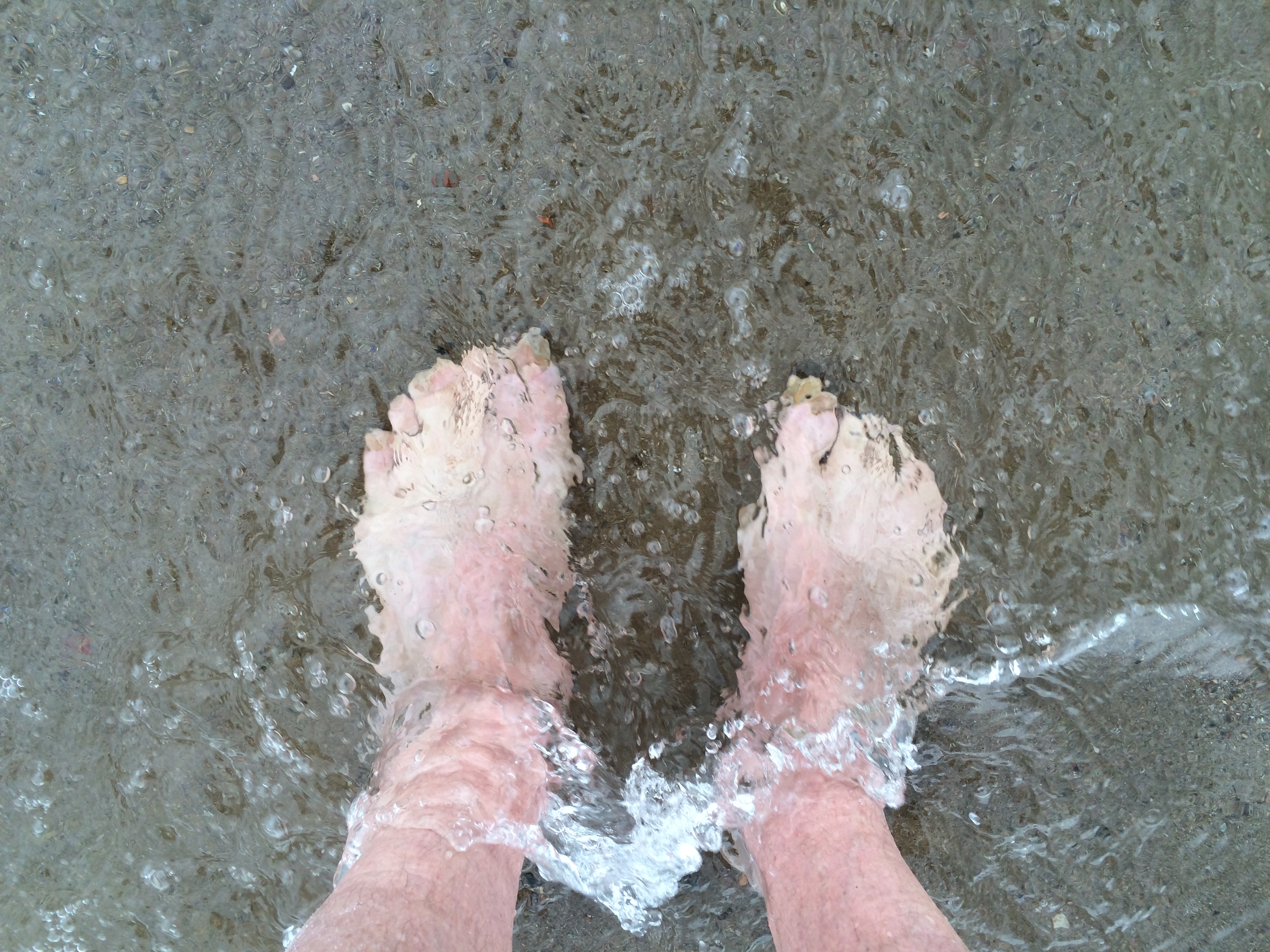
But I’ll tell you one thing that is possible. You can walk across Scotland and put your feet in the sea.


Homer & Wyeth in the studio

November 20, 2014

You can’t tell much about a painter or a writer from the place where they painted or wrote. That’s true even when the wax apples and fruit bowl are still on a table, as in Cezanne’s studio, or the outline of a novel is written on the wall, as in Faulkner’s study.

Nevertheless, many people (and I’m certainly one of them) are moved by the chance to stand in the space where someone else’s brain, eye and hand created wonderful things. For lovers of American painting, there’s a chance to do that at two places within a hundred miles of each other on the Maine coast. The destinations are the Winslow Homer Studio, in Prouts Neck, 12 miles from Portland, and the Olson House in Cushing, south of the mid-coast town of Rockland.

Winslow Homer (1836-1910) made many of his narrative paintings (“Lost on the Grand Banks,” “The Gulf Stream,” “Fox Hunt”) and virtually all of his seascapes in the oceanside studio, in which he also lived for the last 25 years of his life. Andrew Wyeth (1917-2009) painted in the Olson House for 30 summers. Its occupants, an eccentric brother and sister, their farm and the building itself were frequent subjects of his paintings, most famously in “Christina’s World.”

Both sites were rescued from destruction or decay. The Olson House has been open to the public since 1993, the Homer Studio only since 2012. Each place reveals (and hides) its famous occupant in different ways.

A visit to the Homer studio requires planning, and in some seasons, patience. It is owned by the Portland Museum of Art, which runs two tours a day, each accommodating only 10 people at $55 a head.  When I first tried to get one, in August 2013, registration was filled six weeks out.

A van carries visitors from the museum to the studio, a 25-minute ride that allows the docent to describe how the Homer family came to buy land on Prouts Neck, the area’s history as a summer resort, and the six-year, $3 million rehabilitation of the studio.

Homer moved to the Neck in 1883 from New York City. His father and brother offered to provide him with a studio in the compound’s main building, called “The Ark.” Winslow, however, wanted his own place, and claimed the carriage house. He had it moved 100 yards away and closer to the ocean — a decision with both symbolic and practical effects. He also had a balcony, called the piazza, built across the entire water-facing side.


Homer was a bachelor, a dandy, an outdoorsman, an intermittent grump. Some scholars believe the trauma of the Civil War (which he’d chronicled as a newspaper artist) or unrequited love (of a woman or man) led him to an intensely private life. Whatever the reason, the studio has a monastic feel.

The big downstairs room is dominated by a fireplace in which Homer cooked some of his meals.  (Others he got from a nearby hotel by displaying a flag outside the house whenever he wanted a meal delivered.)  The walls are unpainted headboard.  The decor includes several dessicated and mounted fish skins.  There’s a hand-painted sign announcing the presence of snakes and mice, which he put outside to discourage visitors.

Upstairs is another large room, where he painted until a room for that purpose was added on the ground floor. There is no bedroom described or displayed.


Thankfully, visitors are allowed to linger on the piazza, with its view of rock ledge, ocean, islands and whatever boats may be passing by. It is from there a person can see a bit of what Homer turned into his famous “marines”–the paintings of crashing waves, anthropomorphic pillars of spray, weather-blown grass and bush, water and sky barely distinguishable from one another.

A webcam on the roof provides a daylight feed of the view to the lobby of the Portland museum.

Homer had a wonderful eye, and this place continuously beckoned it.

When a school of herring arrived offshore in the summer of 1884, he had a local boy row him out so he could watch fishermen hauling fish (“The Herring Net”). A decade later, he was sitting outsidethe studio smoking with a nephew one summer evening when he leapt up and said, “I’ve got an idea! Good night, Arthur,” according to one account. He painted until 1 in the morning and produced “Moonlight, Wood Island Light.”

But he wasn’t a literalist. It’s often hard to see the paintings in the landscape. “Cannon Rock” shows a piece of ledge jutting over the water and a wave breaking on an offshore bar. Those are events that occur at high and low tide, respectively, and thus never at the same time.

The tour, including the van ride out and back, takes 2 1/2 hours. It’s not enough time, especially at the price. The docent’s lecture and slideshow at the studio lasts too long; I wanted more time to explore both the house and the grounds.

That isn’t a problem up the coast at the Olson House.

Visitors may wander almost unrestricted through the 14-room structure, which is owned by the Farnsworth Art Museum in Rockland (which also has a large collection of Wyeth paintings). Weathered nearly black, it was built in the late 1700s, gaining its present appearance and a third story a century later. It’s a “saltwater farm” on a spit of land called Hathorne Point, although the water is less visible than it once was, and most of the outbuildings are gone.

Andrew Wyeth first visited the farm in 1939 on his 22nd birthday, brought by the teenage daughter of a family summering nearby. (They would marry the next year.) He also met Christina Olson that day and painted a watercolor — the first of 300 paintings he made there.


Olson had a neuromuscular disease that began in childhood. (It may have been Charcot-Marie-Tooth disease, and almost certainly wasn’t polio, as often claimed.) When Wyeth met her in her mid-40s, she couldn’t walk. Indoors, she transferred from chair to chair using her arms. Outside, she dragged herself over the ground, the strategy depicted in Wyeth’s most famous painting.

Both Christina and her brother, Alvaro — neither ever married — slept on the ground floor. The rooms above were unoccupied. Wyeth set up an easel in one of them and came and went as he wished. (His family had a summer house nearby). He painted some pictures of Christina and fewer of the shy Alvaro. His tireless models were the house’s rooms, the views out the windows, the battered exterior.

The kitchen and pantry today contain a few household objects and pieces of furniture. A poignant relic is a wooden dory in the loft of a shed attached to the house. Alvaro gave up lobster fishing when his sister’s disability became so severe that he had to be around during the day. The boat has never been moved, the docent said.

Most other rooms are empty. The house’s contents were sold at auction in 1968, although a few have since trickled back. Someone donated a rocking chair last summer.

What the Olson house displays is what can’t be taken away: the play of light on walls, the landscape seen through glass, the texture of worn wood and nubby plaster. They are among the things that make Wyeth’s art so memorable and moving. To stand alone in a room and look out the same window (different frame) he depicted in “Wind from the Sea” is to experience some of the “hair-standing-on-end” sensation he recalled he had upon opening the window one summer day in 1947.

What’s not obvious in the house (and even less in the pictures) is the inescapable fact that Christina and Alvaro lived in shocking squalor and poverty, even by the standards of rural Maine 75 years ago.

The house had no running water, and for most of the time the Olsons lived there, no electricity. There was no bathtub. A nephew recalls that the door into the kitchen left a four-inch gap to the outdoors, through which the winter wind howled. They burned 14 cords of wood a year, much of it stacked inside. Christina was incontinent and the house stank of urine. At the end of her life, there were too many cats.

Wyeth emphasized the Olsons’ dignity and self-reliance. Whether he owed them more is a matter of debate. He didn’t pay rent or modeling fees, but did sometimes cover bills at the general store. He stopped painting there in 1968 after Christina died. (Alvaro had died three weeks before her.) But he eventually returned.

At the family graveyard down the hill (that Christina may be crawling back from in “Christina’s World”), his is the first headstone you see.


Here are some photographs of the Olson House that were not published with the story.

The Olson House in Cushing, Maine.


The view approximately depicted in Andrew Wyeth’s most famous painting, “Christina’s World.”


Old front door, in front of which a road once passed.


The view of the house that is seen in Wyeth’s 1965 painting “Weatherside.”


Hops that are said to have been planted by Christina Olson still grow and flower each year.


View from the living room out to the front door.


View from the shed through the kitchen and pantry to the living room. Wyeth painted this door and one out of view to its left in the 1968 watercolor, “Alvaro and Christina.”


A window in the kitchen.


Another view of the kitchen.


The other door in the shed depicted in “Alvaro and Christina.”


Alvaro’s lobstering dory in the hayloft, reportedly never taken down since the day he put it there after giving up fishing to take care of Christina.  The door to the privy is on the left.


A rare (but allowed) view into the two-hole, outhouse-style privy.


Remnants of things pasted to the privy wall.


A close up, from long ago.


The window (not original) in the 1947 painting “Wind from the Sea.”


The 1947 watercolor “Third-Floor Bedroom.”


And the window today.


For most of Christina’s life the house was without electricity.


Washboard, blueberry rake, clothes wringer.


A Maine, summertime hint of Wyeth’s Chadds Ford painting “Groundhog Day” (1959).


Gravestone of Christina and Alvaro Olson, sister and brother.


Andrew Wyeth’s grave.

Deep in the heart of Big Bend

April 30, 2015


Awake long before sunrise for other purposes, I decided it was a good opportunity to check on Capella and the kids.

I was camped with friends in a West Texas arroyo on a gravel bed just wide enough for two tents. On either side of us were a jumble of limestone boulders and the cliffs they came from. In the distance were humpback desert hills along the Rio Grande.

The arresting part of the landscape, however, was overhead. It was the night sky alight with stars.

I took out my phone, fired up the star-finding app and pointed it in what I thought was the right direction. I dug out of memory the first lines of a poem by Edna St. Vincent Millay I memorized in high school.

See where Capella with her golden kids

Grazes the slope between the east and north . . .

Alas, I couldn’t find the “goat star” (as Capella is less romantically known). I had done so the night before. But it didn’t matter. Her light had traveled 42 years to reach Big Bend National Park, and there would be another chance. Back in the tent, a scrim of mosquito netting between me and the universe, I saw two shooting stars.

The Milky Way rises in Big Bend National Park. (Brad Goldpaint/Getty Images)


There are many reasons to visit Big Bend, which seems to announce, in true Texas fashion: “No need to go anywhere else; we have it all here.”

It’s big — bigger than Rhode Island. It’s empty, accounting for less than 1 percent of Americans’ 65 million visits to national parks each year. It’s dangerous; three hikers died of heat-related illness there in 2013. It has a world-class desert and river, three canyons, its own mountain range, more species of birds (450) than any other national park and 1,300 kinds of plants, most of which seem to be barb-protected.  People who saw last year’s Oscar-nominated “Boyhood” got glimpses of it late in the film.

It’s also the best place in America to fall asleep under the stars.

Over the past five years, Big Bend has eliminated or retrofitted the outdoor lights on the park’s 289 buildings, as well as in its parking lots and campgrounds. In 2012, it received gold-tier certification from the International Dark-Sky Association, based on five measures of nighttime darkness and clarity. Only 13 parks in the world have that designation. Big Bend shares with three other places the claim to having the least light-polluted sky in the Lower 48 states.

The time may come when star-gazing is Big Bend’s big draw. (The cover photograph of the official 2014 park calendar was the night sky.) Like most visitors, however, I went there for down-to-earth reasons.

A college classmate I saw at a reunion invited me to accompany him and a friend on a trip they take each fall to celebrate the friend’s recovery from a serious illness years ago. They have a fondness for less-visited national parks. At Capitol Reef in Utah, someone told them to try Big Bend.

Big Bend is nestled in the U-shaped dip of West Texas’s border with Mexico. The name refers to the curve in the Rio Grande, where the river’s flow turns from southeast to northeast. Getting to the park requires flying to the middle of nowhere, and then driving three hours.

“We’re not a place that you drive by and visit,” said Kym Flippo, one of the park rangers. “You either really want to be here or are really lost.”

We spent nine days in Big Bend, straddling the end of October and the start of November. We took two hikes separated by a sojourn in Terlingua (population 799), the nearest town. There, we stumbled into the preparations for two — two! — national chili-cooking contests, which turn out to be the big tourist draw in this part of the country.


The campsite on the Chihuahuan Desert. 


Even before the plane lands at Midland International Airport it’s clear what this part of Texas is all about. Oil-well pumps bob just off the runway, and inside the terminal the advertisements are for work gloves, pipe-threading, and “horizontal completions.” The one nod to non-working visitors is a billboard for the George W. Bush Childhood Home, open six days a week.

After loading up on food and fuel canisters — campfires are prohibited in Big Bend — we headed southwest toward the park. The road passed the King Mountain Wind Farm, 214 turbines on a mesa south of Odessa and evidence that fossil and renewable energy are sometimes bedfellows. Eventually, the half-prairie, half-desert landscape turned into hills and, beyond them, the pillared Chisos Mountains.

Big Bend National Park is a geological textbook. Its oldest rocks date from 500 million years ago. There are ancient sandstone and shale beds, and more recent fossil-bearing limestone. The landscape is carved by igneous intrusions, lava and ash from volcanic eruptions, and tectonic fracturing, uplift and erosion.

The 35-million-year-old Chisos Mountains, topping out at 7,825 feet, are topographical newcomers. (They are also the only mountain range contained entirely within a national park.) They have some features of Utah’s and Colorado’s mountains, but their distinguishing attribute is they’re in Texas. We were constantly running into Texans who couldn’t believe they were seeing their home state.

For our first hike. my companions — Dick and Gary — and I took the popular “outer mountain loop,” a 30-plus mile tour around the highest part of the Chisos. Popular, however, is a relative term. Only 5 percent of the park’s visitors are backcountry campers, and only 10 percent of overnight stays are in the backcountry. One reason: Big Bend has little reliable water.

Creeks flow only after rain, springs are sometimes dry, and the Rio Grande is too polluted to drink except in an emergency. At least that’s what the park service says. Hikers are told to carry or cache all the water they’ll need, which in hot weather is a gallon a day per person. The three dehydration deaths in 2013 — two of them men in their 20s doing geological research — was an unusually high number. But there’s often at least one a season.

We took this to heart and stashed two four-gallon containers of water in a park-provided honor box at the end of a gravel road near a trail on the other side of the Chisos range. After a night in the motel at the visitor center and a morning of packing, we headed into the mountains carrying 15 pounds of water each, in addition to everything else.

With 3 1/2 miles of switchback trail, it was an unpleasant, sweaty, shoulder-digging slog. When we got to the saddle between two mountains we skipped a further climb to the top of Emory Peak, the park’s highest spot, in favor of staying on the ridge-top trail to the campsite. We slept that night in a grove of junipers. A few mosquitoes bit us and a couple of deer wandered by as stars appeared through branches. It didn’t seem much like the desert.

Our destination — and most everyone else’s in this part of the park — is the view into Mexico from the South Rim of the Chisos. We could get to it by a four-mile loop that intersected with the trail we were on, so in the morning we hid our water-laden packs in the woods and proceeded unencumbered to the rim.

It had rained recently, and the fall wildflowers were out. Tubular blossoms of scarlet bouvardia decorated the trail that wound through dwarf oaks and pinyon pines. We passed a couple of tarantulas, big as mice and almost as furry, ambling down the trail with us.


The view from the South Rim of the Chisos Mountains. 


The view from the South Rim is the Big Bend postcard shot (or at least the daytime one). You can take it in from several vertical overlooks so high and unprotected your feet tingle as you inch to the edge of them.

Yellow lichens stained the rock face (if you want to look down), and junipers and laurels, growing from cracks, peeked over the top. To the south were the pink cliffs and mesas of a formation called the Sierra Quemada. To the west were the foothills of the Chisos, covered in what looked like the olive upholstery of our grandparents’ Buicks. In the distance were shiny stripes of the meandering Rio Grande. It was as if a giant Japanese watercolor — uninhabited, idealized, and horizontal — had been unscrolled in front of us.

We headed back to our packs and began our descent into the postcard.


The South Rim of the outer-loop trail in the Chisos Mountains. 


It was a drop of 3,000 feet over six miles, the temperature rising as we walked. The first mile was alpine, the air scented with sage. The trail eventually gave way to steep washes that made downhill walking treacherous. At the desert floor the trail leveled out and we soon encountered an overnight hiker, a lone man from Galveston.

He’d started from the visitor center that morning but had stopped short of his intended campsite because, he said, “my hips gave out.” He was sitting in a collapsible chair on a patio-size piece of cactus-free ground with a view of the mesas. He seemed ready for cocktail hour.

After persistent querying by my companion Dick, who is a physician, he assured us he was okay. He didn’t need Naprosyn and had plenty of water (and, he added, “some vodka”). He said he’d feel better in the morning — and he wouldn’t even have to call Dick.

We left him and trudged on. The sun set and we, too, eventually stopped short of our goal (and water cache), making camp on a gravel patch beside the trail. That night we rationed water, a reminder of where we were. Gulping the last of it at breakfast, we headed down the trail and found we’d stopped just a quarter mile from our bulging jerry cans.

Rehydrated and reburdened, we headed out across the desert below the South Rim. Within minutes we had to walk around a rattlesnake on the trail, which perhaps was an omen. Soon we’d lost the trail, and fanned out, search-party style, to look for it.

It took an hour, but finally from the top of a sandstone outcrop I spotted a tan slash going up the side of a distant wash. We headed for it by dead reckoning, legs and arms bleeding from rocks and plants. You could get scared pretty quickly if you were lost for long in such a place.

This part of Big Bend once had enough grass to support ranching, but overgrazing had turned it to desert. The only sign of human occupation we encountered for 10 miles was a single rusted horseshoe.

We spent the day going over ridges, across streambeds and past Elephant Tusk, a miniature mountain we’d seen from the South Rim. We flushed quail. We wandered through a grove of ocotillos, leafed out after a recent rain. Sections of the trail were overgrown, and every encroaching stalk and leaf was sharp. Our socks were full of needles when we reached our destination, the Homer Wilson Ranch.

A one-story sandstone building, it was once part of a sheep-and-goat operation that began in 1929 and eventually took up 28,000 acres. Last occupied in 1944, it lacks windows and interior partitions but is untrashed and doesn’t have a stroke of graffiti on it. A south-facing door frames a formation called Carousel Mountain. The house feels like a Zen temple, the rare human remnant that completes rather than mars the landscape.

Homer Wilson ranch.

The interior.

We made camp nearby and slept soundly after a dinner of avocado halves, pasta and double rations of wine. It rained in the night. Our now-sodden packs were even heavier when we headed back into the mountains the next morning.

We were ready for a couple of days in town.

*                                                                  *                                                                  *

That meant Terlingua, a name some may recall from the 1973 album “Viva Terlingua! by Jerry Jeff Walker (which, it turns out, was recorded elsewhere in Texas). A center of mercury mining at the dawn of the 20th century, it’s now a ghost town, with a few stores, motels and outfitters, and competing chili-fests.

The original one (now called the International Frank X. Tolbert-Wick Fowler Memorial Championship Chili Cookoff) started in 1967 as a competition between two journalist-cooks. Over the years the competitive field expanded, as did the number of spectators. In the 1980s there was a schism. A second organization, the Chili Appreciation Society International (CASI), was formed, and now holds the Terlingua International Chili Championship on the same day — the first Saturday in November — as the cook-off down the road.

The two events draw about 10,000 people for most of a week. Only a few hundred are cooks, and we ran into one of them at the laundromat.

Larry Walton, a maintenance man from Robinson, Tex., won the 2011 CASI competition, which had 315 competitors. He and his wife compete three weekends a month in cook-offs throughout the Southwest, racking up points to qualify for the big ones in Terlingua. The rules of competitive chilimaking are restrictive and unbending. The meat can’t be marinated; all the cooking must be done outdoors; there can be no visible onion or tomato in the final product, only meat and “gravy.” Visitors do the judging, following a strict tasting protocol.

Tolbert-Fowler is a family-oriented event, with things like an ugly hat contest and live music in addition to the cooking. CASI is better known for hard partying by the post-family set. We were going to miss the cook-offs, but I wanted to sample the scene. Early one morning I went up to the CASI venue, a 320-acre patch of desert that looked like a high-rent refugee camp.

I wandered in behind a truck spraying water to suppress the dust and soon encountered Jim Holbrook, 65, who was ornamenting his English bulldog with sunglasses and a tiara of devil’s horns. A replica of the Statue of Liberty stood in front of his camper. He flew three flags — the American, the Marine Corps and the “Don’t Tread on Me.”

Holbrook is a Vietnam War veteran who won a Silver Star and Purple Heart on his 21st birthday. He’d spent much of his career as a New York bartender. Two decades ago, he retired to Terlingua. His homestead outside town looks like a hand-built theme park. It has a volcano that erupts (“three gas lines to it,” he said), a pirate ship and a replica of the conning tower of the USS Thresher submarine. Asked the meaning of it all, he said: “It’s the product of too much time and too much alcohol.”

He then put the bespectacled dog in the front basket of his ATV and offered to let me ride on the back as he went visiting.

Jim Holbrook

We passed a 53-year-old man named “Wandering Bear” (no other name offered), who’d ridden from Montana on a Harley. Needless to say, he wasn’t cooking. Neither was Jim Taylor, 81, who was out collecting tattered flags to be ceremonially retired and burned that evening. (“Every son of a bitch ought to do it,” he said). At the edge of the encampment’s commercial district was a man named Bill Bourbon, who sat under an awning selling chili paste. That’s where I jumped off the ATV.

The dark and fiery product was made from a recipe Bourbon’s wife’s grandparents had produced commercially in the 1930s. The next generation — three sons, all World War II pilots whose pictures decorated the booth — didn’t want to go into the business. Bourbon, 70, and his wife had recently pried the recipe out of the surviving uncle after years of trying and put the seasoning back into production. I bought a jar.

A two-tour Vietnam veteran himself, Bourbon had been a Big Bend park ranger for 19 years, his weathered face attesting. I told him our next outing would be on the Marufo Vega Trail at the eastern end of the park.

“That’s a beautiful one,” he said. “But water up.”

Bill Bourbon

One of the 2013 deaths was on the Marufo Vega Trail, which goes to the Rio Grande. A sign at the trailhead announced: “12 mile round trip temp. exceeds 100 F min. 1 gallon water per person/day no shade no water.” Suitably warned, we loaded up on water for this one, too.

The trail passed over hills and then split into two spurs that looped around and met at the river.

The landscape was classic Chihuahuan desert. The shadeless limestone hills were stippled with vegetation — the shin daggers of lechuguilla, the star-burst of sotol, the lavender fuzz of plume tiquilia, ceramic-leafed tidestromia — spaced uniformly to make the most of what little moisture existed. But it had not always been dry. Part of the trail was mudstone embedded with fossil mussel shells.

We saw just two other hikers before arriving at the trail split. We left our gear in a dry streambed — that night’s campsite — and headed down the northern spur of the loop.

It went over more hills and then descended a canyon at an angle steeper than stadium steps. We steadied ourselves with our hands and eventually had to get down and slide on our rear ends. We passed occasional piles of dessicated horse manure attesting to the astonishing fact that the descent could be made on four legs, if not two.

Soon, we were on a bluff that eons ago had been the Rio Grande’s bank. In the distance were the cliffs of the Sierra del Carmen, in Mexico. The river, pea-soup green, flowed north in silence. Above it was a hill with a patch of erosion showing sedimentary layers, like a scar revealed in private. There wasn’t a person in sight, nor a building or animal. The only thing moving was a late-afternoon breeze off the cooling rock. It would be dark in a few hours, and we had the other half of the loop to do. We left a walk to the river’s edge for another day.

Jupiter and Venus were bright in the sky by the time we got back to our packs on the gravel bar.

The evening show was about to begin.


Newer posts »

© 2024 A wee walk

Theme by Anders NorenUp ↑