A blog about a hike across Scotland (and possibly other things)

Month: May 2016 (Page 2 of 2)

The Moray Coast

So here’s a little about the Moray Coast, much of it thanks to the book, “Portrait of  The Moray Firth” (1977) by Cuthbert Graham, former weekend editor of The Press and Journal, a newspaper in Inverness.

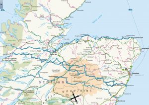
The Moray Firth is an isosceles triangle lying on one of its equal sides. It’s roughly 100 miles from Inverness to Fraserburgh (where the land makes a 90-degree turn south), and 100 miles along the southwest-to-northeast diagonal whose apex is Inverness. The other side, which connects the headlands in Caithness and Aberdeenshire, is about 75 miles long.

image

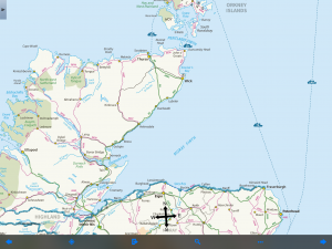
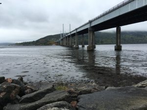
Moray Firth is a drowned river system.  The upper side of the triangle–which is to say, the northern shore of the firth–likes along a geological fault line that includes Loch Ness, the Caledonian Canal and various other lochs down to the Firth of Lorne on the Atlantic Coast.

Creating Loch Ness’s fabled depth, the rift is like a deep saber slash running diagonally across the Highlands.  In the Moray Firth, it is evident as a trench, known locally as “the Trink,” a half-mile wide and15 fathoms below the rest of the sea bed.

For reasons that are not obvious to me, the coast gets less rain that other parts of the Highlands and points west.  Nairn, which is the next town of any size east of Inverness,  gets about 25 inches of rain a year, half that of Stornoway in the Outer Hebrides.

Neolithic people built many tombs, some of which remain as stone circles or ring cairns, the ground-level outlines of the burial chambers.  However, they are easier to find on the map than on the landscape.

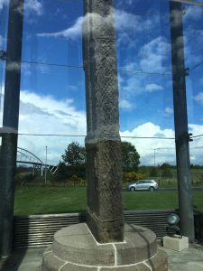
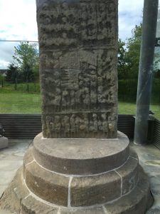
After the start of the Common Era, the Picts were carving stones with pictographic inscriptions, and later, after their conversion, with Christian and Celtic crosses.  They left no written language, and the meaning of many of their stones can only be guessed.  One of the better known and later ones, Sueno’s Stone, which I walked by, is thought to depict the course of a conquest, culminating in the beheading of the vanquished.

image


image

By 875 the Norse had conquered the land north of the northern side of the firth, which remained a Norse province for 350 years.  The southern side of the firth was a buffer between the Scandinavian invaders and the Scottish kingdom to the south.  Its rulers sometimes claimed, or usurped, the Scottish throne.

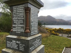
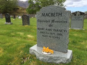
The most famous was Macbeth, who in 1040 killed the Scottish King Duncan.  Duncan had killed the brother of Macbeth’s wife, Gruoch (whose name Shakespeare wisely chose not to use), in order to consolidate power.  Duncan died not in Inverness Castle, but at a blacksmith shop near Elgin, inland from the mid-Coast.  Macbeth was subsequently killed, in 1057, by Malcolm Canmore, who later unified Scotland.

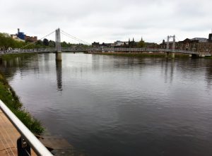
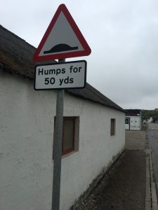
This is Macbethland.  I’m walking near Cawdor and through Macduff.  I’m spending the night at a B&B in Forres, the village that is the site of the scene in Act 1 in which a wounded sergeant reports Macbeth’s battlefield heroism to King Duncan.  Birnam Wood and Dunsinane Hill, however, are farther away.

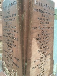
Various wars and battles, both religious and secular, occurred along the Moray Coast over the centuries. The 1746 Battle of Culloden, the last great battle fought on British soil,  ended the Jacobite Rising and began the legal suppression of the clan system.

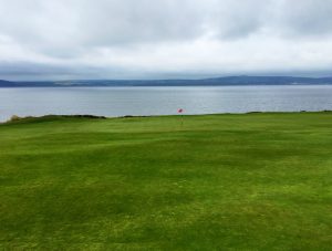
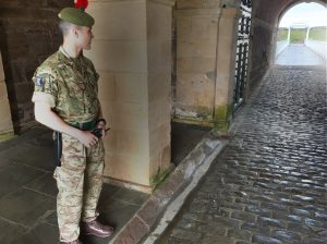
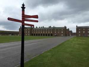
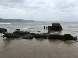
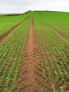
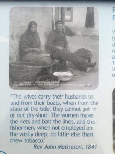
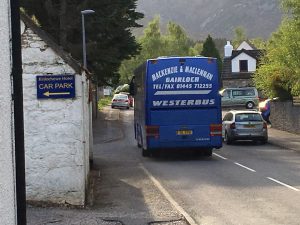
The coast received people during the Highland Clearances in the late 1700s when subsistence farmers were replaced with sheep on huge, often absentee-owned, estates.  At various times the area’s industries included flax spinning, herring and salmon fishing, whisky distilling, and farming.  In the 20th century, there were a number of big military installations, most now closed.  Golf-based tourism appears to be important today.

image

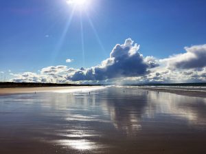
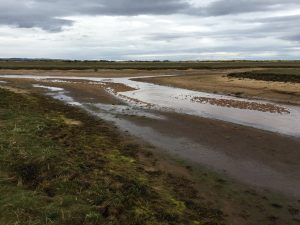
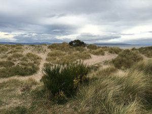
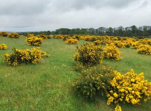
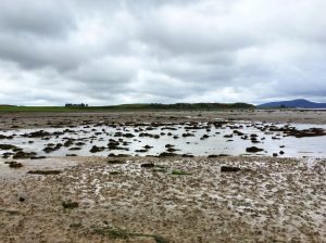
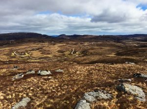
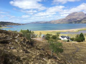
In its western and central segments  the Moray Coast has sand beaches that are a quarter-mile from wrack line to water at low tide.  Yesterday, as I walked from Findhorn to Burghead, I turned around and saw a gigantic anvil-based cloud illuminated by the late afternoon sun.  (The sun which wouldn’t set for another four hours).

image

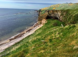
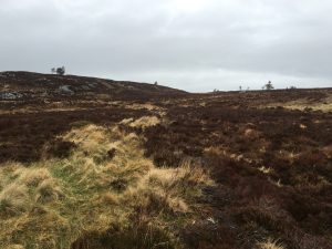
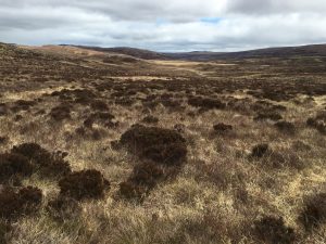
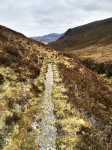
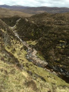
About the middle of the coast cliffs start to appear, and they eventually dominate the eastern end of the coast.

image

National Geographic Traveler magazine in 2010 asked a panel of 340 experts to rate coastal destinations for “authenticity and stewardship.” The Moray Coast was 11 out or 99 (tied with Italy’s Cinque Terre).

It’s a placed that moved the aforementioned Mr. Graham to write:  “Nothing in fact can be so exhilarating as to climb up over the Spartan uplands of Aberdeenshire or Banffshire till one reaches the windswept  plateau overlooking the coiffed coast .  .  .  where a breeze from the north-west is ruffling the manes of the waves’ white horses while, on a really good day, the thin blue line of the Sutherland hills is faintly visible on the water’s far horizon.”

I can’t attest to all of that.  But it’s pretty nice so far.


Fort George and beyond

I was the only guest in John Ross’s B&B, which he operates more or less when he wants. He makes money installing closed-circuit TV systems. His wife died a dozen years ago and he lives alone. His four children–all boys–are long out of the house.

image

He also plays the guitar, banjo and mandolin, and is the creator of a weekly live-music night in Ardersier, a village of about 1,500 people. Unfortunately, it was the night before I arrived.

On the wall of his kitchen are photographs of relatives going back several generations. One of them was an uncle, Donnie Ross. He was a sniper with the Queen’s Own Cameron Highlanders during World War II. He was one of the 10,000 members of the Highland Division that surrendered in St. Valery on the French coast near Dieppe, on June 12, 1940, when it was clear a Dunkirk-like rescue wasn’t possible.

He survived transfer by foot and cattle car to Poland, and then five years as a prisoner of war. He might not have survived the first day, his nephew said, if a fellow soldier (also from Ardersier and also named Donnie Ross) hadn’t thrown his friend’s sniper rifle in a pond and cut the sniper insignia off his uniform. Otherwise the Germans might have shot him on the spot.

Donnie (the uncle) had been a farmer, and worked on a farm in Poland. “That’s probably the other thing that saved him. There was more food,” John said. Every five years, he returned to St. Valery to reunite with other survivors. He died a few years ago in his upper 90s.

image

With military matters in mind, I headed out in the drizzle once more, with the destination Fort George, an 18th-century fort at a headland two miles to the north. It’s a historical site and also an active garrison, with a small number of soldiers still stationed there. It was built after the Jacobite Rising of 1746 and has never been under attack.

image

It’s beautifully maintained.

image

Out of the rain under an arcade I met Glenn Lawson, who was putting the final paint job on a WOMBAT anti-tank gun, one of the few left in existence. It has an American-made 50-mm spotting rifle (which fired phosphorus-tipped tracer bullets) mounted on top of a 120-mm artillery piece.

image

He’d retired from the British Army as a sergeant major after 25 years of service. He was one of the last people to fire the gun, in 1986 when the  British military installation in Belize was closed. Seven WOMBATs were dumped in a lagoon by helicopters, and this one was taken home for historical purposes.  It had spent much of the last three decades incorrectly assembled and out in the weather.

This was Lawson’s fourth trip up from his home in Newcastle-upon-Tyne, in England, to work on it. He was almost done.

By this time it was mid-afternoon and I’d hardly started walking. So I turned in the audio guide, left the fort, and made my way to the beach.

Almost immediately, I came across what I believe is the remains of a pillbox, part of the network of defenses built along the northern coast of Scotland during World War II. I expect to see more of these.

image

The tide was out. The views were beautiful. My feet got wet.

image

On the outskirts of Nairn, my destination, I had to cross an annoying stretch of bogland between the beach and high ground. I was glad to finally see this.

image

The caravan park and campground was on the far side of the village. It wanted £17 to pitch a tent. That seemed a bit high, so I staggered on, out past the wastewater treatment plant to the dunes east of town and found my own place. It was again after 8.

image

Bushwhacking 1

One of the aspirations of this trip is to walk the Moray Coast–roughly 100 miles, from Inverness to Fraserburgh–within view, and if possible within touch, of the water.

The Moray Coast Trail, a recreational path for walkers and bicyclists, runs for only half the distance, and isn’t always on the water.  Much of the rest of the shoreline is industrial park, military reservation, nature preserve, and private farms.  How much will be accessible, even given Scotland’s remarkable public access law, remains to be seen.

The first test was at the northern end of Inverness.

I walked into town on the end of the Great Glen Way, crossing on pedestrian bridges over the River Ness, which connects the Caledonian Canal and Loch Ness to the Moray Firth.  On an island in the river I finally saw the Loch Ness monster, come ashore.

image

I passed an old block of stone cottages.

image

I passed a World War I monument under renovation.  I always stop for these.  This one says it was dedicated in 1922 “By Colonel the Mackintosh of Mackintosh / Lord lieutenant of Inverness-shire.”

image

It listed an unbelievable number of engagements.  About 750 men from Inverness died in the war.

image

Inverness has several handsome bridges over the river.

image

The route to the much larger Kessock Bridge, which spans the confluence of fresh and salt water, goes through an industrial area.  In this day and age that means more storing and selling than making.

image

This would be a first-strike site for some of the Challengers I’ve met in past years, who view wind farming in the Highlands as an abomination. These objects, which I first thought were some sort of boat, are turbine blades.

image

These are pieces of the tower.  It’s hard to show scale, but they’re gigantic.

image

I walked past the home stadium of the Inverness Caledonian Thistle Football Club.  Soon after that I got to the entrance of a landfill, which is still active, although the sign out front says it stopped taking general refuse a dozen years ago. The driveway went by a building next to a raised truck-weighing ramp. Parallel to it was the exit lane, at grade level. That’s the route I took. I could see the hair on the top of the head of the man minding the scales. He didn’t turn.

There was a slight smell of garbage, but most in evidence were masses of residential trash bins, recycling boxes, and bulk trash containers full of broken bicycles and other metal goods.

image

I walked down the road until it stopped. To my surprise, at the end was a small building and a “Highway Maintenance” truck parked next to it. Fifty yards away a man was standing; possibly he was urinating.

I figured that if I got past him, every step would make it harder for him to catch up and confront me. So I kept walking into the field of wet grass and gorse. I didn’t look back.

image

Soon I was at a rip-rap shore at a cove that was mostly mudflats, as the tide was out.

I was where I wanted to be.  I cut across the mudflats where I could, but frequently came to places where a trickling tributary made the water just deep enough to ensure that over five hours my feet became thoroughly wet.

image

I passed a golf course, which had several holes paralleling the shore. For the next several miles–long past the links–I saw golf balls in the water. At least 50. Some in groups, carried up the coast by tide and wind.

image

I walked and walked, and eventually got to my destination, Ardesier.

It had once been a fishing village, with 50 boats taking Kessock herring  and salmon coming and going from the fresh-water tributaries. I’d heard there was a tradition, here and elsewhere on the coast where the tide exposes huge mudflats, of fishermen’s wives carrying their husbands on their backs across the mudflats to their anchored boats, so the men wouldn’t have wet feet at the start of the day. It seemed hard to believe, but a historical marker I later passed confirmed it.

image

In any case, it was time for me to slow down.

image

It had rained on and off all day. I was very happy to make landfall about 8 p.m. at a bed and breakfast run by a man named John Ross. The first day of bushwhacking had worked out.

Into Inverness

I spent nearly the whole open period of the one-room Beauly library (10 a.m. to 12.30 p.m.) using the Internet and listening to the chitchat between the half-dozen visitors and the librarian.

Then it was down the road again. I passed a horse. Or perhaps it was a donkey.

image

I passed something that was marked Moniak Castle on the map. The wall was covered with vines. This door hasn’t been closed in a while. I peeked into the driveway but didn’t see a castle.

image

I eventually got to a forest with a small parking area and the trail head of several short hikes. My route, however, had me going up a hilly road and into the woods in another direction.

I did this, but soon found myself on a gravel road not on the map and, according to the GPS signal, not on my route. Bushwhacking to get back to the path seemed like a lot of work, so I decided to continue on the road as long as it was going uphill, as I knew I had to go over the top of a ridge eventually.

By this point it was drizzling, which it continued to do for the next five hours. The road eventually terminated at a large chalet-style building surrounded by construction equipment and split wood covered with a blue tarp. There were also a few old cars, but none that appeared to have been recently parked.

I walked onto the back porch and considered taking the pack off and eating a snack. A skeleton key was in an old lock in the back door. I looked in and saw carpentry tools and two pairs of boots. I tried the door. It was locked, so I turned the key, unlocked it and stuck my head in. I called hello several times. I heard music coming from upstairs and called again.  No answer.

I decided I didn’t want to go tramping up the stairs and surprise whoever was there, so I headed off through all the stuff to the open hillside, going in the direction I knew the path must lie. The ground was wet and it was cold. I stopped and put on mittens. I found the path eventually, crested the hill and came down.  It was a bleak and beautiful landscape.

image

The path eventually connected with the Great Glen Way, a walking and biking trail that goes from Fort William to Inverness in a diagonal across  the Highlands. As I was coming down the final hill into the outskirts of town I saw about 20 people running up the hill in the rain. I asked if they were a triathlon club. One of them managed to get out: “We’re a hill-running club.” They passed me again, running downhill. And then again, running uphill.

image

By the time I arrived at a “caravan park” in Bught Park on the south end of town my boots were soaked and I was pretty cold. I checked in and paid my £10. The place had at least a hundred trailers, and in a separate area, five tents. Three of them were occupied by Challengers, and in one of them was Anthony Driscoll, whom I’d walked with earlier.

Soon after I set the tent up the rain stopped. After I got the boots off and different pants on, and the freeze-dried “Moroccan couscous, with chicken and mild spices” under my belt, I felt better. After dinner, I invited Anthony and another Challenger named Mark Janes over to visit.

image

Anthony brought a half-bottle of wine, Mark a wee dram of Glenlivet, and I served honey and ginseng tea with a side of chocolate bar.  Anthony told us about one of his early Challenges when he went over seven Munros in a day and was caught in a snowstorm that turned his boots into shorty skis, making the descents adventurous.

Mark talked about moving from southern England to Tain, north of Inverness, four years earlier with his wife (who was with him on the Challenge, but had gone to bed). They have 40 acres of land, from which they cut Christmas greens for income. The only thing Mark said he didn’t like about his new home was the period after New Year’s, when the holidays are over and the sunlight starts to fade at 2 in the afternoon. That’s when he and Carol go to Morocco for a month.  Not for warmth, but for light.

There was still a little light left for us, however, when we said goodnight at 10.30 and headed for our tents.

image

Bothy to Beauly

On one of the early days I walked about four hours through a forest and down a glen until I came to a bothy.

Bothies are buildings open for public use, the public in this case being walkers quite far from civilization.  For that reason, an expected level of respect and responsibility generally obtains.  They aren’t trashed and covered with graffiti.  In many cases, they have a small supply of emergency provisions–a few tins of food, the remains of propane fuel bottle, candles, occasionally even an unfinished bottle of whisky.

They are almost always owned by the “estate” on which they lie, which is to say to owners of vast tracts of land in the Highlands.  Estates all have names (often ancient ones) and are the size of townships or counties.  The owners are individuals, or families.  Rich, of course, and sometimes foreign.

This is Luipmaldrig bothy, as seen from the stream (“burn” over here) I crossed to get to it.

image

Bothies are usually former farmhouses or tenant cottages.  They vary in size and architectural sophistication.  This was one of the bigger ones I’d seen.

It was well kept, with a bright and recent paint job.
image

The front door led to a stairway, and to the right to a door to a room with two wooden storage bins (one assuredly for wood and peat).  There was the remains of a cast iron stove in the fireplace.

image

Finishing a tea break were Jean and Tony Pitchforth, an English couple who’d done the Challenge numerous times. Tony, a retired physician, at 75 was a year younger than the most senior walker.  They were an example of the remarkable number of fit and adventurous older people who year after year come out for this event.

We talked a while and shared some gorp before they moved on.  I explored the house. Upstairs at the head of the stairs was a mounted deer trophy with a single strand of spiderweb between two prongs of its antlers.

image

I soon left, too, and headed across a bridge onto the south side off the River Orrin.  It turned into the Orrin Reservoir, which was river-like much of its way because there hadn’t been much rain recently. .

image

There was no path on the south side of the reservoir.  I was apprehensive about this when I drew up my route.  The estimable Roger Hoyle, who provided this route–he’s the father of a Times of London correspondent, whom I met on a visit to Moscow three years ago–told me that a person’s map-and-compass skills had to be “up to scratch” to take this unmarked route. (Mine are adequate, nothing more).

He had walked it several Challenges ago when it had been raining for three days.  The sky was so foggy he couldn’t see the reservoir as he walked.   To make matters worse, the streams coming out of the hills from the south–water flows north in this region of Scotland–were “in spate,” which is to say, in flood.  As a consequence, Roger and his companion had to walk upstream (and uphill) every time they came to one in order to find a safe place safe to cross.  It was a memorably exhausting day, he recalled.

It was a memorably exhausting day for me, too.   And I was walking under relatively clear skies with the streams low.

I passed Jean and Tony pitching their tent, briefly considered stopping there, but moved on.

There were things to see along the way.  Because the streams were low, what they’d excavated by their flow was visible.  Ancient parts of trees, buried in the peat for centuries, appeared like the bleached bones of extinct ruminants.

image


image

Walking over heather, grass, and sphagnum moss for hours is exhausting.  It’s like walking on ground covered with sprung mattresses. (Not, of course, that I’ve ever done that).

The sun was going down, and I was still going up and down, when I decided I didn’t have to get as far as I’d planned that day. So I looked for a place to stop.

Coming down a steep slope I descried a stream.  On the near side we’re a few small terraces of grass.  On the far side was nothing but steep heather.  I stopped and chose one of the terraces.

This violated one of the rules of Scottish hill-walking, which is that if you camp beside a stream, camp on the far side.  That’s so if it rains in the night and the water rises, you’re already on the side you want to be on when you take off the next day.

I, however, had no choice.  In fact, I barely had room for the tent.  This was the tame equivalent of the cliff-hanging “campsites” that rock climbers sometimes must create.

image


It was hard to tell which end of the tent was higher than the other.  I actually changed my mind and switched in the middle of the night.  You can see the interior lines aren’t plumb.

image

It didn’t rain in the night.  I crossed the stream easily.  And I walked on.

What’s underfoot is often beautiful.  Here’s a picture.

image

I passed another bothy off the trail and saw from a distance a figure in black outside.  I didn’t investigate and walked on.  Soon enough, “Butch Cassidy”-like, the person was gaining on me.

I got to a place where the path ended and trackless navigation was necessary, and he caught me.

His name was Anthony Driscoll (pronounced “Antony”), and he was a semi-ultralight serious walker.  He works in the quality-assurance department of Bentley Motors’s parts division.  Bentley doesn’t make its own parts; it has 800 suppliers, and assembles the cars.

Anthony has a wife and a 12-year-old daughter, and he does the Challenge with their indulgence.  He moves fast.  Several years ago, he started one three days after everyone else.  It never takes him two weeks.  On this day, he wanted company.  So we conferred on compass bearings and headed off over the heather.

He was a good companion.  He even volunteered to take a break at one point.  He smoked a small cigar and shared his water, as I had none.

image

I was heading to a bed-and-breakfast in the town of Beauly.  Anthony, harder core, was walking just south of Beauly to a camp spot.

Soon we approached the village.  This Highland cow was waiting to welcome us.

image

Soon we parted ways.  But it wasn’t the last I saw of him.


Further on up the road

One of the great things about The Great Outdoors Challenge is that there’s no dedicated path.  That fact is its own challenge (also great) to first-timers, off-islanders, and all who hope to have direction provided. One time or another you can count me among them.

Instead, what Challengers walk on is what other people created when they had more important things to do than walk for pleasure.

It’s interesting that it’s possible to walk across a country, including a largely uninhabited quadrant of one, on such paths. As it happens, five of the 12 miles I walked today was across open ground and on no path at all.

image

But that’s rare.

The paths have many histories. Some are drovers trails along which stockmen moved cattle from the Highlands to markets in the south once a year. Some are stalkers trails that hunters wore around the brows of hills so they could spy deer without being seen or smelled. Most, of course, are just ways to get from one place to another. Social trails (including paved ones), although that designation doesn’t express their seriousness and necessity.

Wherever we are, it seems there’s good reason to be somewhere else fairly soon. Even for the most unfree, unable or unadventurous that’s true. “Somewhere else” can be close. Just not here.

It’s impossible not to think about this when you’re walking along. Most of the time your only companion is the slightly cleared area in front of you. And when she isn’t there, you’re missing her.

Here are some of the trails I went on today.

There’s the paved road that led from the end of the loch where I camped.  As with most rural roads in Scotland it is one lane, with passing spots.

image

There was an impossibly steep road up through a forest. It’s hard to imagine a vehicle going up or down, although it’s built for that purpose and I was told trucks loaded with just-felled trees use it.

image

Here’s a little path that keeps your feet from getting wet.

image

The paths that get to me, though, are those just wide enough for people walking single file, and often worn into a shallow trench that makes even that width confining.

image

Some of these are undoubtedly animal trails, with the animals capable of making them in this part of the world being cattle, sheep,  horses, and of course deer.

image

But even if they began with animals, you can be certain that numberless people for numberless generations have walked them, too.

People going to buy or sell, to borrow or repay, to visit or seek solitude, to find a mate or leave one, to pursue or flee, to come back in a few hours or never come back.  And for thousands of other reasons, and reasons in between.

image

At one point the side of the hill I was walking on changed from a gentle slope to nearly a cliff edge (albeit a cliff of vegetation, not rock). The path, having someplace it wanted to get to, continued straight along the verge.

image

Far below, a stream of clear tannic water flowed over pink granite boulders.  Along it were bright patches of grass surrounded by brown heather, like an ancient bolt of velvet that had lost almost all its nap.

I thought about the hundreds of thousands of people who had walked on it for centuries. Not only the ordinary folks but the exotic ones, too. The Rob Roy types, rustling cattle; the “heather priests,” who spent their lives traveling from one settlement to another; the Covenanters and the Jacobites, and their English tormentors; the tenants driven to the coast in the Highland Clearances; the writers like Robert Burns and Wordsworth, who put the place in words.

Just about then on the iPod shuffle–a great addition to a Challenge, I have to say–came a song from Bruce Springsteen’s “Seeger Sessions” concert in Dublin.

Further up the road, further up the road
Where the gun is cocked and the bullet’s cold
The miles are marked in blood and gold . . .

Further up the road, further up the road
I’ll meet you further on up the road.
Where the way is dark and the night is cold,
I’ll meet you further on up the road.

There’s a break near the end where an echoey penny whistle plays the melody. It sounded like it could have been coming up the glen.

The concert was in Ireland and the song isn’t Scottish, but it was music for the moment nonetheless.

image

A little of Joan’s story

The manager of the hostel where I stayed the first night out has an interesting story. I just caught a bit of it in the morning before I left. I was uploading a post and pictures. I was of course the last of the guests to leave.

His name is Joan Saura. His father was from Catalonia. Joan is the Catalan equivalent of Juan, or John.  As in Joan Miro.

However, Joan, who is 35, is Swiss. He grew up in Lausanne. He speaks perfect English with a French accent. At home he spoke French, Catalan and German. He studied ancient history and philosophy at the University of Toulouse. As he laid the fire in the living room of the hostel, his iPod mix was playing “Big Rock Candy Mountain.”

image

Joan spent the winter at the hostel, hiking the hills in the crusty snow and helping out. He isn’t paid, but he doesn’t pay either. The owner of the hostel, who inherited it last year, is away. Until June, Joan is the boss. He was a good host, giving a tour of the place, explaining how the balky shower worked, and of course making room for an unscheduled guest. He doesn’t hesitate to set limits, however. He makes the guests dry and put away the hostel dishes they use for their meals. “It is self-catering,” he tells them.

Joan spent more than 3 1/2 years nearly bicycling around the world. He left Switzerland and rode east for 1 1/2 years, taking copious notes. He sojourned in places along the way, including a month in Kazakhstan. He pedaled to the base camps of several large mountains in Nepal. It wasn’t as hard as he expected. On one ascent he met a 72-year-old man smoking cigarettes and biking the same route.

Eventually, he got to the Sea of Japan. He took a boat to British Columbia, with the idea of riding the Pan American Highway to Patagonia. He took a nine-month rest in Mexico. In Panama, he hurt his knee and had to stop. He’s still rehabbing and is told he will be able to ride again. He came to Scotland in November 2015.

He makes his living writing twice-a-month pieces for the Swiss newspaper Le Temps, and contributing travel stories to a Chinese website, travelplus.com. (He writes in French and the articles are translated).

“Oh, so you’re a journalist?”

“No, not a journalist. I never studied journalism. I am just a writer.”

For his Chinese audience he is mining a vast stack of notebooks (“perhaps forty,” he said) for stories of strange events and unusual people. Georgia and the Caucasus were particularly fertile territory. A friend asked him to do it. “It is very exotic for the Chinese to hear about such things,” he said.

He realizes, however, that he’s coming to the end of that string. Not because he’s run out of stories but because they’re getting a little old. “The Chinese want new things,” he said. He’s not sure what’s going to come next.

He has a website, cyclosophe.com.

I told him he had a pretty interesting story himself, and perhaps should write a book.

“Perhaps I could. But I only want to write a book if I have a great drive to do it.” As for his interesting life, he said, with charming nonchalance: “Everyone has an interesting life.  It is a matter of curiosity and time to discover it.”

I couldn’t have said it better myself. The problem was it was noon, and I was out of time.

image

“The first days are the hardest days”

Well, that began with a bang. (And I’m sure I’ll be whimpering in the morning.)

I did 13 miles today and it feels like 26.  I could be in for trouble.

The hospitable couple who ran the B&B where I stayed (the Cromasaig) kindly delivered me to Torridon 10 miles away, where the walk officially began. I first had an errand to attend to, so I walked the half mile from the hostel where I had to sign out to the village. And back, of course.  So I guess that makes 14 miles today.

On the way I passed the medical clinic run by the National Health Service.  The staff is two women physicians.

image

Not far beyond was the memorial to the dead of the Great War, which had names on four sides and just enough room to include some of the dead from World War II.

image

I got off at 11.30, which is late (which is no surprise).

image

The first mile or so was on road, to a hamlet called Annat. I walked by the “new cemetery,”  which I wager has four or five times the number of living souls as Annat does today.

image

A name caught my eye. (There’ll be a little more about that in a future post.)

image

And then it was off the road and into the hills.

image

I can’t do justice to the landscape in words, so I’ll use mostly pictures.   Here’s a last look down into Annat.

image

As you can see, it’s land in a spare palette, which personally appeals and is conducive to ruminative walking, and on a good day, meditative walking as well.

image

I thought for a while I’d see nobody. But I was wrong. Soon enough, I met Vanessa and David, and their 19-month-old border collie, Shep. Vanessa is doing the walk; her husband is accompanying her for the first two days. Dogs aren’t allowed on the Challenge, but Vanessa got permission to have Shep come along for these first days in a sheep-free zone. The couple has sheep and Shep is a working dog, which I guess means he’s on holiday.

He’s a gorgeous dog, too fast for an acceptable picture.  He’d run a quarter mile ahead just to sniff me once ran more and get some effusive human nonsense. He’s sleeping well tonight.

I ran into three guys doing a different northern route, who headed off after a brief chat.

image

I wasn’t planning on having lunch, as I’d gotten a late start and had a three-egg breakfast under my belt. But sometime between 3 and 4 in the afternoon I decided I was wrong. I shucked the pack, took off my boots and had oatcakes and Gruyere, with date-heavy gorp and water after. It was the right decision.

Soon enough I was joined by Andrew, who remembered me from two years ago. (He looked familiar, too.)

image

“We met outside Newtonmore when you were sitting disconsolately at the side of the road,” he recalled. “There was a sign ahead with three slashes and you asked, ‘Does that mean three miles to Newtonmore?’ I said, ‘No, it’s three hundred yards.’ I made your day.”

My recollection is that we also walked by the remains of a medieval castle, with the only part remaining the tower-like keep. He said this was true.

He gave me a brief history of the creation of the list of Munros, the hills in Scotland over 3,000 feet. I thought height was the only requirement for listing, but it turns out the creator, Hugh Munro, had a character requirement, as well. (Munro was a Victorian.) There were 277 when he made the list.  There are now 282. Or thereabouts.

Andrew had climbed a few Munros the previous two days, and was debating whether to go up a steep scree in front of us hill to bag another.  From a neighboring summit he’d spied a patch of grass near the top where he thought he could pitch a tent out of the wind.

I did not have a similar debate. I was going down after several climbs.

image

Descending is easier than ascending, but it nevertheless requires considerable muscle power. I was feeling a bit wobblish from jet lag and general exertion. The trail was made of stones and boulders, and in places carpeted with what looked like rejected product from a ball bearing factory.

I took a spill in one such place, coming down hard on my right thenar eminence. Without trekking poles it would have been as lot uglier.

We’re at the latitude of southern Alaska. The sun isn’t setting until 9.15 p.m. (and of course each day later).

image

It was after 8 when I finished the last descent onto a road beside a railroad track. The plan was to camp near a hostel about two miles ahead. As I walked, it occurred to me there might be room in the hostel. Which there was, just barely.

It was nice to not have to set up a tent, get water and cook dinner in the fading light. I was quite sore and a bed–even a top bunk–would be nice. Plus there was a shower.

This change of plans didn’t cause me much guilt. But it’s not like the old days, I’d been told.

Tom Forrest, the husband of the couple who ran the bed and breakfast where I spent the previous night, was one of the original Challengers. In fact, he did it back when it was called The Ultimate Challenge, in the early 1980s.

Back then, people were required to walk 250 miles and choose either a route on the tops or in the glens. If you chose the former you had to go over at least 12 Munros. Only two nights indoors were allowed. You had to carry all your food or cache it in advance. Tom said he once did it in five days, which required 50-mile, 16-hour days.

Tom is a tough guy. He spent 23 years in the equivalent of the Special Forces in the British Army. He was one of the first people to hit the ground in the Falklands War, doing a HALO (high-altitude, low-oxygen) jump from 34,000 feet. He retired from the military after being wounded by an IRA bomb.

image

He thinks the Challenge has gone soft. Too many people, too much partying, not enough time on hard ground.

“It’s lost its character,” he said. “I think they ought to bin it”–trash it–“and start over.”

I was born after the day when people walked five miles to school and back, uphill each way. The Challenge is good enough, and hard enough, for me just as it is.

Back again again

If you really want to hear about it, the first thing you’ll probably want to know is that my flight out of Dulles was cancelled after a three-hour wait on the runway with a broken circulating fan, where I had to spend the night after the airline ran out of hotel rooms, what it was like to see my Leatherman confiscated because a I forgot to put in in checked luggage, how I had to buy a £25 hat because I had left that behind too, that my phone keeps telling me I have no cellular service even though I bought a Vodafone SIM card, what it’s like to be 24-hours behind schedule and make a connection to a three-day-a-week bus with less than 10 minutes to spare, and that my Bluetooth keyboard thinks an ‘at’ sign is a quote mark, and a quote mark is an *, and all that David Copperfield kind of crap, but I don’t feel like going into it, if you want to know the truth.

The important thing is that I’m back in Scotland for another whack at The Great Outdoors Challenge, the annual west-to-east walk across the country with backpack and mental baggage.

I’m taking a different route from the two previous ones (of course)–a history-rich beach walk along the Moray Coast.  I wouldn’t have thought it possible to walk a hundred miles straight east along salt water in Scotland, but it is.  Or at least I hope it is, because that’s my plan.

A map may help.  The one below shows my three crossings, which have become successively more northerly.  (Ignore the intermittent double-lines in the middle one; it shows the ‘foul-weather alternative’ required for some parts of that route).

image

This year I’m leaving from a place called Torridon and going through deep and steep Highlands for four days, surfacing on the Moray Coast in Inverness.  From there it’s by trail and bushwhack to  Fraserburgh at the corner of the Moray Firth and the North Sea.

I appear to be carrying more than ever, although the how and why is hard to understand.

I’m carrying fewer clothes, and have downsized to a lighter three-season tent.  I traded a thermos for a pair binoculars, as the Moray Coast is famous for birds, cliffs, dolphins and seals.  True, I’m carrying four days of food (including cheese and oatcakes for lunch instead of the tiresome granola bars), which adds weight.  So does the small bottle of malt.  I’m offloading a lot of paper tomorrow, which I hope makes a different.  But it’s hard to figure.

I wish this were the true weight.

image

But it wasn’t.  It ate heavily in Glasgow.

image

At the Glasgow Airport I met a father-and-son team from Catonsville, Md., who are doing the Challenge for the first time after learning about it from the travel story I wrote in The Washington Post last year.  I’m told there are an unusual number of Americans on the walk this year.

On the train, I met an American named Paul D’Ambrogio, who is a neuroscientist at the University of Stirling and has lived in Scotland for 17 years.  This is his second Challenge.  His wife was going to join him for part of it but twisted an ankle, so he’s going alone.  We had an interesting couple of hours as we sped through a landscape of new-growth grass and flowering gorse–vivid green and vividder yellow.  It was snowing here two weeks ago.

I made it to the Kinlochewe Hotel in time to make 7.30 p.m. reservation for one.  The bus drove off.

image

I had rope-cultured mussels and wild boar-and-apple stew–Highland surf ‘n’ turf (or more precisely, loch ‘n’ load).

Then I shouldered the barely portable pack and walked the mile to the B&B.

image

Now vee may perhaps to begin. Yes?


Newer posts »

© 2024 A wee walk

Theme by Anders NorenUp ↑