I am a writer living in Baltimore. I worked as a reporter at The Washington Post from 1991 to 2013, writing mostly about medicine, public health, epidemiology and the life sciences, and occasionally about history and art. I am also a physician, a graduate of Amherst College, and a native of Framingham, Massachusetts.
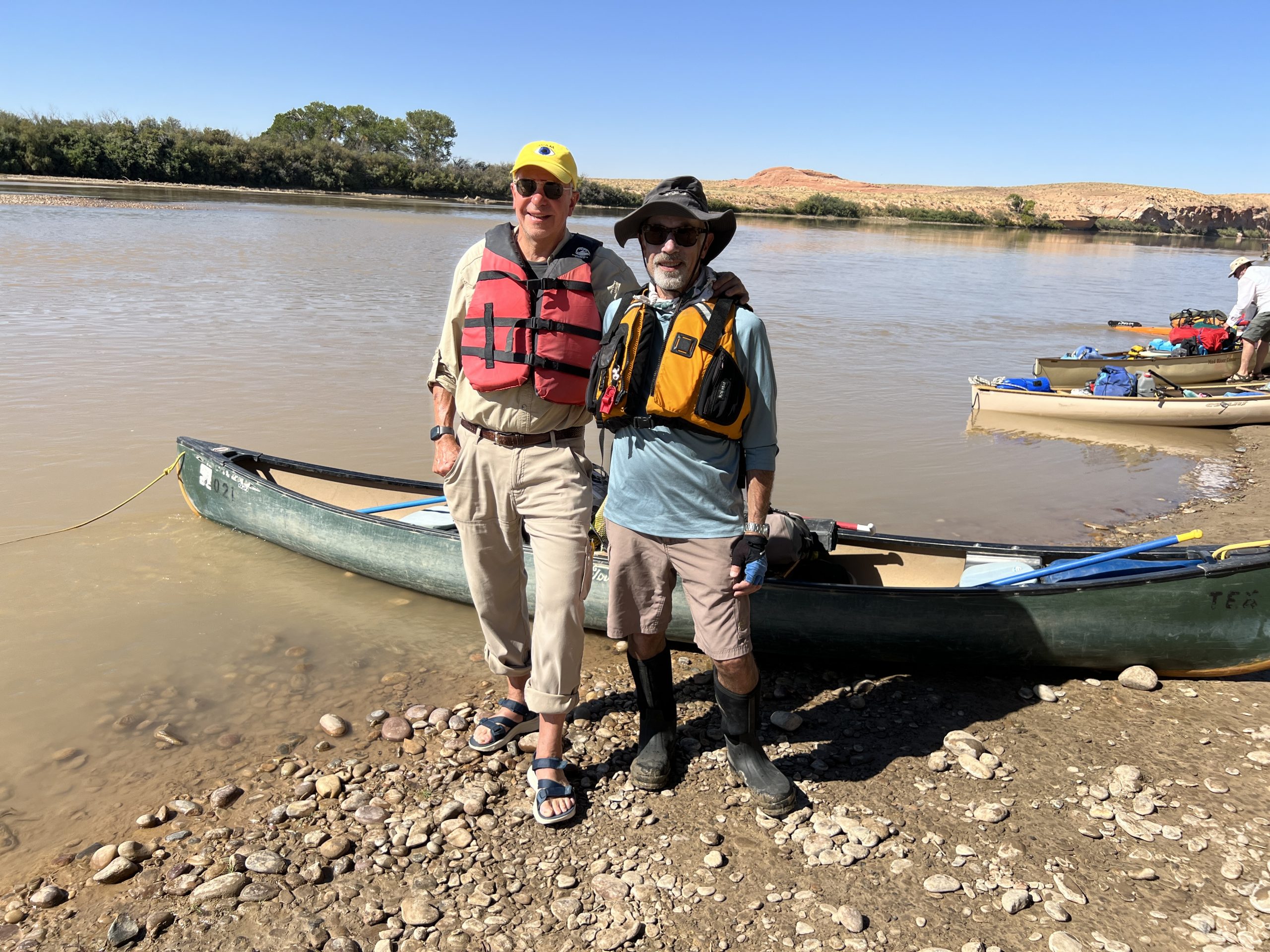
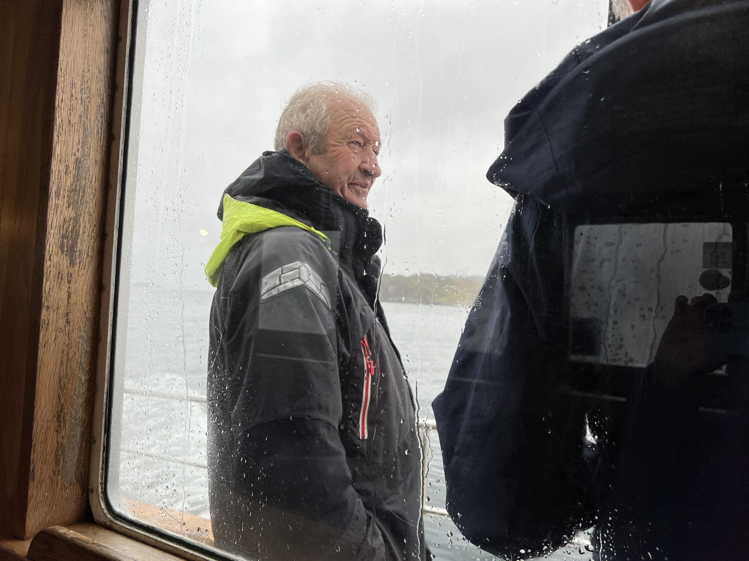
We rented a canoe, paddles, life jackets, and a portable toilet from Tex’s Riverways, an outfitter in Moab, Utah, that’s been in business since 1958. The plan was to paddle through all of Labyrinth and Stillwater canyons, which have no whitewater beyond a few riffles, and thus can be run by non-experts.
In nine days, a jet boat would pick us up a few miles beyond the confluence of the Green and Colorado rivers at the last campsite before Cataract Canyon. Cataract has 14 miles of rapids in its 46-mile length; some are Class V, defined as “extremely long, obstructed, or very violent rapids which expose a paddler to added risk.” The jet boat would then take us up the Colorado from the confluence to a takeout from which we’d ride a Tex’s Riverways bus back to Moab.
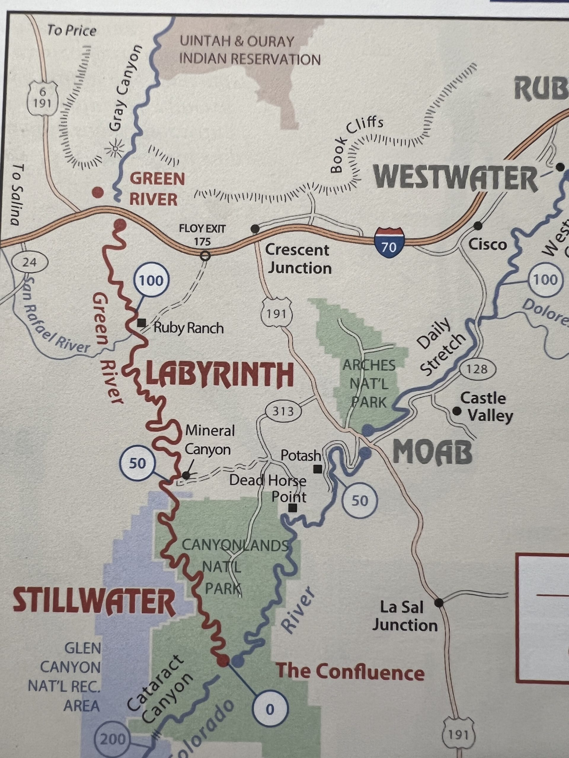
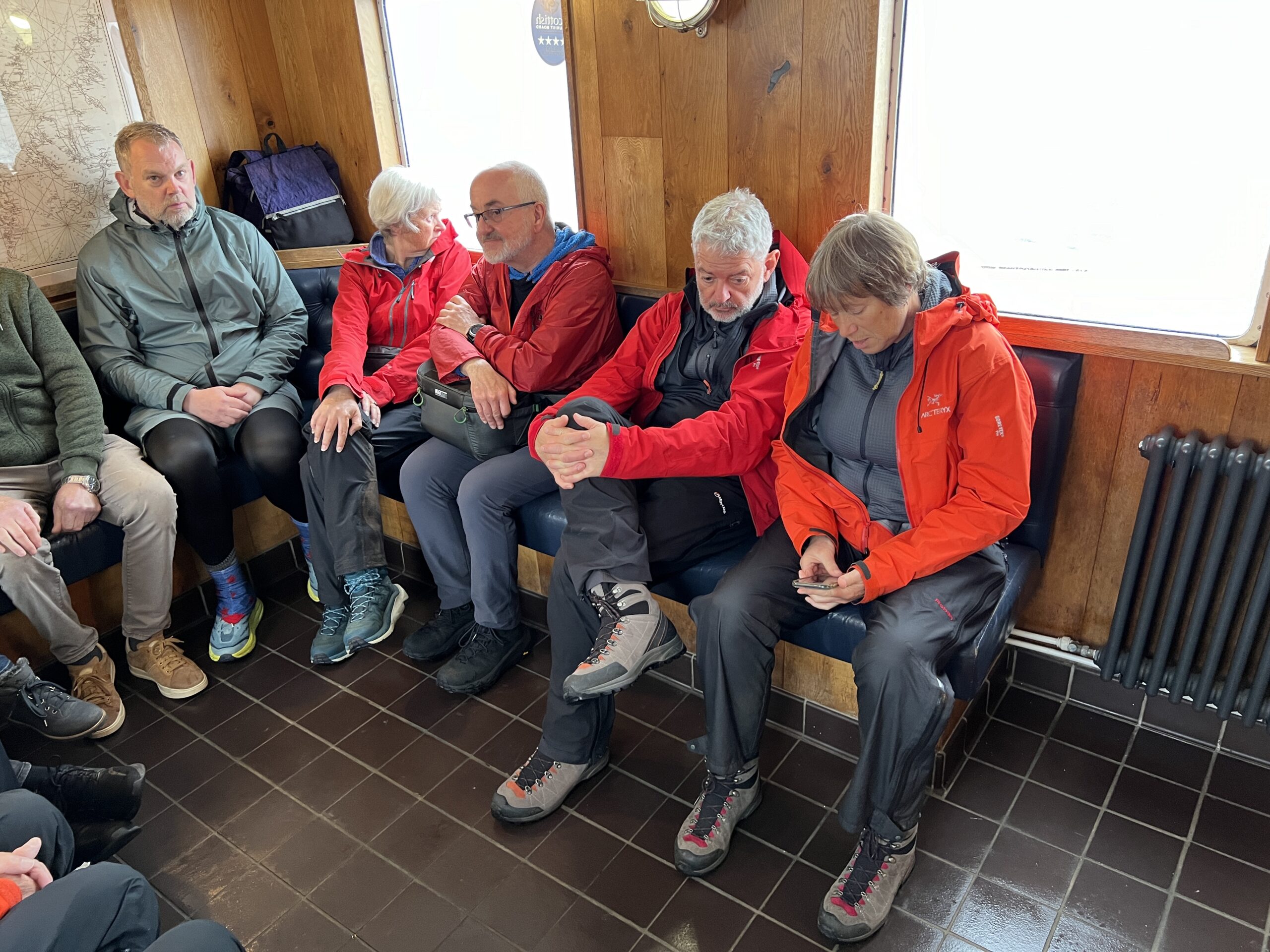
We left Moab in a van with about 10 other people soon after 9 o’clock in the morning. Half the trip was on gravel roads through rolling desert scrubland.
The put-in was at a place called Ruby Ranch. There there were fenced and irrigated fields nearby and a few buildings visible in the distance. A dozen groups were loading boats–canoes and kayaks–at the the same time we were. Most of the trekkers were about our age (which is never a surprise), although there was one family with children, and three young women on stand-up paddle boards piled high with camping equipment.
Our boat was loaded to the gunwales; its cargo included 18 gallons of water. You can precipitate silt out of river water with alum (a procedure called “flocculation”) and then run it through a filter, but most people carry drinking water if they have room, which we did just barely.
We left a few minutes before noon.
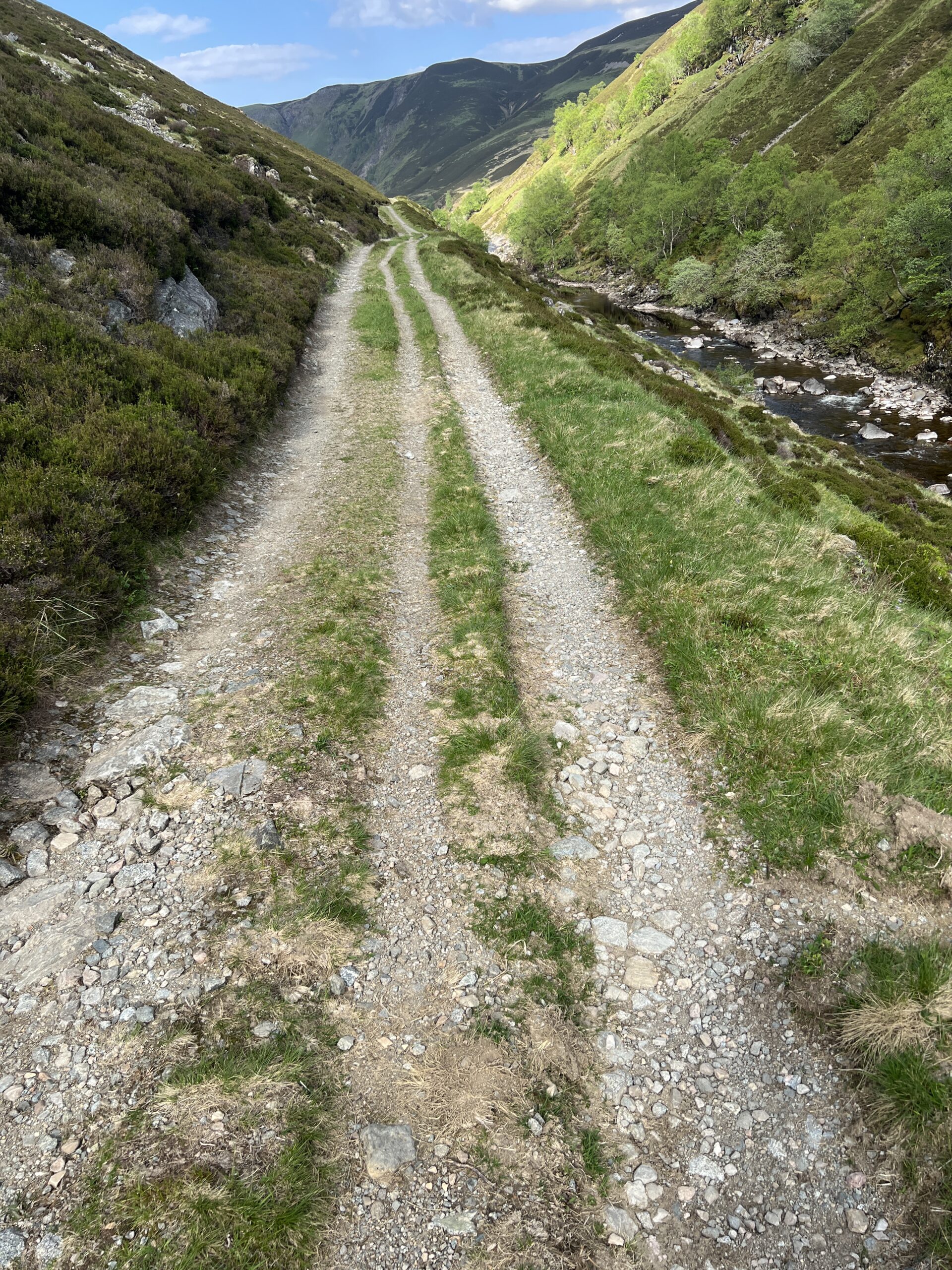
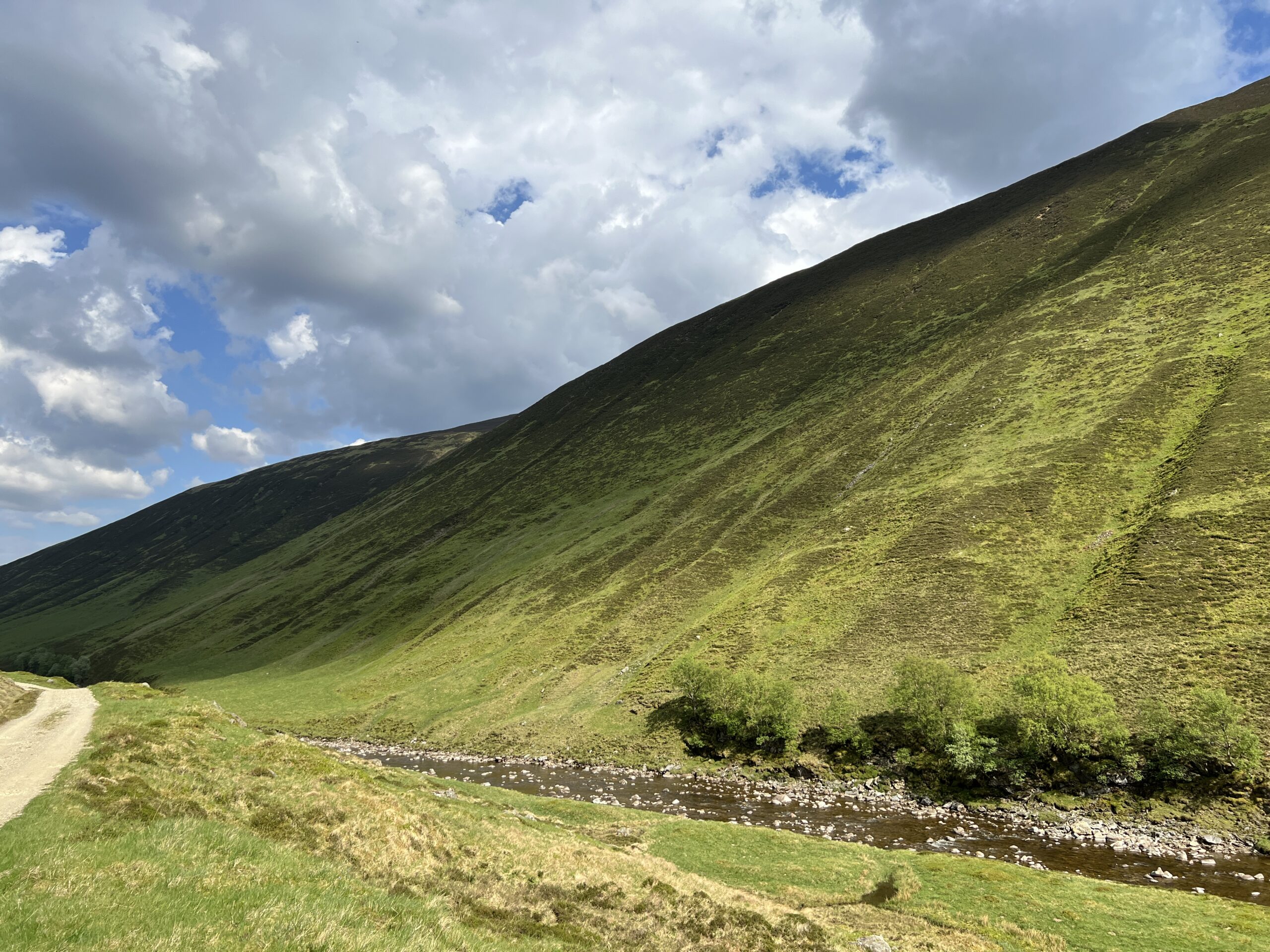
For a while both sides of the river were flat above the fringe of tamarisk, which created an unappealing visual and physical obstruction. In fact, the spindly plant, which can grow more than 30 feet tall, formed a hem between water and rock in all but a few places the entire length of the trip. It’s invasive, of course.
Tamarisk goes back a long time and has always been trouble. In Book 6 of “The Iliad” Homer writes:
. . . But Menelaus lord of the war cry had caught Adrestus alive. Rearing, bolting in terror down the plain his horses snared themselves in tamarisk branches, splintered his curved chariot just at the pole’s tip . . .
Exactly when the plant arrived in the United States is uncertain, but by the 1870s it was being used for erosion control on ranches and, unbelievably, as an ornamental in cities. Its growth became uncontrolled in the second half of the 20th century.
When I went through Desolation Canyon on the Green, and Westwater Canyon on the Colorado, in the early 1980s there wasn’t nearly as much tamarisk as there is now. When Edward Abbey rafted through Labyrinth, Stillwater, and Cataract canyons a few years before that, the river bottoms where his party camped had “jungles of tamarisk [which] does not belong here, has become a pest, a water-loving exotic engaged in the process of driving out the cottonwoods and willows.”
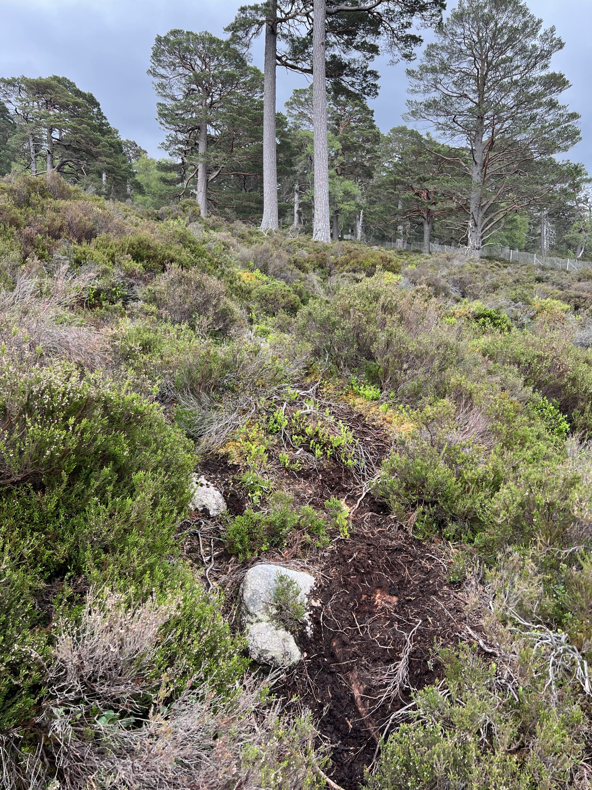
In many stretches of the Green that work is complete. Tamarisk often makes leaving the river and getting to the canyon wall impossible, with sandbars the only place where you can pitch a tent.
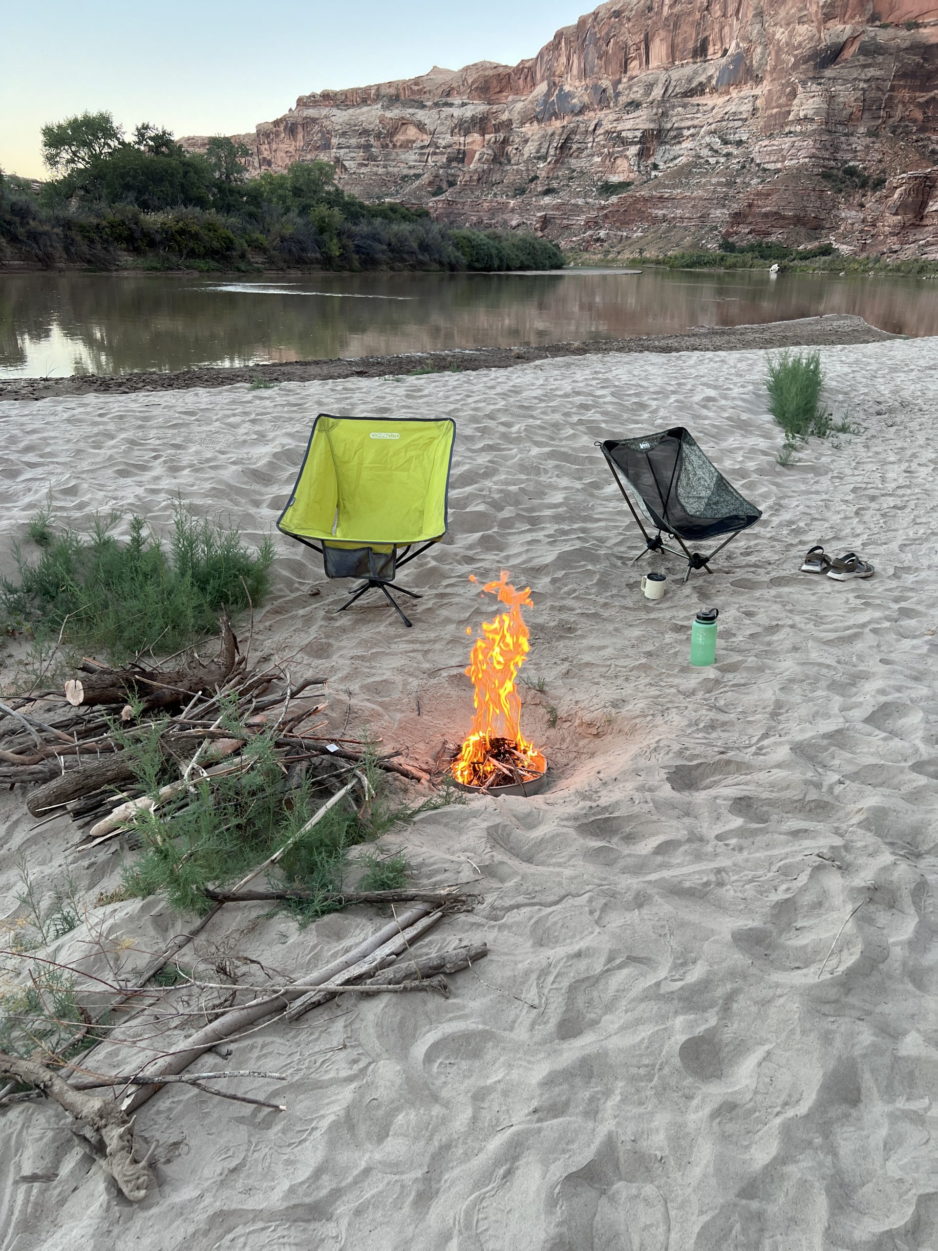
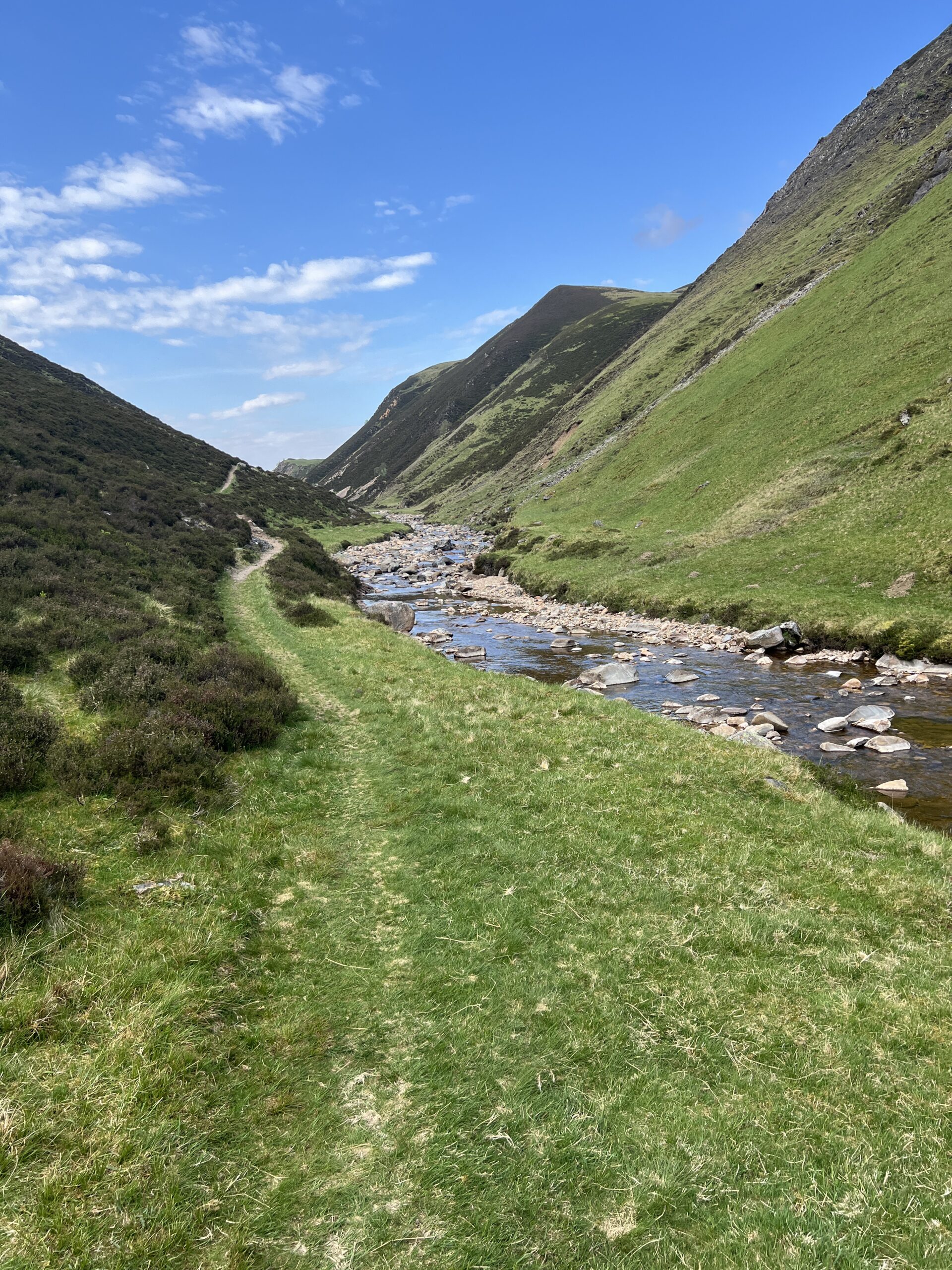
As we floated along there soon began to be rock walls and cliffs on one side of the river or the other, but never both. Usually they were on the outside of curves, where the flow is faster; on the inside curves were mud and sandbars.
We passed a few other groups, including four red canoes from our outfitter, and two other canoes rafted up and pulling a white-and-pink inflatable sea monster. The current was almost imperceptible when traveling with it, but strong when going against it, especially in our craft.
We stopped on the left shore for a lunch of leftover pizza from the night before. Larry got out in his muck boots and immediately sunk so deep in the mud he could barely move. Keeping mud out of the boat would become a theme of the trip. So would finding places to camp that were dry and not on the far side of great wallows.
A friend of Larry’s who’d done this trip several times had given him a list of possible camping spots. By mid-afternoon we were starting to look for one. We rejected a site that would have required carrying our stuff 30 vertical feet up a bank to a sandy clearing. We eventually found one on an island off a red-rock bowl on the right bank.
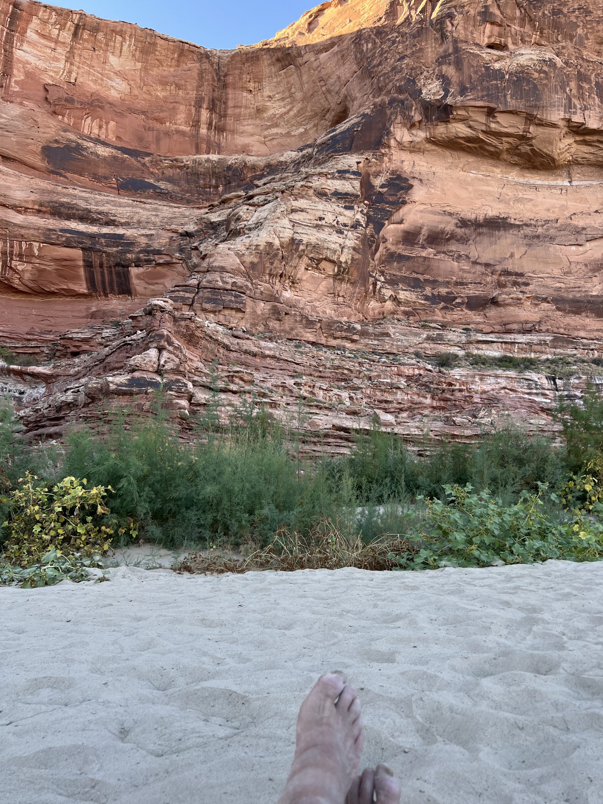
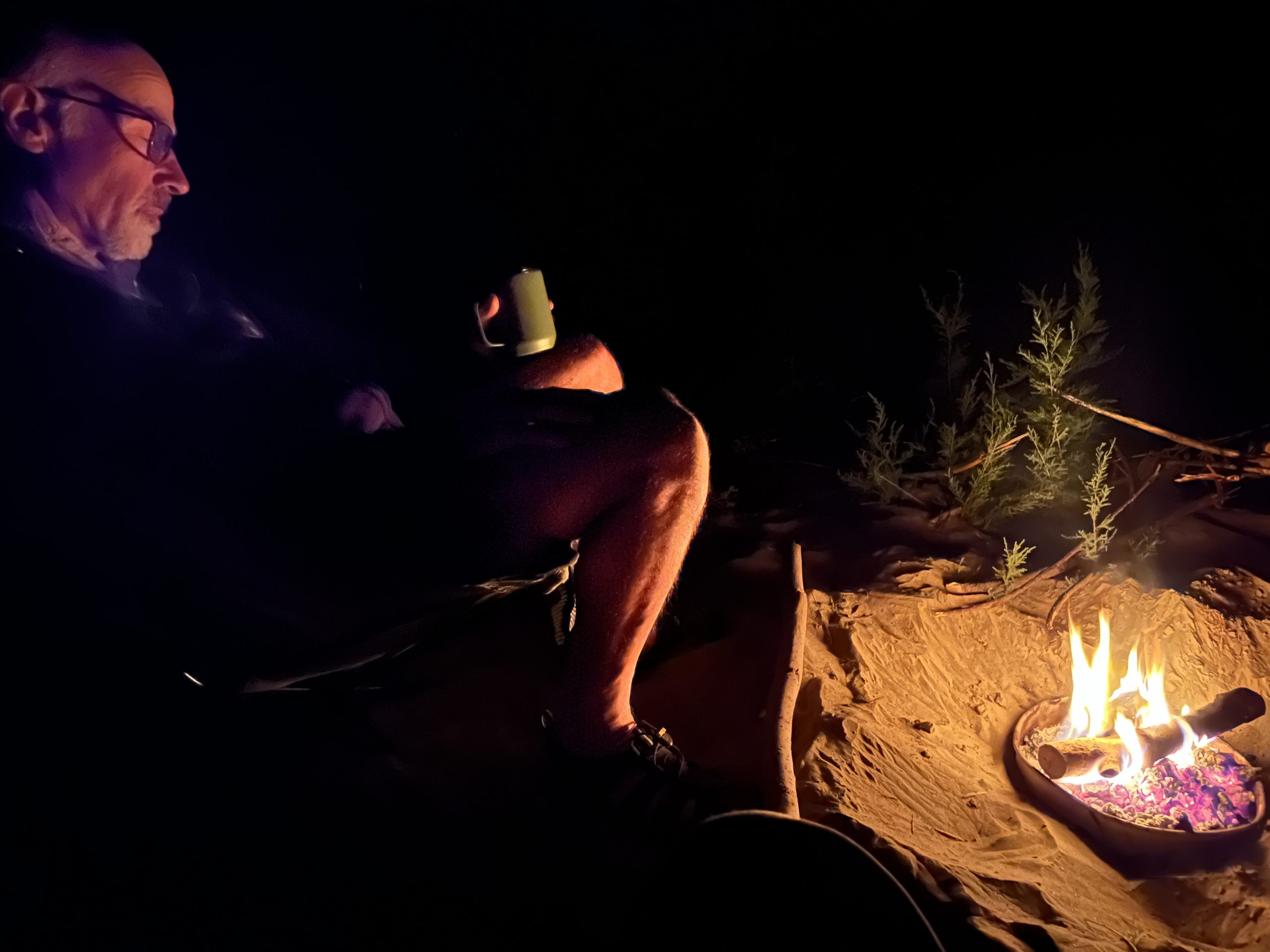
The sand was flat and dry, and there was enough driftwood for a small fire on our fire pan, which was the size of a trashcan lid. Fires on sand or rock are prohibited.
We heard animal noises that night. Larry wasn’t sure what they were, but I think they were from beavers. I’d seen branches with telltale gnaw marks when I’d gone looking for wood.
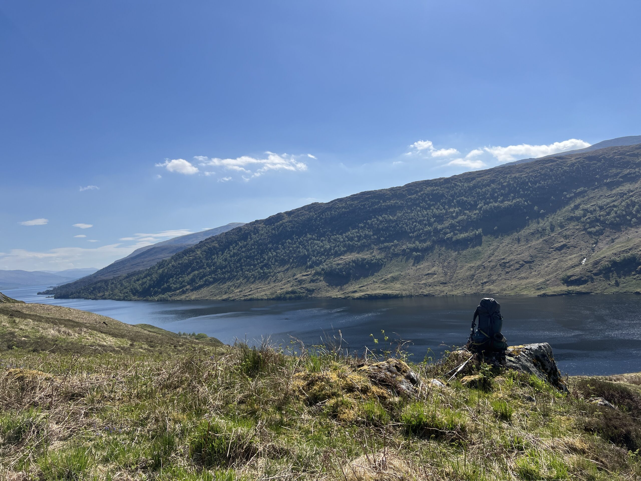
In March 2024, my friend Larry Abramson and I learned that we had once again not won in the lottery to get a permit to paddle on the Smith River in Montana. Instead of just hoping for better luck next year, we decided to take a trip on a river where it was still possible to get a permit for the season ahead–the Green River in southeastern Utah.
In the early 1980s I’d taken raft trips through two of the Green’s white-water canyons–Desolation and Gray. We chose a stretch through two canyons–Labyrinth and Stillwater–where there was no white water. Larry did the planning and rounded up eight interested people. We’d take canoes and go in early October, when the weather was cooler and the bugs, we hoped, would be gone.
Over the ensuing months people dropped out by ones and twos until it was only Larry and me.
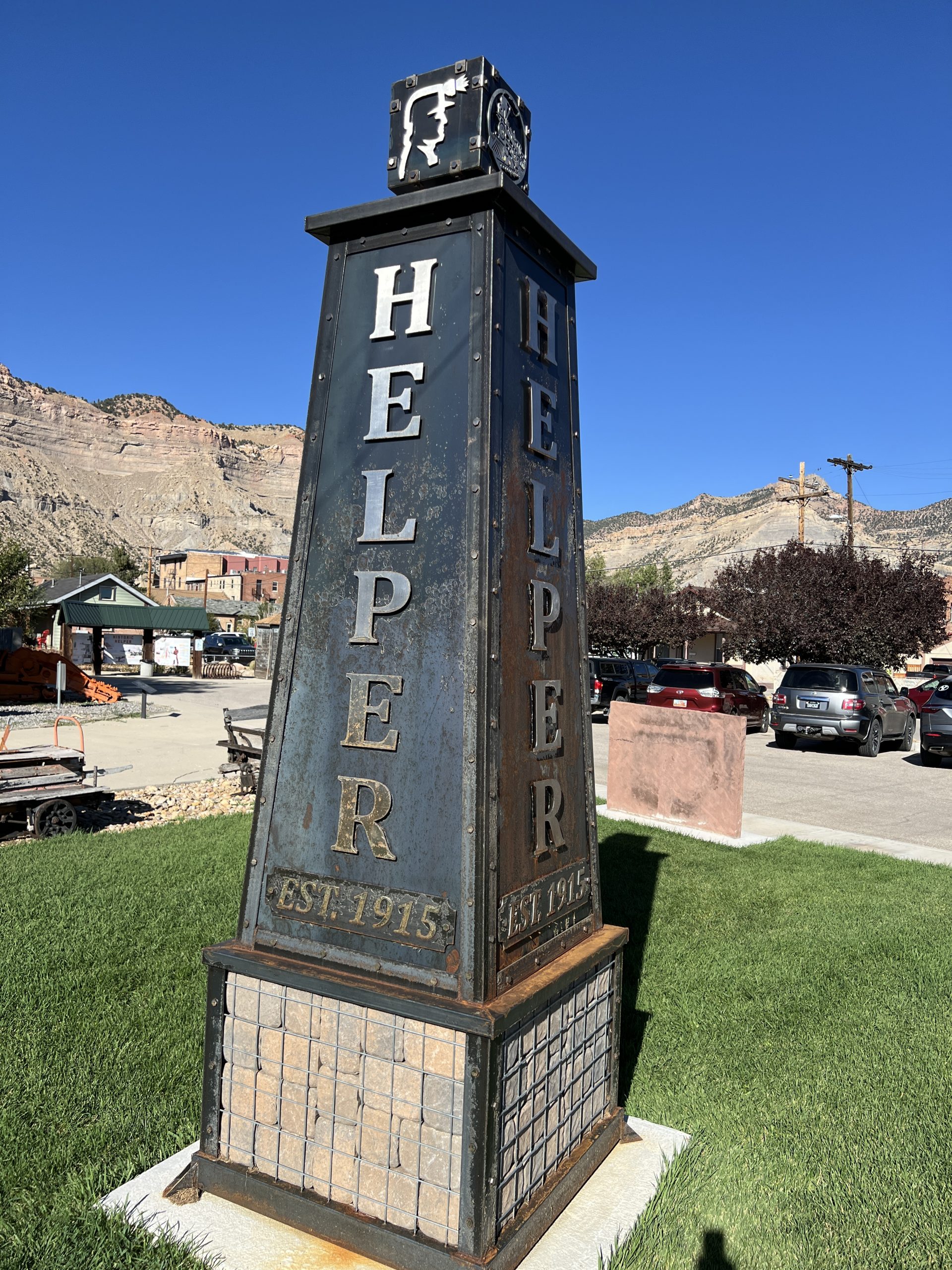
He picked me up at the airport in Salt Lake City on the last day of September. Our destination was Helper, a town 116 miles to the south. We’d spend a night there and then go on to Moab, where we’d spend another night before rendezvousing with the outfitter who’d take us to our put-in on the Green River.
Helper seemed like the right place to stop on my first road trip in the West in many years. The name was friendly, transparent, optimistic, and had a touch of jocularity. It sounded All-American, which is how I think of this part of America in general.
Larry had driven down from Missoula, Montana, where he and his wife, Anita Huslin live. He was in a 2021 Ford FX4 pickup truck they’d acquired since I’d last seen them a couple of years earlier. It was their first pickup since moving to Montana 12 years ago, and from it I concluded that they now thought of themselves as westerners.
I met Larry in the 1980s when I did contract reporting for National Public Radio and he was the assistant science editor. He went on to become the National Editor, education correspondent, Pentagon reporter, and fill-in foreign correspondent in Israel. He eventually took a buyout and became dean of the University of Montana School of Journalism. Recently retired from that, he was filling his time as a ski patroller and volunteer teacher–a good tail to a distinguished career.
I knew Anita from The Washington Post, where she worked for many years before also going to NPR, and thence on to other things. Alas, she would not be on our trip down Labyrinth and Stillwater Canyons. She had to work.
As we traveled south out of Salt Lake City we saw Utah Lake out of the passenger-side window as we passed Orem and Provo. The water eventually disappeared and was replaced by sere scrubland sculpted by gullies and ridges. To the southeast were tan cliffs with green and black horizontal stripes. Far to the southwest were mountains.
We got to Helper in the middle of the afternoon. It was bright and hot. We’d both expected that by the last day of September fall weather would be sneaking in, but the only evidence that summer was over—or almost—were occasional stands of trees trees turning yellow and orange.
We turned left off the highway to get to downtown Helper, but when we turned onto Main Street we found it blocked off, with a half-dozen cars and trucks in front of us. Right in front of us was a Sinclair gas station with four trucks from the 1940s in parallel bays, ready to be dispatched. We turned around. We eventually found our Airbnb on Locust Street, one of about 20 identical houses lining both sides of the street.
“Company town,” Larry said.
The house was a bungalow with a concrete front porch. There was a living room with a bedroom off it, and beyond that a kitchen with another bedroom (no door) off it. The rear of the house was a bathroom and a laundry room. The backyard, also concrete, had two porch chairs, and a cat on one of them. The rental folder said the house was built in 1911, but gave no more history.
We brought our stuff in and then headed out to explore Helper.
It had been a coal-mining town, once a big one. A little mining was still being done on the table lands around it. It got its name because trains coming from the south needed to temporarily take on a “helper” steam engine to get them out of Price Canyon, where the town is located.
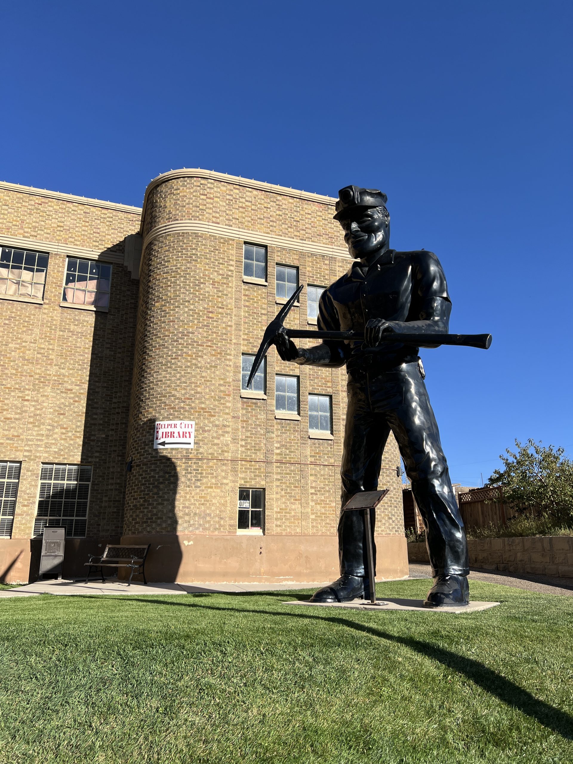
At the top of Main Street, a triple life-size statue of a miner in faux obsidian guarded City Hall.
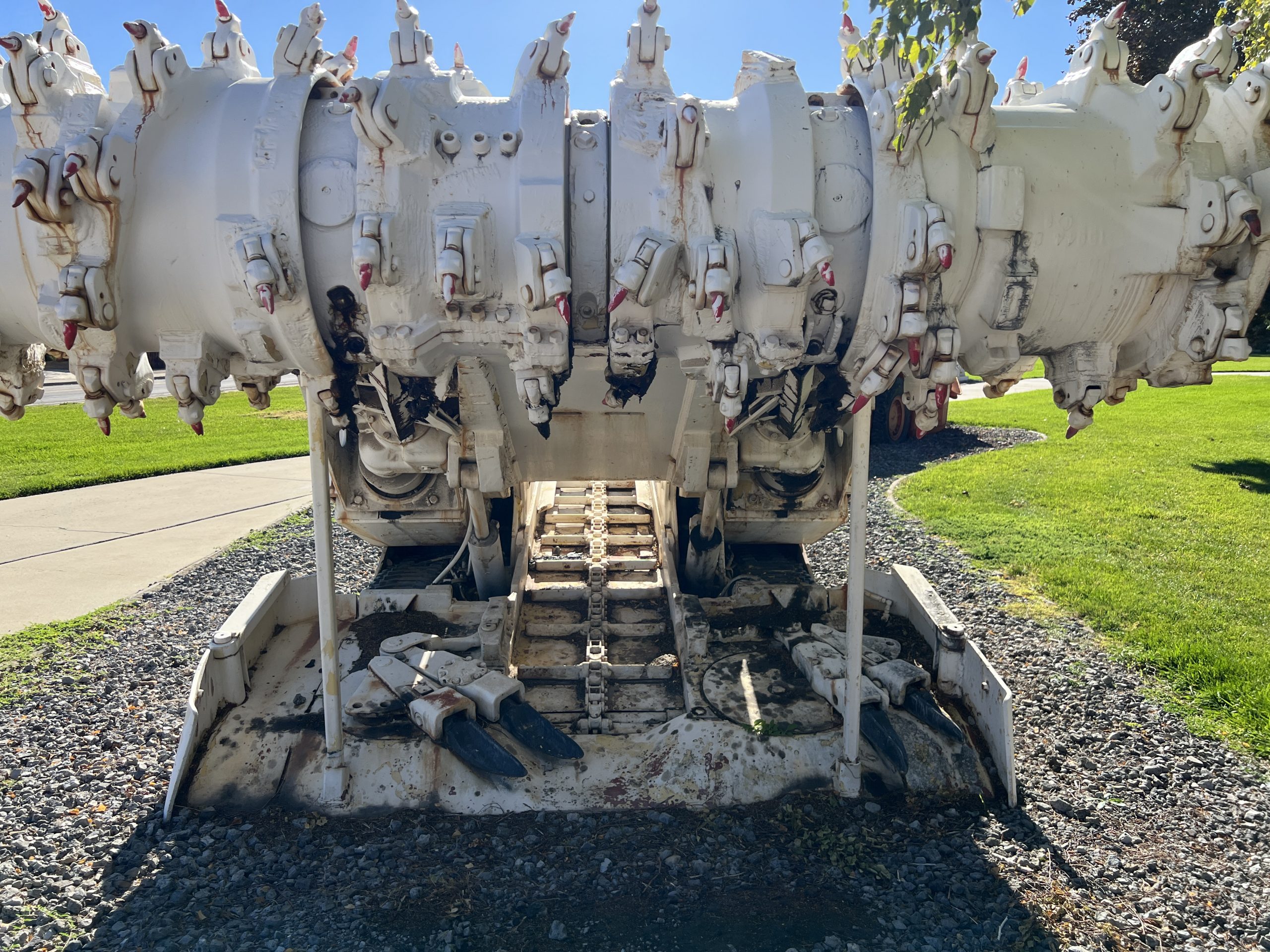
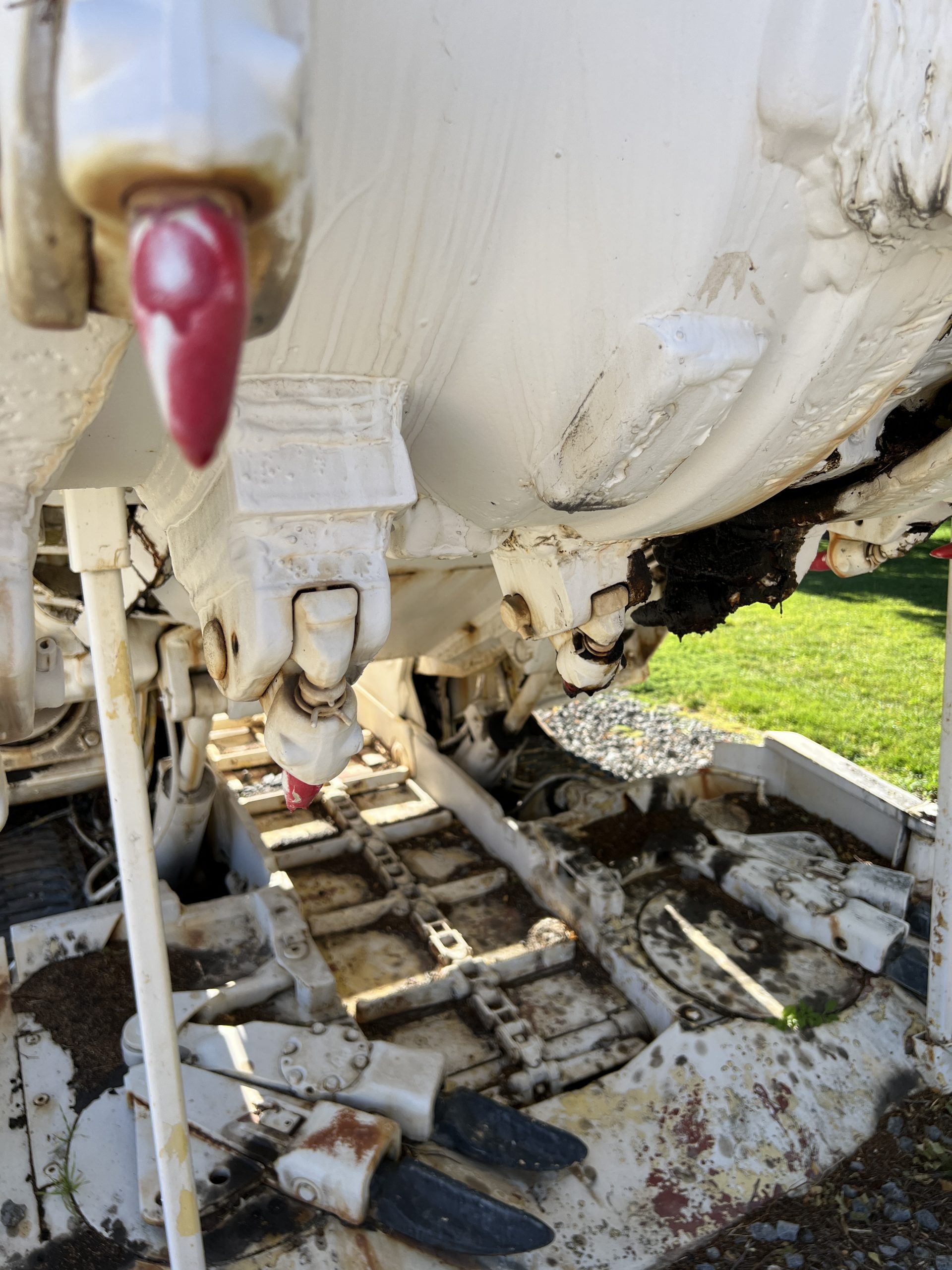
We hadn’t gone more than a few blocks before we came to a grassy park with heavy equipment on it—possibly the Department of Public Works’s yard, except that as we approached none of the pieces looked familiar. It was, in fact, an outdoor display of retired mining machinery.
The coal mines of the “Carbon Corridor” (which includes the towns of Price, Wellington, and East Carbon to Helper’s southwest) are deep mines, not open-pit ones. The machines on display included ones that ground the coal face with rotating or shearing teeth in fixed upper and lower jaws; one that picked up the pieces while simultaneously propping up the ceiling; another that passed the pieces backward to trams that took it to the surface; and ones performing myriad other tasks. Their designs were phantasmagoric; some looked like deep-sea fishes brought to the surface, where they grew to million-X size.
There were several commemorative monuments in the park. One listed “Coal Mines of Carbon County Utah,” with 79 listed, along with their dates and the number of fatalities in their years of operation. The biggest death toll was 277 for Castle Gate #2 and #4, which operated from 1888 to 1970.
More than 200 of those deaths were from the area’s worst disaster, which occurred on March 8, 1924. There were two explosions, the first caused by a miner igniting a carbide lamp that went out, the second by an inspector who did the same thing after the first explosion blew out everyone’s lamps. Later, I saw a broadside on the door of a closed theater advertising a “short documentary,” shown several months earlier, commemorating the centennial of the tragedy.
Driving into town we’d seen people with folding chairs walking toward Main Street and wondered if there was going to be a parade. Now, as we walked on from the machinery museum we passed people returning from downtown, some carrying chairs. We asked a policeman in a cruiser on a side street what was going on.
“It’s cross-country race for the junior high team,” he said.
“It goes down Main Street?”
“Yes, and down this street, too,” he said, indicating the one he was parked on. “They go around three times. This happens twice in the fall.”
We asked about mining operations. He gestured up a ridge on the far side of the highway we’d come in on.
“There’s still some up there, but most of the old mines are sealed. Some have fires in them that are still burning. The biggest mine has a long shaft that comes out of the ground miles down there.” He pointed to the south.
“Is it worth going to see?”
He thought a moment and seemed to be weighing our adventurousness. “Only if you want to see a big pile of coal.”
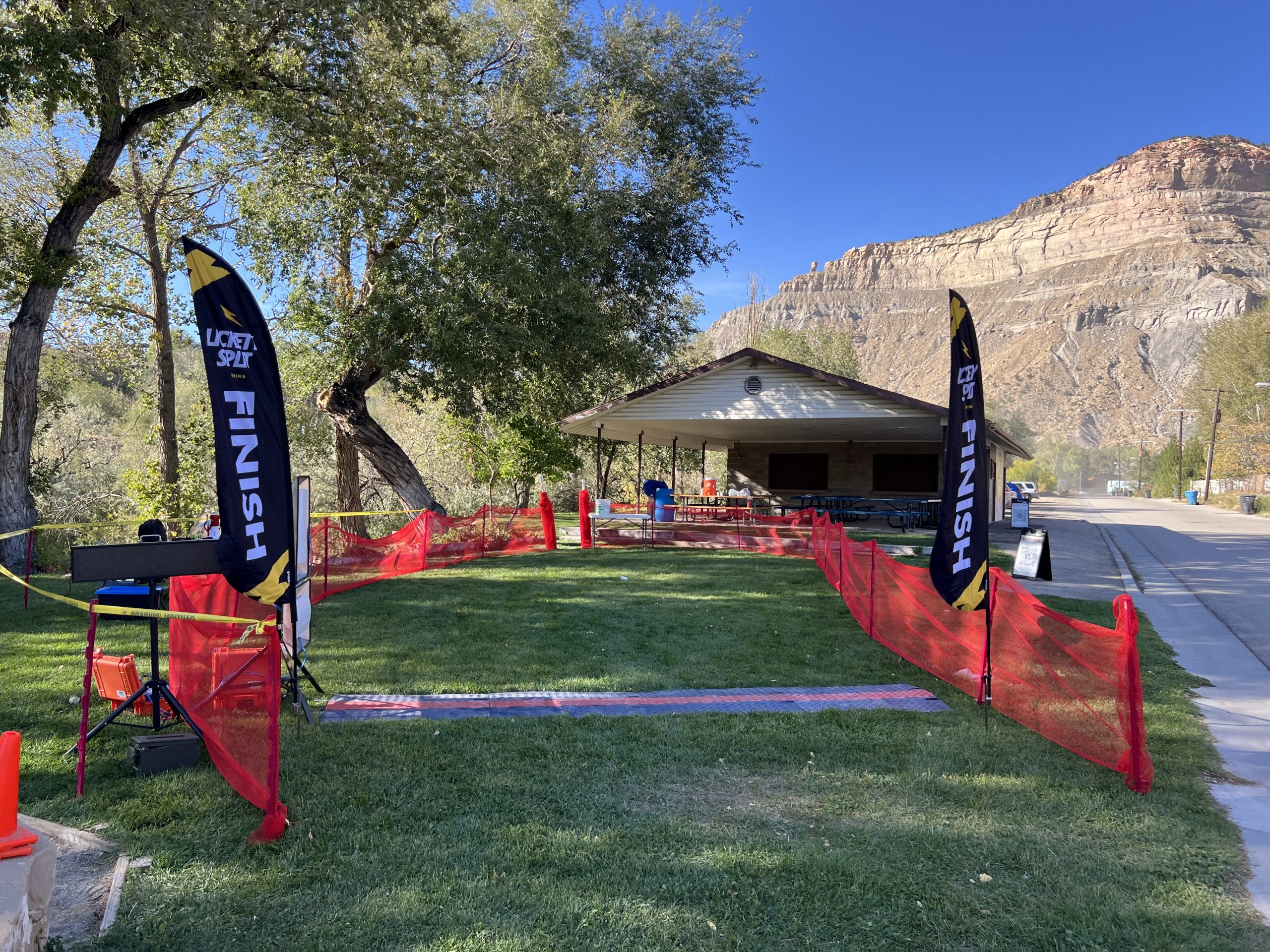
We soon noticed runners among the people walking toward us, singly and in groups, many carrying water bottles. The gangly adolescents wore singlets with maroon ram’s horns on the chest, probably the school mascot. The girls were taller than the boys.
A few blocks farther on we passed a small park with a playground. Vertical “FINISH” banners stood motionless on either side of the chute. A man was cleaning up what had probably been post-race drinks and snacks. There was an orange water jug on a picnic table.
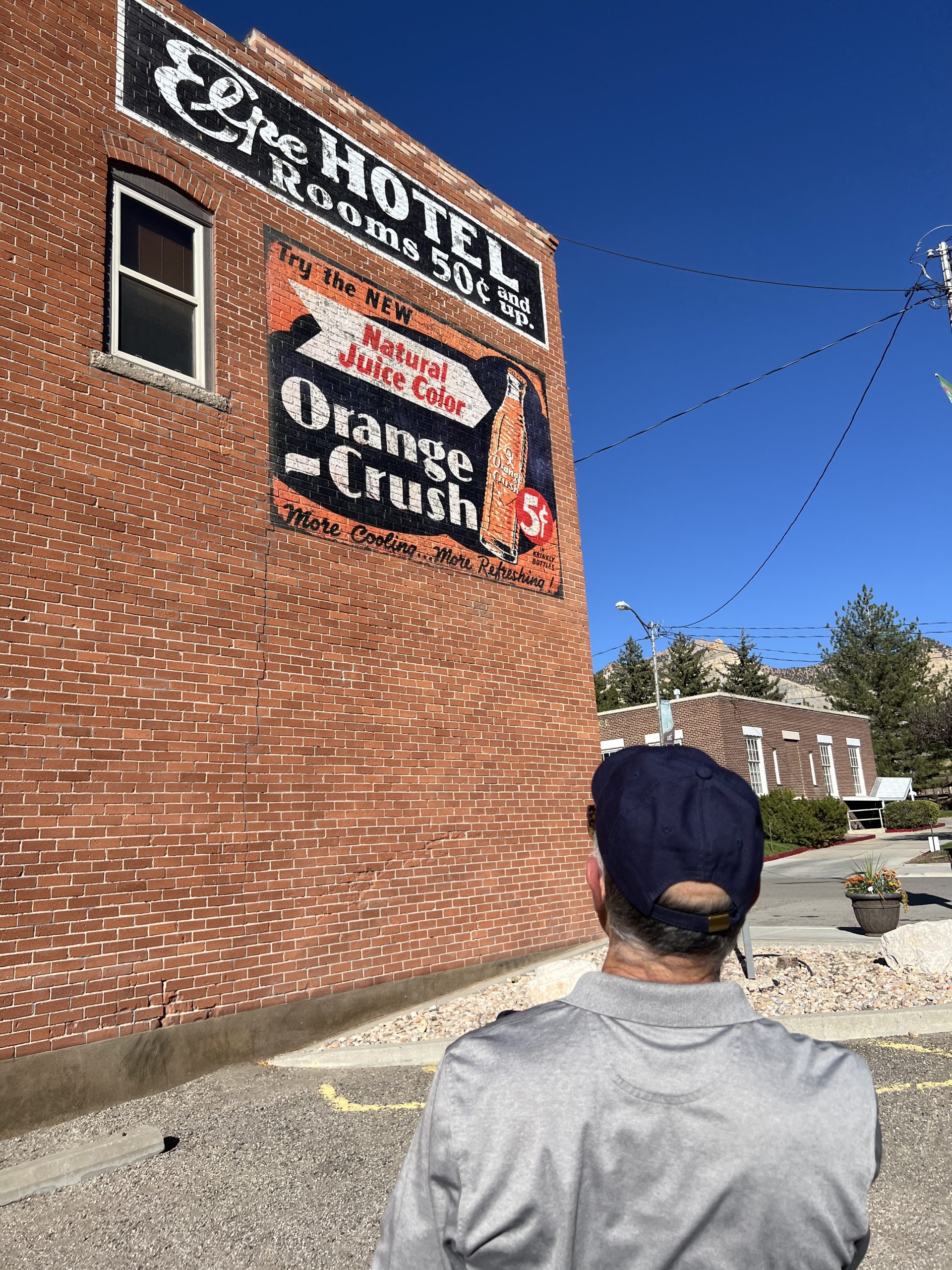
We turned down a side street to get to Main Street and passed a brick building with a painted advertisement high up on the wall: “Elpe Hotel Rooms 50c and up” and below it was “Try the new natural juice color Orange Crush 5c. In Kringle bottles More Cooling . . . More Refreshing.” The paint was unfaded and seemed restored, although on original lettering.
From the moment we’d entered Helper it was obvious this was a town obsessed with historical preservation.
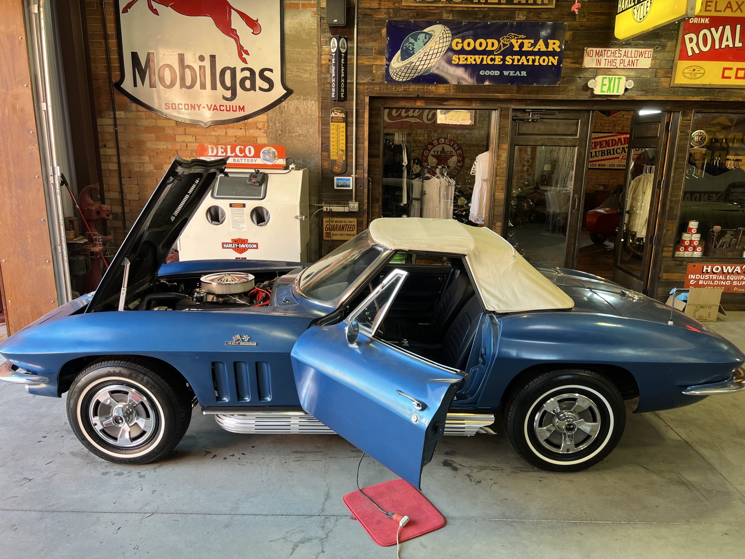
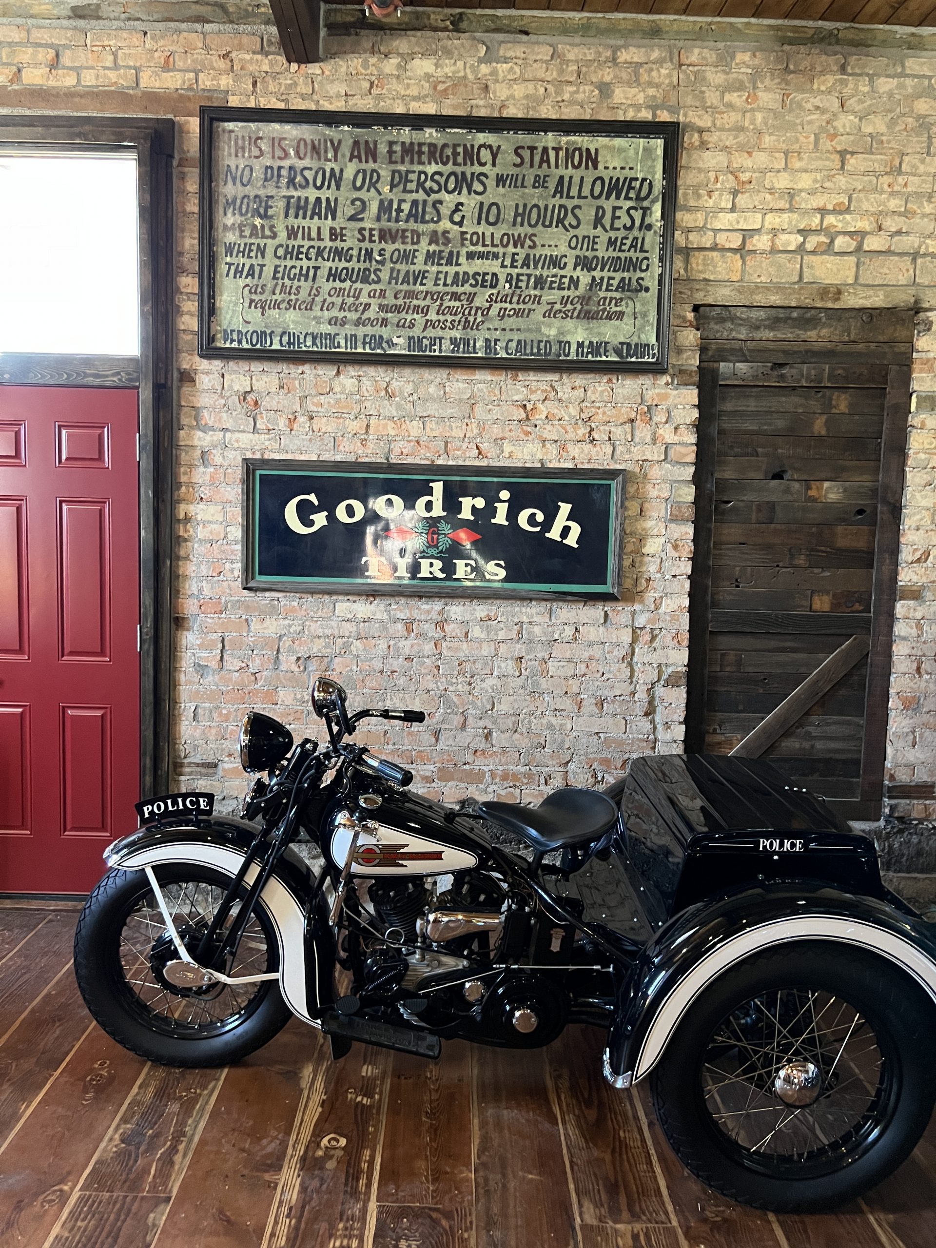
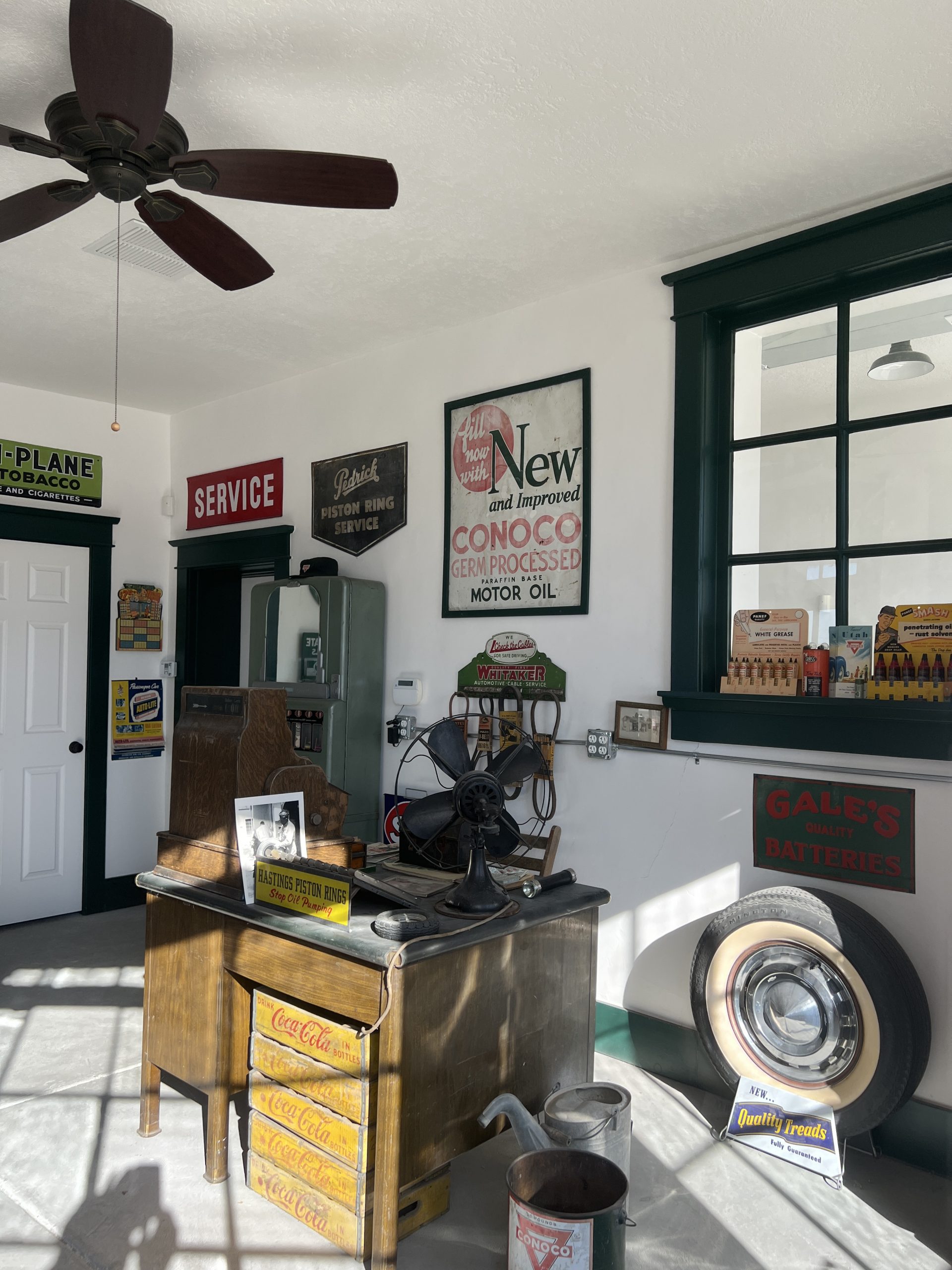
In less than a block we came to an old hotel that was no longer accepting guests. Through the windows next to the front door you could see a room full of shiny old motorcycles.
Beside the hotel was a commercial garage with the door open. An old blue sports car had its hood up, and a light for working under it was on the ground with its yellow cord snaking across the concrete floor. Behind it were two other sports cars (both 1957 Corvettes, we soon learned), one yellow and one black.
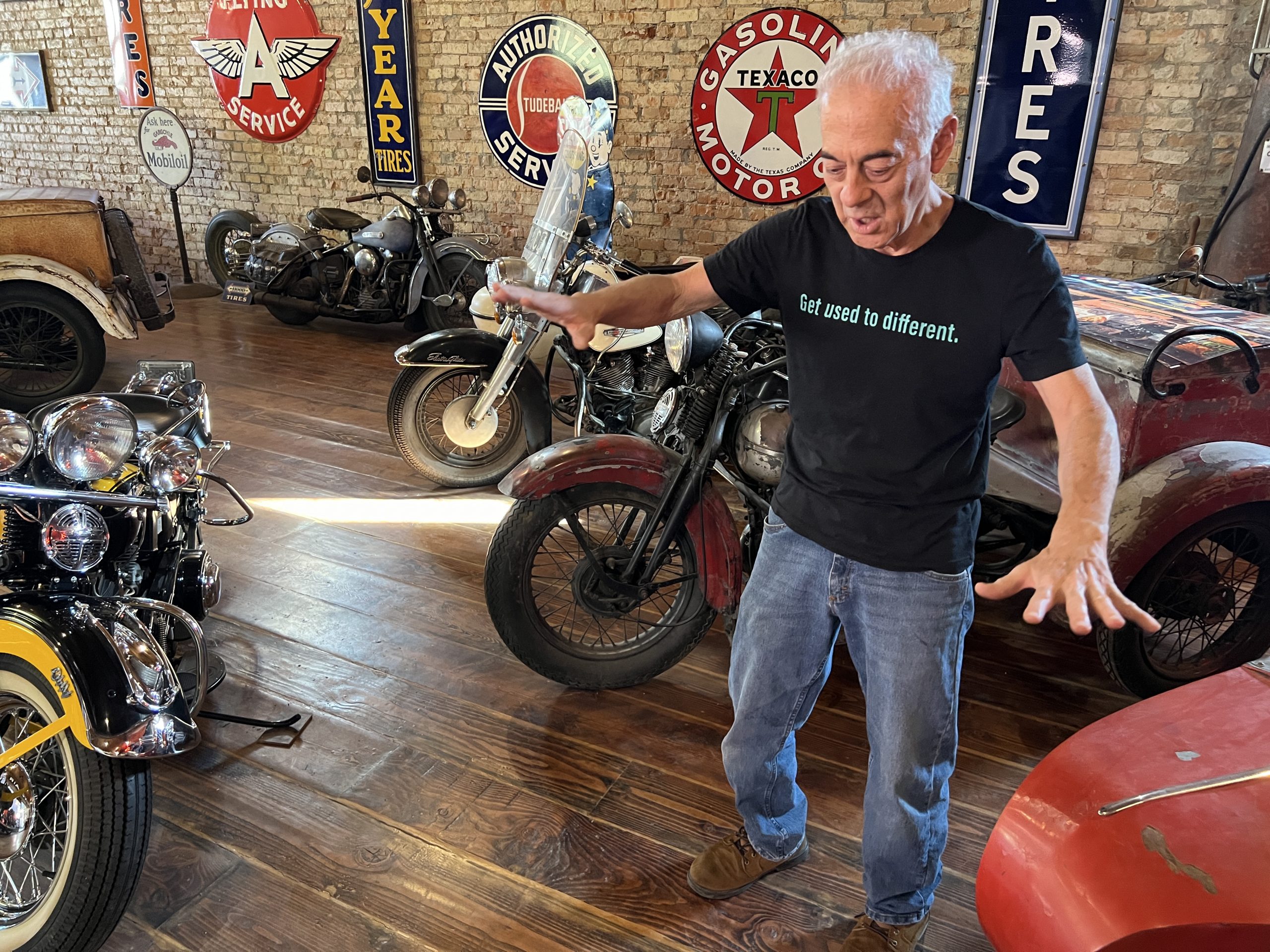
A door off the garage opened into the motorcycle showroom. We wandered in, hesitant and perplexed as to what this business actually was.
A man inside was giving a family a tour of the room, whose walls were covered with signs for gasoline, oil, tires and soft drinks—Mobiloil, Flying A, Texaco, Goodyear, Coca-Cola–well-preserved and from the middle of the last century. When the family departed, thanking the man profusely, we stepped up and introduced ourselves. He was trim, with thinning gray hair and a black tee-shirt with “Get used to different” on it—a good piece of advice, it turned out.
His name was Bob De Vincent, 74, retired from a career as an electronics technician for “the Bell System,” which dated him. He was working on the blue Corvette, and also keeping an eye on the roomful of restored motorcycles—big, small, police, military, sidecarred, three-wheel—that belonged to his younger brother, Gary.
The more we talked with Bob the more opaque this business became. It wasn’t a commercial showroom, although Gary did occasionally sell one of his restored beauties. And advance team for “American Pickers” had been through the week before and loved the place, but they said it wasn’t right for the TV show because not enough things were for sale. The exception were racks of black tee shirts with “Vintage Motor Company” in archaic script on their fronts.
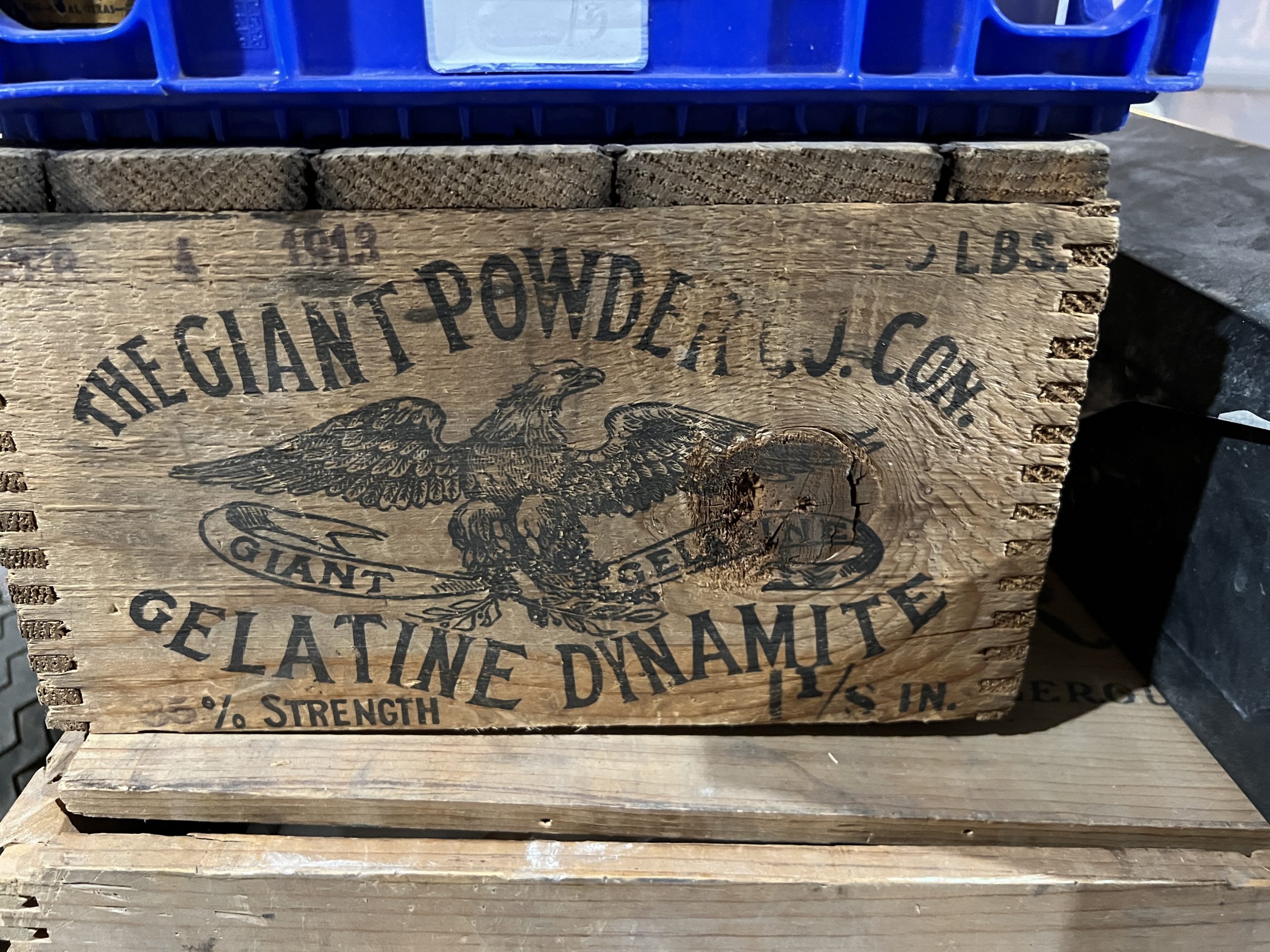
There was also a lot of junk downstairs, in a cellar that went the length of the building. Shelf after shelf held motorcycle parts–gas tanks, carburetors, fenders–and a variety of non-automotive items, including wooden crates that once held dynamite.
I asked what Bob’s brother did that allowed him to acquire such a collection and sell very little of it, but Bob didn’t take the bait.
Cemented to the back wall of the first floor was the most interesting and mysterious item–a sign that appeared to have been written during the Great Depression. It said:
This is only an Emergency Station . . .
No person or persons will be allowed more than 2 meals & 10 hours rest. Meals will be served as follows . . . One meal when checking in & one meal when leaving providing that eight hours have elapsed between meals. (as this is only an emergency station. you are requested to keep moving toward your destination as soon as possible . . .
Persons checking in for the night will be called to make trains.
Was this a service the Lincoln Hotel provided out of sympathy and charitable feelings? Or was it a government service that had been subcontracted out? Bob De Vincent didn’t know, and neither did Roman Vega, the 52-year-old curator of the Helper Museum, whom I called later.
The townsite was originally owned by a Mormon named Teancum Pratt, who settled there in 1881. Pratt had two wives and 11 children with each, and served time in prison for polygamy. He was a farmer and miner who died in 1900 when he fell down a mine shaft.
A marker in the outdoor mining-equipment museum noted that in 1900 Helper had a population of 385 with 16 nationalities represented. “By the 1920s, at least 27 languages could be heard on Helper Main Street,” it said. The population peaked in 1939 at 5,500, and is now about 2,100.
As in eastern coal country, there was lots of labor unrest. In 1903 and 1904, Italian miners went on strike. Mary Harris “Mother” Jones made a visit to support them, but the strike was broken. The Italians were blacklisted from mines in Castle Gate, 12 miles to the north, and many moved on to farm jobs. They were replaced by Greeks.
In 1923, the boxer Jack Dempsey trained in a town eight miles to the west, which was briefly renamed Dempseyville. When he decided against investing in a local mine the name was changed to Coal City. Harry Truman had whistle stops in Helper in 1948 (campaigning for himself) and in 1952 (campaigning for Adlai Stevenson).
By the 1970s, however, most of the mines were closed, and the railroads were less important, too. “When I left in the late 80s all these buildings were empty and some were starting to fall down,” Vega, the museum curator, said of Main Street. “There was a big homeless problem.”
In the early 2000s Helper reinvented itself as an artist colony, with summer courses and eventually a year-round population of painters, sculptors, and fiber-artists. Today, there’s an arts festival in the summer, a film festival held immediately after Sundance, a vintage-car show, and a Christmas festival and parade. Paintings by local artists hung in a gallery above the restaurant where Larry and I had two meals. (It also had once been a hotel.)
Vega returned to Helper in 2013. He’d served at the Army Logistics University in Fort Lee, Virginia, where one of his tasks was to work in the museum. Back home, he volunteered at the Helper museum for three years. When the director quit after the pandemic lockdown, he was appointed.
“It’s been really great to see the city kind of reinvent itself,” he said.
Everyplace we walked in Helper the past was on display in its restored finest. There was lots of old neon and earnest advertisements, with a little contemporary messaging (whose point, to me, wasn’t clear) thrown in.
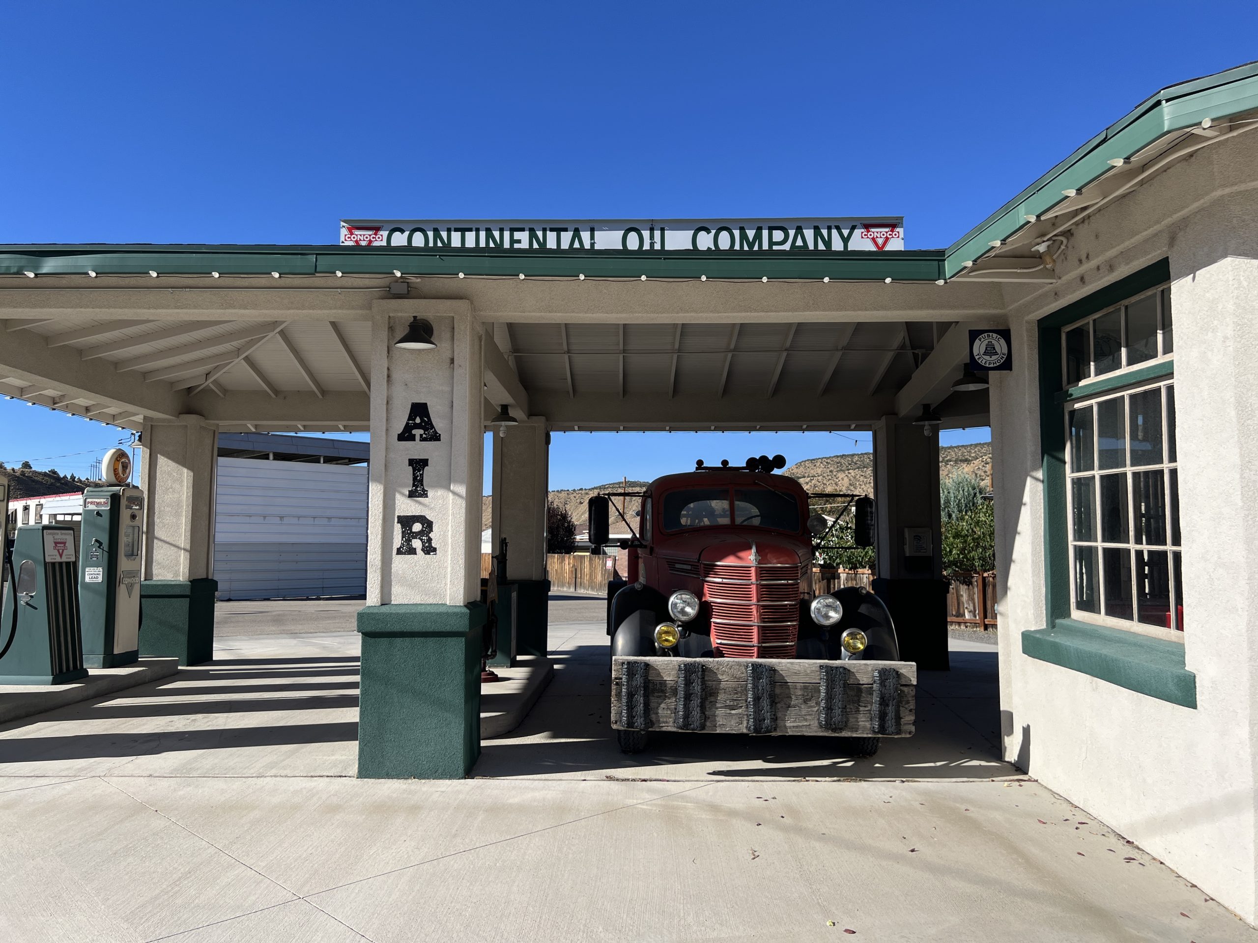
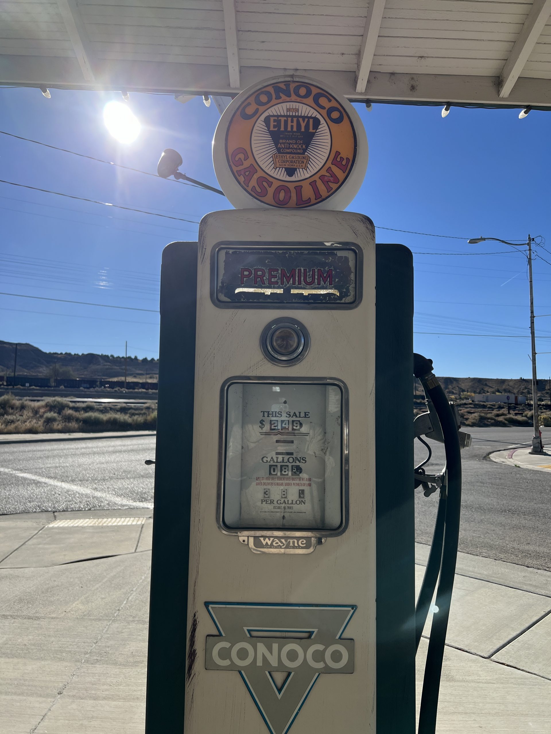
At the end of Main Street was the Continental Oil Company–Conoco–station, which had become an Airbnb. A tow-truck was ready for dispatch. In the office, a four-blade desk fan was ready to turn. The price of gasoline was 38 cents a gallon.
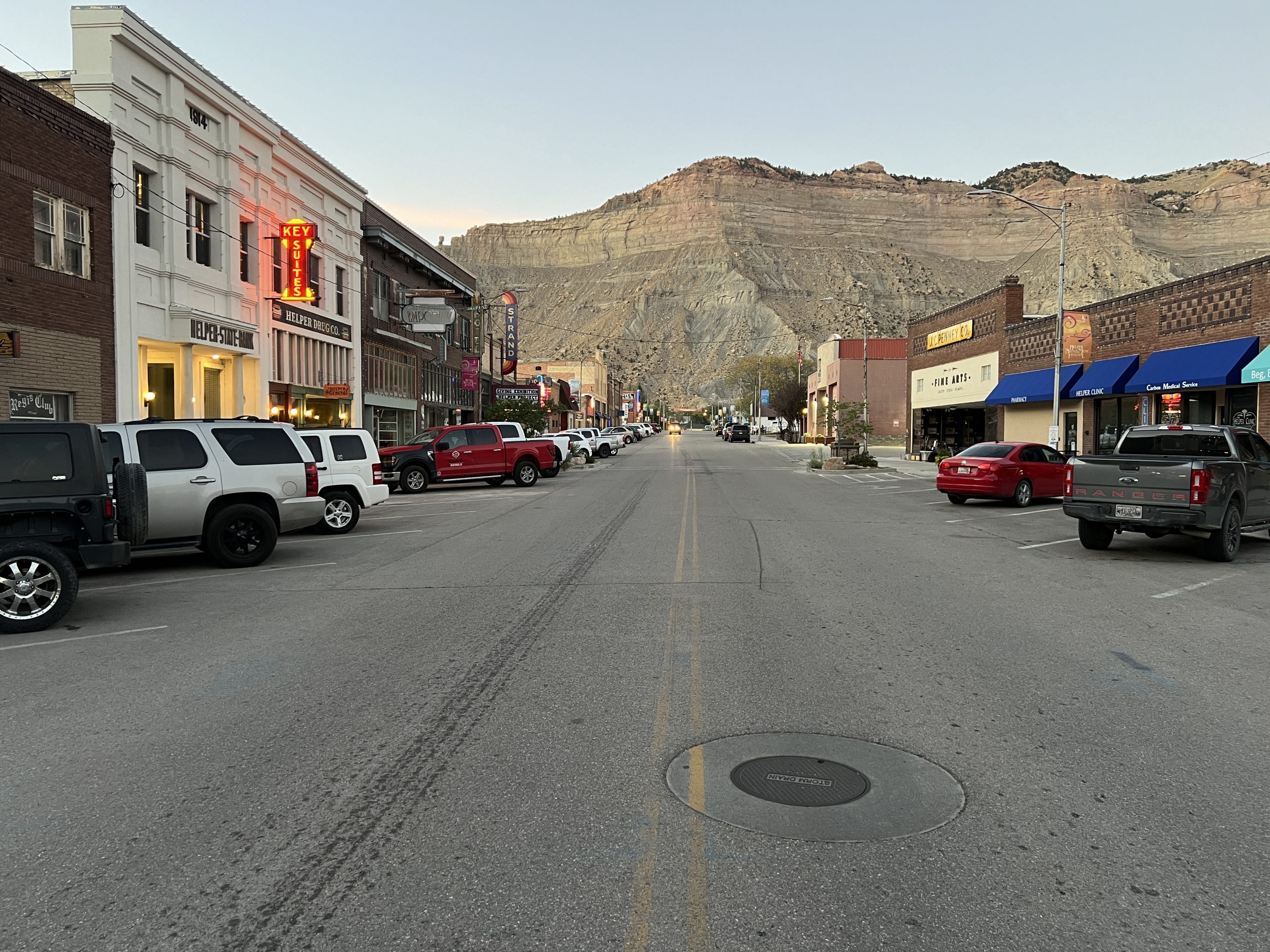
I looked back down Main Street.
In the distance stood the timeless cliffs that were part of the town’s reason for being. The main drag, straight as a spinal column, celebrated a life that had been dead for most of a century. At the far end, a car was heading toward me. I’d soon have to step aside.
Helper was a living thing caught in amber, and still moving.
I’ve finished my crossing of Scotland from the west coast to the east.
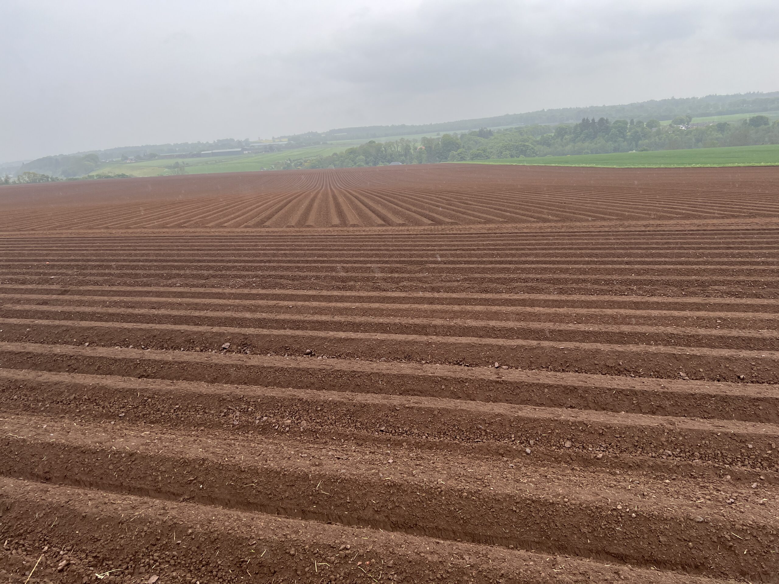
The last couple of days, as always, featured a lot of asphalt road. The landscape of the east coast lacks the wildness of the west, but is still beautiful.
It rained the last day and there was a cold wind off the North Sea. But the weather had been great for most of the two-week walk, so no grounds for complaint.
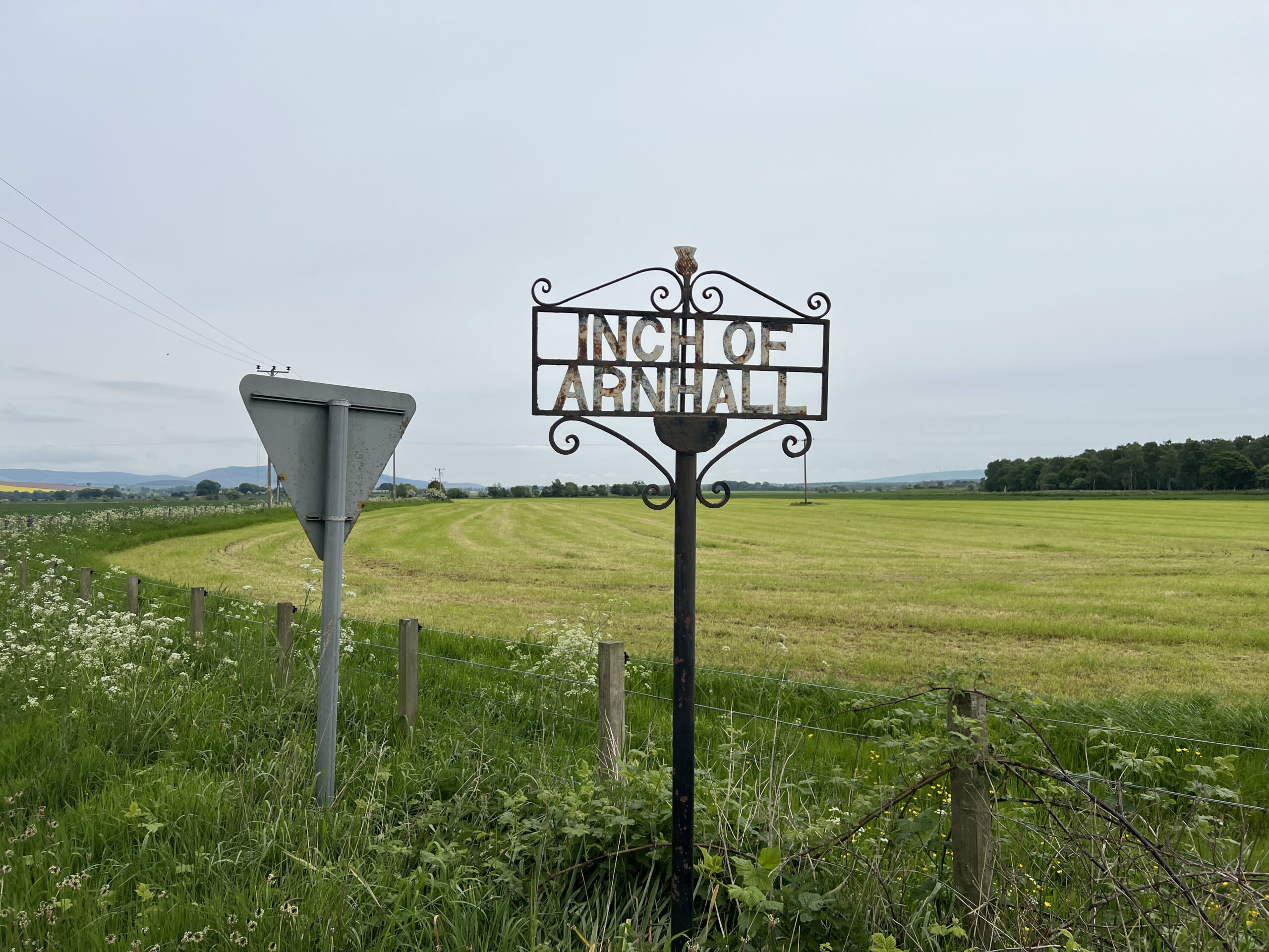
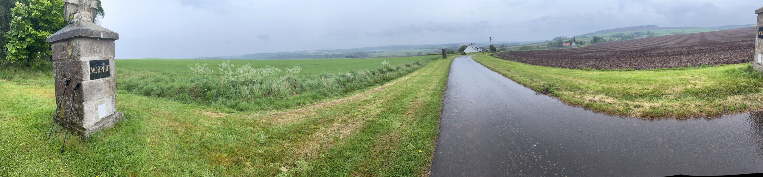
I won’t make my usual joke about the Hill of Morphie, the last climb.
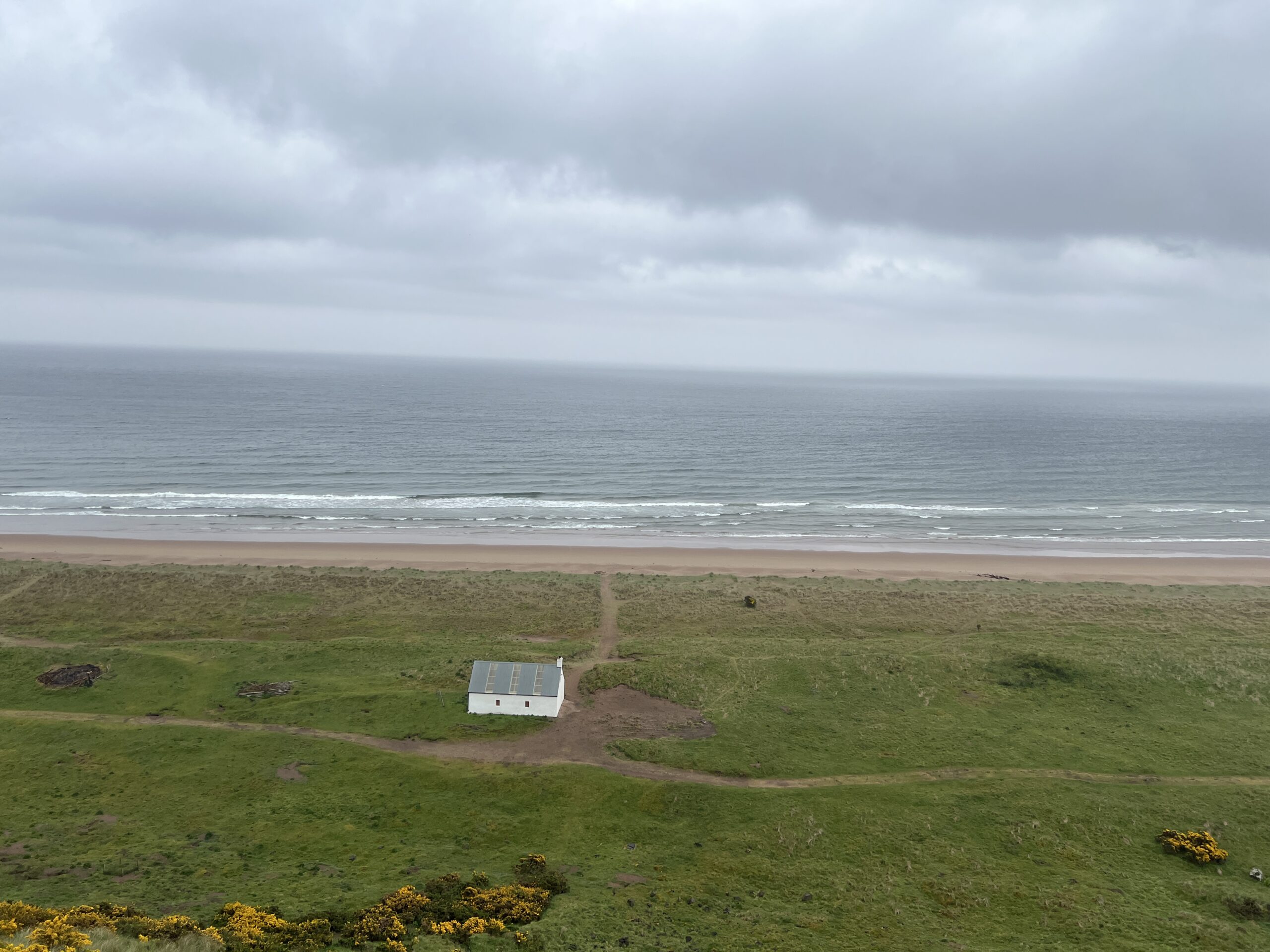
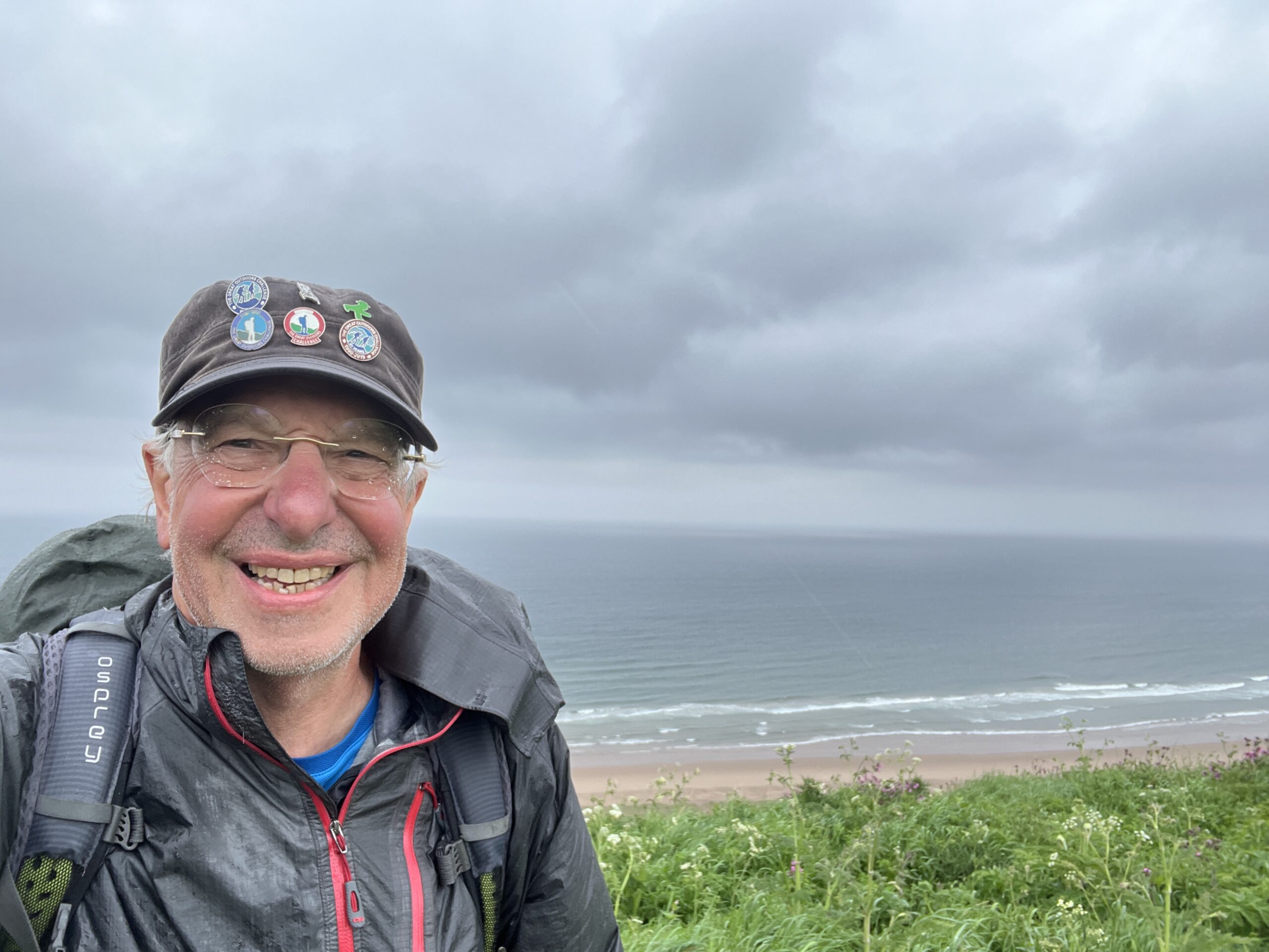
Then, finally, there was the North Sea in front of me, and the long bluff down to it, at St. Cyrus. I was tired and cold, so my smile is a bit forced.
You’re supposed to go down to the beach, take off your boots and walk into the water. I got halfway down when I realized I would probably miss the bus to Montrose (the check-in and banquet site) and have to wait at least an hour for another one if I continued on. I was cold and wet, and decided I’d do the foot-dipping ritual someplace else the next day.
When I got back to the top, a woman in an SUV rolled down the window and asked if I was one of the cross-country walkers. I said yes. She offered me a lift to Montrose. She said she was waiting for a woman who was also on the Challenge who’d gone down to the beach for pedal ablution.
Soon that woman appeared—Jean Turner, the senior Challenger with whom I’d walked a couple of days earlier.
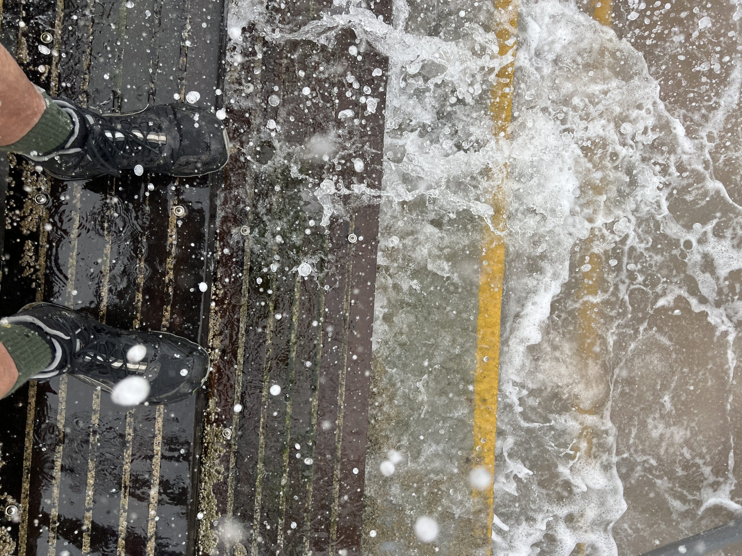
Jean is a stickler for protocol. “I won’t tell anybody,” she said, chiding me for my plan to do the foot ritual after the check-in that would officially seal my crossing as successful. By that time, Irene Robertson, the woman driving the car, was picking up on the spirit of the Challenge. Jean had met her by chance earlier in the day and Irene had volunteered to meet her at St. Cyrus.
“We can find a place close to the road in Montrose,” she said.
Irene drove to a public beach. I got out in the rain and walked down some metal steps that were being splashed by the high tide. I didn’t take off my boots, but I let the North Sea salt them. I was official, more or less.
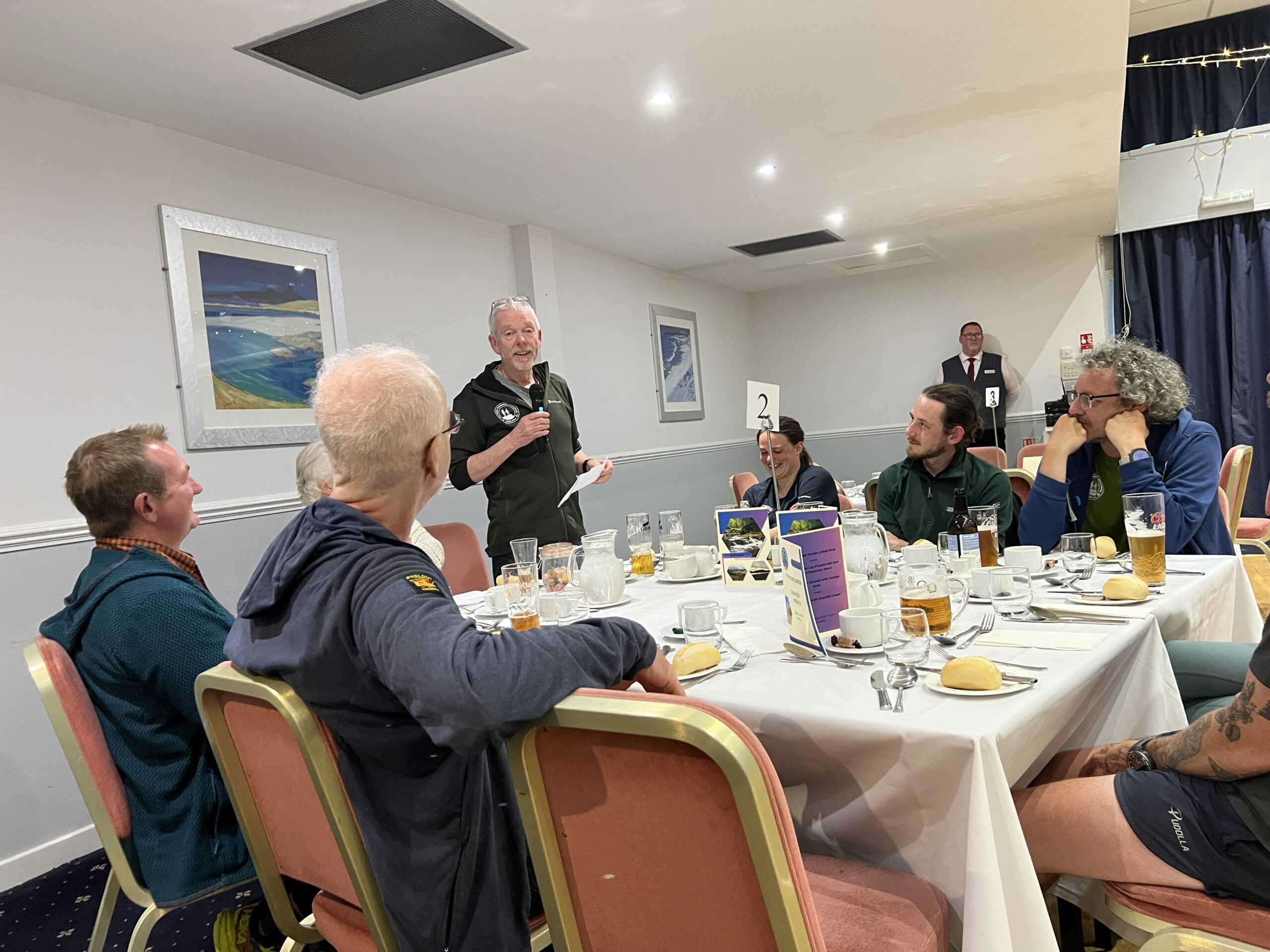
At the banquet that night, it was great to see some of the people I’d met on this crossing, and a few I remembered from previous ones. And to see and thank the wonderful coordinators, Ali, Sue, and Mick. This is Mick talking at the banquet that night (the first of three, on sequential days, as Challengers came in on different schedules).
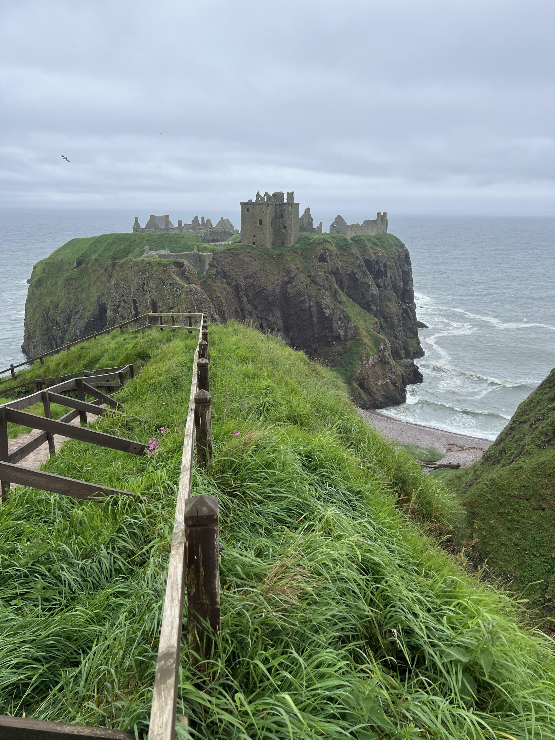
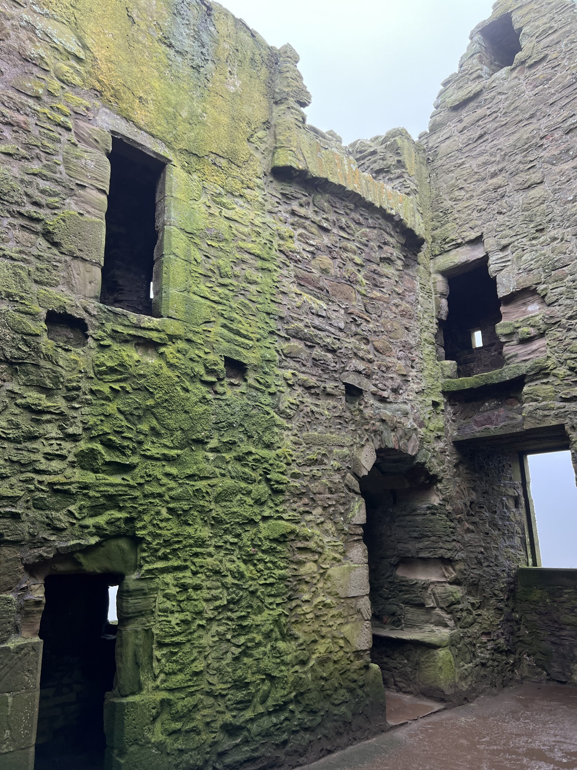
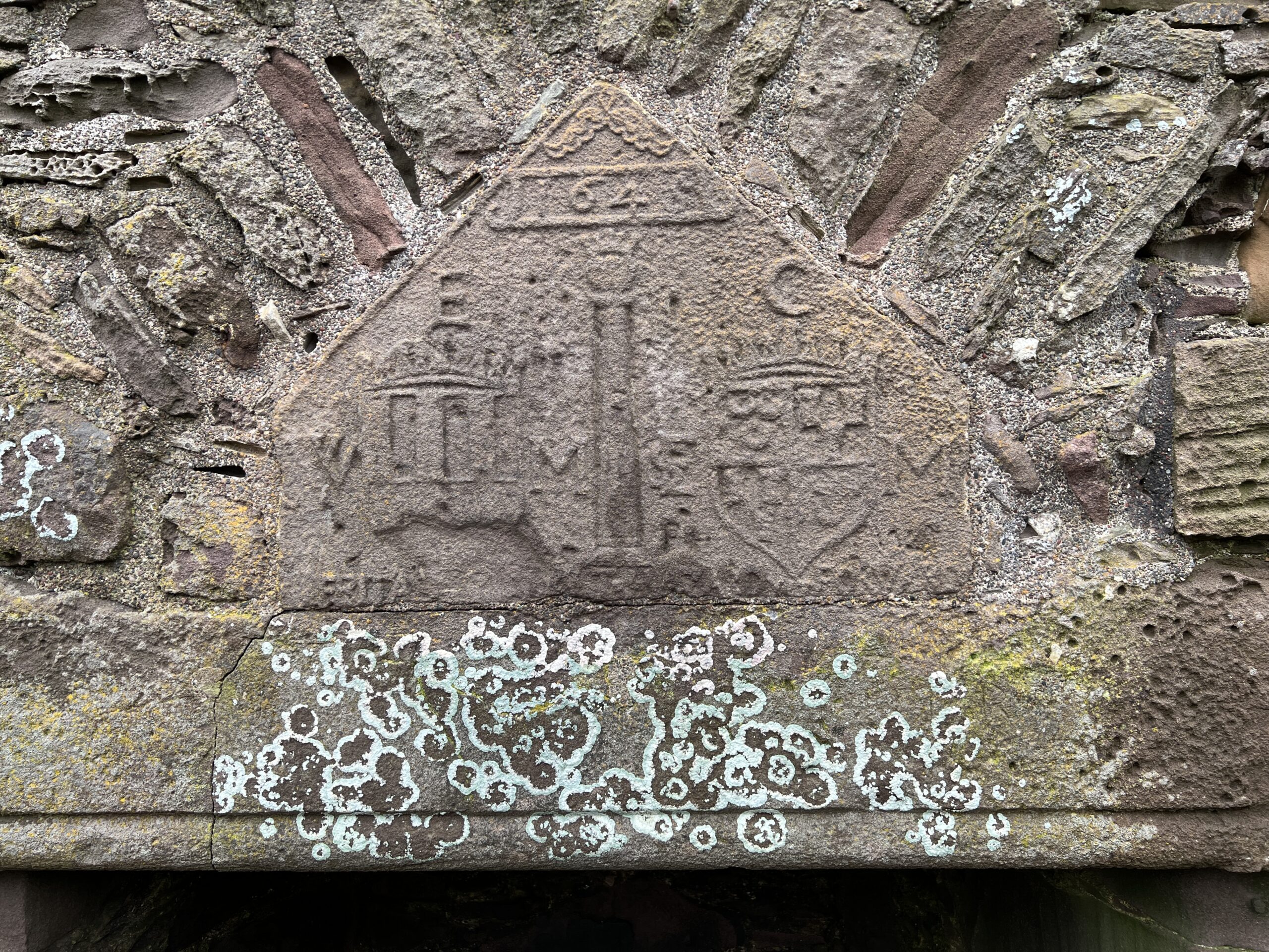
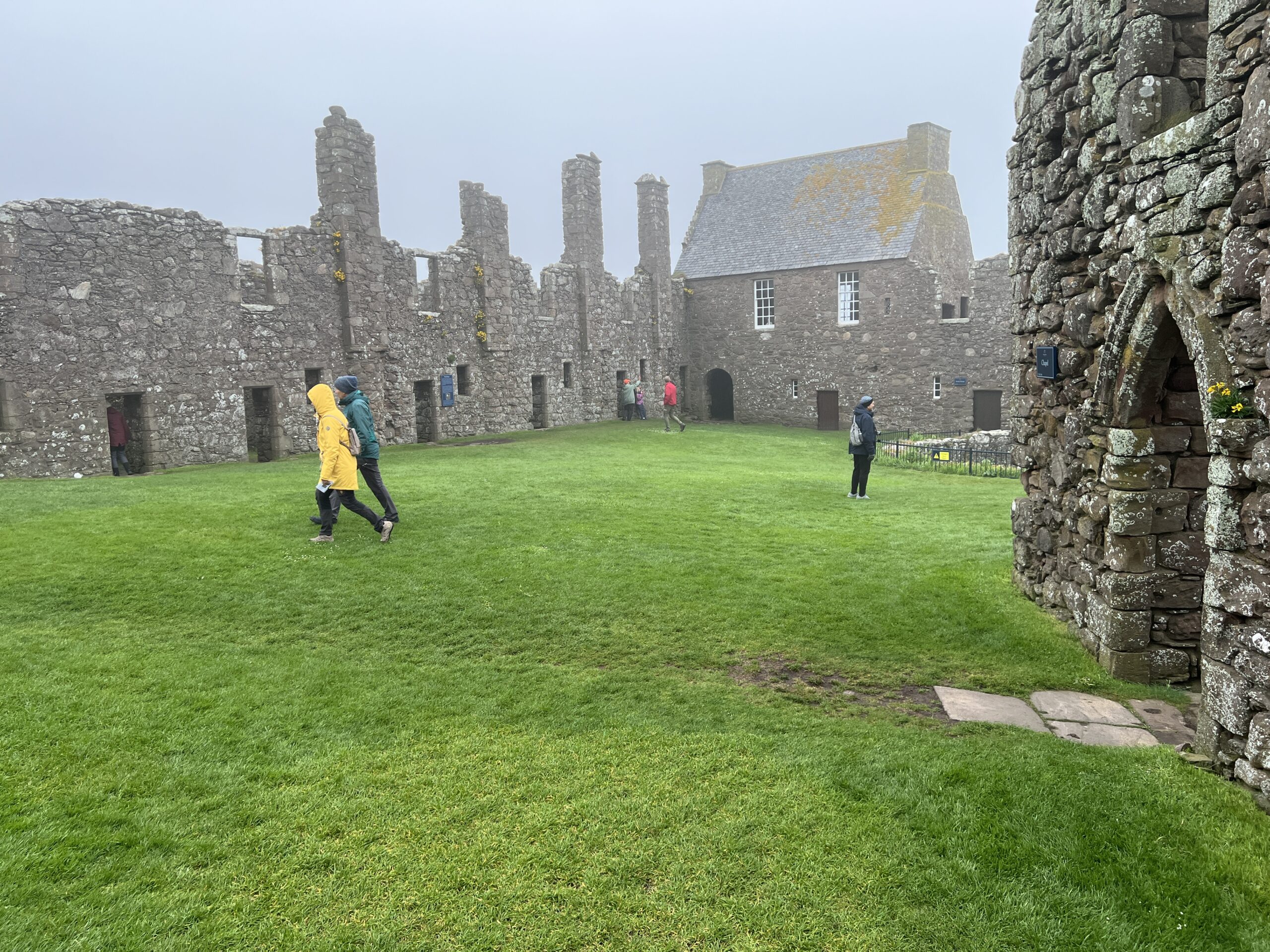
I spent the next day in Montrose writing a blog post, and in the afternoon took a bus to Donnattar Castle near Stonehaven. It goes back to the 1200s. William Wallace (“Braveheart”) visited once. It’s the where the Scottish Crown Jewels were hidden from Oliver Cromwell’s army. Franco Zeffirelli filmed a version of “Hamlet” there.
It’s the castleiest ruined castle you could imagine, especially on a cold and misty day.
So what is the after-action report?
The weather was exceptionally good. People were talking about this as you met them along the way—the locals, that is. It had been rainy and cold almost right up to when the event started. In fact, there were two days when it was about 80, and many Challengers found that challenging.
316 people started the walk–106 were first-timers–and 55 “retired” before the end—a slightly higher percentage than usual. Of the 49 Challengers in their 70s (my age group), one-third retired. In the biggest age group (the 60s), one-fifth of the 104 starters dropped out. Overall, foot problems were the most common reason; no one needed to be rescued.
The 20 vetters reviewed 268 different routes. (That’s fewer than the number of starters because some people went in groups.) Each route required an average of three reviews—edits and re-edits—which is a tremendous amount of work. There were walkers from Mexico and Malawi; 22 percent were from outside the United Kingdom. The youngest Challenger was 18, the oldest 85.
The seventh person who finished this year marked the 10,000th completed walk since the event began in 1980.
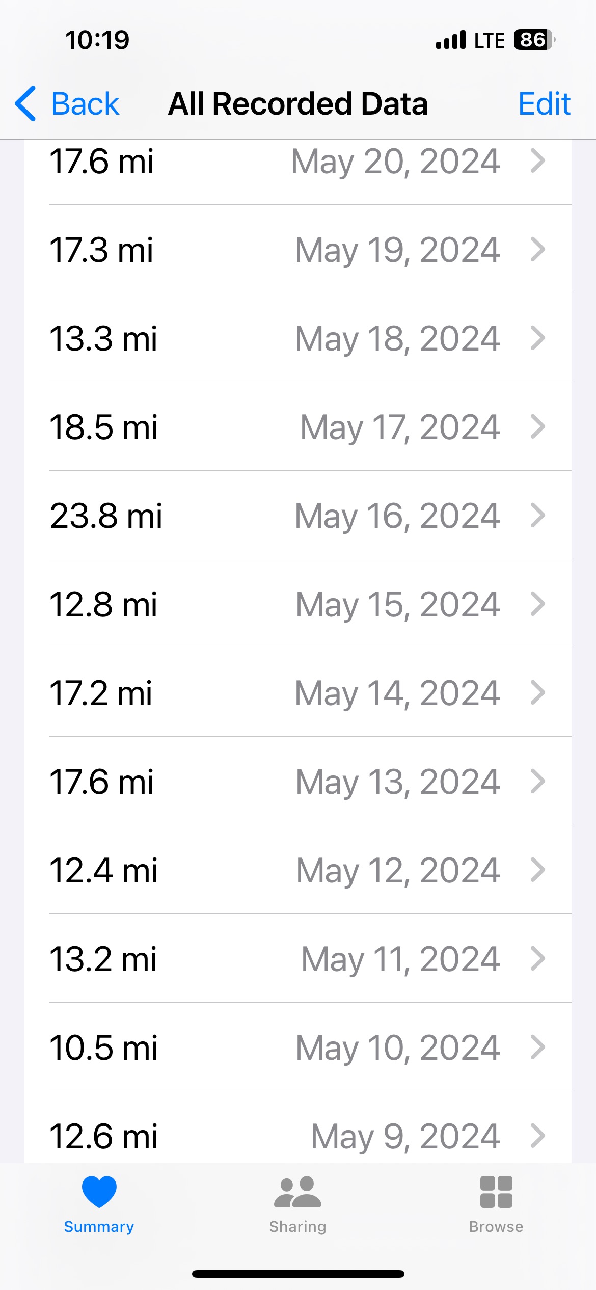
I was pleased with my route. I thought it was going to be too tame and repetitious of previous walks, but it was neither. While I didn’t summit mountains, I did a lot of climbing and had lots of long days. These are the distances for the first 12 days. The final two days were 14.4 miles and 16.6 miles.
Screenshot
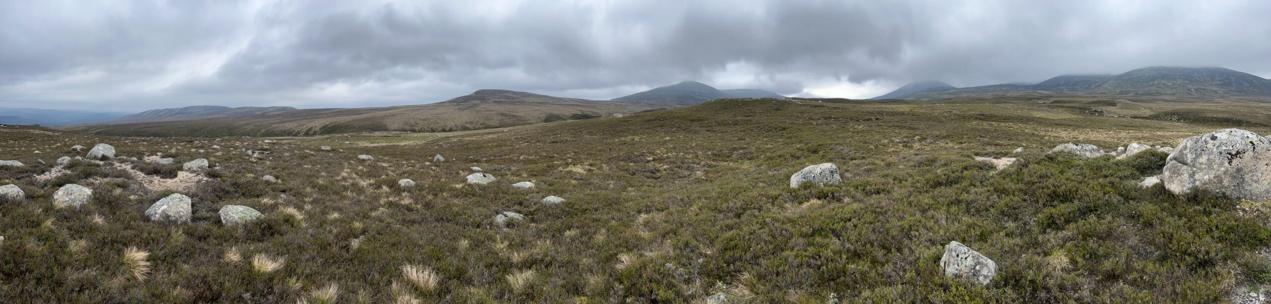
I got to plenty of isolated places. Not the most isolated on offer, mind you, but nevertheless places where you could look forward, back, and to the the side and see no person, structure, or vehicle.
As on all outdoor expeditions, I regret that I don’t know any geology. There’s a lot of it out there.
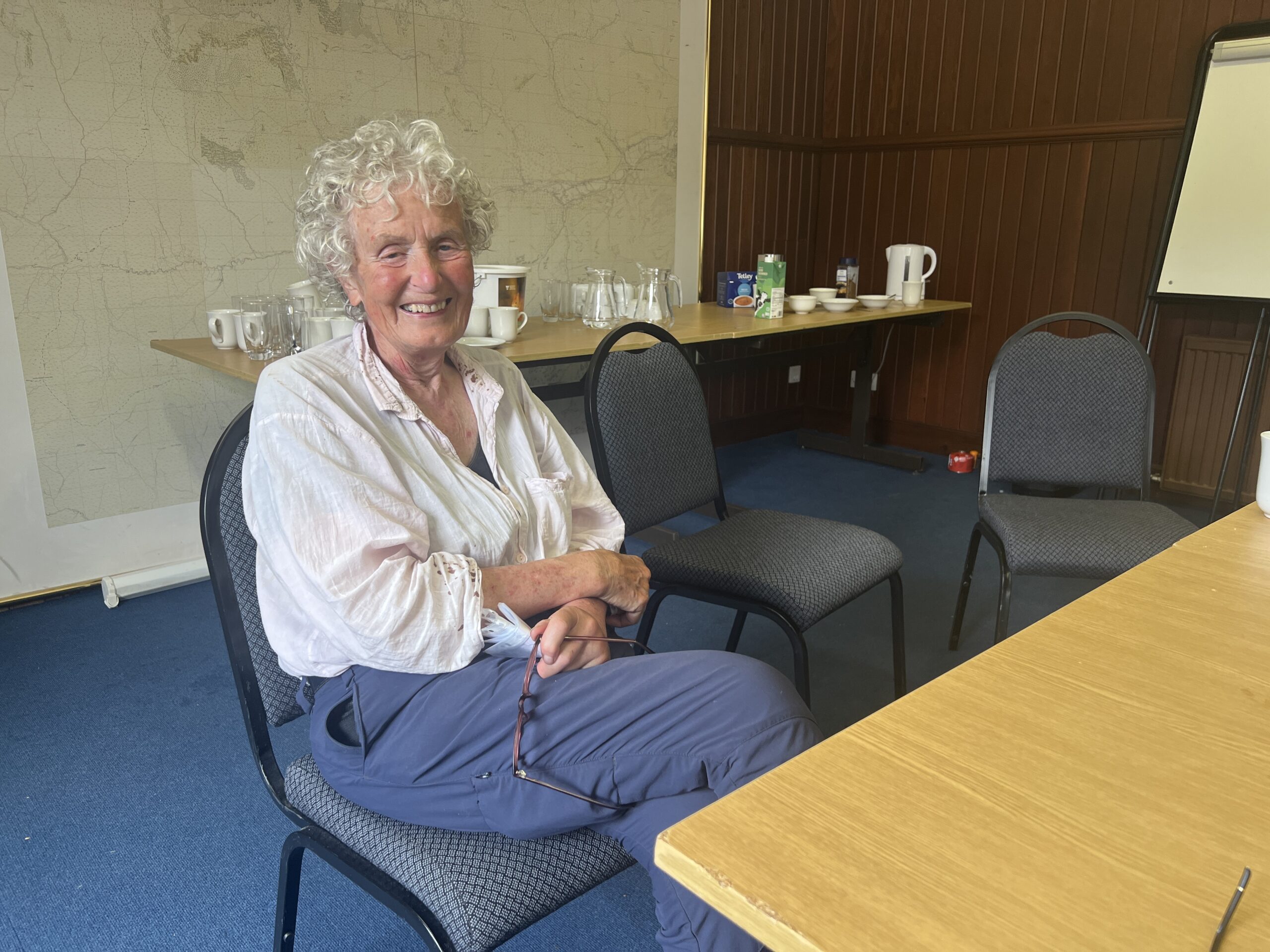
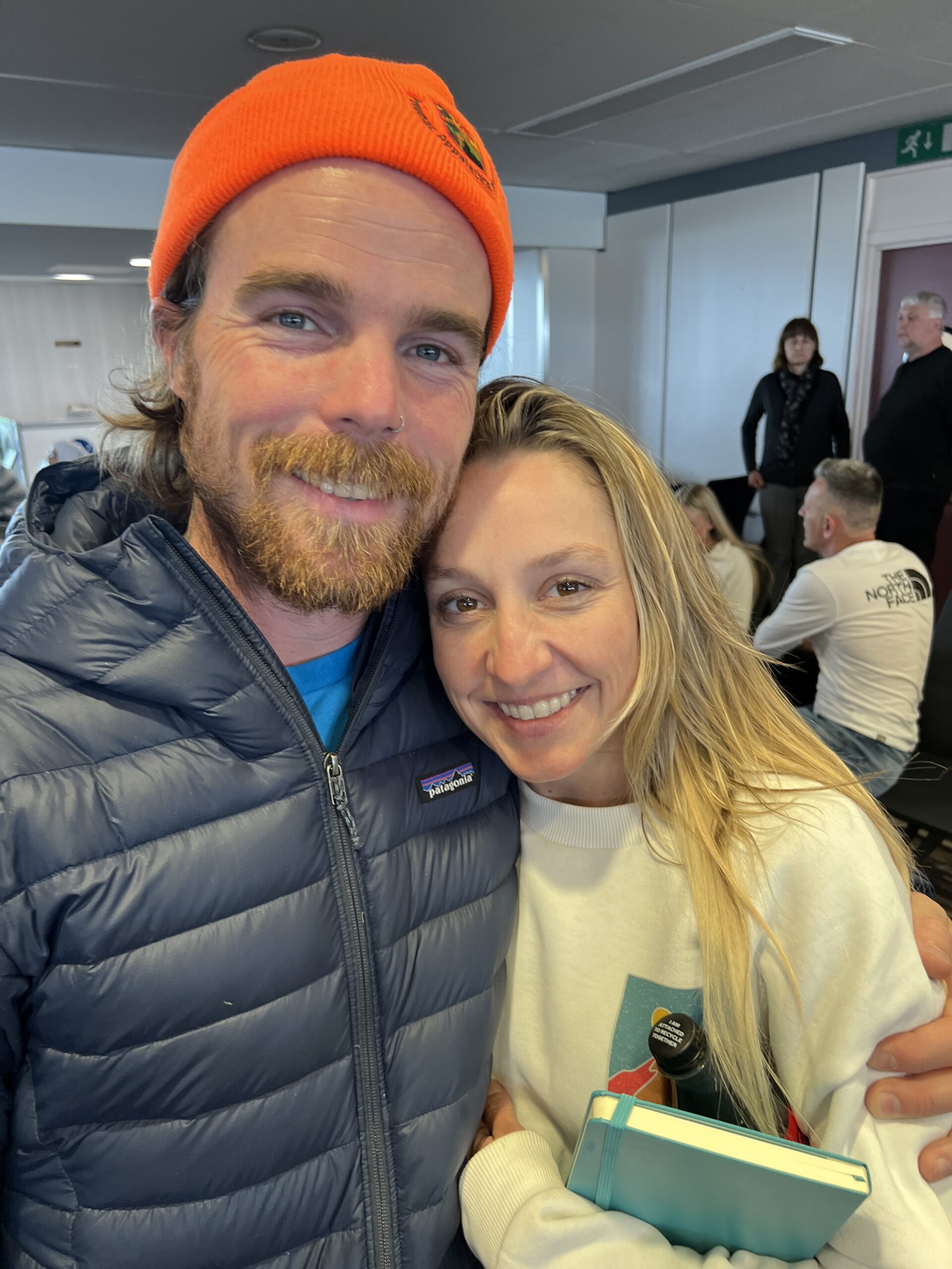
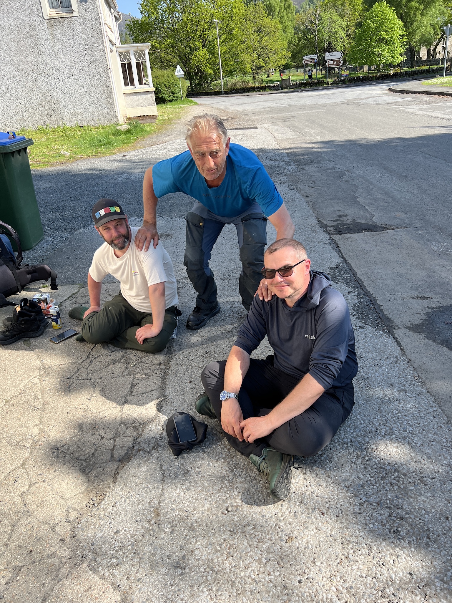
I met interesting people, both Challengers and passersby. I was especially happy to spend time with Jean Turner, who at 84 was the senior woman walker, completing her 18th Challenge this year.
Jean’s a retired general surgeon and mother of six who spent much of her career filling in for surgeons in the Hebridean and Shetland islands, where there was rarely more than two (and usually only one) surgeon. Her instinctive care for the welfare of others has continued long after she stopped practicing at age 65. She’s one the most admirable and remarkable people I’ve ever met.
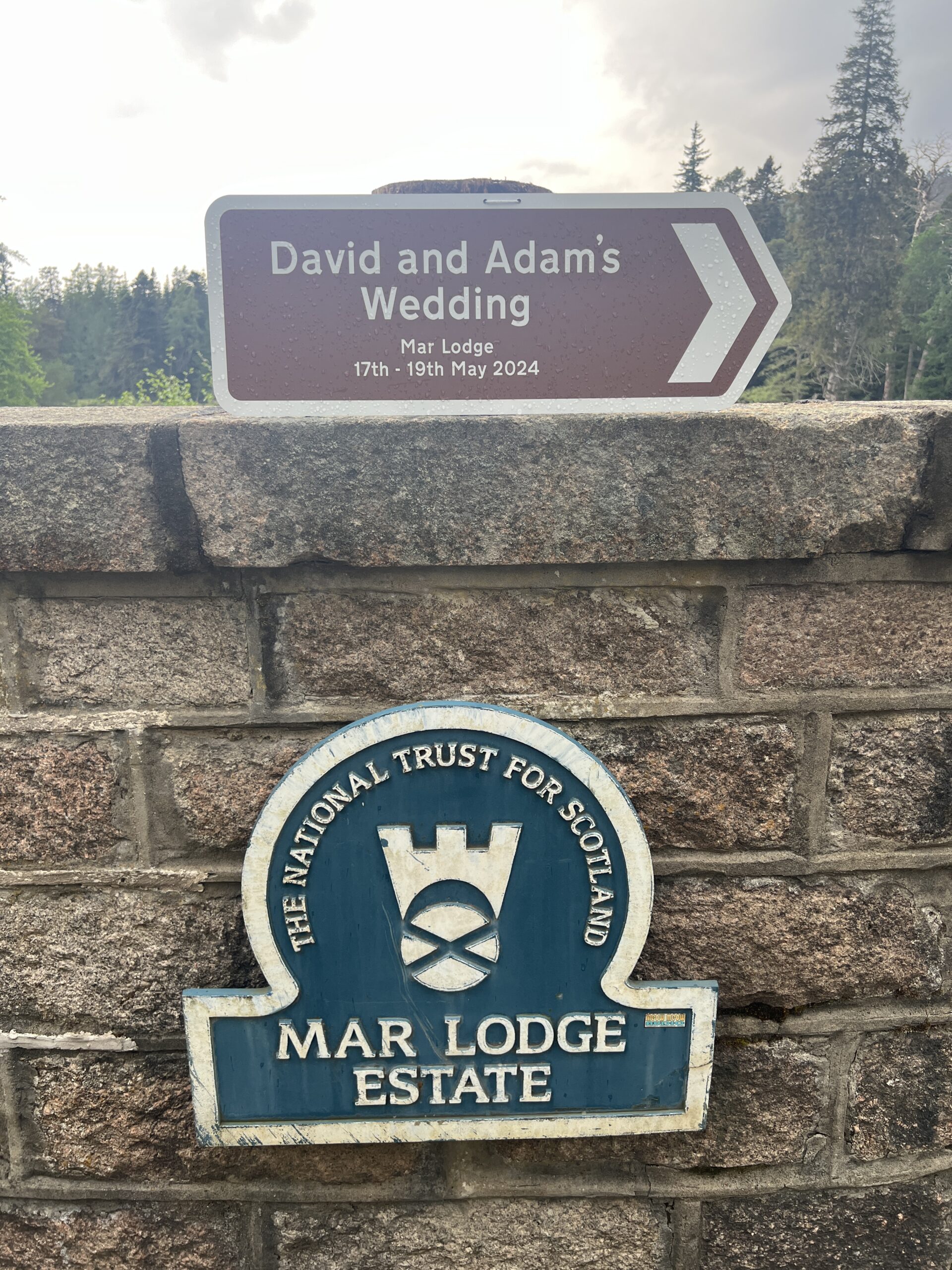
I met her on my first crossing 10 years ago, and ran into her by chance at Mar Lodge, a tea-cookies-parcel-pickup stop on a large estate about halfway through the crossing. We walked together one afternoon and she kindly answered lots of questions about her life.
Among the other people I met were Brian and Jackie, from Richmond, Va. Brian represents Hoka running shoes, and Jackie is a registered nurse. We had lunch at the Shielin of Mark before heading pathless up to Muckle Cairn to pick up a trail.
Brian and Jackie got engaged on the Challenge, in Glen Feshie, where Brian had been before. (“I knew I wanted to pop the question there. It’s so beautiful.”)
It was a surprise. Everyone applauded them at the first-night banquet in Montrose when their engagement was announced. I ran into them in the Glasgow airport as we were all heading home.
In my stopover in Glasgow after the walk I went to the Apple store and explained the problem with the keyboard I’d made such an effort to get mid-Challenge, but couldn’t get to work.
The guy there got it to work in about three minutes—no surprise.
The problem was that when I turned on the Bluetooth function on my iPad mini, a keyboard came up—but it was the old keyboard, which I’d thrown away in Spean Bridge. The new keyboard couldn’t override it, and wouldn’t even announce itself until one clicked on “info” on the keyboard listed and told the iPad to “Forget this device.” Of course, the manual (in seven languages) that came with my “magic keyboard” didn’t mention that.
This walk was harder than I expected, even after trying (pretty unsuccessfully) to make it easier than previous ones. My feet hurt (they always do), and so did my shoulders. More willpower was required than I expected.
Will I do it again? Probably not.
As wonderful as the event is, it requires months of planning and consumes nearly all of May, when lots of other things are going on. (I missed my 55th high school reunion this time.) Plus, there are other places to see before my taste for travel dwindles away entirely.
Nevertheless, it’s not an exaggeration to say that The Great Outdoors Challenge changed my life, although exactly how is hard to explain. I’m deeply grateful to have encountered it.
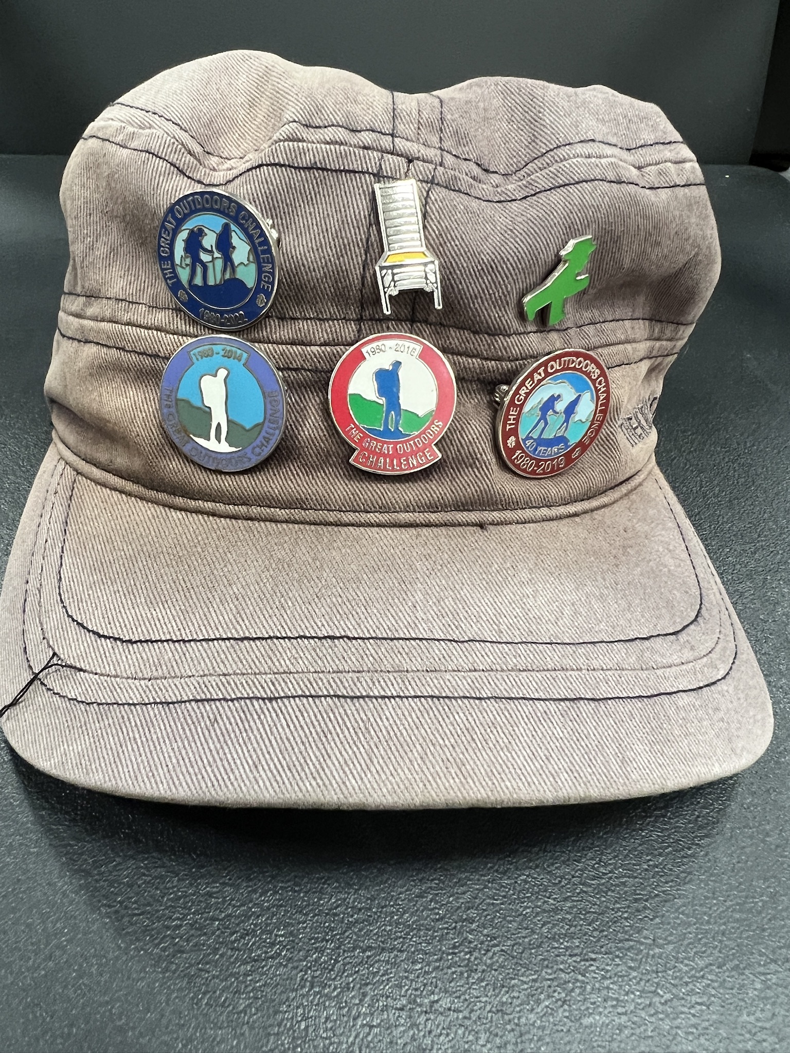
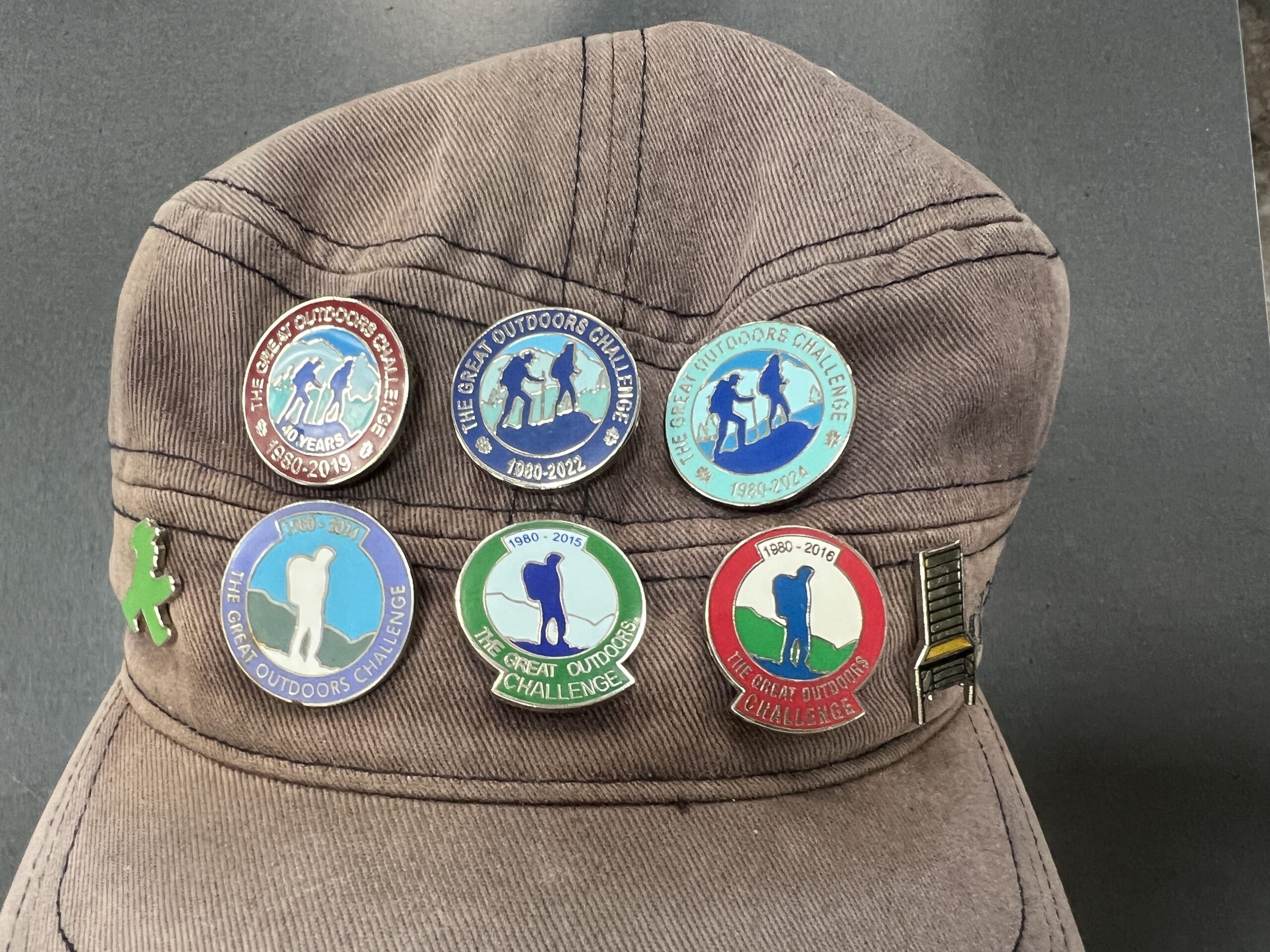
For a modest fee, you can get a pin—“badge” is what they call it in Scotland—noting the year of your crossing. I lost the one for 2015, my second crossing, a few years ago when I was crashing through brush on an island on the Eastern Shore of Virginia.
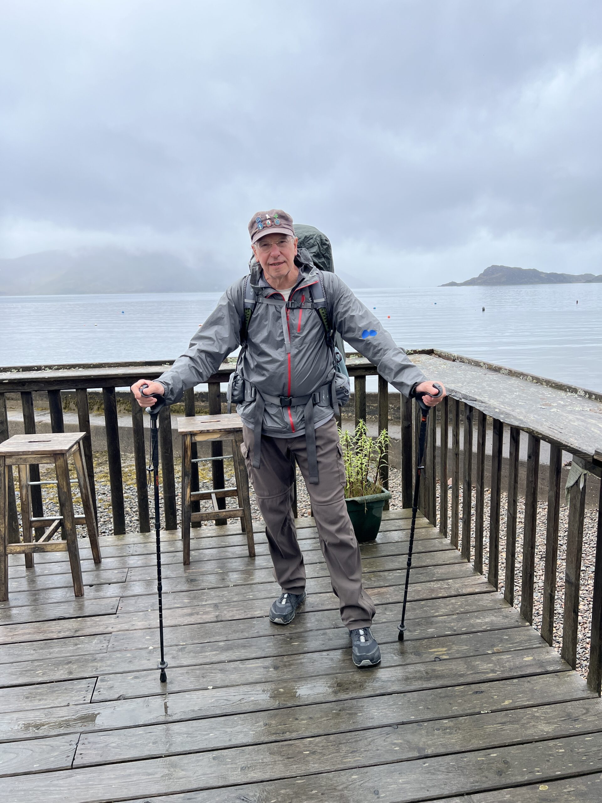
This is the hat I crossed with. The chair is one designed by Charles Rennie Mackintosh, an architect, designer, and artist–the Leonardo of the Glasgow School of Art and the “Glasgow Style” of Art Nouveau. The green Walking Man is from Germany, a gift of a friend.
I asked the coordinators if they happened to have a badge from 2015. They did, and kindly brought it to Montrose. It was in the bag with my other post-Challenge swag (tee shirt, hiking socks, post card).
In the airport waiting to go home, I rearranged the badges and pins. Now the Walking Man is heading across six years of The Great Outdoors Challenge to rest in a Scottish chair.
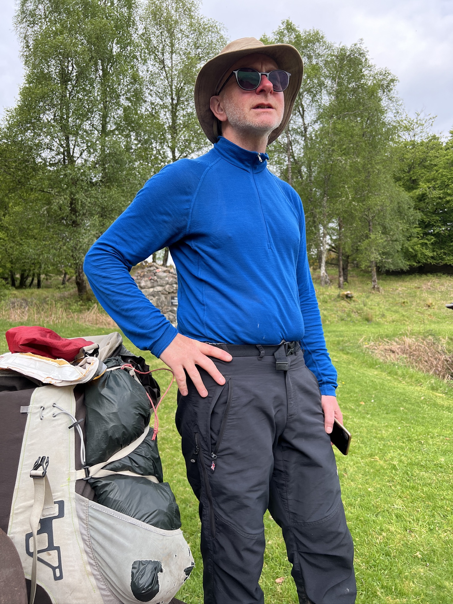
I didn’t bring either sunglasses or sunscreen on this crossing. I wish I’d had both.
The high latitude—Mallaig, where I started, is one degree south of Juneau, Alaska—and long days were perfect for sunburn. After several days I was developing one on my arms. I mentioned this to a woman named Cathy, whom I met taking a break on a gravel track heading toward Mar Lodge.
Cathy, 65, is a former cytotechnologist, seamstress, and inveterate hillwalker from Lanarkshire, south of Glasgow. She had decanted sunscreen from a large bottle into a small tube (“it’s not easy and involves a lot of sucking”), and offered me some. I accepted.
Just then, two younger women, Belgians, appeared. They weren’t on the Challenge, and in fact knew nothing about it.
As I was covering my arms with sunscreen, Cathy pulled the bandana that was around my neck aside to show them my TGOC tee shirt (from 2019). We both explained what the event was about.
As I moved on to my face, Cathy stopped and said: “You have a big smear over here,” pointing to my right cheek. Soon she made a similar gesture to my right ear. I worked on that. The Belgian women leaned in to inspect. “And there’s some right in the middle,” she said, pointing between my eyes.
When I was done, they all straightened up.
“Isn’t it nice to travel with women?” the tall Belgian said.
*************************************************
But no risk of drowning.
But you only need to tap your brakes at rhino crossings.
A slightly indignant appeal to reason.
I wonder who the Supervisors are.
“Chicken Maryland” please don’t come home!
Times change. These are at the end of the same bridge.
All roads lead to lichen.
*********************************************
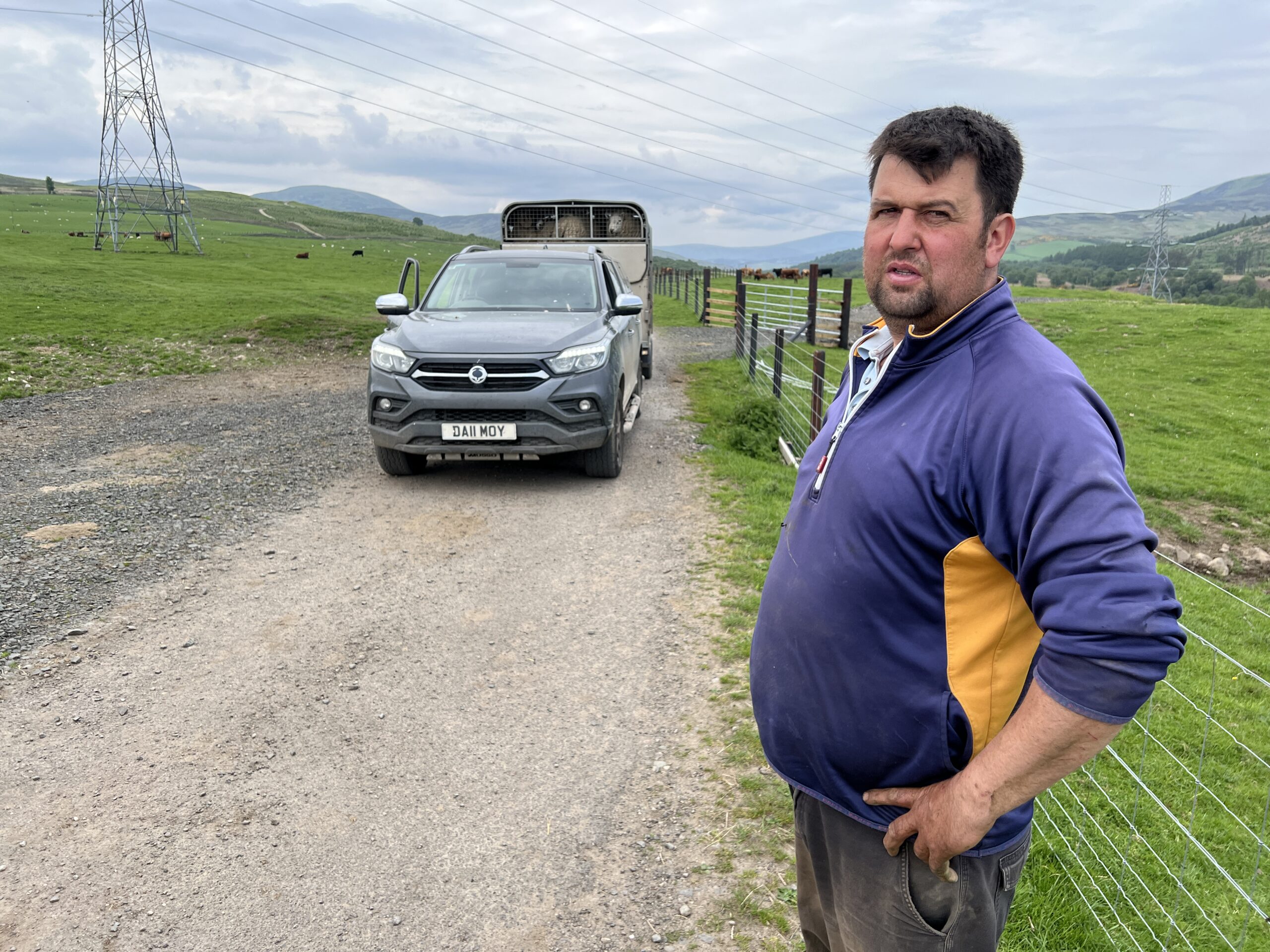
You sometimes meet interesting people on the farm tracks. Graham, whose farm is along River North Esk, was opening a gate to move his rams—“tops,” he called them—to a field of luxuriant grass. I figured that a trailer full of rams would be an explosive cargo, but he said it wasn’t
“They’ve done it before and kind of have a pecking order now. Of course, it’s different in the fall when the hormones are running.”
The gestation time for lambs is “five months minus five days,” he said. He aims for births about April 15, but higher up the glen where the grass comes in later, the target is April 25.
I met David on the north shore of Loch Lee, tapping the grass and bushes along the dirt road with a long prod. I couldn’t imagine what he was doing. He was looking for the nests of ring ouzels, a species of thrush.
If he flushes one, he notes the spot by GPS coordinates and ties a small ribbon on a nearby bush. Someone will return and count the chicks and band them—a task that requires years of training. The data goes to the British Trust for Ornithology, which has many citizen science projects.
David is a volunteer. He comes up to Scotland twice a hear to do some ornithology project. The ring ouzel population is in steep decline. The last time he found a nest was in 2019.
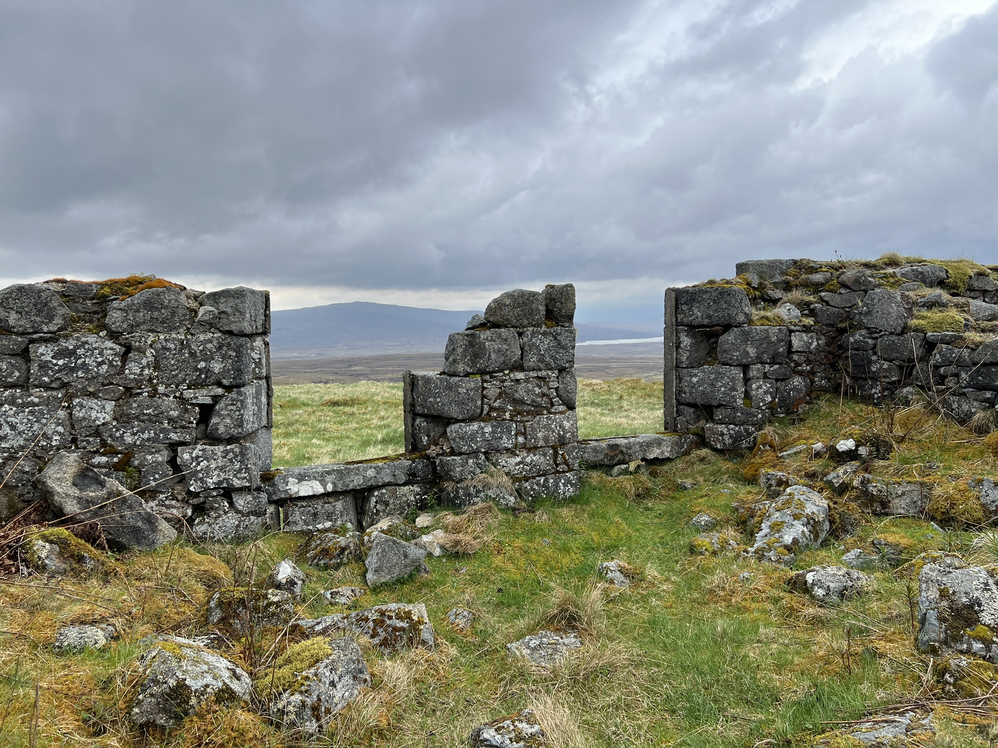
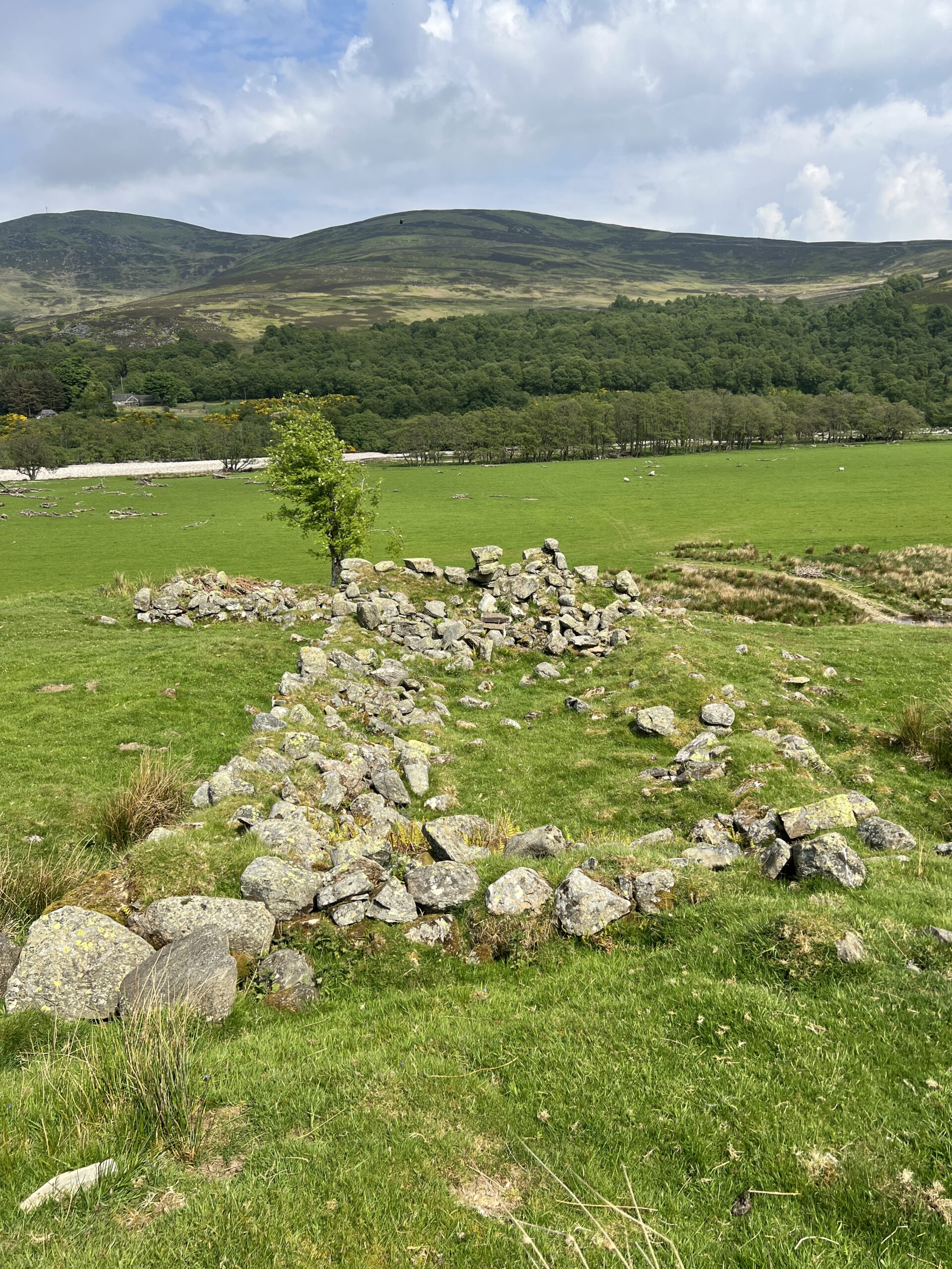
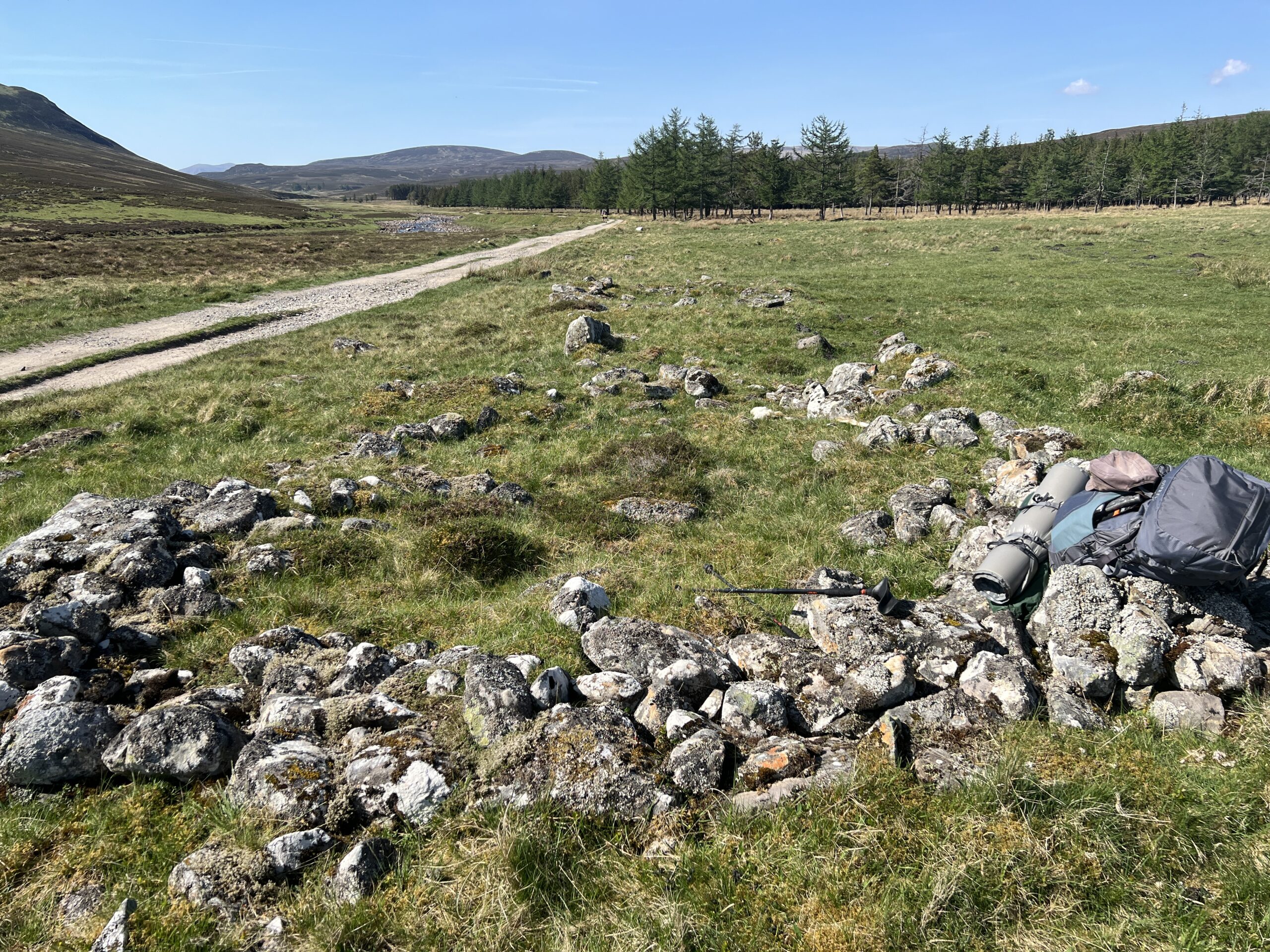
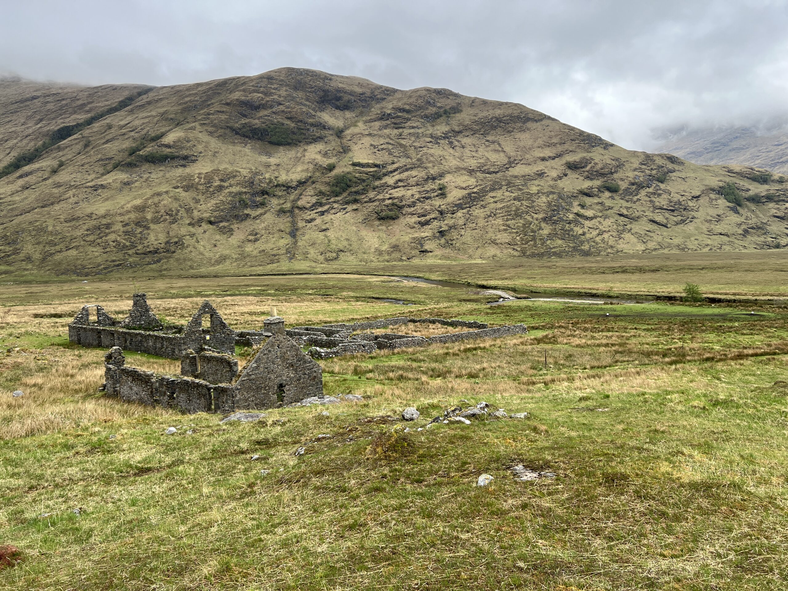
These are the remains of the Corrour Old Lodge on the 57,000-acres Corrour Estate. The lodge is above Loch Ossian and once had smaller buildings, and possibly large tents, for patients with tuberculosis. Its roof was removed in the early 20th century and it went to ruin. Taxes back then were calculated on the area of roofs and sometimes buildings were unroofed simply to avoid them.
There are places where you can see the remains of more modest dwellings. Sometimes all that’s left is a rough rectangle of stones from the exterior walls, with a line of stones remaining from the wall that divided the building into two parts–one for the people and one for the animals.
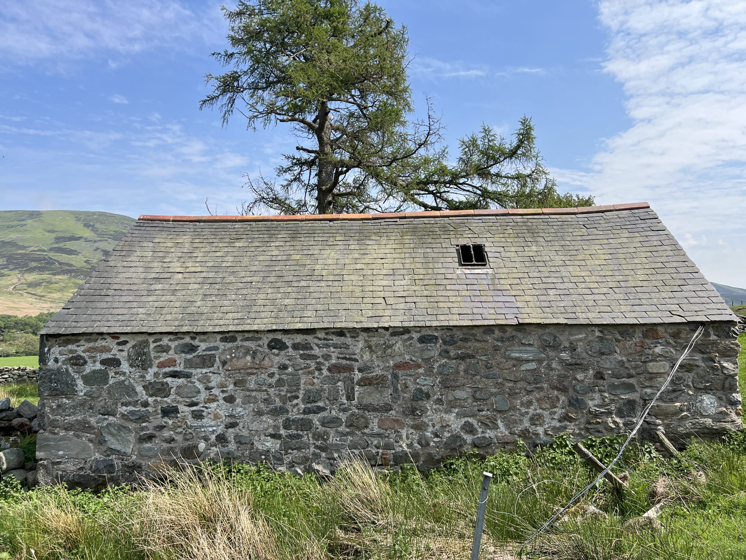
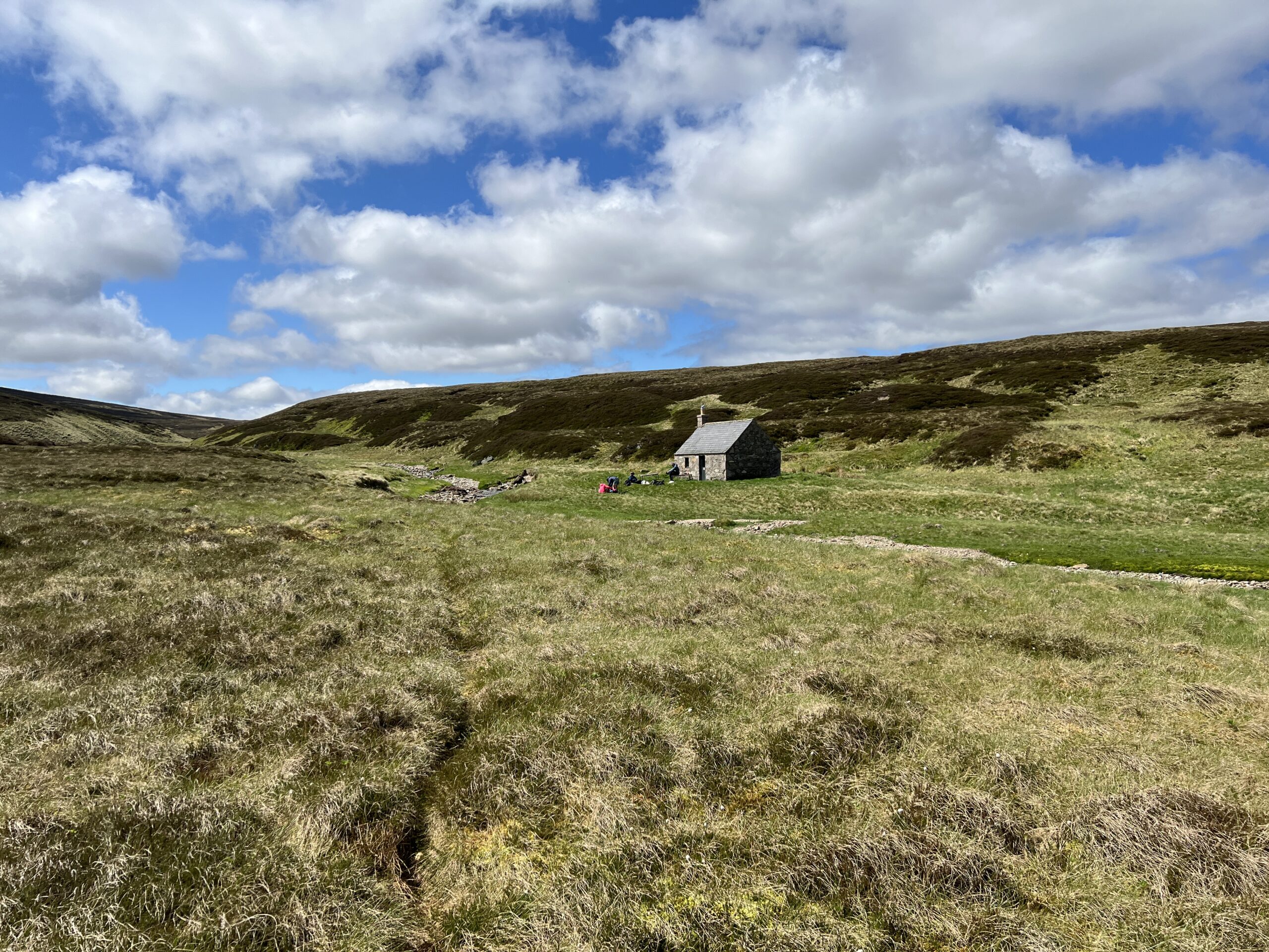
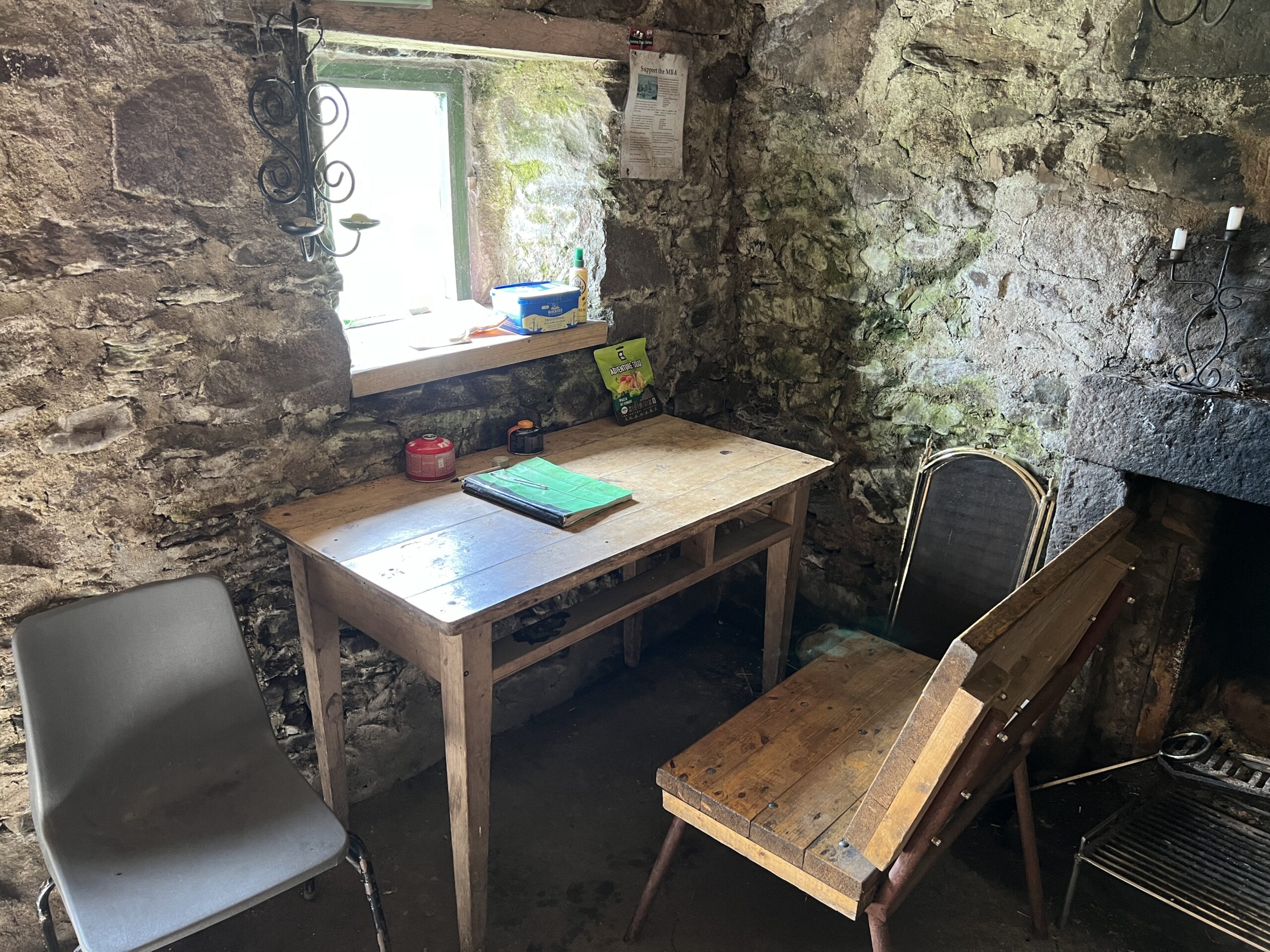
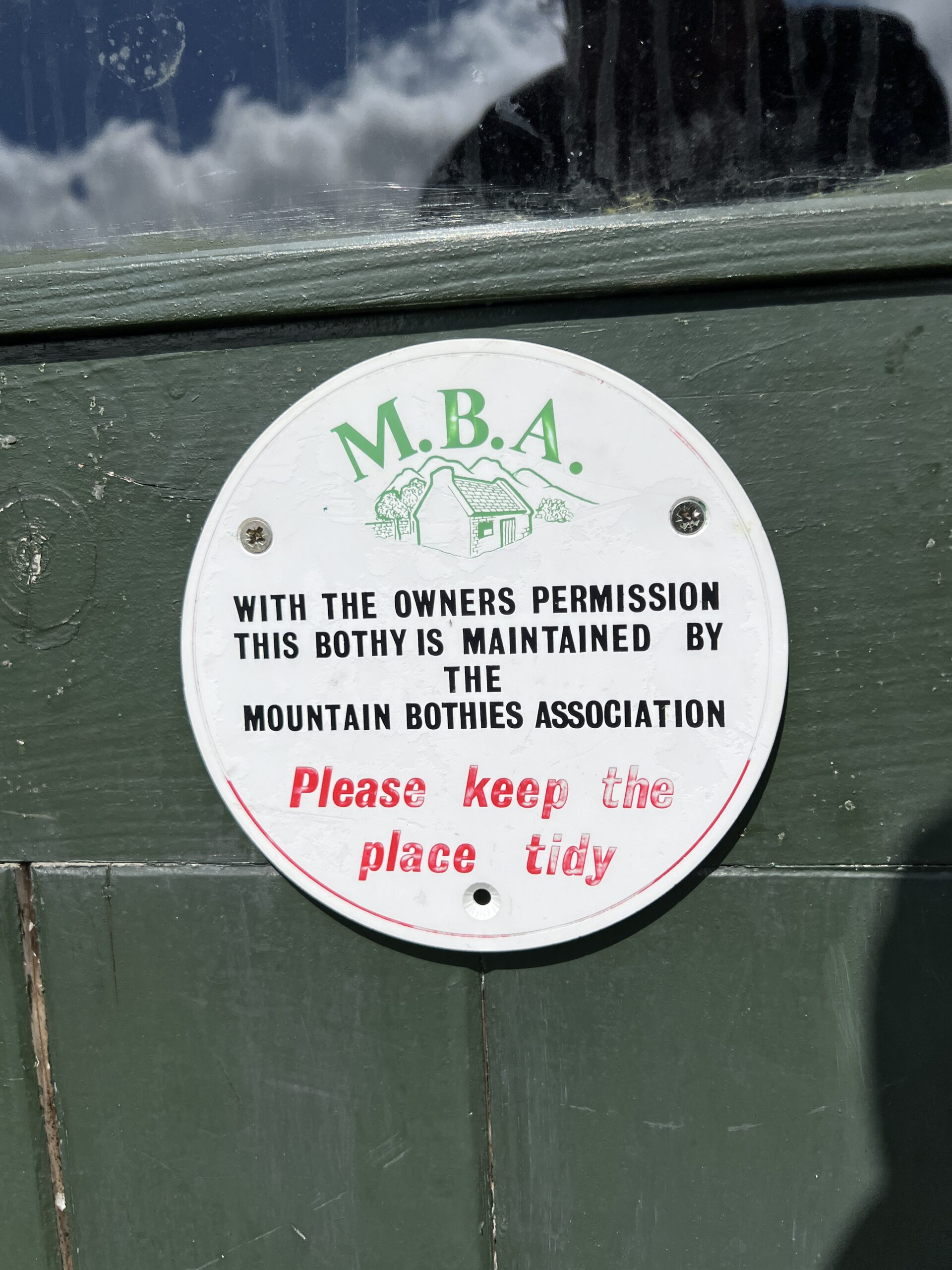
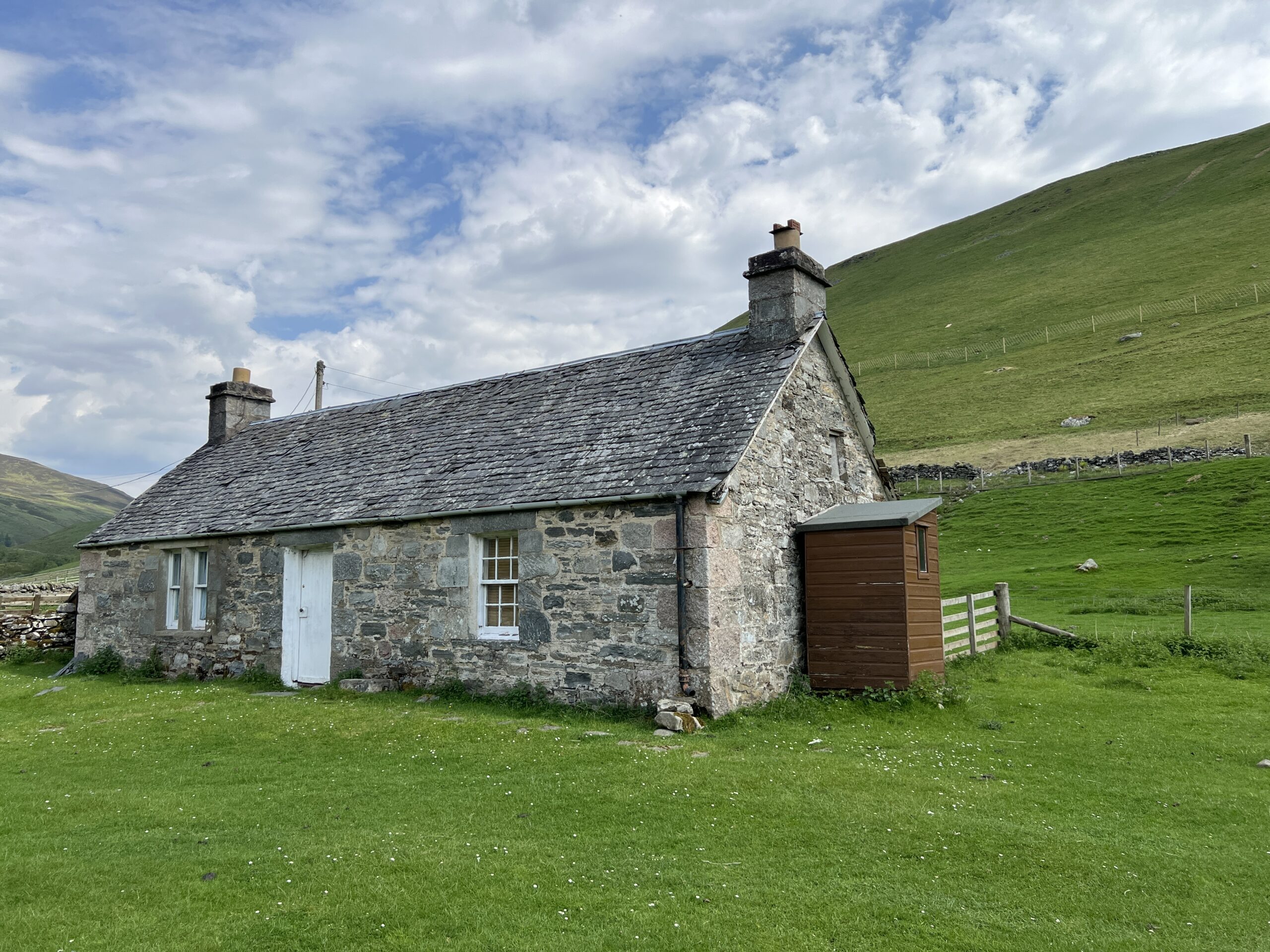
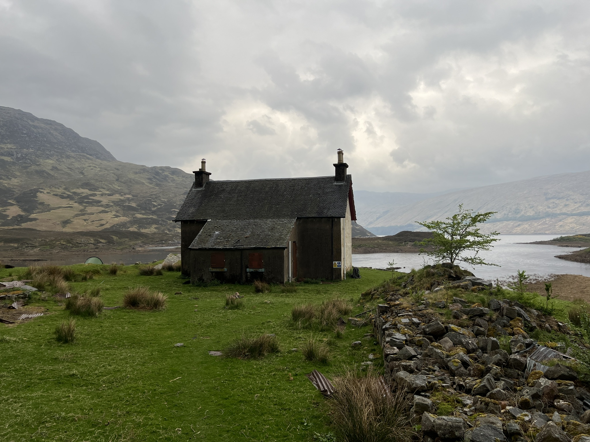
Along the way there are bothies—small buildings usually owned by the estate but maintained for use by hikers by the Mountain Bothy Association, a volunteer organization. Some are former crofter houses but most are shielings—residences of shepherds tending sheep in higher parts of glens during the summer.
Bothies differ in repair, cleanliness, and appeal. Many hikers prefer to camp in the grass around them, which is generally flat, and go inside only if it rains. They all have fireplaces, but no peat and rarely any wood to burn in them.
This is the Shielin of Mark bothy.
The evidence of Scotland’s warrior history isn’t hard to find. The empty and open Highlands was where tens of thousands of airmen in World War II learned to fly (and hundreds lost their lives in crashes).
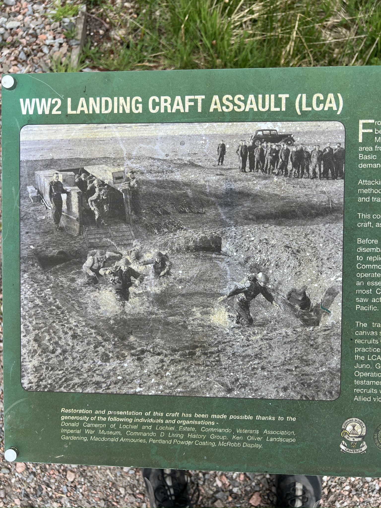
In Achnacarry in the Western Highlands commandos from many Allied countries trained in harsh conditions. One of the few outdoor remnants of that activity is the concrete base of a mock landing craft. A photograph from the time shows soldiers emerging from it into water and mud in a simulated amphibious assault.
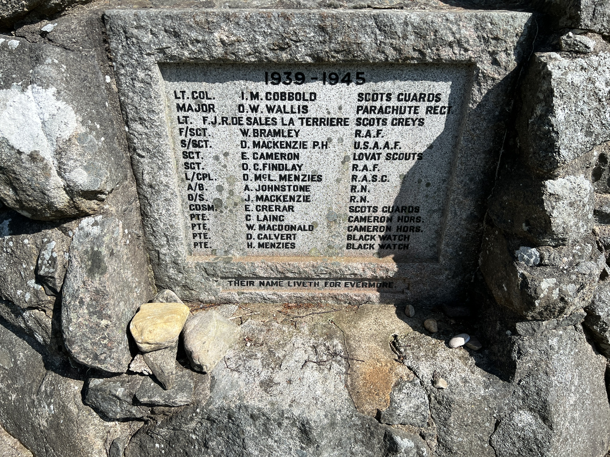
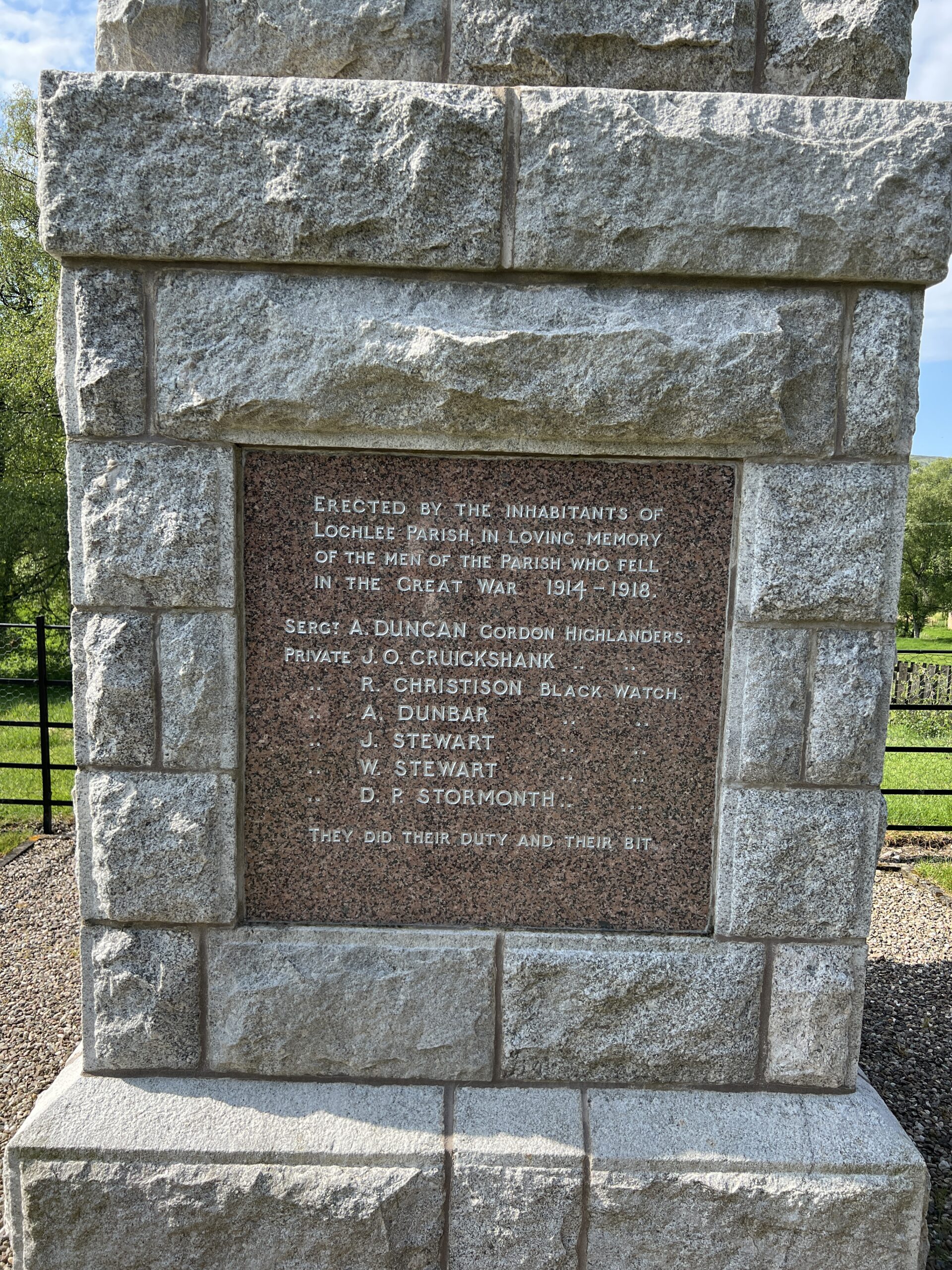
Every village has a memorial to its dead in the Great War. Most have a plaque for the World War II dead that was added later. This is at Kinloch Rannoch.
I’d seen this one before, in Tarfside, near the end of the walk. It’s hard to know what to make of the description of death in the charnel house of the Western Front as “their bit.” No claim of heroism here, just duty.
The Great Outdoors Challenge is all about the route. The route is determined by answers to four questions.
How high do you want to go? How much civilization (villages, stores, phone signal) do you want to encounter? How much company do you want to keep? What sort of surface do you want underfoot?
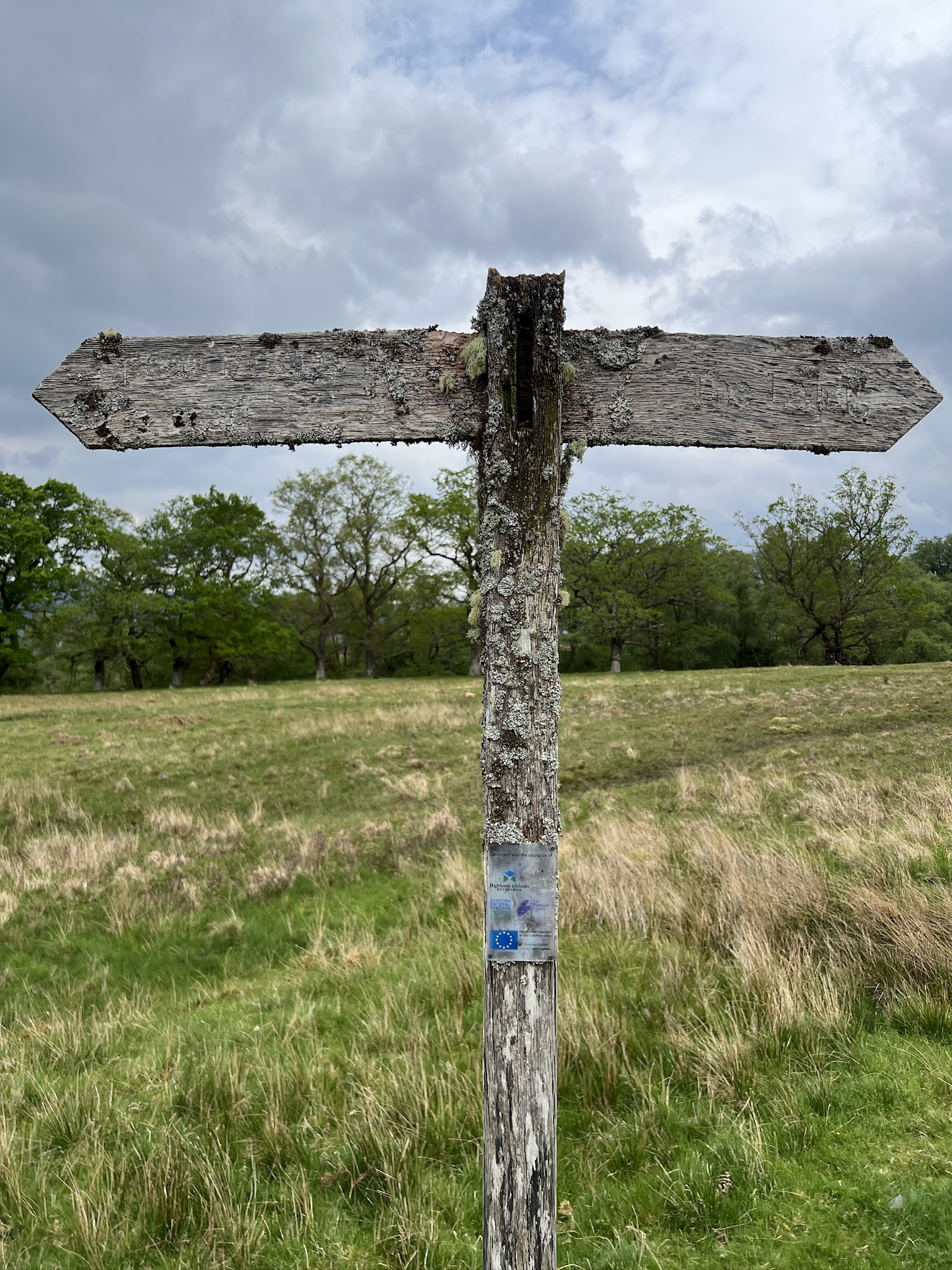
Although there’s no single cross-country path, there are networks of them between localities and regions, hillwalking being the national pastime. Some are built on “drove roads” down which cattle were taken long distances to market.
Others have more ancient origins, laid down by villagers, hunters, and deer employing the wisdom of crowds. You can be pretty sure that a well-worn path is the easiest and safest way to get from Point A to Point B.
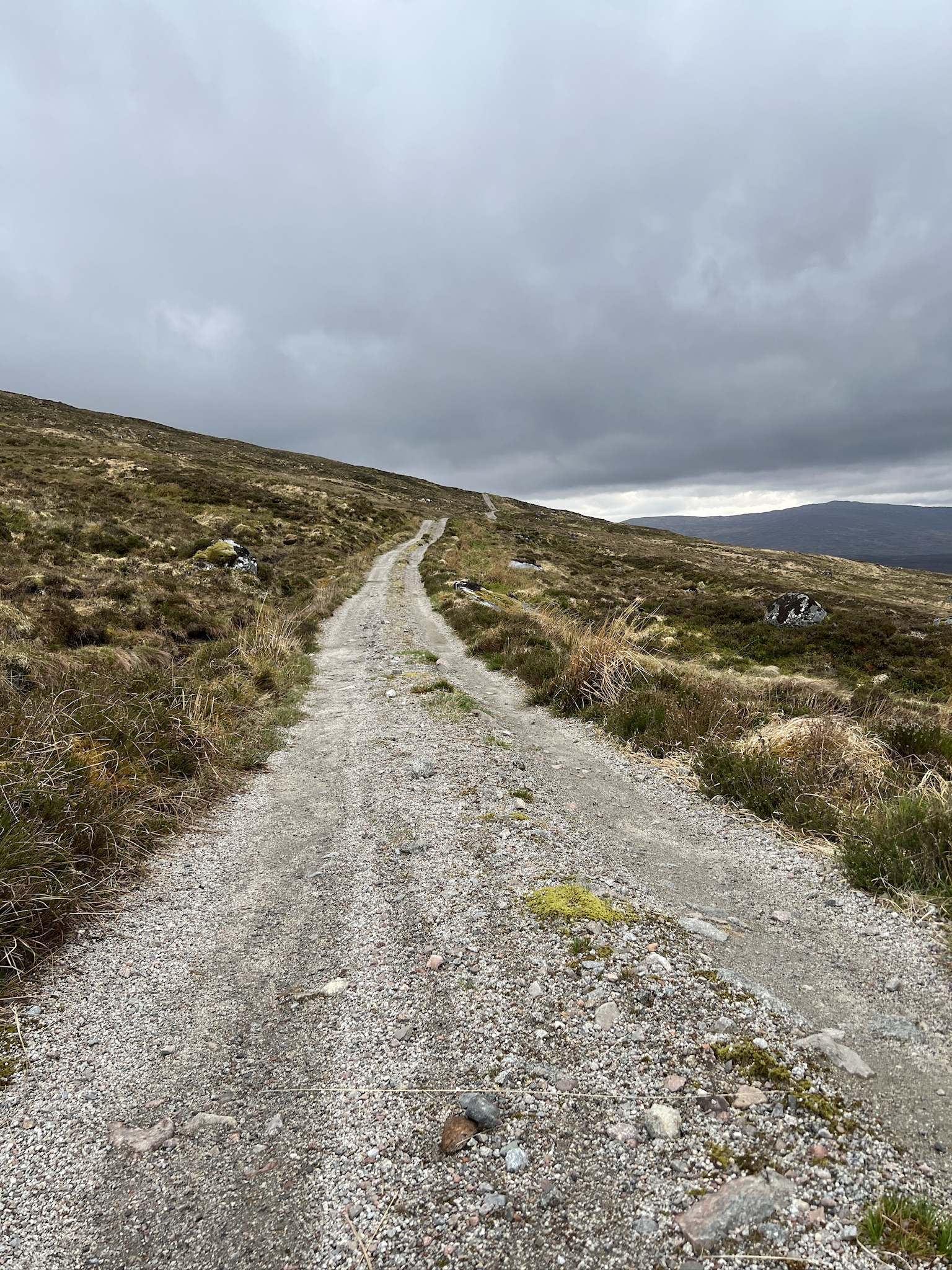
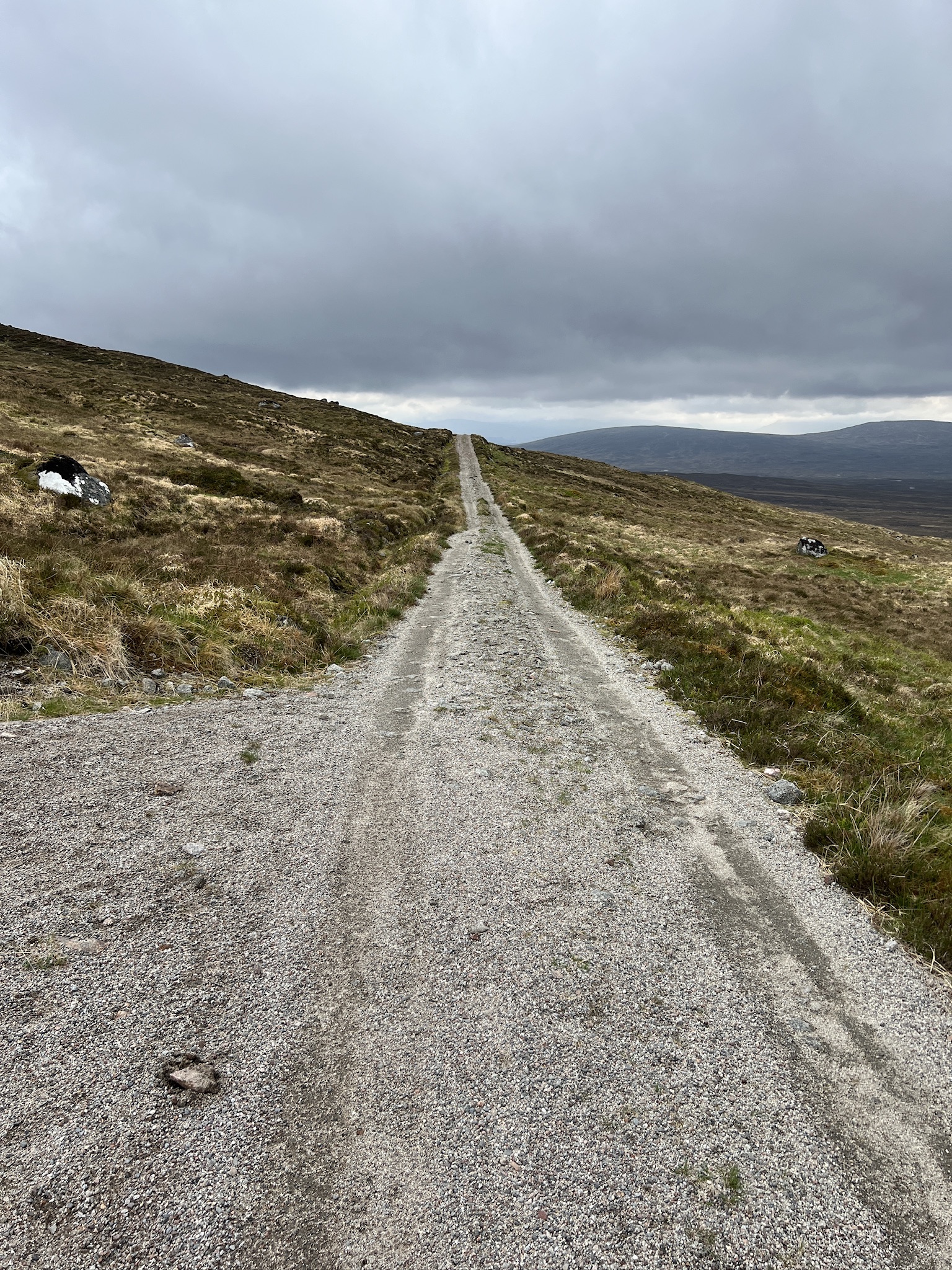
Time and farm vehicles have turned many footpaths into two-wheel tracks and maintained gravel roads.
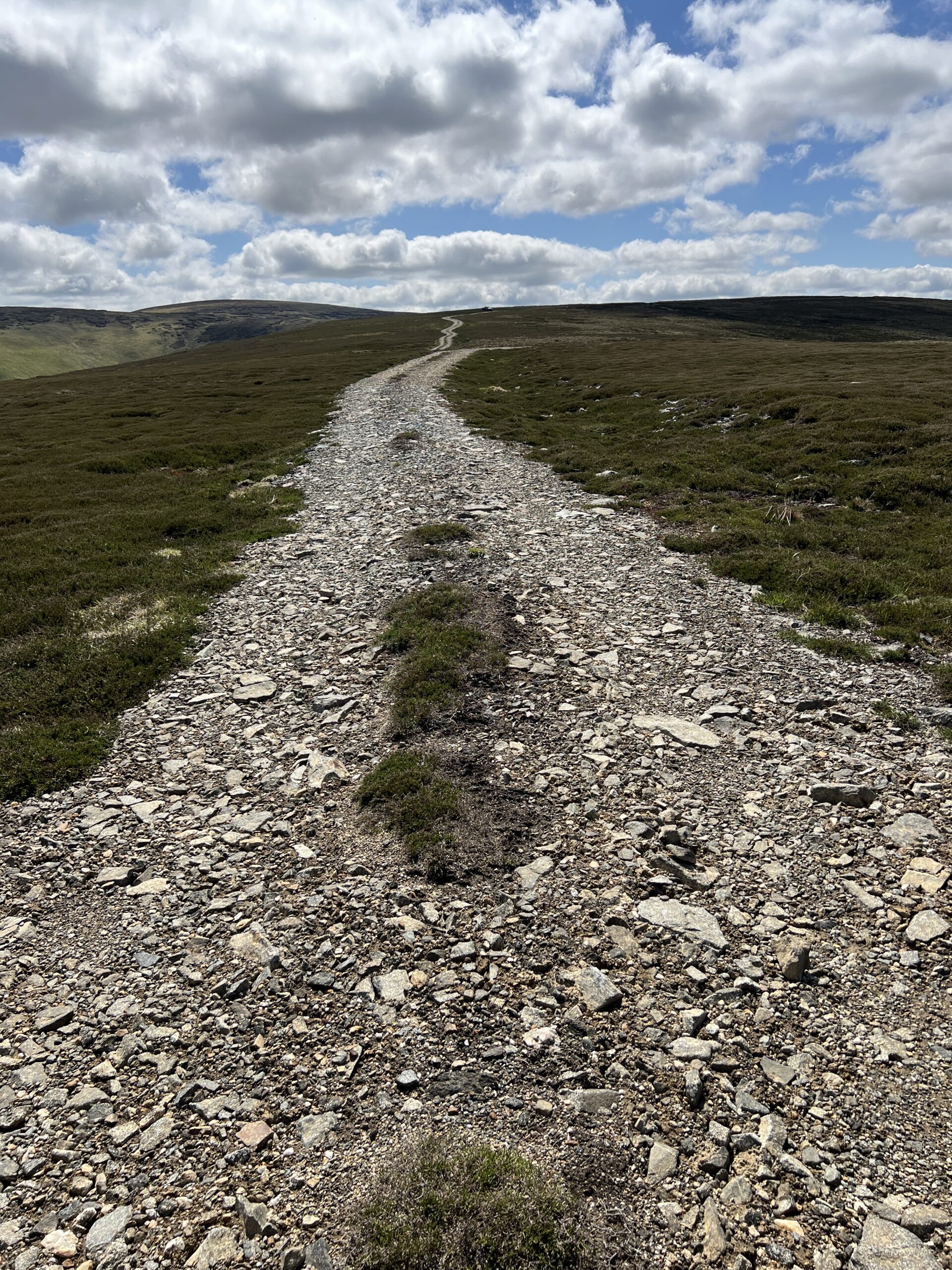
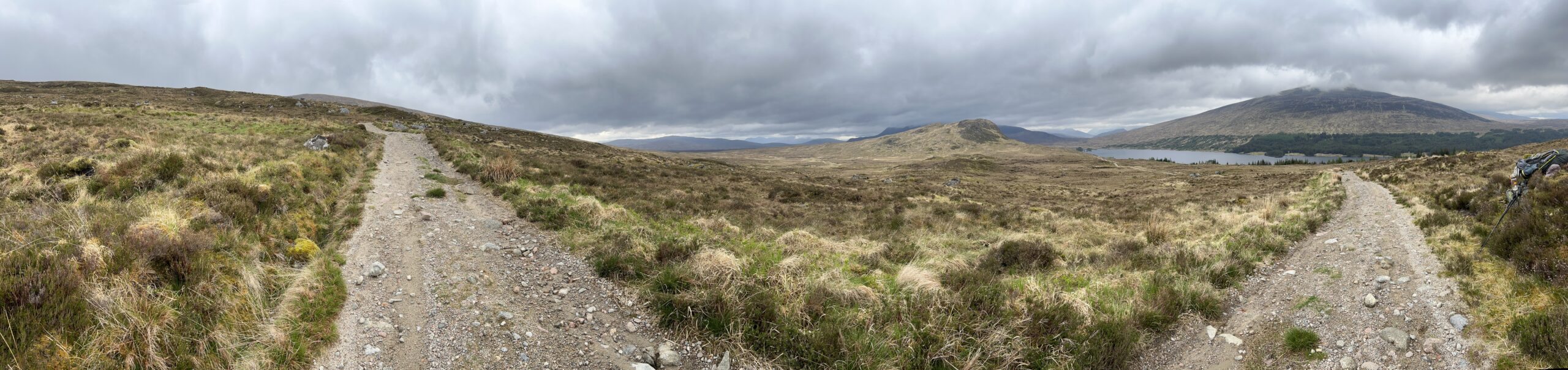
Because much of the Highlands is unforested and undulating, it’s often possible to see a path (or bits of it) far ahead. This can be a mixed blessing if your feet are sore and the pack is heavy.
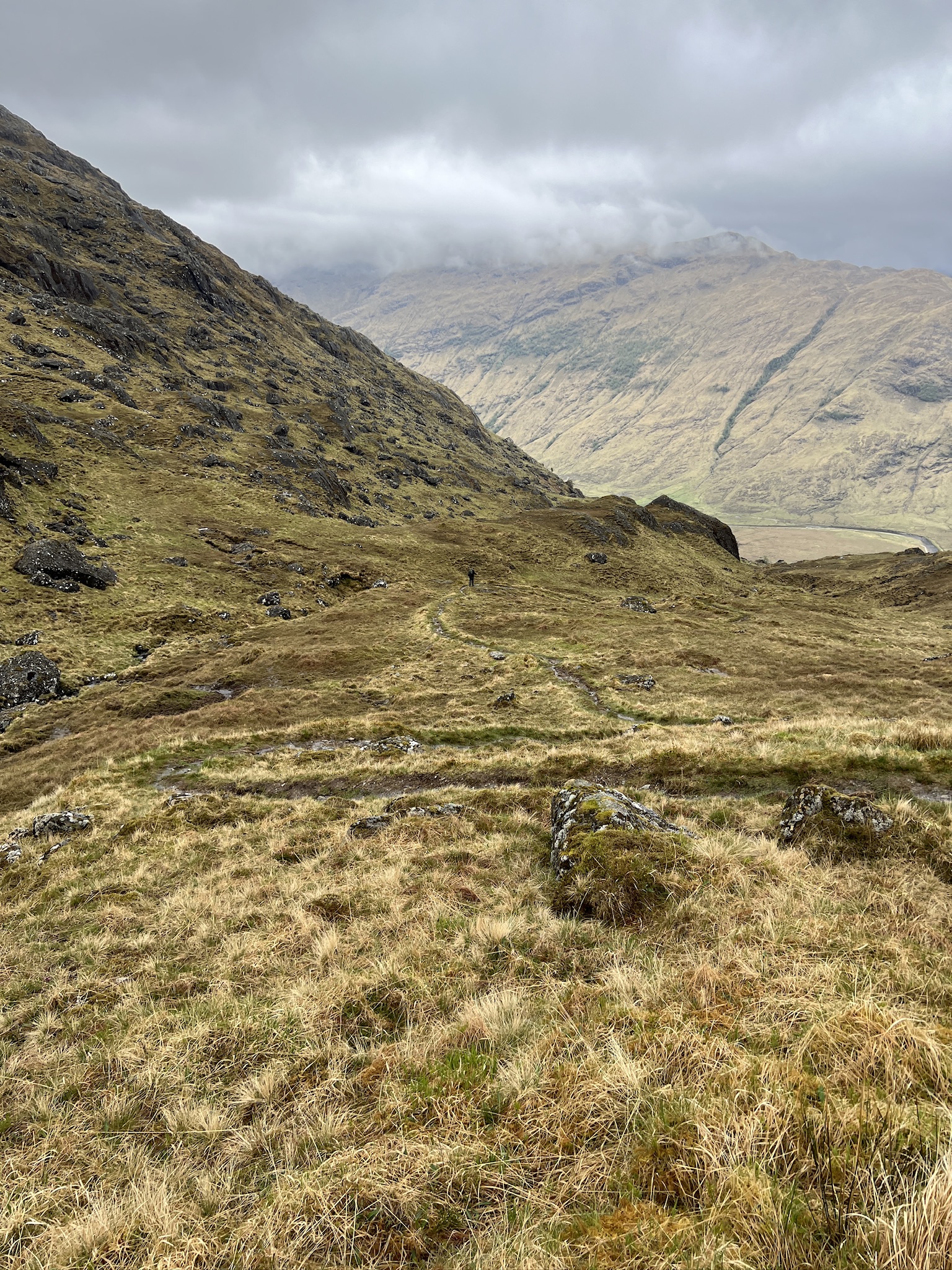
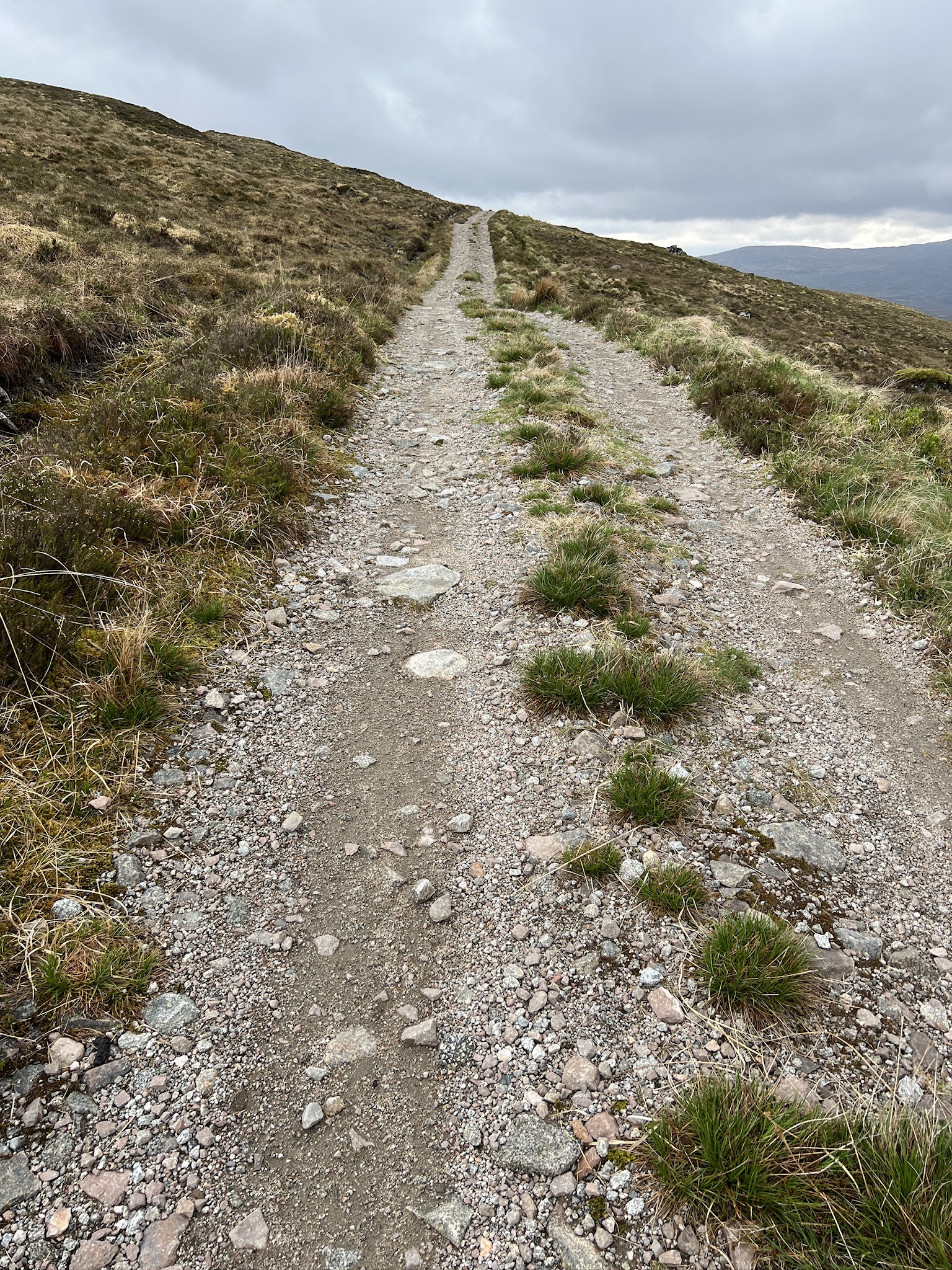
Sometimes, however, the path ahead can be deceiving. Here, it looks like the top is in the distance.
But when you get there there’s more climbing to come.
And when you get to that crest there’s even more.
Eventually, however, you get to the top.
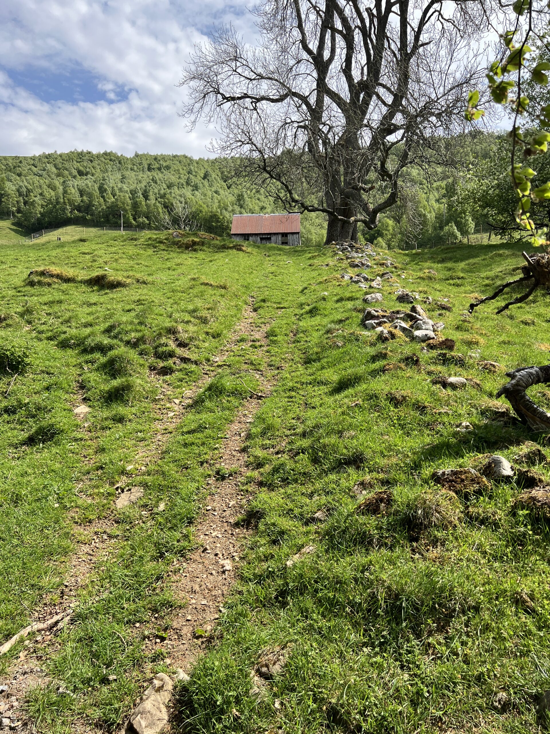
It’s surprisingly easy to lose a path, at least for me. On one of the early days I was walking in a state of insufficient situational awareness on what seemed to be a path.
When I got to the place near the tree, where I expected the path to go on, this is what I saw.
No path, and a slide down into the rocky river if I slipped freelancing along the fall line. While I did have a find-my-body beacon on me, I didn’t want to use it, so I got onto my hands and knees and crawled up the slope. This is the view looking back once I got to a flattish area.
I worked my way farther away from the river and found the real path.
In the woods it’s easy to lose a path if the route isn’t a commonly used one and well tramped-down. This where having a map on your phone with a dot showing your location by GPS comes in handy.
And then there’s trackless walking, which some Challengers seek to get themselves to even more isolated places or just make things more difficult. I did a little trackless walking on this crossing, one piece unplanned.
I took the wrong path out of Gelder Burn bothy on the way to Glas allt Shiel. When I realized the mistake, instead of backtracking I cut across the moor to the right path. I had GPS to guide me, but even without it I knew I’d hit the right track soon enough. This a panoramic from halfway across.
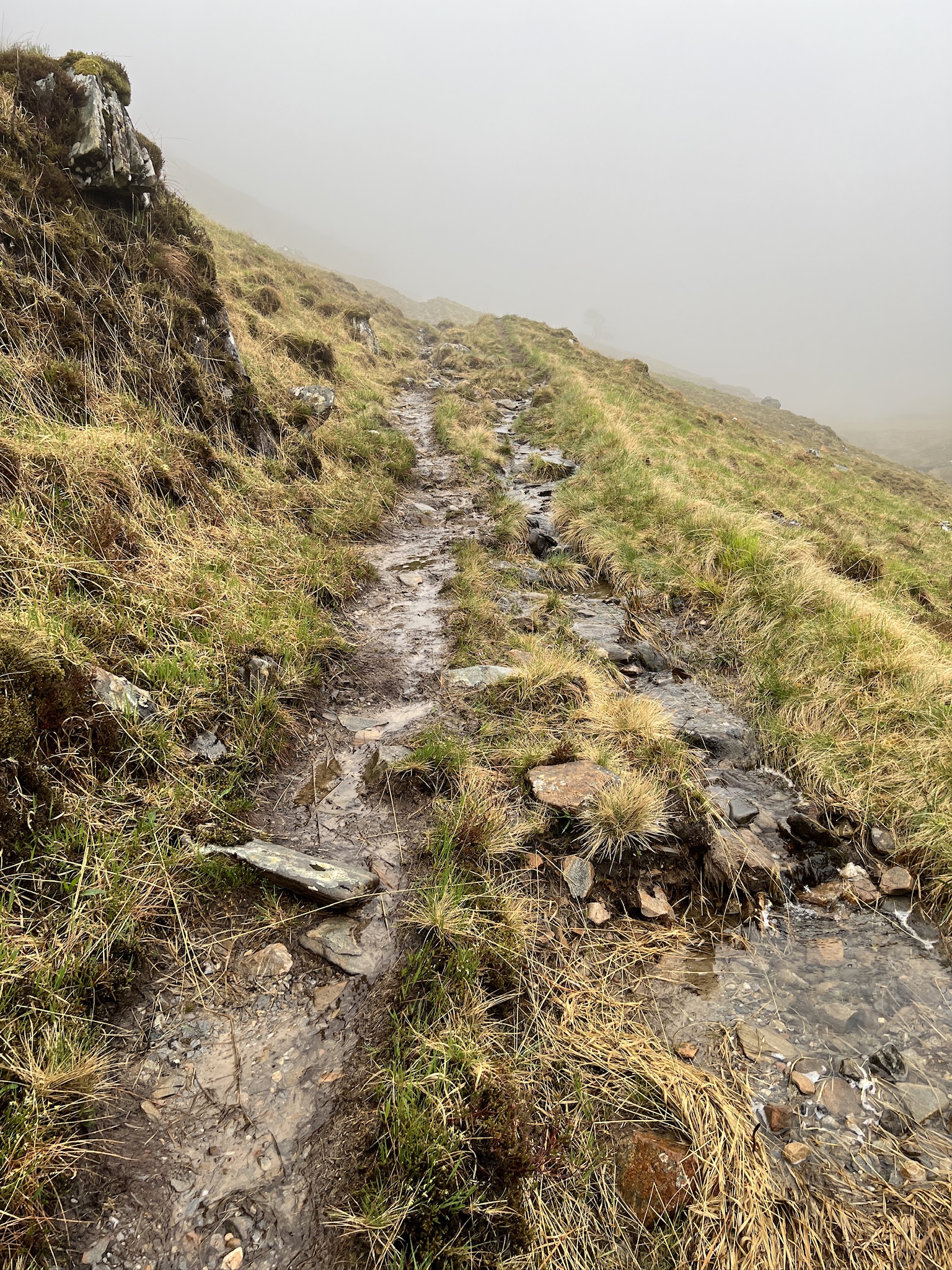
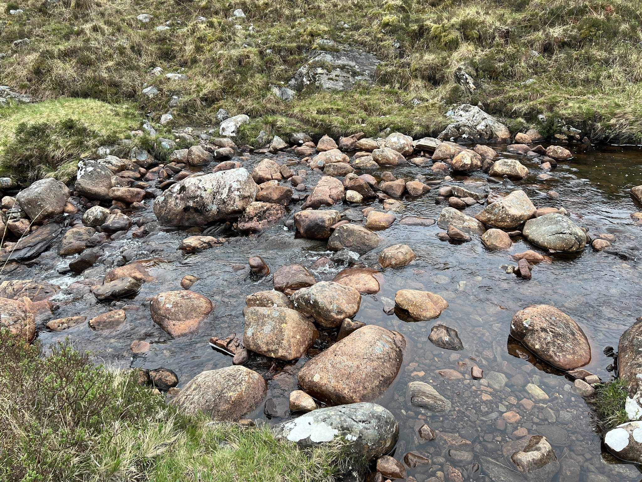
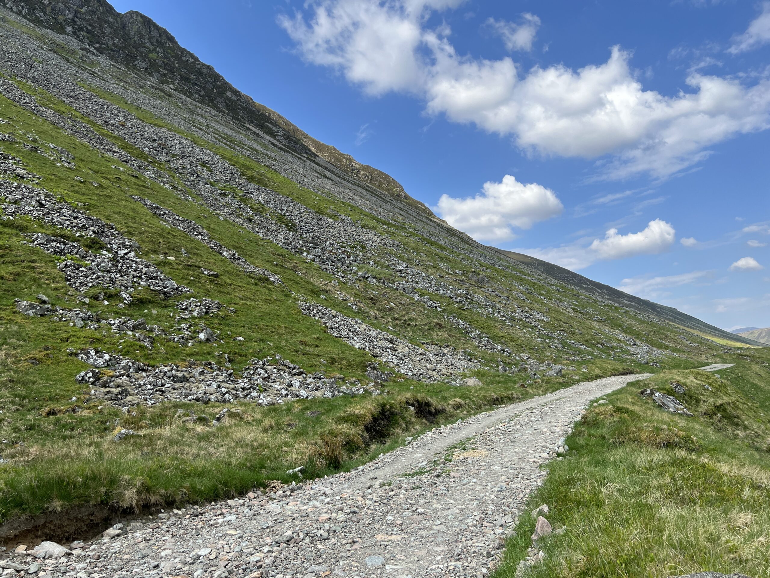
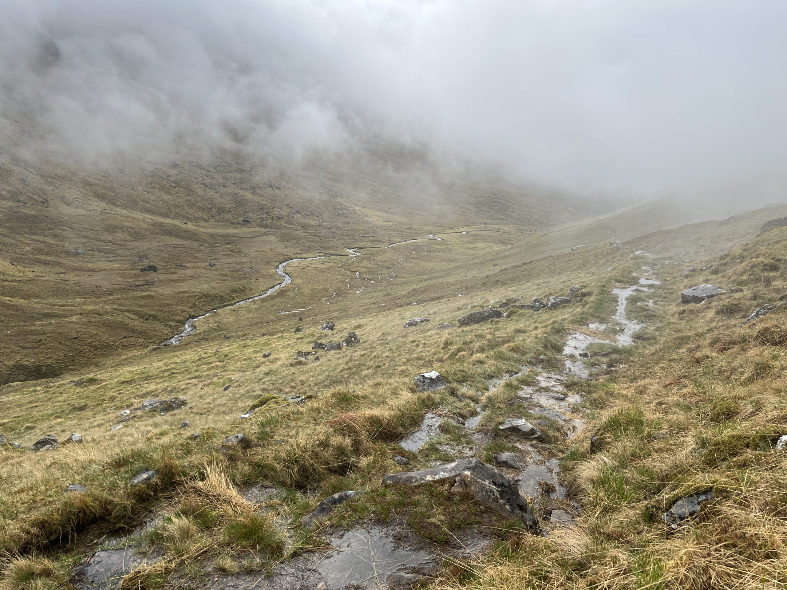
Paths are often stony and wet, but because there was little rain on this Challenge the latter problem was less prevalent than in the past. Trekking poles are essential.
Even when it hasn’t been raining, hillsides can be wet and boggy with sphagnum moss. This makes for hard walking.
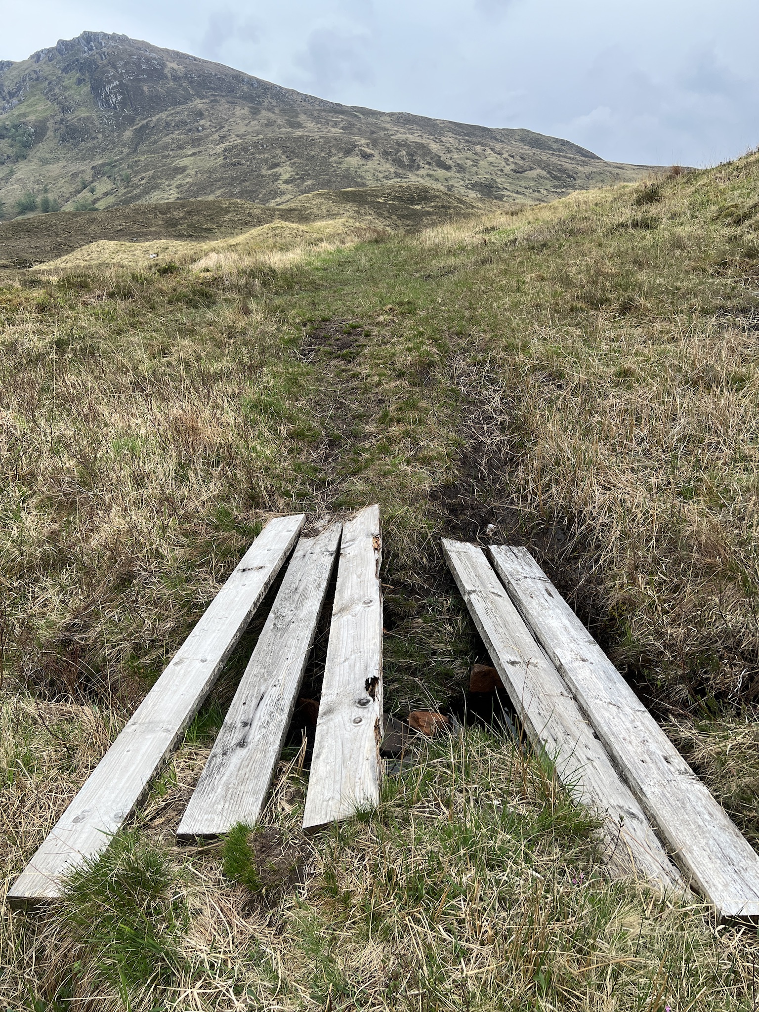
You get help along the way—bridges, board ramps, stones placed to make crossing rivulets easier, and channels cut across the path to prevent it from washing out.
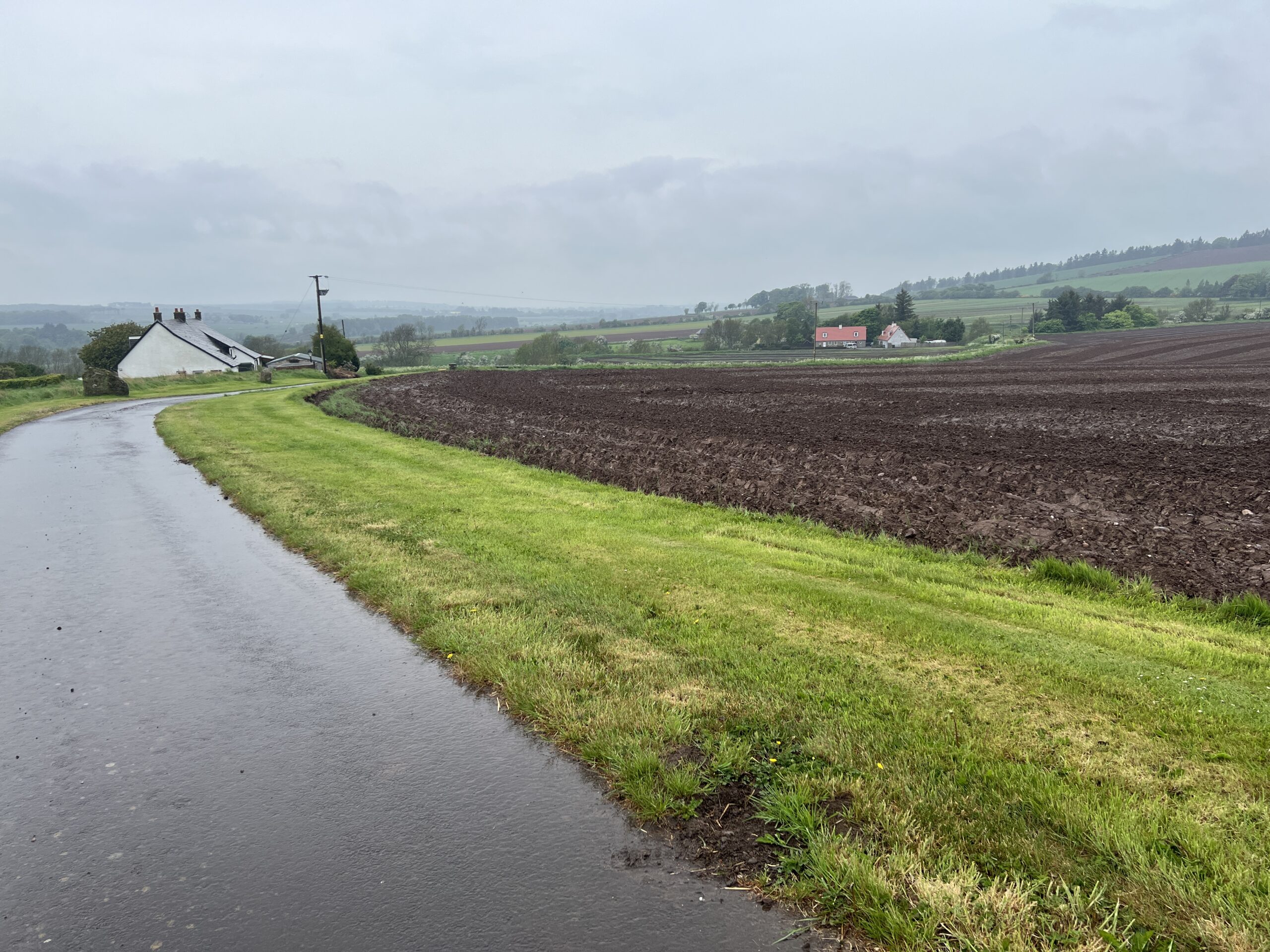
Eventually, however, the paths dwindle and asphalt road becomes the dominant surface. This is a sign you’re nearing the east coast.
The Challenge’s vetters now ask walkers to send GPX files of their proposed routes in addition the traditional written descriptions. (The routes have to be approved in advance, and the vetters’ advice is invaluable.)
From this year’s data, the coordinators created an extraordinary image—all of the routes displayed on a map of the Challenge territory (with much of the rest of Scotland barely discernible around it).
It’s a picture of the individuality, and the unity, of this event.
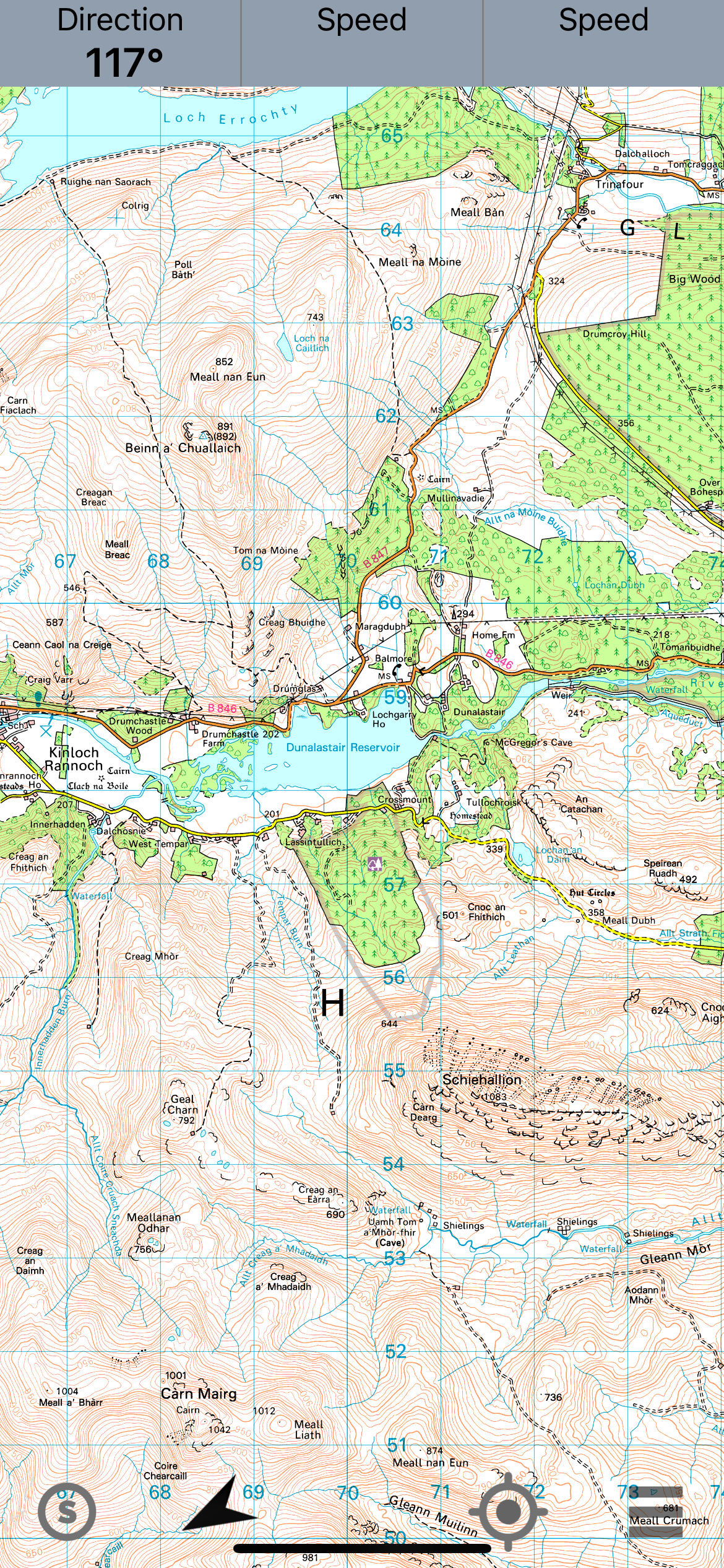
The night I spent in Kinloch Rannoch, my dinner companion, Colin Somerville, a Scot who works in London as an accountant and recently retired, mentioned that a mountain we could see from the hotel played an important role in the history of science.
The mountain is Schiehallion. It means “fairy mountain” in Gaelic, but is better described by its Norse name, which translates to “maiden’s breast.”
In 1774, it was the site of an experiment designed to confirm the prediction by Isaac Newton that all objects with mass exert gravitational “pull,” not just massive ones such as planets.
If confirmed, this idea that the measurement of a competing mass to that of the planet would allow one to make deductions about the Earth’s density and, indirectly, that of the known planets.
Newton considered such an experimental measurement impossible because a competing mass on the Earth’s surface would be too small to produce a meaningful deviation in the measured effects of gravity.
However, Charles Mason, an astronomer whose name is permanently (if less importantly) associated with the Mason-Dixon Line separating Pennsylvania from Maryland, believed Schiehallion’s shape, symmetry, and isolation might make it a candidate. Mason, however, didn’t want to do the work, so Nevil Maskelyne, the Astronomer Royal took it up.
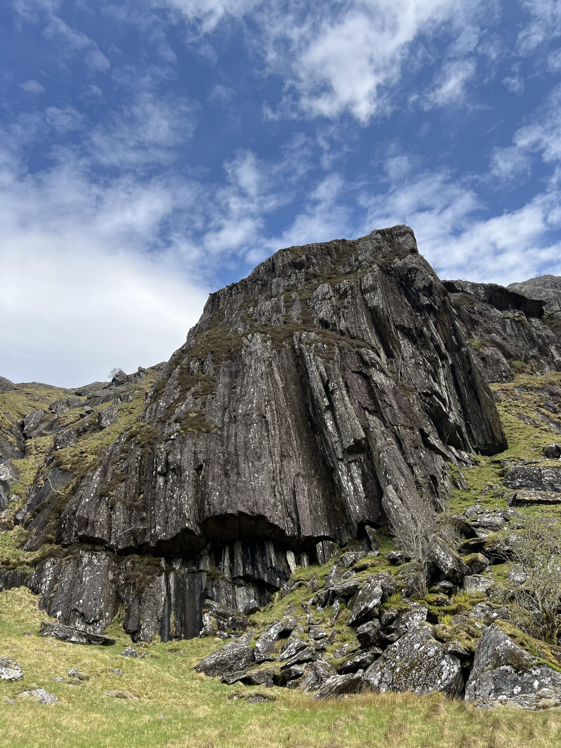
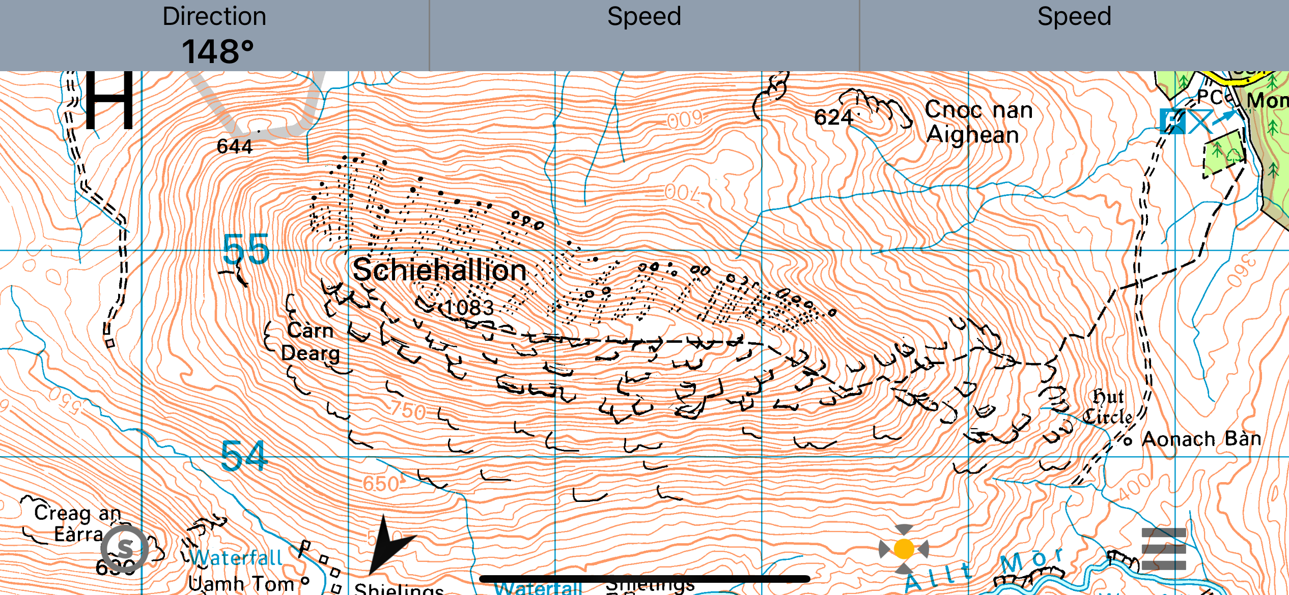
Schiehallion wasn’t a cone, despite how it looks from a distance. It’s more of an overturned boat with a pointed keel (as a modern journalist has described it). Importantly, it has relatively symmetrical sides. A topographic map on my phone shows its shape. Note the consistent distance between contour lines, which measure elevation.
Bothies—small stone buildings—were built on two sides of the mountain. The scientists used the most analogue of analogue instruments—brass quadrant, zenith sector, regulator (a precision pendulum clock), theodolite, surveyor’s chains, and barometers.
The task was to see whether a plumb line, which we normally think of as hanging straight in gravity, would deviate from its usual drop when measurements occurred next to the mountain. To test the hypothesis that it would deviate, one needed a standard angle of drop for comparison.
This is where my understanding of the physics breaks down. Somehow, astronomical observations provided this “gold standard” index of gravity’s effect.
The measurements were taken in summer, at night (so stars could be observed), in overcast and rain (when observations couldn’t be made), in midge season with no headnets or bug dope, and probably while wearing ties and recording the data by candle light.
Maskelyne collected his data, which included “76 measurements on 34 stars in one direction and 93 observations on 39 stars in another direction. From the north side, he then conducted a set of 68 observations on 32 stars and a set of 100 on 37 stars,” according to Wikipedia.
These measurements were only useful if one knew the mass of the mountain, which required an estimate of its volume. This task was turned over to Charles Hutton, a mathematician and surveyor at the British military college.
He’s a bit of an Abraham Lincoln story in that he had only secondary school education (Lincoln, I believe, had only three years of education) and was thereafter self-taught and tutored. He escaped going into the coal mines, where his father (who died when he was five) had worked, because a dislocated elbow incurred at age seven was never reduced and left him permanently crippled.
Hutton’s job was to determine the volume, and therefor the mass, of the mountain, which in turn was necessary for determining its gravitational effect. This, of course, was difficult, as all science is. He did it by creating rings around the mountain based on elevation. These required contour lines allowed him to calculate the area between the lines, and ultimately the surface area of the mountain.
While lines of some constant variable (depth of water, altitude) had been used in cartography occasionally before, Hutton’s use of elevation above sea level in the Schiehallion experiment became standard in government maps, such as the Ordnance Survey. From there, it spread to other “official” maps, such as that of United States government (and today the USGS’s topographic maps).
So how did it turn out?
Maskelyne’s measurement was that Schiehallion deflected the plumb bob 11.6 arc seconds off vertical. An arc second is 1/3600 of a degree. That’s a tiny deviation but, they concluded, a real one. Maskelyne, Hutton, and their team determined that Schiehallion exerted a gravitational force;
From that, they estimated the mass of the Earth (at a value that was within 20 percent error of the modern calculated one). They concluded that the density of the Earth as a whole was greatert than that of its rocky surface. They rejected the (ridiculous) idea the Earth was hollow. The deduced the Earth must have a deep component that was more dense than rock (believed by modern geochemists to be of molten iron). They made estimates of the mass of the known planets.
Years later, their measurements were used to calculate Newton’s gravitational constant, one of the half-dozen most important numbers in the knowledge of our world.
It’s a pretty good payoff for a summer of midge bites.
Is it possible to be wearing sweaty underpants you haven’t changed in three days, have legs itchy with two-day-old midge bites, have feet that ache, and to intermittently groan from exhaustion and still think you’ve had a perfect day?
If your answer is yes, then The Great Outdoors Challenge may be the event for you.
The previous day had featured a 17-mile walk, which turned into 20 miles when I couldn’t find the footbridge into Blair Atholl. I didn’t get to the campground in town until 10 o’clock, the end of nautical twilight, with just enough to raise a tent by.
I wanted an easier day when the sun rose.
The next morning I broke camp, left Blair Castle Caravan Park, and headed northeast up Glen Tilt.
Glens are river valleys; every river has one. Some glens are famous; one is even called The Great Glen. Glen Tilt, however, isn’t, especially famous. But it has everything of the best of them.
I walked briefly through the woods on dirt roads until I came to a sign welcoming me to the estate—the privately owned land—through which I’d be walking.
This was followed by a sign that had no threats of punishment or declarations of liability, and that assumed adults could behave responsibly.
The walk started out with a little history—a monument to the last public hanging on the estate, in 1630, that was erected in 1755. I didn’t visit the monument; it was too early in the day for a diversion. I wasn’t clear whether it was a celebration of capital punishment or of the end of it.The last public hanging in Scotland was in 1868, the last judicial hanging in 1963.
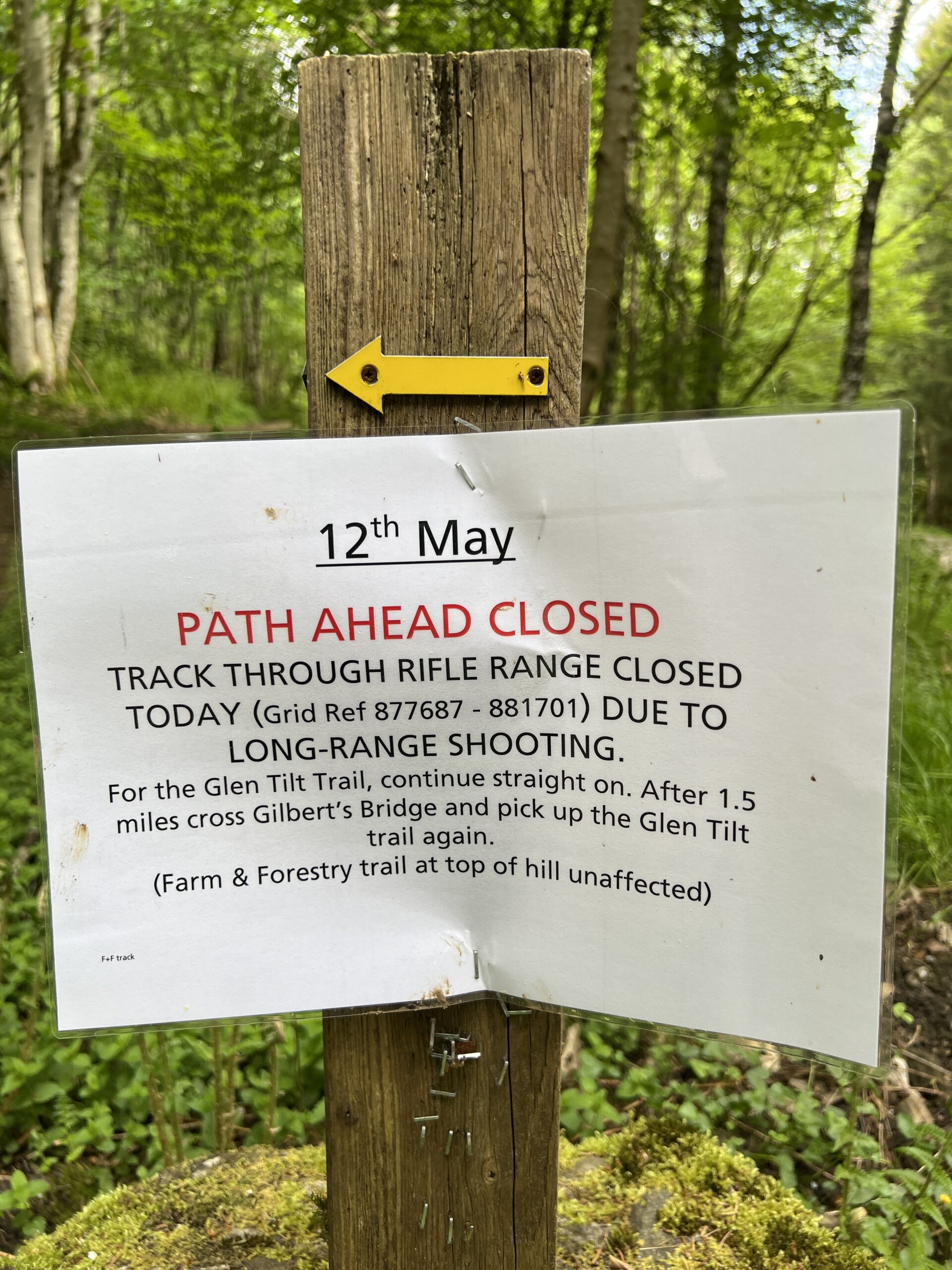
Soon after, I passed this sign. I knew from my route planning there was a gun range nearby, but I didn’t know whether it was a military installation or a recreational venue. It was the latter.
It wasn’t clear to me whether the path was closed after May 12 or just on May 12. As I pondered, a couple walked by without a glance. I stayed on the road just to not be a rule-breaker, but I ran into them two miles up the road. They said the prohibition was only for that one day.
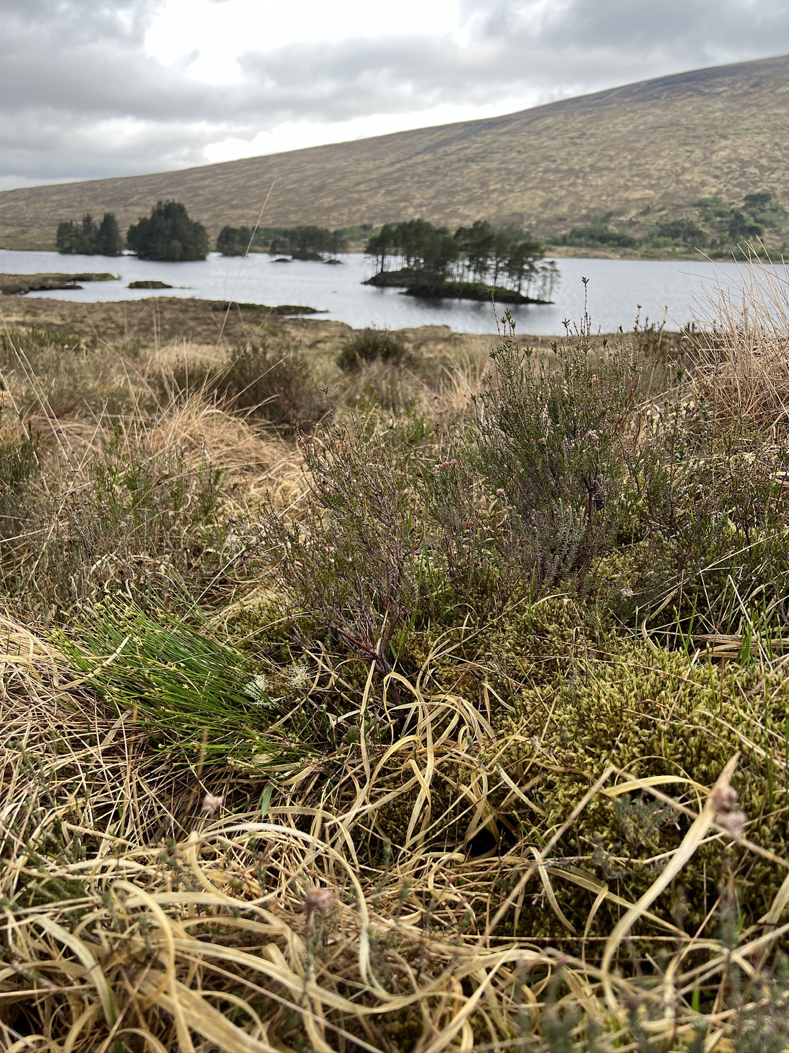
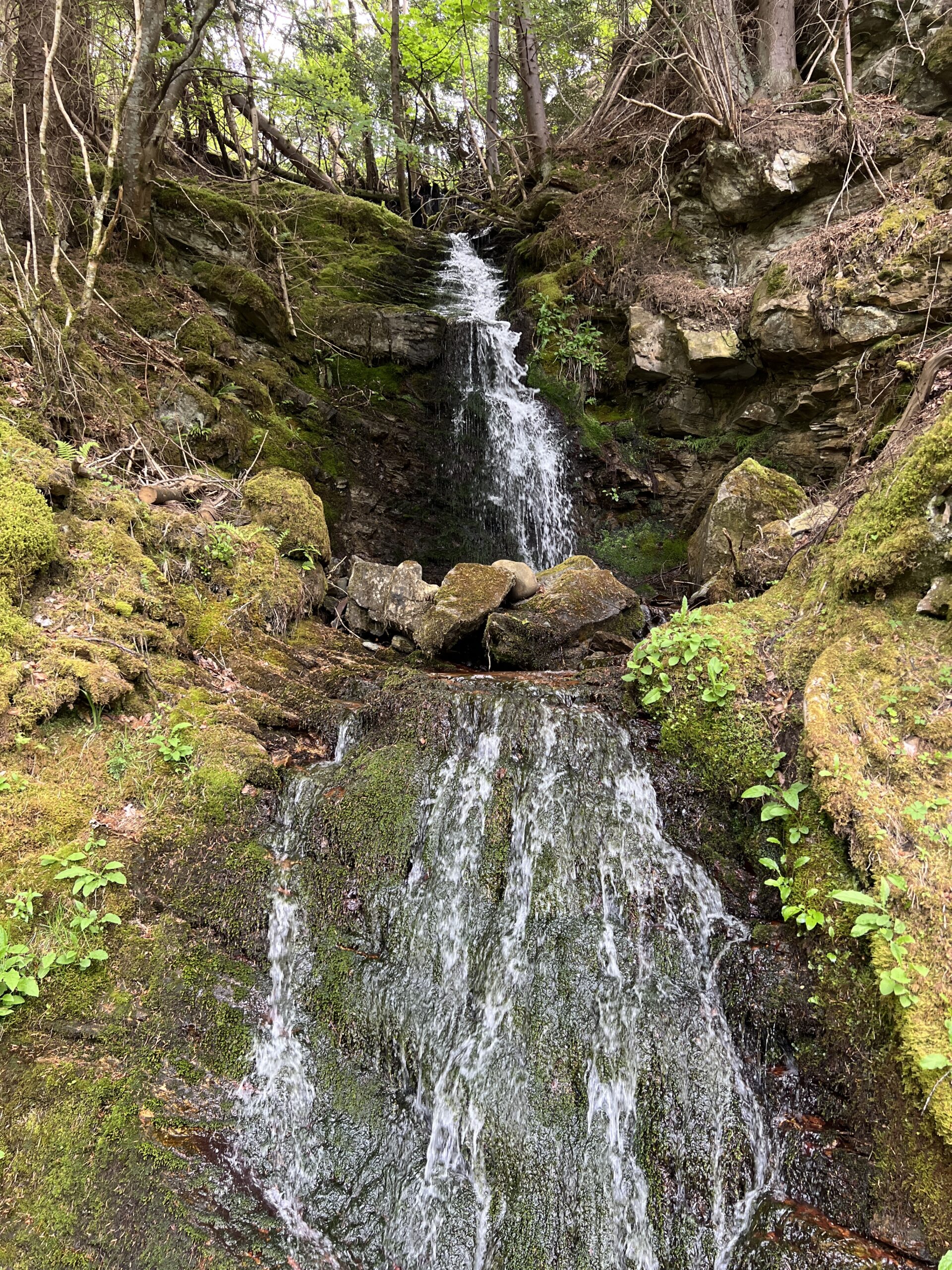
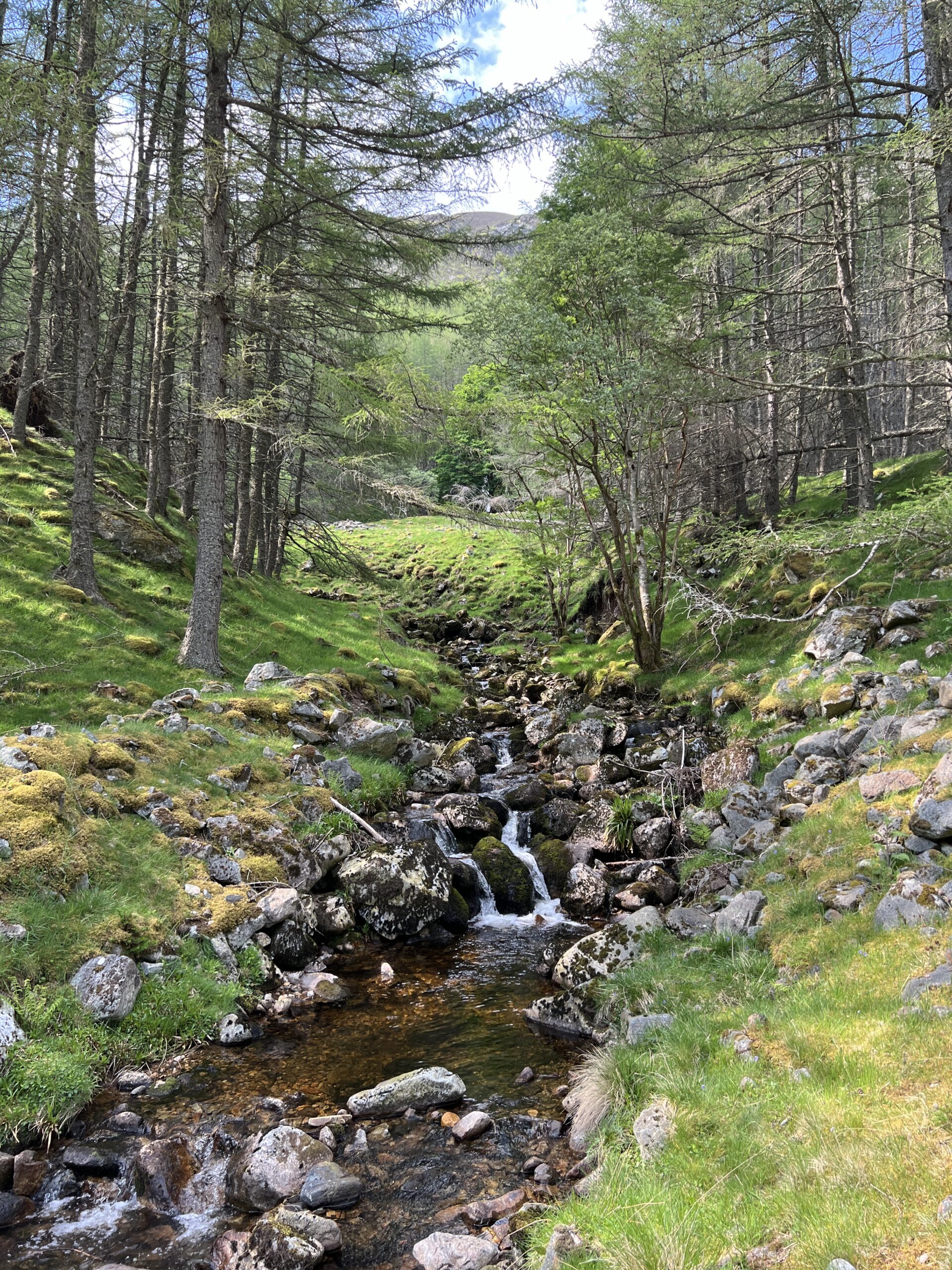
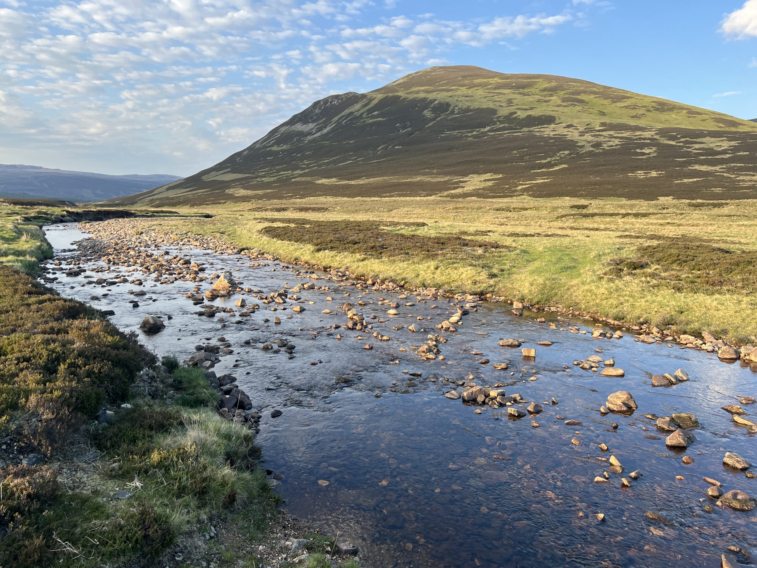
The rivers that form the watery spines of glens are wide and big at the bottom of the glen, where they leave to join a larger watercourse or flow into a loch or reservoir.
They’re fed by streams (“burns”) coming off the hills.
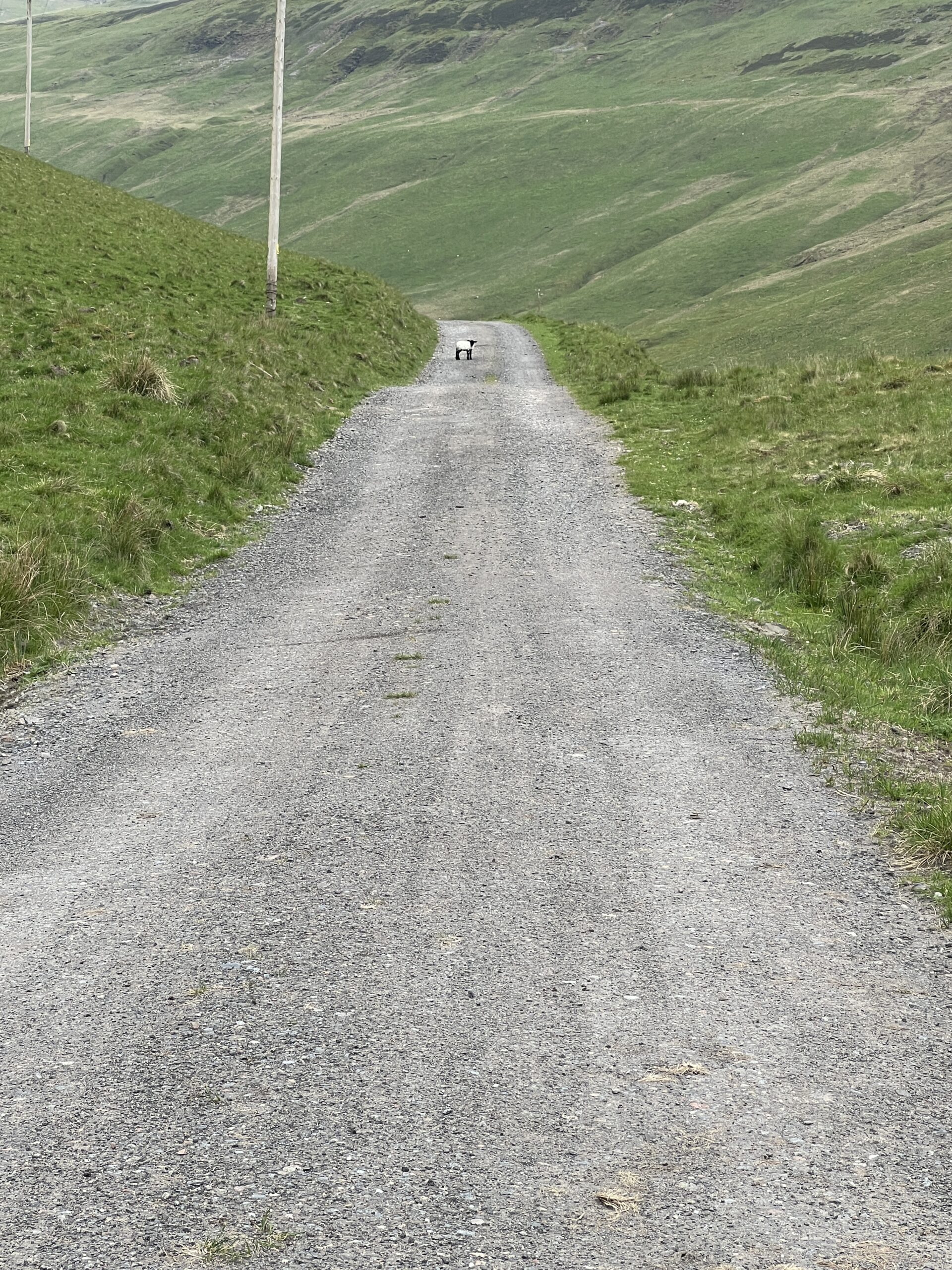
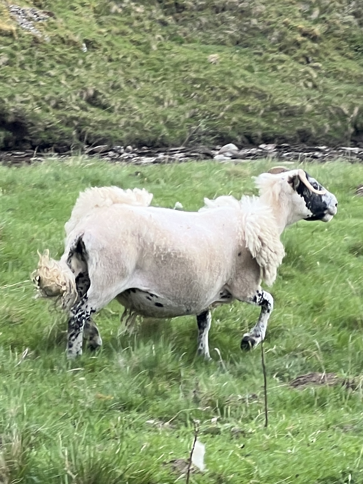
Sheep were much in evidence, as we’re signs of previous inhabitants.
I roused this lamb from a lie-down in the middle of the road.
This one was all clipped and ready for the Westminster Sheep Show.
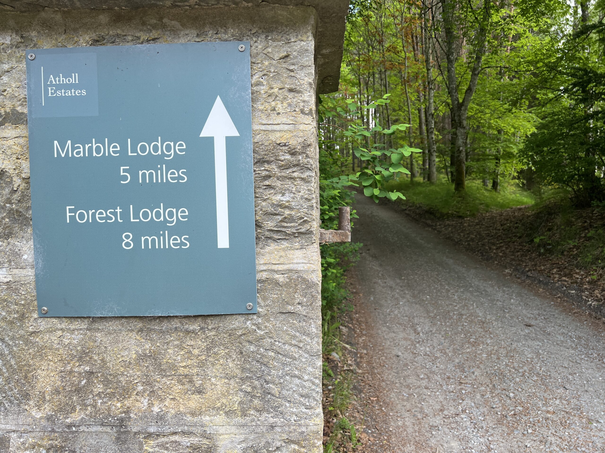
I passed the named destinations on the estate sign—Marble Lodge
and Forest Lodge.
Lesser buildings raised their brows to glimpse walkers on the gravel road.
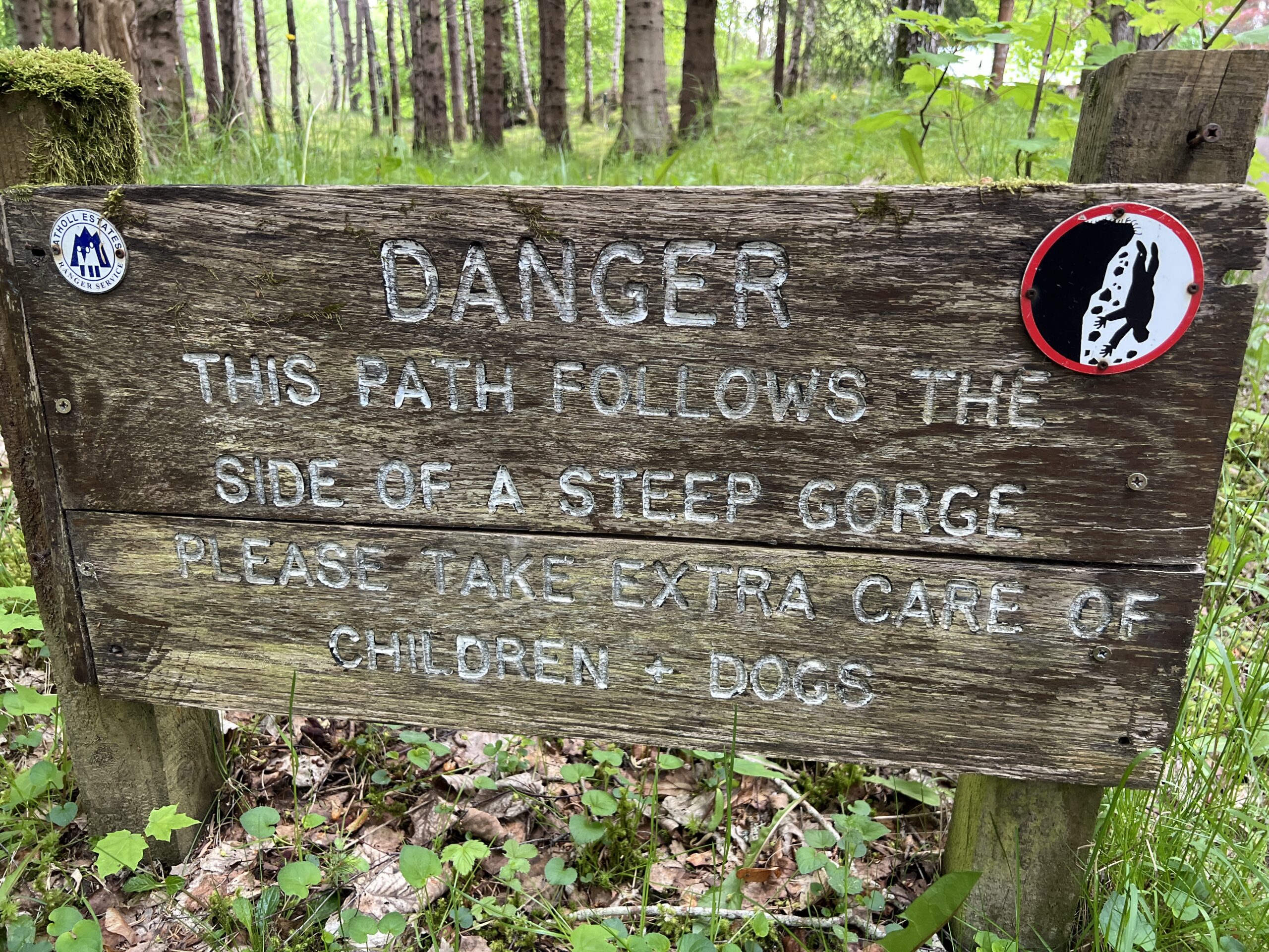
The sun was out and it was warm, almost hot. On one side of the river was (almost) treeless luxuriance.
And on the other, signs of catastrophic wall slump and scree fall.
I stopped several times for water and gorp, and once for an unscheduled lie-down from which I awoke with the first deep snore. If I’d taken my boots off I would have gone back to sleep. But I got up and “cracked on,” as they say here.
I was going to stop at a place called the Falls of Tarf for the night.
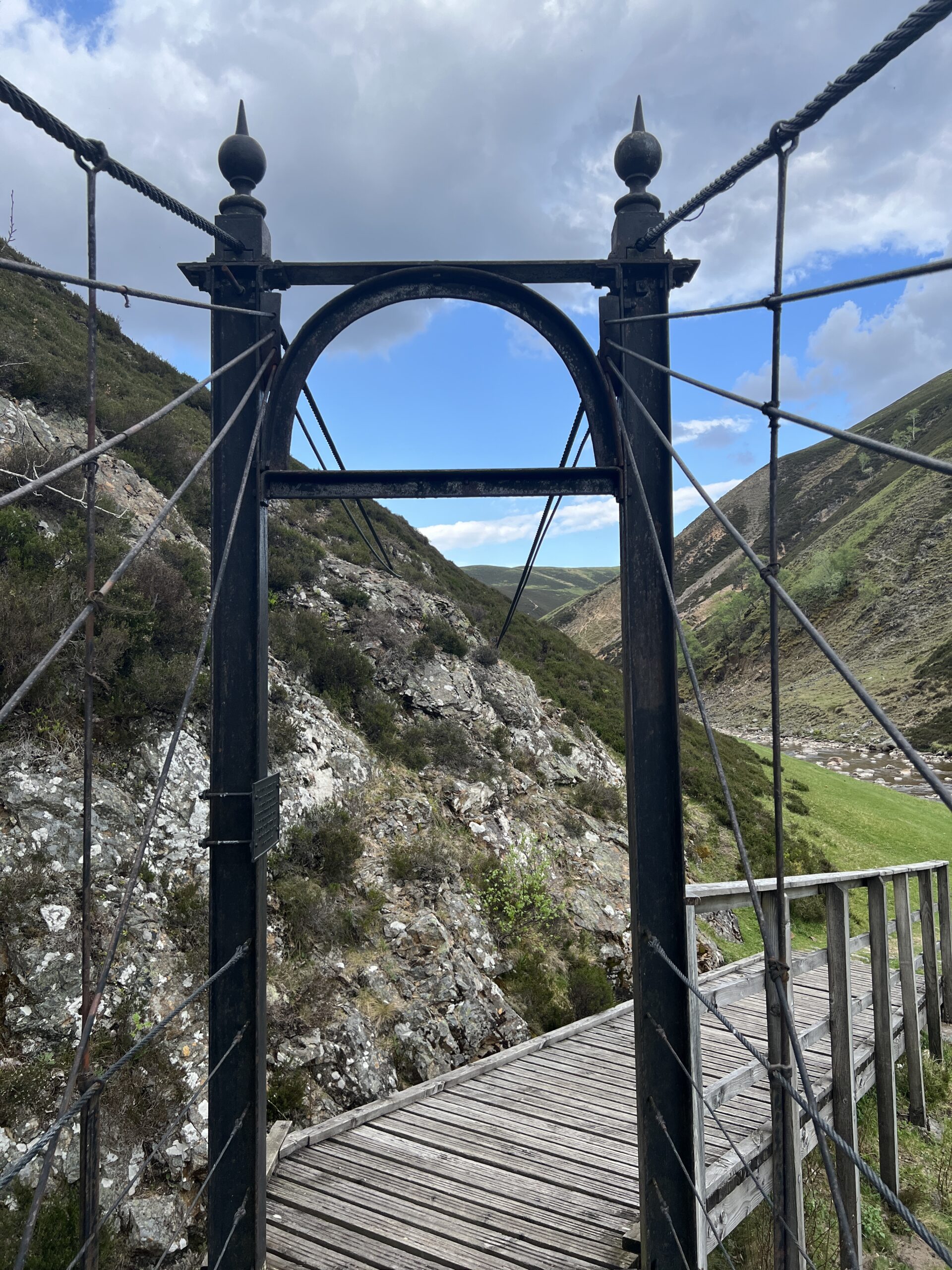
There was a footbridge there from the days when bridges in the middle of nowhere were endowed with unnecessary beauty.
It wasn’t early, but it was still light. The place where I started the Challenge is 1 degree of latitude south of Juneau, Alaska. The place where I stood was only a little farther south—and the days we’re getting longer. So I decided to crack on to the next place with good pitches, the ruins of a lodge about 3 miles up the trail.
The shadows grew long and I grew tall.
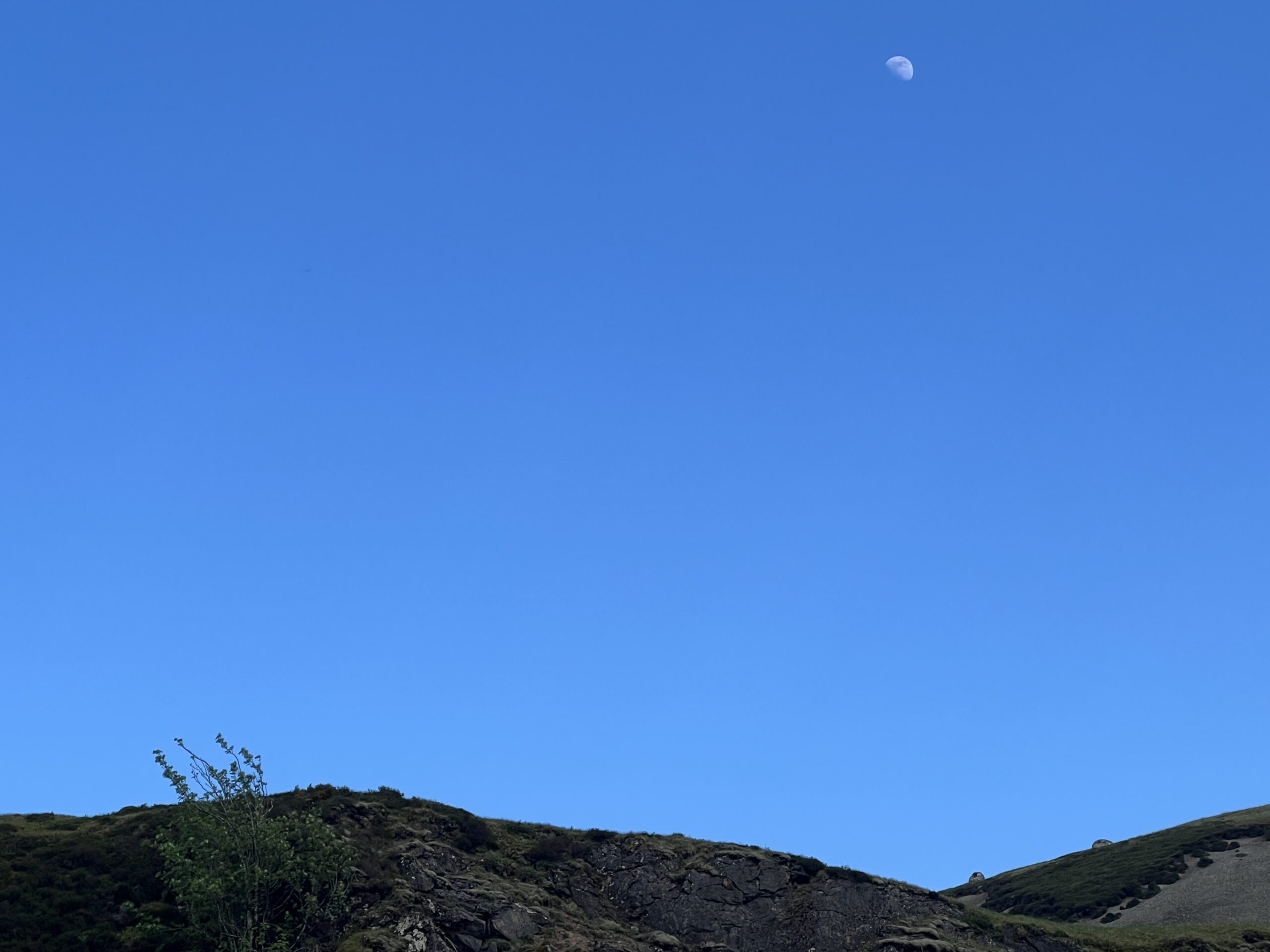
A barely gibbous moon appeared over the hill.
I passed a section of the opposite hill that someone someplace undoubtedly thinks has a message left by space aliens.
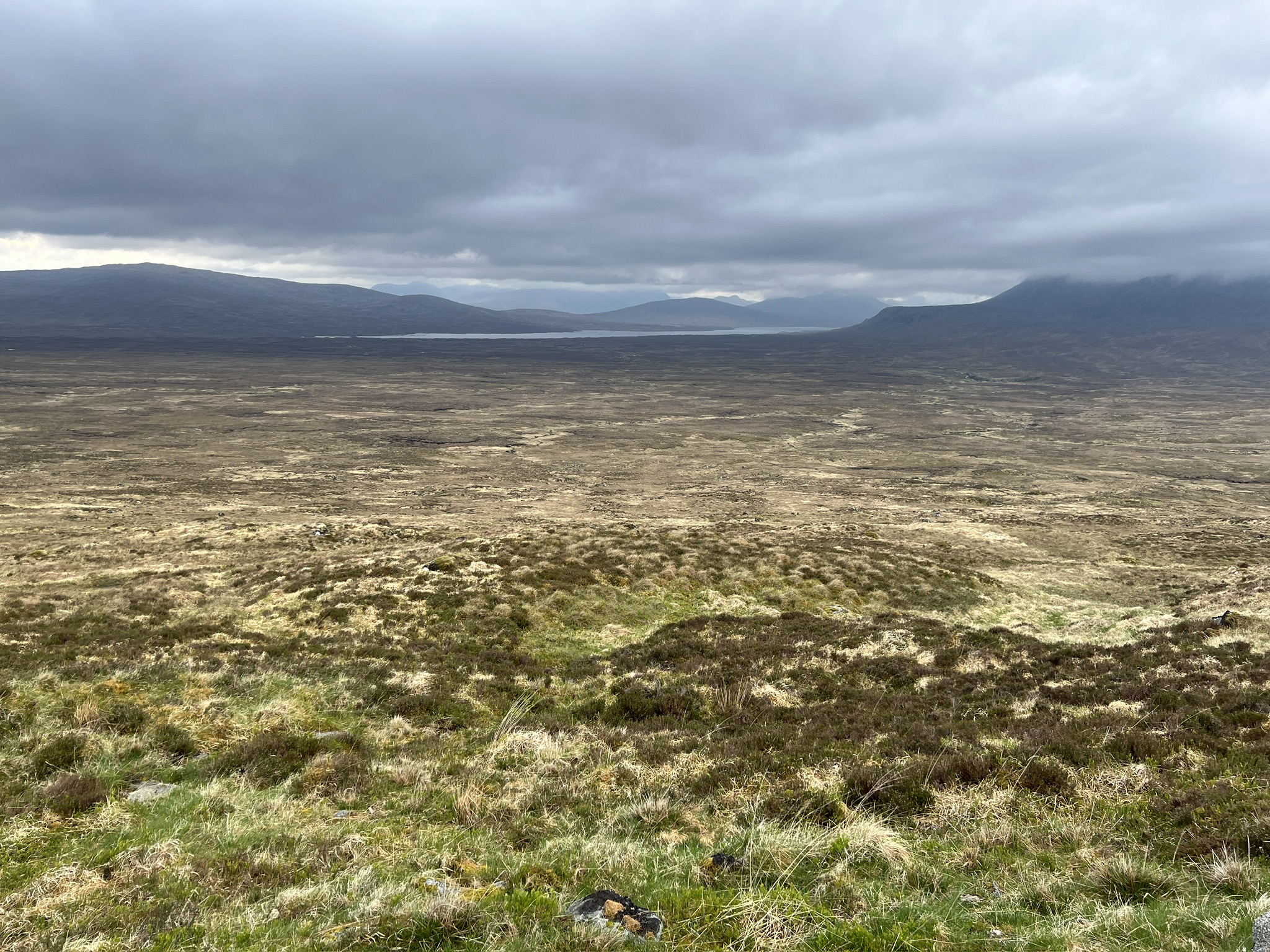
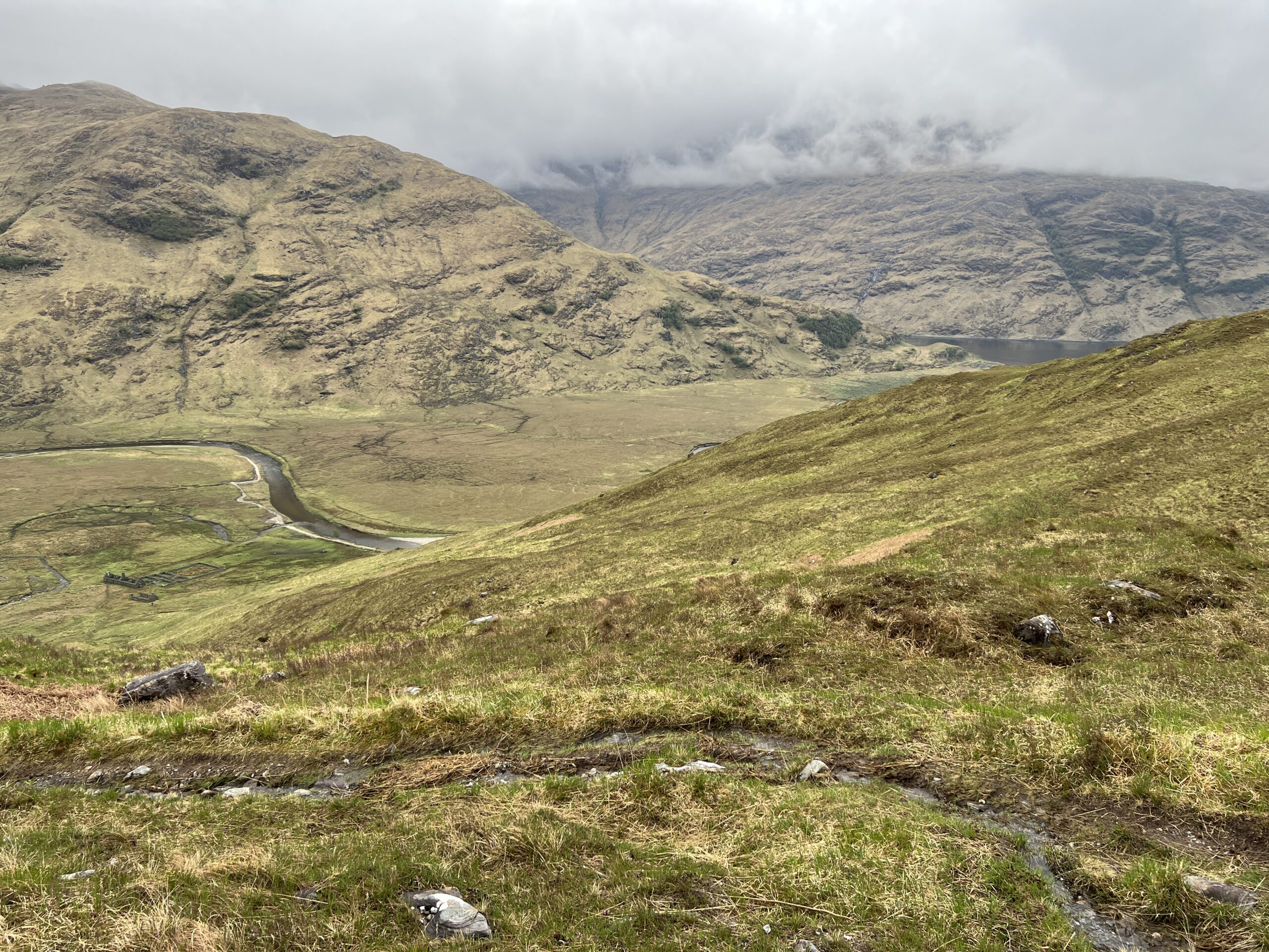
The wonderful thing about walking up a whole glen is that you witness a basic lesson in geography. The farther up you go, the smaller the river becomes. Eventually it’s a brook, and then nothing.
I never have the presence of mind to look for the nothing. But I do notice when, all of a sudden, I’m walking beside a stream flowing in the opposite direction. As they say here, I’ve “gone over the watershed.”
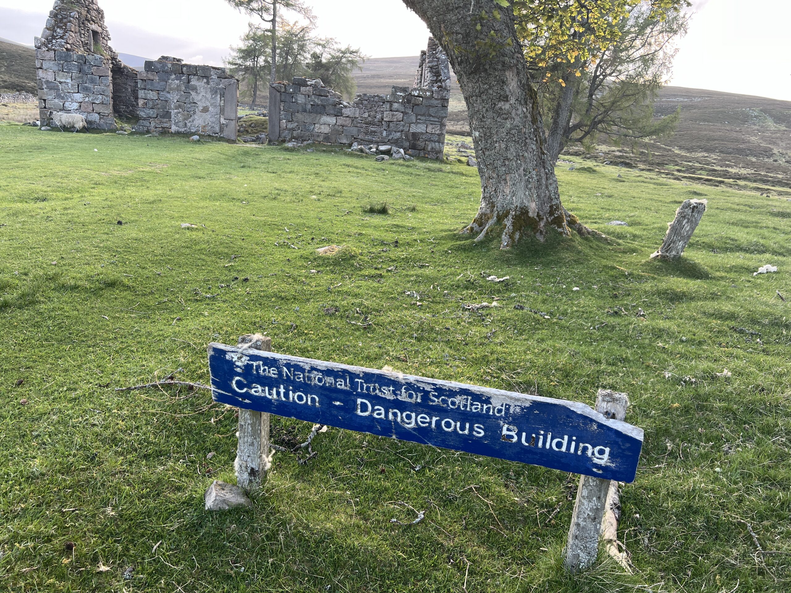
Soon after I noticed that I’d reached my destination, one of Scotland’s “dangerous buildings.” Never was I happier to court such catastrophe.
I set up my tent, had chicken tikka out of a foil bag, and a wee dram of Old Poultenay.
As noted, I picked this year’s route because I thought there was a good chance of meeting people along it. I have not been disappointed.
One’s reaction to chance encounters is usually “not enough” rather than “too much.” Of course, how could it be otherwise? Too much, then just walk on.
One also realizes there’s a big world out there in purpose and direction, not just identity and timing.
The first person I met on the trail was Hugh from Leicester. He’d done two or three crossings, was serious but not obsessed, fast. I wanted to know more of his story but I haven’t seen him since the morning after the first night when he was packing up beside the sea loch. I hope I see him again.
The next person I encountered was Mikhail. He was going in the opposite direction from me, so unlikely to be a Challenger. It turns out he’s Polish and headed to Cape Wrath, most northwest point in Scotland. Could there be a better named place?
There is no no single route to Cape Wrath, only headings. Mikhail was not going the whole way. He planned to get off the train closer to the coast but got impatient. He got off at Ft. William.
”I just decided to come on this way,” he said. He’s going to be out six days, no time to waste.(So much for meticulous route planning, which is the way of the Challenge.)
“It is so beautiful here,” he said in barely accented English. “We don’t have this at home.”
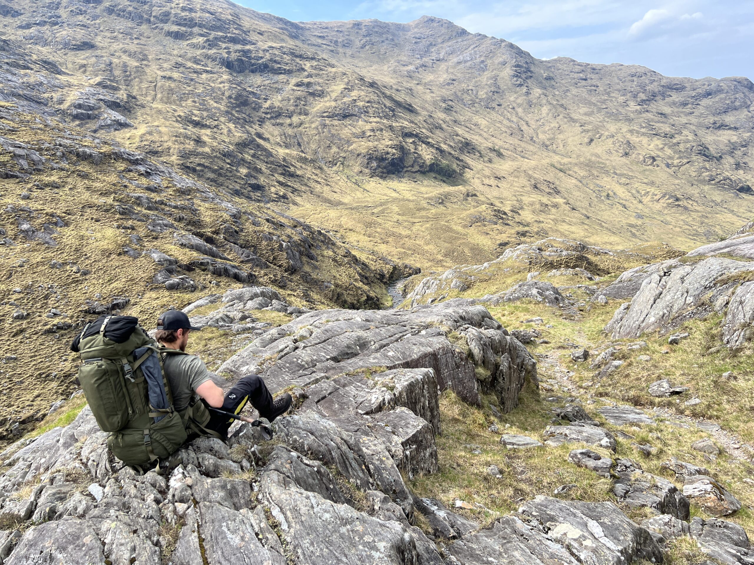
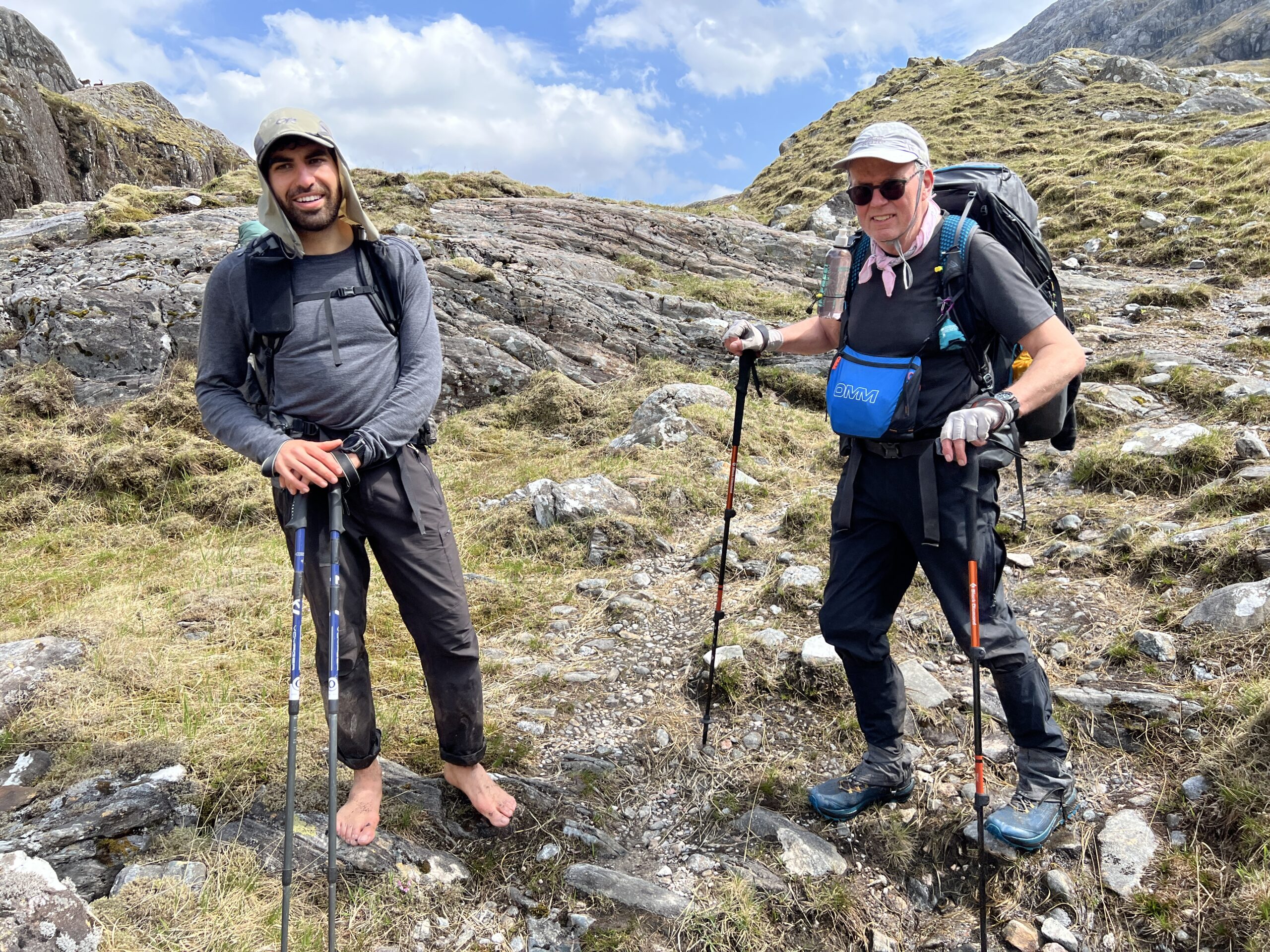
Not long after, I ran into two more men heading in the opposite direction from me. I was surprised to see that one of them was barefoot. He’s Roy, an Israeli. The other man is from France; I didn’t catch his name.
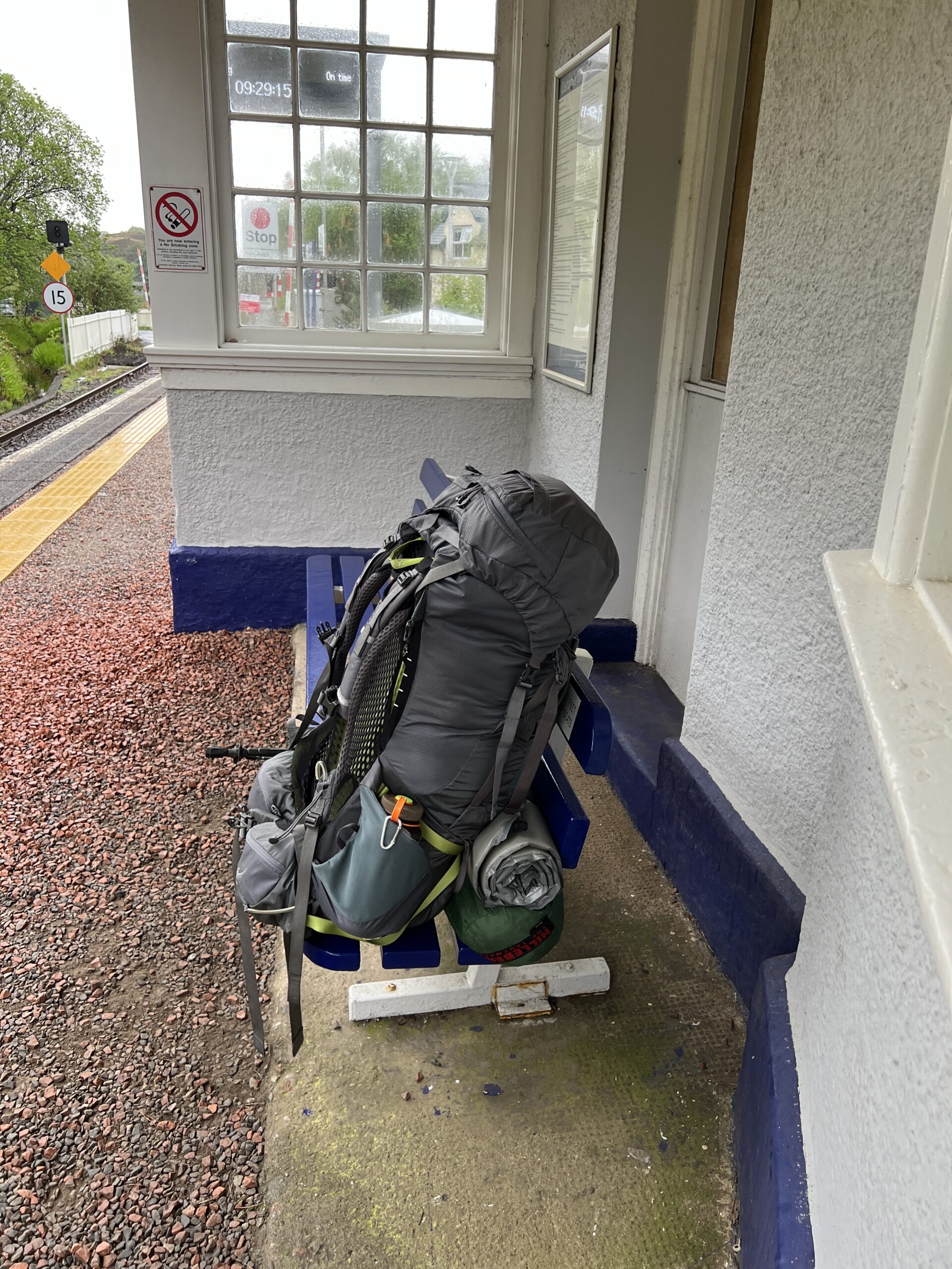
Roy said he was tired in walking in wet feet. You can see how small a “kit” ( as they call it here) he has. You can hardly see his backpack. He’s never been to the United States, but is coming next year to hike the Pacific Crest Trail—Canada to Mexico down the West Coast.
Roy plans to make Cape Wrath in 10 days, the Frenchman in 14. A chance encounter, they’ve been walking together for 36 hours, but will soon part ways.
Farther along, I met Jessica from Amsterdam. She said she’d just finished bathing in a pool of frigid, tannin-stained water in a stream the path crossed. She had a Garmin beacon like the one I’d bought. We agreed the instruction manual, in six languages, was no help, although she’d managed to figure out more than I (no surprise).
That night I had three fishermen as neighbors at the east end of Loch Arkaig. I was over a hump in the shoreline; I don’t think they even knew I was there. Their camp included an elaborately protected privy. This man was heading to it as I left.
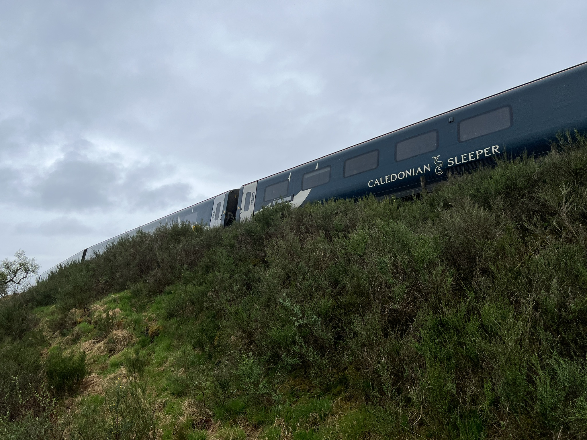
This was the day I left the road and went up the hillside to get a cell signal so I could order a replacement keyboard from Apple.
(It’s arrived, but I can’t connect it despite following the directions, which are in seven languages. It’s a “magic keyboard”; all I wanted was one that worked. This is a disappointment but not a surprise; see “waterproof” boots in a previous post).
After a tiring day—the hillside was trackless and I had to walk along the fall line of the slope—I got to a forest road and started to look for a place to camp. I didn’t find one, but I did find a bird-watching blind the forestry company had put up. There was a nice view, but no eagles.
I proceeded downhill to the lakeside, hoping to find an acceptably private stretch of shore. They were hard to find. I eventually rounded a corner and saw a tent on a patch of grass next to a rocky foreshore. Beyond it was a small peninsula that might have dry ground. A man and woman were sitting outside the tent.
“Would you mind if I looked for a pitch out there?” I asked.
“You on the Challenge?” the man asked. I nodded. He gave me a thumbs-up sign. “There’s room right here.”
The right here was right next to their tent. I hoped they weren’t on their honeymoon. I protested, then thanked them, then stepped off the road onto the patch of grass, and heaved off my pack.
He was Graeme Dunshire, on his 16th crossing. The woman was Liz, his longtime companion, whose last name I don’t know. She’s accompanying him for a week, not the whole Challenge, as she has commitments at home,
I was appreciative of their generous gift to me of their privacy. Before bed I gave them a bag of homemade gorp—quite tasty and famous among my outing friends—of which I had an extra.
Graeme and Liz turned out to delightful and helpful travel companions, even though we didn’t travel together. Graeme is a builder and joiner; he told me to look out for house he’d worked on that I’d pass that morning. I don’t know what Liz does.
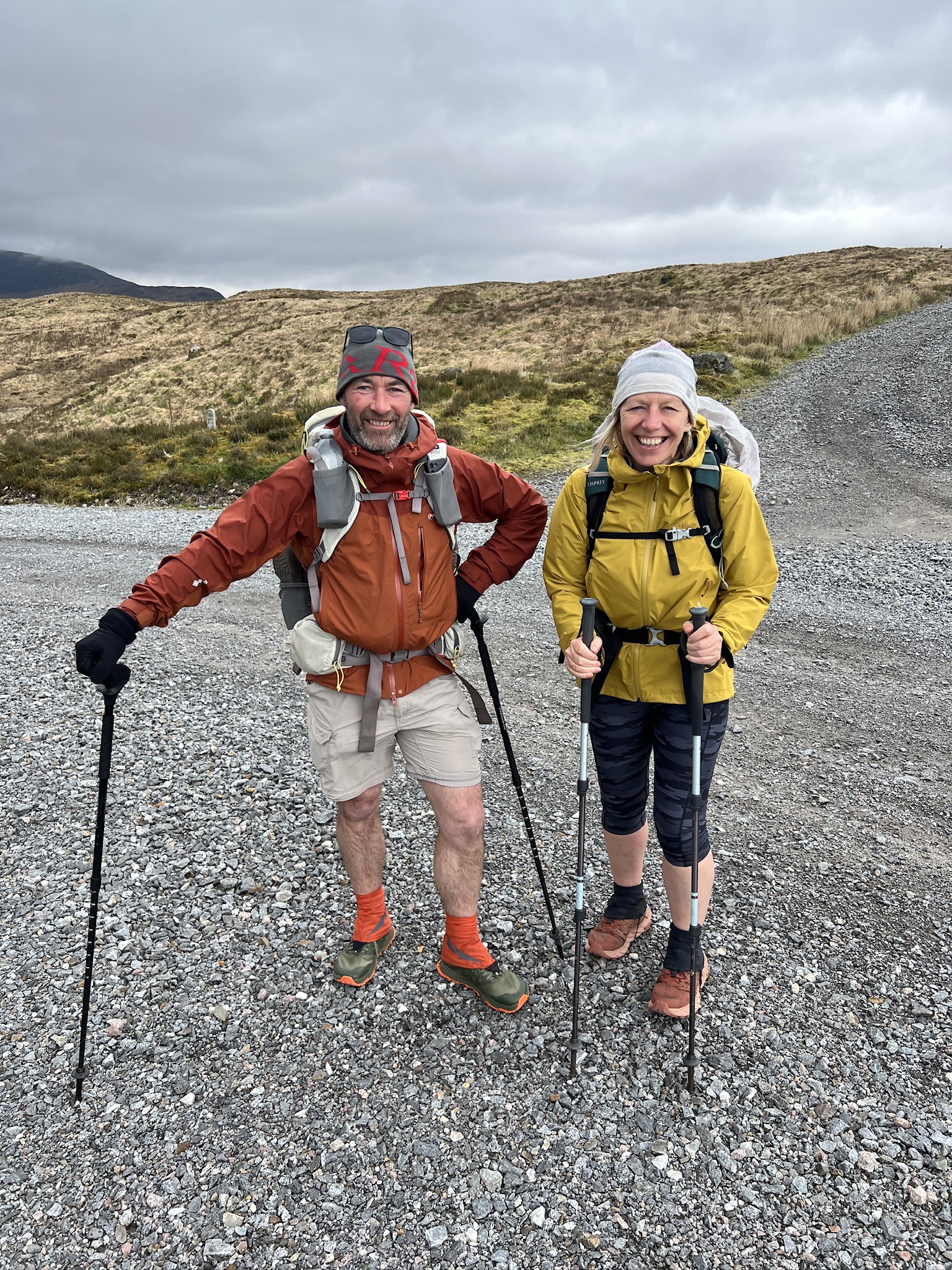
The next morning they headed off before me. Soon after I started I met a man named Tim, also on the Challenge. We got into deep conversation and eventually got a bridge and waterfall that seemed like a good place to stop.
Graeme and Liz were there. Graeme graciously pointed out we’d missed a turn a while back that was going to take us on our route, which was different from theirs.
Tim and I turned around and got back on the right route. We walked and talked. It was a nice morning, intermittently sunny with no rain in the air.
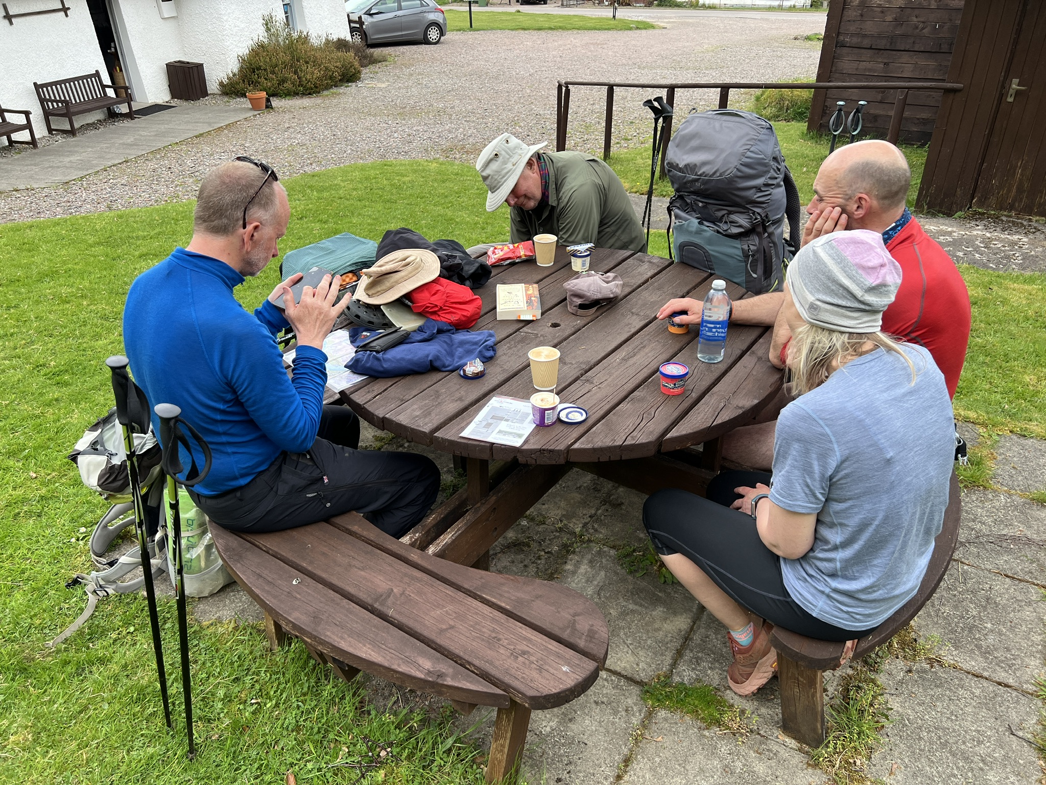
I’d seen the designation for a museum coming up on the map and mentioned I’d like to stop. Tim was game , but more interested in coffee and ice cream, which he’d been told was on offer.
We got there before it opened and sat at a picnic table. Soon a car with two people appeared. Soon after so did Graeme and Liz, from a different way About 10 minutes before the official opening time a young man came out and said we could come in.
I thought the topic was going to be about commando and other World War 2 training that had taken place on the estate, but it turned out it was the museum of the Clan Cameron, whose home grounds we were on.
The Camerons have a complicated history I only vaguely understand. They were mortal enemies of a couple of other Highland clans, and supporters of the Catholic Stuarts and their attempt to reclaim the English and Scottish thrones in the person of Bonnie Prince Charlie. They struck me a bit like the Indians who fought on the side of the French in the French and Indian War.
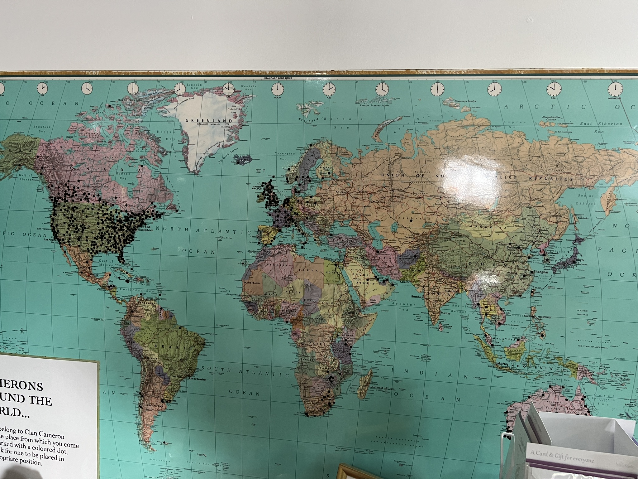
The prince’s invasion and uprising failed, but that wasn’t the end of the clan. It spurred emigration and there are now millions of Camerons around the world. The museum is a bit of a Mecca for them. Here’s a map of the homes of Cameron-blooded visitors to it; they’re the black pins.
The commonness of Scottish ancestry in the U.S. and Canada is evident.
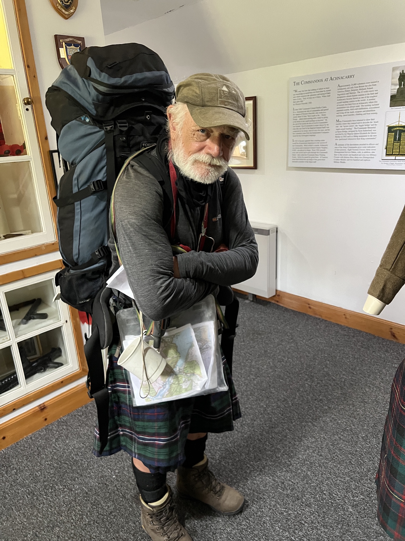
One of the visitors was another Challenger who looked like he’d stepped out of one of the paintings. (You’re hard core when you don’t even take off your pack.)
We all had some snacks and headed off in different directions.
Amazingly, a couple of days later I was coming down off a ridge to Loch Ossian. I saw two people heading toward me at a place where several trails converged. They crossed a small bridge.
It was Graeme and Liz again, heading on a different route, but still eastward, of course.
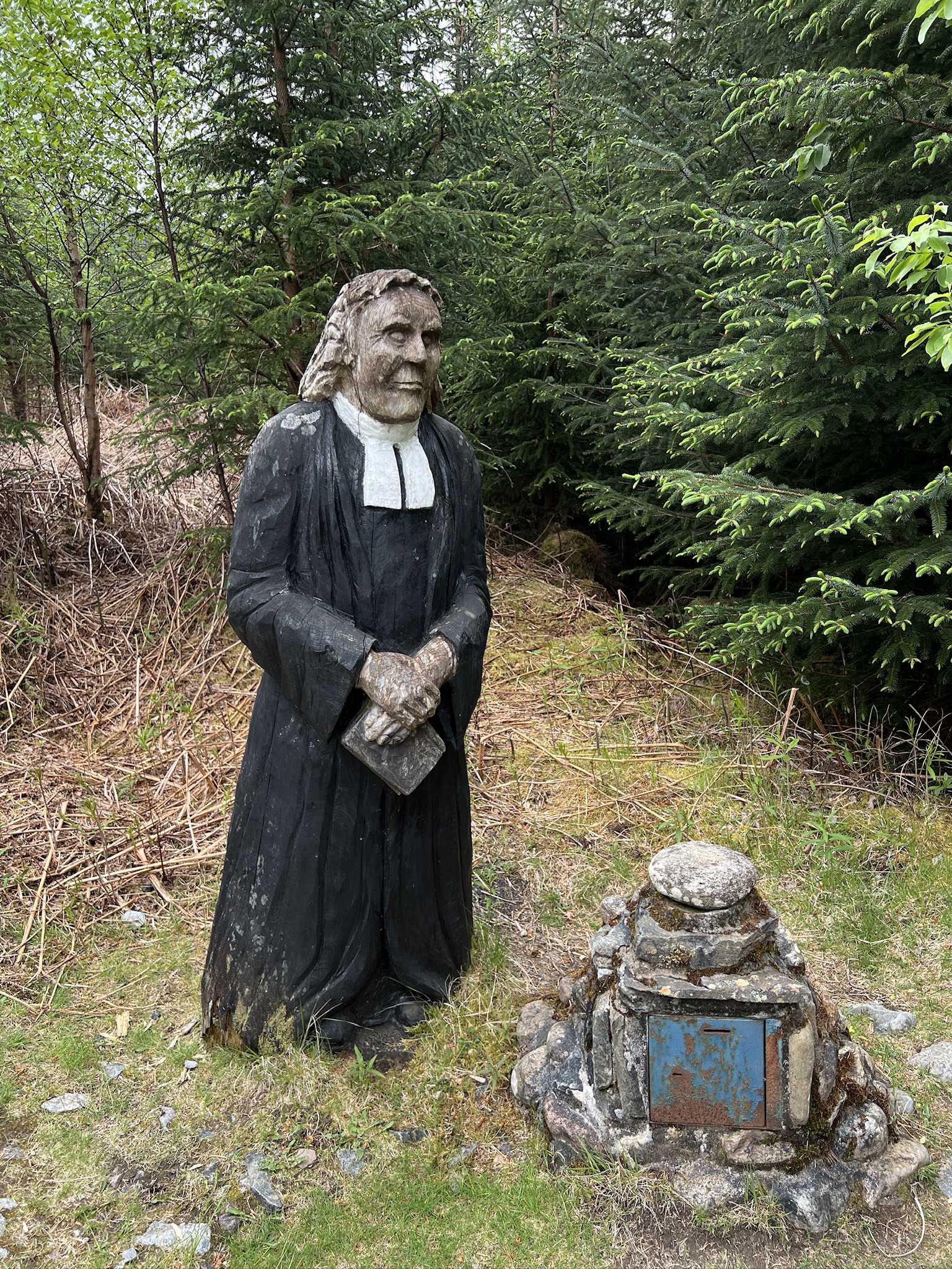
Some people surprise you on the trail. I walked around a corner in a forest track and came across “the wee minister.”
A sign said a previous sculpture in metal had been destroyed in the 1970s. (No mention whether it had been an an act of God or man.) This was the replacement. I put all the coins in my pocket in his collection box. It’s supposed to be good luck.
There are fleeting companions. I thought I was in the middle of nowhere
when I heard a distant rumbling and in a few minutes this came by.
There are some companions you never see. I got to the foot of Loch Treig about 7 o’clock and really wanted to stop. It was drizzling. I looked around for a water source but couldn’t find one other than the loch, which required going across a swampy shore.
The person in the tent at the extreme left might have had an idea. But nobody came out as I walked around, and I didn’t want to disturb them, so I walked on.
There are people who you’d like to get to know better, like these guys taking a smoke break outside the village shop in Kinloch Ranoch.
The most memorable companions, however, are those with whom you share distilled accounts of important experiences and history.
Tim and started out with small talk about routes and equipment, as is often the case. His pack was on the bigger side of the bell curve, but nothing like mine. I asked how much it weighed. He didn’t know.
“I fill it with what I need and that’s the last I think about it,” he said.
We talked about tents, and the trade off between a light one and a comfortable one. He has a Hileberg, as do I—a Swedish beauty that used to be considered light but, comparatively, is no longer. He bought his in the 1980s with the 50-pound inheritance his father, a coal miner in Nottingham, had left him.
Tim’s father was one of “Bevin’s Boys,” named after Ernest Bevin, who was Minister of Labour and National Service during World War 2. They were young men persuaded (and some eventually conscripted) to go into the mines when Britain’s coal production lagged. He worked there for more than 40 years.
Tim went on a school field trip down into a mine when he was 15. He couldn’t imagine working there. Instead, he worked at the post office for more than 30 years before retiring a few years ago. He now does part-time maintenance and ushering at Albert Hall in Nottingham, and hospitality for the city’s football club.
Tim grew up in council housing and knew nothing about camping or hillwalking as a child. But he knew he wanted to see Scotland, so he took a trip there when he got out of school at age 17.
“I would look up at the hills and say to myself, ‘I wonder what it’s like up there.’ I had no idea you could actually go up on them.”
In Braemar, he met an Australian couple from Melbourne. David was a printer and Caroline was a librarian. He talked with them and they told him they spent the free time and money they had traveling the world, seeing things and going to places they’d never get to unless it was by specific intention.
“I never realized you could live a life like that,” Tim said. “It had never occurred to me it was possible.”
After that, Tim started hillwalking. He corresponded with David and Caroline and they invited him to come to Australia, which he did for one of his holidays in the 1980s. About 10 years later, he took unpaid leave from his job and went again, for a couple of months.
“One of my mates at work said, ‘What are you doing taking unpaid leave.’ I was 33. I told him, ‘I’ll never be this age or this fit again. I’m just going to go’.”
Tim does hillwalking when he can. He belongs to an outdoor club in Nottingham. He’s 56 and this is fourth Challenge. His aged mother is looking after his dog while he’s on this one.
I asked him if David and Caroline are still alive.
“Yes,” he said. “They changed my life.” His eyes filled with tears. I asked if he still kept in touch with them.
That’s what my inner guru told me when I woke up at the Morar Hotel the morning of the start of The Great Outdoors Challenge, 2024
Morar is the toughest starting place on the west coast—steep, without trails or tracks for the first two days, with cliffs you’re tempted to get close to for ease of passage. I’d been encouraged to plan an alternative start in case I didn’t feel ready for it on starting day.
It was raining when I got up. I was hoping to meet some other Morar-starters in the hotel, get advice, and insinuate myself into their climb for the first two days, but there were none there.
Morar is reputed to have the most beautiful and isolated views on the west coast, but rain was predicted for at least a day so I wouldn’t be offered them. I’d purchased a find-my-crippled-body GPS beacon from REI (for $400) two days before I left Baltimore, but didn’t want to be so inhospitable as to use it.
Excuses? Of course.
I didn’t feel comfortable—I was too scared—to leave alone from Morar. So I took the train to Mallaig, seven minutes to the north.
I started from Mallaig on my first Challenge, in 2014. It didn’t seem like old hat going back there.
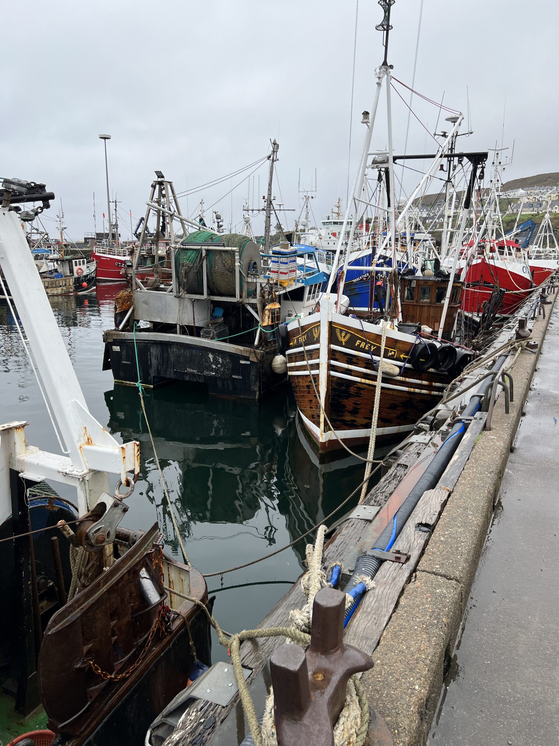
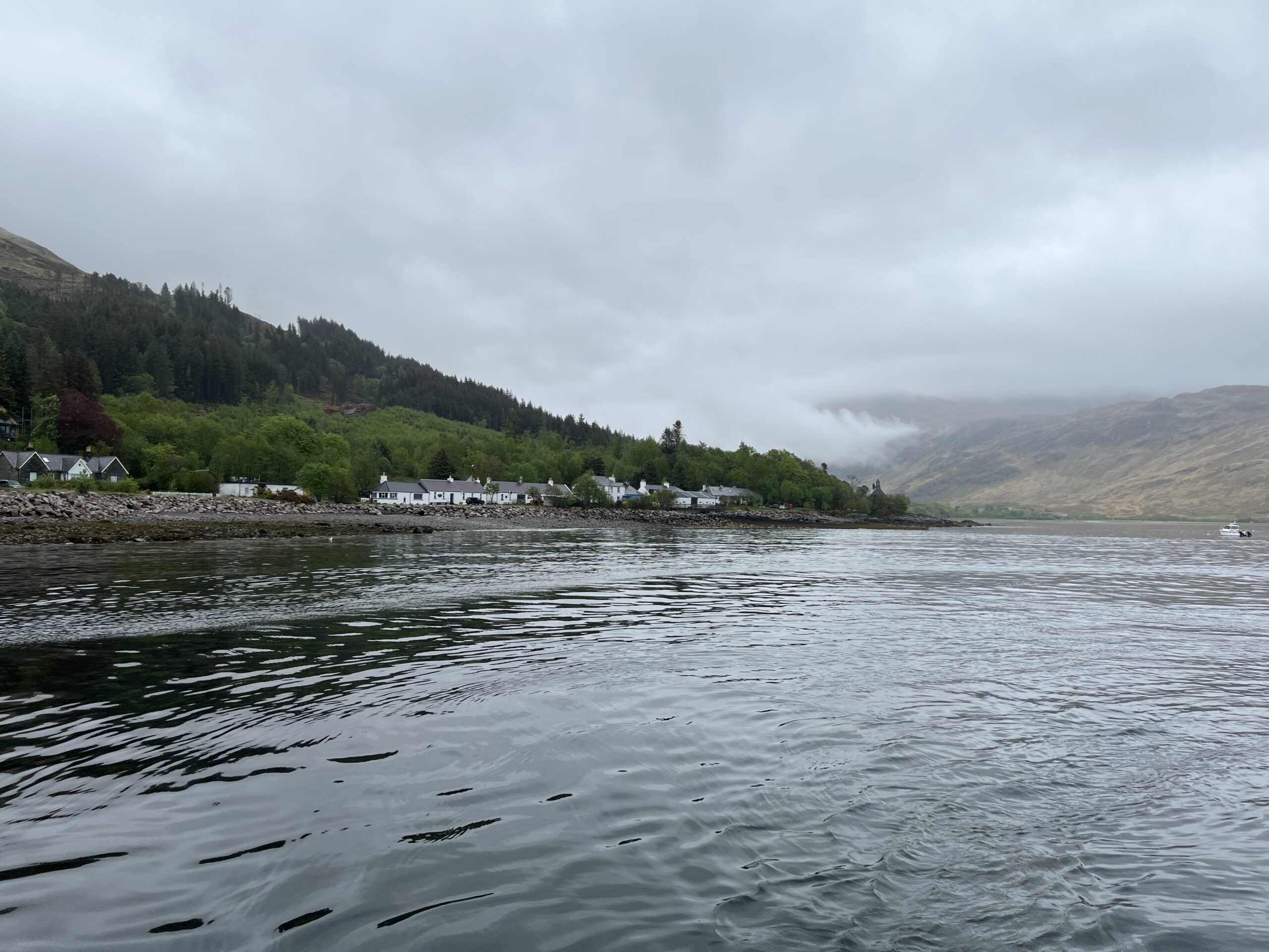
Mallaig is a fishing village of about 850 people and about 50 active boats. Both numbers are greatly reduced from the old days. The herring—the main catch—are gone. Now the boats go after langoustines (large shrimp) and mackerel, among other species. About 3,500 farmed salmon are stunned, bled, and shipped out of Mallaig on trucks each day, too.
One of the deckhands was Alastair MacKellaig, 69. He made and sold ice for 40 years, retiring nine years ago and taking his current job. Mallaig isn’t what it used to be, he said.
“Some of the boys would make 500 pounds a week when the herring was here. They bought a new car every year. The fishermen’s wives redecorated their houses twice a year.”
The ferry serves several villages on the jagged coastline, mostly carrying tourists. There were a half-dozen Challengers on the boat. They’re not hard to spot—white, gray-haired, and dressed in orange.
Our destination, 45 minutes away, was Inverie, at the edge of what was once a 17,000-acre estate.
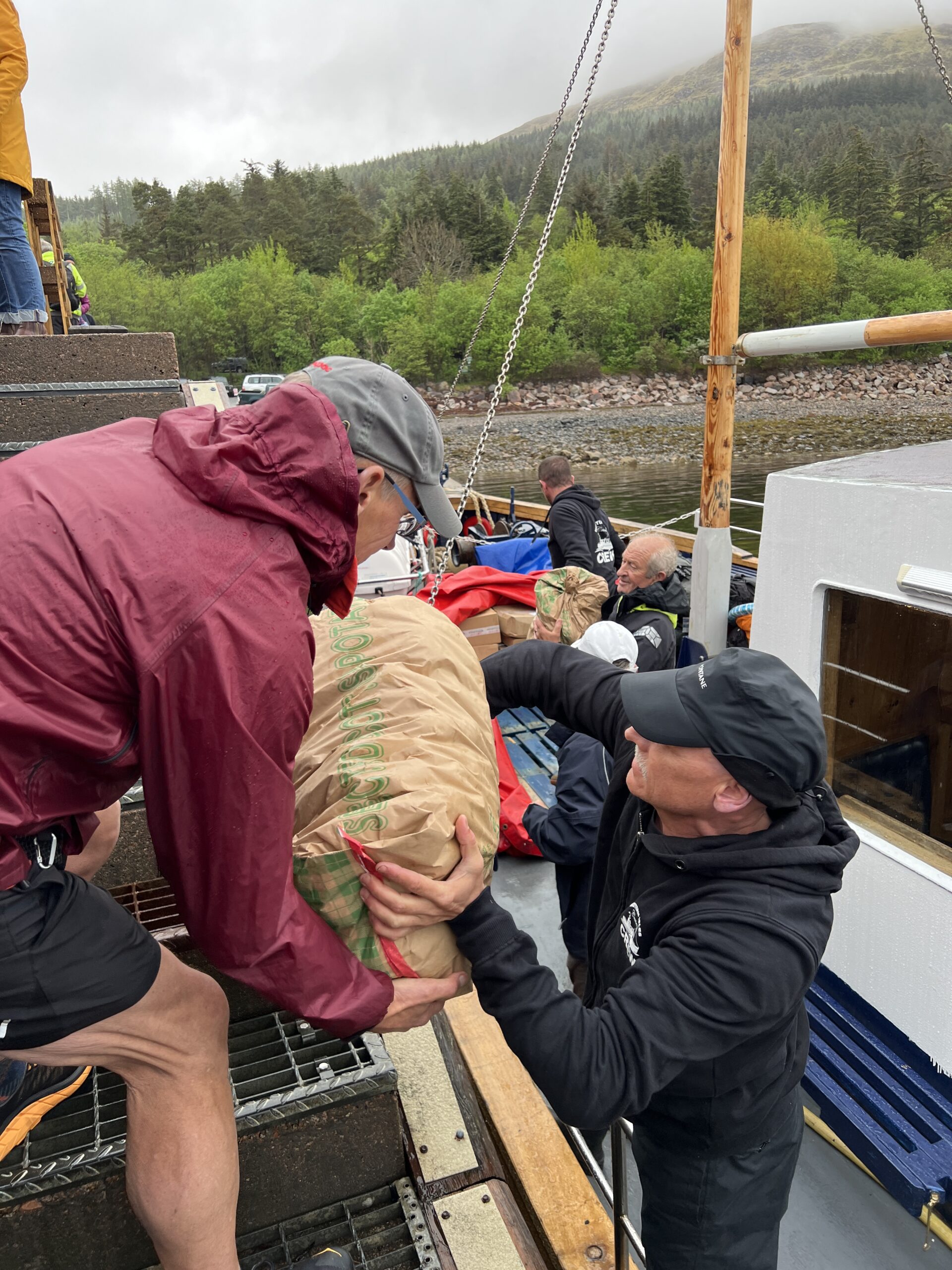
There’s a lot more tourist activity there now than 10 years ago. Before our packs were unloaded there was a bucket-brigade to take crates of vegetables, bags of potatoes, flats of berries, and boxes of pastries ashore.
The Old Forge, a watering hole where Challengers sometimes grab a last pint before heading off, wasn’t opened yet. There was a coffee shop doing brisk business. I stopped there for coffee and a scone. Another patron offered to take my picture as I maneuvered for a selfie.
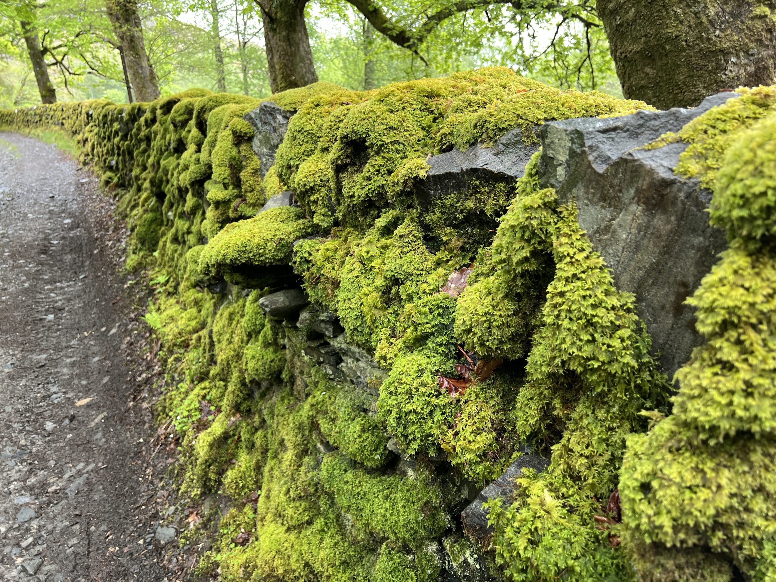
It was raining lightly. It was time to walk. I headed out of the village up a dirt road that, like so many, has a meticulously built stone wall along it. There aren’t many places in the world where moss grows this luxuriantly.
I was going up and over some hills, with my destination the end of a “sea loch,” a long fiord from the Atlantic Ocean. It would be about 2,400 feet up and 2,400 feet down, sea level to sea level.
Here are a few views looking back. In one are two ancient graveyards near an old house and some new ones.
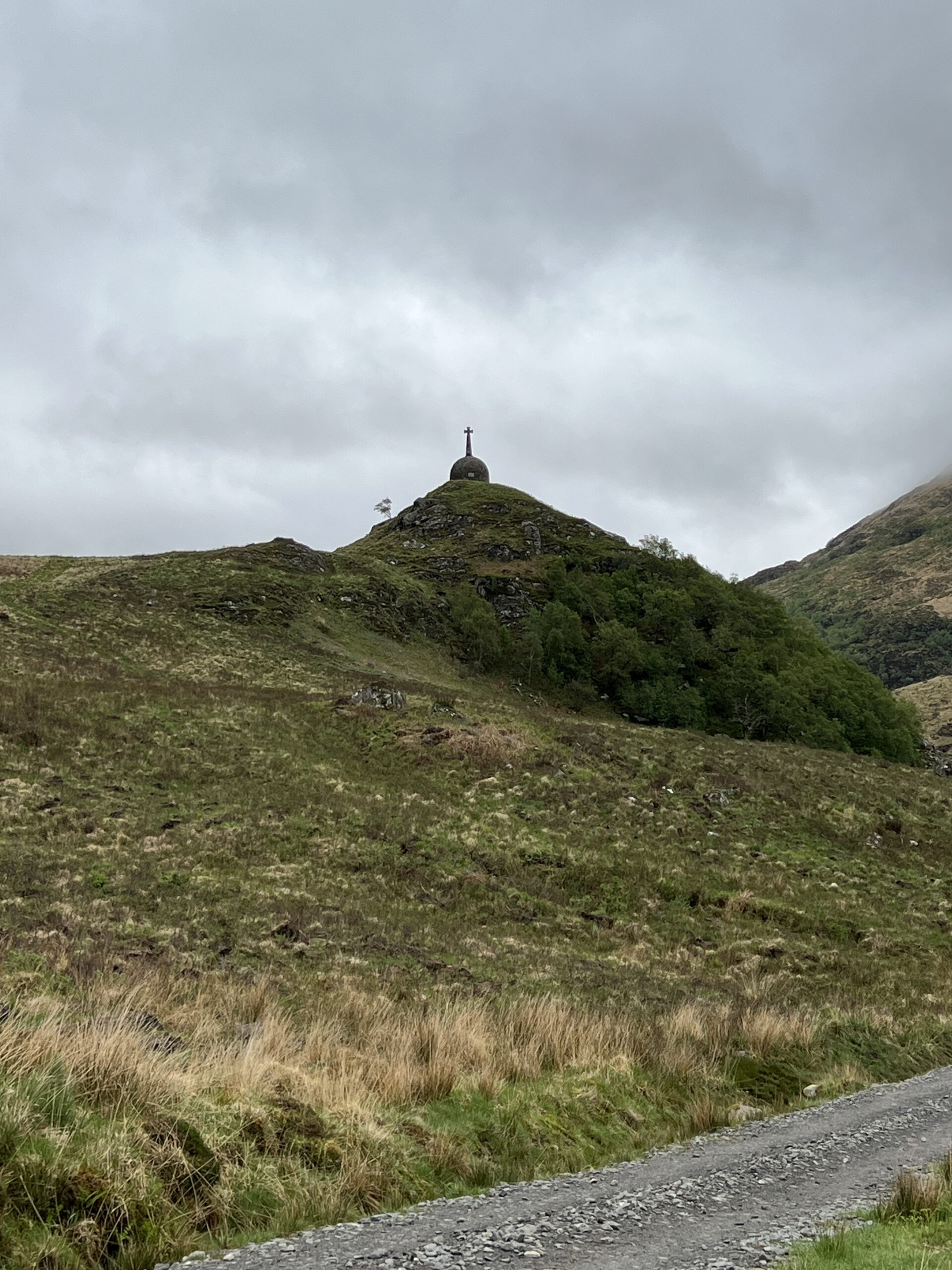
Soon I came upon something I remembered from 10 years ago. I’ve seen a number of these in Scotland—monuments that aristocrats have built to themselves.
This is the Brocket Monument that was put up by Arthur Ronald Nall Nall-Cain, the 2nd Baron Brocket, in honor of his father. (My question: why not go for the hat trick and be Arthur Ronald Nall-Nall Nall-Cain?)
The second Baron Brocket was an unsavory figure. Here is Wikipedia on him:
At the outbreak of World War II in September 1939, Brocket continued to work for an understanding between Britain and Germany. He urged a negotiated peace settlement and tried to arrange talks with Hitler . . . However, Brocket was informed that the proposal to grant Germany control over Poland and Czechoslovakia was not acceptable to the British government.[5] Brocket was interned at the outbreak of war and his properties sequestrated by the War Office . . . The house and estate was taken over by the British Army when Brocket was interned; it was used to train commandos . . . After the war, the British government returned ownership of the estate to Brocket. He ordered that anything which might have been used or touched by [commandos] removed from Inverie House; all the cutlery, crockery and toilets were dumped in the sea at the mouth of Loch Nevis.
He was kind of an extreme version of Lord Darlington in Kazuo Ishiguro’s “The Remains of the Day.”
The rain came and went, never hard. Mist blew in and out, obscuring the tops of the hills and then revealing them. The path became a freshet of its own. It wasn’t full immersion until the end when I had to go through sphagnum bog, but my feet got wet pretty quickly. What did I expect? My boots were “waterproof”; it says so right on the inside next to the water stains!
I passed a ruin, but didn’t take time to explore it.
The deer can spot you from great distances. I guess that’s why they’re still around.
In the far right corner is the bog I had to walk across. And because the tide was in, I then had to go over the end of the land, not around it on the shore.
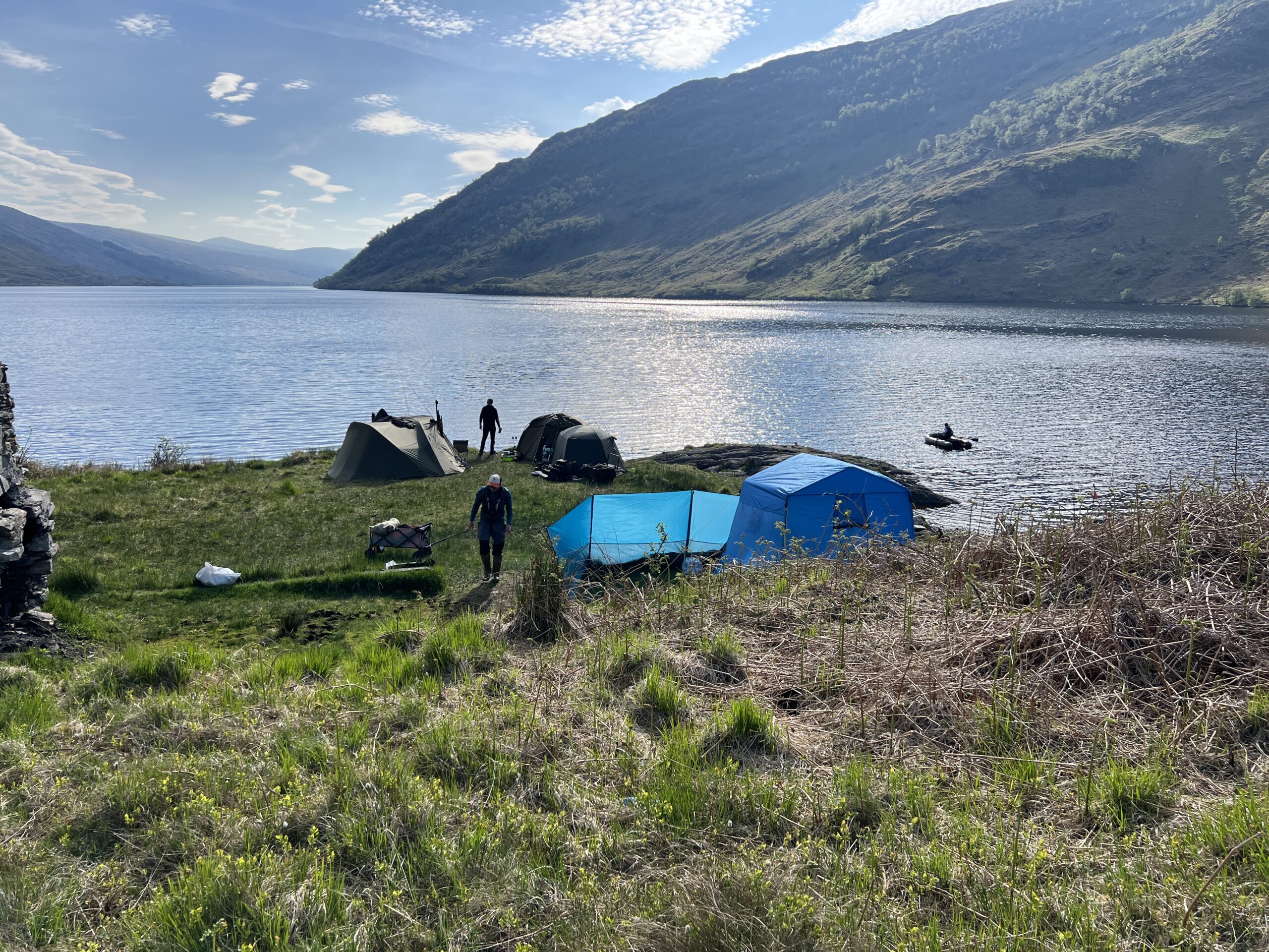
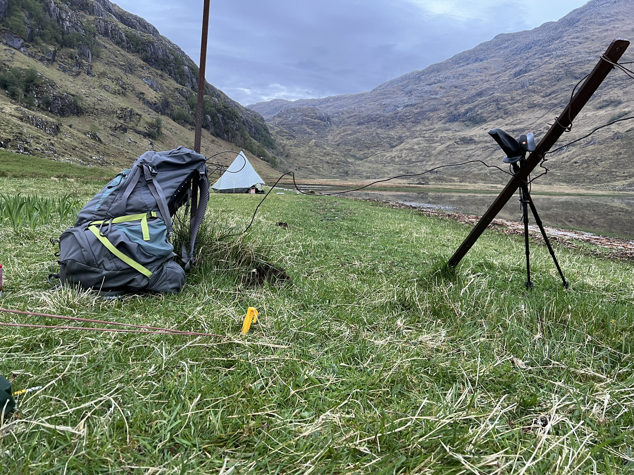
I finally got to Sourlies, the camping spot. There was a bothy, but it had three people in it, and in any case I preferred to sleep in a tent. I pitched mine next to a man named Hugh, who’d overtaken me late in the afternoon. (We’d chatted for a while.)
It had been a long hard day. (And, alas, one of the shorter ones!) I was in a beautiful place. This is a view out of the tent a little after 10 when I went to sleep.
All is well except for a wee visit by Murphy and his law.
On my first night out sitting in the tent I fired up the iPad mini and wireless battery keyboard to get started and discovered the keyboard had broken overnight. I’d used it at the Morar Hotel the night day before.
I tried changing batteries, putting the batteries in the wrong way, banging it, and tonight, four days later, trying just-bought batteries. Nothing worked. I’m kissing it goodbye and binning it tomorrow.
Figuring it was truly broken, yesterday I deviated somewhat from my route to see if there was a cell signal higher up the on the hills. (I’d been walking along a loch.) There was.
So, for 90 minutes I did research and calling and managed to place an order for a new keyboard from the Apple store in Glasgow. It will be delivered at an (indoor) stopping spot in three days’ time.
This is where I placed my order.
All of this is to say that the posts will be coming slowly, and they will be heavy on pictures and light on narrative arc for the next few.
I hope you’re still around when verbosity is born anew.


Recent Comments