I am a writer living in Baltimore. I worked as a reporter at The Washington Post from 1991 to 2013, writing mostly about medicine, public health, epidemiology and the life sciences, and occasionally about history and art. I am also a physician, a graduate of Amherst College, and a native of Framingham, Massachusetts.
On departure morning, everyone at Wildflower Hall—Deborah and Paul Richard, and me—arose a bit nervous, hearts beating faster, with one of us (me) casting around for an escape route in the deep recesses of the mind.
I joked it felt like I was packing the car and being driven to college by my parents before the start of freshman year. Actually, it’s more like going to sleep-away camp for the first time, except that that didn’t bother me in the slightest.
It’s interesting how when you get old everything changes except your adolescent fears.
But before we leave, let me show you a little of Wildflower Hall.
Deborah and Paul have owned it for 25 years. For most of that time they’ve split their time between her and Washington, about 1/3 and 2/3. Paul was the art critic for The Washington Post, Deborah an event planner whose events include the annual Kennedy Center Honors (which she still helps run).
This is Paul. Deborah didn’t want her picture taken.
It’s a hundred-year-old house (added onto, of course) that sits on a hillside outside the village of Colintraive, in Argyll. It overlooks the Y-shaped meeting of two fingers of Atlantic water that reach many miles into the west coast of the country. This junction is called the “Kyles of Bute.”
Bute is an island just across the way. It’s fully inhabited—monks lived there when the Christian Era still had only three-digit dates—and now has three cheap and beautiful golf courses, several towns, a small population of Syrian refugee immigrants, and a restored castle tower, built in 1500, that just went on sale for $581,000.
One gets from Colintraive to Bute on one of the shorter car-ferry trips I’ve been on—seven minutes. It’s at the narrowest passage between the two pieces of land. Until late in the 1800s, cattle drovers would swim herds of cattle across the water at low tide on the first leg of a long walk to markets in Falkirk and Glasgow.
Colintraive has a “heritage center” in the village, about a mile from Wildflower Hall. Wall displays summarize the last thousand years, and old farming and fishing equipment fills an adjacent room. When I was there, a couple was exclaiming delight in finding forebears in the laminated copies of census records from the early 20th century.
There’s a community “poly tunnel” garden and a bowling pitch, with no action in either when I was there.
However, there were things to do on this visit other than check out the local attractions. Chief among them was stuffing my stores of freeze-dried food, gorp, and topographic maps into three padded envelopes and sending them to places I’d be passing through so I could restock. (Even without them I’m heavily laden.)
Deborah and Paul drove me an hour to a Scotrail station at Arochar & Tarbet, for a 9.38 a.m. train. It was not two hours late, it was not full to standing room, and it was not raining—all the case when I was here two years ago.
Four hours later the train pulled into Morar.
The one hotel is full and there was a party of 40 at dinner tonight, so I guess Morar isn’t the backwater it once was. Still, there can’t be more than 25 houses here.
It was low tide in an estuary that reached in from the Atlantic. It was time to run dogs and throw balls on the mudflats.
The mud, like the dry land, has lots of mountains.
I walked up a hill (on steps) close to the hotel. At the top, a Catholic parish had erected (and replaced at least twice) a large cross. It commemorated “a very successful mission” by the Redemptorist Fathers in 1889.
My interest, however, was getting a view of what I was in for.
The problem was that the GPS route on the navigation app on my phone didn’t look like what I was seeing. I won’t go into the details of the confusion, but it was considerable.
As noted in an earlier post, Morar is the hardest place to start from, with two days of trackless walking on the top of a craggy bench with steep sides. It’s potentially dangerous for a solo walker, which is why I’d like to talk to one of the seven other people scheduled to start here. However, none of them are staying in the hotel, the front desk man tells me.
If I don’t leave from here I’ll leave from Mallaig, five miles up the road, which is the starting point for about 60 people.
Either way, you won’t be hearing from me for at least four days. It’s three nights of “wild camping” (as they call it over here) before I get to electricity and the internet.
By then my decision will be old news. And I hope not “news.”
On the cab ride back to Cumnock from Priesthill Farm, where I’d visited John Brown’s grave, the driver pulled off the road.
”You see to the left of the telegraph pole, way out there?” he said, pointing out the window. “There’s another one.”
I could barely make out an obelisk with a conical top. It rose out of a rectangular enclosure, much like the monument at John Brown’s grave.
The Airds Moss Covenanter Memorial, which he was pointing to, marks where 112 English troops and about 60 Covenanters encountered each other on July 22, 1680. (The place name denotes a kind of bog.) Twenty-eight soldiers and nine Covenanters were killed, including their leader, the Reverend Richard Cameron. Five wounded Covenanters were taken to Edinburgh and hanged. Cameron’s head and hands were cut off and shown to his father, who was in prison there, and then publicly displayed.
Cameron’s fighting spirit was much admired. A regiment of Scottish infantry called the Cameronians was formed. It fought around the world for the next 279 years until it was disbanded in 1968.
The Covenanters are still heroes here. There are dozens of monuments to them. Many are more than two centuries old, tended by the Scottish Covenanter Memorials Association, established in 1966 three centuries after the fact.
Why?
Covenanter memorialization isn’t big business and there can’t be many Covenanter tourists (although I suppose I’m one). Local pride counts for some of it. But the bigger reason, I believe, is that people realize they represent something worth remembering.
The Covenanters bear a resemblance to the maquis, or French Resistance fighters, and the Italian partisans of World War II, although they were not nearly as violent. They were a living, voluntary statement that not everybody will go along with the demands of an occupying force.
True believers that they were, they kept up their opposition for more than two decades. Hundreds of people died in what was known as “the Killing Time,” roughly 1667 to 1688. John Brown was just one of the better-known victims.
The English army routinely executed without judicial proceeding Covenanters taken as prisoners in armed encounters. Most killings, however, were for religious and political crimes, including worshipping in secret “conventicles” or refusing to swear that the king was head of the church.
In the spring of 1685, two men, David Dun and Simon Paterson, were arrested by Highland troops in the employ of the English as they were returning from a conventicle. They were taken to Cumnock (where I’m staying), and shot. When Dun’s sister, Margaret, came to town to inquire after her brother she was shot, too. Nearby, in coastal Wigtown, two women (one a teenager) refused to swear religious allegiance to the king. They were taken to a cove at low tide, tied to stakes and left to drown as the water came in.
Alexander Peden, who performed the marriage of John Brown and his second wife (and predicted his martyrdom at the wedding), was the movement’s Mandela-like figure.
He spent time in exile in the Netherlands. He was imprisoned for four years on Bass Rock, Scotland’s Robben Island off the east coast. In 1678, he and 60 followers were sentenced to banishment to the “American plantations.” When the American captain of the ship that would carry them learned their crimes were religious he refused to take them aboard. Peden escaped to Ireland.
In 1686, six weeks after Peden died (of natural causes) back home in Ayrshire, a “troop of dragoons” exhumed his body and brought it to Cumnock. They planned to display it on the village’s gallows, but were dissuaded. They reburied it there instead, which was itself an insult. The Cumnockers responded by turning Gallows Hill into the village graveyard, making it hallowed ground.
And then in 1688, William of Orange, a Dutch Protestant, became king of England and Scotland. Two years later, Scottish Presbyterianism was accepted by the Act of Settlement. The Covenanters had won.
I walked around the Cumnock graveyard the morning after I visited the John Brown monument and before I took the train back to Glasgow.
Here is Alexander Peden’s gravestone, and a monument to him.
And the shared grave of David Dun and Simon Paterson—obviously a recent replacement for one no longer legible. Remember them!
The Covenanters were not tolerant people. Like the Puritans, they were religious fanatics. The Puritans were so intolerant that in 1690 they hanged one of their own, Mary Dyer, when she converted to Quakerism and refused banishment from the Bay Colony. Her statue stands in front of the State House in Boston, a permanent reminder of shame.
Like the Puritans, the Covenanters had an armature on which a new, more tolerant society could be sculpted once religion had been stripped away.
That society has become America.
The tens of thousands of Scots-Irish immigrants to colonial America (and their millions of desendants) have an even better claim on being the progenitors of American democracy than the Puritans.
They resisted authoritarian rule. They refused to swear oaths of allegiance. They died (and occasionally fought) for self-rule in both church and civil matters. They had common dedication to principles. They eschewed elitism and hierarchy more than most people of their time. As the Alexander Peden monument says, they resisted “the graft and rage of power.”
In seeking freedom from several forms of oppression, they paved a way for the enshrinement of several forms of liberty beyond that of religion (thank you, Thomas Jefferson), although obviously not enough (see: Jefferson, above).
In important ways, the Covenanters’ personality and principles have bred true to the American present.
I took a cab from my hotel in Cumnock to the entrance road of Priesthill Farm, two miles north of the village of Muirkirk. It was a 15-minute, 40-pound trip. This is Ayrshire, 40 miles south of Glasgow—the Scottish Lowlands.
The farm fields are bright green with new growth, the moorland still mostly brown. Wandering across both are sheep—ewes with lambs a few weeks old.
John Brown was “of Priesthill” in the historical accounts of his life and death. He had a few animals (more likely cattle than sheep) and planted a small amount of ground, but almost certainly didn’t own land. Priesthill was probably a hamlet of a few houses. There’s a house with barns there now, but nobody appears to be living in it.
This is the part of the Ordnance Survey map–the U.K.’s topographic service–showing Priesthill in the right upper quadrant, and beyond at the end of a trail the “Martyrs Grave.”
When you stand in a particular place, particularity comes to mind. Who was this John Brown?
Not a lot is known. He was born in 1626 and wanted to become a preacher, but a speech impediment prevented that. He became a “pack-horse carrier,” ferrying goods to market for people, and bringing things back for them–a FedEx driver in a place with no roads. His religious devotion gave him a name, “the Christian Carrier.” His first wife died. He almost certainly spoke Scots, a variant of Middle English. (Gaelic was restricted to northern Scotland and the islands off the west coast.)
He was married to his second wife by a famous Presbyterian preacher and seer, Alexander Peden, who ruined the wedding festivities by telling the bride: “You have got a good husband . . . keep linen for a winding sheet beside you; for a day when you least expect it, thy Master will take him from thee.”
That day was May 1,1685, when John Graham of Claverhouse and his mounted troops caught John Brown cutting peat. They brought him to his house, where his seven-year-old daughter told her mother what had happened. When Brown refused to agree to attend Anglican services, he “kneeled down and prayed loud and fervently, in words that appalled the soldiers,” the author of the 322-page genealogy of his descendants wrote.
Graham ordered his troops to shoot him, but they refused, so he drew a pistol and did the deed himself. A man of curiosity, he then asked Brown’s wife, Isabel, what she thought.
“I always thought much of him, but now far more than ever,” she’s said to have said.
Graham didn’t like the answer. ” ‘Twere but justice to lay thee beside him.”
“If permitted, you would do so,” Isabel observed. “But how will you answer for this morning’s work?” He mounted and rode off with his troops.
If even half of that is true–or a quarter–it’s still a hell of a story.
On my day at his grave, the sky was overcast and misting enough that water droplets eventually formed on my eyeglasses. It was chilly, too, but the walk was mostly uphill, so I got warm enough to unzip my jacket halfway.
I expected to find the monument and grave on high ground, but it wasn’t. It was across a ravine with a step-over stream running down it, and halfway up the other side. It appeared out of the mist like a navigational beacon on an ocean of grass.
Up close, it looked like a pale and startled corpse had sat up in its coffin to look around.
One account says that Brown was buried where he was shot. That means he would have been buried outside his front door, which seems unlikely. The grave also didn’t seem like a good house site; I suspect the family lived on the high ground where uphill path finally leveled off.
Brown’s grave is inside a stone enclosure. (The size and cut of the blocks testify to what people thought of him.) A stone slab lies on the ground.
Its inscription is unreadable, but fortunately someone recorded it in a drawing. It features an acrostic that reads from top to bottom “IOHN BROWNE,” or JOHN BROWNE in modern orthography. (I don’t know why there is a variant spelling of the last name, which is spelled correctly elsewhere on the stone.)
I can’t say I understand the acrostic, but the inscription around it is comprehensible.
Here lies the body of JOHN BROWN martyr who was murdered in this place by GRAHAM of Claverhouse for his testimony to the Covenanted work of Reformation Because he durst not own the authority of the then Tyrant destroying the Same, who died the first day of May A D 1685 and of his age 58.
That’s 339 years and three days ago.
The monument was added later (in 1826, to be exact). Time, water, and lichen have rendered it nearly indecipherable, too.
At the corners of the stone enclosure are the remains of hardware that might have been grommets for a covering or anchors for a fence. One piece has rusted so that it looks like a miniature lion threatening anyone who’d even consider disturbing Brown’s bones.
This is his spirit’s view each day. (I took a picture of the two of us.)
And then it was time to go.
I walked back to the road, never to return, as his wife and children had. Two of them eventually came to America. The wisdom of crowds being what it is, they probably walked down this very path.
John Brown laid down his life for his religion, an act that’s gotten a bad name in recent decades. (Personally, I think the world could use less of it.) But that’s only part of what he did. He showed courage. He remained calm. He eschewed violence. He died for principles.
A few other people who did those things when circumstances called came to mind.
Nathan Hale, the American patriot hanged by the British at age 21. Dietrich Bonhoeffer, German pastor and anti-Nazi dissident hanged on Hitler’s orders a month before Germany’s defeat. Jean Moulin, a leader of the French Resistance tortured to death by Klaus Barbie in 1943. Arrigo Paladini, an Italian partisan who, like Moulin, revealed nothing under torture, and escaped execution only because the truck taking him to the killing grounds wouldn’t start on the day the Allies entered Rome (June 4, 1944).
Almost nobody has heard of John Brown, the “Christian Carrier,” Covenanter, martyr, but he’s in their company.
I’m sure his shade couldn’t care less. However, I do. Who doesn’t thrill at learning there’s a hero in the family? Who doesn’t hope that, somehow, long-ago courage breeds true to the present?
There’s little chance of that. In fact, there’s a 37-percent chance I share no genes at all with John Brown, my seventh-great grandfather, or his brave wife. Statistically, I should inherit 0.2 percent of my genes from each of them. But linkage events during meiosis can lead to unequal segregation of genes, so my inheritance may be 0.0 percent.
If that’s the case, John and Isabel Brown’s contribution to me is homeopathic, so dilute that only the vibration in the solvent–the “resonance,” as homeopaths call it–remains.
The funny thing is: that’s enough.
I stand on ground calcium-rich from his dissolved bones and listen to his words, the demand of the officer, the pistol shot, the crying of his wife and children, the retreating hoofbeats, in silence.
I’m grateful to be called one of his descendants. That’s plenty.
Today I’m going to visit the grave of my ancestor John Brown.
My parents visited the grave 50 years ago. My sister, Ellen, and my second cousin, Michela Nonis, also visited it when they were 16 years old and traveled alone through the British Isles. (What a different world we live in today!)
I’m interested in history, and family history, and I want to see this grave before I’m in one myself.
So who was John Brown?
For starters, he’s not from the Brown side of my family, although he’s certainly from the Brown side of many Brown families. He’s an ancestor of my mother, Sally Jane Mosser, whose mother was Dorothy McCormick—whence the Scottish lineage.
When an ancestor is a martyr it’s tempting to think of him or her as a reasonable person, or at least someone committed to a laudable creed. I have no idea how reasonable John Brown was, but his religion was an unappealing one.
At the time of his death, Scotland was a “nation governed by a harshly repressive Kirk [church bureaucracy]; a nation of unforgiving and sometimes cruel Calvinist religious faith; of trials for blasphemy and witchcraft; of a cranky, even perverse contrariness in the face of an appeal to mercy or reason or even the facts,” wrote historian Arthur Herman in “How the Scots Invented the Modern World” (2001).
The restoration of the Stuart line after the Cromwell interregnum threatened this world.
The British monarchy had resumed its efforts to control worship, and in particular to force people to attend Anglican services. The people who refused were known as “Covenanters.”
The name came from a document that circulated for signatures in 1638.
“The National Covenant was more than just a petition or declaration of faith,” Herman wrote in his book. “It was the Presbyterian version of democracy in action. In the name of true religion, it challenged the king’s prerogative to make law without consent, and affirmed that the Scottish people would oppose many change not approved by a free General Assembly and Parliament.”
By a half-century after the Covenant was written, however, many Scots were tired of chaos. They submitted to the British monarch’s required worship.
“The new church was greatly detested, both as superstitious and foreign; as tainted with the corruptions of Rome, and as a mark of the predominance of England,” wrote the author of a genealogy called “Matthew Brown,” a leather-bound book published in 1900 that meticulously (and, for me, thankfully) describes the direct descendants of one grandchild of John Brown the Martyr.
“Disastrous wars and alien domination had tamed the spirits of the people, and there was no general insurrection, and a majority of the people, with many misgivings of conscience, attended the ministrations of Episcopal clergy,” the author wrote.
But not John Brown.
He and fellow dissenters gathered in isolated places, often outdoors, to worship. They brought edged weapons, and sometimes guns. The practice was most prevalent in the western lowlands, south of Glasgow. Priesthill–an ironic name for the place where Brown’s hovel stood–was in the middle of Covenanter country.
“Hunted down like wild beasts, tortured, imprisoned by the hundreds, hanged by the scores, exposed at one time to the license of the English soldiers, abandoned at another time to the mercy of bands of marauders from the highlands, they still stood at bay in a mood so savage that the boldest and mightiest oppressor could not but dread the audacity of their despair,” wrote the genealogist.
(That’s compelling writing for an obscure author, whose name was Robert Shannon. ” Audacity of despair”–that’s even more memorable than “audacity of hope.”)
The persecution was so great that John Brown had to give up his occupation as a carrier and intermittently go into hiding.
He was cutting peat at his holding when English troops came for him on the morning of May 1, 1685. Their leader was John Graham of Claverhouse, who later became a Jacobite hero, killed at 41 in the Battle of Killiecrankie in 1689. To Covenanters, however, he was–and still is–a merciless enforcer. He’s the Klaus Barbie of what was known as the “Killing Times.”
This is a depiction of Brown’s death from the book “The Scots Worthies” (1844).
A more dramatic rendering is entitled “The Martyrdom of John Brown of Priesthill, 1685,]” by Thomas Duncan (1807–1845).
When Brown was killed his household consisted of his wife, Isabel Wier; a seven-year-old daughter, Janet, whose mother was Brown’s previous wife; and a two-year-old son, John. Isabel was pregnant with a boy, James, born later that year. Brown was 58; his wife’s age is unknown, but she was certainly younger.
How long she and her children stayed in Scotland is unknown. What’s certain is that a decade after John Brown’s death, life in Scotland became even more difficult.
Starting in 1697, the country had three harvest failures in a row. Tens of thousands of people died in what became known as the Lean Years, which ended in 1703. “For an already impoverished and sparsely populated country of fewer than two million souls, the 1690s set a benchmark of collective misery and misfortune Scots never approached again,” the historian Herman wrote.
Brown’s survivors eventually immigrated to the “Province of Ulster” in Ireland, which is now Northern Ireland. It’s believed that Isabel remarried, but if she had more children they’re lost to history.
Her sons James and John, with their families and some friends, immigrated to America in 1720. (John’s wife delivered twins at sea.) They settled in Pennsylvania about 10 miles southeast of present-day Harrisburg on Swatara Creek, a tributary of the Susquehanna River.
John, the older brother, had seven sons and no daughters, and James, the younger, had six sons and no daughters. This is one of many reasons why Brown is such a common name in America.
Whether my father’s Brown ancestors, who emigrated from England much later, have kinship with this line of Browns seems doubtful. But I haven’t investigated.
What’s certain is that my mother, Sally Jane Mosser (later Brown), is descended from John Brown in two ways. Her mother, Dorothy McCormick (later Mosser), was descended from the Martyr through both her mother and father.
Dorothy’s mother was descended from Jean Brown, one of John Brown’s great-granddaughters. Her father was descended from Mary Brown, Jean’s older sister and also a great-granddaughter of the martyr.
(Dorothy’s parents had John Brown as a direct common ancestor, but technically they weren’t in a “consanguineous” marriage. That requires a second-cousin or closer relationship of the husband and wife, which they didn’t have.)
What’s interesting is that the descent of John Brown’s “blood” took three generations to reach Dorothy through her father’s line, but only two generations through her mother’s. It took three generations for Mary Brown’s descendants, but only two generations for Jean’s, to reach the 1850s—which is when Dorothy’s parents were born.
The reason is that in the maternal line the blood link was carried by children born near the bottom of the birth order in large families, while the paternal line descent was carried by people born at the top or middle of the birth order. The paternal-line descendants started farther back in time; it took an extra generation for them to get to the 1850s.
To be precise (non-family can skip this paragraph) Jean Brown’s descendants of my grandmother were from the later-born of several generations. Jean was the 5th of 8 children, her daughter Martha 11th of 12, and her daughter 7th of 10. In contrast, Mary Brown–Jean’s sister–was 2nd of 8; her daughter Hannah was 1st of 10; her son was 4th of 6, and his son was 5th of 8.
One of Jean Brown’s granddaughters was Margaretta Hill, born in 1854. One of Mary’s great-grandsons was Horace Greeley McCormick, born in 1850. They married and were my maternal grandmother’s—Dorothy’s—parents.
Like most married couples, they were roughly the same age. But in their case they were genealogically a generation apart when it came to one particular ancestor—John Brown.
This out-of-sync descent blood yields an unusual result.
The Martyr is both my great-great-great-great-great-great grandfather (“sixth great-grandfather,” as Henry Louis Gates, Jr., would say) and my great-great-great-great-great-great-great grandfather (“seventh great-grandfather”). You might ask, how can that be? If you chart a family tree, it’s just what happens.
John Brown the Martyr may stand out in my family history, but he’s only a face in the crowd. I—and you—have 256 sixth great-grandparents, and 512 seventh great-grandparents. That’s so many it’s hard to think of them as relatives. But they are.
Tomorrow I’m going to stand over the bones of one.
I’m back in Scotland to once more to spend two weeks walking from the west coast to the east coast of the country.
Why, you might ask?
I’ll answer only because I’ve asked myself the same thing.
There isn’t an overarching reason. But among the top few is that it’s a physical accomplishment still possible (at least I think so) in my early 70s. That can’t be said for running a marathon or swimming across Chesapeake Bay or climbing Mt. Ranier (which I never did)—all of which I might still be capable of doing, but for which I lack the willpower. I still have the willpower to walk across Scotland.
The sense of accomplishment lasts a few weeks—a bargain.
The Great Outdoors Challenge was my “discovery,” with a major assist from Roger Hoyle, and lesser assists from Kathy Lally and Will Englund, who introduced me to Roger in Moscow in the fall of 2013. So, I feel proprietary about it.
The people who do the event—“Challengers”—are energetic, talkative, and modest people with interesting stories to tell. They speak English and tend to be old. They inspire and are pleasure to tarry with.
The Challenge is the only perfectly run event I’ve ever been around. The coordinators who run it (and the other volunteers they impress to help them, and us) are models of selfless and thoughtful devotion to a complicated enterprise. No corner is cut, no detail is overlooked. Watching it unfurl each year is both education and entertainment. It’s the way things should work.
Scotland is beautiful, and Scottish people friendly.
Going away for most of May also prods me to finish things. After a career of nail-biting deadlines all I do now is bite my nails and break self-imposed deadlines.
However, in the two months leading up to this event I hosted two of my oldest friends for a five-day visit after talking about it for 20 years; did a three-day volunteer program in a prison; made arrangements for two home-improvement projects to be done while I’m away; pitched a complicated story to a reporter; drained the hot tub; finished planting the vegetable garden; and (hours before I left) mulched two saplings.
I should go away more often.
That said, whether I go away to do this again next year is uncertain, which I know I’ve said before. It may be time to walk across Ireland, or around Wales.
However, I definitely wanted to come back one more time so I could visit a monument to a long-ago ancestor, John Brown (who interestingly is not from the Brown side of the family). He was shot in cold blood by the religion police, which in 1685 were also called the army.
Just this afternoon, as I waited at a bus stop in Auchinleck to go the two miles to Cumnock, where I am now, I chatted with a woman with three face nails and an accent that was hard to understand through. She asked why I was here. I told her “to see the John Brown monument at Priesthill.” “I’ve been there,” she said. “Very pretty.”
That’ll be the subject of the next two blog posts. Grab a drink and buckle your seatbelt.
Which gets me to my route for this year. (Despite what I’ve said, the Challenge is all about the route. But that’s a blog post in itself, which you’ll be happy to know I won’t write.)
This year’s route is not inspired, and not even very new. I’ll be traversing some unfamiliar territory, but also a fair amount that’s old. The route is also soft—eight nights of camping and five nights of staying indoors. But it has something to recommend it: I’m sure I’ll meet people.
Two of the five crossings I’ve done were at the edges of the permissible territory. In one I met no Challengers in 13 days; in the other only a few. This time, I want company.
Here is my route for this year.
It’s the barely perceptible pink line across the middle of the map. The discerning eye will note there are two start points, and two initial routes, on the left (western) end of the walk. The more southern starts at Morar, which leads to an unusually difficult first two days. The more northern is starts at Inverie after a ferry ride from Mallaig. It is easier and safer two days. I haven’t decided which one to take.
My pack (“rucksack” over here) weighed in at 41 pounds when I left Baltimore. There will be repacking and mailing of items, but I’ll be lucky if it’s less than 40 pounds when I take off.
It contains (among other things) 2 pounds, 11 ounces of wind shirt, rain pants, rain jacket, puffy jacket, mittens, hat, and scarf; a 4-pound, 14-ounce bombproof tent; 3 pounds, 5.1 ounces of sleeping bag and pillow; and 5 pounds, 14 ounces of electronics. The clothes, toiletries and first-aid materials, and other things I haven’t weighed.
I also have 7.7 pounds of gorp, which will be 13 days of lunches. (With some to share; it’s famous gorp.) I’m going to divide the gorp and mail most of it, along with varying numbers of freeze-dried meals, to pick-up spots where I’ll stop along the way.
That repacking will be done at the home of my friends Deborah and Paul Richard in Argyll, on the west coast. The British-made freeze-dried meals I ordered have already been delivered there. The Richards have, once more, agreed to be my final-days’ hosts and logisticians, as they have for four of my five Challenges. They’re also terrific company and I’m lucky to have them as friends.
I can’t resist adding some random facts I learned a few months ago.
In the buildup to the Normandy invasion, most American troops left from Glasgow and nearby Greenock to go to the southern coast of England, whence they left on D-Day. In “The Guns at Last Light,” the third volume of Rick Atkinson’s magisterial trilogy about the U.S. Army in Europe in World War II, he reported that 100,000 American soldiers arrived in Scotland in April 1944 alone.
The combat load of the average rifleman shipping out of Scotland was 68.4 pounds, Atkinson wrote. (That included a life belt.) The recommended weight of kit for assault troops going ashore in France was 43 pounds.
I’m carrying less than them. And that’s the only comparison I’ll make.
Some cities have a past that is beautiful in the present. Old buildings and public spaces effortlessly become tourist attractions long after their reason for being has disappeared. Venice is like that. So is Paris.
Other cities carry their past into the present as an unavoidable burden, sprucing up their edges with beautiful things, new and old, to distract attention. Dundee, on the east coast of Scotland, is one of those. So is Baltimore, my home.
I spent most of a week in Dundee last spring while doing archival research in St. Andrews, 13 miles to the south across the River Tay, Scotland’s longest river. Every day I commuted to my hotel — 40 minutes by bus — in a “real” city, as I had between Washington and Baltimore for 22 years.
And I came away a fan. More than a fan, actually. When I left, in my breast was the defensive love felt by people who stumble into has-been cities and stay, as I’ve done in Baltimore for more than half my life.
Dundee, like Baltimore, is a city whose great days are a century gone.
It has a world-class industrial past, and a vast inventory of vacant industrial buildings in the present — like Baltimore. Both cities have a dominant and oppressive building material — red brick in Baltimore, and in Dundee a local sandstone that can’t make up its mind whether it’s tan or gray. As in Baltimore, some of these buildings — wonderful ones — have been repurposed, like the hotel I stayed in, an old linen mill.
Both cities have signature culinary products — crabs in Baltimore and marmalade in Dundee. Both have a lot of litter. Both are defaced or decorated with graffiti, depending on your taste. Dundee has the highest crime rate of cities in Scotland while Baltimore ranks third in the United States.
Where does one begin to learn about Dundee’s history and heart? Luckily, for a tourist, there is a place.
It’s called Verdant Works, a former jute mill in a part of the city known as Blackness. (Dickens couldn’t have come up with a better name.) Once the employer of 500 people, the mill is a keyhole through which most of Dundee’s history can be descried. Unlike many factory museums, its story is made vivid by docents only one or two generations removed from its inescapable clutches.
But before we spend an afternoon there, let’s look around.
A vibrant maritime history
Dundee is a port on the Firth of Tay, the place where the river widens into a tidal estuary before entering the North Sea. It was built on trade, and for many centuries it was Scotland’s second most important city, behind Edinburgh. Its maritime past is telegraphed in street names (Chandlers Lane, East Whale Lane), stone workshops along the waterfront, a compact Maritime Trail where its piers and shipyards once stood, and a small collection of historic ships.
Of the last, the most notable is the Discovery, a three-masted sailing vessel that also had a steam engine. Billed as the first ship designed specifically for scientific research — there was no iron or steel within a 30-foot radius of its “magnetic observatory” — it was built in Dundee in 1901 and owned by the Royal Geographical Society.
The Discovery’s most famous voyage was a four-year trip to Antarctica featuring two of Britain’s legendary explorers — Robert Falcon Scott, the captain, and Ernest Shackleton, the third officer. Visitors are allowed to go almost anywhere on it. (In that regard it’s better than Baltimore’s estimable Constellation, built in 1854 and used to catch slave traders, among other tasks.)
On the pier next to it is V&A Dundee, an offspring of London’s Victoria and Albert Museum. Like its parent, it’s dedicated to design, decorative arts and performance. Opened in 2018, the V&A is the antithesis of Discovery — no vertical lines in view, and clad in what looks like a grate from a pier. But it’s just as interesting, with a wonderful collection that includes a salvaged tea room from Glasgow that was designed by Scotland’s art nouveau genius, Charles Rennie Mackintosh.
The ship and the museum are the most visible pieces of a 30-year, nearly $2 billion development project along five miles of waterfront.
A 15-minute walk inland is the McManus, a gallery and museum that’s a good place to see art and artifact telling Dundee’s story. That includes eras as Britain’s most important whaling port; a textile and shipbuilding center; and, in the second half of the 20th century, the British home to American companies, including Timex and National Cash Register.
As in Baltimore, Dundee’s shipyards and factories eventually closed. (The city lost 10,000 manufacturing jobs in the 1980s.) Like Baltimore, it’s now trying to cobble a future out of tourism, biotech and lots of little companies.
There’s a lot to see in Dundee’s environs, including castles and archaeological sites. But if you have time for only one stop, make it Verdant Works. The museum stands in for the more than 100 jute mills that once operated in Dundee and employed, by the late 1800s, 40,000 of the city’s 170,000 residents.
The jute era
Jute?
It’s a fiber made from the middle layer of a 12-foot-high grass that grows mostly in India and Bangladesh. Its closest competitor is hemp.
You make burlap from jute. From burlap (in the old days) you made the binding of cotton bales and sacks for coffee, cocoa, sugar, potatoes and lots of other things. Woven tighter, it became cloth for tents and the covers for artillery pieces. War was good business for jute. In one two-week period during World War I, 150 million jute sandbags were shipped out of Dundee.
Ian Findlay
So how did a city on the North Sea come to process fiber grown in South Asia?
In the 1700s, Dundee developed a linen industry, importing flax from the Baltic states and other high-latitude countries where it grew. By 1840, the city had overtaken Leeds, in England, in the production of coarse linen. The Crimean War (1853-1856), however, interrupted the flax trade.
Dundee’s industrialists realized they had the knowledge and labor to process, spin and weave other fibers. Imperial Britain had access to a flax alternative growing in its colony, India. Add a little time and Dundee became the jute capital of the world.
A small thing that made a big difference was Dundee’s whaling fleet. At some point the mill managers discovered that washing the raw fiber in a mixture of 90 percent water and 10 percent whale oil made raw jute less likely to snag in fast-moving machinery. This 10 percent solution was enough to keep Dundee’s whaling industry alive 50 years longer than in almost anywhere else in the world.
‘Only show in town’
The first docent I encountered at Verdant Works was Ian Findlay, a 73-year-old retired civil servant. His mother’s mother was a jute weaver. His father’s mother was a jute spinner. His father’s father was a maintenance engineer in a jute mill.
“It was the only show in town, to be honest,” he said.
On the factory floor I met another man, Iain Sword, also 73, whose jute pedigree wasn’t as long. His father left school at 14 and was a jute salesman, mostly to the carpet industry, his whole life.
Sword had been a banker around the United Kingdom before retiring to Dundee, his hometown. He was a jute Wikipedia, and no apologist for the mill owners. He told me that when Britain finally required public education, Dundee mill owners successfully petitioned to be an exception. They got permission to employ “half-timers” — children who’d work 30 hours a week in the mill for minuscule pay and go to school for half days only. They were so good at crawling under machinery and pulling out dust and fibers!
Iain Sword
In fact, 70 percent of mill workers in Dundee were women and children, who were paid less than men. The city was known as “She Town” and was the first place in Scotland where jailed “suffragettes” went on hunger strike. It was also full of men raising children and drinking too much.
In part as a consequence of these conditions, 63 percent of Dundee’s eligible men fought in World War I, where they were slaughtered in droves. A battalion known as “Dundee’s Own” sent 423 men and 20 officers into battle at Loos, France, in September 1915. All but one of the officers were killed, as were 230 enlisted men. The McManus has a spectacular painting of two dozen Dundonians — that’s what the city’s residents are called — standing in the ruined landscape after another battle, Neuve Chapelle. The painter, Joseph Gray (1890-1962), had been a newspaper artist in Dundee; everyone in the painting is identified.
“Working conditions were just very, very hard. It’s very difficult to think of what life was like,” Sword said, between explanations of how various pieces of machinery operated.
A glimpse of that life, however, comes through in a remarkable piece of public health research published by the Royal Society of London in 1886. The authors were three men — Dundee’s health officer; a chemist at University College in London; and a second scientist from that institution, J.S. Haldane, who would become the most important respiratory physiologist of his generation.
The team took air samples from tenements occupied by mill families — 29 one-bedroom and 13 two-bedroom dwellings — and from 18 dwellings of four or more bedrooms occupied by middle- and upper-class families. They measured temperature, carbon dioxide (a product of respiration and a measure of crowding), as well as “organic matter” (basically dust), and bacteria and mold.
“The samples were taken during the night, between 12.30 A.M. and 4.30 A.M.,” the scientists wrote. “The houses were visited without warning of any kind to the inhabitants, so as to avoid the risk of having rooms specially ventilated in preparation for our visit. In every case but one we were most civilly received.”
The average number of sleepers per room in the one-room flats was 6.6; in the two-room ones, 6.8; and in the houses of four or more rooms, 1.3.
At 52 pages, it’s a long and complicated study that highlights the dramatic effects of crowding. Compared with four-room houses, one-room ones had air with twice as much carbon dioxide, four times as much dust and seven times as many microorganisms.
The most important data, however, was provided by Dundee’s health officer.
The death rate of children was four times higher in one-room tenements than in four-room houses. Residents living in one room “have the chance at birth of living only one-half as long as those in better-class houses, or they die nearly 20 years sooner, on the average, than those of the better class.” At this the scientists couldn’t restrain themselves: “This is an enormous difference.”
Other research found that teenage boy mill workers were 4½ inches shorter and “a stone lighter” — that’s 14 pounds — than rural teenagers in Scotland.
Haldane’s more famous son, mathematician and geneticist J.B.S. Haldane, later said of his father: “His experience of the Dundee slums may not have made him a radical, but it kept him one.”
Jute mill owners eventually found a way to make even more money: They moved the business to India, closer to the fiber’s source. Dundee lost a whole industry, much of its culture and untold thousands of people. Before, it had been a place where a boy with mechanical aptitude could advance — even if he left school at 14. “The loss of the textile industry pretty much led to the loss of all that,” Iain Sword told me.
But remnants of the jute trade are still visible in Dundee, if you keep an eye out. Passing a trash-strewn factory yard early in my visit, I saw at the far end a sign over a door: “Drivers should not stand under slings while bales are being hoisted.” Jute bales — compressed rock-hard to save space on shipment from India — weigh 400 pounds.
The city is also full of concert halls, parks, pools and other public amenities that might not exist but for the barons. They gave generously while mercilessly exploiting their workers — like Andrew Carnegie, a Scot whose wealth paid for more than 1,500 libraries in the United States.
Verdant Works shows this story and doesn’t just tell it. The exhibits are clever and moving. Physical objects butt up against photographs of people doing work with those same objects. You feel as if you’re in a diorama or onstage in a play. Mural-size photographs make faces larger than life. You can’t help pondering the individuality of the people staring at you.
It’s a place to feel the beating heart, and the stony heart, of a city.
Six years ago I took a sailing course in New Zealand run by the National Outdoor Leadership School, an organization headquartered in Lander, Wyoming, at the foot of the Wind River Range. NOLS runs expedition-based courses—some lasting a semester—around the world for about 25,000 students a year.
In the New Zealand course nine students (most in their late 20s), two instructors, and one instructor-in-training, sailed two 40-foot sloops in the Marlborough Sounds at the north end of the South Island for two weeks. The course was rigorous and emotionally trying; sailing is serious business that masquerades as recreation.
On the strength of that experience I bought an 18-foot pocket cruiser and berthed it at the mouth of Jones Creek, a tributary of the Chesapeake Bay east of Baltimore. The boat turned out to be a lemon with bad luck. The chainplates on deck leaked rainwater into the tiny cabin; the centerboard trunk sprung serial leaks; a freak windstorm blew the boat off its trailer one winter, bending the mast and wrecking the rigging. I sailed it fewer than 20 times—and not once for two seasons.
In the spring of 2023 it was finally fixed and in the water, but my sailing skills and confidence were badly in need of rehabilitation. So, I signed up for another NOLS sailing course.
This was an “alumni course”—more casual and less austere than the one in New Zealand. But it was still a course; we were advised not to think of it as a cruise, or even a vacation. We’d be in the Ionian Sea off the west coast of Greece—one boat, six students, two instructors, nine days, and no ban on going ashore or drinking alcohol.
I’d never been to Greece. My knowledge of ancient history and Greek mythology was slim (although I did memorize the Greek alphabet at summer camp when I was 13). I learned a bit about the history of the region in historian David Abulafia’s “The Great Sea: A Human History of the Mediterranean.”
The book’s 783 pages can be summarized as: “Endless war in a beautiful place.” When I told one of my Italian cousins about my plans she replied with a hint of this history: Your trip sounds wonderful. The weather should be lovely and the winds brisk. I’ve always considered the Ionian Sea Italian, but I will share it with Greece 🙂
Here’s how it went.
* * *
Monday, May 1, 2023
We left Villa Diodati, where we’d spent two nights, about 8.30 in the morning in a van and a rented Kia stuffed with duffels, bags of food and water, and a cardboard box with three kinds of leftover pizza.
Our teachers, Dave Hanaman and Nick Braun, were unable to move the boat from its home berth in Vlikho Bay to Nikiana, which we looked down on from the villa. Even this early in the season—many tourist destinations are opening only next week—all the public slips were taken. We suspected charter companies big-footing them.
The view from Villa Diodati.
As a way to give permission to step aboard, here’s who we were.
The lead teacher was Nick Braun. Like all the NOLS instructors I’ve met—I also took a Wilderness Medicine course a couple of years ago—he has a long and eclectic resume. He’s the son of an immigrant from Austria; a student of German and environmental education who studied abroad in college and got a master’s degree in Sweden. Once an employee of The Nature Conservancy and now a firefighter in Colorado (where he also helps manage a ranch), Nick works remotely fulltime in the alumni office at NOLS. He was gored by a bull on an expedition in Australia a decade ago. He survived. He teaches backpacking, kayaking, and sailing courses. Needless to say, he’s a person of immense energy.
The other instructor is Dave Hanaman, a former Navy intelligence officer who after leaving the military started and sold a company, retired, and later returned to work. He now heads a “clinical research organization” (CRO to you all in health care), which runs digital clinical trials of drugs, medical devices, and non-pharmaceutical therapies.
The students were: Hugh Hudson, an engineer who now works as a “problem solver” for a consulting company (a source of mirth onboard, where problems aren’t rare); his daughter Emma, an outdoorswoman who runs programs for Outward Bound in the Pacific Northwest for troubled youth; Dave Bock, an arborist for the city of Austin, Texas, who grew up in Chicago sailing boats on Lake Michigan; Brian Le, who escaped Vietnam at 16, became a nurse anesthetist in the United States, and lived in Bangor for 15 years before moving to San Francisco (and that’s not the half of it); and Sasha Lennon, who’s a potter in western Maine (https://sashalennonpottery.com). (She’s also the daughter of an anesthesiologist my nephew has worked with in Portland, Maine.)
And me.
We arrived at Vlikho, five miles south of Nikiana, about 9 a.m. and took possession of our boat. It’s a 42-foot German-made Bavaria sloop named “Freedom”; its name is written in English and Greek on the hull. It’s nearly new; Nick thinks it’s a 2022 model. It is bigger than the boat I sailed in in New Zealand, and better appointed (befitting alumni, I thought).
There were two heads and a bigger galley. The forward berths each accommodated two (intimately), and the aft stateroom had its own head. The two instructors chose to sleep on converted beds in the saloon. The floor was unscarred faux parquet.
We loaded up. I packed the refrigerator. This required triaging out the cheese when I discovered the cold cuts weren’t stowed when the box was stuffed. Provisions for this trip are a world apart from the New Zealand course’s menu of carbohydrates lightened with tomato paste, a few slices of onion, and no fresh vegetables.
The charter company is named Sail Ionian. It’s owned by an English family and run by the second generation. A man helping our final preparations, Billy, came and went from the dock as he attended other boats. He kindly answered a few questions.
The company has 45 boats in its charter fleet, and it takes care of 40 private boats not for hire. It’s the only charter company in Vlikho; the whole waterfront is its territory.
Billy has a broad working-man face, and the accent to match. He’s from Preston, in the north of England near Liverpool. He started out as an automobile mechanic and eventually got a job on the Liverpool waterfront. From there he made contact with the Sail Ionian folks. He moved to Greece 11 years ago.
He didn’t speak a word of Greek when he arrived and also didn’t know how to sail. Now, he speaks passable Greek and talks as if he’d won the lottery: “Not many people in my part of the world get to move to a beautiful place like this.”
We cast off at 10.45 and headed out into the cove beyond the marina. We each got a turn at the helm driving the boat forward, backward, and in circles. For 42 feet it was responsive and fast-turning, with almost no prop-walk in reverse.
It rained on and off, never hard or unpleasantly. We had a dodger and a Bimini, but we took the Bimini down when the rain let up and it became more important to see our surroundings than to keep dry.
Vlikho Harbor is shaped like the candy at the end a lollipop stick. We went down the stick to the open bay, which was the water we’d looked down on from the villa. It was a perfect place to practice sailing—open, windy, no commercial traffic, few sailboats, and no obstructions (the chart told us) except for a two shallow rocks and a submerged wreck next to them.
Nick and Dave showed us how to work the lines, raise the sails (both self-furling, so they move in and out, not up and down), how to tack and jibe. Only Sasha got a chance to jibe, but we all tacked numerous time when we got our 15 minutes at the helm.
It was breezy and we made 7-8 knots under sail. We furled both sails and saw how the performance of the boat wasn’t hurt with smaller sail area—and may have been better. So, my first lesson of the course was that furling is not just for safety, it can also enhance performance.
We made the harbor at Spartakhori about 5 o’clock, docking bow-in to a stone bulkhead beside three other boats. Bow-in is preferred because the water gets shallow close to the wall and could threaten the rudder.
Five of us—Sasha, Hugh and Emma (the father-daughter team), and Brian (with whom I’m again sharing a bedroom, as at the villa) walked up the switchback single-lane road to the village at the top of the ridge. We passed a bronze monument to a man in uniform who died fighting organized crime in 1997, according to the camera-based translation app on Emma’s phone. A bas-relief showed two open boats, one pursuing the other.
We went by a schoolyard with two mothers and four children, two on swings over a synthetic play surface, with the Greek flag fluttering overhead. We went up to a church, but it was locked. We passed what appeared to be an old government building with a sign saying that rehabilitation was taking place with the help of the European Union.
We passed Tropica Pizza and a souvenir shop, both doing no business. At an open-air bar under a plastic cover only old men drinking and smoking.
The village was mostly small concrete houses painted white and trimmed in color. They were in good shape in the main. Trees were putting out fruit that was so far from harvest that we couldn’t identify what they would become. Some of the stone-paved streets needed work.
Clearly tourism is the main business, although there must be some fishing. We’d passed a small fishing boat coming in, and there were many at the two marinas with piles of fine-mesh yellow netting piled on deck and quay. I wondered what they were after. Maybe sardines.
We descended the hilltop on a road whose Achilles heel was hairpin turns, not holes. In our absence, the others had laid out hors d’oeuvres—red wine, stuffed grape leaves out of a jar, carrots, cucumbers, potato chips, and green and black olives—before a dinner of cheeseburgers made by Dave the instructor. He washed the dishes too, quite a generous introduction to the cruise.
Before the instructors took over the saloon for themselves at 9.30 p.m. we reviewed tomorrow’s weather forecast. We knew it was going to rain for about 36 hours, but now the prediction included the possibility of “cyclonic winds.” Our destination was Sivota, a desirable place under fair skies we are told, but one that may be especially sought in the weather we’re expecting.
We plan on getting there by noon.
Nick Braun, Dave Hanaman, Sasha, and Emma.
Tuesday, May 2
I asked Brian what time it was at 6.30. There was not enough time to try to go back to sleep, so I got up without a lot of debate. We had breakfast of dry cereal, yogurt, fruit and coffee laid out by Nick. These instructors are very solicitous—no leaving all of the grunt work to the paying students.
It was the first day that most everyone used the heads post-prandially in the space of an hour—a test of self-consciousness and mutual sympathy.
We motored out to the open water, hoping the weather wasn’t so bad that we’d have to hightail it to Sivota to wait things out. It turned out to be a great day for sailing. We passed a cliff of brindled rock with a huge half-circle of blackness at the level of the water. It was a cave, one of the biggest in Greece, someone said. But we didn’t go over to explore; we had things to practice.
As before, we took turns at the helm, setting the main sail and jib and then tacking without adjusting them. This seems to be an important skill, good to know when beating up wind. Two of us tried jibing, but I haven’t had a chance yet.
There was enough sailing traffic to require strategic decision-making; it also gave Nick and Dave reason to talk about right-of-way and rudimentary rules of the road. (I did remember some of this.) The wind picked up to small whitecaps. We reefed the sails, our speed maxing out at 7.8 knots according to the app-recorded route we reviewed later. The wind reached 20 knots right before we pulled in the sails and headed for the harbor.
We’d taken a spin into Sivota before the sailing lesson to reconnoiter the anchorage. The piers were already full of boats. We looked at the one where we thought we’d tie up and it appeared that tricky docking was in our future.
Dave called the person in charge of that part of the harbor before we returned in the afternoon. We were told to approach a different dock and pull in between two boats, each with a pair of Englishmen on them.
Nick did a masterful job. Billy, of Sail Ionian, was on the dock helping with the lines. It wasn’t clear why he was here, but someone later speculated it was to keep an eye on the company’s on-water investment. In the harbor were 10 yachts flying the company’s banner in their shrouds.
Late that afternoon a woman who worked for the charter company (and was wearing a Bavarian Yachts tee-shirt) asked to come aboard to attach a tracking device to one of our batteries. It would allow people in the Sail Ionian office to observe our position and track our route and speed in real time. We’d seen black ship icons on our electronic chart and wondered what they were; it turns out they were Sail Ionian vessels equipped with this device. So, we’d briefly been a ghost ship; the company was putting an end to that.
“But we’re Freedom,” Emma said. “That’s why we didn’t have that device.”
“It’s very Orwellian,” I said. “Now we have what the Soviet communists used to call a ‘new kind of freedom’ .”
“I wonder what those things are called,” someone said.
“Big Brother.”
After a mid-afternoon lunch we had a couple of hours to kill. Most of us sat in the saloon doing various things. Dave, the instructor, who sleeps there at night, retired to the forward vee berth for a nap, and Brian went ashore to walk around.
Nick kindly spent more than an hour helping me with the Navionics and Windy apps. I still had routes through the Everglades I made last fall before the Tonino trip and hadn’t been able to remove. He showed me how to delete them, make new ones, and other useful tasks. We also explored both the windy.com and the windy.app apps. We didn’t learn until the end of the session that the reason I couldn’t get a screen I’d see on Nick’s iPad was that I was on the wrong app. Windy.com and windy.app—why isn’t one of them trademark infringement?
This was very nice of him.
We ate at the restaurant run by the people whose dock we were on This apparently isn’t required but is appreciated. NOLS paid.
We got local fish dinners—red snapper, dorado, calamari, octopus, and sardines—with vegetables, French fries, bread, and spicy feta. Also beer and wine, although in general this is a temperate group. Our waiter, Ioannis (which he said is the name of 40 percent of Greek men), was witty and full of Greek chauvinism.
Most names in the Western world were originally Greek—Nicholas, Philip, Peter, John. Greece (and by that he seemed to mean Attica) has better yogurt than northern Greece and the Balkans. Macedonia conquered the whole world except Attica. Greece has more guns than Texas. That sort of thing.
Ioannis the waiter.
We were on the restaurant’s second-floor porch. It had clear vinyl walls and was not really indoors. It was cold when we arrived at 6.30 p.m., but after 8 when the crowd arrived it warmed up. A real storm was underway and we were glad we’d come in early.
As rain ran down the vinyl curtain we watched a yacht that had dragged its anchor being blown toward the dock. A Zodiac raced to help in the near darkness. Fifty feet before crashing the anchor held.
The boat started its engine, disappeared, and after a while reappeared. It moved stern-first toward a finger dock across the harbor, trying over and over to keep a safe course in the blustery weather. Night fell before we could see the end of the drama. But all was well the next morning, so it must have been successful.
“They’ll be doing laundry today,” Dave the instructor said as we had breakfast the next day at a bakery in front of where all that had been happening.
The weather forecast was for thunderstorms. We didn’t want to be a sailing lightning rod, so we were leaning toward spending another day in Sivota.
Brian in the wind and the rain.
Wednesday, May 3
We slept late, but by 8.30 everybody but one was up. People went off the boat as they were ready.
The village is a U-shape around the harbor. The arm across from us is the longer and has a row of shops—perhaps 20 in all—catering almost exclusively to the tourist trade. They include two small food markets, a half-dozen restaurants, a bakery, several gift and sundry shops, and several real estate offices.
We all gathered in a bakery the first group off the boat had stopped at. We drank coffee and ate pastries until after 10. At one point Brian bought a loaf of peasant bread and a jar of marmalade and we all dug in for dessert. The leaders formalized what was obvious—we were staying the day and another night here, waiting for better weather.
The weather, in fact, was changing about every half hour from overcast, rainy, broken-sunny, and windy. It was a good call.
I headed off in search of a nautical chart of our cruising ground—the charter company had lent us one, but I wanted one of my own—but couldn’t find one. However, I did find a shop that sold olive-wood kitchen spoons and spatulas, and a small pair of salad implements, which I bought.
By the time I was back on the boat a list of chores had appeared on the teachers’ whiteboard. People checked a box and put their name next to the task. The work was underway.
I took sweeping the floor, with a whisk broom and dustpan on my knees. I covered the stateroom floors, the saloon floor, the cockpit and the aft boarding platform. As a late arrival I’m glad I got one of the harder tasks.
When we were done we sat around for a while and then headed out on a hike. Our destination was the point of land at the entrance of the harbor on our side of the U. It wasn’t raining, but we heard intermittent thunder and there were storm clouds and rain across the open water. Three ranks of low mountains were visible but featureless in shades of gray.
Billy had told Nick there was a path to the point of land that was an alternative to the paved road. It paralleled to the road briefly, and we headed onto it as soon as we found it.
A two-abreast path soon turned to a single-file one, and then to a barely visible one that required holding back branches of thorny bushes for the people behind. Wildflowers were out and we passed through an area with the scent of spice bush and mint whose source we couldn’t find.
A true path ran out long before we got to either the point or to a swimming place midway along the route that Billy had mentioned. We found what we thought was the latter. It was clearly on private property, but this didn’t bother Nick, who was in the lead. (Dave the instructor had stayed behind on the boat). We descended a set of stone stairs to a cement platform built on the rock.
As we’d set out, Sasha, Emma, and Brian had all said they planned to swim. It was overcast and cool, but they were good to their word.
Brian swam out into the choppy deep-blue water; the women dove in, did a few strokes and headed back to the rocks. A piece of bent stainless steel pipe that emerged from the rock just above the water line turned out to be a hand-hold.
We climbed back up the stairs and turned right onto the remnant path. Eventually we came to a fence. Billy clearly hadn’t been down this path recently, or had gotten bad information. We considered turning around but instead headed uphill along the fence until we got to a gate.
“It’s somebody’s back yard.”
“Does it open?”
“The gate’s welded shut.”
We were about to leave when I stepped up to the top step to take a look for myself. On the right-hand gate post was an open padlock, suggesting the gate had been lockable in recent memory. I pushed on it and it opened.
We went through it and turned right, on a stone walk below a stone wall. Eventually, though, the walk’s elevation rose and we came into view of a house on the left where a car was parked. A few seconds later we saw two women, one blonde, the other dark-haired, sitting on a deck in front of computers.
It occurred to me to try to just sneak by hoping they wouldn’t see us, but of course they saw us. One person suggested we turn around.
“Just keep a smile on,” Nick said.
Our earnestness—we were a group of varying ages and both sexes out in the rain—was obvious. Nick, in the lead, asked the women about a route to the road and said something about being told there was path to our hoped-for destination, the point at the mouth of the harbor.
The dark-haired woman got up, stepped forward and welcomed us. She said there used to be a public right-of-way, but new property owners had built on it and blocked it off. The municipality had recently asserted the existence of a right-of-way and things were in some sort of litigation. In any case, we were fine to be walking on her mini estate, she said.
We proceeded until we came to another obstruction. This time we walked down to the shore, looking for a way to proceed onward, but there wasn’t one.
We gave up going to the point, and as a consolation prize headed back along the shore in search of a way onto a bald promontory that looked like a place with a good view.
We didn’t find a path to that destination, either. Instead, we continued down the shore, which was covered with ledge and boulders of porous gray volcanic rock stuccoed with a white calcified coating that was worn off in many places.
Where the gray stone was bare it was rough, and in places worn to blades and points. It was probably the most dangerous surface I’d ever walked a long distance on. A stumble would have been bloody mess, and even breaking a fall with a hand would have created a nasty wound. Brian was in flip-flops and Emma in sandals. I was in shorts and wished I’d worn long pants. I also thought longingly of my bike gloves back on the boat as I picked my way through the boulders.
After half an hour we got to a place where the shore became a cliff. It might have been possible to pick our way along the top, but now the hazards included a tumble 30 feet into the sea. Nick declared it was time to turn around. We hadn’t reached either of our destinations. But we’d gotten farther than most of the group expected.
It was notable that Nick, the leader and person who’d have to solve the problem if one of us got hurt, at every point but the last expressed a desire to keep going. His willingness to walk on private property, seeking forgiveness with a smile while also seeking permission, isn’t what most organizations that take fee-paying strangers on trips advocate or allow.
Maybe it’s NOLS or maybe it’s Nick, but this attitude meets with my enthusiastic approval. And his decision to turn around when we did was, of course, the right one.
We made it back to where we’d come onto the shore in 17 minutes—half the time it took us to go out. Up on the road, I congratulated myself and everyone else in making it across killer rock without bloodletting. Hugh held up his right hand to show a small cut between two fingers, so it wasn’t quite true. But it was true enough.
We returned to the harbor on the road in steady rain. We passed many houses newly finished or under construction, all vacation properties. The signs at the driveways were in English—Blue Coves, Villa Emma, Villa Ella, Dynasty Estates.
We were wet when we got back on the boat. My running shoes—the only footwear besides my sandals—were soaked, and given the weather report, likely to stay that way. Rain was predicted for the whole next day.
We had dinner at the same restaurant, with the same entertaining waiter, who seemed to think I was a famous person he couldn’t quite name. We wanted to try a different dining spot—there were several—but Dave the instructor had been told on an errand in town that the expectation was that if you stayed on the restaurant’s dock you’d eat at the restaurant every night. We stayed until after 10 o’clock, which in this season of retiree sailing meant we closed the place down.
We did passage planning in the saloon when we got back to the boat. We’d sail tomorrow, rain or not.
Thursday, May 4
It did rain all day.
We went out of Sivota into the open water. There were a few sailboats in view and more appeared as the morning progressed. Visibility was good but the sky was overcast the whole time and we sailed with running lights.
I took the helm early on and drove for a long time. The task was to keep on course. We were close hauled. I did a good job, but there were few decisions to made.
I’d said in the before-cruise self-introduction we all made that one of the things I wanted to get out of the course was to learn how to heave-to. I’ve never reefed the sails on my boat, and doing that single-handed requires heaving-to. I needed to learn the maneuver before my ignorance became dangerous.
Today was the opportunity.
We each took a turn, moving into hove-to using the jib principally as the brake, and then out of hove-to with a jibe. For me it’s confusing to the turn the wheel at the helm in the opposite direction from what I’d do with the tiller on my boat. But I think I have enough knowledge now to try it on “Windlass.”
When we were done we headed to our anchorage—Port Leone, an abandoned village on an uninhabited peninsula. An earthquake in 1953 had driven the inhabitants off.
It was blustery when we sailed into the harbor near the village to look for a place to anchor. The original plan was to motor, but the teachers wanted us to push our limits. We feared the place might be full of boats, but nobody was there. Hugh was at the helm and did a great job. I wonder how I would have done.
The remains of a windmill and a second similar structure were visible on the point leading to the village’s harbor. They looked like ruins in a Thomas Cole painting. A nub of land turned the harbor into two coves. We tried to anchor in one, but the anchor failed to hold four times, so we rounded the nub and tried on the other side. There the anchor held.
Dave the instructor and Brian went ashore with two long lines, which they turned into one using a bend we’d been taught in a break in the action earlier in the day. They made the boat fast.
We tidied up, left our sopped clothing under the Bimini, and went below. We’d skipped lunch, so we moved right into cocktail hour; it was after 5. We’d explore the abandoned village tomorrow.
Friday, May 5
We woke up and the sun was out. We felt the thrill that people on whale ships and naval vessels of the Frobisher era must have had after days of rain—except that they’d really had a reason to feel miserable, unlike us.
The plan for the day was to have half of it onshore at the abandoned village of Port Leone and half under sail to an anchorage somewhere on Ithaca. (Or Ithaka, as we’re in Greece and should honor Homer and Odysseus.)
Hugh and I made breakfast, which got excellent reviews. He chopped, buttered, and cut, while I cooked. The menu was an omelet with sautéed red onions and red bell pepper, with grated cheese, and toast and jam. It was fun doing it all in a small space with several things happening at once, and everything served (on warm plates) at the same time. I can’t imagine doing it for a living.
Hugh, me, and Dave “the instructor” Hanaman.
After breakfast Dave Bock ferried us ashore in the dinghy. The beach was rocks and trash. There was some trash inland too, but not enough to detract from the mysterious appeal of ruin and abandonment.
A paved road ran as a brown thread down the shore to a distant village visible by its terracotta roof tiles. The road was in surprisingly good shape. We were told that women come out every month to keep the church presentable. A late-model Land Cruiser-like vehicle was parked near it.
Up hill from the road were tumbledown terraces with olive trees and walls of buildings. The church had been painted in the last decade for certain. It was locked, as were the doors of two buildings next to it, one a residence, the other a small tower.
Two flags hung limp on poles on a terrace looking out on the water. One was the Greek flag, shredded to ribbons that were tied in a Gordian knot. The other was yellow and had simply wrapped around itself into an unflyable state. I explored the area alone and then later with Brian and Sasha. Brian unwrapped the yellow flag; it had a double-headed eagle on it. Was it Russian? It flapped in the wind.
Below the church there was what looked like a public building, also intact and locked up, and three piers of concrete and wood. To one side was a roofless ruin with a rusted vertical screw and tun, which someone had read in the cruising book had been an olive press.
There were a few words of graffiti on the stone and stucco buildings, but not many. Clearly lots of people came out here—there were campfire scars—but it was largely an unruined ruined town.
A point of land on one side of the cove had the two ruins of stone towers. We all headed out there on a goat trail but Brian, Dave, Sasha, and I turned back, as it seemed too much work. We returned to the dinghy to row to the point instead. Just as we were shoving off Emma and Hugh appeared; they’d turned back, too. So, we all piled into the dinghy and rowed out to the sailboat.
After an unsuccessful effort to pick up the electric outboard—nobody, including Nick, could get it running—we left Dave and paddled to look at the ruined towers. Each had about 30-degrees of the original stone cylinder still standing, and each had the remains of circular steps and windows at the top. It was hard to tell if the top was the original top, or if something had been above it.
What were windmills doing out here? Clearly not making electricity, and unlikely to be moving water. We concluded they drove olive presses. There were remnant walls that might have been buildings, and olive trees on the slope above the point. We wondered what it must have looked like a half-millennium ago, with people carrying baskets of olives down the hill, and shuttling casks and crocks of oil to the village in boats.
Brian on the ruin.
We got back to the sailboat and weighed anchor just as another boat arrived. I was glad we’d been alone, and I’m sure they were happy to see us leave.
We sailed south and went past Atoka Island, which has dramatic cliffs of sedimentary rock that had been uplifted at a slant. We’re going back to explore there tomorrow.
The route to Ithaka was one long close reach. I handled the sheets a few times but had no time on the wheel. I meditated in a supine position on the foredeck and practiced cleating and knot tying in the stern.
We looked at two anchorages on the northeast end of the island before finding a beautiful one more to the south. It’s in a broad bay and we are the only boat in it. As I’m writing a full moon has risen over the cuprous sea.
Saturday, May 6
We woke in a cove out of a sailing magazine or travel brochure, and didn’t want to leave soon. A shore party of most of us headed to the island of Pera Pigadhi to find a trail to a spring, which was visible on Google maps but wasn’t mentioned in the 2017 cruising guide we are using.
It was sunny and beautiful. Brian, who is an open water swimmer, swam to our landfall about 400 yards from the boat. He had no wetsuit but did have a neoprene cap. He shivered for 10 minutes after we got to shore and delivered his clothes to him.
The trail to the spring went up a stream in a cleft in the mountain. We started there and then left it in favor of a path on which we saw white and blue blazes, Greece’s national colors. We walked about 15 minutes to a junction that Nick arrived at first. He went down to the spring, which he reported was surrounded by a steel fence and not much to see. So the group decided to proceed farther up the trail without visiting it.
Brian, Hugh, Emma, Sasha, Dave Bock, and me, with Nick out front.
We walked another 20 minutes, gaining height and better views of our boat below every time we had an unobstructed view. And, of course, great views of our little patch of the Ionian Sea. It was sunny and warm, especially with our exertion.
Dave Bock, Emma, and Brian swam back to the boat while the rest of us paddled or traveled as passengers in the dinghy, which unlike the sailboat is a pathetically designed and inadequate-to-the-task craft.
Dave the instructor had stayed behind to prepare breakfast. It wasn’t quite ready when we got back; he was awaiting our return. Everyone who hadn’t swum, and some who had (except Hugh) changed into bathing suits and dove into the gin-clear water. I did this too–the last in, but not wanting to be the hypothermia-fearing hold-out. I wore my neoprene vest, silicone cap, and of course my prescription goggles.
It was less cold than I expected. It was wonderful, in fact.
Just before I went in, some of the people drying off on the starboard deck saw in the water next the boat a long and occasionally moving thing.
There as a debate about what it was; it looked a little like a sea snake, but it had a spade tail, so wasn’t that. Someone thought it was an anemone. It appeared to have a mouth and I said with a straight face that it was a “Mediterranean pencil moray.” Everyone stopped talking for a few seconds and looked at me with semi-believing faces. I relieved them of this.
We later learned it was a siphonophore—scientific name Farskalia edwardsi—and in fact a colony of more than one organism. The more amazing thing, however, was that when viewed underwater (which I did) its body became transparent except for a white line down the body–a gut or spinal cord. Its shape was represented by hundreds of tiny tentacles (or so they appeared) anchored to the body by brown feet. It looked, floating in the water column, like a constellation of unconnected stars, unlike anything I’d ever seen.
We had a great breakfast, far from NOLS’s infamous 1965 winter-camping cuisine. We had sweet potatoes and bell peppers sautéed and softened, with fried eggs (their topsides steam-cooked from a cover over the pan), with melon slices on the side. It was unfancy, fat and starch-rich, and delicious.
We set sail without reluctance, as our destination was Atoko Island, which we’d passed on the way down the previous day. It’s nearly uninhabited, high, with dramatic cliffs of uplifted and deformed limestone from the Jurassic era.
We motor-sailed there, as the wind was light and we wanted to have time to explore.
We got a closer look as we approached the island. Layers of sedimentary rock a foot thick were bent like parallel curves on a high-school algebra graph. The stone had been plastic at some point, or more likely the force that moved the ancient seabed was so strong it had made the stone plastic.
Sasha and I swam into a rock beach. About fifty yards offshore the bottom turned to rocks tumbled smooth by millions of years of tides. Interspersed among the white stones were ones brindled red and brown, perhaps one percent of the shoreward bottom. The water was both perfectly clear and intensely blue, a mysterious trick.
Once on the beach it was possible to see how beautiful flat, white, ovoid stones can be. It was also a lesson that random friction’s target shape isn’t the circle but the ellipse (although there were a few near-perfect circles; I picked one to keep.)
A section of the cliff on the beach was a fascinating geology lesson—if only I’d studied geology. Studded through the rock at regular intervals—never touching—were round, grapefruit-size pieces of brown stone. Some had lost their weathered surfaces and revealed a shiny grainless interior that looked like flint. How the inclusions came to inhabit the limestone like raisins in a Christmas pudding is another mystery of the place.
We swam up the beach and around some rocks to a tiny cave, where another deposit of stones was high but not dry. I was curious whether they were more nearly perfect than the ones exposed on the beach, but they weren’t. It was in such a place on the California-Oregon border that I found two beautiful elliptical stones when walking with my beautiful friend Charlotte, and later wrote “Two Stones.”
Wind was light in the afternoon as we headed to Kioni, a town north of the hourglass waist of Ithaka. The instructors turned the boat over to us. We raised the anchor, motored out into the open water, raised the sails, shut down the engine, and sailed a course to our destination.
We were on a close reach much of the way. I got helm time. We practiced sailing in circles—off the wind to a jibe, then up the wind to close-haul. When three of us had done that and the last person had taken us into the anchorage, Nick took over the helm. It was about 6 o’clock.
I won’t go through the details except to say we spent nearly two hours securing the boat for the night. The boat’s stern was tied with two lines to hooks and loops of rebar fixed to the rock, the bow at anchor. One of several problems was that the anchor refused to hold, until it finally did. On a road along the shore high above us people watched, got bored, and walked off, and new people arrived. A few stopped to watch us on the way to dinner in the village and stopped to watch us on the way back home.
Kioni has three ruined stone cylindrical buildings in a line on a point of land that forms one half of the entrance to the harbor. They were windmills for grinding grain (vintage unknown) we were later told.
The cruising guide said that Kioni once had 2,000 residents but now only 200, as there’d been a big migration to Australia and America. It seems unlikely there are so few inhabitants today, but I’m sure many of the houses are occupied by seasonal visitors.
The village is on a series of terraces on the hillside. The houses are two-storey white stucco with two-over-two windows. The shutters are red, blue, and a few black. Most were closed.
Sunday, May 7
So what to say today?
We all started out on an upstairs, view-of-the-harbor café in Kioni. After ordering breakfast but before it arrived I walked around. The streets were steep and I only went up two of the terraces. I passed an elementary school that had a tidy new schoolroom and a tired basketball court next to it. How far Springfield, Massachusetts’s invention has traveled!
There are burned-out hulks for sale for 200,000 euro; if you want something habitable it will cost at least 700,000. It’s a beautiful little village—a great place to spend the winter writing a book. In another life.
We reprovisioned, returned to the boat, and headed out.
We sailed upwind until we came to a cove in Arkoudi, an uninhabited island. I went below and finished the account of yesterday and also wrote a message and sent photographs to John Mosser, my cousin, who is about to die in Colorado. Most everyone else, led by Brian, the frigidmeister, went swimming. It was very cold, they said.
We had lunch—we do lot of eating on NOLS alumni cruises—and headed off. We’d once hoped to get to Assos, on the outside shore of Kefalonia, but it wouldn’t happen today.
Instead, we learned about the “favored tack”—the tack that will get us to a destination, which now was Fiskardho, a bigger and fancier place than our last few stops.
Houses were under construction on the starboard shore as we headed into the harbor. There was also the remains of what the cruising book said was a “Venetian lighthouse.” There were many other boats; we tied up to two trees stern-to-shore in line with six others.
Hugh and I made dinner—pasta with tomato sauce. The boat has no herbs and spices, and I had to save our two onions for the cooks who wanted them for our last dinner. This left us with a reduced flavor pallette (and possibly palate, as well). We constructed the sauce from sautéed garlic and carrots, and red wine (which I consumed too much of while cooking) in addition to the tomato sauce. Grated cheese was offered at the table. It turned out better than expected.
While I was cooking other members of the crew rigged the dinghy up to one of the mooring lines as a hand-driven ferry. After dinner we took it to shore and walked around the town. I finally found a place with a chart, which I bought for 22 euros. We then turned around and walked out a path to the old lighthouse.
Too much red wine for me.
It was dark and we all sat on the rocks when we got to the lighthouse. We waited for the moon to rise over a hill across the harbor. The sky took on a yellow glow before the bright edge appeared.
We were on Ithaca, and as the moon came into full view I read “Ithaka” by Greek poet C. P. Cavafy.
As you set out for Ithaka
hope your road is a long one,
full of adventure, full of discovery.
Laistrygonians, Cyclops,
angry Poseidon—don’t be afraid of them:
you’ll never find things like that on your way
as long as you keep your thoughts raised high,
as long as a rare excitement
stirs your spirit and your body.
Laistrygonians, Cyclops,
wild Poseidon—you won’t encounter them
unless you bring them along inside your soul,
unless your soul sets them up in front of you.
Hope your road is a long one.
May there be many summer mornings when,
with what pleasure, what joy,
you enter harbors you’re seeing for the first time;
may you stop at Phoenician trading stations
to buy fine things,
mother of pearl and coral, amber and ebony,
sensual perfume of every kind—
as many sensual perfumes as you can;
and may you visit many Egyptian cities
to learn and go on learning from their scholars.
Keep Ithaka always in your mind.
Arriving there is what you’re destined for.
But don’t hurry the journey at all.
Better if it lasts for years,
so you’re old by the time you reach the island,
wealthy with all you’ve gained on the way,
not expecting Ithaka to make you rich.
Ithaka gave you the marvelous journey.
Without her you wouldn’t have set out.
She has nothing left to give you now.
And if you find her poor, Ithaka won’t have fooled you.
Wise as you will have become, so full of experience,
you’ll have understood by then what these Ithakas mean.
I’d warned the group early in the trip this might happen. They didn’t seem to mind.
My cousin John Mosser sailed around the world in 1976 with four college friends in a leaky 50-foot wooden boat. Their technology was closer to Captain Cook’s than to ours. His courage and expertise, which I admired for decades, was one of the things that made me want to learn to sail.
I sent him this poem about a long journey and its impending end. It arrived the day the died. He didn’t see it, and I think that’s best.
Monday, May 8
I got the first mosquito bites of the season last night. We were anchored along a stretch of woods, which was probably the reason.
We’ve eaten out more than most NOLS alumni trips and more than I expected. Nick has been nice about picking up checks and refusing contributions from the crew. But we’re also about using the food we have on board and wasting as little as possible, so this morning Hugh and I made french toast, grizzled ham, and orange juice, working through our stores. We had no vanilla and of course no maple syrup, but I made a syrup of melted butter and honey, and we had apricot and peach jam.
We motored out past the Venetian lighthouse. On closer inspection we saw portholes in the stone-and-stucco tower at different heights and points of the compass. Dave the instructor said that he thinks it worked this way: fires were lit at every porthole; the light from each was visible only from certain positions at sea, providing directional signal.
The crew has been lobbying for a while to go on the “outside”—the open-Ionian side of the islands. The charter company doesn’t let its customers spend the night in anchorages out there. We’d originally wanted to go to Assos, on the western shore of Kefalonia, but it’s been obvious for a couple of days that it was too far for a lunch stop. So instead we set a course for the west side of Levkas, the island north of Kefalonia and Ithaka.
We motor-sailed most of the way, as the wind was light, passing an unlit lighthouse that looked to be from the late 19th century (Ak Dhoukato, according to the chart). Beyond it were spectacular cliffs, white with rusty veils that had dripped down from above.
We dropped anchor and had our late-morning snack. I’m trying to get rid of my gorp, so I brought out a bowl, which was mostly consumed. Our mid-afternoon snack—we eat almost continually in NOLS Alumni World—finished it off.
The sun wasn’t out, but it was a beautiful place that invited swimming. Around a point, which we’d looked at and rejected, was a beach with umbrellas dotted along it and people strolling. We retreated from them and anchored the boat.
There was a small beach and a diagonal fissure in the cliff that formed a cave, with two smaller ones next to it. This beckoned, and of course Brian and Sasha took up the challenge. I was determined to take up the challenge as well, but needed time to suit up—neoprene vest, cap, goggles, and willpower. I also didn’t want to swim in alone, as it was about 300 yards, so Emma rowed me. She picked up the other two and they all went off exploring while I stayed and looked around the fissure-cave.
There was an empty water bottle at the far end. Drops of condensation fell from above, and high up a basketball-sized rock was wedged in the crack. The place was protection in a pinch if you were without a boat, but not without hazards.
The water was not as cold as I expected. The bottom was covered with smooth, white ovoid boulders—a Brobdinagian version of the beaches we’d seen.
We were somewhere near Sappho’s Leap, where she supposedly jumped to her death after being spurned by a lover. As if in recognition, a rock fell from the cliff with a great splash, the people who’d stayed on the boat reported when we returned. It seems improbable that we’d be witnesses to erosive forces in real time, but apparently we were. (I didn’t see or hear it.)
In the afternoon we practiced going downwind, which we’d done little of, including sailing wing-on-wing. The wind was brisker than predicted; it peaked at 20 knots, the heaviest of the trip. Nick had us sail blindfolded when we eventually changed course and began to sail upwind. We tacked from close reach to close reach, steering by the sound of the sails, feel of the boat underfoot, and wind on the face. It was a thrilling exercise.
Nick showing us how you can sail blindfolded.
We sailed 34.3 nautical miles today.
We motored to a pocket cove—actually a pocket bight that offered little protection other than the hundred-foot cliffs above it. Dave the instructor and I took the dinghy to the cliff edge where tumbled rocks went down into the water. He tied us to two domed pinnacles while I worked the oars to keep us in place.
These were cliffs one could look at for hours—their bent bands of whorled strata, the baklava and taffy patterns in the rock unexplorable except by eye. High up were a two little caves worthy of New Yorker-cartoon hermits. Swifts, flashing blue wings and yellow bellies, came and went from invisible nests.
Tuesday, May 9
Today is the last day—half-day, actually—of the trip.
We have one thing on the agenda, which required us to get up 30 minutes earlier than usual and eat a quick cold breakfast. On our way back to the charter dock we planned to stop at the big cave on Meganisi that we’d seen on the second day.
It was a windless morning and we never even put up the sails.
We anchored outside the cave, a half-moon of tawny stone disappearing into darkness. I was on the second party to go into it in the dinghy—Dave Bock rowing and Nick and me spectating. How it formed so symmetrically—and with a top 30 feet above the water—is hard to imagine.
Small stalactites sketched a ragged eyebrow over the opening. Deeper in, diagonal threads of raised stone were a variant of stalactites, Dave said. Water dripped from the dome ever so often. The deepest part was not in full darkness and it looked like there was a small stone beach there.
“You could get out of the rain back there, but it wouldn’t be the most comfortable place,” I said.
“I don’t think it has ever seen rain,” Dave said.
We rowed around taking pictures, mostly in silence. No one tested it for an echo. The swifts seemed disturbed by our presence, darting, diving, and giving high-pitched whistles. But perhaps that’s what they would have been doing without us.
As we motored to the harbor we separated the food that could be used by the next trip from the food that would seem second-hand to people expecting a fresh start. We packed up our belongings, piled the towels, sheets, and mattress covers, and coiled the lines so they looked smart—something to inspire the next crew.
The six people coming in tomorrow are a couple, two close friends, and a father and daughter. They are older than this group. It was the trip that I wanted to go on, but there wasn’t room.
I’m glad I got this one; it was a convivial group, not paired-off except for Hugh and Emma, father and daughter, and we had the instructors fresh and enthusiastic. That’s not to say they won’t be that when the others roll in tomorrow—I’m sure they will be—but it was nice to have them before there was something to compare us to.
As we had lunch at a restaurant in Nikiana we talked about how NOLS’s approach to outdoor uncertainties is so different from that of many organizations, and from the American people in general.
NOLS acknowledges risk; there have been 13 deaths since it started in 1965. But uncertainty, hazard, and novel challenges requiring real-time evaluation by leaders and students are not only acceptable, they’re part of the “leadership” NOLS aims to teach.
I asked Nick if he’d be going to new places with the next group, or be heading to the places he now knew would work.
“As always, it depends on the weather and conditions,” he said. “But I’m always interested in seeing things for the first time.”
NOLS is an organization led by people of immense skill and knowledge, and an adventuring spirit that’s cultivated rather than squelched.
I asked about the NOLS scholarship program that’s been soliciting me unsuccessfully for years. It turns out NOLS gives lots of scholarships, some to people it seeks out and some to those who come asking. I may start to give.
We spent the last night back at Villa Diodati. Four of the group walked up from the village—a couple of miles of switchbacks. I needed exercise, but didn’t feel like doing that right after lunch, so later in the afternoon I went up the road from the villa.
About a quarter mile up the road there was a stone track with a stripe of weeds down the middle that went off to the left. I walked up it. Trash, including a toilet and a clothes washer, had been tipped down the slope. Caterpillars descended on invisible threads from branches overhead.
Remnants of squared stone walls and olive trees suggested this was once farmed, and I suppose could still be, although there were no dwellings. Trickles of water flowed among wildflowers and grass that were already tall enough to be falling over. The track disappeared, and soon after, the path. I turned around. The Ionian Sea was visible down the hill and far away.
I walked a mile or so farther up the road, passing a house under construction that will have a spectacular view, and on the uphill side a clearing that had 86 bee hives (all I could see). Two cars passed me; one was a police car.
Nick had ordered another takeout dinner—three salads, gnocchi with beef, grilled vegetables, Greek cannoli and chocolate cake—that was enough for two sailboat crews. The food on this trip couldn’t be more different from what I’d had on the New Zealand sailing class and that I’d lampooned in the travel story I wrote for The Washington Post. (If you’re interested, the story “NOLS for Olds” is in the “Journalism” section of the website.) NOLS has been unusually generous on this trip.
We didn’t have a formal debriefing, which was fine with me. People had made their views known about the experience as it had unfolded, even if they hadn’t declared a best-and worst parts of it.
Brian’s sea-glass sailboat.
For myself, I’m glad it occurred to me six months ago to do this, and that I’d said yes to myself. I’m in the yes-or-never stage of life.
I’ve seen a bit of Greece and paid homage, indirectly, to the ideas and history that led to the United States, into which I’m boundlessly lucky to have been born.
Our territory, with anchorages (in order) on the left.
The group is dispersing to various places—Hugh to Ireland for work; Sasha to Amsterdam; Dave Bock to Athens; Brian to points in Greece unknown (perhaps to the hilltop monasteries of Meteora); Emma to the United States on a multi-leg trip that will end with her back at work in less than 48 hours. I’m going home, and am glad for that.
It’s too late for me to have the Greece of romance—Lord Byron, Zorba, Joni Mitchell and “Carey.” But I had the Greece of stone, ruins, wind, water, sun, and rain, and that’s good enough.
The end of The Great Outdoors Challenge is always something of a bring-down. The emptiness, the brown and gray, the mysteries real and imagined, give way to the modern world.
You leave behind scenes like this, which looks like Homer in the Adirondacks
and enter bright-colored farmland worthy of Van Gogh.
It’s still grazing country. That’s a herd of sheep on the path ahead.
There are interesting things to see, of course. We walked by Invermark Castle, built in 1526 on a site where a castle existed back to the 1300s. It’s wonderfully intact. The other side has a semi-circular corner tower lacking only Rapunzel.
One of the things that makes this reentry tolerable is the promise of meeting a mass of Challengers at Tarfside, a village that hosts a Scots version of a mountain-man rendezvous.
People set up tents on the village green—sometimes there are 40–and eat sandwiches and cake at the local church hall made by volunteers, most of them Challenge alumni and alumnae. Afterward, everyone repairs to the clubhouse of a fraternal organization, where the beer taps open for a price and walkers exchange exaggerated accounts of the previous week.
Alas, there was none of that this time. I’m a little unclear why not.
Covid is the standing excuse for any buzzkill decision, but I’ve also heard there were complaints of objectionable behavior from bibulous Challengers in previous years. By now you have a sense of this crowd. How much damage could a bunch of self-punishing 70-year-old bald men do? Maybe it was the women, and the sub-40 cohort.
In any case, we drowned our sorrows in tea and nut bread at St. Drostans parish hall. One of the volunteers, Ann Thorn, was there in 2014 when I met my distant cousin, Marion Mitchell, who like me is descended from John Brown the Covenanter.
He was a Presbyterian martyr shot in cold blood on May 1, 1685, by a notorious English military enforcer, John Graham of Claverhouse, in front of his pregnant wife and two children. (There’s an obelisk to him on a Lowland moor my parents once visited.) His widow and her children moved to Ireland, and two sons moved from there to Pennsylvania in 1720.
The church offered 12 rooms for 25 pounds apiece (and toilets and showers, of course.) It tells you something about this group that I was the only Challenger in the place that night. My excuse: an underperforming tent. The real reason: I needed a place to write, and I wanted to sleep in a bed.
Personally, I hope superannuated dissipation returns to Tarfside someday.
In its stead—and a good, if sober, substitute—was The Right Reverend Mark M. Beckwith’s reading (and later, on the road, interpretating) the Oak of Mamre story in Genesis 18, in which three angels tell Abraham that his wife Sarah will bear a child in old age.
St. Drostans (part of the Episcopal Church of Scotland) had in its nave a copy of a famous icon of this encounter, which, among other things, is about hospitality. Mark had contemplated it for an hour alone before Ole and I got up.
After Tarfside, we spent the night in Edzell, at the Panmure Arms Hotel. The original plan was to camp somewhere, perhaps sneaking onto the grounds of the ruins of Edzell Castle. By then, however, we were no longer casting around for good excuses for eating in a bar and sleeping in a bed.
The last day was 14 miles on road. The last climb was up the Hill of Morphie, which I’d done on a previous crossing. (Love that name.)
At its foot we met Rich, who like his wife, is a local school teacher. They’re used to seeing Challengers trudge by their house. He came out to greet us.
We talked for a few minutes. “We can’t get away this time of year,” he said enviously. But he and his wife have plans for the summer.
Coming down the hill I passed a road sign.
You’d think this was the end of the story, but it wasn’t quite. We still had to get to St. Cyrus, just ahead, and beyond it, in the mist, to the North Sea.
We got to the cliffs and looked out. It was a beautiful sight. We’d made it.
According to the built-in Health app on my phone, We’d walked 230 miles in 13 days. That included everything–walking around campsites and villages–not just time underway. And I think the app exaggerates distance. Nevertheless, it was a long way.
We still had ahead of us the podiatric intinction. We left our packs at the top of the bluff and walked down to the beach, Ole first. It was almost a half-mile.
We took off our boots and walked into the sea, and took a picture of ourselves.
We had to wait more than an hour for a bus to Montrose; luckily there was a pub nearby. When we arrived we signed in at Challenge Control, a room in the Park Hotel. Then we truly were done.
Sue Oxley, one half of the sainted “Ali and Sue” who run the show and have been communicating with us since last October, was there. She provided a few statistics.
So far, 74 people had “retired”—dropped out—from the starting field of 400. Because of the staggered starts that number could increase; there were still several days to go. That’s both more people, and a higher percentage, quitting than since 2015, and possibly longer.
The weather, and its associated hazards and discouragements, were the main reasons. Mountain Rescue had been called for three people, although one search was aborted when the person appeared.
I put my tent (slept in three nights) in front of the message board and taped to it a note saying it was for the taking–as long as the taker gave a donation to The Great Outdoors Challenge. I’ll be interested to get follow-up on that sometime.
The next morning I went into Challenge Control. The only person there was Pierre De Greef, the Belgian we’d briefly encountered when he came in late at the pony shed.
We talked for a while. As we exchanged observations, I realized he embodied the Challenger ethos in an extreme form. Everyone who does this has a bit of Pierre in him or her.
He’s 50. He has a sister, six years younger, who is schizophrenic. He dislikes it when people paper over her illness with euphemisms. (I don’t know the French ones.) In his walk he’s raising money for Macaulay College, a “community interest company” on the Hebridean Island of Lewis, where he lives. People with mental and social problems run a farm. Things are expected of them, and their work is productive. This is what he wants to support.
So far, he’d raised 1460 pounds of a target of 3750. The effort has liberated him, he said.
“For my sister, there is no escape. This has allowed me to speak freely of that.”
In his driven state he’d climbed 20 Munros—mountains over 3,000 feet—in 10 days. He’d walked 240 miles in 13 days. He pulled up his shirt. “I have lost eight kilograms,” he said, in amazement. (That’s 18 pounds.)
We’re all a little driven and we all have some agenda, however secret.
What it is for most Challengers was the topic of discussion in a tea break with some of the old English and Scottish guys one day about mid-crossing.
The consensus was that the illusion of keeping death at bay—“Rage, rage against the dying of the light,” as Dylan Thomas put it—was the main driver. I observed that when people are young, strength, speed, and perseverance allow them to accomplish feats of endurance. Perseverance is a lagging indicator of age and the last of the three to disappear. It’s what most of us were running on.
So how was this TGOC for me?
The route was harder, with lots more pathless walking. The weather was only a little worse—but at the beginning, when everything is difficult.
It was interesting to have a walking partner. I learned a lot from Mark Beckwith, and enjoyed getting to know him better. And Ole Hollesen—he was the Danish lagniappe.
I thank them both.
As for me, who knows if I’ll do this again? It was difficult, and my feet hurt a lot. I’m getting older and I’d rather not end with an incomplete crossing. If I never do it again, I will carry it with me.
In my cap I now have one more pin, or “badge,” as they call it over here. The coordinators promise they’ll send me a 2015 badge to replace the one I lost.
I consider myself in the deaccessioning stage of life. But this is a piece of bling I’ll happily and gratefully accept.
For the English and Scots walkers, it’s worth the trouble of getting out the boiler just for tea in the afternoon.
Braemar Castle was closed, but it looked like Christo had come back from the dead to wrap it.
Some days, you can be sure, Mucomist is more accurate.
Road signs or Rorschach test? You be the judge.
Morning ablutions.
It’s hard to believe that with so much to climb in the Highlands that a park would need to put “anti climb paint” on its toilet block. (Photo by Ole Hollesen)
This is a rather odd thing to see parked in front of a second-hand store in Scotland.
This wasn’t entirely a surprise.
There were wildflowers.
It’s always nice to get a second bite at the apple (blossoms).
And in every village there is a monument to those lost in the Great War, mourned and remembered. This is in Kingussie.
By now you’re tired of hearing me talk about walking, and frankly I’m not only tired of talking about walking, I’m tired of walking. But who cares about that? We have to continue to the end—until feet in the sea—so let’s neither of us complain.
Here is a little about the walking in recent days.
One morning we left from a sheep pasture, next to a burn, near a corner of the Balmoral Estate, which is owned by the British royal family. As usual, it was an upward course.
By this time we’d gotten to know Ole Hollesen better. Better than what? Better than when he’d sat down next to us with his swollen ankle.
The previous night we’d heard a 20-minute synopsis of his working life. We’d gotten the synopsis of his two marriages and the death of his parents at a young age a few days before that. This is the wonderful thing about time with strangers, especially when discomfort and a foreign language loosens the lines and allows the sails to luff. It’s one of the reasons for doing this event.
Ole is a smart, skilled and principled man. He told us how he’d been approached two decades ago—he had an investment company—by a large Russian man with dyed hair who wanted to partner with him in seeking good businesses to invest in in Europe. In addition to him there was a money-crunching sidekick and a beautiful Russian siren who’d be in charge of marketing (and possibly other opportunities). Ole became suspicous, and then a bit afraid. He fended them off, and they disappeared, looking for other honest people through whom to launder dirty post-Soviet money.
Ole by this time was recovered enough from his ankle sprain to go on alone. But he stayed with us.
We headed off for a place called the Shielin of Mark. “Schielings” is the word (presumably Gaelic) for summer houses for shepherds in the high glens. ”Shielin” is a variant.
But first there were rivers to cross and trackless stretches of boggy ground to cover, across eroded banks of peat.
Underfoot is an entire ecosystem built on water. To the naked eye, it’s a vegetable world, except for the occasional ochre frog, black beetle, black slug, and salamander too quick to get a good read on coloration.
It is also beautiful and abstract. Closeups resemble Jackson Pollock paintings a little.
You’ve heard of Pollock’s ”Blue Poles”? This is my take on it.
We passed by a stream called the Burn of Mohamed. I have no idea how it got its name. But unlike the mountain, it appears to have always been here.
We got to the bothy at the Shielin of Mark. It was small but nice, and contrary to reports, had dedicated sleeping places.
From there it was across another burn and up a field of heather and sphagnum moss toward a track more than a mile away. It’s difficult to describe the effort required to carry a 35-pound pack up such terrain, all the while searching for the step that won’t finally result in full-foot immersion.
It requires navigation, by line-of-sight and GPS. And rests.
The gravel track you finally gain is a mixed blessing—rock-hard, and in places ridiculously steep.
But everything that goes down eventually flattens out. For us, on this day, it was at the Stables of Lee, which actually are still stables.
I didn’t see any horses, however.
We stopped for lunch, which involves not only taking off the packs but also the boots and socks. It’s important to find a place out of the wind, on a slope where one can lie back on a pack and sleep for 15 minutes after eating. Lunch is invariably gorp, cheese, dry sausage, and water.
This is Ole and Mark.
This is the last thing I saw before my 15-minutes kicked in.
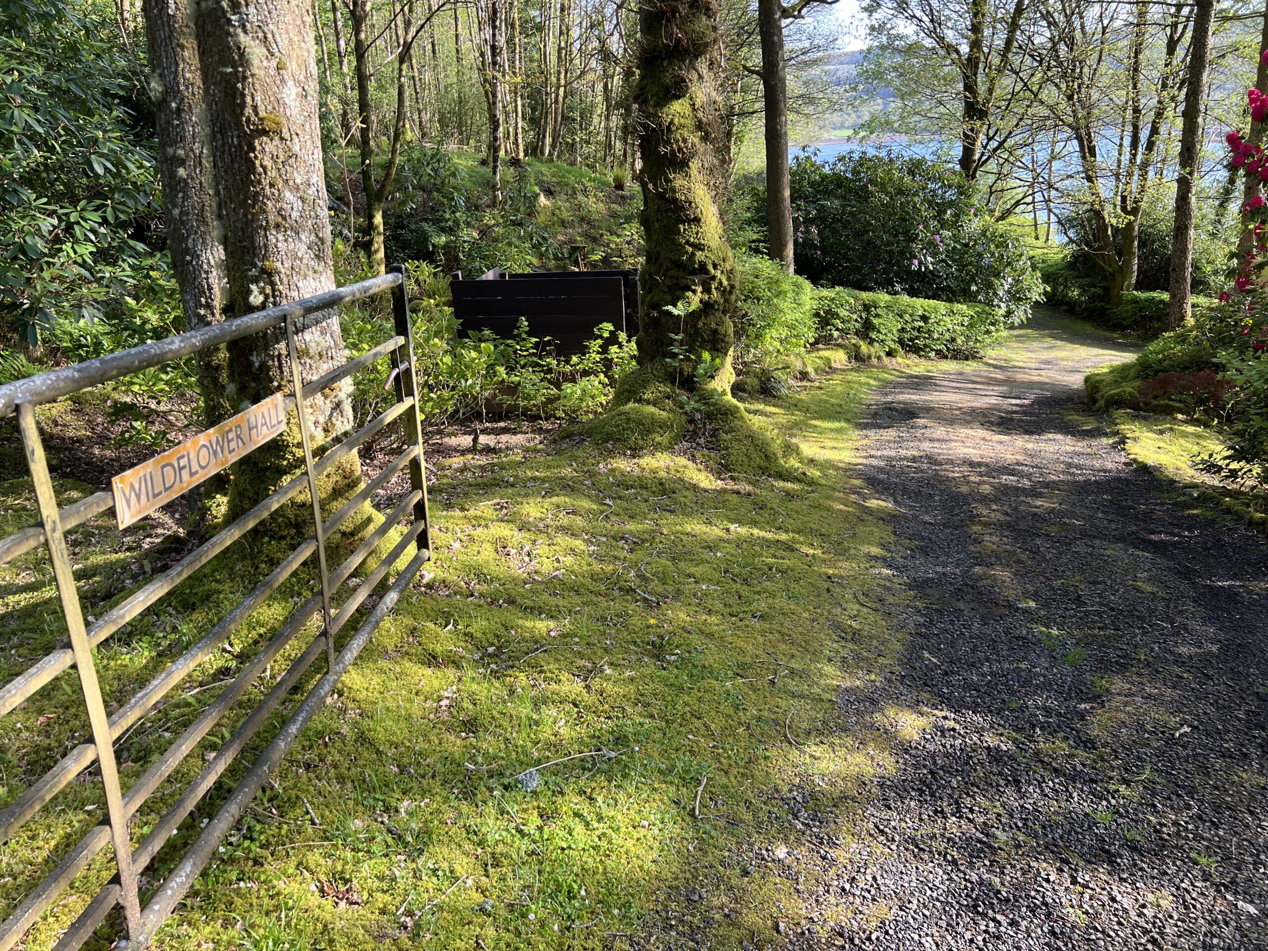


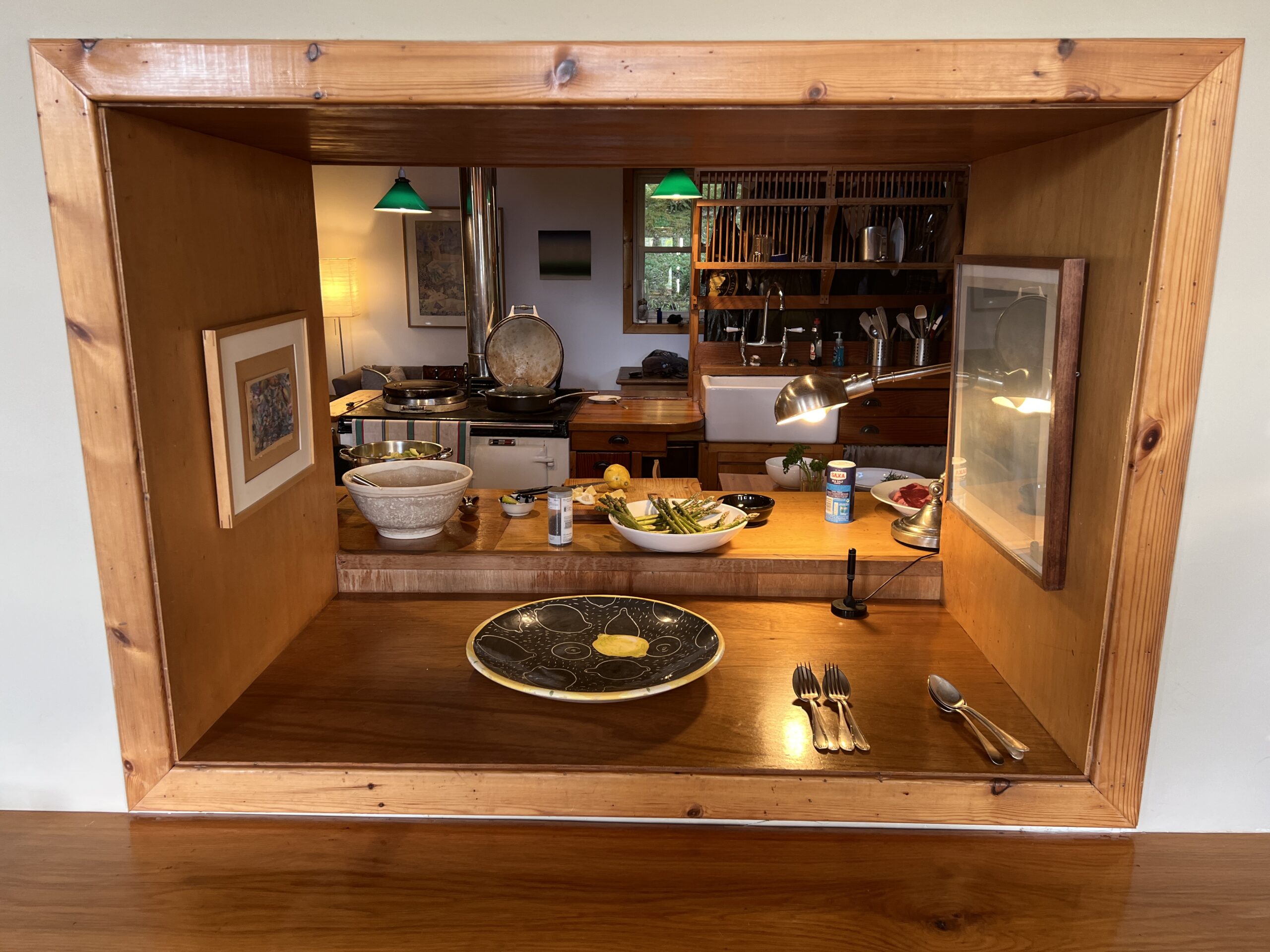
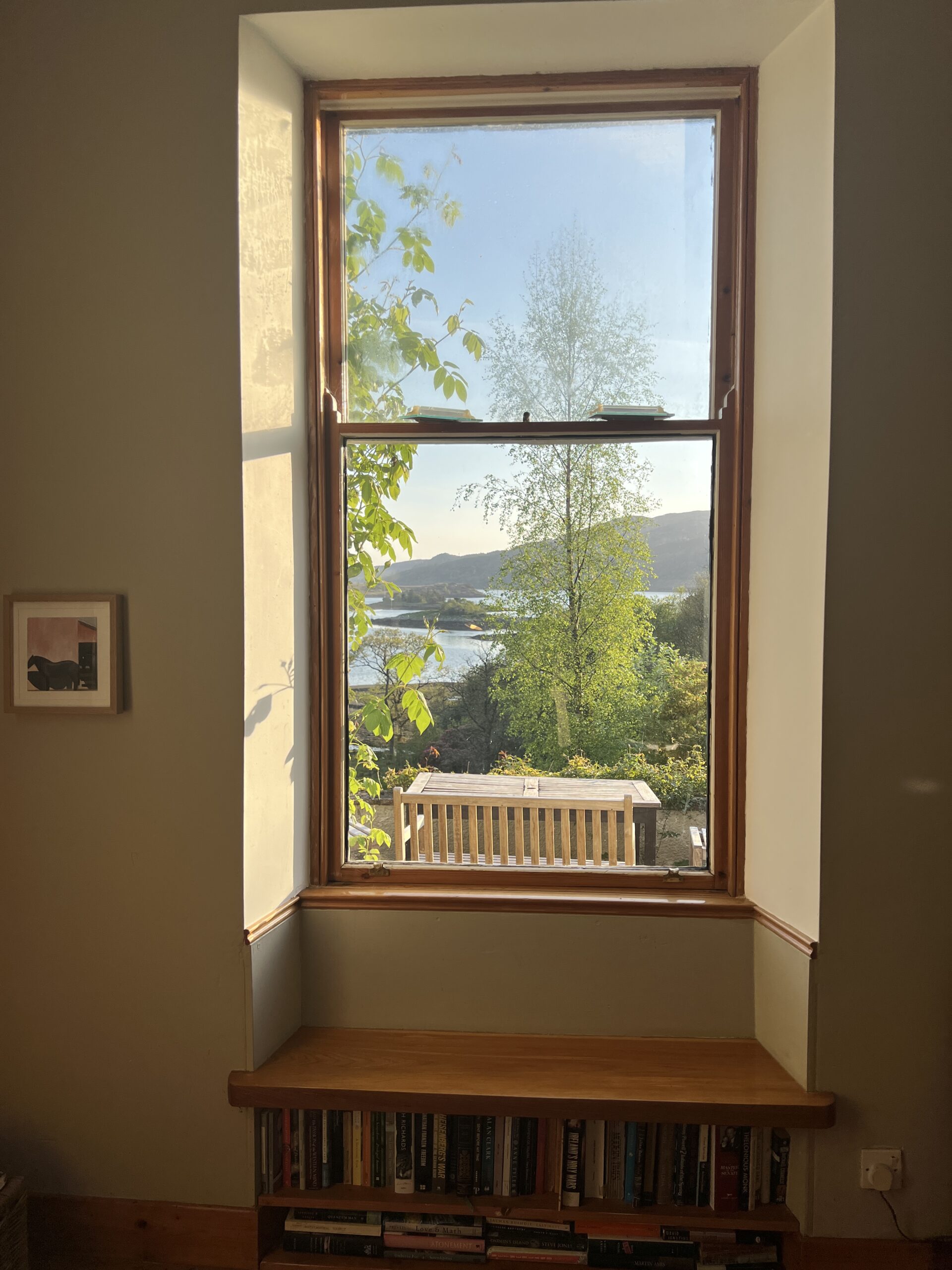
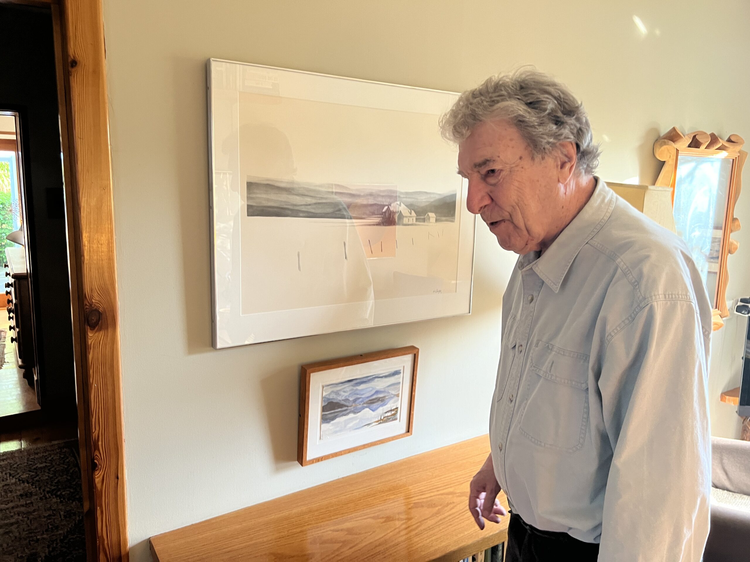
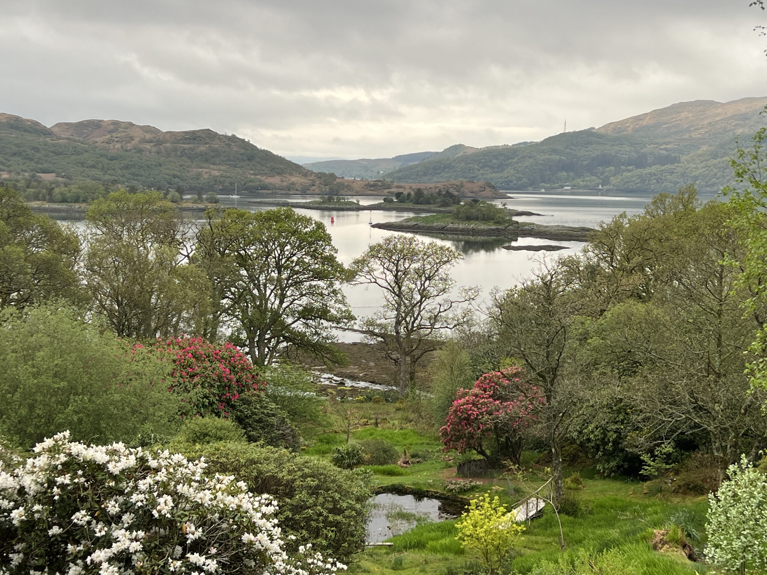


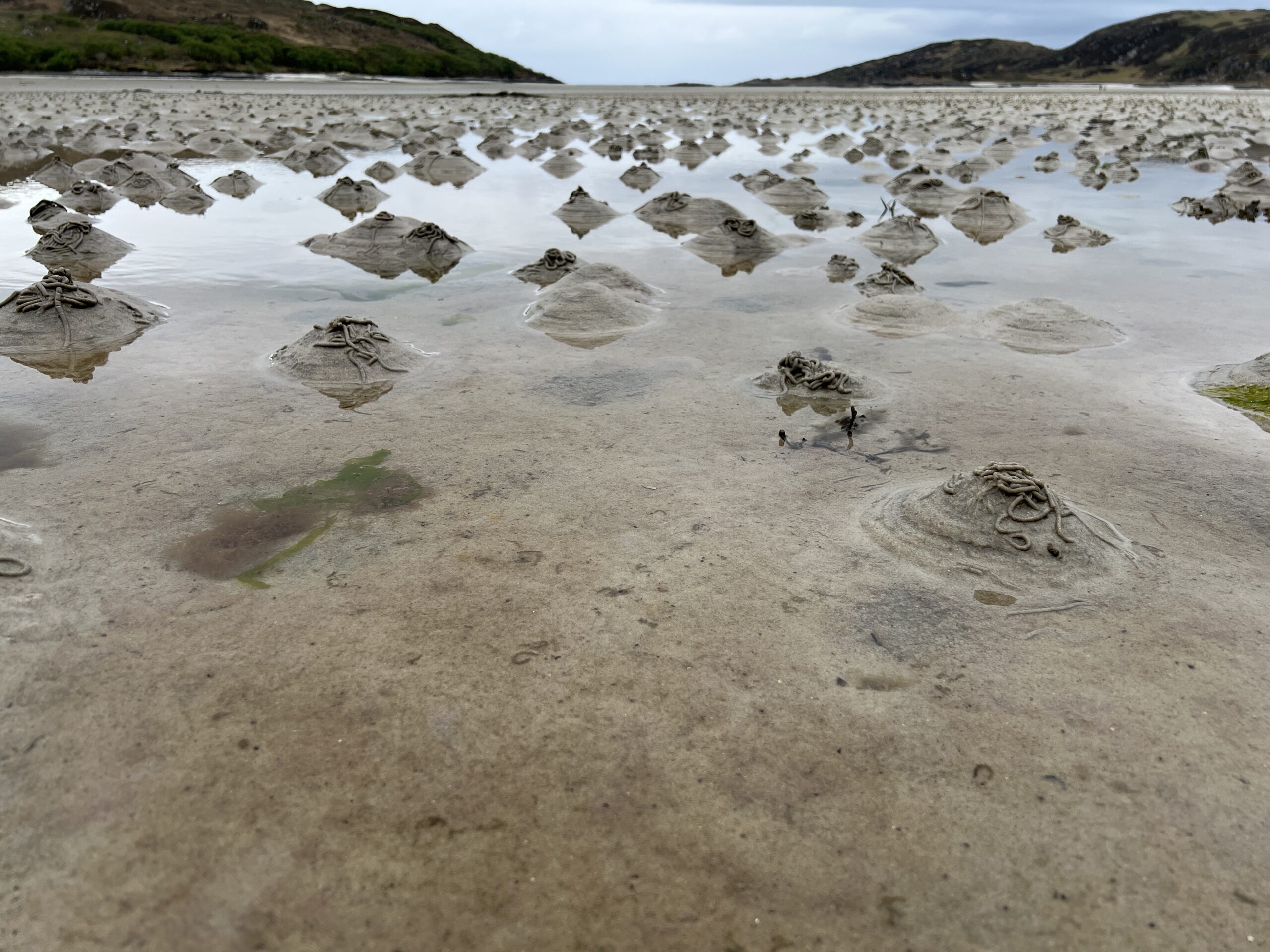

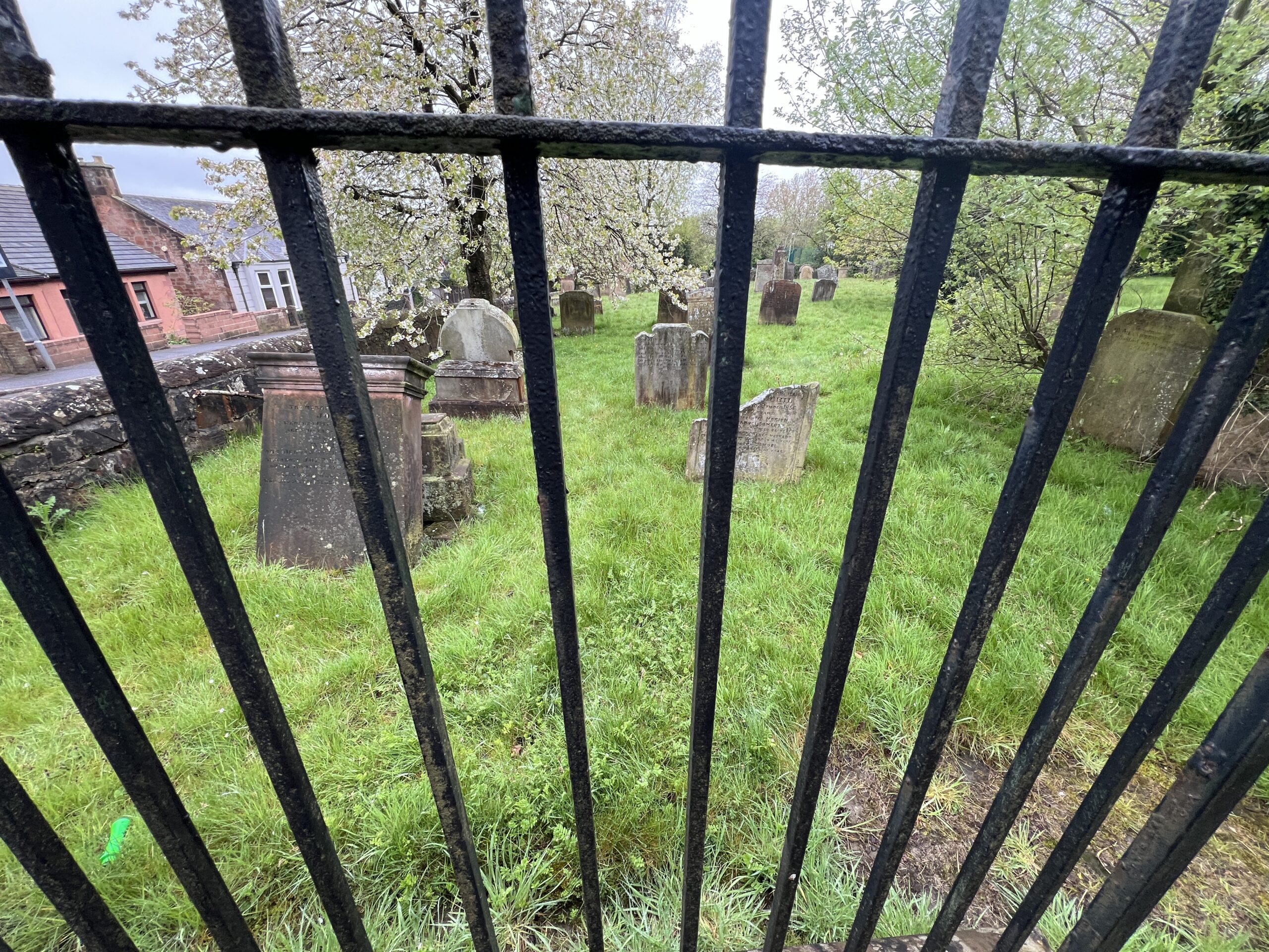
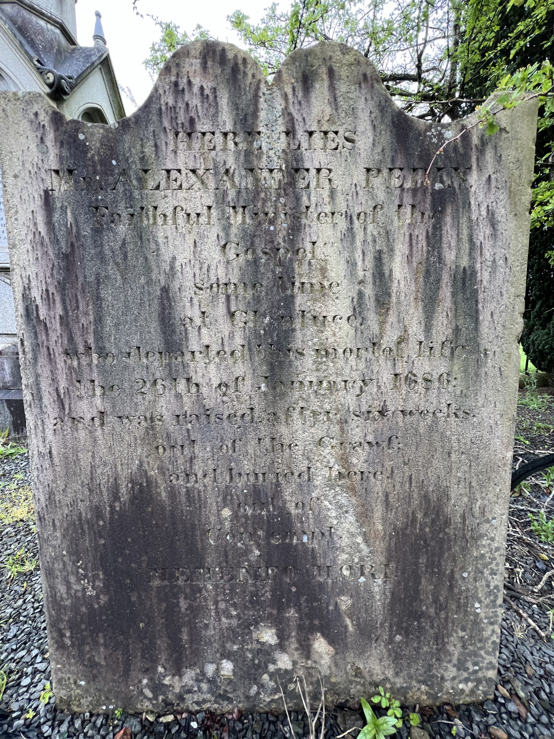
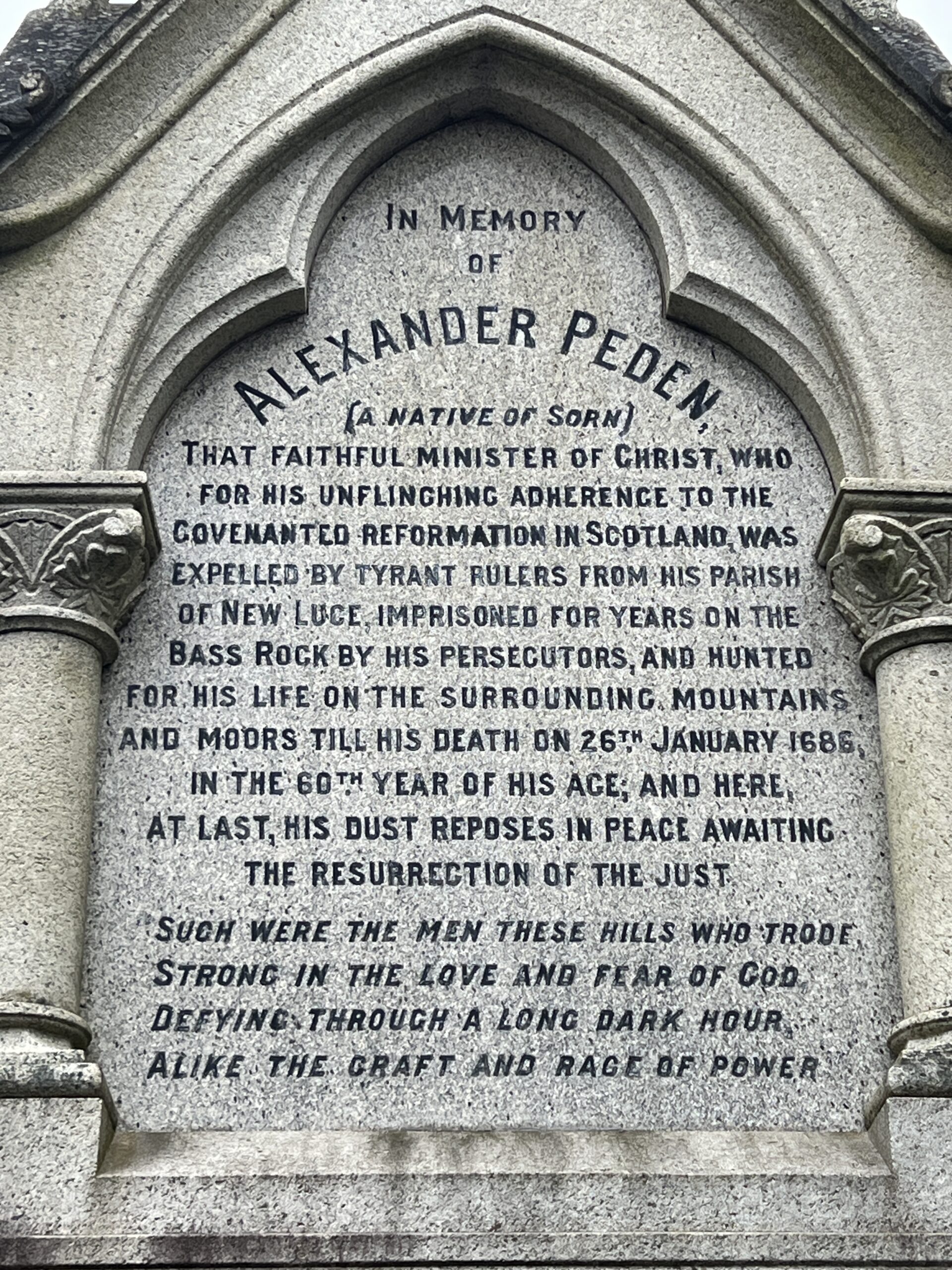
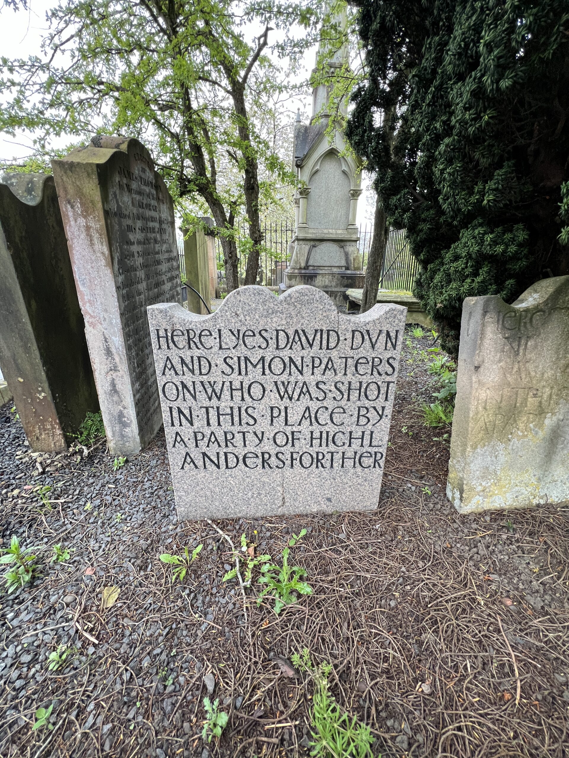
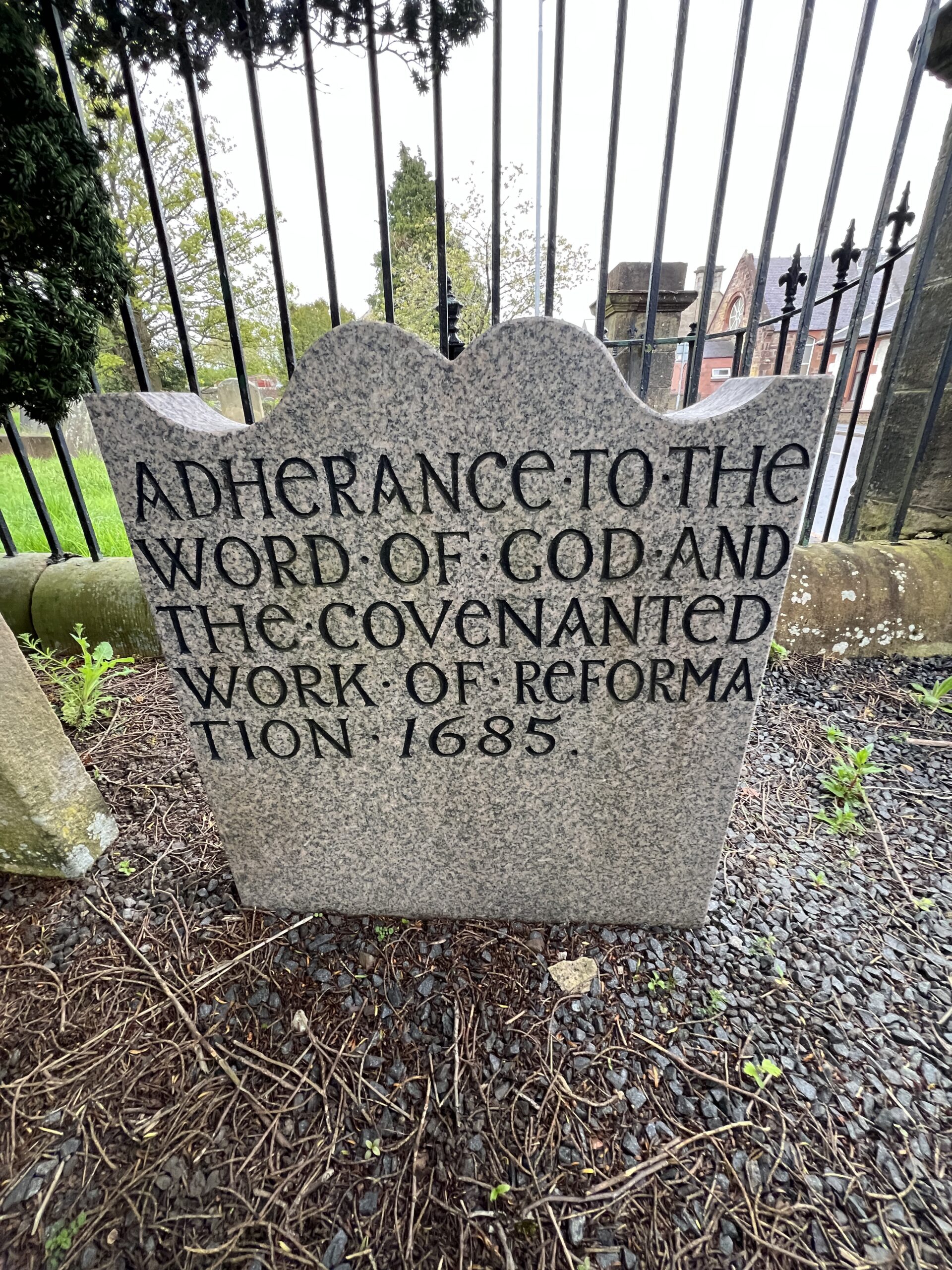
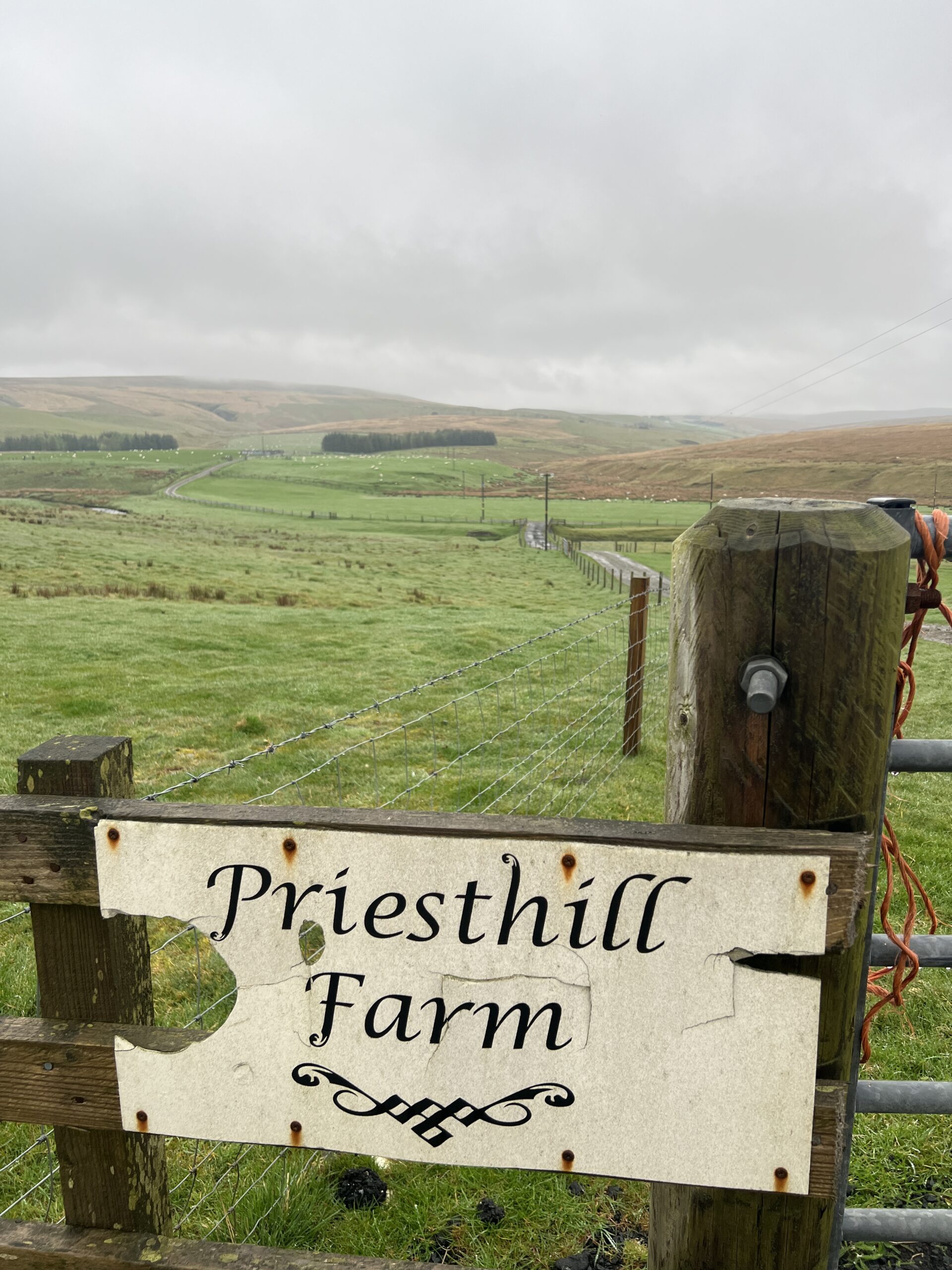
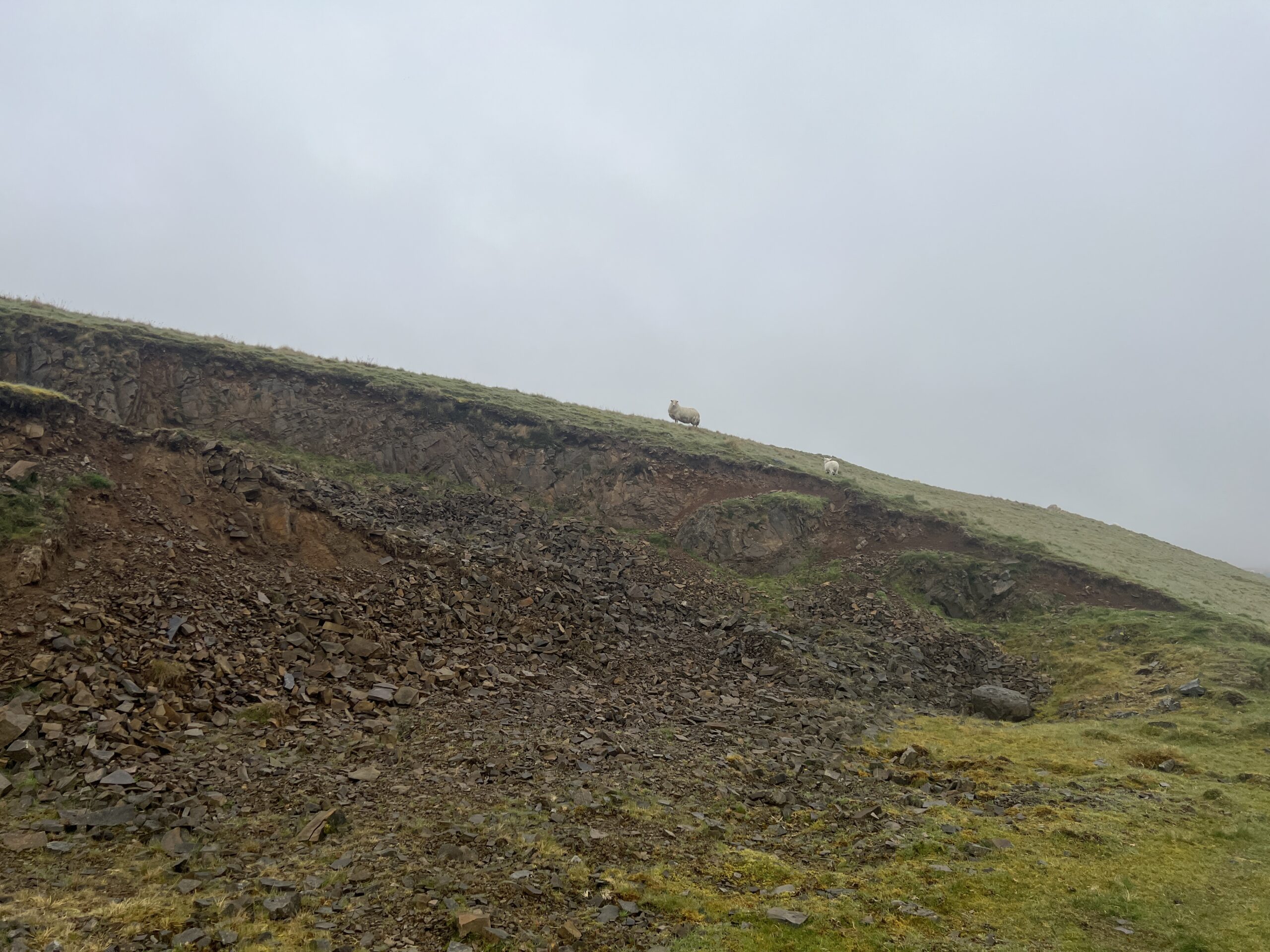
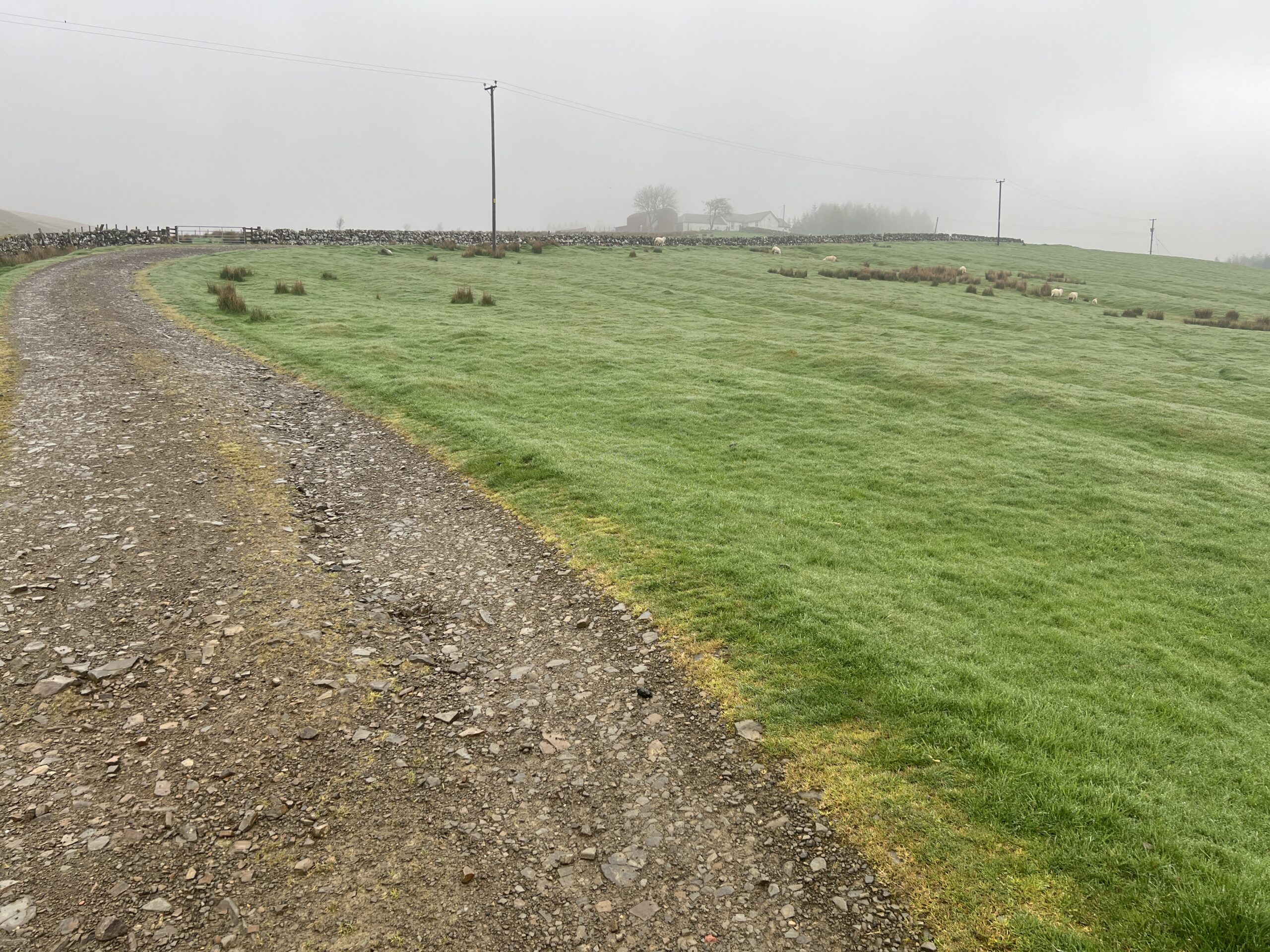
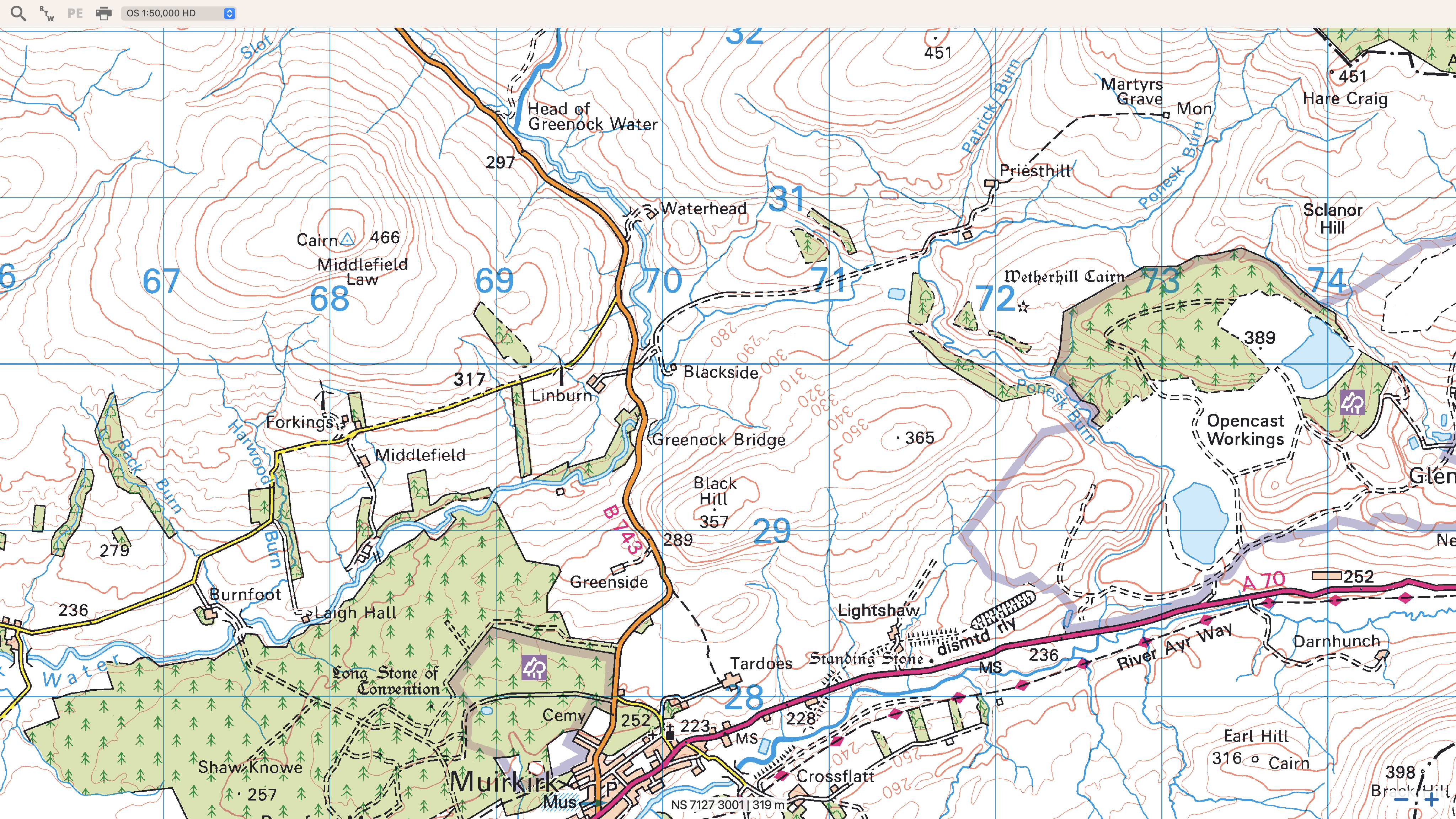
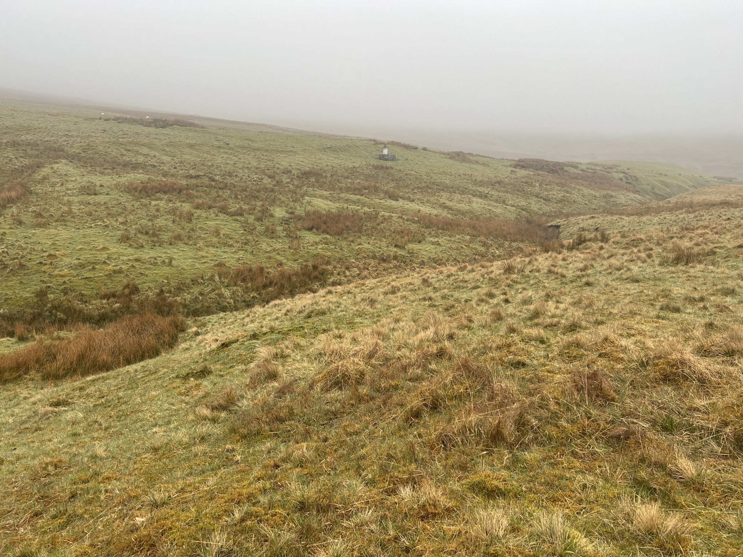
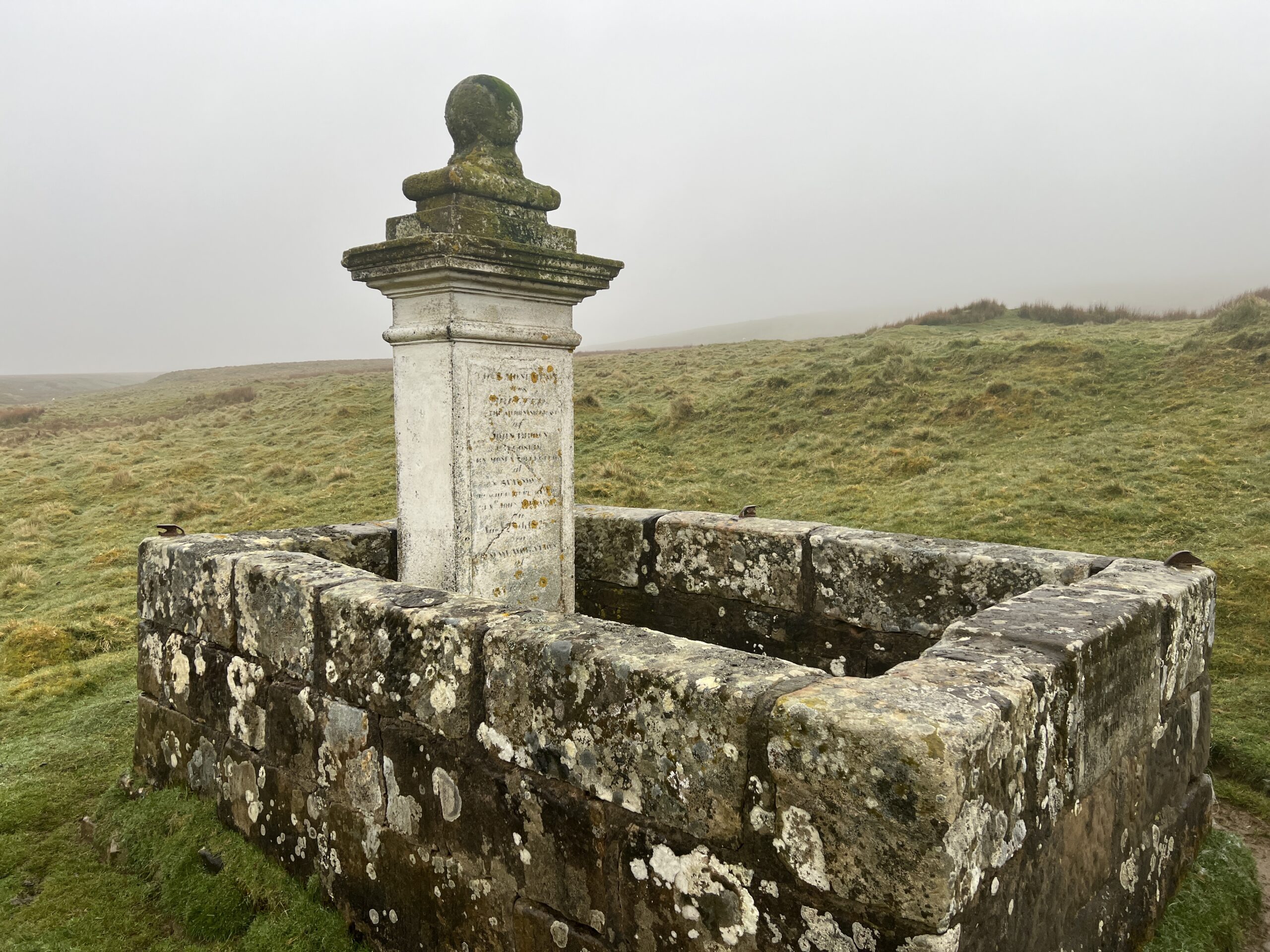
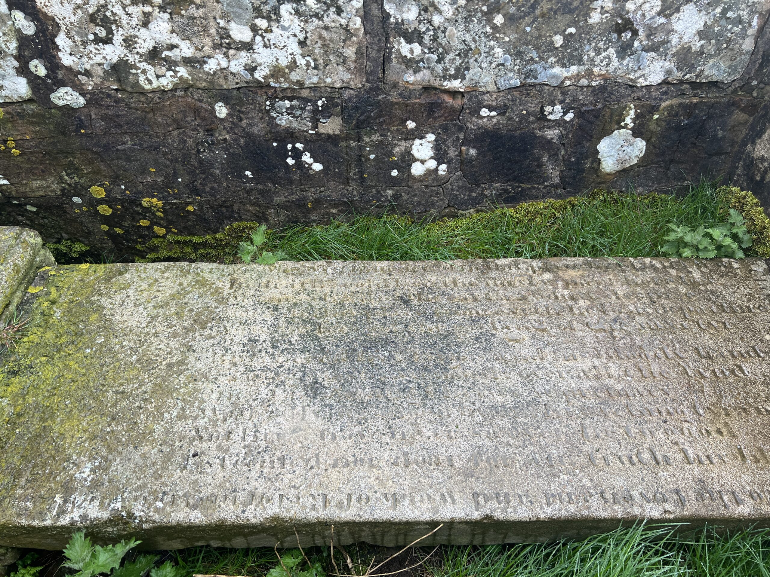
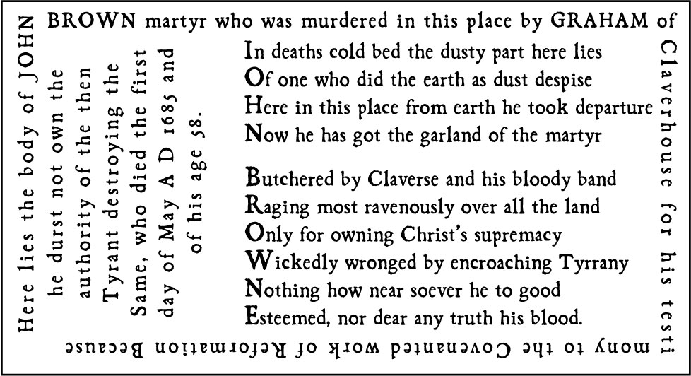
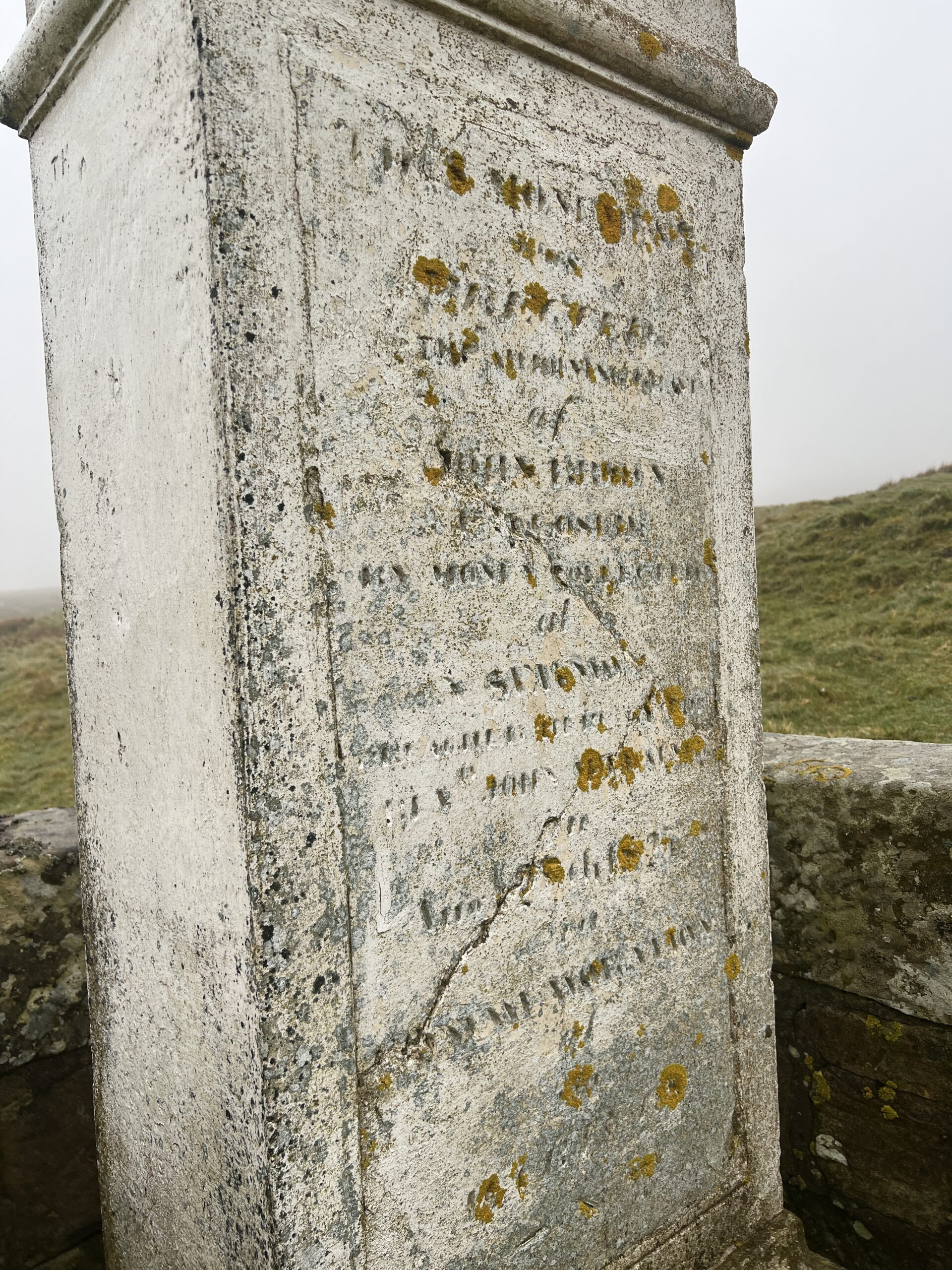
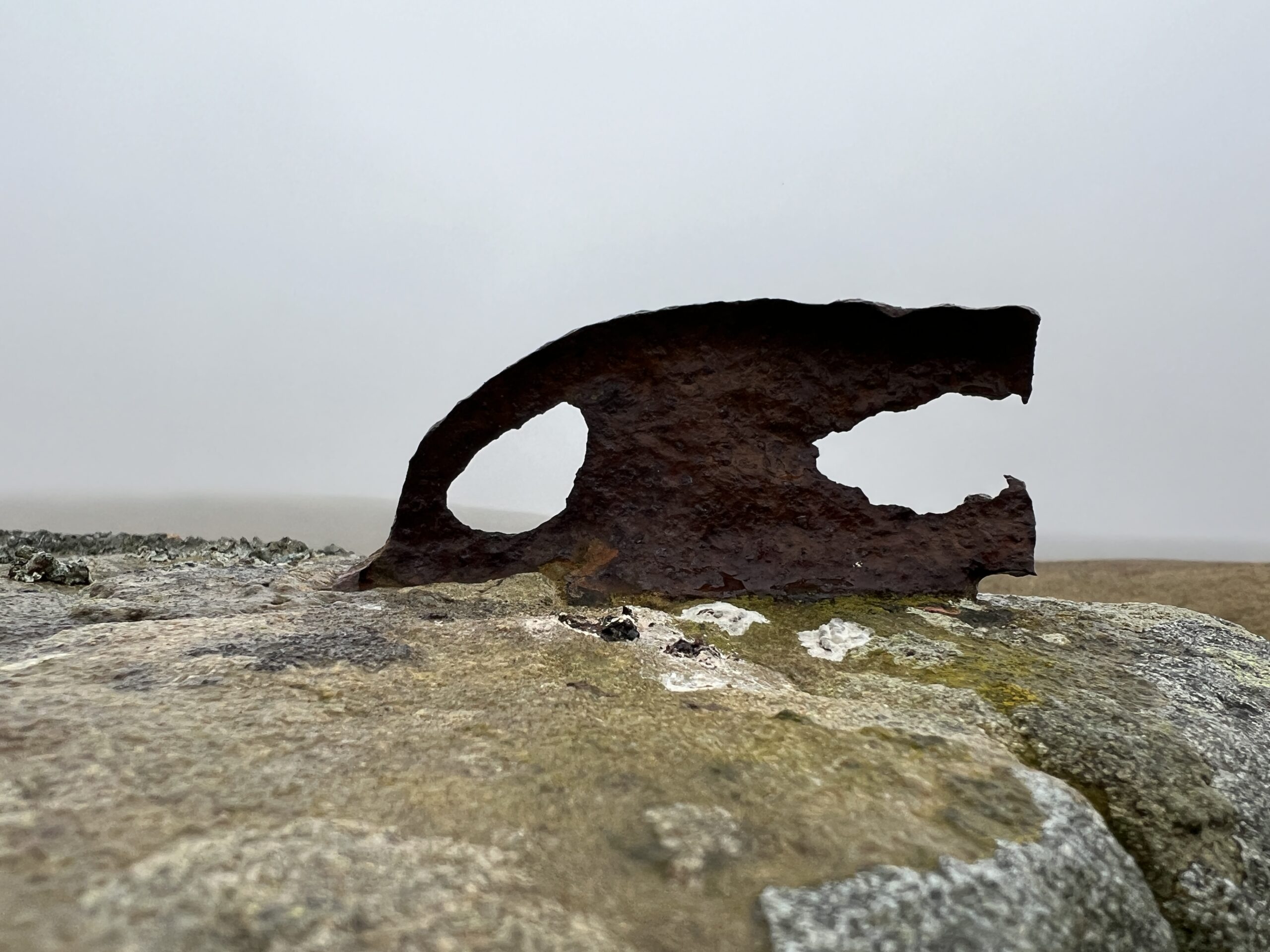
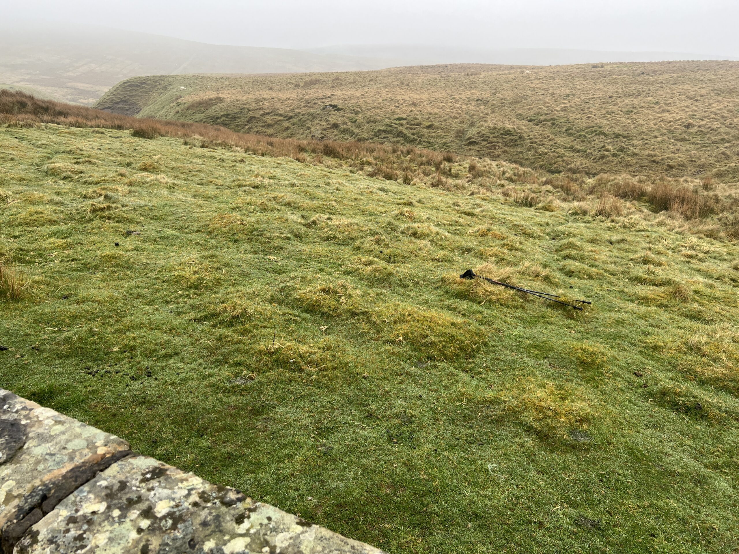
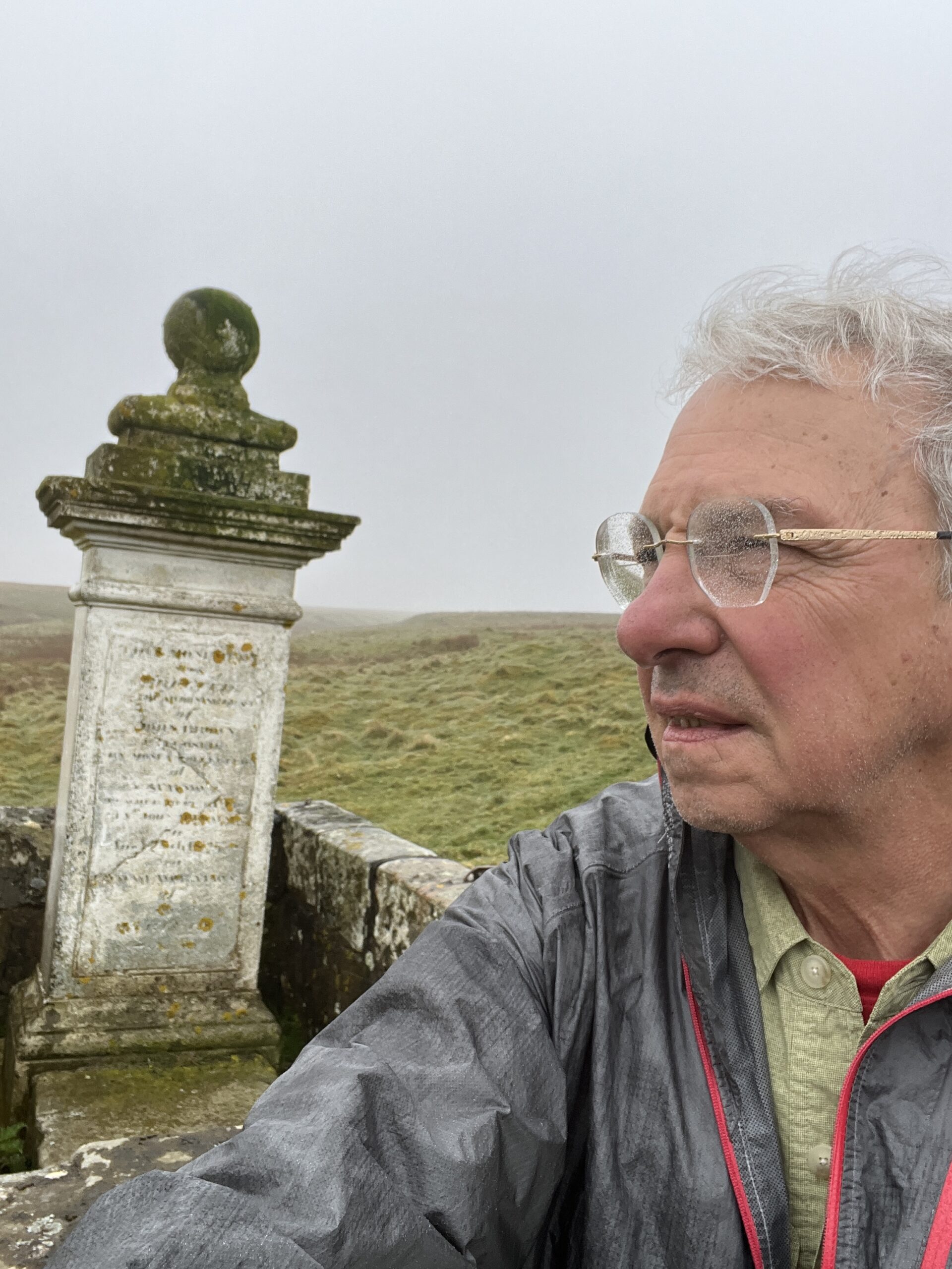
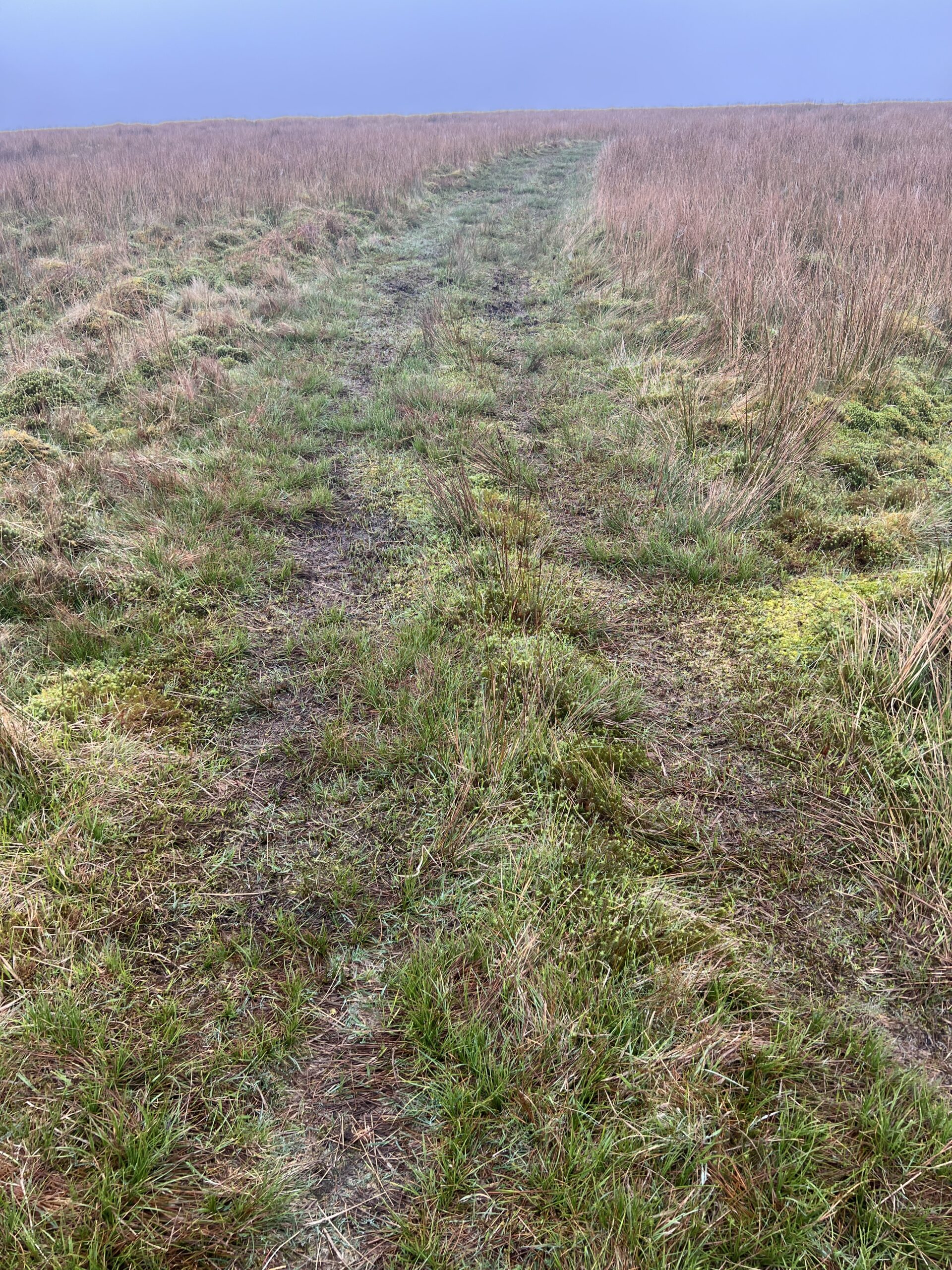
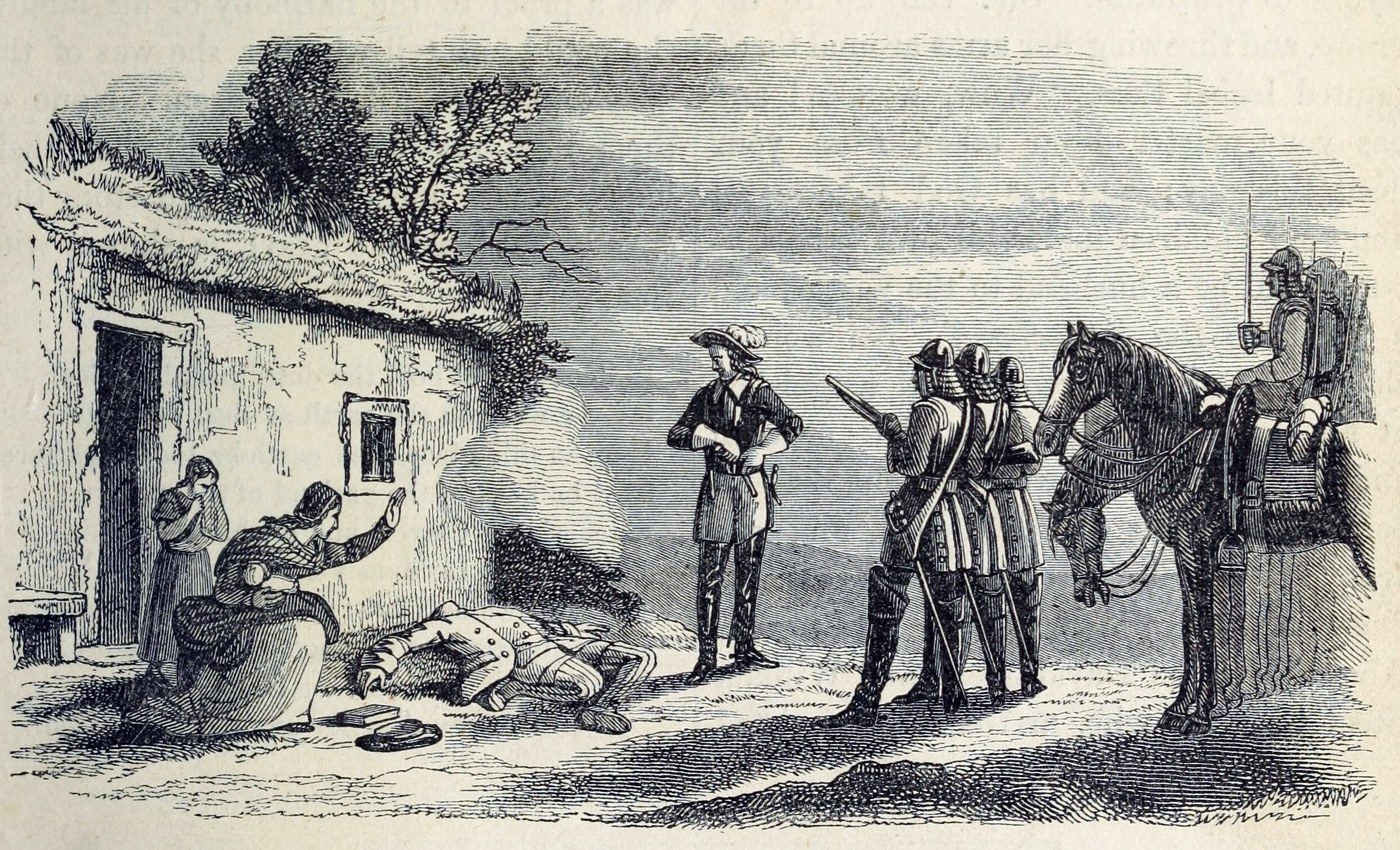
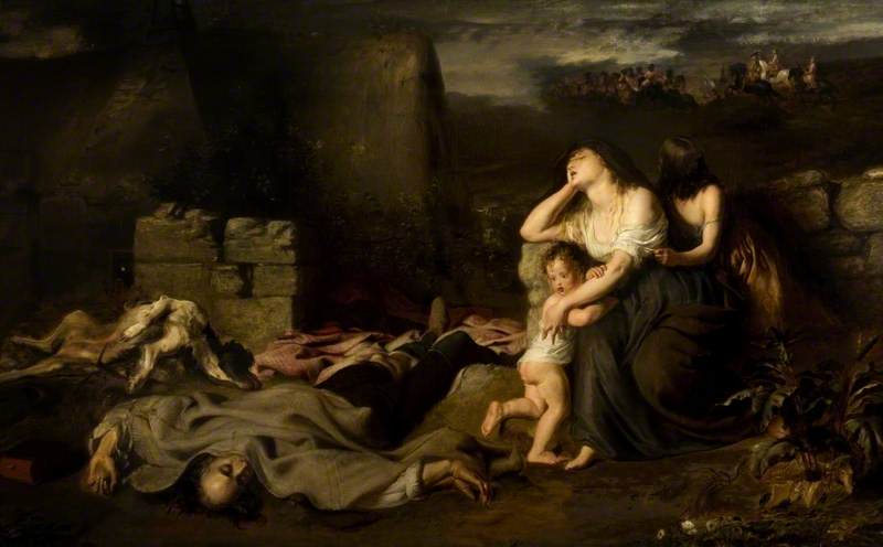
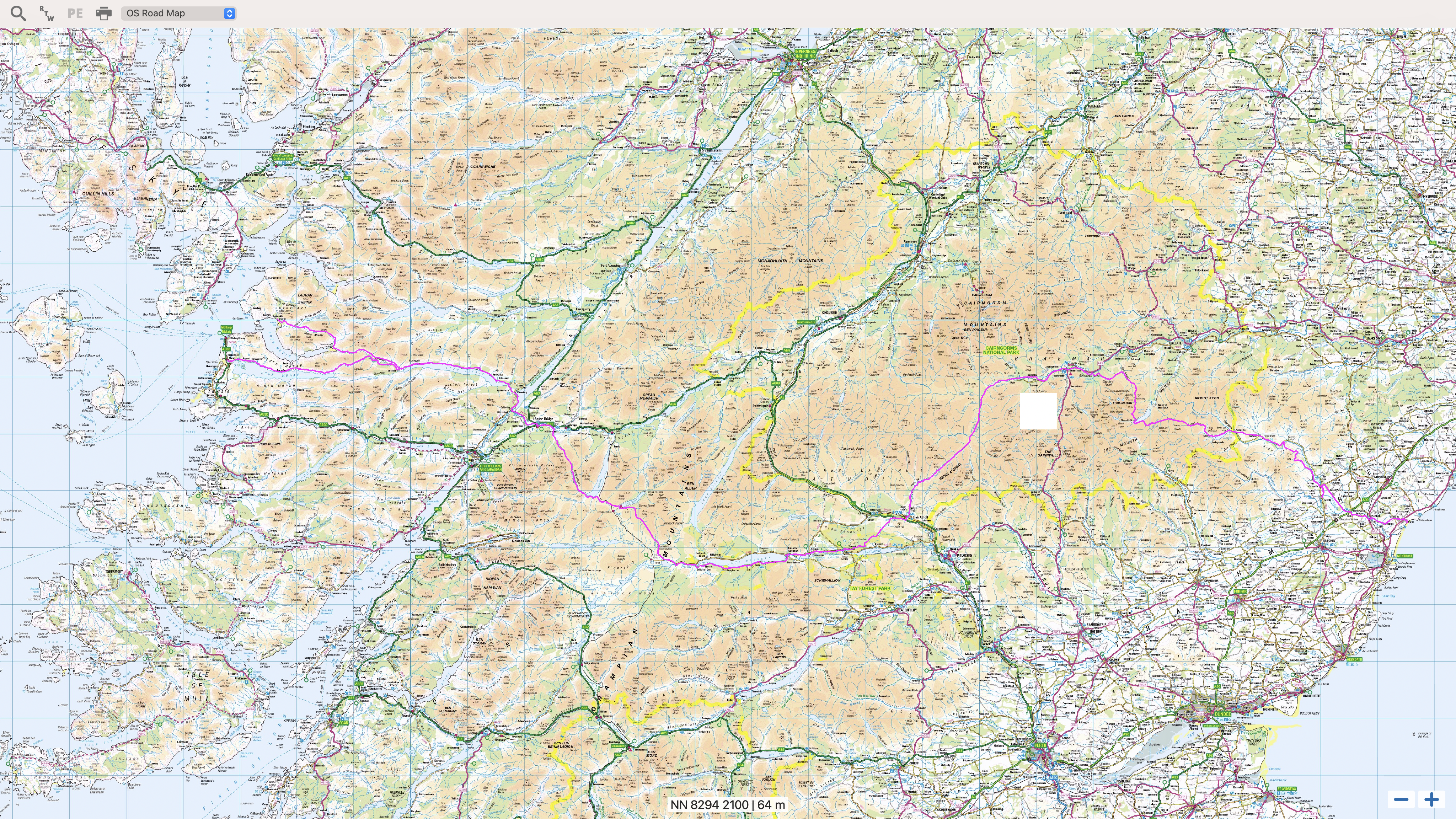
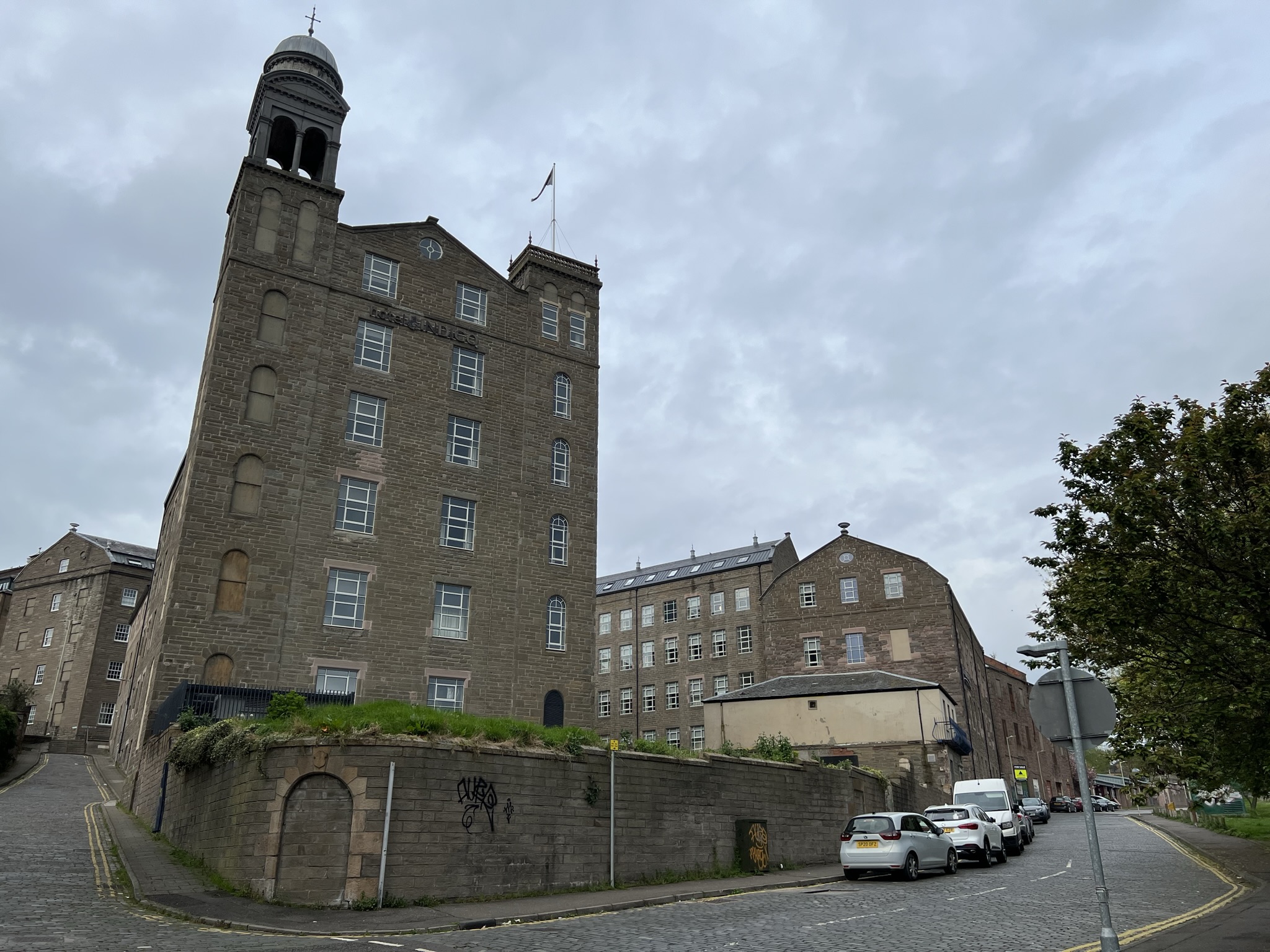
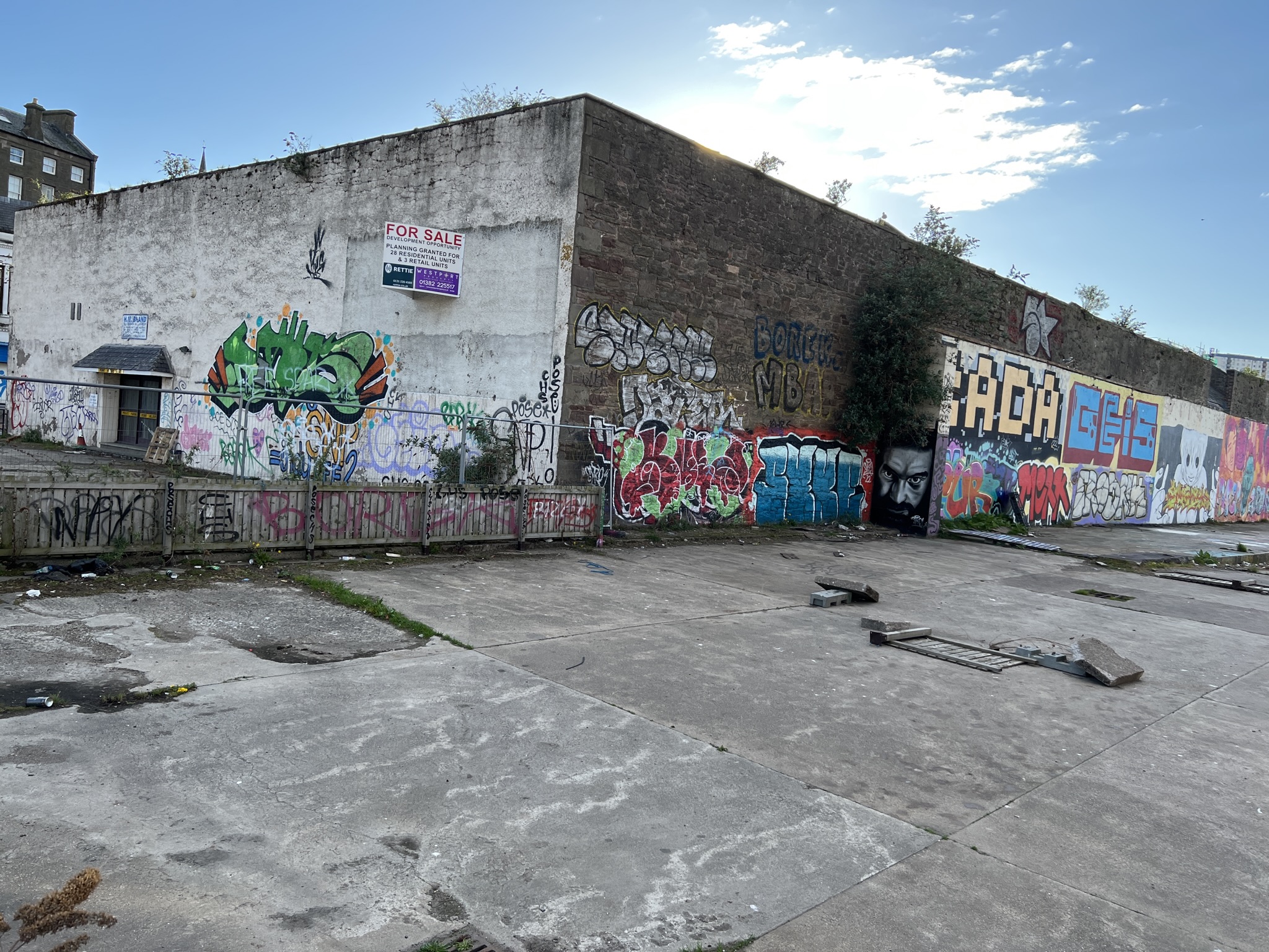
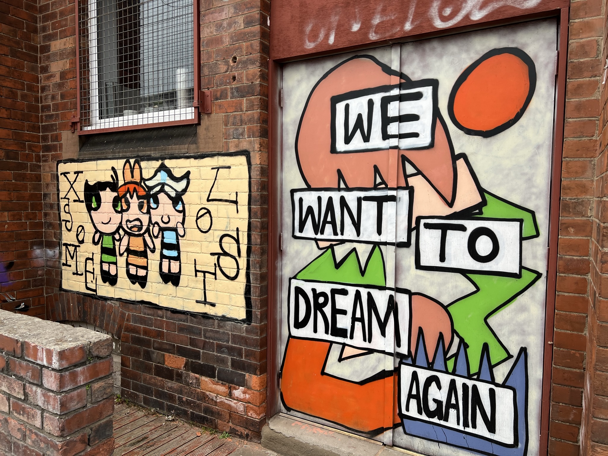
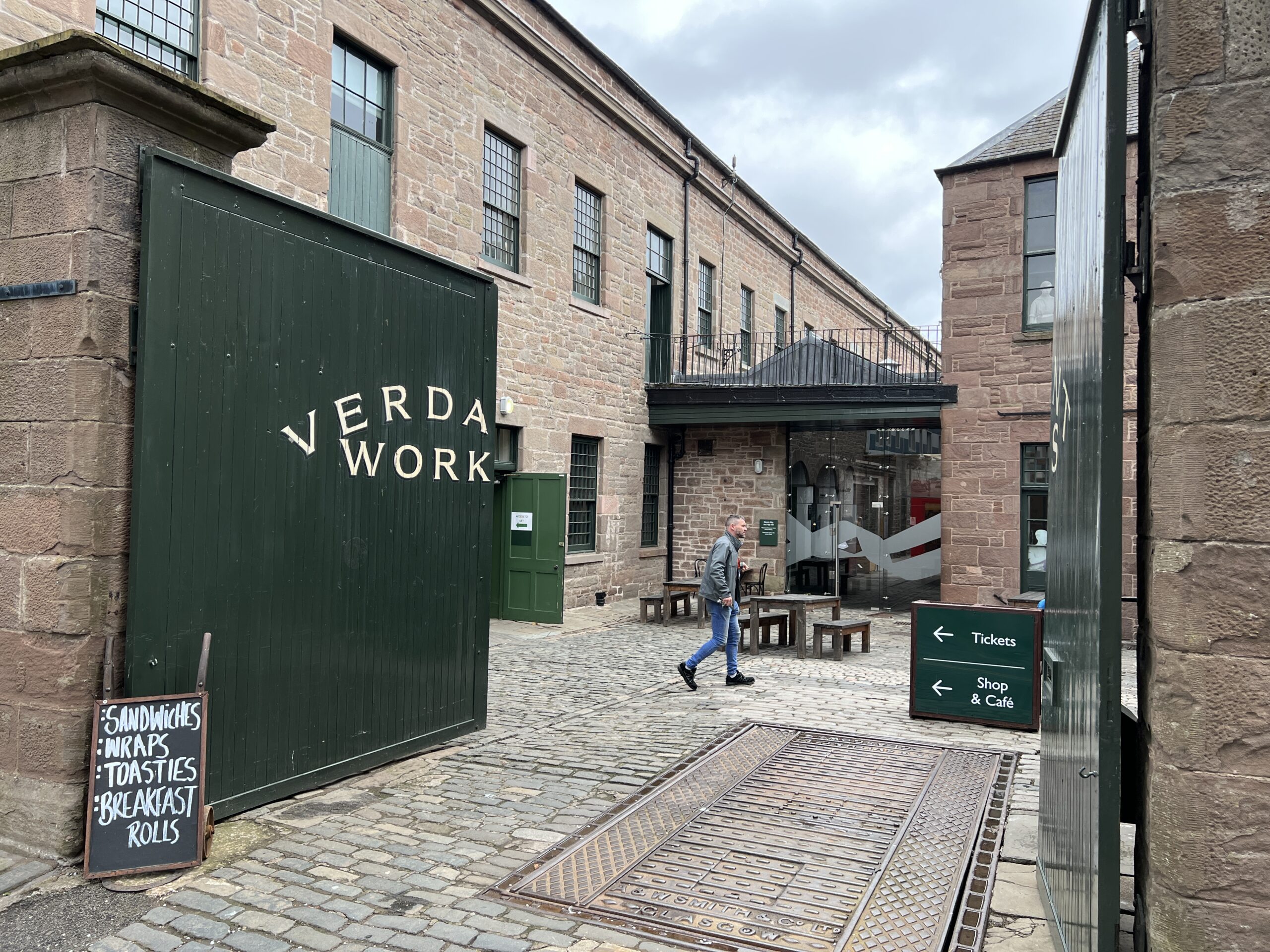
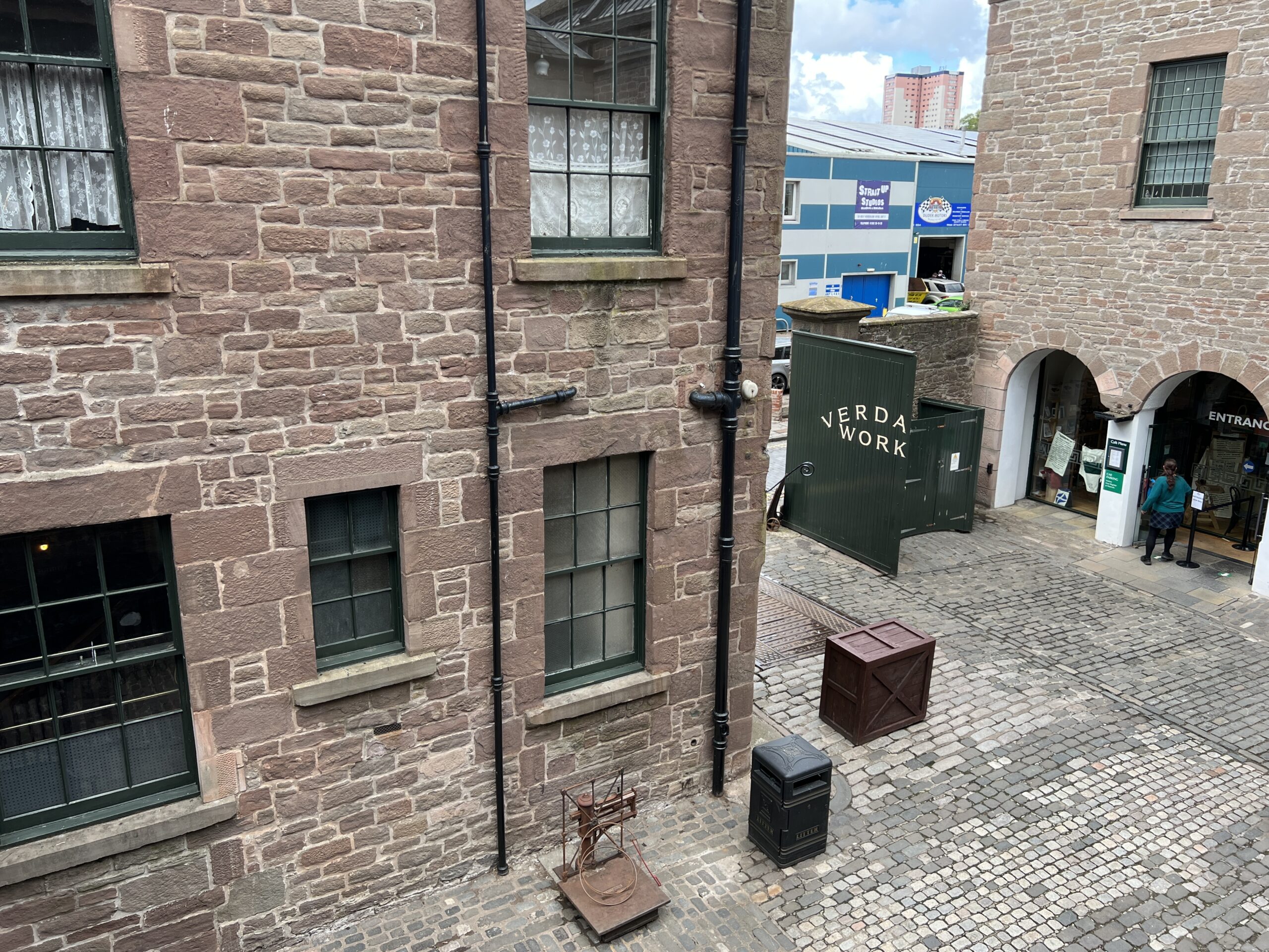
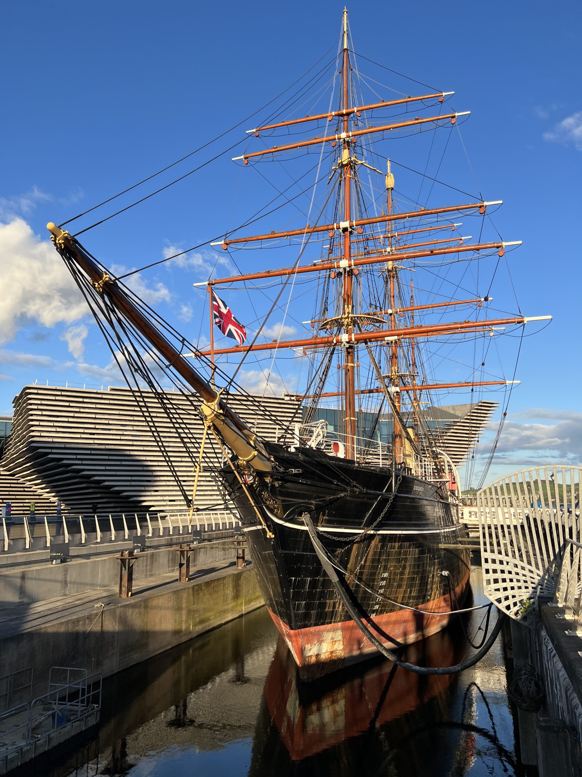
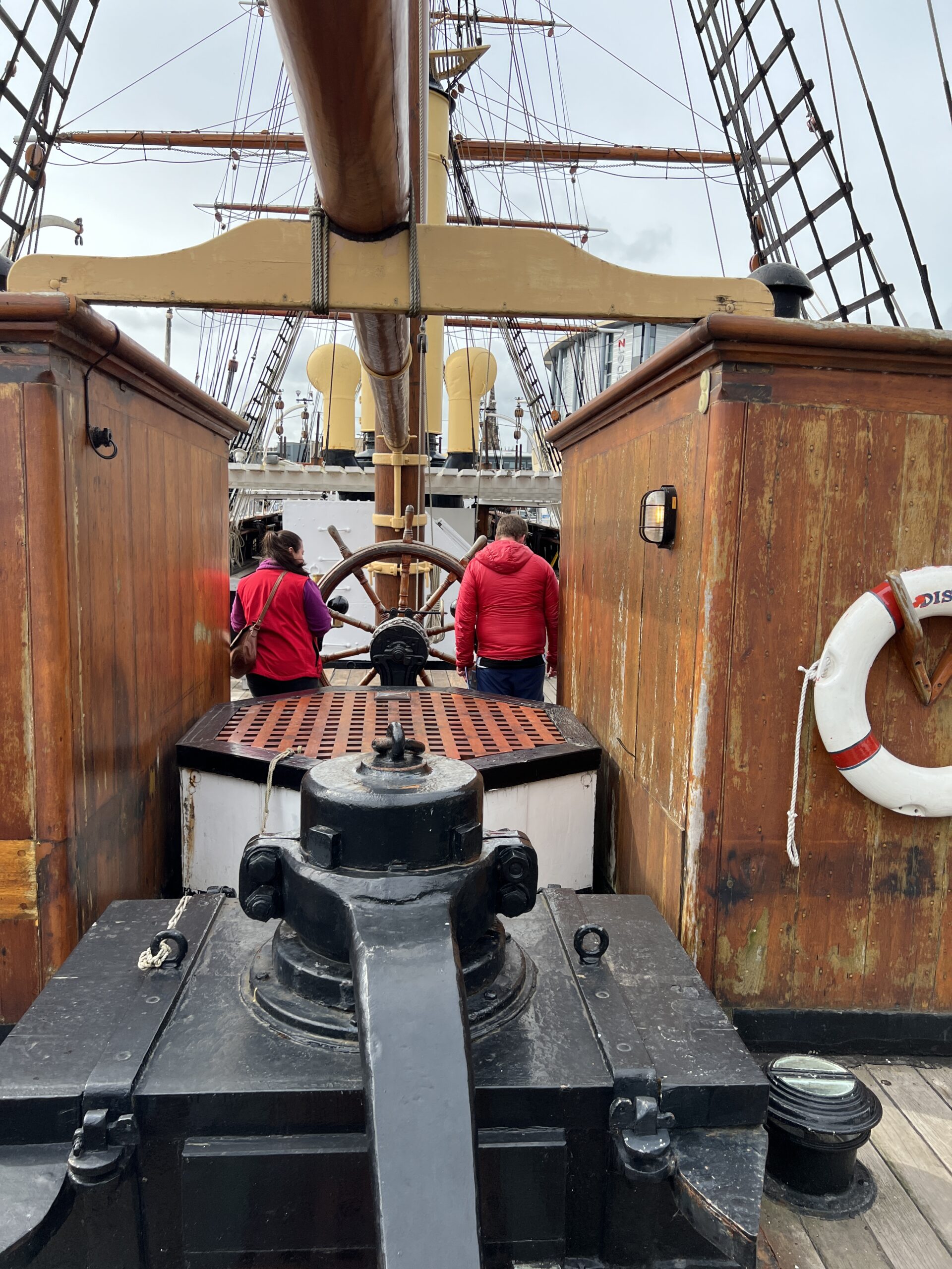
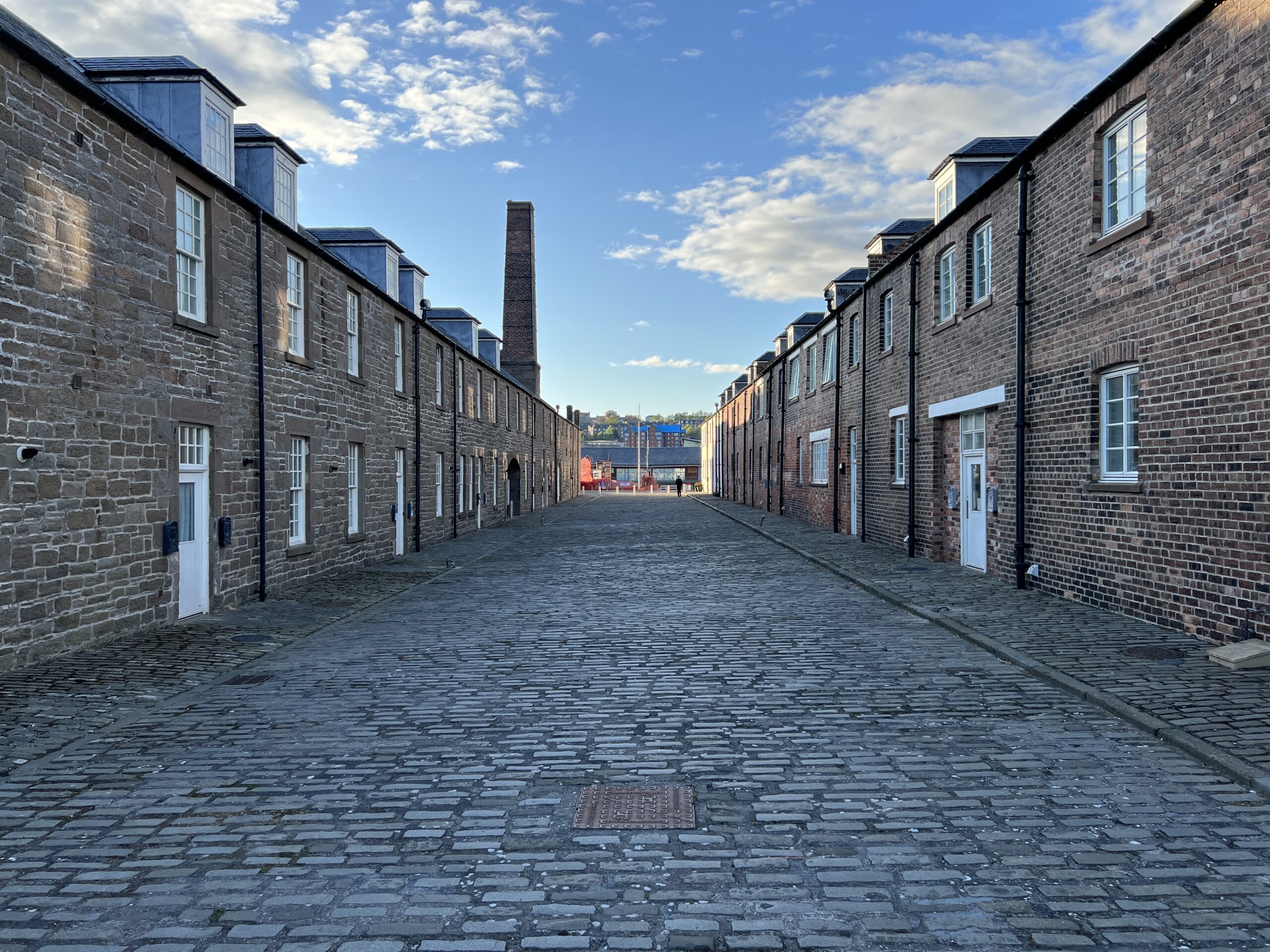
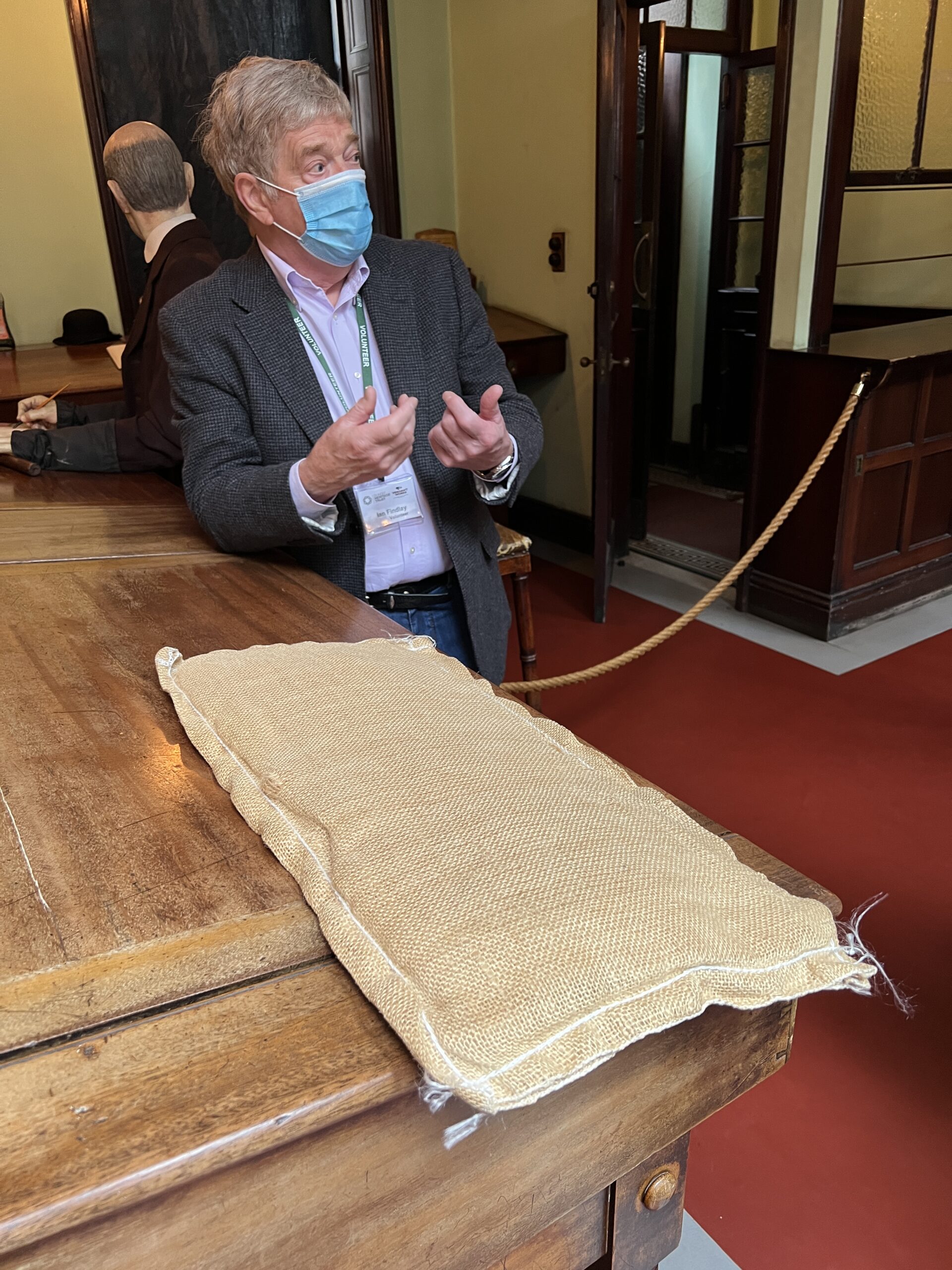
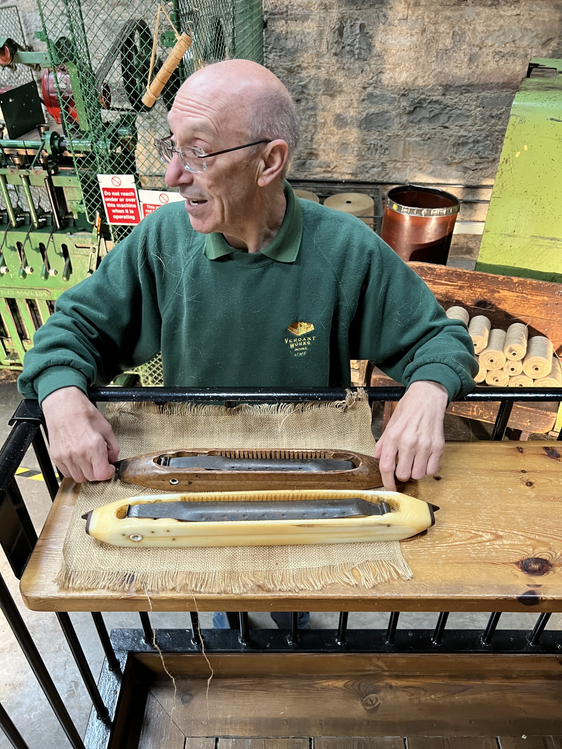
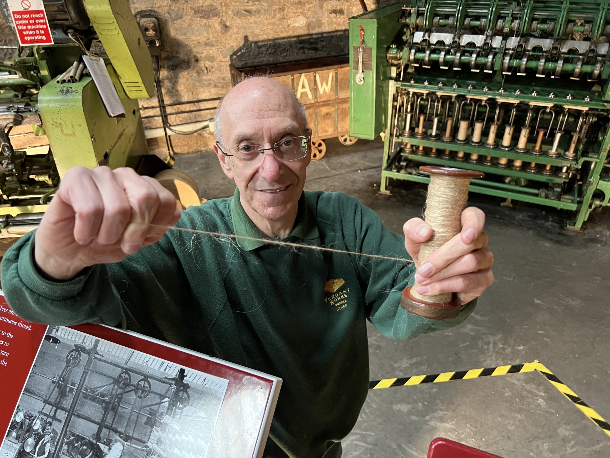
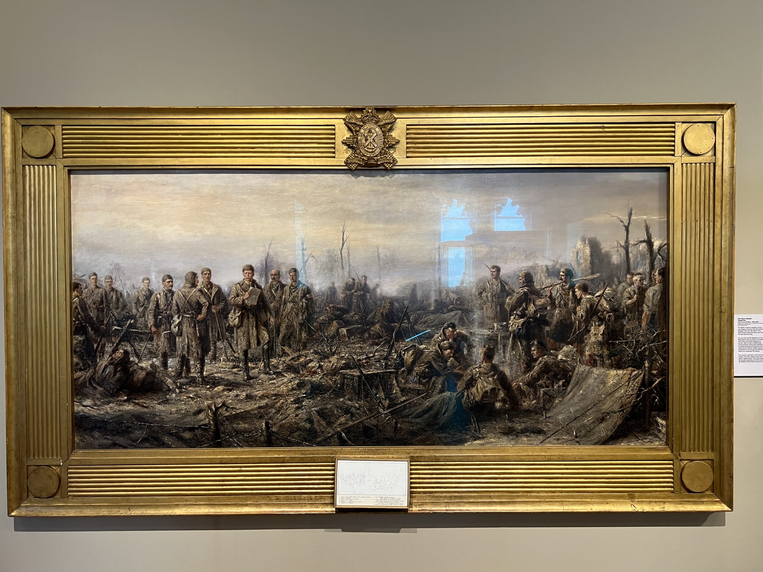
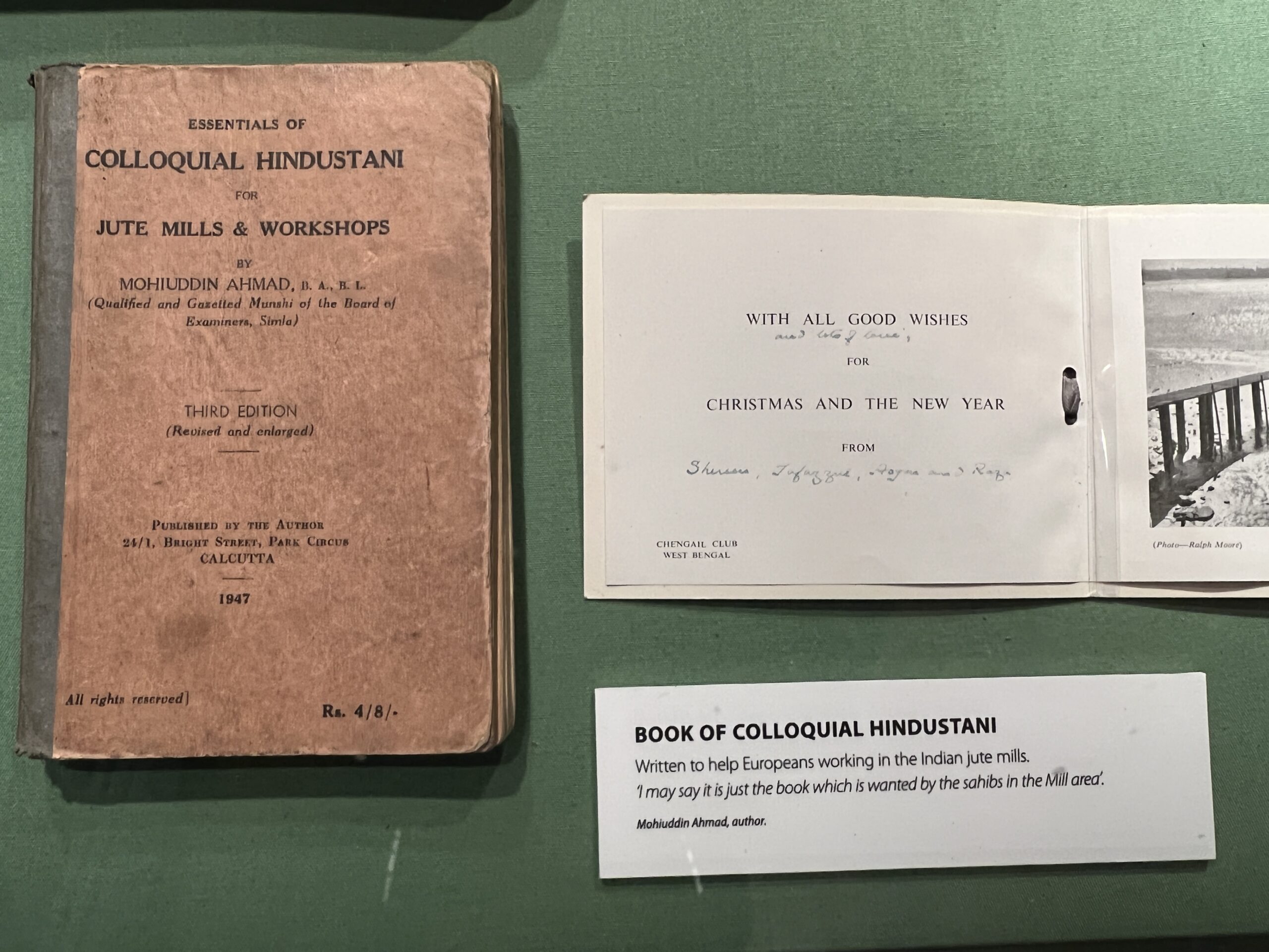
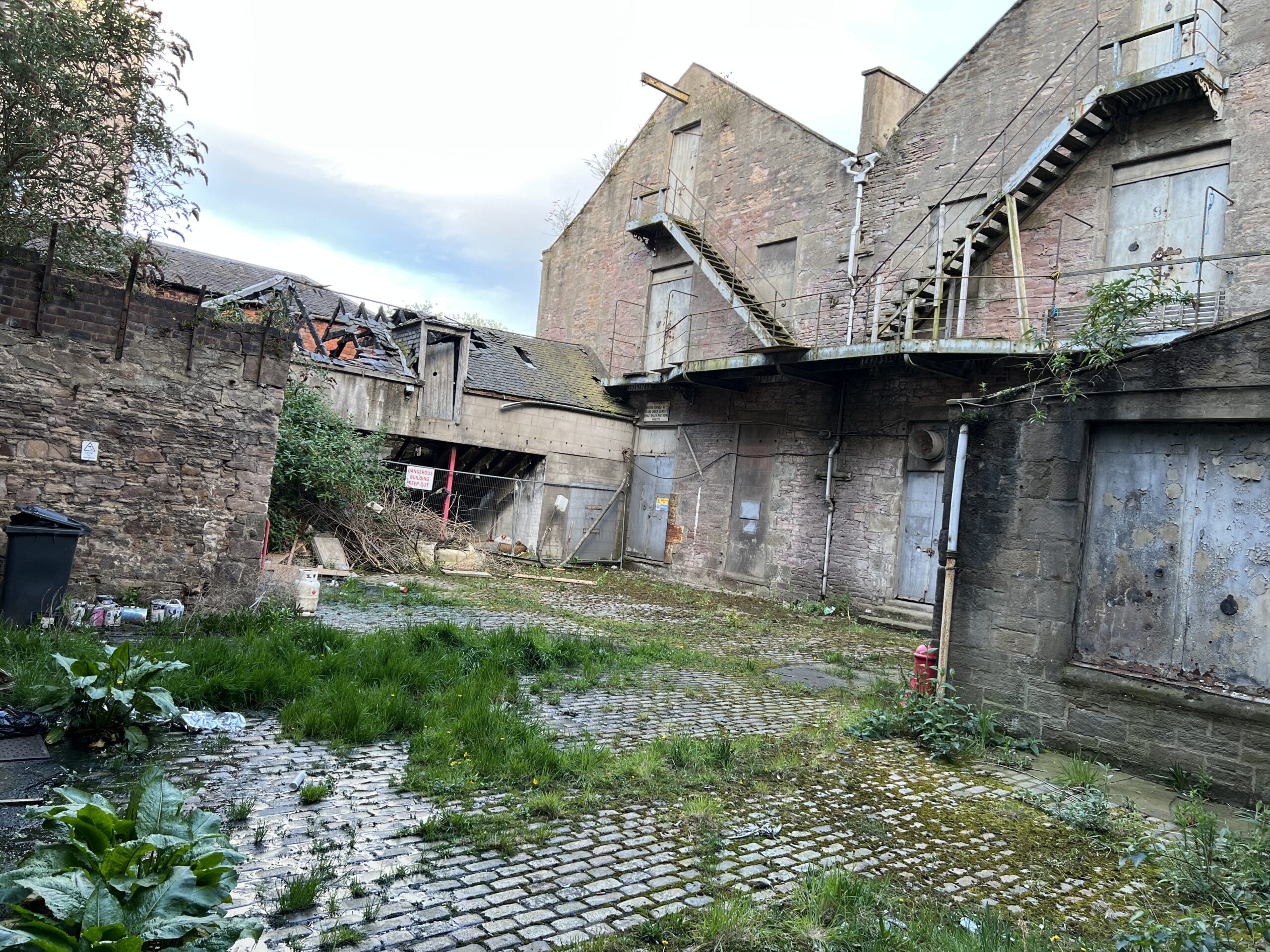
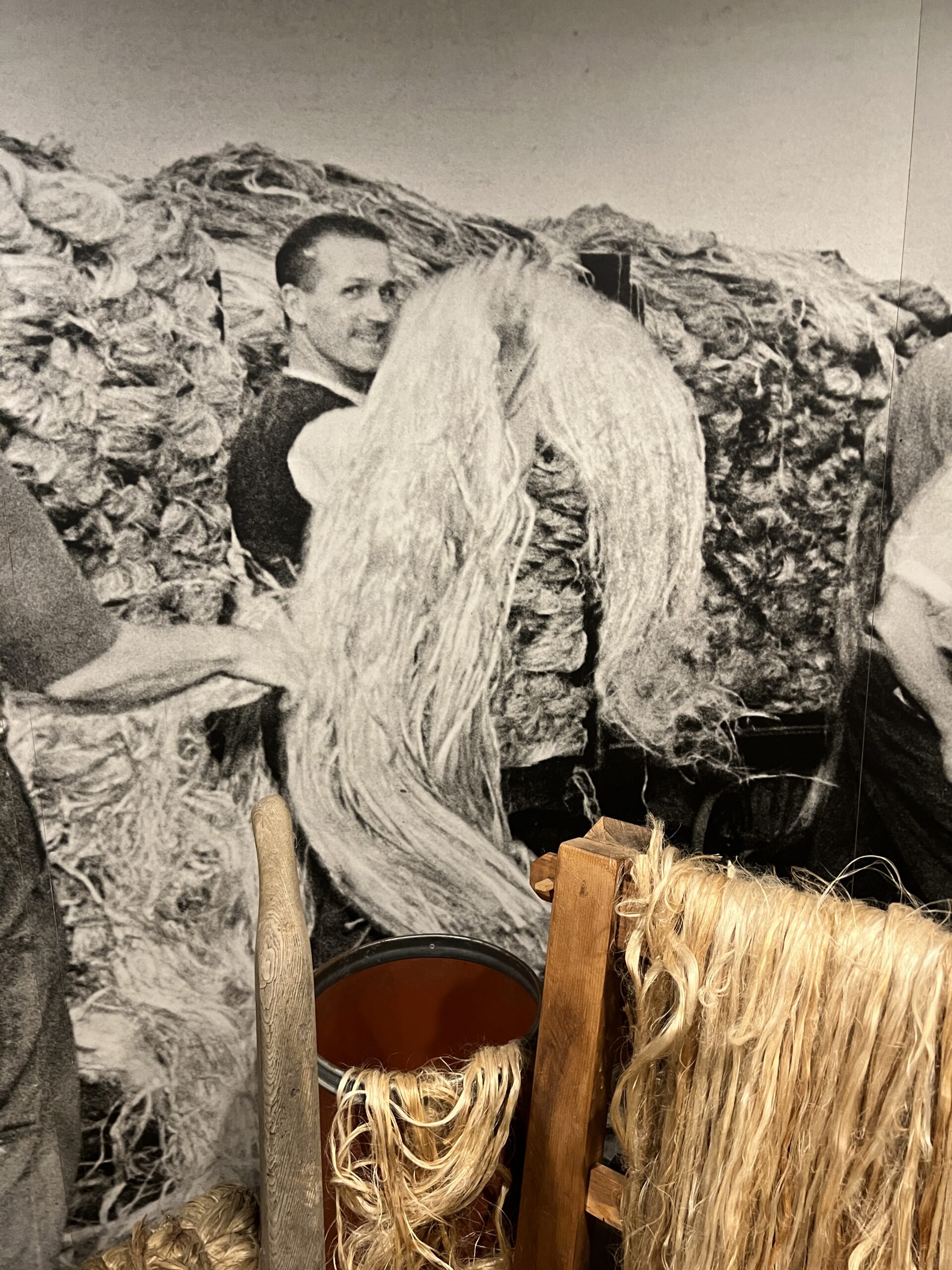
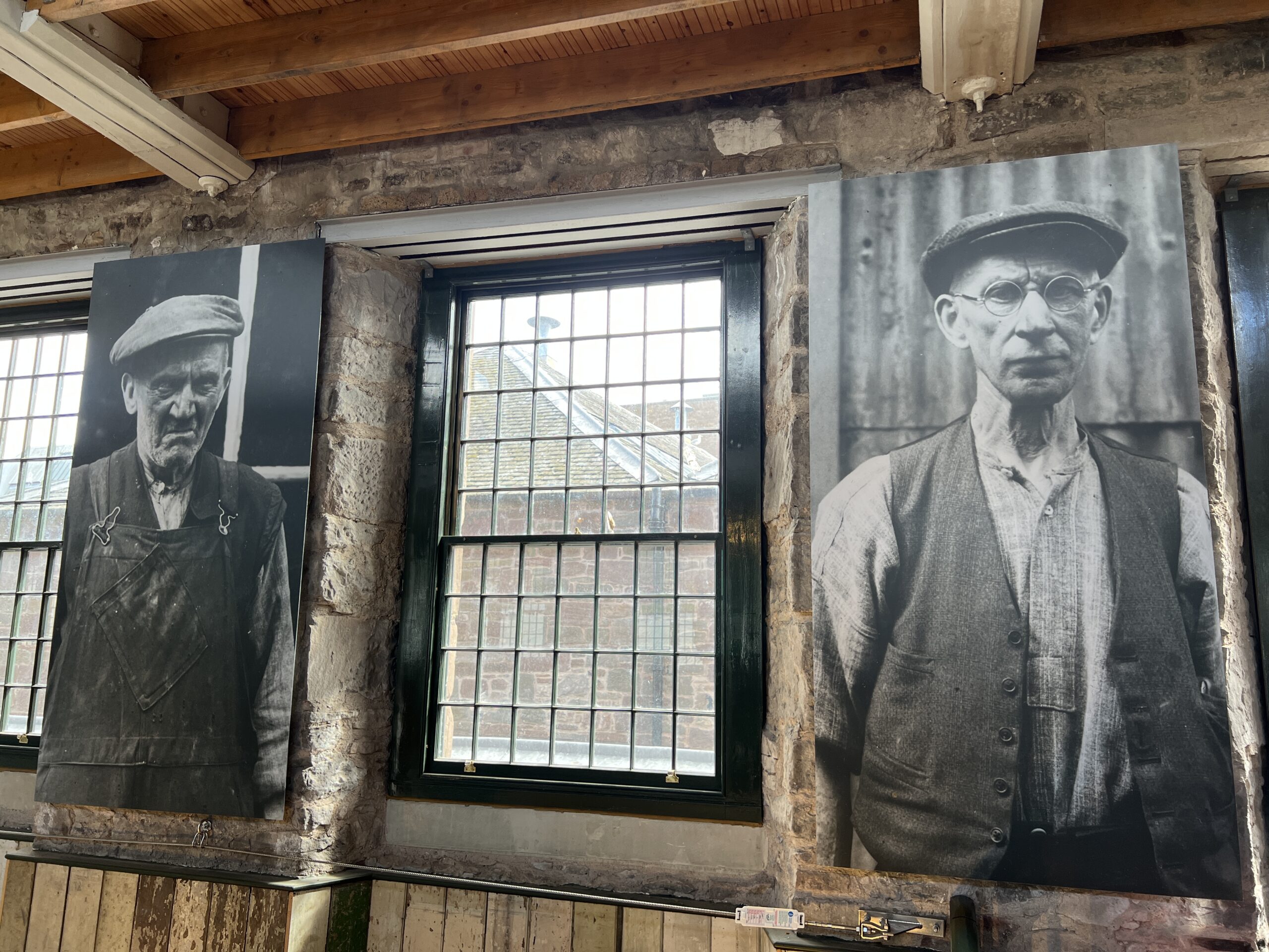
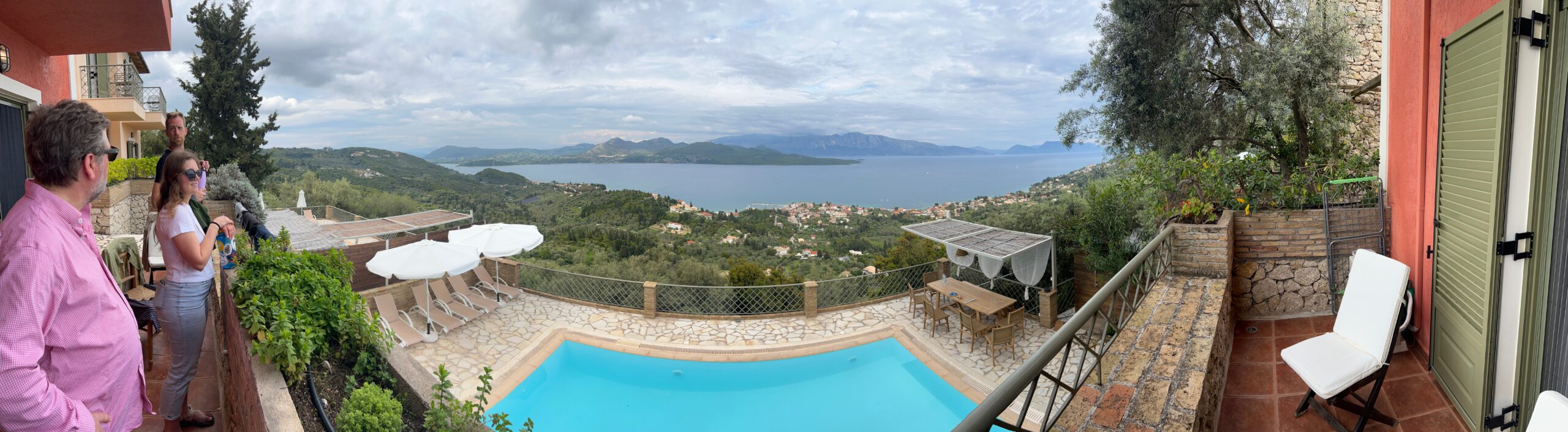
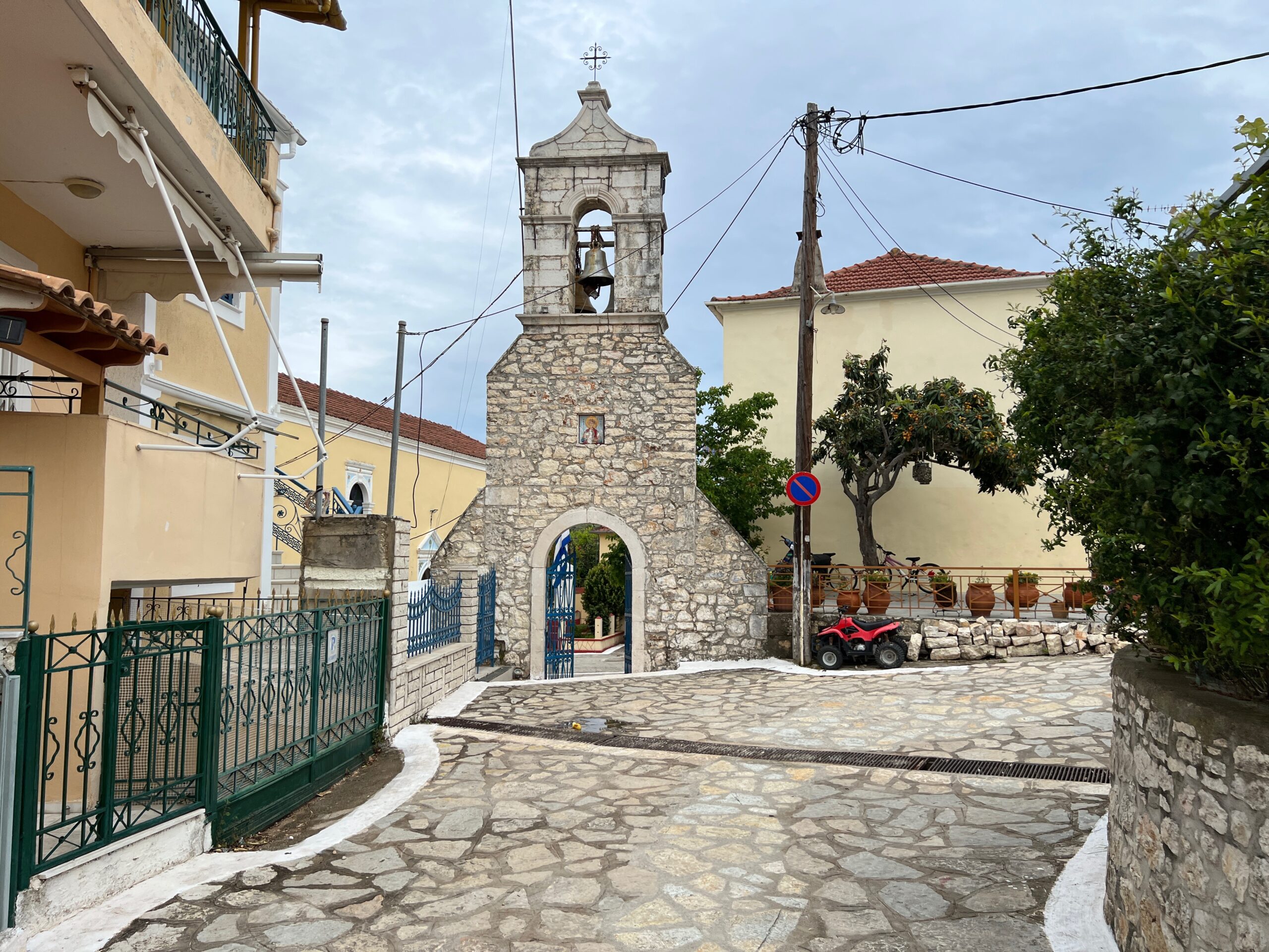
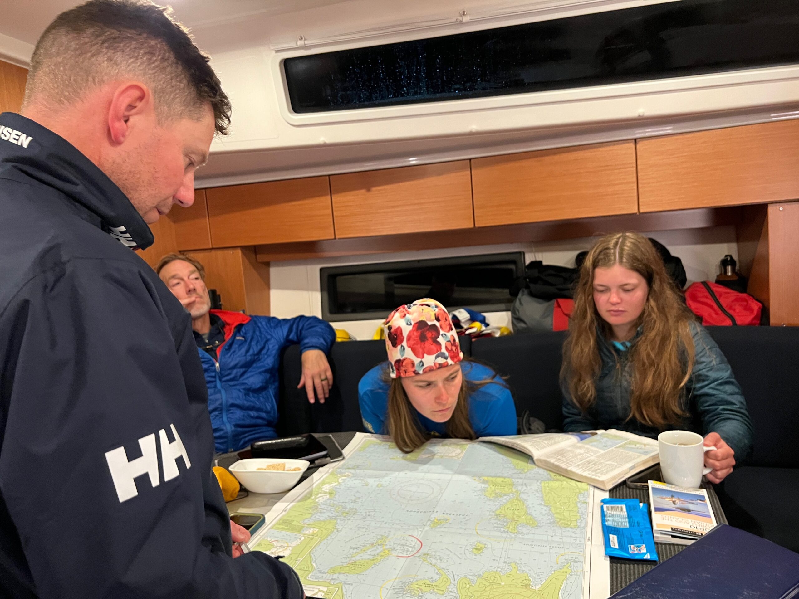
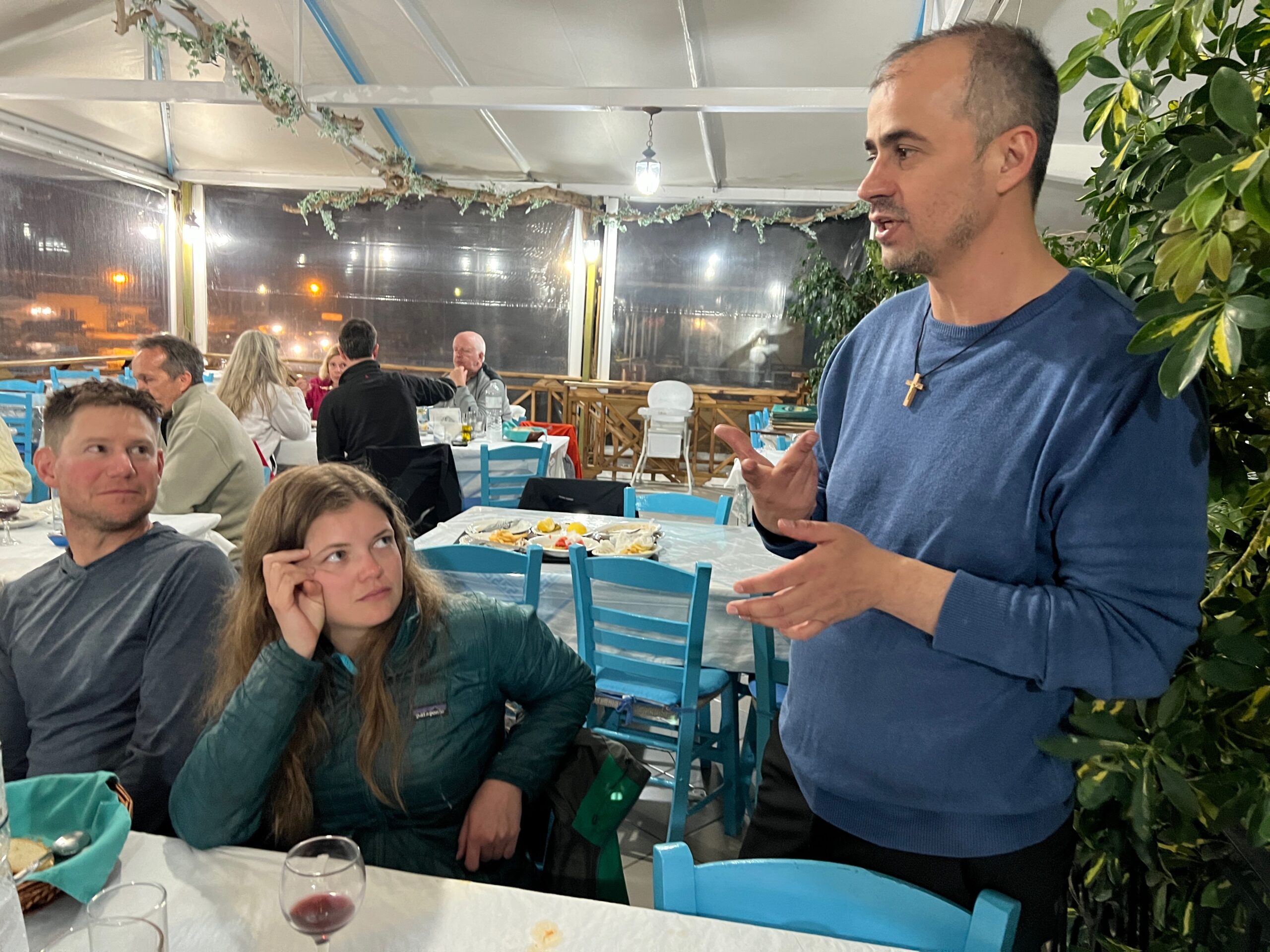
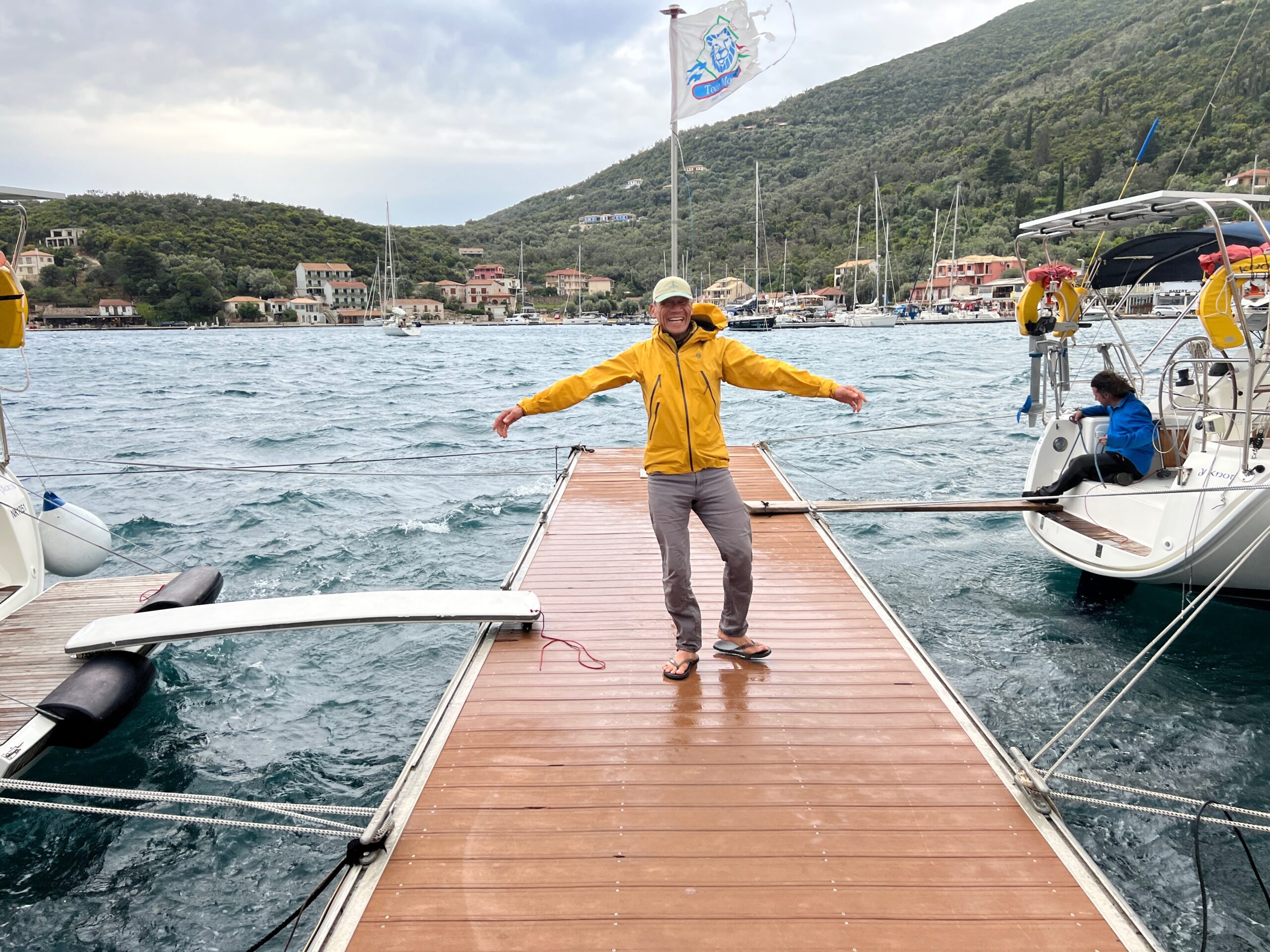
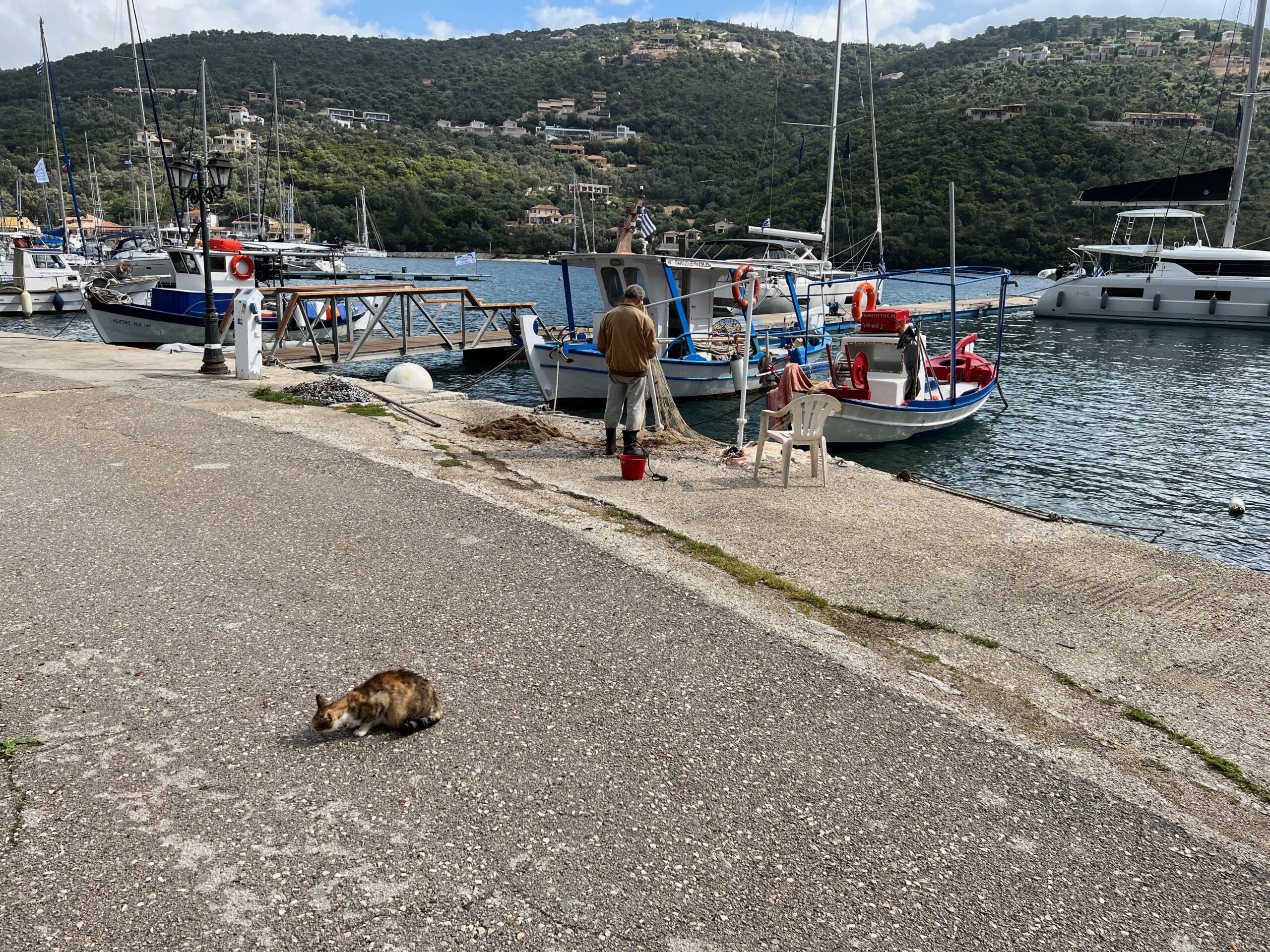
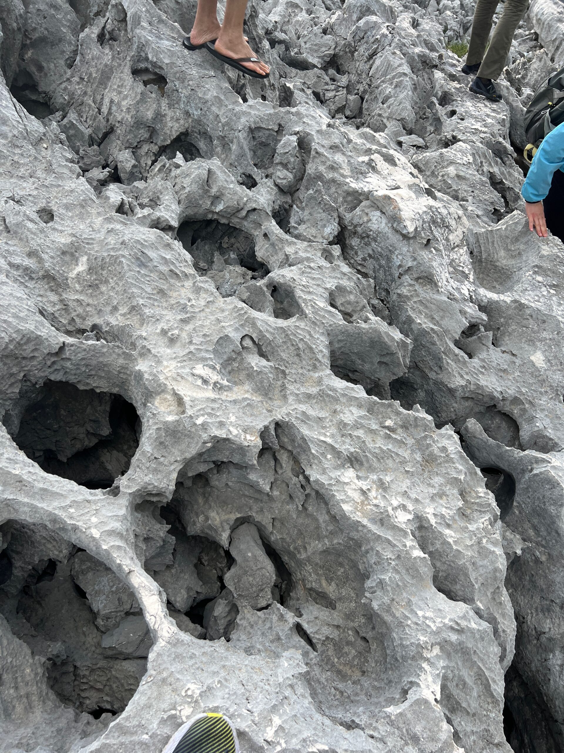
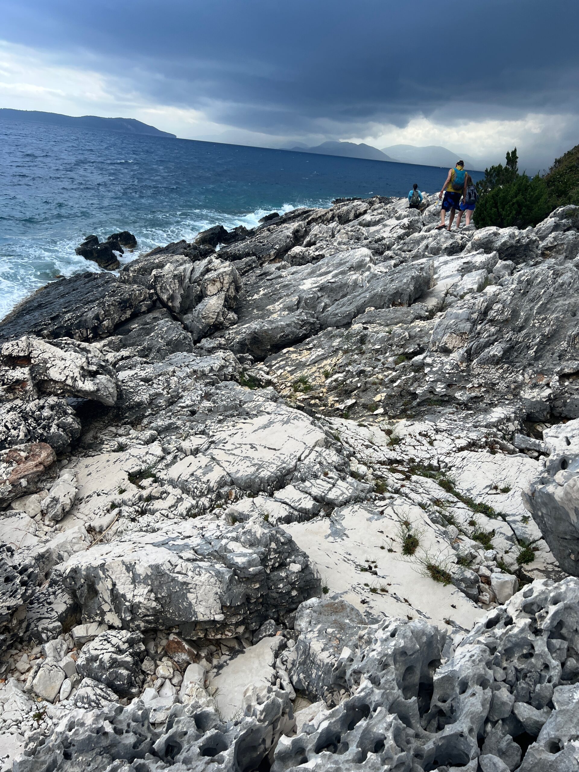
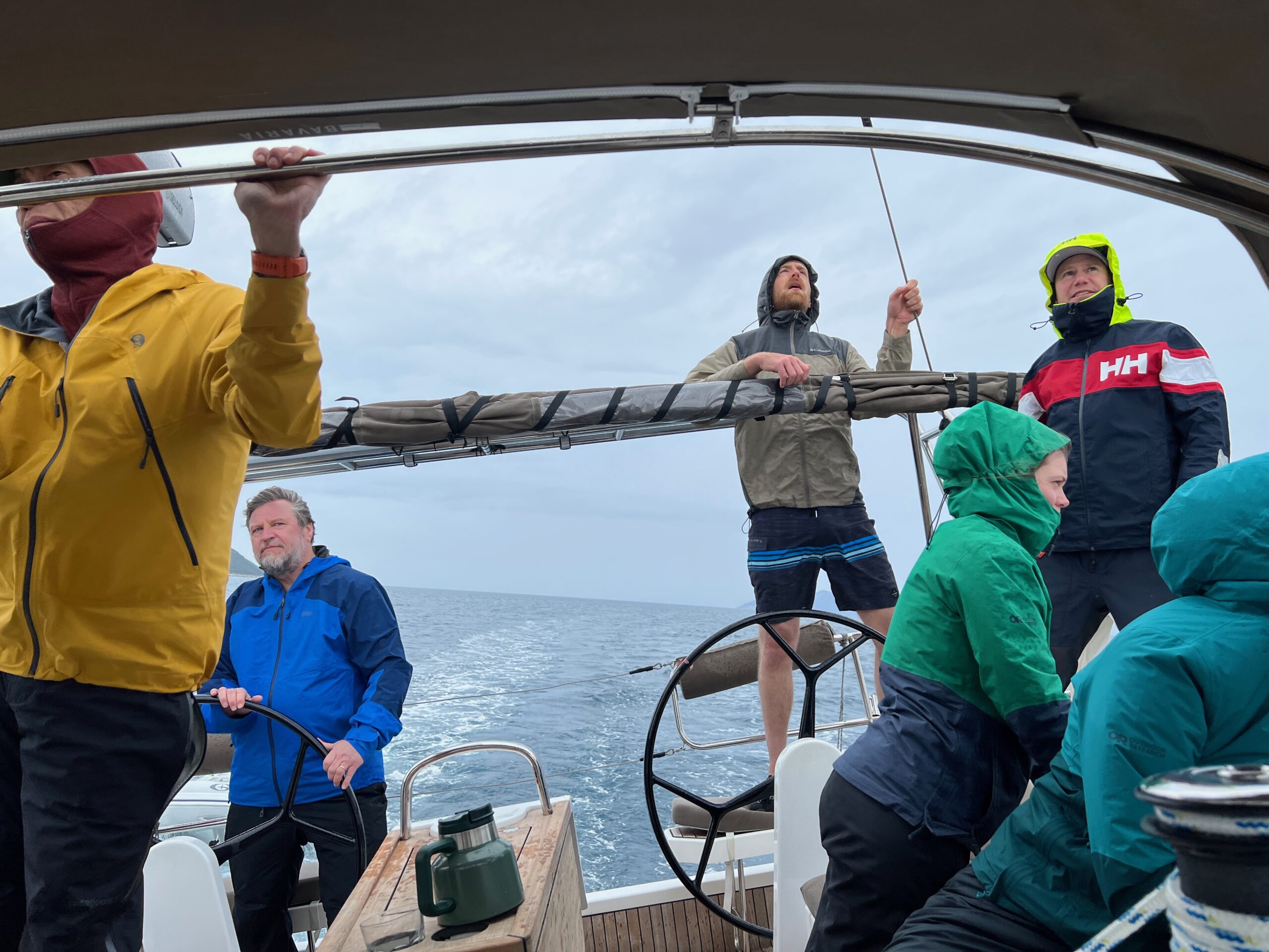
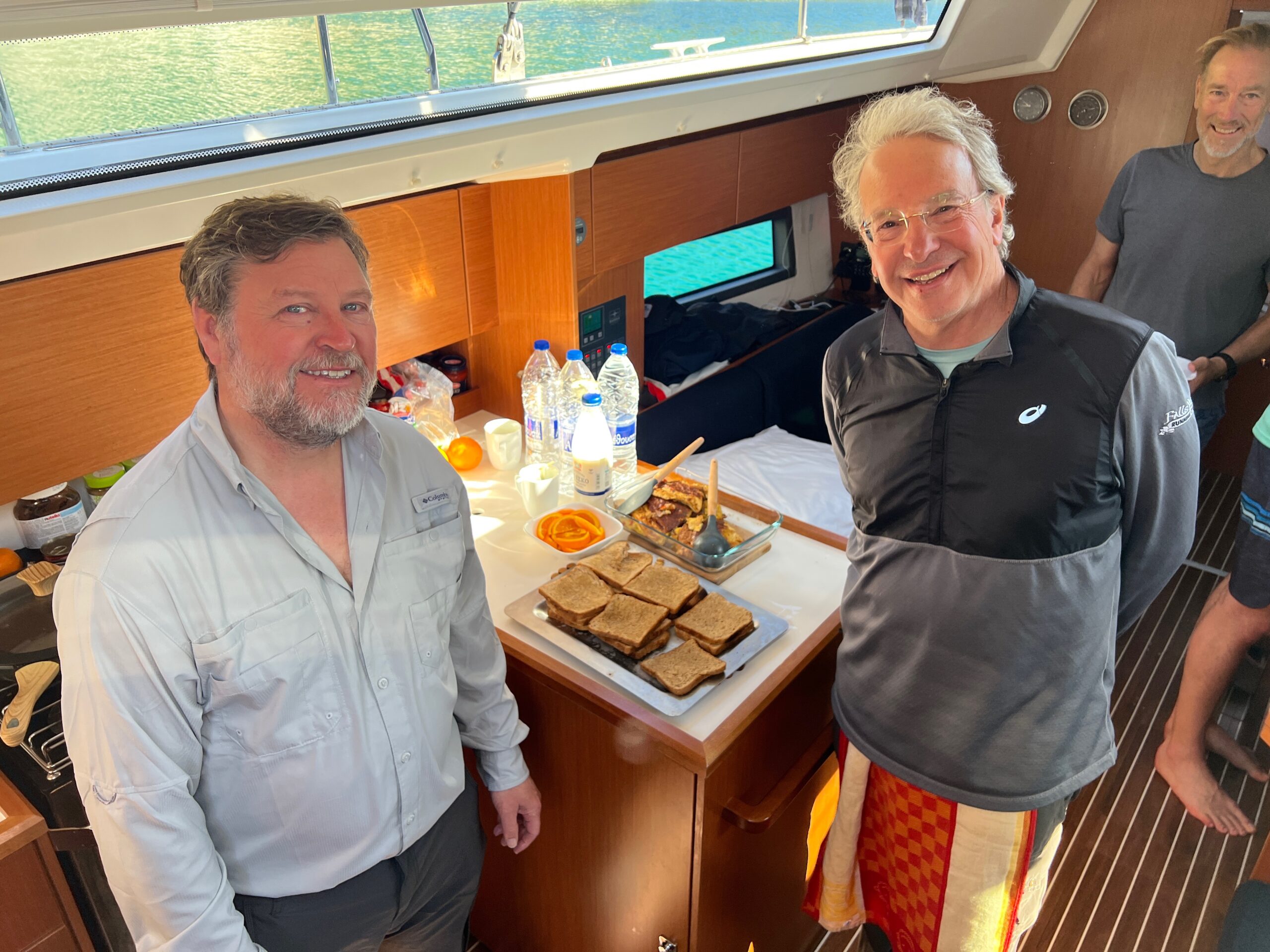
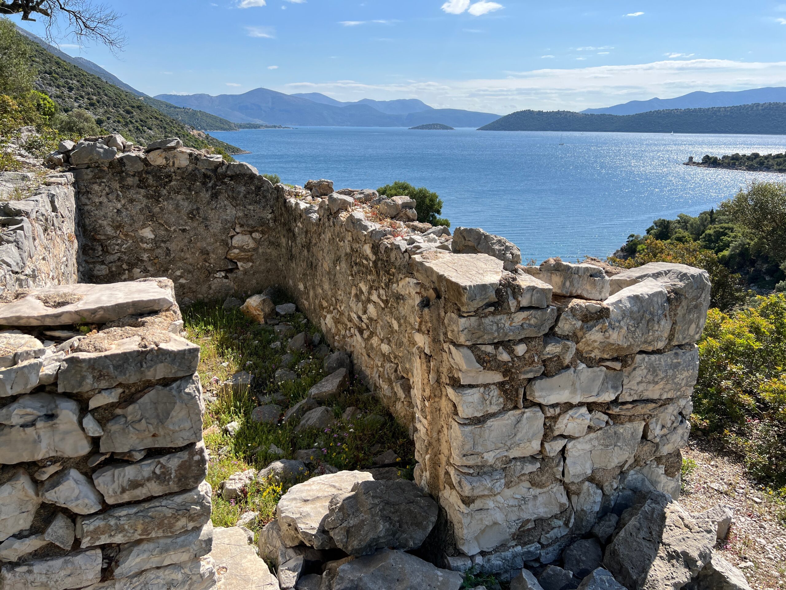
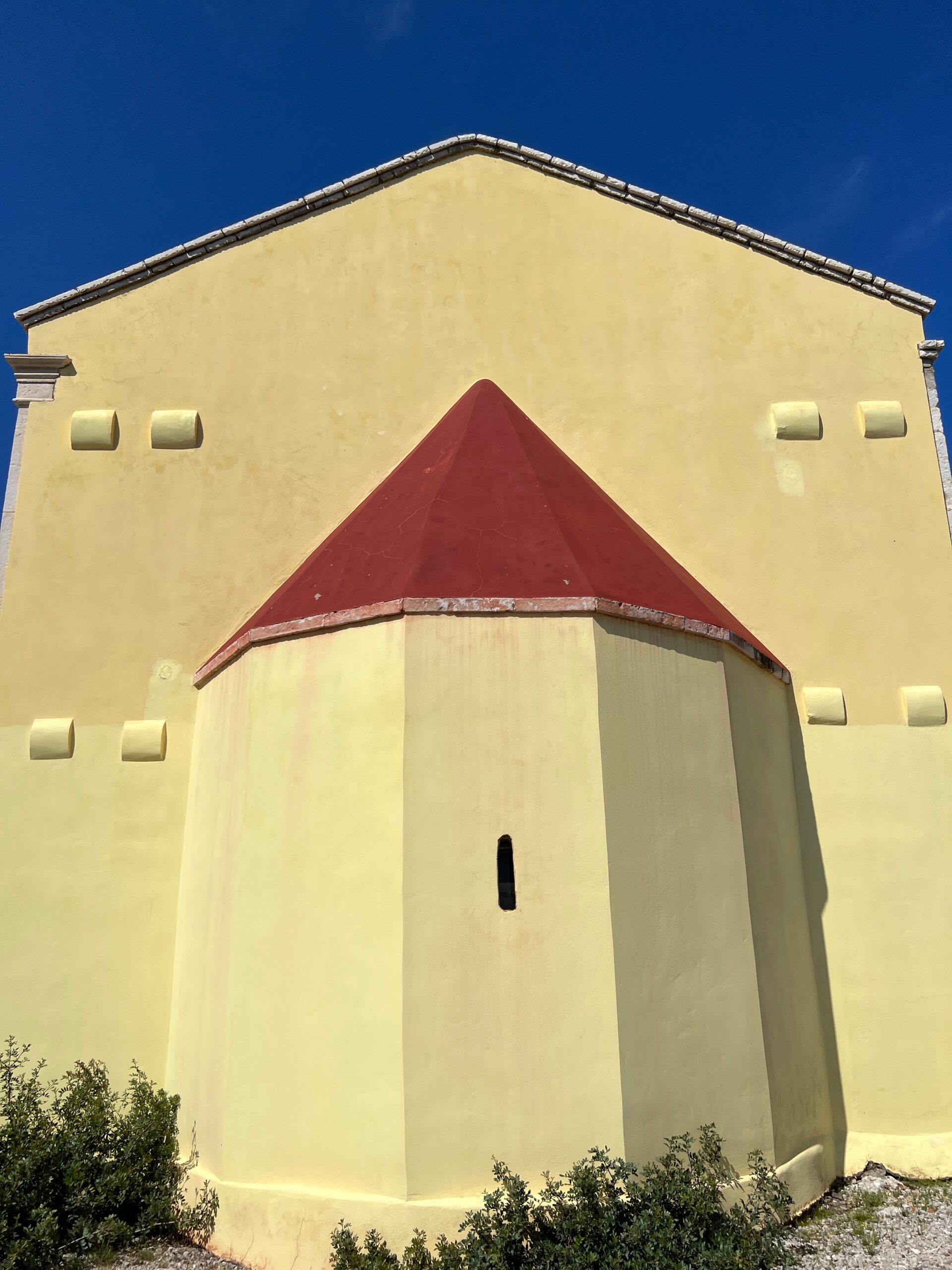
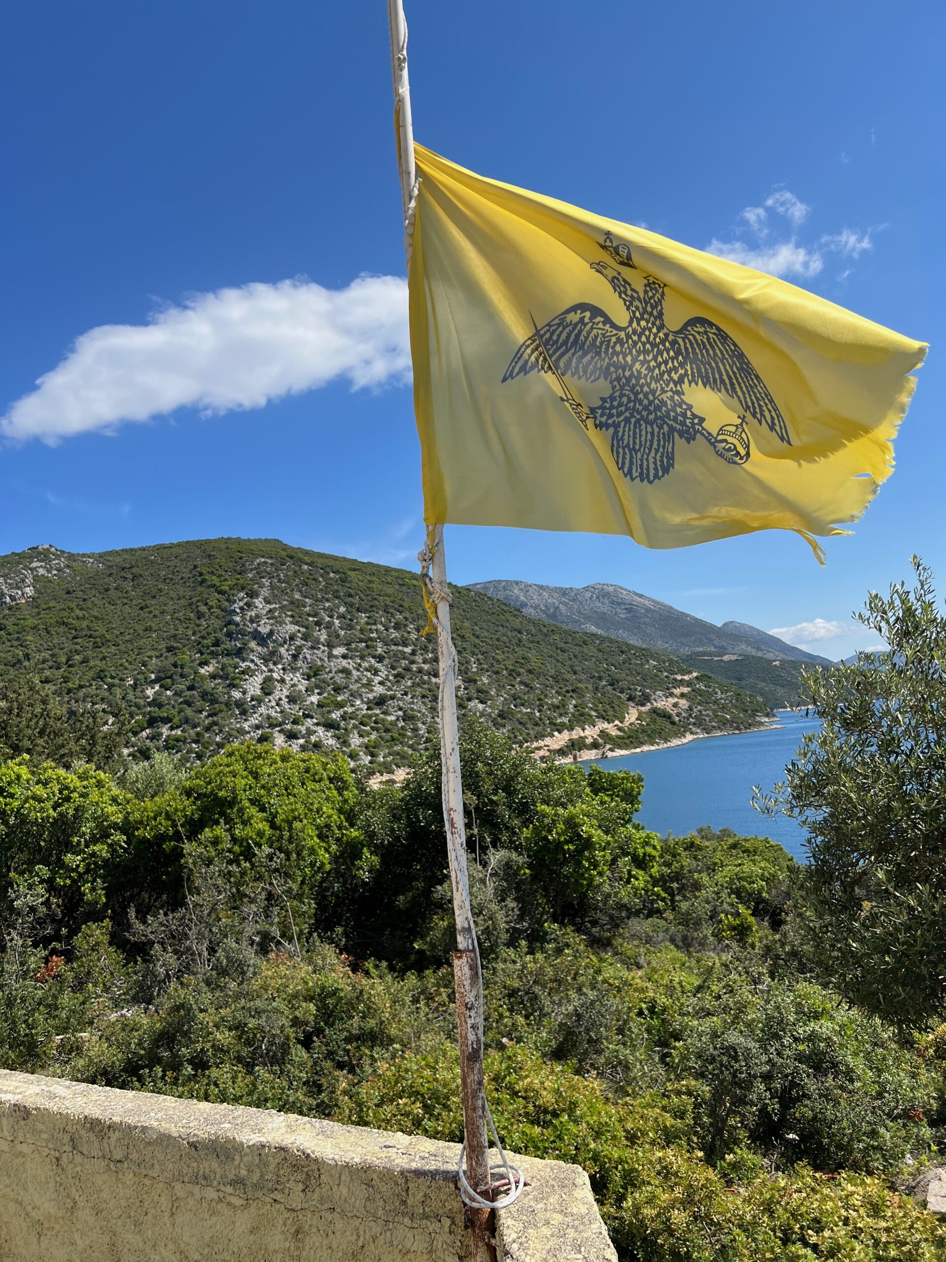
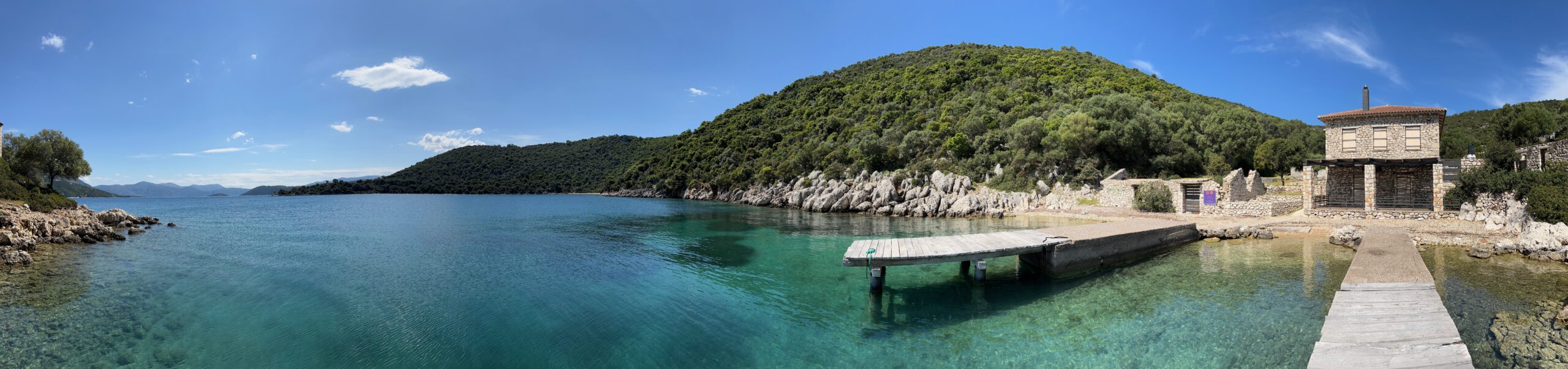
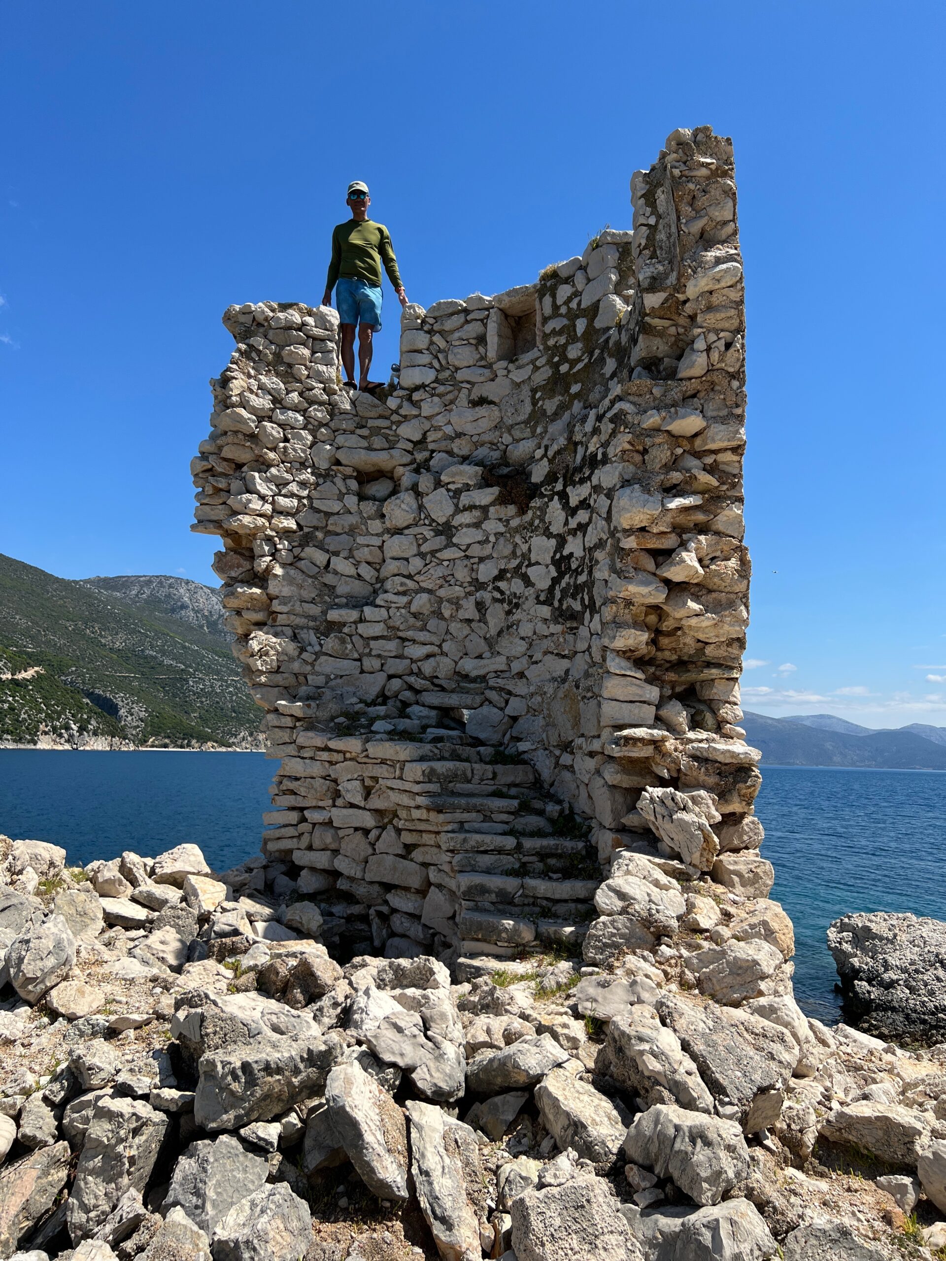
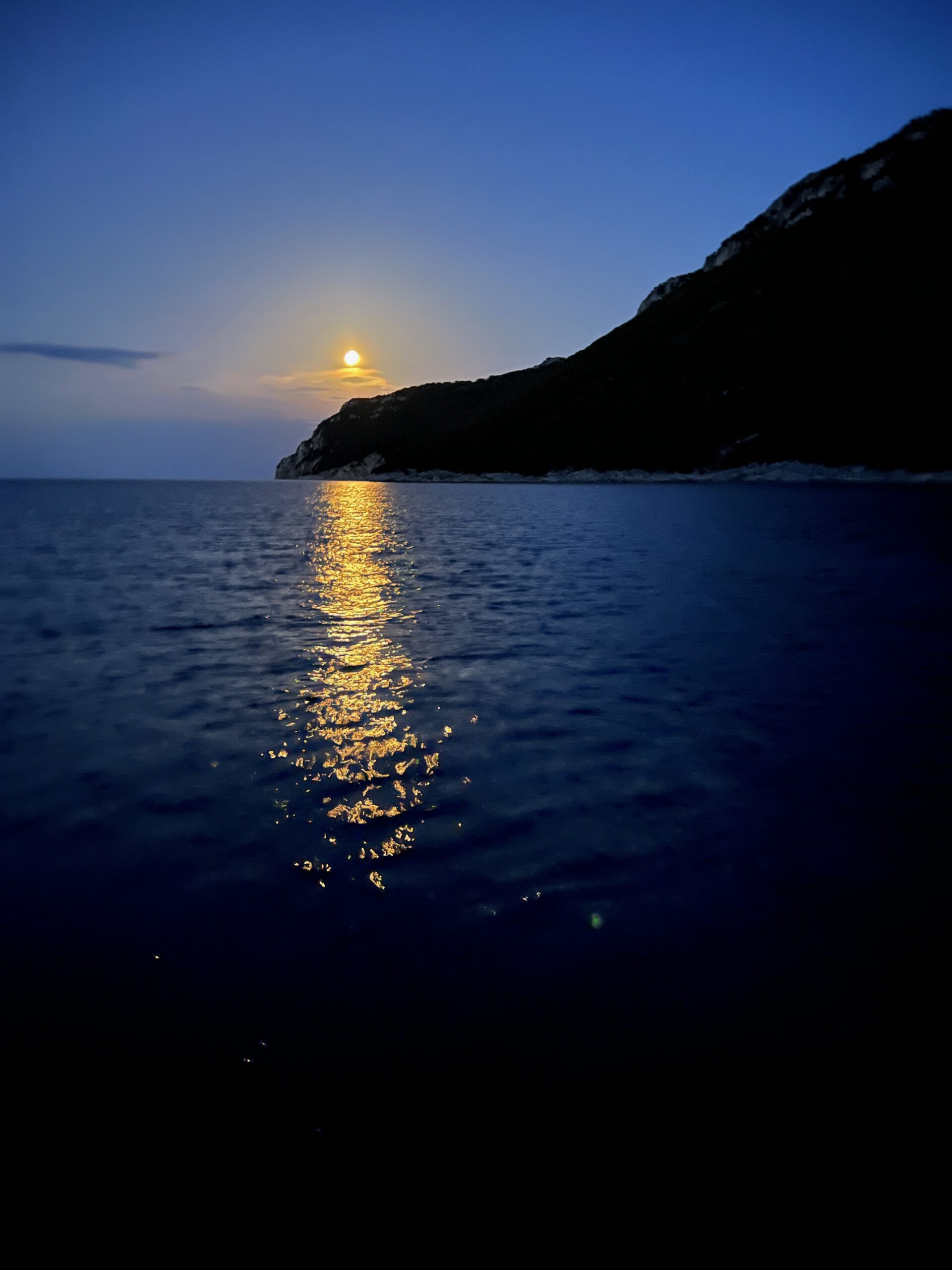
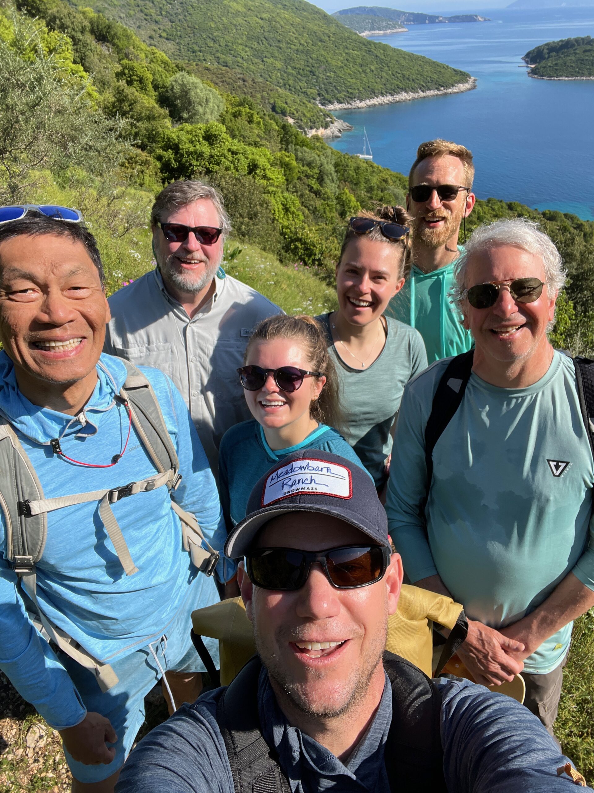
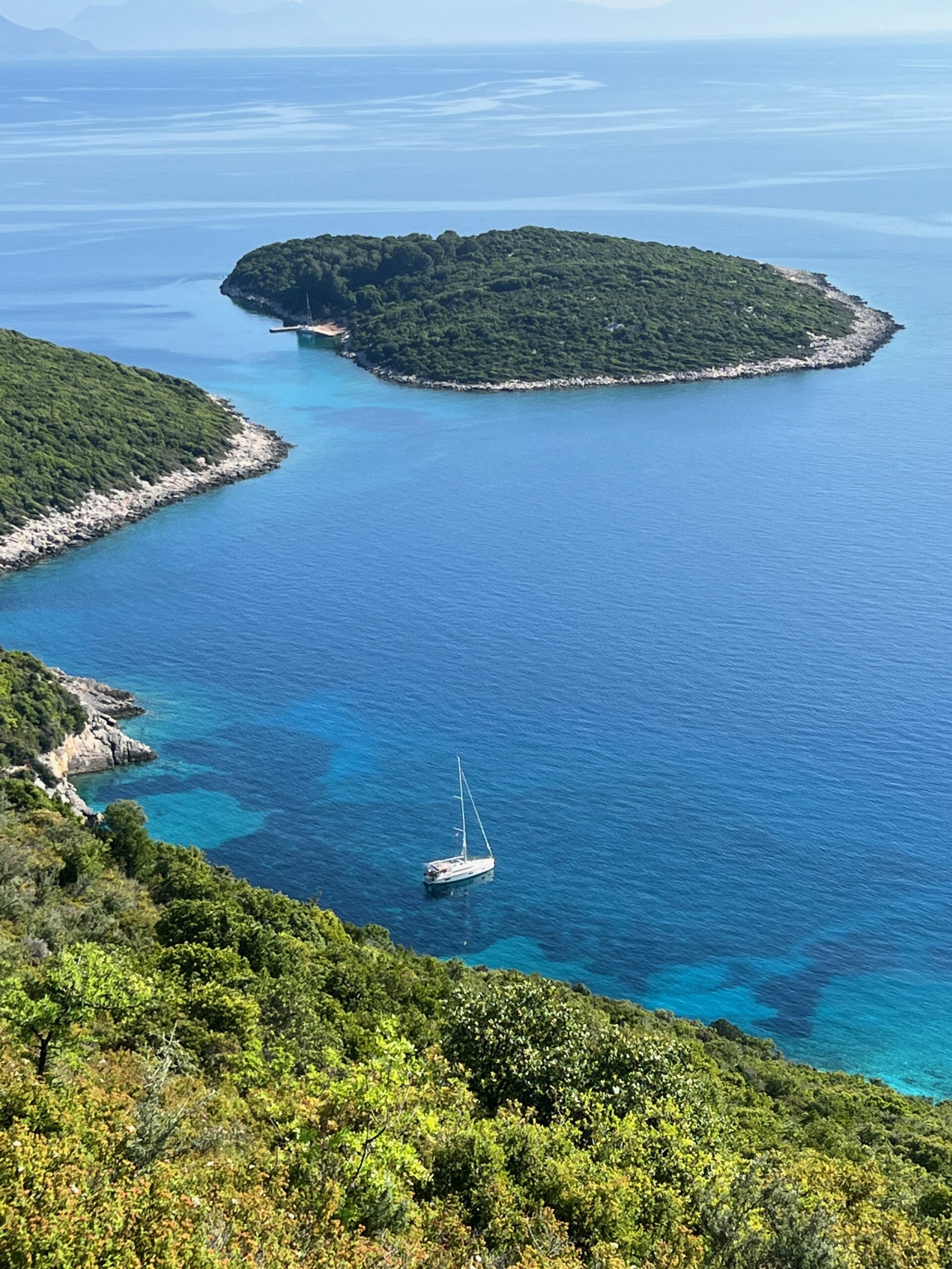
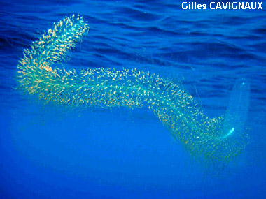
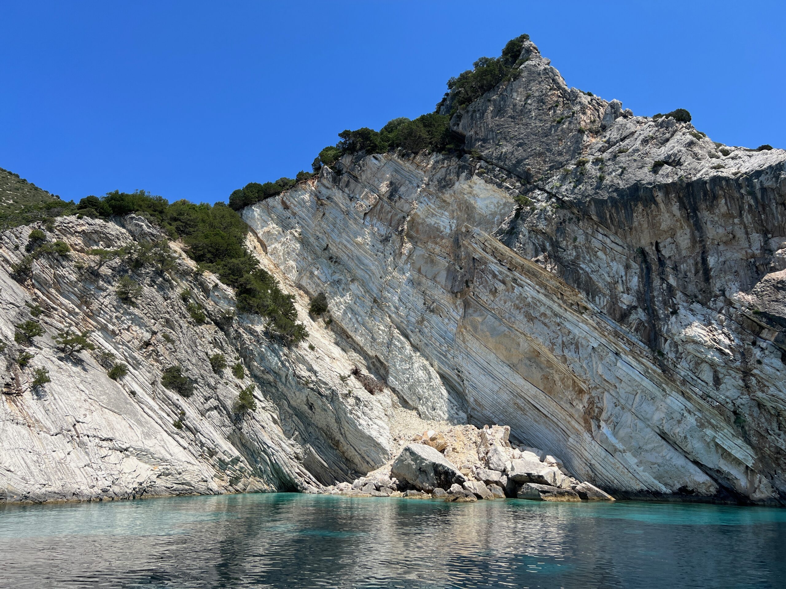
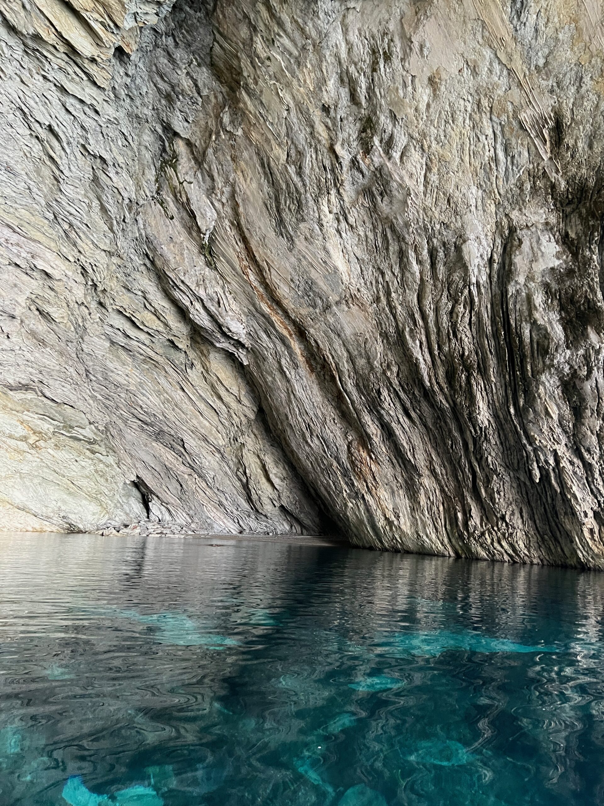
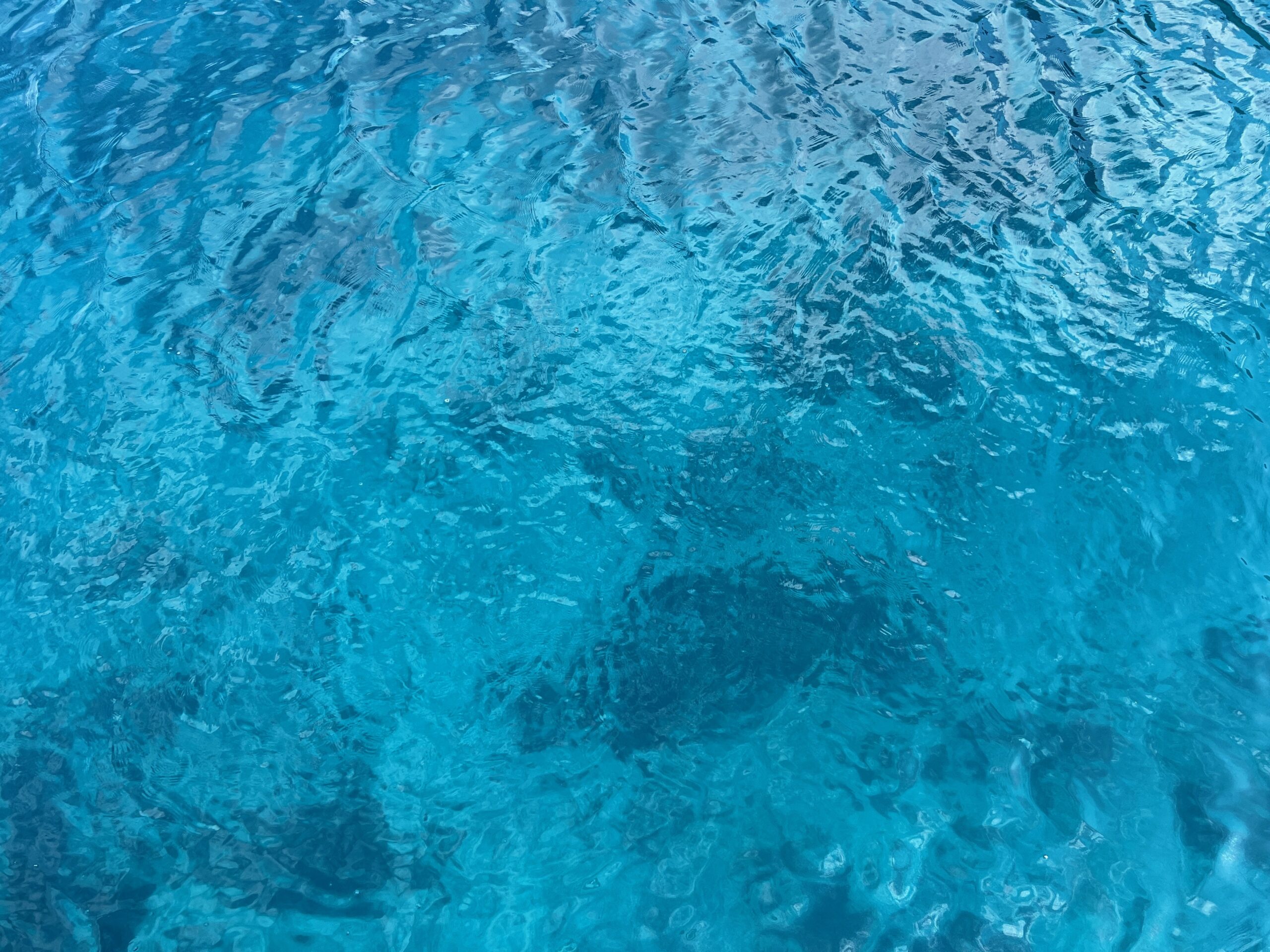
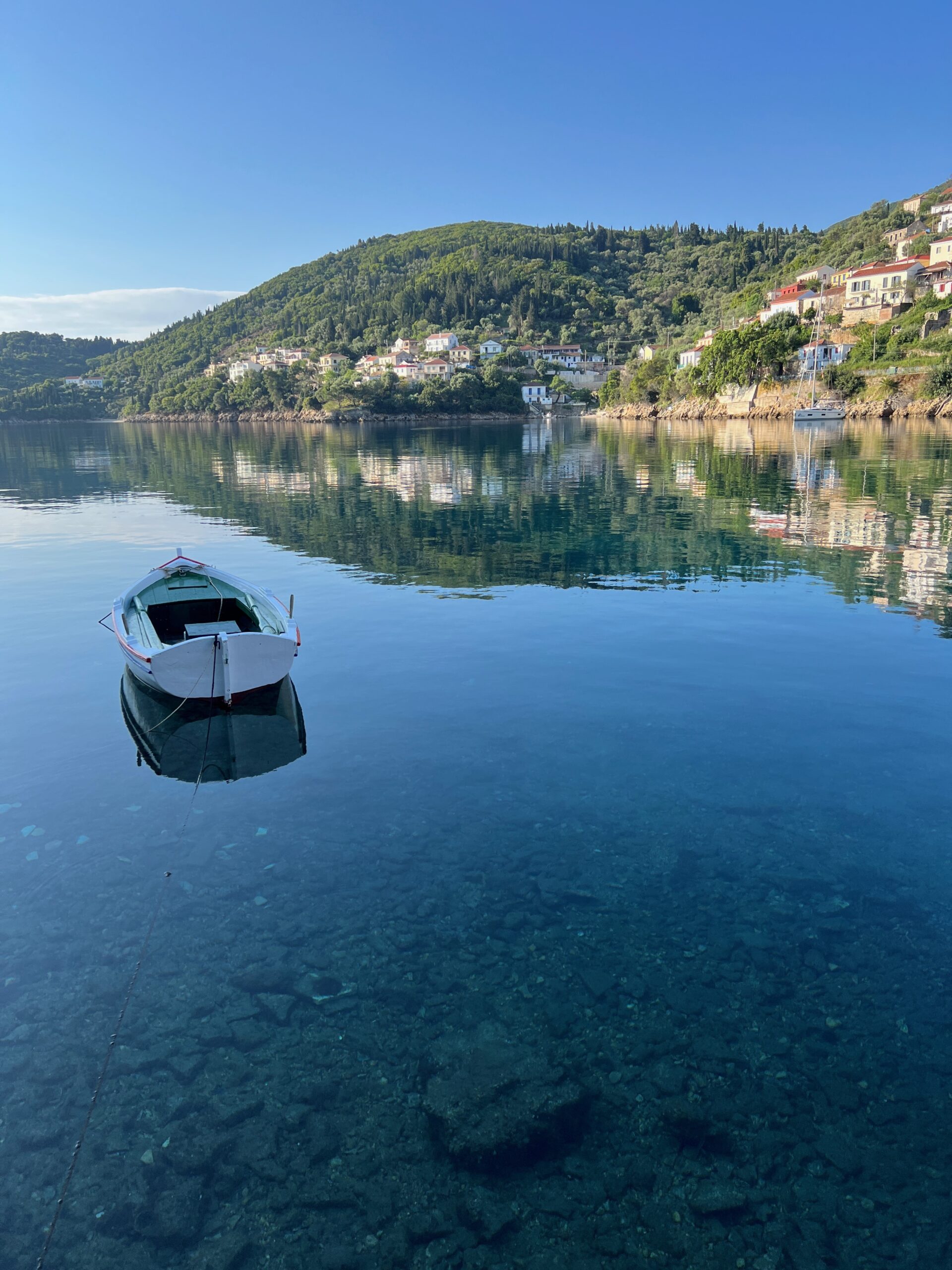
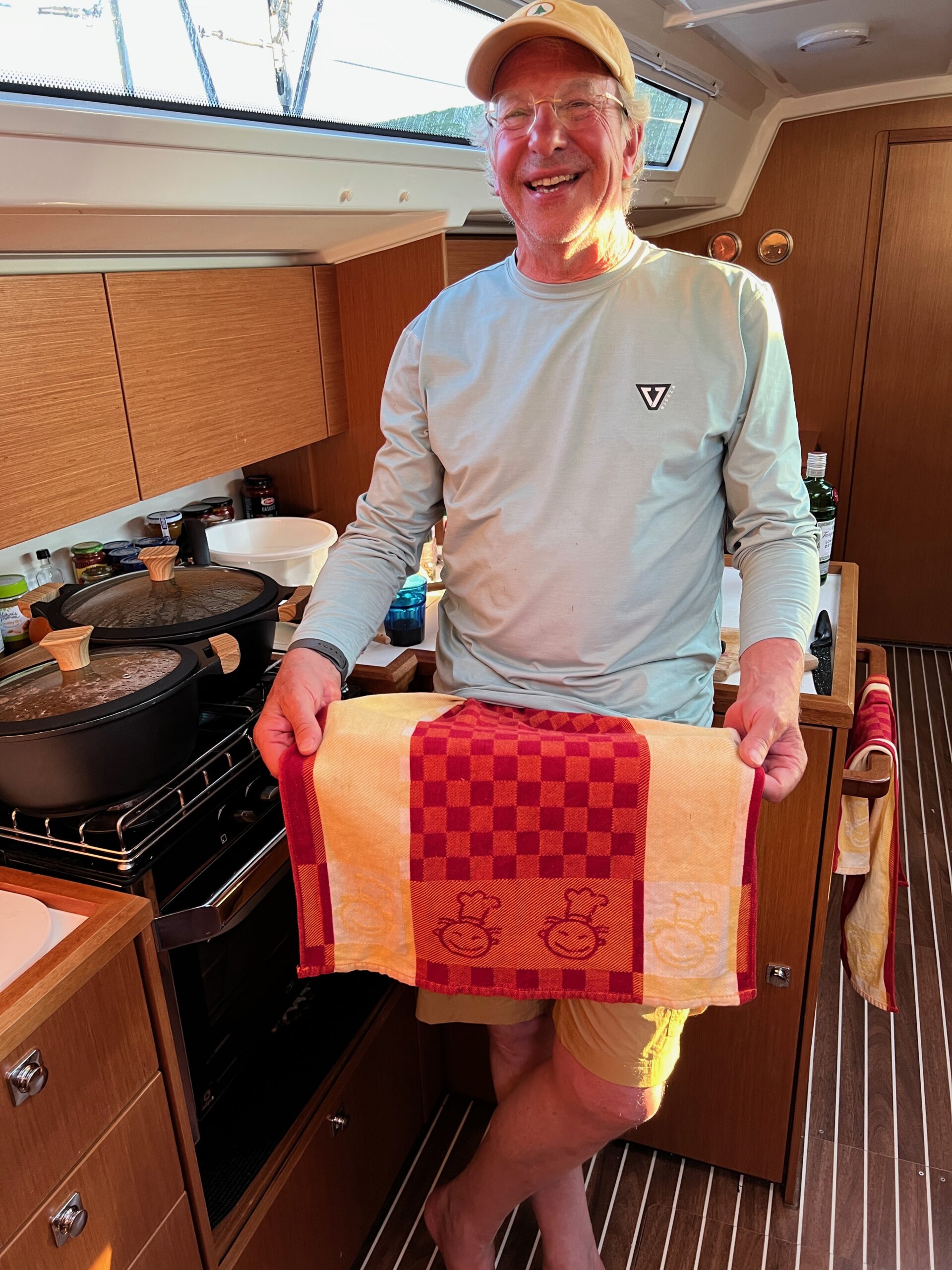

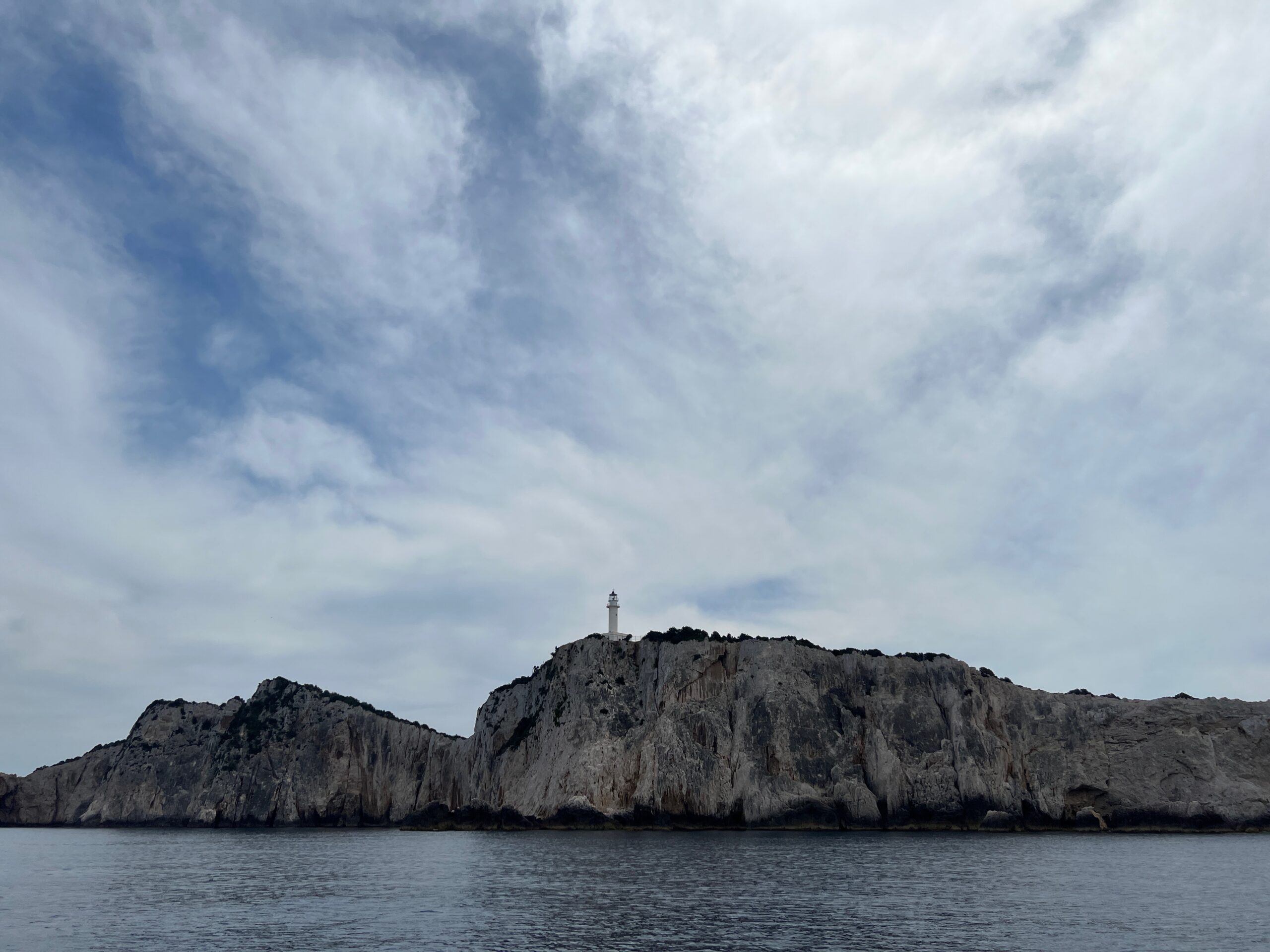
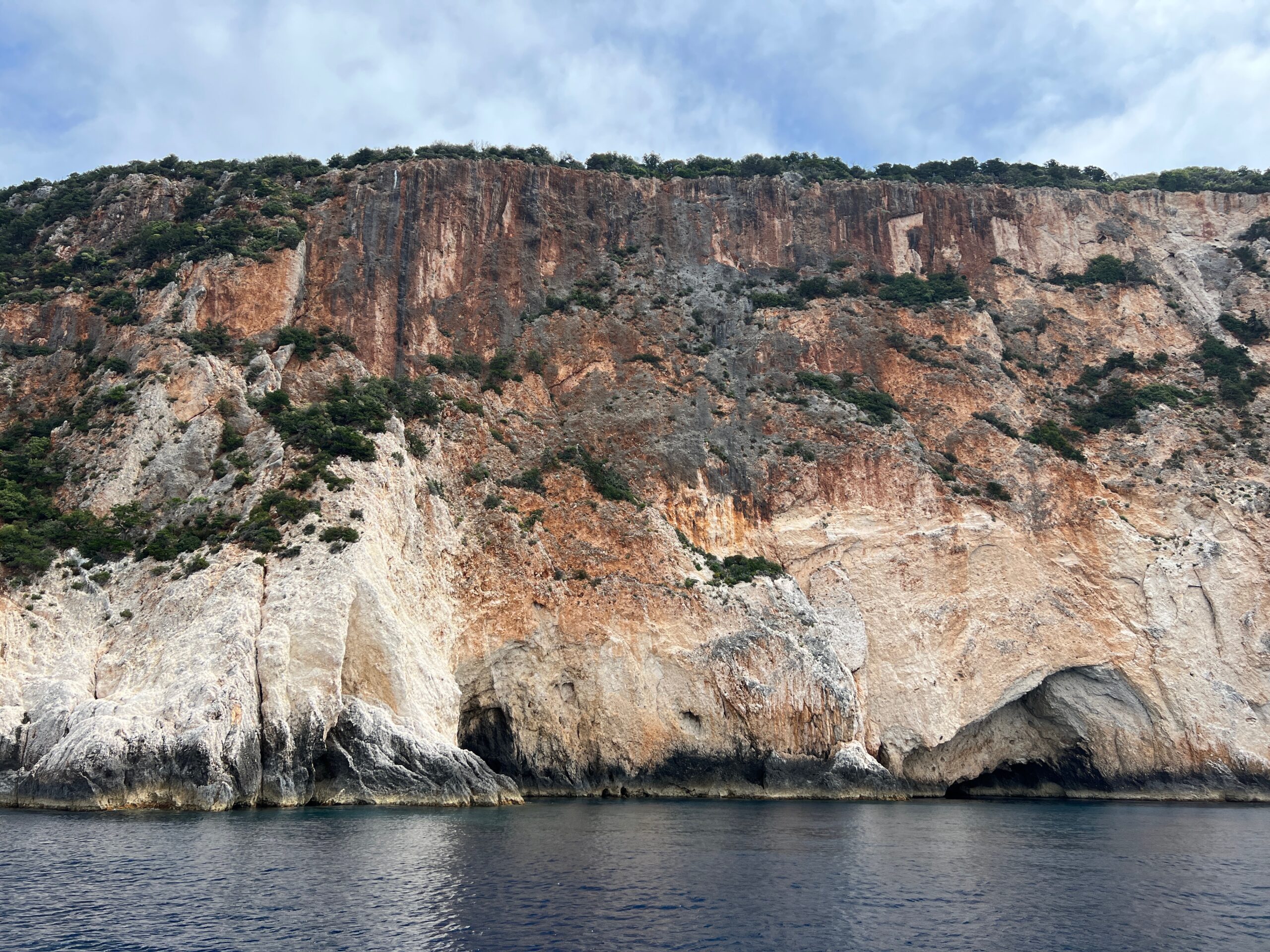
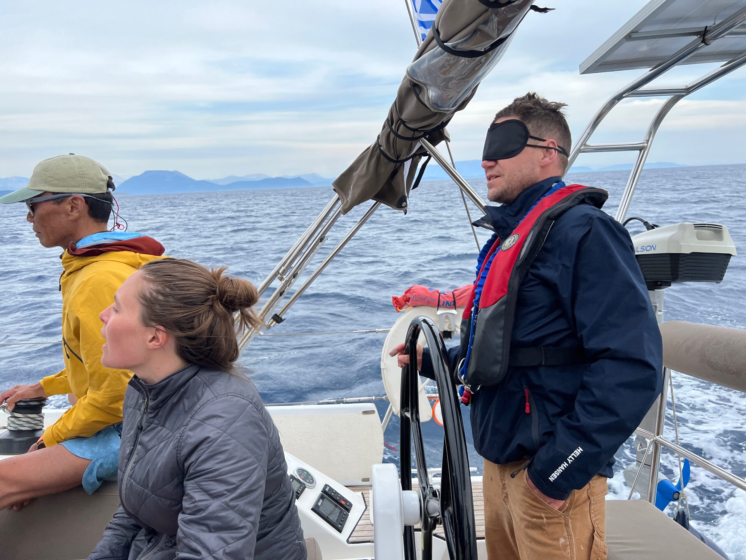
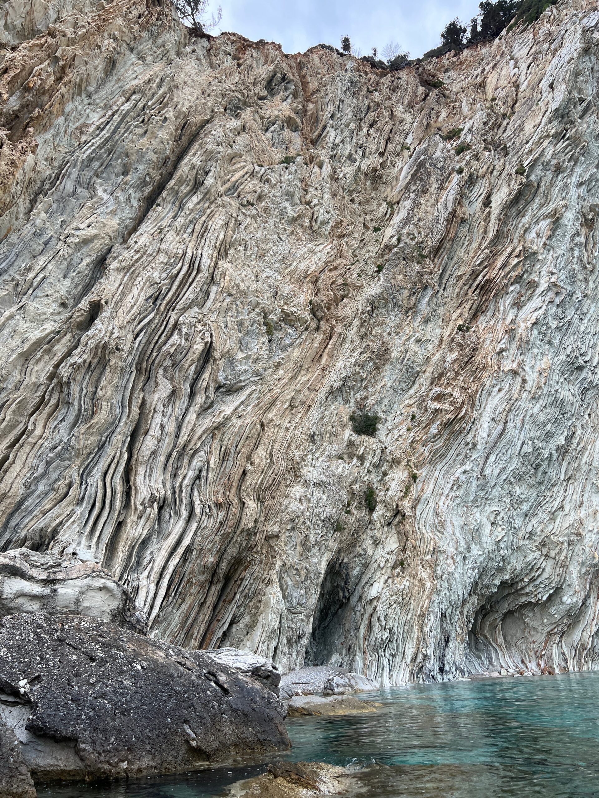
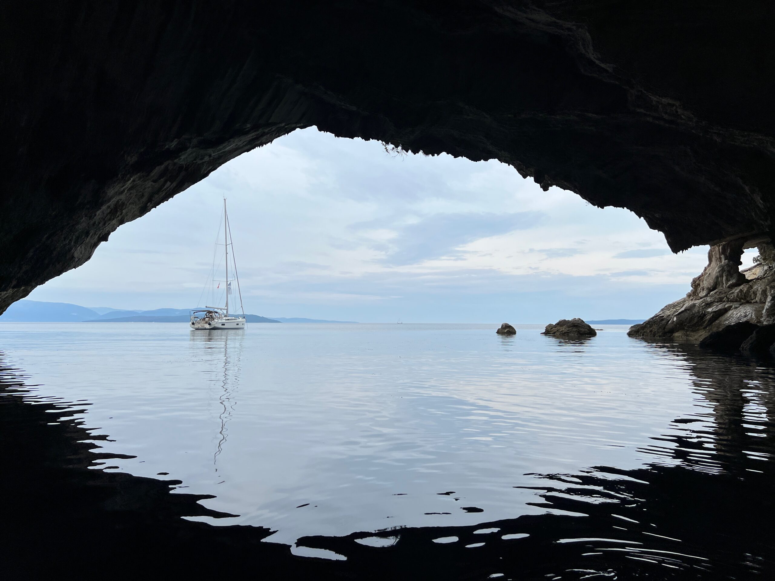
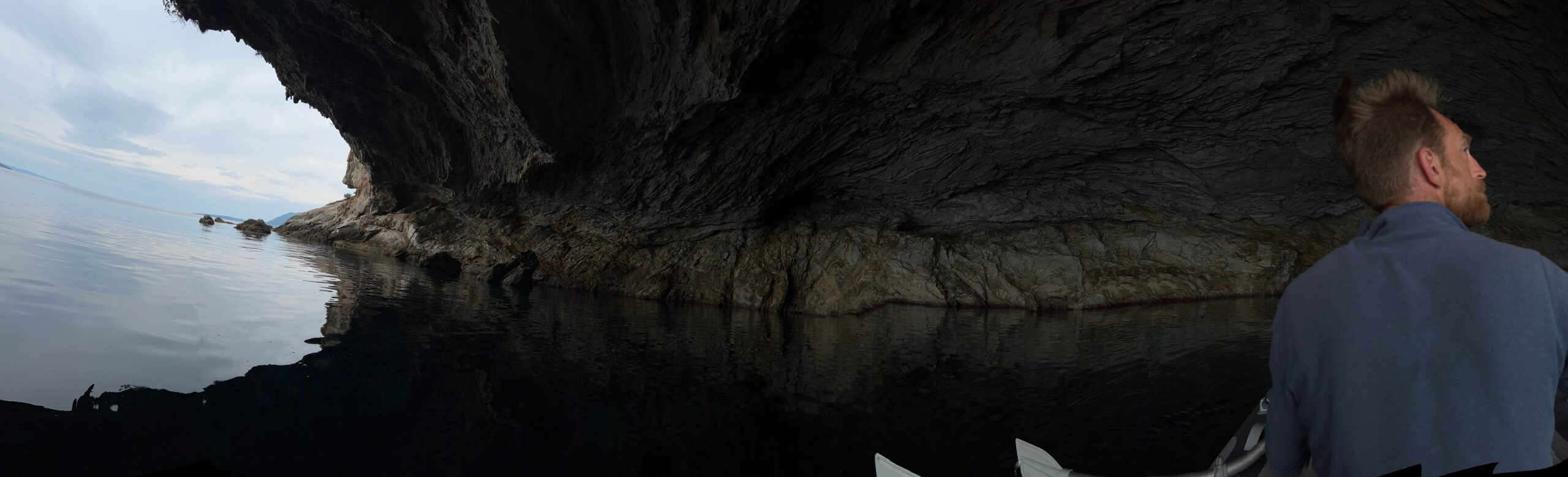
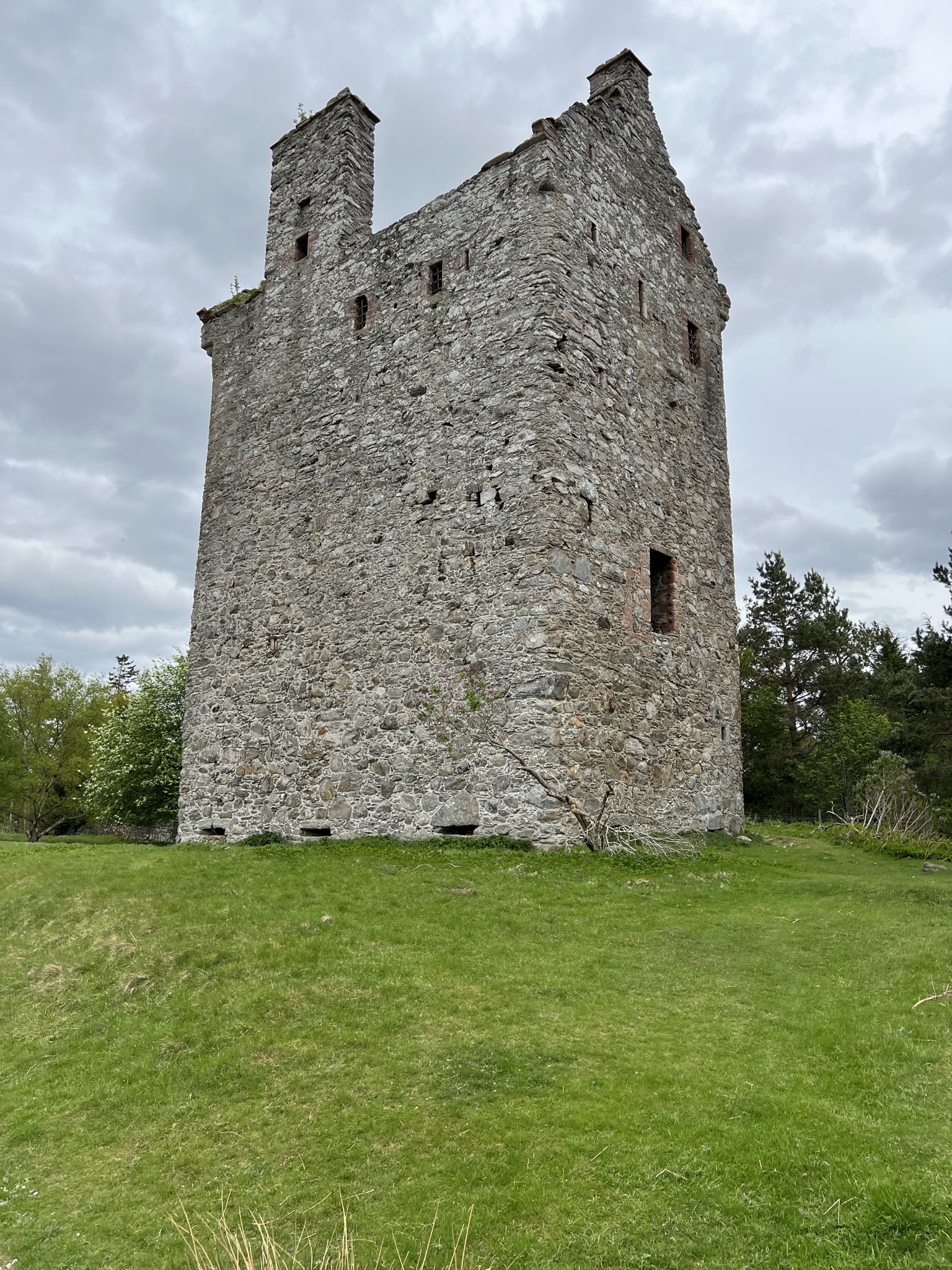

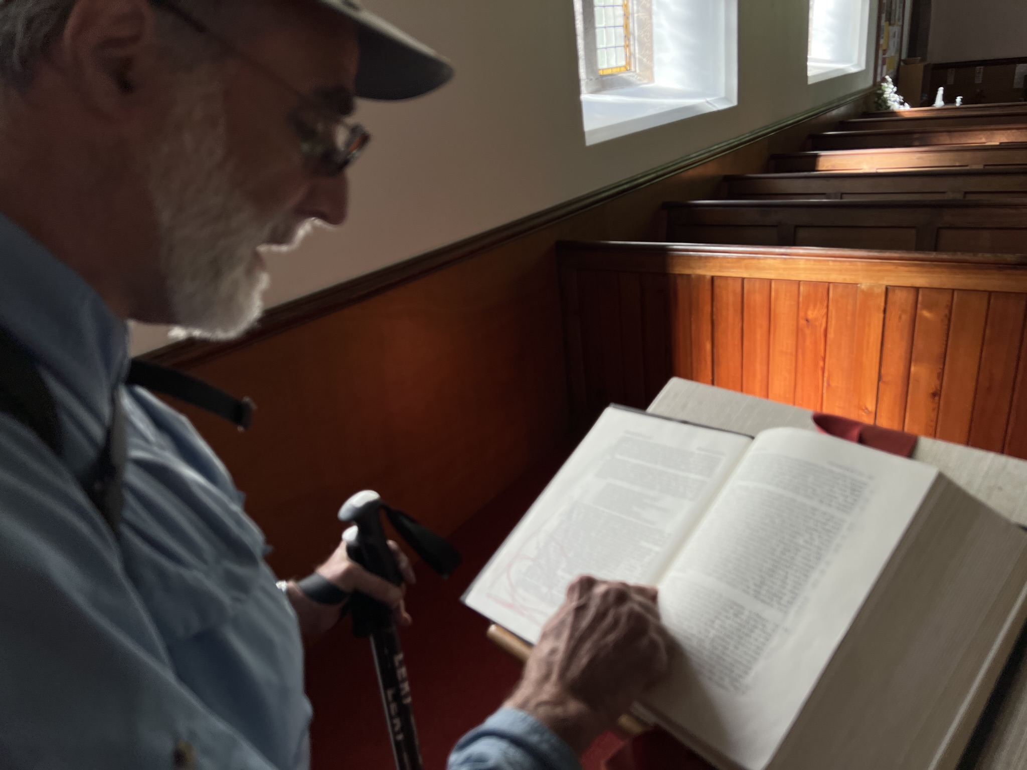
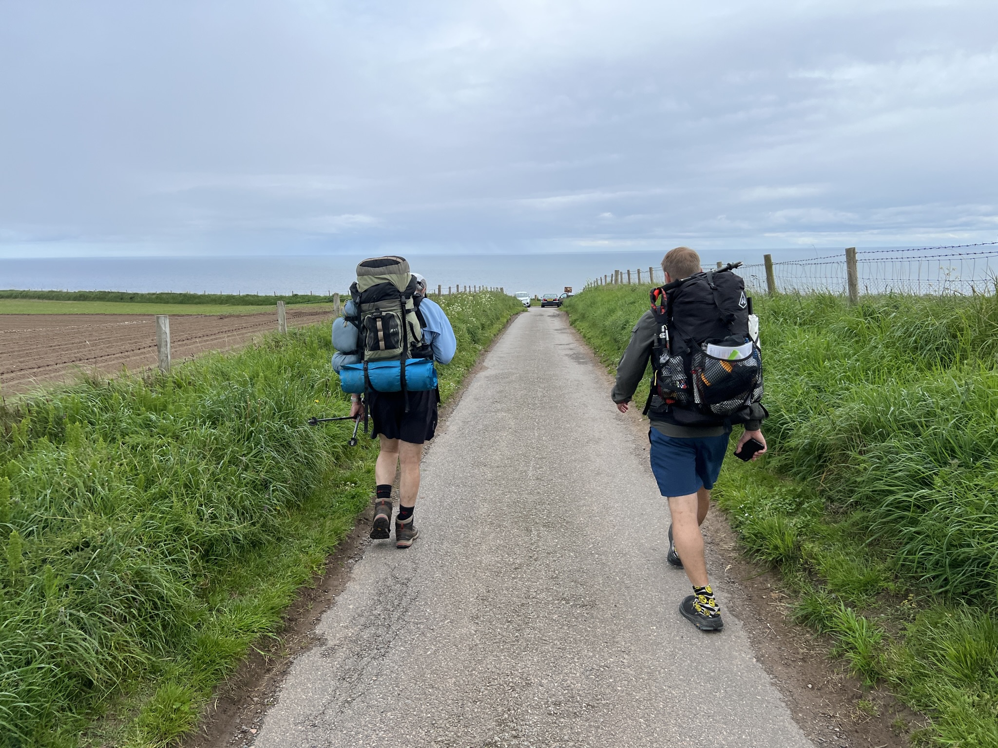
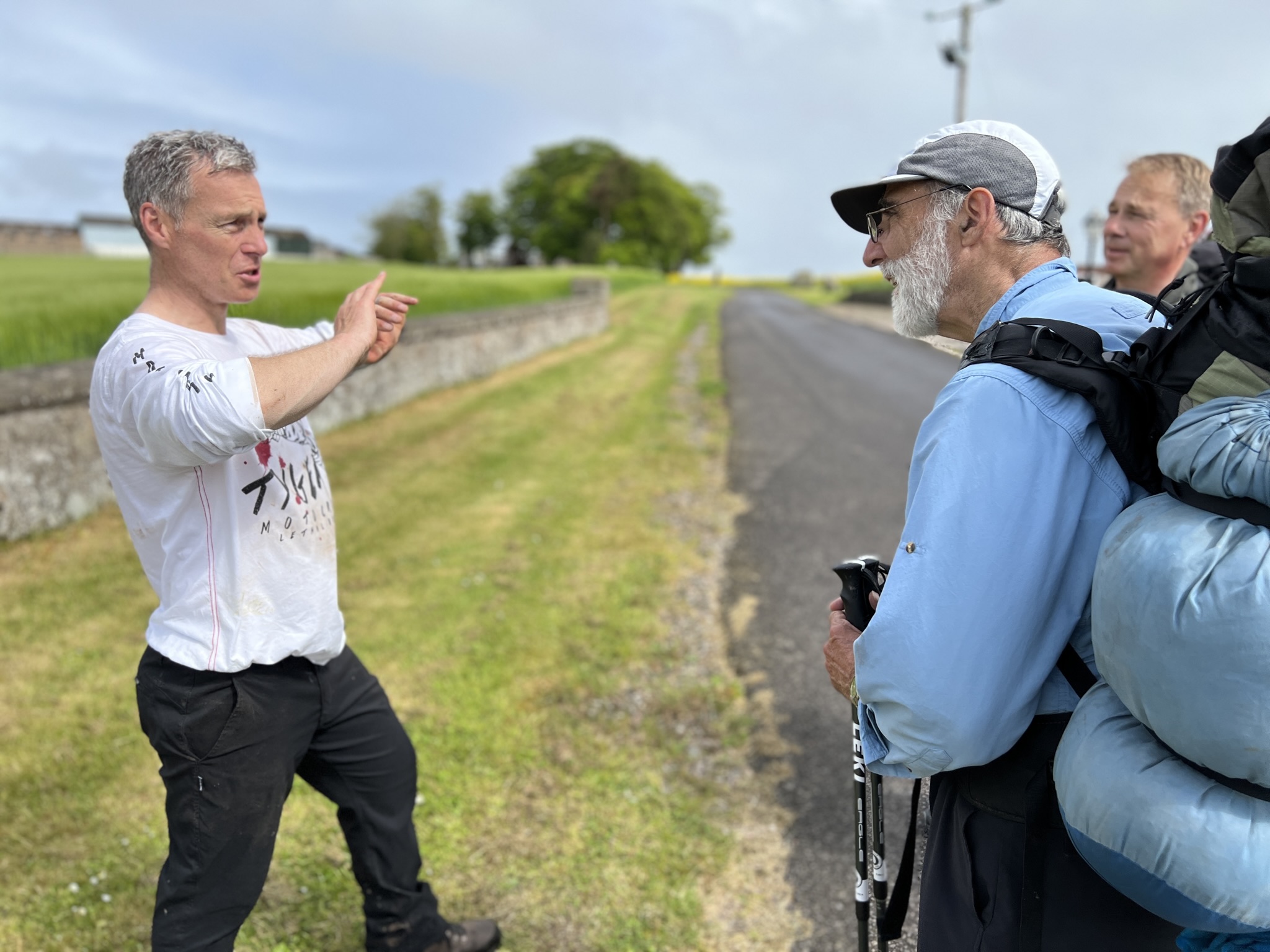
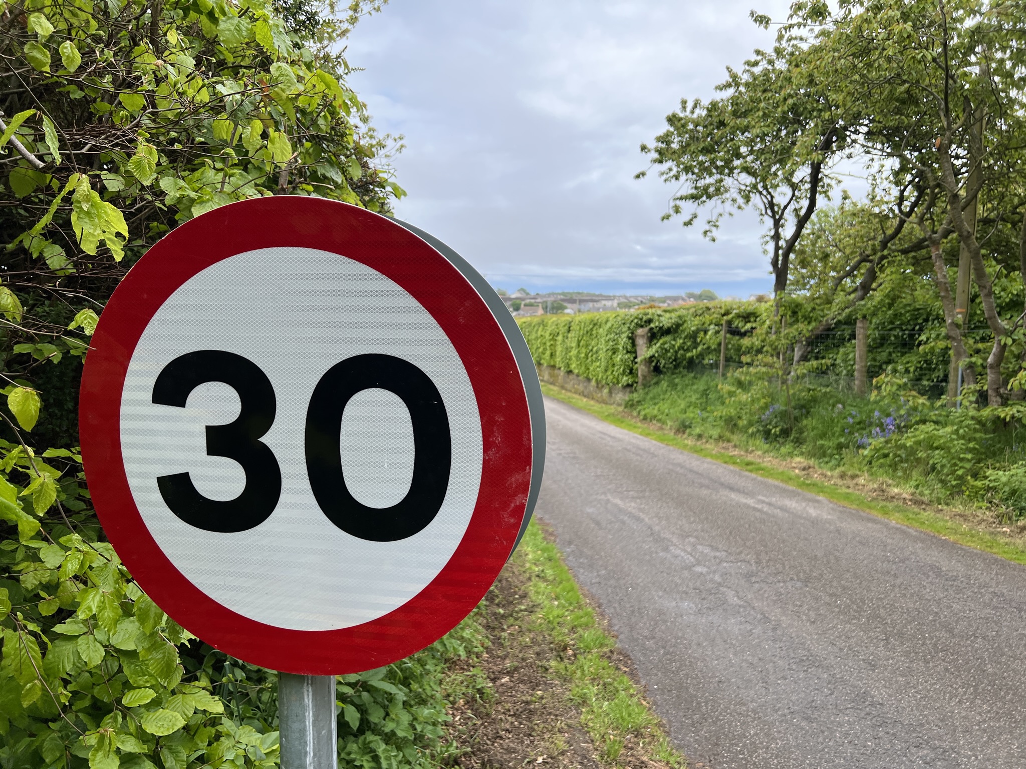


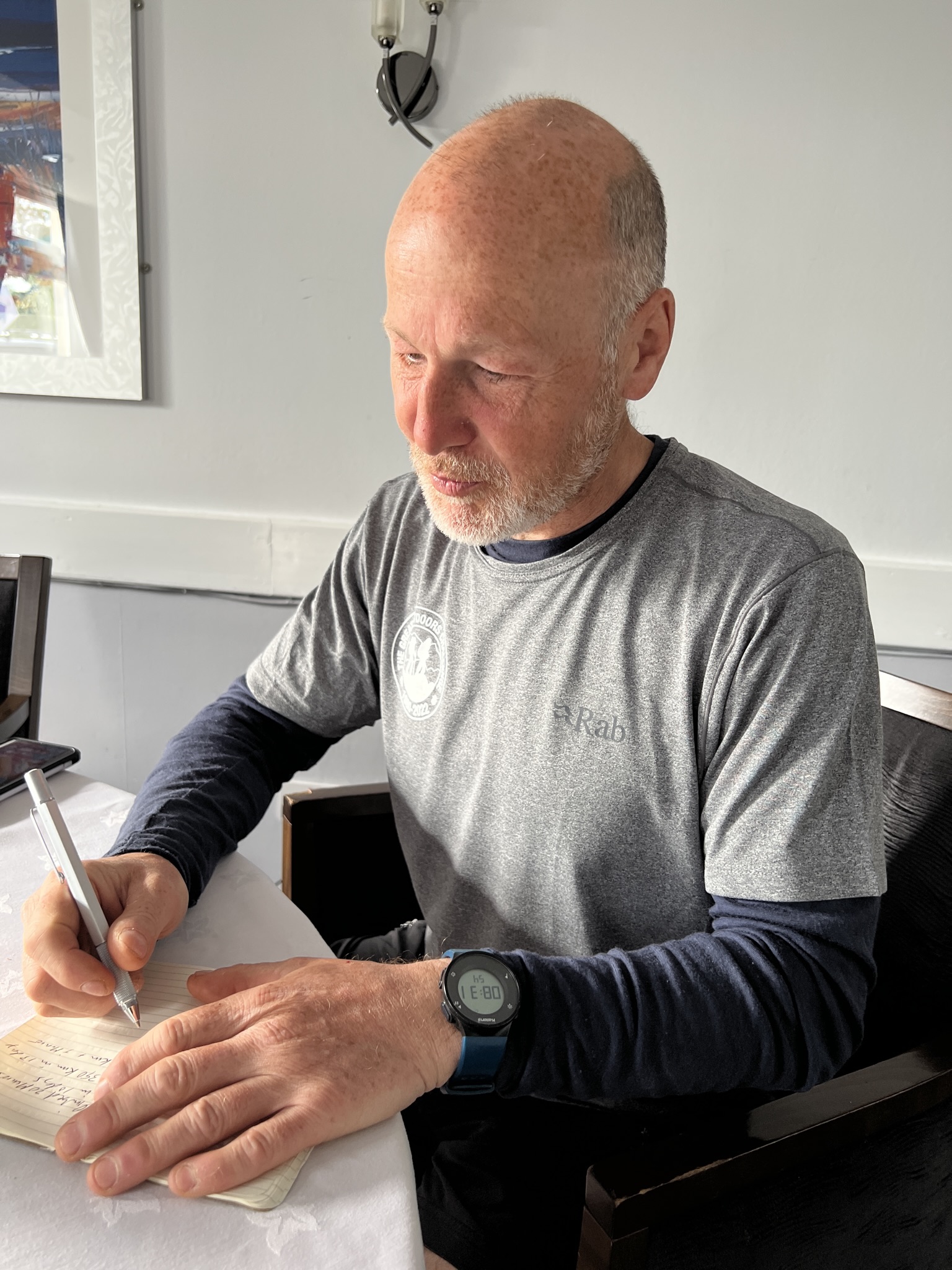

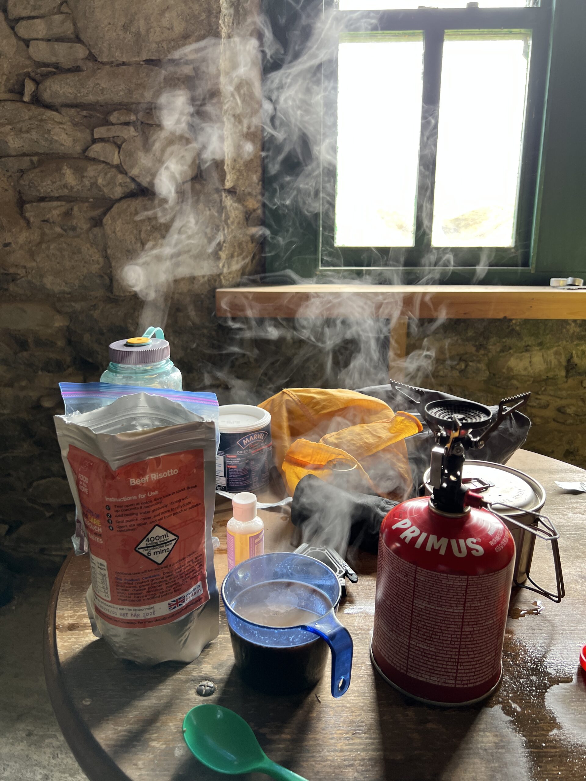
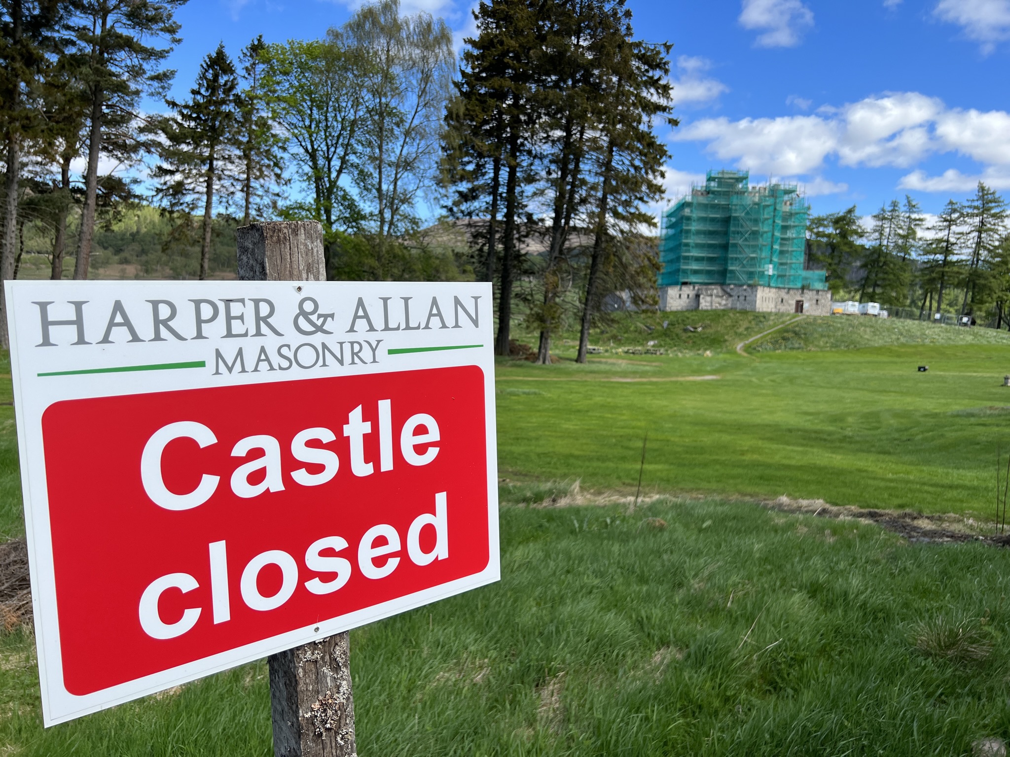
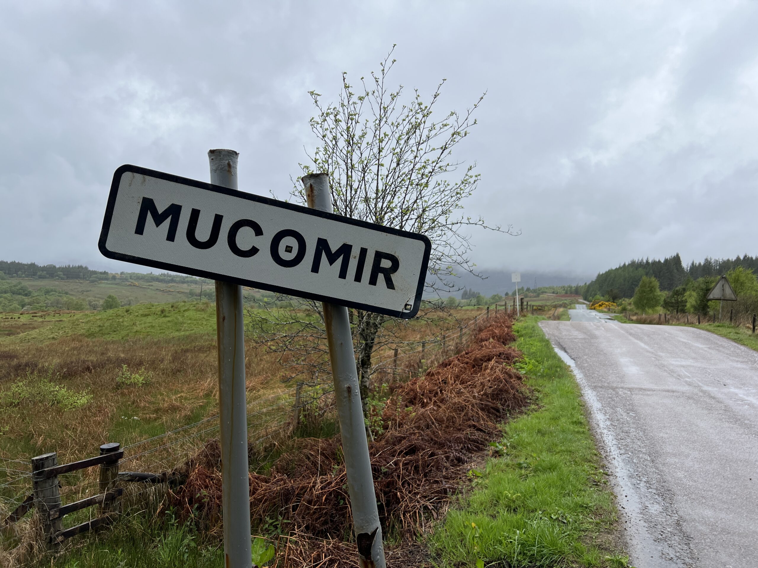
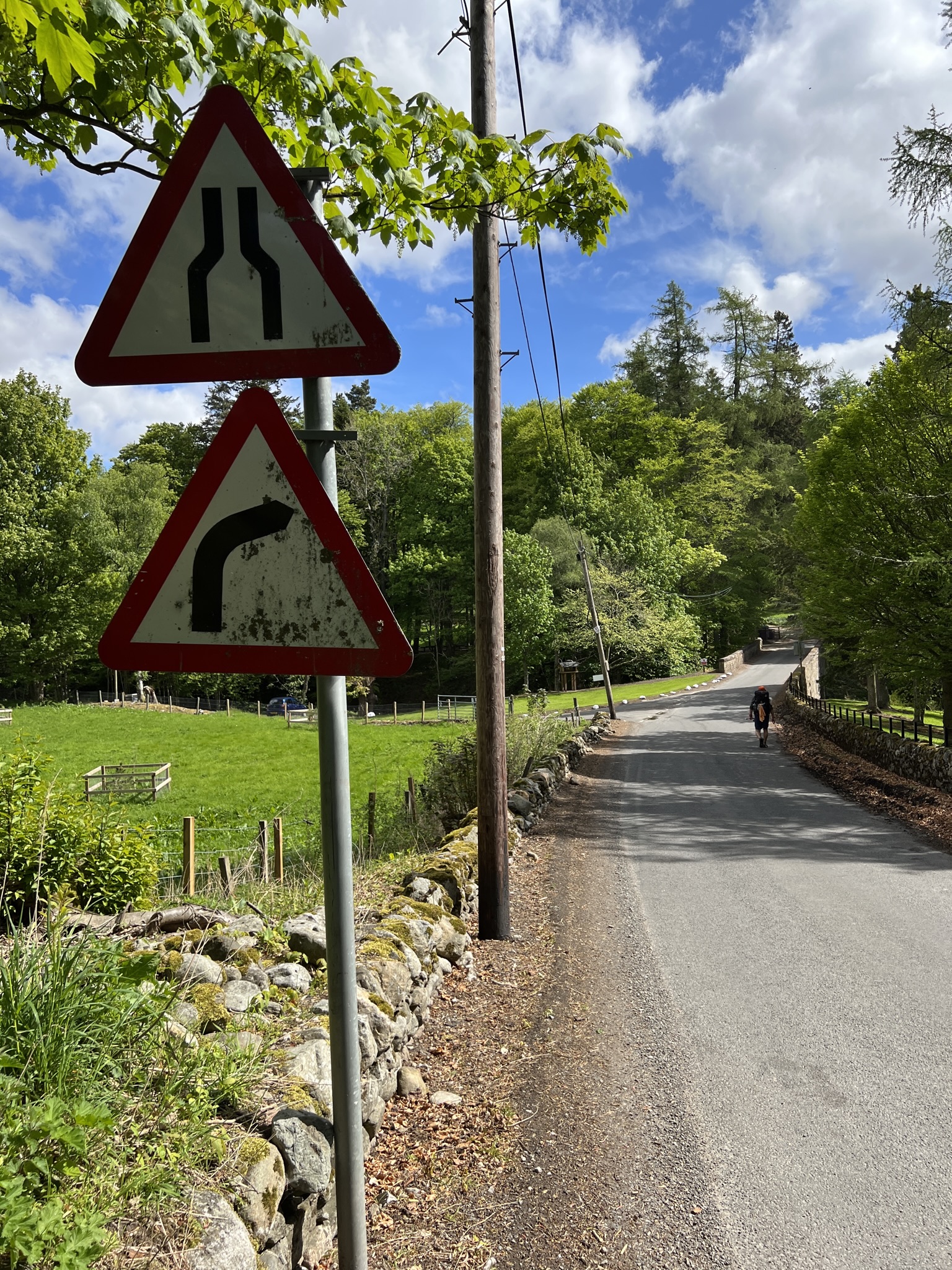
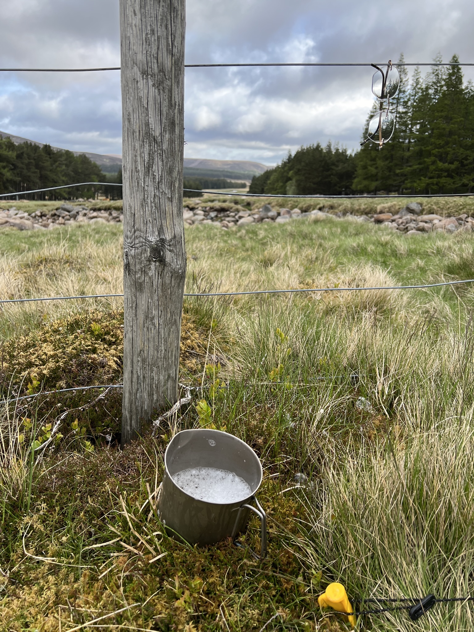
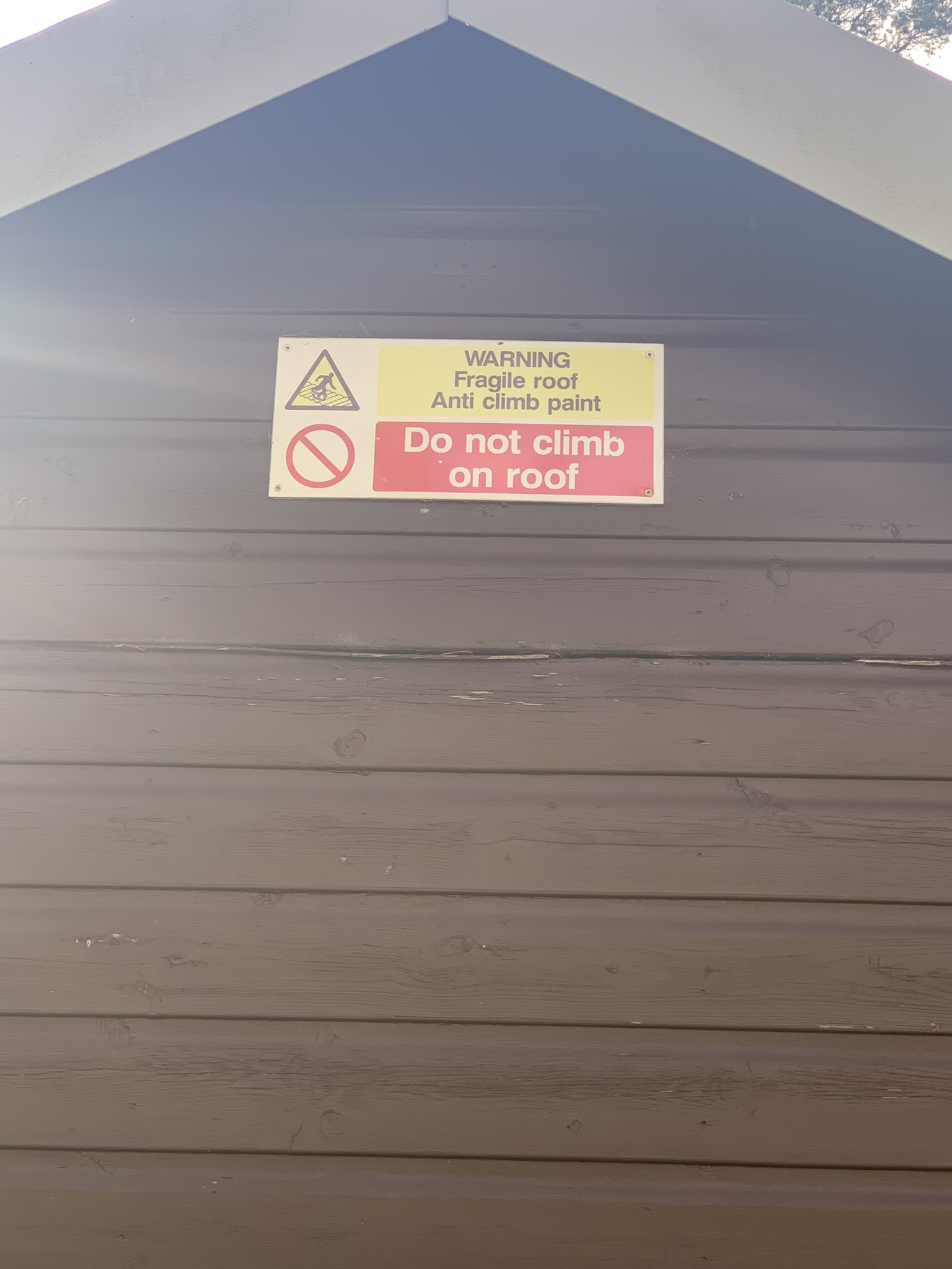
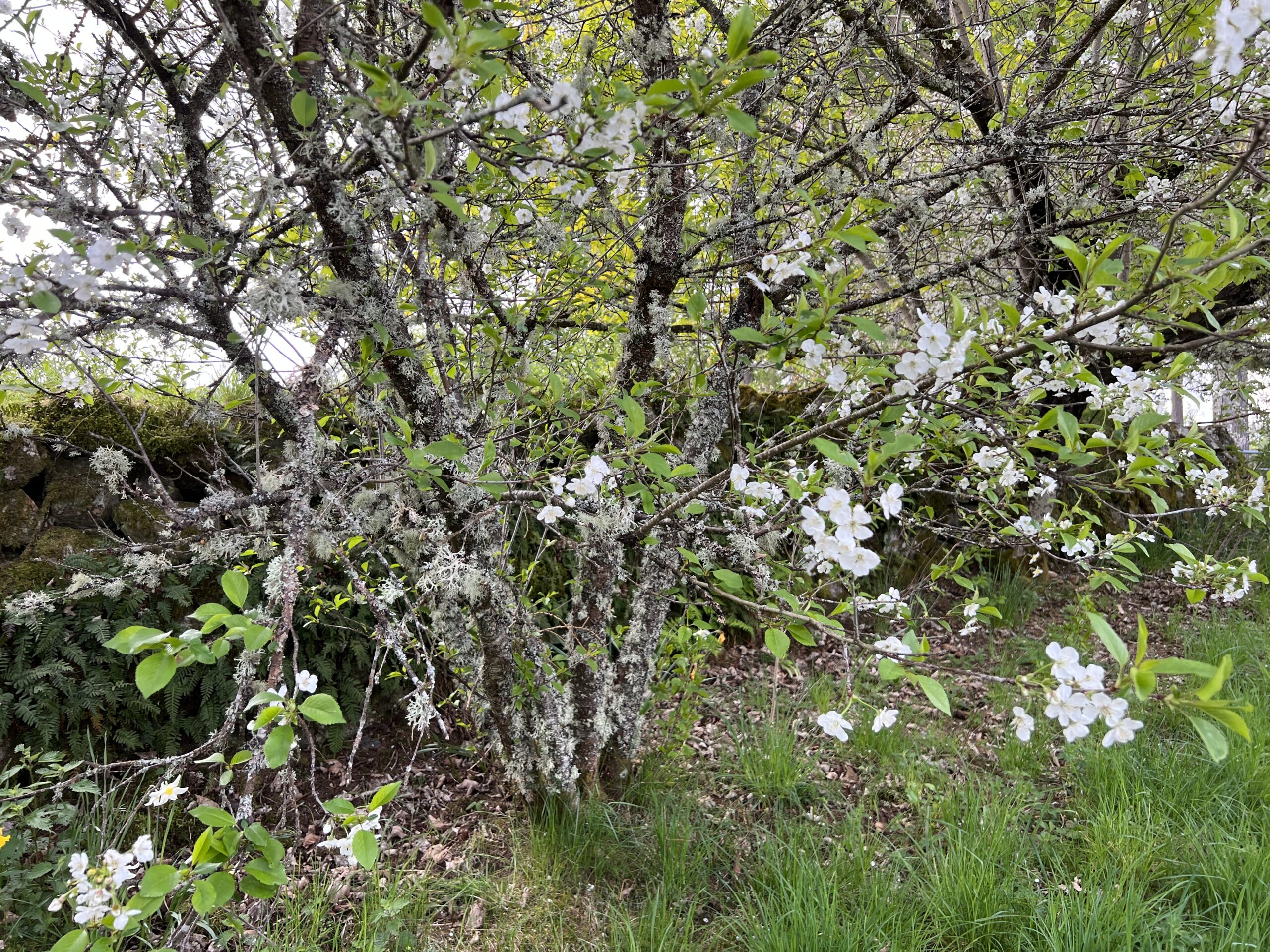
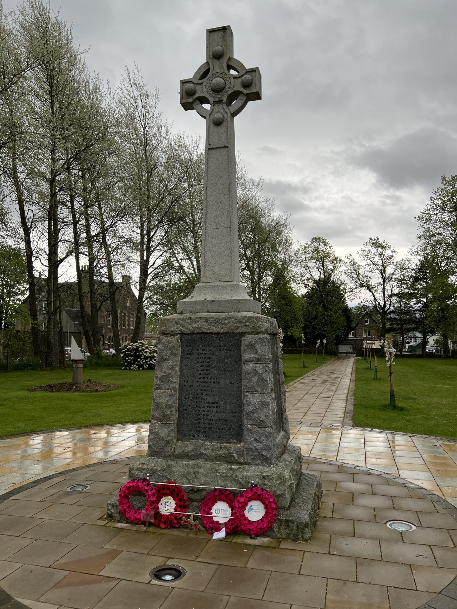

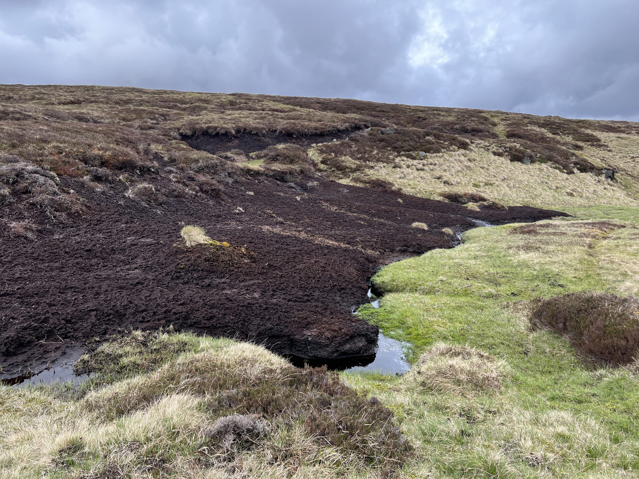
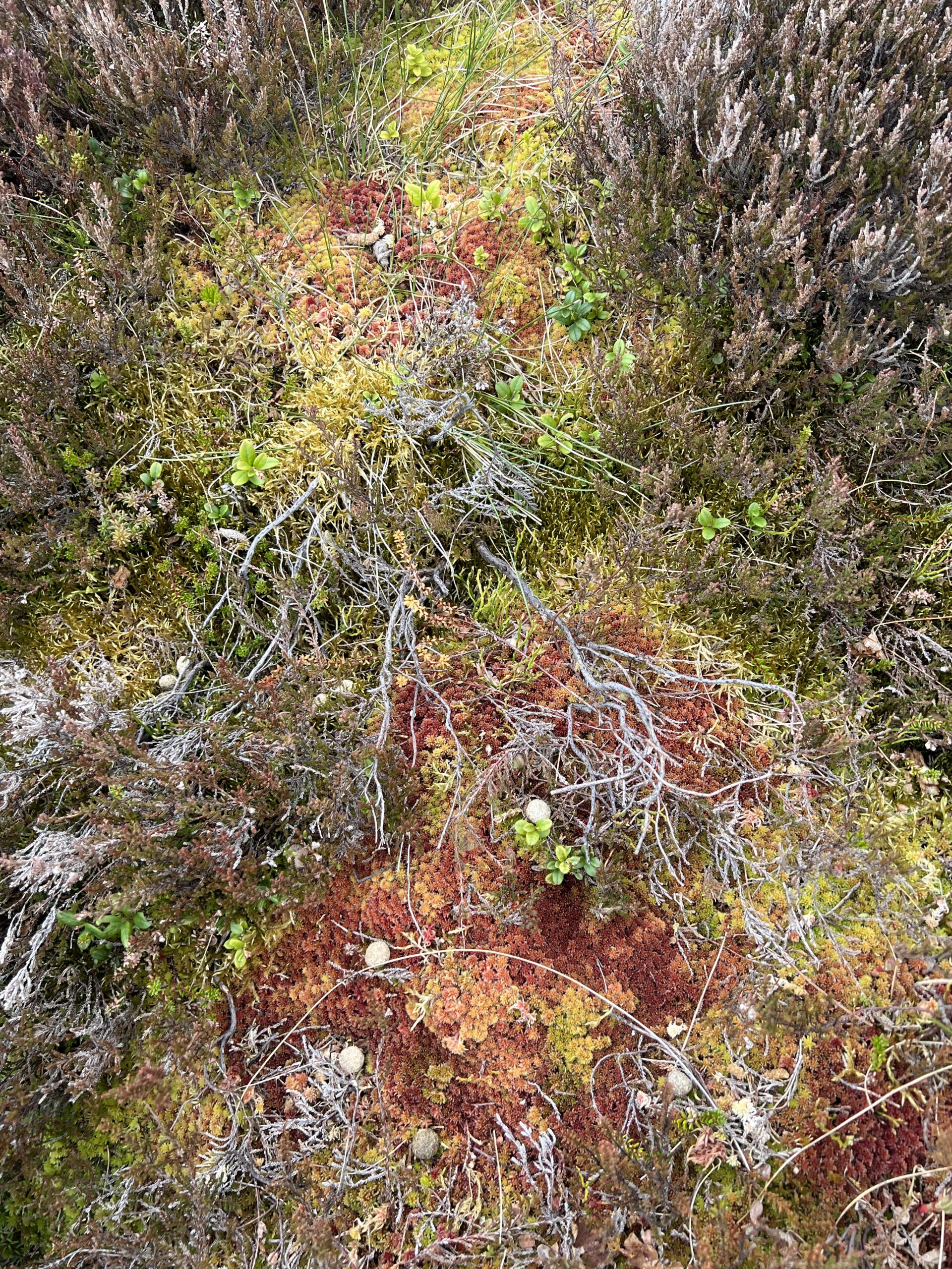


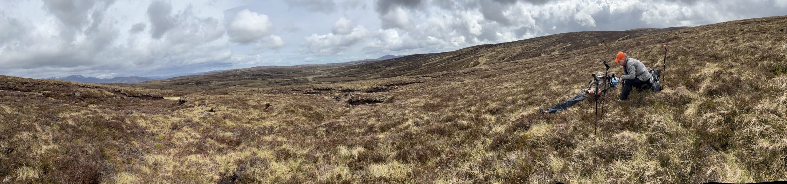
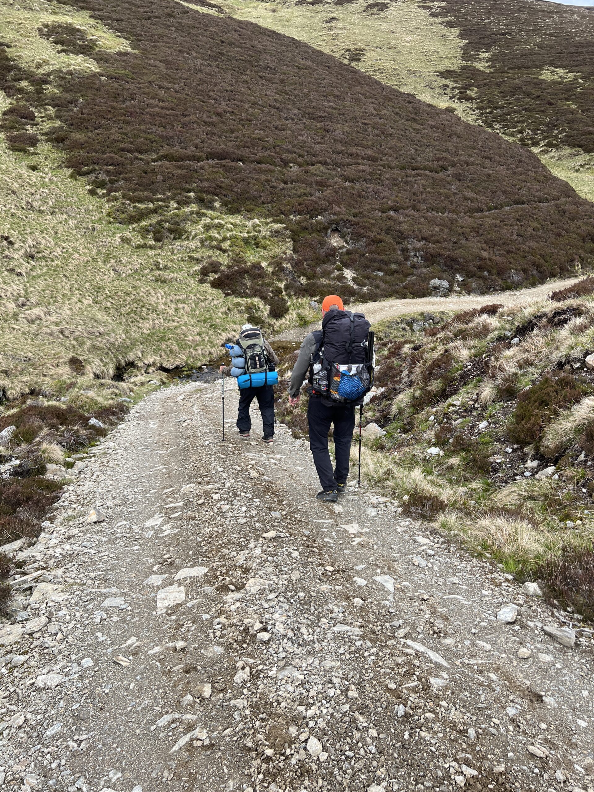
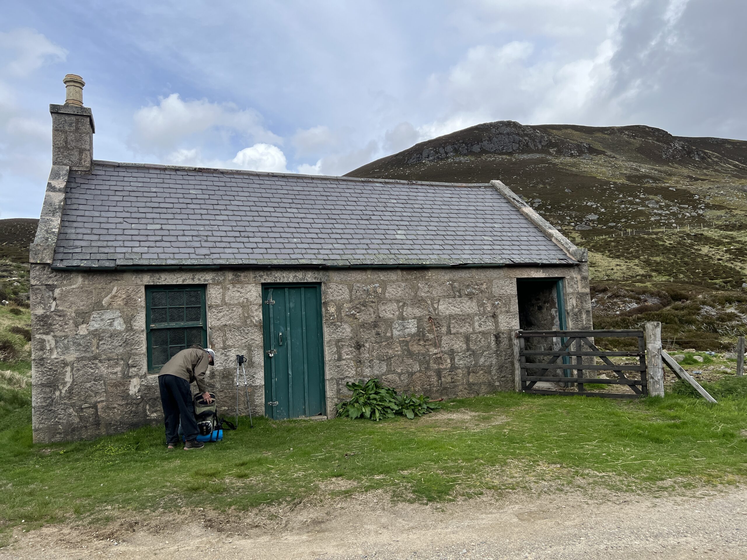


Recent Comments